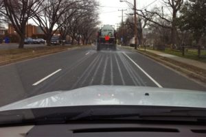
 Arlington County is prepping roads ahead of a winter storm that could create icy conditions tomorrow (Saturday).
Crews are out today pre-treating roads with a brine solution. They’re focusing on primary (red) and secondary (blue) routes, which can be seen on the county’s online 2012-2013 snow map. Workers will deploy from 4:00 a.m.-4:00 p.m. tomorrow to treat and plow roads as necessary during the storm.
Although areas north and west of D.C. may get around 4 inches of snow, significant accumulation isn’t expected in Arlington. The Capital Weather Gang’s forecast currently calls for a warm up on Saturday afternoon that should change the snow to rain or a wintry mix. However, a snow crew will remain on call through Sunday morning to treat icy roads in case a re-freeze occurs.
The Department of Environmental Services encourages residents to stay informed and to be prepared with extra food and water in case the storm worsens. Residents are also asked to avoid parking on the street, if possible, or to coordinate with neighbors to only park on one side of the street. Snow removal vehicles need a width of at least 15 feet to pass down a street.
The National Weather Service issued a Hazardous Weather Outlook for the D.C. area, noting that it’s still unclear exactly where the worst of the storm will hit. An excerpt from the advisory follows:
.THIS HAZARDOUS WEATHER OUTLOOK IS FOR THE MARYLAND PORTION OF THE
CHESAPEAKE BAY…TIDAL POTOMAC RIVER…AND ADJACENT COUNTIES IN
CENTRAL MARYLAND AND NORTHERN VIRGINIA AS WELL AS THE DISTRICT OF
COLUMBIA.DAY ONE…TODAY AND TONIGHT
A STORM SYSTEM WILL BRING WINTRY PRECIPITATION TO THE AREA LATE
TONIGHT. THE HIGHEST CONFIDENCE OF ACCUMULATING SNOWFALL RESIDES
ACROSS PORTIONS OF CENTRAL MARYLAND WHERE A WINTER WEATHER
ADVISORY IS IN EFFECT BEGINNING LATE TONIGHT. PLEASE REFER TO
WBCWSWLWX FOR FURTHER DETAILS..DAYS TWO THROUGH SEVEN…SATURDAY THROUGH THURSDAY
THE WINTER WEATHER ADVISORY FOR PORTIONS OF CENTRAL MARYLAND
CONTINUES ON SATURDAY. FURTHER SOUTH INCLUDING THE GREATER
WASHINGTON METRO AREA…THERE REMAINS SOME UNCERTAINTY REGARDING
WHERE THE RAIN/SNOW LINE WILL SET UP AND EXACTLY HOW MUCH SNOW
WILL FALL. IT IS POSSIBLE THAT THE WINTER WEATHER ADVISORY MAY
NEED TO BE EXPANDED FURTHER SOUTH…SO PLEASE MONITOR THE LATEST
FORECASTS.A SMALL CRAFT ADVISORY MAY BE NEEDED FOR PORTIONS OF THE WATERS
LATE SATURDAY NIGHT AND SUNDAY.

