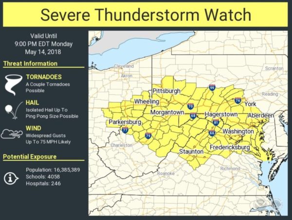
Update at 2:25 p.m. — Forecasters warn that a derecho is possible tonight. The last such wind event to hit the region caused significant damage on June 29, 2012.
Potential for a derecho…a line of severe thunderstorms producing widespread damaging winds to develop this afternoon & move through parts of the central Appalachians and northern mid Atlantic region including Washington DC metro. Stay alert for warnings and seek safe shelter. pic.twitter.com/rlkbNzJPgV
— NWS Eastern Region (@NWSEastern) May 14, 2018
Earlier: Arlington County and much of the D.C. region is under a Severe Thunderstorm Watch today.
The National Weather Service says severe storms are possible later today (Monday)
“Scattered severe thunderstorms with damaging wind gusts and large hail are possible this afternoon and evening,” NWS said in a Hazardous Weather Outlook statement.
#WeatherAlert: Much of Northern Virginia is under a SLIGHT RISK for severe storms this afternoon. This image from our high-res forecast model shows the potential for a severe line of storms reaching I-95 between 6-7pm. Stay with @NBCWashington for updates. pic.twitter.com/xIaZNqNLvU
— Chuck Bell (@ChuckBell4) May 14, 2018
Here is area covered by severe t'storm watch thru 9p and our severe storm dashboard. We think the immediate metro has highest chance of storms between 6-8p. Details/discussion: https://t.co/CgxFbB265t pic.twitter.com/fkxJpT55Bd
— Capital Weather Gang (@capitalweather) May 14, 2018
Photo via @NWS_BaltWash


