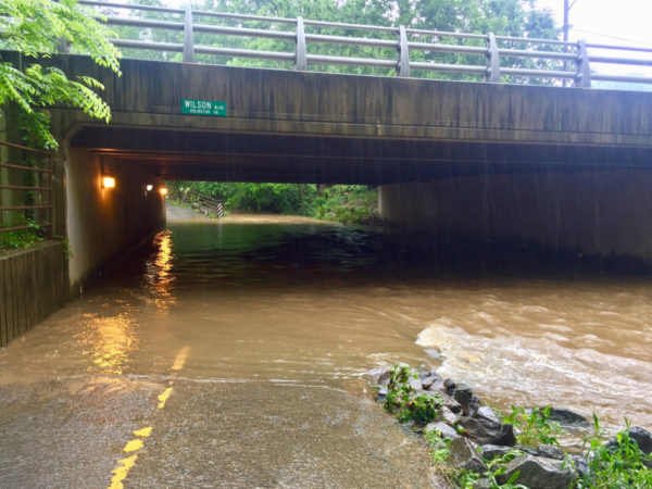
Arlington and much of the region is under a Flash Flood Watch today.
Forecasters are warning of the possibility of “multiple rounds of torrential rainfall” that could result in flash flooding given the already-saturated ground.
More from the National Weather Service:
…FLASH FLOOD WATCH IN EFFECT THROUGH TONIGHT… THE NATIONAL WEATHER SERVICE IN STERLING VIRGINIA HAS EXPANDED THE * FLASH FLOOD WATCH TO INCLUDE PORTIONS OF MARYLAND, THE DISTRICT OF COLUMBIA, AND NORTHERN VIRGINIA… MULTIPLE ROUNDS OF TORRENTIAL RAINFALL WILL BE POSSIBLE FOR TARGETED AREAS THROUGH TONIGHT. GIVEN SATURATED SOIL FROM RECENT RAINFALL, REPETITIVE HEAVY RAIN MAY RESULT IN FLASH FLOODING. * URBAN AREAS, LOCATIONS ALONG SMALL STREAMS AND CREEKS, AND POOR DRAINAGE AREAS ARE MOST VULNERABLE TO FLASH FLOODING. THE FLASH FLOOD WATCH WILL LIKELY NEED TO BE EXTENDED THROUGH FRIDAY. PRECAUTIONARY/PREPAREDNESS ACTIONS… A FLASH FLOOD WATCH MEANS THAT CONDITIONS MAY DEVELOP THAT LEAD TO FLASH FLOODING. FLASH FLOODING IS A VERY DANGEROUS SITUATION. MONITOR LATER FORECASTS AND BE PREPARED TO TAKE ACTION SHOULD FLASH FLOOD WARNINGS BE ISSUED. &&
Flash #Flood Watch through tonight for areas shaded in dark green (eastern WV, much of MD west of bay, DC/Baltimore metros, I-81 corridor/Shenandoah Valley and central VA). Repeated heavy showers and thunderstorms may result in rapid rises of water. Be alert, avoid flooded areas. pic.twitter.com/iuBGIl9S3G
— NWS DC/Baltimore (@NWS_BaltWash) August 2, 2018


