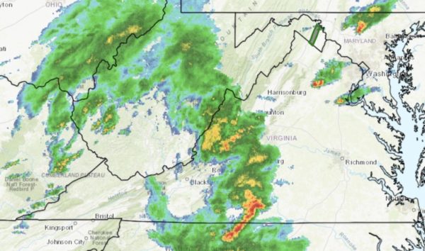
Arlington County and much of the D.C. region is now under a Flash Flood Watch.
The watch is in effect until 10 a.m. Sunday. Forecasters say multiple rounds of heavy rain and storms could produce flash flooding.
More from the National Weather Service:
…FLASH FLOOD WATCH REMAINS IN EFFECT FROM 8 PM EDT THIS EVENING THROUGH SUNDAY MORNING… WIDESPREAD SHOWERS AND POSSIBLE THUNDERSTORMS WILL DEVELOP THIS EVENING AND CONTINUE INTO SUNDAY MORNING. LOCALLY HEAVY RAINFALL IS EXPECTED. AVERAGE RAINFALL AMOUNTS WILL BE BETWEEN 1 AND 3 INCHES WITH LOCALLY HIGHER AMOUNTS AROUND 4 INCHES POSSIBLE. * HEAVY RAINFALL IN SHORT PERIODS OF TIME MAY CAUSE CREEKS AND STREAMS TO RAPIDLY RISE OUT OF THEIR BANKS ALONG WITH THE POTENTIAL FOR FLASH FLOODING IN URBAN AREAS. PRECAUTIONARY/PREPAREDNESS ACTIONS… A FLASH FLOOD WATCH MEANS THAT CONDITIONS MAY DEVELOP THAT LEAD TO FLASH FLOODING. FLASH FLOODING IS A VERY DANGEROUS SITUATION. YOU SHOULD MONITOR LATER FORECASTS AND BE PREPARED TO TAKE ACTION SHOULD FLASH FLOOD WARNINGS BE ISSUED. &&
Showers and possible thunderstorms are expected tonight into Sunday morning. Locally heavy rain is possible that could lead to flooding of small streams and creeks. One to two inches of rain are expected. #DCwx #MDwx #VAwx #WVwx pic.twitter.com/w5W2046R20
— NWS DC/Baltimore (@NWS_BaltWash) May 4, 2019


