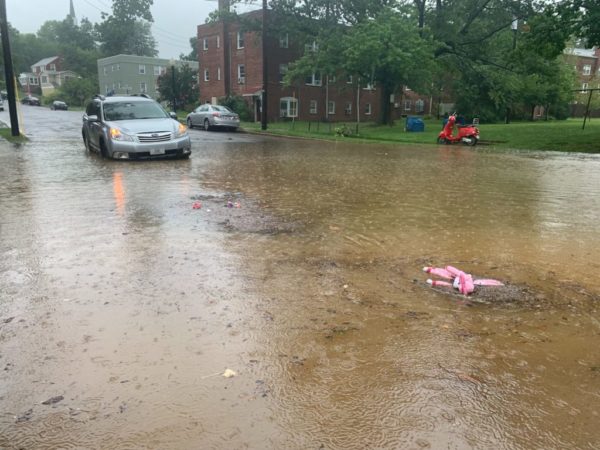
(Updated at 1:45 p.m.) As Arlington continues to recover from Monday’s flash flooding, another Flash Flood Watch has been issued.
The National Weather Service says more heavy rain and flooding is possible today, in addition to storms and damaging winds. The watch takes effect starting at 2 p.m.
After numerous water rescues on Monday, forecasters are also reminding people to “turn around, don’t drown” when encountering water of unknown depth on the roads.
More from NWS:
…FLASH FLOOD WATCH IN EFFECT FROM 2 PM EDT THIS AFTERNOON THROUGH LATE TONIGHT… SHOWERS AND THUNDERSTORMS ARE EXPECTED THIS AFTERNOON AND EVENING. TORRENTIAL RAINFALL MAY LEAD TO TOTALS EXCEEDING 2 INCHES IN A SHORT PERIOD OF TIME. THIS MAY CAUSE FLASH FLOODING OF SMALL STREAMS AND OTHER POOR DRAINAGE URBAN AREAS. PRECAUTIONARY/PREPAREDNESS ACTIONS… A FLASH FLOOD WATCH MEANS THAT CONDITIONS MAY DEVELOP THAT LEAD TO FLASH FLOODING. FLASH FLOODING IS A VERY DANGEROUS SITUATION. YOU SHOULD MONITOR LATER FORECASTS AND BE PREPARED TO TAKE ACTION SHOULD FLASH FLOOD WARNINGS BE ISSUED. &&
A Flash Flood Watch has been issued for areas in green from 2pm through tonight. 2+ inches of rainfall in a short period of time is possible. This could cause flash flooding of streams and other poor drainage urban areas. Remember, turn around, don't drown! pic.twitter.com/UqGQa0Hhla
— NWS DC/Baltimore (@NWS_BaltWash) July 11, 2019
In addition to the flash flood threat this afternoon, severe weather is also expected. Much of the region is under a slight risk of severe weather this afternoon. Damaging winds will be the primary threat, lasting into the evening hours. #DCwx #MDwx #VAwx #WVwx pic.twitter.com/QyGtrp4Uvg
— NWS DC/Baltimore (@NWS_BaltWash) July 11, 2019
Showers and thunderstorms starting to pop up along the I-95 corridor between DC and Baltimore. Additionally, a line of showers and storms is approaching from the west. Again, damaging winds and heavy rainfall, which could lead to flash flooding, are the main threats today. pic.twitter.com/ulJiTk387d
— NWS DC/Baltimore (@NWS_BaltWash) July 11, 2019
There is a growing flash flood threat in the Mid-Atlantic, including cities along I-95. Rainfall rates with the approaching line of storms could reach 2"/hr, and soils are still saturated from rain earlier this week.https://t.co/geggvS9IXg pic.twitter.com/23D61LL0Kt
— NWS WPC (@NWSWPC) July 11, 2019


