Arlington, D.C. and much of the region is now under a Winter Storm Warning.
The county is expected to receive 4-8 inches of snow accumulation from the incoming winter storm, likely the biggest in two years. The flakes are expected to start falling Sunday morning before the nor’easter finally pulls out Monday night, as it makes its way up the East Coast.
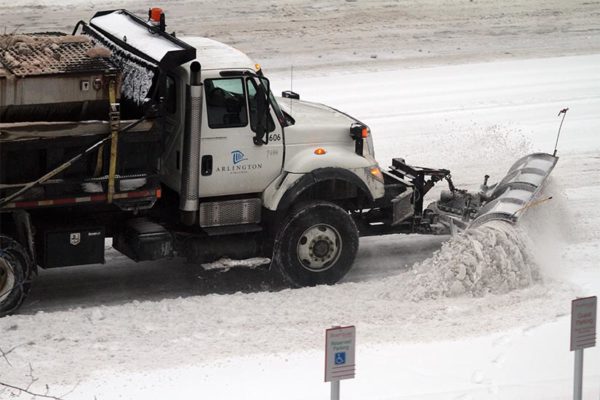
Arlington County and VDOT crews have been pre-treating roads and trails ahead of the winter weather, and snowplows will operate in shifts as the snow accumulates.
“Crews will finish pretreating roads in Arlington, Fairfax, Loudoun, and Prince William counties today, to help prevent ice and snow from bonding to the pavement at the onset of the storm,” VDOT said today. “More than 1,850 trucks will be staged by the onset of the storm ready to treat roads, and will begin to plow once two inches of snow have accumulated. Additional equipment and crews are ready as needed, including tree crews to handle downed branches from ice.”
“Monitor the forecast closely and prepare to stay off roads when the storm begins to allow crews room to work. Plan to avoid travel Sunday and into Monday,” the state transportation agency added. “Park in driveways or a single side of the street to allow a wider path for plows. If you must drive, ensure gas and wiper fluid tanks are full, be prepared with an emergency kit and be familiar with these winter driving tips.”
Metrobuses will operate under a “moderate snow plan” on Sunday. Metrorail will operate under a normal weekend schedule, though changes may be make if the snow accumulates more than 6 inches. Arlington Transit buses are also likely to operate under some form of limited service.
Nearby Falls Church is activating its snow emergency routes at 9 a.m. Sunday.
In parts of Arlington today, some grocery shelves were bare as shoppers stocked up before the multi-day storm. While the pandemic has nixed most local events, some that are still being held, including the Columbia Pike Farmers Market, have been cancelled.
The snow, meanwhile, isn’t the only weather threat to monitor. Gusty winds from Monday into Tuesday could, in combination with the wet snowfall, cause tree branches to fall, resulting in power outages.
More on the Winter Storm Warning, from the National Weather Service:
230 PM EST SAT JAN 30 2021
…WINTER STORM WARNING REMAINS IN EFFECT FROM 1 AM SUNDAY TO MIDNIGHT EST SUNDAY NIGHT…
* WHAT…HEAVY SNOW EXPECTED. SNOW ACCUMULATIONS THROUGH SUNDAY NIGHT AROUND 3 TO 6 INCHES WITH ICE ACCUMULATIONS AROUND ONE TENTH OF AN INCH.
* WHERE…THE WASHINGTON METROPOLITAN AREA.
* WHEN…FROM 1 AM SUNDAY TO MIDNIGHT EST SUNDAY NIGHT. SNOW WILL OVERSPREAD THE AREA BETWEEN 3 AND 5 AM EARLY SUNDAY MORNING. THE STEADIEST SNOW WILL FALL THROUGH SUNDAY AFTERNOON BEFORE TAPERING OFF TO AN INTERMITTENT MIX OF LIGHT SNOW, SLEET, AND FREEZING RAIN. ADDITIONAL SNOW IS EXPECTED MONDAY THROUGH MONDAY NIGHT WITH ADDITIONAL ACCUMULATIONS MOST LIKELY AROUND 1 TO 3 INCHES, BRINGING THE STORM TOTAL ACCUMULATIONS AROUND 4 TO 8 INCHES.
* IMPACTS…TRAVEL WILL BE VERY DIFFICULT SUNDAY THROUGH TUESDAY MORNING DUE TO A PROLONGED PERIOD OF SNOW AND WINTRY PRECIPITATION WITH TEMPERATURES NEAR OR BELOW FREEZING.
PRECAUTIONARY/PREPAREDNESS ACTIONS…
IF YOU MUST TRAVEL, KEEP AN EXTRA FLASHLIGHT, FOOD, AND WATER IN YOUR VEHICLE IN CASE OF AN EMERGENCY.
WHEN VENTURING OUTSIDE, WATCH YOUR FIRST FEW STEPS TAKEN ON STEPS, SIDEWALKS, AND DRIVEWAYS, WHICH COULD BE ICY AND SLIPPERY, INCREASING YOUR RISK OF A FALL AND INJURY.
Two snowfall maps, from NWS and the Capital Weather Gang, are below.
For comparison, here's the National Weather Service snow forecast…just updated (note they increased totals in our northern areas)…pretty similar to ours.
Read our storm briefing here: https://t.co/fpM4o6Jh69 pic.twitter.com/FM1Fn8Kk6a— Capital Weather Gang (@capitalweather) January 30, 2021


