
(Updated at 11:50 a.m.) If the early morning lightning storm didn’t wake you up, congratulations: you’re either an exceptionally deep sleeper or have some very high quality windows.
A supercell thunderstorm spawned ahead of the remnants of Hurricane Ida brought exceptionally frequent lightning and thunder to the area between 3-4 a.m. The light show and the loud booms awakened numerous local residents, not to mention their dogs and kids.
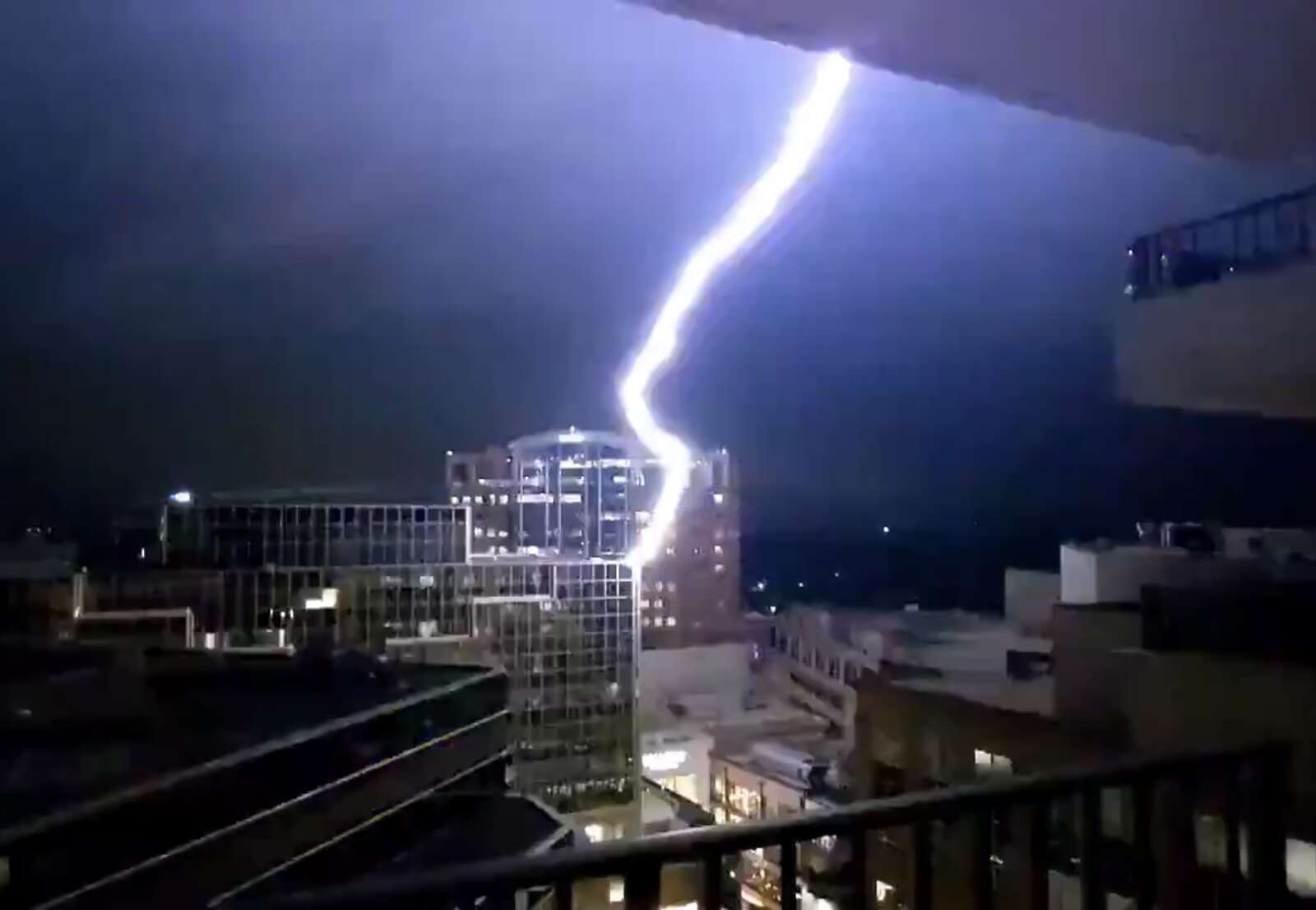
One Ballston resident and weather enthusiast even captured a bolt of lightning striking a building above Ballston Quarter mall.
Yeah, that'll get your attention, when lightning strikes across the street. Noped out of the doorway and straight into bed pic.twitter.com/TVfAYj6A8m
— Jordan Tessler (@TerpWeather) September 1, 2021
The bolt — one among many during the storm, which also packed torrential rainfall and prompted both a Flood Warning and a Severe Thunderstorm Warning — set off fire alarms in the area.
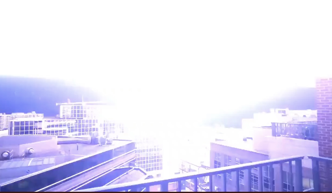
https://twitter.com/elaurenb/status/1432980032205508613?s=21
Wakey wakey. It's 3am lightning in Arlington pic.twitter.com/8dDo16xeT7
— Jordan Tessler (@TerpWeather) September 1, 2021
Severe Thunderstorm Warning for Arlington, Fairfax, City of Alexandria, City of Fairfax, City of Falls Church until 3:45PM. Possible hazards include 60mph wind gusts, heavy rain, and frequent lightning. #vawx pic.twitter.com/PXX0DYFYsF
— Washingtonian Weather Geeks (@WashingtonianWx) September 1, 2021
A map of the lightning strikes last night, below, shows the degree to which Arlington was peppered by mother nature’s fury.
")
Luckily, there were no reports of major flooding in Arlington as a result of the storm, unlike parts of Fairfax County and Montgomery County, where water rescues took place. There were some reports of storm damage, including a large tree branch that went through a home’s roof near the intersection of Military Road and Route 29 in Cherrydale, at least one tree down along the GW Parkway, and multiple trees down on Roosevelt Island.
— Nicole Merlene (@NicoleMerleneVA) September 1, 2021
We’re not done with the wild weather yet, however. Ida’s tropical remains may spawn more strong storms and cause additional flooding later today.
Tornadoes are even a possibility, forecasters say. A Tornado Watch was issued just before noon today.
A tornado watch has been issued for parts of DC, MD, NC, VA until 7 PM EDT. pic.twitter.com/UfPt47nDAs
— NWS Baltimore-Washington (@NWS_BaltWash) September 1, 2021
A Flash Flood Watch for Arlington and the region remains in effect through Thursday morning.
Be Weather Aware Today (Wed) & Tonight! Tornado and Flash Flooding Threat. Be ready to act if NWS warnings are issued for your area. Also be aware of ongoing flooding in some locations along the I-95 corridor this A.M. If you encounter a flooded road, Turn Around/Don't Drown. pic.twitter.com/P60d8wy684
— NWS Baltimore-Washington (@NWS_BaltWash) September 1, 2021
⚠️ A LARGE and RARE *HIGH* risk for excessive rainfall has been issued by our colleagues @NWSWPC The expected #rain could produce dangerous flooding in a large area of the Mid-Atlantic basin. Never drive through flooded roads! ⚠️ #TADD #PAwx #MDwx #WVwx #VAwx #DEwx #NYwx #NJwx pic.twitter.com/LzAv09h4Jb
— NWS MARFC (@NWSMARFC) September 1, 2021
As our Warm Front pushed north, SPC has outlined areas east of the Blue Ridge for a likely Tornado Watch. Atmosphere to start destabilizing, leading to more severe conditions. Watching closely. #vawx #mdwx #dcwx #tornado #dmv pic.twitter.com/e75GtHfL3s
— Washingtonian Weather Geeks (@WashingtonianWx) September 1, 2021