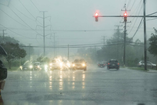
Arlington — along with D.C., Alexandria, Fairfax County and most of the rest of Northern Virginia — is under a Flood Watch today.
The watch takes effect at 2 p.m. and will remain in effect into the evening hours as slow-moving storms roll into the area.
The combination of slow storm movement and the potential for training — a series of downpours focused on a specific west-to-east area — raises the possibility of flooding, forecasters say.
More from the National Weather Service:
…FLOOD WATCH REMAINS IN EFFECT FROM 2 PM EDT THIS AFTERNOON THROUGH THIS EVENING…
* WHAT…FLASH FLOODING CAUSED BY EXCESSIVE RAINFALL CONTINUES TO BE POSSIBLE. […]
* IMPACTS…EXCESSIVE RUNOFF MAY RESULT IN FLOODING OF RIVERS, CREEKS, STREAMS, AND OTHER LOW-LYING AND FLOOD-PRONE LOCATIONS.
* ADDITIONAL DETAILS…
– SHOWERS AND NUMEROUS THUNDERSTORMS ARE EXPECTED THIS AFTERNOON INTO THIS EVENING. RAINFALL AMOUNTS WILL AVERAGE AROUND 1 TO 1.5 INCHES ACROSS THE AREA, BUT LOCALLY HIGHER AMOUNTS OF 2 TO 4 INCHES ARE LIKELY AND MUCH OF THAT MAY FALL IN A ONE TO TWO HOUR TIMEFRAME. HEAVY RAIN IN SHORT PERIODS OF TIME MAY CAUSE CREEKS AND STREAMS TO RAPIDLY RISE OUT OF THEIR BANKS ALONG WITH POTENTIAL FLASH FLOODING IN URBAN AREAS.
– HTTP://WWW.WEATHER.GOV/SAFETY/FLOODPRECAUTIONARY/PREPAREDNESS ACTIONS…
YOU SHOULD MONITOR LATER FORECASTS AND BE PREPARED TO TAKE ACTION SHOULD FLASH FLOOD WARNINGS BE ISSUED.
Showers and thunderstorms are likely later this afternoon and evening which may produce locally heavy rainfall. A Flood Watch has been issued for DC/Balt metro areas and SW into northern VA and the Potomac Highlands of VA/WV to account for the potential for flash flooding. pic.twitter.com/qRlPK8L4YV
— NWS Baltimore-Washington (@NWS_BaltWash) August 10, 2022

