A number of options have emerged for upgrading an iffy portion of the Arlington Blvd Trail.
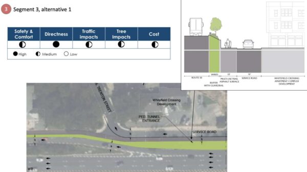
Engineers found it would be possible to accommodate a trail up to 11 feet wide with buffers and guardrails, between the bridge to Thomas Jefferson Middle School and George Mason Drive. That could be accomplished by narrowing a few on- and off-ramps, closing slip lanes and reducing the number of thru-lanes and turn lanes in some places.
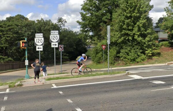
This summer, Arlington County asked trail users how they feel navigating the 1.3-mile stretch of the trail, which runs along the busy and congested six-lane Route 50. Many said they feel unsafe due to bicycle, pedestrian and vehicle conflicts and the lack of buffer between the trail and vehicle travel lanes.
“It’s not very welcome to users. It feels narrow, it’s not continuous and there are poor pavement conditions,” Arlington County transportation planner Bridget Obikoya said in a Nov. 17 meeting. “We want to develop design concepts that improve the existing conditions, such as widening key pinch points and removing barriers and obstructions, improving connectivity and making the trail overall a much more pleasant place to be.”
Over the years, several plans have recommended improvements to the Virginia Department of Transportation-owned trail, which runs east-west from D.C. through Arlington to Fairfax County and bisects a 16-mile bike loop ringing the county.
The 2022-24 Capital Improvements Plan allocated $200,000 to study potential intersection improvements and accessibility upgrades to the area, which has a number of destinations: Thomas Jefferson Middle School and community center, Fleet Elementary School, the National Foreign Affairs Training Center, the Columbia Gardens Cemetery and several churches.
Despite these features, there isn’t much of a trail, and sidewalks are not continuous, says Jim Sebastian, an engineer with Toole Design, a firm that studied the corridor and developed the proposed changes.
“It is challenging, but it’s also exciting thinking about some of the improvements we can make to allow biking and walking to be a little more safe and comfortable,” Sebastian said.
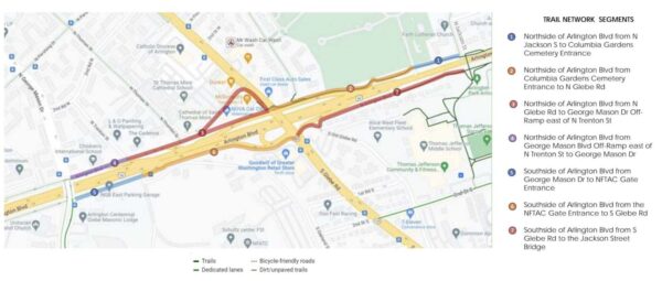
The 1.3-mile stretch was broken into seven segments, four on the north side of Route 50 and three on the south side.

All but one segment has two proposed alternatives, and details of these proposed alternatives can be found in a presentation and explained in a recorded online meeting.
Residents can share their feedback on the proposed alternatives through Monday, Dec. 5. There will be pop-up events along the trail corridor, hosted by the county and local churches and other community destinations.
“This is extremely preliminary,” Nate Graham, a DES public engagement specialist, said in the Nov. 17 meeting. “This is an opportunity… to hear what parts you prefer and develop some combination of first and second alternatives between these seven segments to meet the goals of this project and serve the needs of the community.”
The study found that accommodating the trail, along some segments, could require changes to vehicle traffic.
For instance, between Glebe Road and George Mason Drive, one alternative calls for the closure of the off-ramp slip lane west of N. Thomas Street. The connection between the service road and George Mason Drive would also be closed, with traffic rerouted up to N. Trenton Street.

In a second alternative for this segment, Cathedral Lane would become a westbound-only one way street after the fast food driveways to accommodate a 10-foot trail.
Between the off-ramp east of N. Trenton Street and George Mason Drive, a lane for turning left or going straight would be removed to accommodate a trail, which “may have consequences for traffic queuing,” according to a presentation.
From George Mason Drive to the National Foreign Affairs Training Center gate entrance, a lane would be removed from the service lane to accommodate the trail, which would impact queuing for the National Guard Bureau (111 S. George Mason Drive), the presentation says.
Some residents could lose their driveway access to Route 50 in one proposal on the south side of Arlington Blvd from S. Glebe Road to the N. Jackson Street bridge. Instead, the service road that also provides access to the main road would be extended.

Another proposal for this stretch says the trail could be widened and residents could maintain their existing driveway access to Route 50.
A draft study report is expected this winter, followed by county commission briefings in the winter and spring of 2023. The study recommendations are set to inform capital planning funding in spring 2024.

