The Rosslyn of the future is envisioned to be more walkable, more dynamic and more green with the County Board’s approval of the Rosslyn Sector Plan and Western Rosslyn Area Plan (WRAP). However, with the approval comes the loss of open space from Rosslyn Highlands Park, which left some residents frustrated with the County Board’s process.
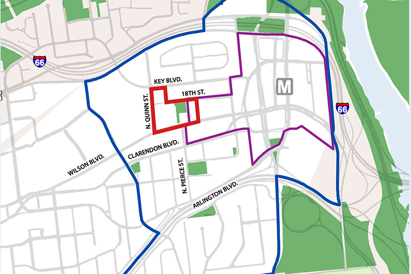
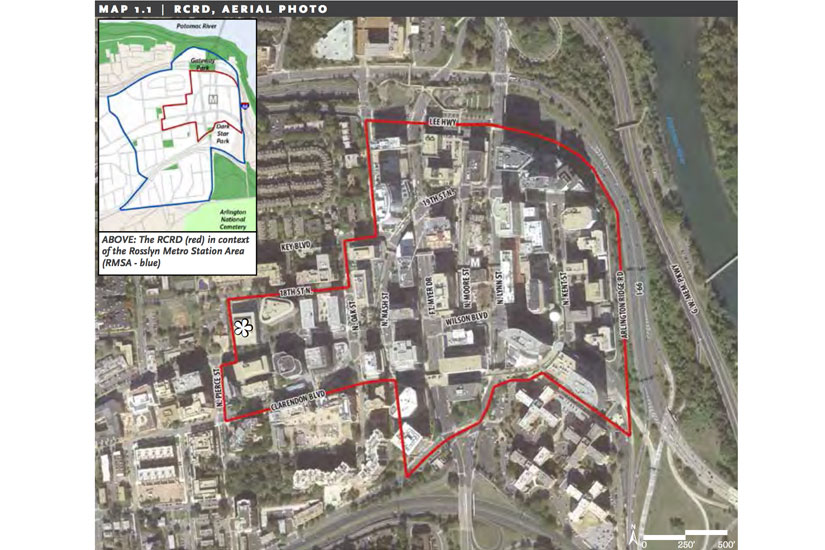
The County Board unanimously approved both plans after hearing resident and staff concerns. Residents generally supported the new sector plan, focused primarily on areas around the Rosslyn Metro station. The Western Rosslyn plan focused on the area around Fire Station #10, up the hill on Wilson Blvd.
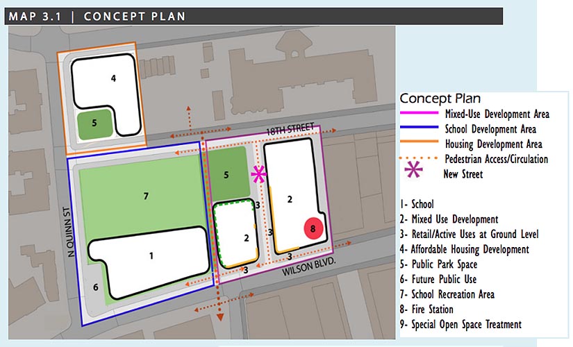
It was the Western Rosslyn plan — which calls for a new fire station to be built by a developer, which is in turn building a mixed-use office and residential complex next to it — that attracted the most opposition.
“It is a shame that we felt we needed to pay for the fire station with public land, such an irreplaceable asset, especially here,” said resident Stuart Stein, who was involved with the WRAP study. “This has been an unfortunate process, but it is time to pass this plan.”
The lack of energy from the previously vocal WRAP opponents was reflected in the County Board’s responses. Although they all voted to approve the plan, Vice Chair Walter Tejada said that he came out of the vote “with a sense of resignation, almost, about the open space angle particularly.”
“We do need to move forward, but it really is a good lesson learned,” he said. “We just can’t let this happen again.”
With the Rosslyn Sector Plan, Board members were more enthusiastic.
“It’s been a bit of a marathon, but I think it was a good conversation and I think we have a plan that will work for all of us,” Chair Mary Hynes said.
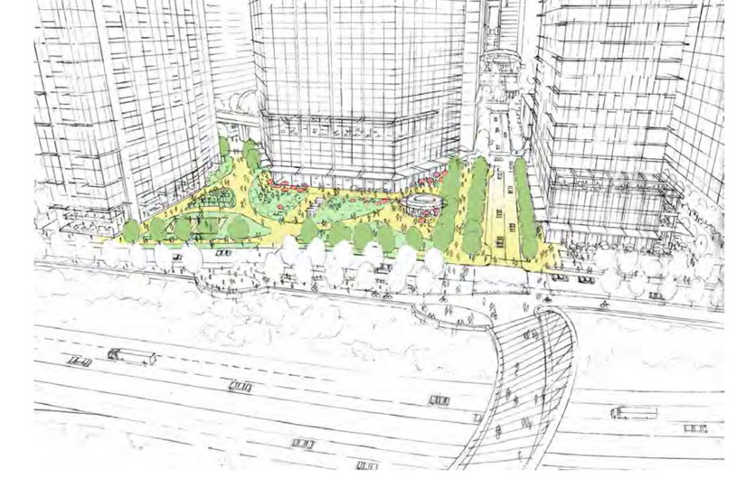
Under the Rosslyn Sector Plan, the neighborhood will get a new open-air Metro entrance, Fort Myer Drive, Lynn Street and Wilson Boulevard will become two-way streets and the county will create a new esplanade that runs along Rosslyn’s eastern edge, connected to the Mt. Vernon Trail via a new pedestrian bridge. It also calls for a corridor along an extended 18th Street, which is envisioned as “a new central spine for Rosslyn.”
Green space has been a big concern for residents under both plans. The Rosslyn Sector Plan calls for a new park and redesign of existing parks, but residents fear that these are empty promises.
“Whether that green space really is developed in the amount that is projected is a question,” Rosslyn resident Diane Gorman said during public comment at yesterday’s recessed County Board meeting.
Parks and Recreation commission member Caroline Haynes urged the County Board members to make sure that plans for open space in Rosslyn were followed, adding that there are limited parks in the neighborhood.
“If we overbuild Rosslyn to the detriment of open space, views and daylight, the built environment will never reestablish those features,” Haynes said. “This plan represents the long-term view for Rosslyn, and should look to achieve long term value for the entire sector, not just for individual land owners and their interests.”
While the Rosslyn Sector Plan looks to create more open space and redesign existing Freedom and Gateway Parks, the Western Rosslyn plan will shrink Rosslyn Highlands Park to rebuild the fire station, a move that prompted residents to rally in protest, pleading with the County Board to save the park.
Under the plan, the county would take away 3,000 to 7,000 square feet of land from the park to allow for the fire station expansion and the Wilson School will be replaced with a larger, 775-seat secondary school building. However, the plan also calls for a 9,000 square foot park to be built across the street at the Queens Court affordable housing complex, which is slated for redevelopment.
Residents have argued that the lost space will greatly affect their livelihood in Arlington, noting the limited open space in the area.
“We have so little on our side of Wilson Boulevard, we have only one recreational park for 10,000 residents, and we need the maximum open space that will be preserved,” said Stan Karson, a member of the WRAP study working group.
In order to help residents have access to open space, the County Board asked that they be able to use the fields and playground area at the new school that is replacing the Wilson School.
Hynes charged county management staff to “initiate a public park space planning process in fall 2015 to develop a cohesive park and public spaces plan for Rosslyn Highlands Park and other public spaces within the WRAP area and work with APS to develop a community use [Memorandum of Understanding] for consideration with the school use permit request.”
Both plans also focused on additional housing units being built in Rosslyn. The Western Rosslyn plan call for the 39-unit Queens Court apartment complex to be redeveloped with up to 250 affordable housing units.
While WRAP specifically called for affordable housing, the Rosslyn Sector Plan does not specifically designate any of the new housing units in the Rosslyn Metro area — up to 5,000 new units at “full build out,” decades from now — for affordable housing. Resident John Snyder said the plan does not comply with Arlington’s Affordable Housing Master Plan, which the Board will discuss in the fall.
In proposing additional housing in Rosslyn, the plan hopes to have an evening population that’s at least 25 percent of Rosslyn daytime population of office workers.
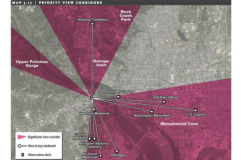
Under the sector plan, Rosslyn will have new building guidelines that limit heights in order to preserve views of Washington landmarks, such as the Washington Monument and Capitol building. The future Rosslyn will have “an urban pattern of buildings, streets and open spaces that produces an attractive and memorable skyline and provides breathtaking views of the nation’s capital,” according to the plan.
Residents responded well to new skyline, but the Arlington Chamber of Commerce is concerned that the plan limits the ability for economic growth in Rosslyn, said Kate Roche, president and CEO of the Arlington Chamber.
“We have significant concerns that the planning commission recommendation about protecting views from Rosslyn to the west through Courthouse is economically unsustainable,” Roche said during public comment.
The two plans were formulated after a public process that included public meetings and workshops. The “Realize Rosslyn” process for the sector plan started in Dec. 2012, while the WRAP study kicked off in 2014.
“For nearly three years, residents, developers, business leaders, property owners and County commissioners worked with County staff to create this plan for revitalizing and transforming one of our oldest urban neighborhoods,” said Hynes, in a press release. “Everyone who participated should be proud of what we’ve achieved together.”
Mariah Joyce assisted with this report


