A recently-released report recommends that Arlington County improve its delivery of real-time transit information.
The Department of Environmental Services’ Mobility Lab released a 245-page report calling for changes to the way the county shares real-time arrival information. Respondents to a survey said the information was valuable, but they wanted additional updates and more data.
“People are overwhelmingly turning to personal technology as a source of real-time information,” the report notes. “Google Maps, WMATA Trip Planner, and Twitter were all mentioned in the focus groups as useful websites.”
Researchers first convened 14 focus groups of up to 12 participants each to design the survey last July. Afterward, the survey was published online and 346 responses were collected between September and October.
A Virginia Department of Rail and Public Transportation grant funded the work.
The survey and the focus groups indicate that people in Arlington use information about the “cost, time, and convenience” of trips to choose which mode of travel to take.
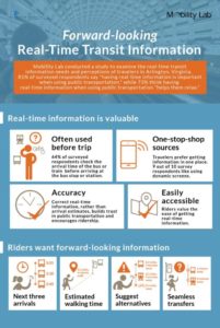
Eighty-one percent of the people who responded to the survey said it was important that information be available in “real-time.” Seventy-three percent said having real-time information helped them “relax” when using public transportation.
Mobility Lab suggested several improvements to the county’s real-time systems based on the feedback, which Research Manager Dr. Lama Bou Mjahed summarized in a blog post:
- Re-evaluate transit phone systems — go straight to the information avoiding lengthy automated messages
- Implement highly customizable or on-demand text message updates avoiding texting “spam”
- Modernize BusFinder — add features and information like routes and schedules
- Continue providing real-time transit information through the county’s website and LED displays
- Diversify the locations of dynamic message boards.
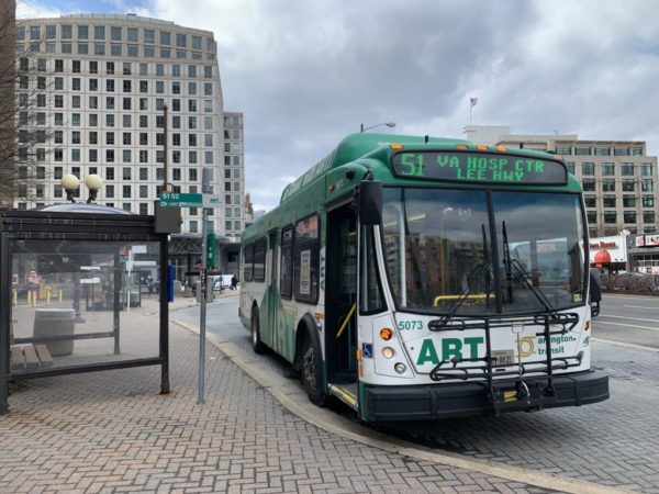
Currently, the county utilizes several real-time transit information systems: online and phone-based bus and rail predictions; the BusFinder at ART bus stops; and LED signs or LCD monitors at bus stops and rail stations.
But the Mobility Lab noted that, “there is limited research into how users perceive these technologies, how well it meets their needs, and how it affects their transit use.”
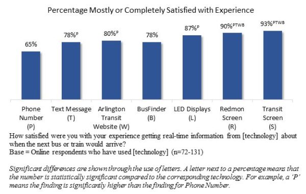
For example, a majority of survey respondents said that the phone system was “valuable,” but many said the service was “a hassle” and was used as “a last resort.”
 Nine out of 10 respondents said the green “Bus Finder” boxes at bus stops were a good service, but some reported they were confusing to use or didn’t work.
“A recurring theme for all technologies stationed at the physical stop or station is that this information is provided too late in the travel process,” the study said. “By the time a rider has access to that information, they’ve already committed to taking that mode of transportation, and are essentially ‘stuck.'”
Users also reported some transit apps were confusing and offered too many options.
“The key takeaway was that respondents do not want yet another app on their phone that only provides a piece of the puzzle,” the Mobility Lab wrote. “Instead, they would like one single or centralized app that works to combine all available information in one place.”
Image via Mobility Lab


