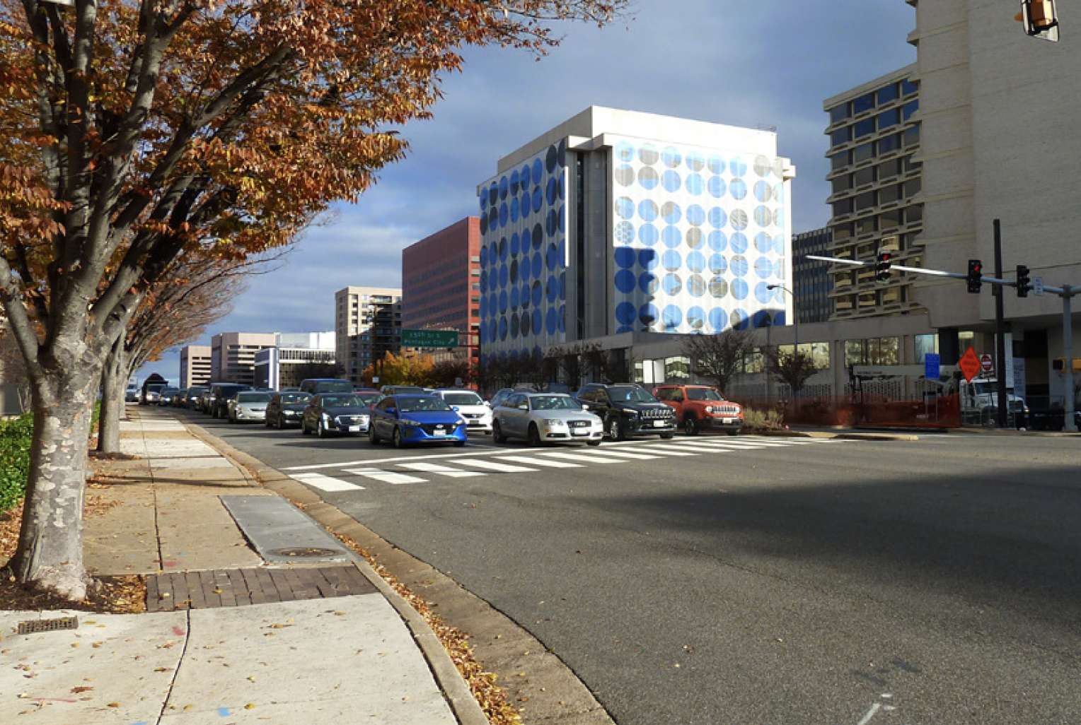
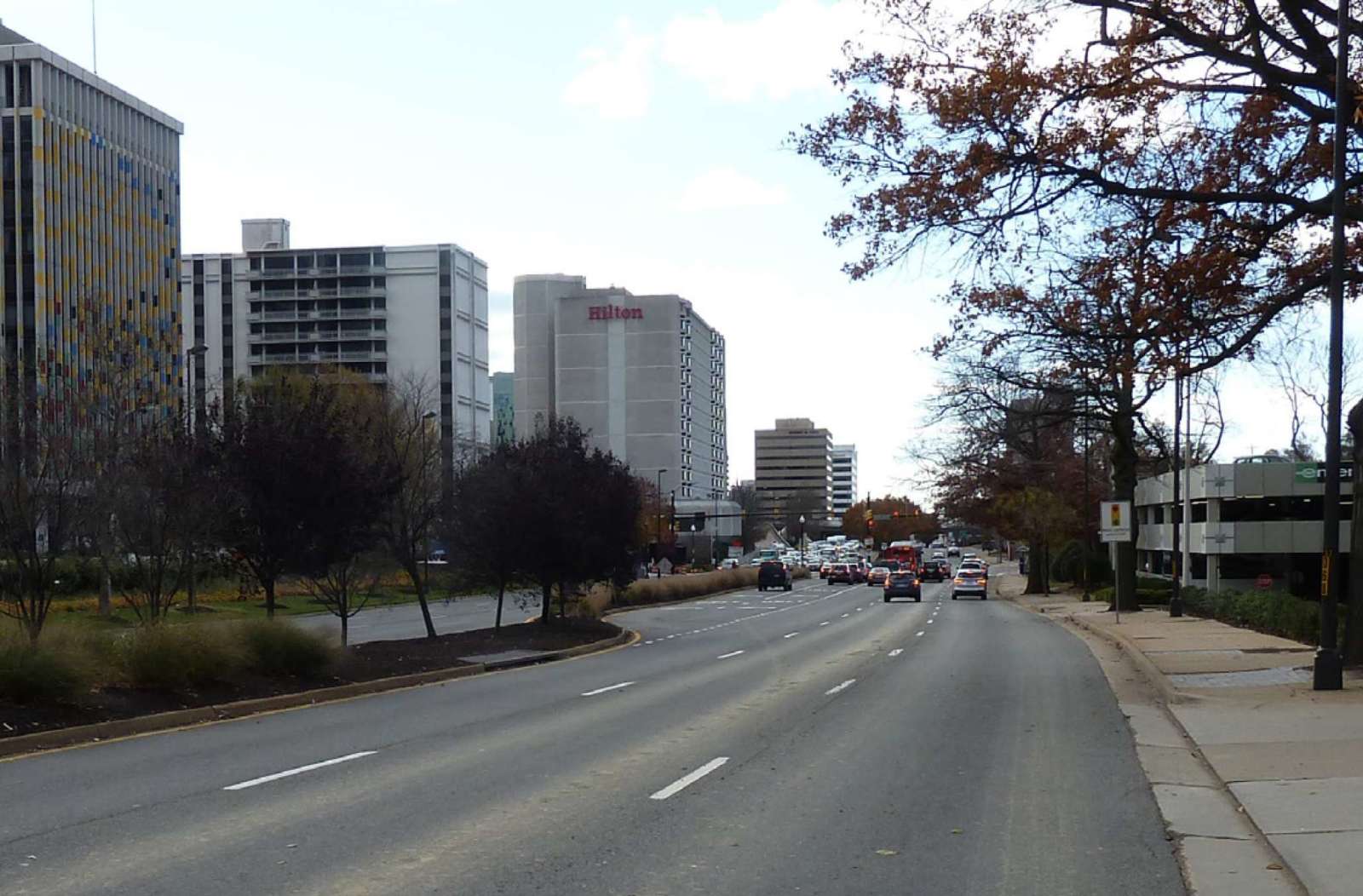
Route 1 through Crystal City is currently a car-oriented, exhaust-clogged asphalt canyon that’s unpleasant for pedestrians to cross or even walk along. But there’s a push for that to change.
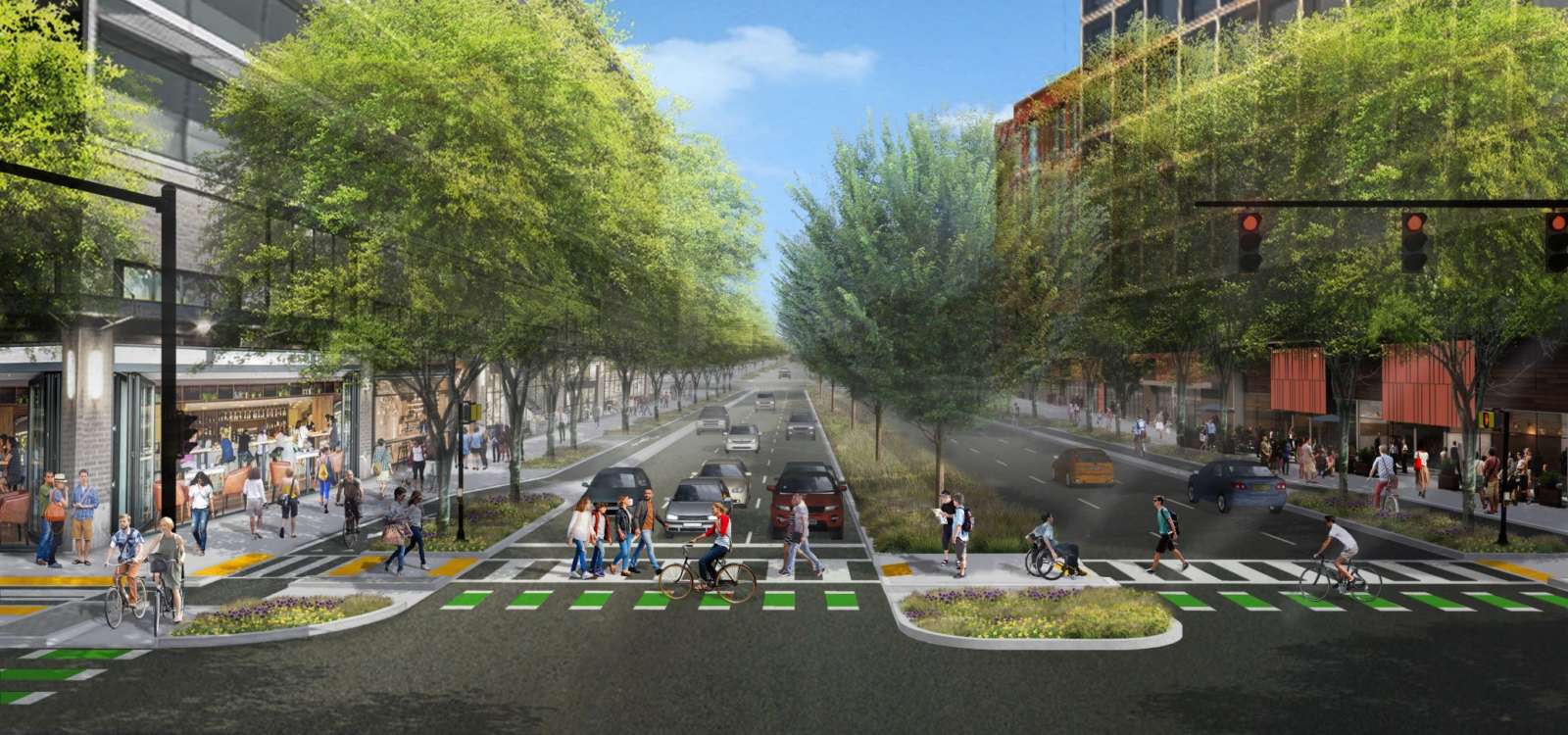
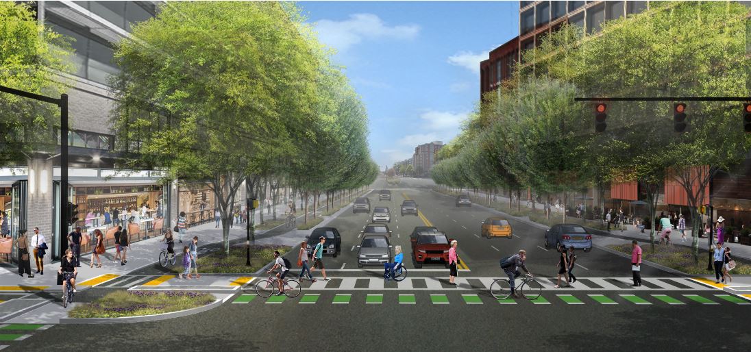
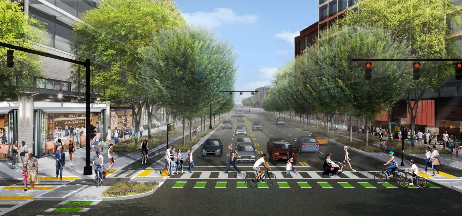
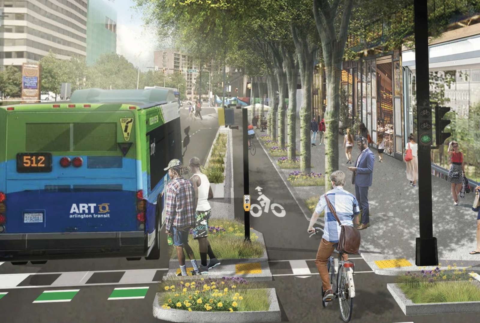
The National Landing BID, formerly known as the Crystal City BID before Amazon came to town, has just revealed its lusher, more pedestrian-friendly vision for Route 1, complete with wide sidewalks lined with ground-floor retail and restaurants.
We are proud to be a champion of projects that enhance connectivity, like "Reimagine Route 1", which begins the conversation around transforming the highway into a more pedestrian-friendly experience. #reimagineroute1 https://t.co/snrzY90Eza
— NationalLanding (@NationalLanding) October 6, 2020
VDOT is currently studying the corridor and considering whether overpasses in the Crystal City area should be removed in favor of a more conventional, urban street grid. The BID’s new Reimagine Route 1 report takes that and other ideas for modernizing the corridor and turns it into a series of concept designs, complete with 3D renderings.
“The concepts presented in Reimagine Route 1 draw upon best practices in urban street design by placing people at the center of National Landing’s future,” Matt Gerber, General Manager of the Westin Crystal City and Co-Chair of the BID’s Transportation Committee, said in a statement today. “Narrow lane widths, lower design speeds, and urban intersection geometries ensure that the autocentric mistakes of the past will not be replicated in the development of the corridor’s new and distinctly community-focused identity.”
The BID’s vision for turning Route 1 — also known as Richmond Highway — from a commuter route into an “iconic corridor serving a thriving urban neighborhood” draws comparisons to main routes in other major cities.
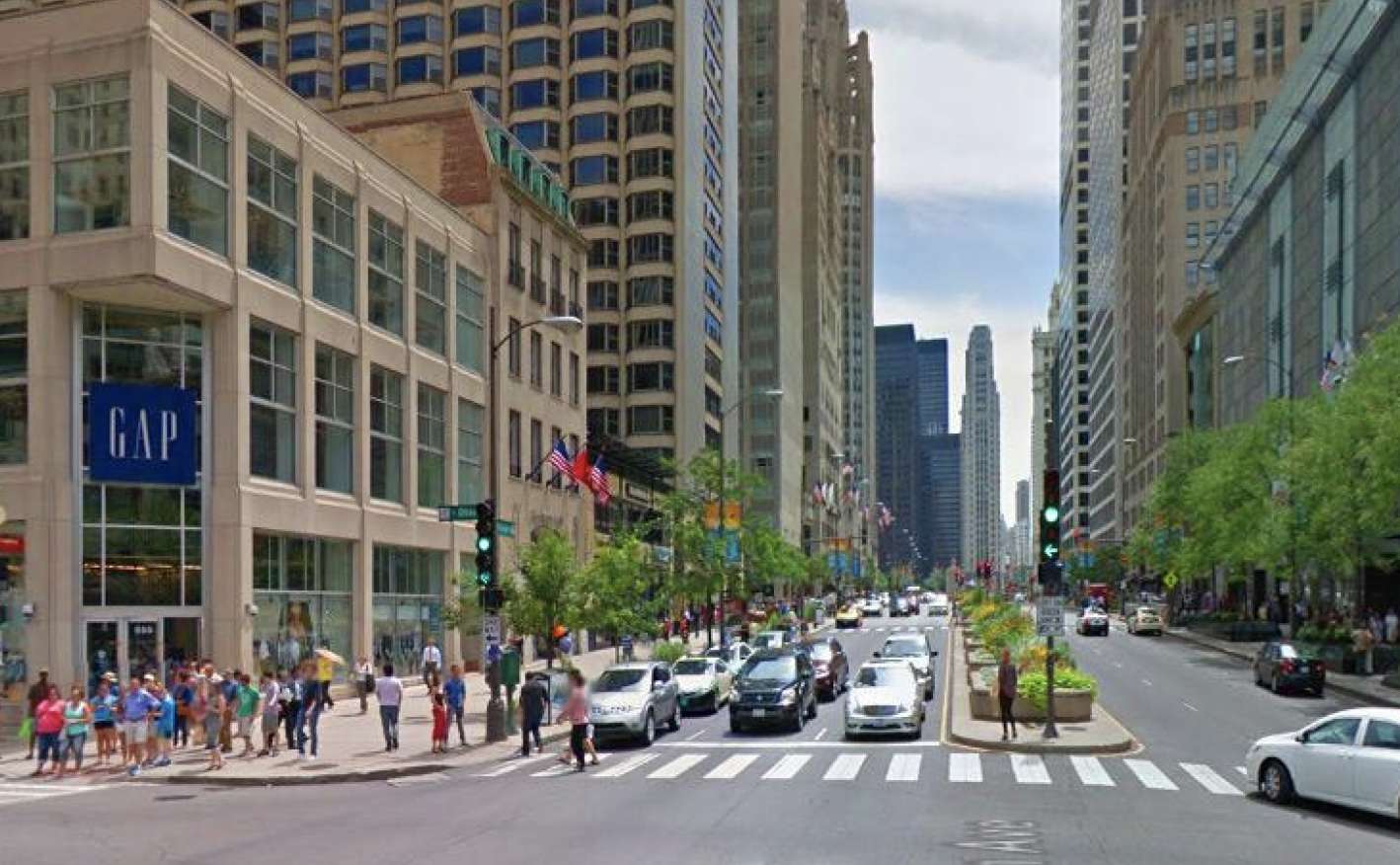
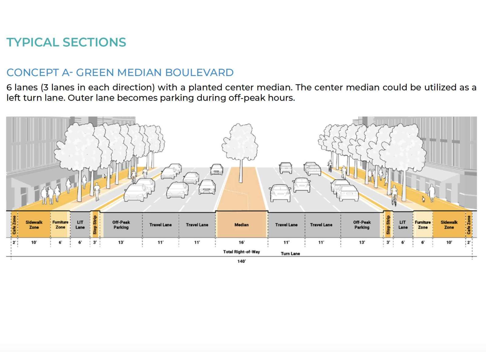
The report includes photos of Octavia Boulevard — formerly Central Freeway — in San Francisco, as well as Michigan Avenue in Chicago, which like Route 1 has three vehicle lanes in each direction.
“Also known as the Magnificent Mile, the 13-block stretch of North Michigan Avenue from the Chicago River to Oak Street has a similar vehicle carrying capacity as the existing Route 1 yet boasts a walkable and vibrant public realm with safe connections to transit and a well-connected street grid,” the report says.
The report is intended to start a conversation about the corridor’s long-term future, which officials may then opt to turn into action via transportation and land use changes. The overall goal is to turn the Crystal City, Pentagon City and Potomac Yard neighborhoods — collectively now known as National Landing — into a cohesive urban area over time.
“Route 1 was originally designed to accommodate the auto-centric development trends of the mid-20th century, when the primary objective was to move cars through the area as quickly as possible,” the BID said in a press release. “The resulting elevated highway, super blocks, and oversized intersections divided the community for decades, inhibiting not only connectivity and access, but also the area’s ability to come together as a singular downtown district.”
Others have also been working on envisioning changes to Route 1. The Crystal City Sector Plan, approved in 2010, set a more urban vision for the community through 2040. Local civic associations, meanwhile, have recently formed a collective called Livability 22202 to discuss ideas. From an August article:
Proposed changes ranged from building storefronts or markets in the area underneath the overpasses, creating more open space where thick sandstone-colored walls now hold up the highway, and putting Route 1 underground to allow for development on top of it.
More on the Reimagine Route 1 report, from a press release, is below.
The National Landing Business Improvement District (BID) released its new report, Reimagine Route 1, which offers a number of guiding principles and potential concepts for transforming Route 1 in Arlington County into a pedestrian-friendly and multi-modal urban boulevard.
The report, which was released following a presentation to a coalition of civic associations, coincides with the launch of the Route 1 Multimodal Improvements Study by the Virginia Department of Transportation (VDOT) examining “enhanced multimodal connectivity and accommodations along and across Route 1 in Crystal City, to meet the changing transportation needs of this growing urban activity center.” Route 1 improvements were included as one of five projects the state agreed to pursue as part of its agreement with Amazon.
The aim of the report is to start a conversation about how Route 1 could be reimagined to improve connectivity, create a more attractive place, and unlock economic value for the corridor. The concepts draw upon national best practices in Great Street design and highway-to-boulevard conversions, while responding to current downtown urban design and mobility trends, most notably the humanizing of highway infrastructure.
“Through smart design and a sustainable approach, we have a rare opportunity to remake Route 1 into an iconic corridor serving a thriving urban neighborhood,” said BID President and Executive Director Tracy Sayegh Gabriel. “If done right, Route 1 can be transformed into an inspired gateway to National Landing that prioritizes the community by putting people first.”
Route 1 was originally designed to accommodate the auto-centric development trends of the mid-20th century, when the primary objective was to move cars through the area as quickly as possible. The resulting elevated highway, super blocks, and oversized intersections divided the community for decades, inhibiting not only connectivity and access, but also the area’s ability to come together as a singular downtown district.
The BID’s report offers three distinct concepts, each of which would bring Route 1 to grade, knit the neighborhoods together and create safer and more seamless east-west connections along improved existing streets. The BID notes that these concepts represent just a few of the many possible permutations of new roadway designs that would align with their vision for National Landing as a truly walkable and connected downtown and the goals of the Crystal City Sector Plan.
Each configuration prioritizes safe, comfortable and convenient crossings; promotes walking, biking, mass transit and other sustainable forms of mobility; encourages human connections and scale; and provides dedicated and well-defined spaces for all users via a street network that is intuitive, attractive, smart and flexible.
“The concepts presented in Reimagine Route 1 draw upon best practices in urban street design by placing people at the center of National Landing’s future,” said Matt Gerber, General Manager of the Westin Crystal City, which is located along Route 1, and Co-Chair of the BID’s Transportation Committee. “Narrow lane widths, lower design speeds, and urban intersection geometries ensure that the autocentric mistakes of the past will not be replicated in the development of the corridor’s new and distinctly community-focused identity.”
In addition to the transportation benefits, a reconfiguration of Route 1 would free up space to incorporate people-centric amenities, such as widened sidewalks, café seating, lighting, and lush landscaping, and create room for further commercial and residential development. The BID report notes that the new development sites could be used to add needed housing, while helping finance the project and strengthening the County’s long-term tax base.
Reimagine Route 1 explains that any successful improvement initiative must take a holistic view of the entire corridor stretching south to Alexandria. Commensurate improvements to existing at-grade intersections, including 20th and 23rd Street, as well as the intersecting streets themselves, must also be made. Potential multimodal street improvements to 15th, 18th, 20th, and 23rd Street are also outlined in the report.
To read the full Reimagine Route 1 report and its preliminary concepts, please visit: www.nationallanding.org/Route1.


