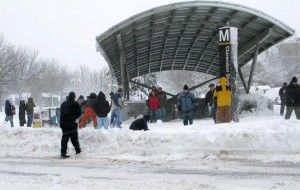
 Arlington and the rest of the region is under a Winter Storm Watch for Tuesday and Wednesday.
Forecasters say chances are increasing that we’ll get a significant late-season snowstorm starting Tuesday night. The storm could dump more than 5 inches of snow, though the precipitation could be mostly rain if the temperature stays too warm.
From the National Weather Service:
…WINTER STORM WATCH REMAINS IN EFFECT FROM TUESDAY EVENING THROUGH WEDNESDAY EVENING…
* PRECIPITATION TYPE…SNOW.
* ACCUMULATIONS…MORE THAN 5 INCHES POSSIBLE…WITH THE POTENTIAL FOR SIGNIFICANT SNOWFALL SOMEWHERE WITHIN THE WATCH AREA.
* TIMING…PRECIPITATION MIXING WITH AND CHANGING TO SNOW TUESDAY NIGHT. SNOW CONTINUING INTO WEDNESDAY EVENING.
* TEMPERATURES…IN THE LOWER AND MID 30S.
* WINDS…NORTHEAST 10 TO 20 MPH WITH GUSTS UP TO 30 MPH.
* IMPACTS…DIFFICULT DRIVING CONDITIONS. HEAVY WET SNOW AND GUSTY WINDS COULD LEAD TO POWER OUTAGES.
PRECAUTIONARY/PREPAREDNESS ACTIONS…
A WINTER STORM WATCH MEANS THERE IS A POTENTIAL FOR SIGNIFICANT SNOW…SLEET…OR ICE ACCUMULATIONS THAT MAY IMPACT TRAVEL. CONTINUE TO MONITOR THE LATEST FORECASTS.
A STRONG LOW PRESSURE SYSTEM IS EXPECTED TO IMPACT THE AREA TUESDAY NIGHT THROUGH WEDNESDAY NIGHT…BRINGING THE POTENTIAL FOR HEAVY WET SNOW…GUSTY WINDS…AND POSSIBLY COASTAL FLOODING. A WINTER
STORM WATCH HAS BEEN POSTED TUESDAY NIGHT THROUGH WEDNESDAY EVENING FOR THE BALTIMORE AND WASHINGTON DC METROPOLITAN AREAS. UNCERTAINTY REMAINS WITH THE TRACK OF THE LOW AND LOCATION OF THE RAIN-SNOW LINE…WHICH ULTIMATELY WILL DETERMINE SNOWFALL TOTALS. PLEASE MONITOR THE LATEST FORECASTS FOR UPDATES.

