For most of the year, a stretch of Columbia Pike on the western end of Arlington County will be reduced to one lane in each direction.

During the extended closure, necessitated by utility work, drivers can expect significant delays during rush hour. Another impact: on left turns in the construction zone.

Following criticism of county officials for insufficient communication about the closure, Arlington’s television arm has released a video detailing the closure and the detours in place to move traffic around it.

After construction concludes, the video notes, the affected portion of Columbia Pike will have wider sidewalks and will no longer have overhead utility lines.


It won’t be nearly as disruptive as the year-long, round-the-clock lane closures on Columbia Pike, but VDOT is planning temporary closures on I-66 next week.

One lane of eastbound I-66 will be closed nightly — from 9:30 p.m. to 5 a.m. — in the East Falls Church area on Monday and Tuesday, the state transportation agency said. There will also be multiple, brief closures of Sycamore Street and eastbound I-66 during that time.

The closure will allow the installation of bridge girders as part of the project to add a lane to eastbound I-66 between the Dulles Connector Road and Ballston.

More from a VDOT press release:

Bridge girder installation to widen I-66 East will require multiple brief closures of Sycamore Street in Arlington during overnight hours on January 6 and 7. Additionally, the left lane of I-66 East will be closed while crews install six bridge girders as part of the I-66 Eastbound Widening Project.

Details:

  • The left lane of I-66 East will be closed from 9:30 p.m. to 5 a.m. on the nights of Monday, Jan. 6, and Tuesday, Jan. 7.
  • There will be a full 20-minute closure of I-66 East shortly after midnight the night of Monday, Jan. 6, so that girders can be delivered to the work area.
  • Vehicle and pedestrian traffic on Sycamore Street under I-66 will be stopped for up to 20 minutes at a time between midnight and 4 a.m. multiple times each night. Stoppages are planned for northbound traffic on the first night, then southbound traffic the second night.
  • Pedestrians will be directed to the opposite sidewalk to proceed through the work zone.

All work is weather dependent.

Drivers and pedestrians are urged to use caution and expect possible delays. Real-time traffic conditions and information is available at www.511virginia.org or through the 511 Virginia mobile app.

The I-66 Eastbound Widening Project will add a travel lane along four miles of eastbound I-66 and install approximately 12,000 linear feet of new and replacement noise barriers. The project also includes building a new bridge over Lee Highway (Route 29) for the Washington & Old Dominion (W&OD) Trail, and constructing a new direct access ramp from eastbound I-66 to the West Falls Church Metrorail Station at the Route 7 Interchange.

The additional eastbound lane is scheduled to open to traffic in fall 2020, and the overall project is expected to be complete in fall 2021. Learn more about the I-66 Eastbound Widening Project and sign up for project updates and lane closure alerts at Transform66.org.


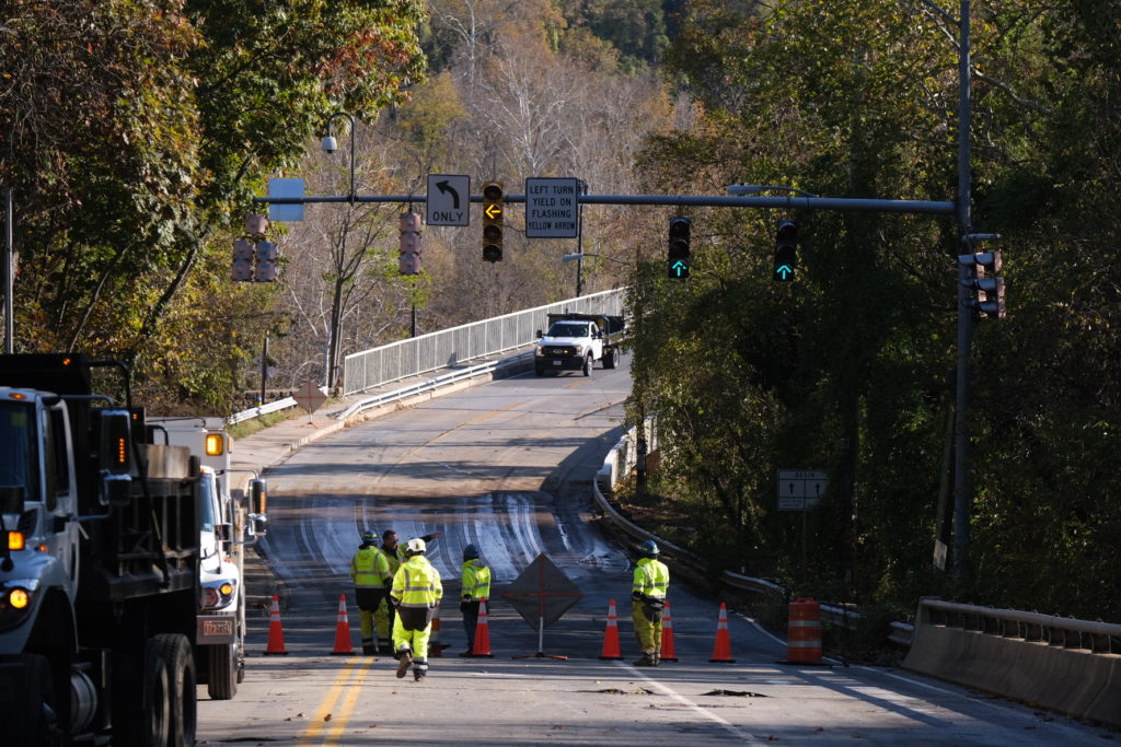
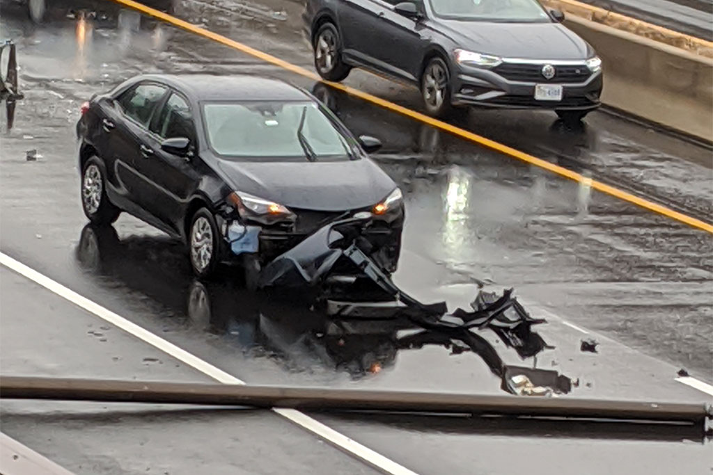
Utility work will force lane closures along Columbia Pike starting next week.

“Starting on or about Monday, Dec. 30, there will be new traffic patterns along the west end of Columbia Pike, in Arlington, which are expected to cause additional delays for those travelling through this area,” the county said in a press release. “The changes are necessary so the contractor for the Columbia Pike west end project can install a utility duct bank system beneath the eastbound lanes.”

Originally the utility undergrounding project was to have placed the aforementioned duct bank under the sidewalk, but a bundle of communication lines was unexpectedly found where it was supposed to go, necessitating the placement under the Pike itself — at the cost of lane closures and an extra $5.5 million.

The work will reduce the western end of Columbia Pike to one lane in each direction for most of 2020, though one additional eastbound lane will open during weekday morning rush hours.

Drivers are being encouraged to take alternate routes.

More from the press release:

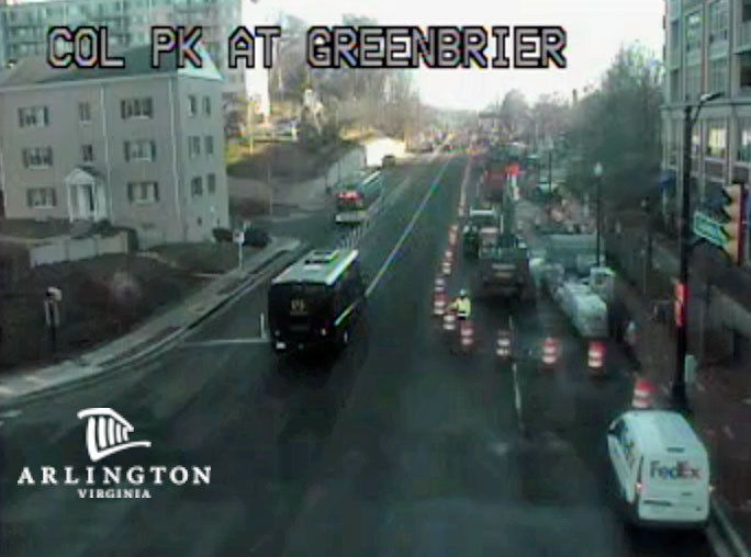
Between South Jefferson Street and the Four Mile Run Bridge, sections of Columbia Pike will be reduced to one lane in each direction daily, including weekends. One additional lane will be open in the eastbound direction, heading toward DC, during weekday morning rush hours (7 am – 9:30 am).

This lane reduction is expected to remain in place for much of the next year. Substantial completion for the Columbia Pike west end project, including utility undergrounding and streetscape improvements, is anticipated for early 2021.
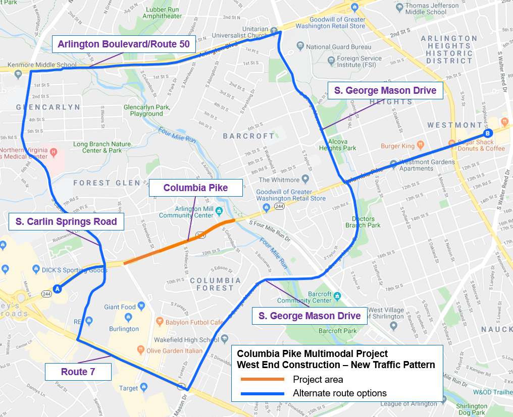
Alternate Routes

Traffic is expected to be affected in and around the immediate area. Drivers not heading to a residence, business or another destination in this area are encouraged to seek alternate routes to reduce road congestion.

Roadways that parallel Columbia Pike:

  • Route 50/Arlington Boulevard
  • Interstate 395

On Columbia Pike, options for travelling around the work zone include:

  • For westbound traffic – Follow George Mason Drive north to Route 50/Arlington Boulevard or south to Route 7/Leesburg Pike
  • For eastbound traffic – Follow Carlin Springs Road north to Route 50/Arlington Boulevard or south to Route 7/Leesburg Pike

A woman has been injured after striking a deer along Spout Run Parkway tonight.

The crash happened between the GW Parkway and Lorcom Lane, during a foggy evening commute.

Initial reports suggest the woman was bleeding profusely from the face after the force of the impact shattered the car’s windshield. The deer was found dead nearby.

Traffic maps show increasingly heavy westbound traffic on Spout Run, starting shortly after the exit from the GW Parkway.

Map via Google Maps


Expect heavy traffic on westbound I-66 in Arlington due to a two-vehicle crash near the Washington Blvd exit.

The crash felled a light pole, which then fell across the right-hand lane of the highway. Police are on scene, awaiting a highway crew to move the pole and tow trucks to remove the crashed vehicles.

As of 1 p.m., one lane was getting by the crash scene, with temporary full closures to help facilitate the cleanup. Westbound traffic was backed up more than a mile, to the Rosslyn area, as a result.

Update at 2 p.m. — It appears that the pole has been moved out of the roadway and the blocked lane will reopen soon.

Photo (1) courtesy David Johnson


A fire in the engine compartment of a Loudoun County commuter bus snarled traffic in Rosslyn this morning.

The fire was reported shortly before 7:30 a.m. on Lee Highway and N. Nash Street. The fire was small — at least compared to yesterday’s truck fire in Pentagon City — and quickly extinguished.

No injuries were reported, but at least two lanes of Lee Highway were blocked as a result of the emergency response.


A medical emergency might have been the cause of a fatal crash last night on I-395.

The single-vehicle crash happened around 10 p.m. in the northbound lanes of the highway, near the Pentagon.

The driver of the car, a 54-year-old Maryland woman, was later declared dead at a local hospital. All northbound lanes of I-395 were closed as a result of the crash, which is being investigated by Virginia State Police.

More from VSP:

Virginia State Police Trooper T. Karbowski is investigating a fatal crash in Arlington County. The crash occurred Dec. 3, 2019 at 9:51 p.m. on Interstate 395 at the 8 mile marker.

A 2008 Nissan Altima was traveling north on I-395 when it ran off the left side of the interstate, sideswiped the Jersey wall and then struck an impact attenuator.

The driver, Eddy A. Hernandez-Torres, 54, of Adelphi, Md., was transported to a nearby hospital where she was declared deceased.

A medical emergency is being investigated as the cause of the crash. The Arlington County Fire Department assisted at the scene.

Photo courtesy Dave Statter


A portion of Lee Highway in Rosslyn will be closed during the day this week for paving.

The southbound section of Lee Highway, adjacent to the Custis Trail between N. Lynn Street and Fort Myer Drive, is expected to be closed from 10 a.m.-2 p.m. on Wednesday and Thursday.

The work is part of the Lynn Street Esplanade and Custis Trail widening project.

More from a Virginia Dept. of Transportation press release:

Southbound Route 29 (Lee Highway) between North Lynn Street and Fort Myer Drive will be closed Wednesday, Nov. 20 and Thursday, Nov. 21 from 10 a.m. to 2 p.m. each day for paving as part of the Lynn Street Esplanade and Custis Trail Improvements project, according to the Virginia Department of Transportation.

Traffic will be detoured via North Lynn Street and Fort Myer Drive back to southbound Route 29.

During the closures, traffic coming from the Key Bridge will still be able to proceed through the Fort Myer Drive/southbound Route 29 intersection. The Custis Trail will also remain open to bicyclists and pedestrians during the work.

A quarter-mile of a wider Custis Trail from North Lynn Street to North Oak Street opened to bicyclists and pedestrians in August. The overall Lynn Street Esplanade and Custis Trail Improvements project is scheduled for completion in spring 2020.


The Memorial Bridge rehabilitation project is halfway complete.

The bridge is back open today after a total closure over the weekend (delayed from earlier this month) that allowed crews to replace concrete support structures and panels, along with other work, on the southern side of the span.

The National Park Service released a new video (above) highlighting work so far on the $227 million project, which kicked off last fall. The video notes that the bridge is “a symbolic link between north and south” and “a symbolic entrance to our nation’s capital.”

It took years to secure federal funding for the project, as warnings of the bridge crumbling and becoming unusable grew more dire.

More on the construction progress so far, from NPS:

Over the weekend, workers finished preparing the southside of the bridge for users and made changes to transition to the next phase of the rehabilitation project. The work included:

  • Moving the bridge’s center barrier.
  • Striping the southside of the bridge for drivers.
  • Moving the poles that support overhead lights guiding drivers in three reversible lanes.
  • Installing or uncovering new detour signs for pedestrians and bicyclists.

The total rehabilitation of Arlington Memorial Bridge began in fall 2018 and is on schedule.  So far, workers have:

  • Replaced the concrete structures that support the southside of the bridge.
  • Installed new pre-cast concrete panels to replace half of the bridge deck.
  • Placed new steel beams on the southside of the bridge.
  • Cleaned, repaired and reinstalled the bridge’s historic granite balustrade.

“Since its dedication in 1932, Arlington Memorial Bridge has served as a monument to national sacrifice and valor — a symbol of reunification, spanning the historic divisions of the North and South,” NPS said of the bridge, which connects Arlington and D.C. across the Potomac River. “As one of the largest transportation infrastructure projects in National Park Service history, the rehabilitation of Arlington Memorial Bridge will give new life to our Capital’s ceremonial entrance while respecting its character, history and national significance.”


Arlington is considering removing a planned section of road in the Metropolitan Park site in Pentagon City, the future home of Amazon’s permanent HQ2.

The Arlington County Board will vote during its meeting this Saturday, November 16 on the first step to nixing a stretch of 14th Road S. that was supposed to one day extend eastward on the lot that now slated for the first phase of Amazon’s headquarters plan.

Officials say the road no longer necessary now that Amazon is moving in.

The 14th Street segment was originally planned to “connect South Elm Street to a private court at the rear of two planned residential buildings” once envisioned on the site almost two decades ago, per a staff report to the Board.

Now that Amazon is finalizing designs for two sky-high office towers on the lot, “there will no longer be the need for the planned 14th Road segment,” the staff report noted. “The proposed new buildings have been designed to utilize S. Elm Street and 14th Street S. for their vehicular access.”

If members vote to advance the removal, the county will hold a public hearing on Monday, December 2 during the county’s Planning Commission meeting at 7 p.m. in the Bozman Government Center (2100 Clarendon Blvd.) The discussion would then return to the County Board for a final vote on December 14.

Approving a public hearing is currently listed on the Board’s consent agenda for tomorrow’s meeting — a position usually reserved for items staff expect members to pass without debate.

The Transportation Commission unanimously approved removing the road in a vote last month, per a letter of support sent to the Board.

Nearby, the Board also recently considered doing away with a pedestrian path in the way of the Verizon site project on 1400 11th Street S.


Last week’s major water main break near Chain Bridge is not done disrupting traffic.

Arlington County crews are planning to close N. Glebe Road again tonight, between Military Road and Chain Bridge Road, for more repairs. The work is intended to “restore full water system capacity and redundancy following the large water main emergency of last Friday,” according to a press release.

The closure is expected to start “no earlier than 7 p.m.” tonight (Wednesday). The road is expected to reopen by Thursday night’s rush hour “barring complications.”

More from the county:

Throughout the work, northbound traffic on Route 123 will only be able to turn left onto Chain Bridge. Traffic crossing Chain Bridge from the District will have to turn right onto Route 123.

Within a few hours of the Friday break, crews were able to isolate and stabilize the break and restore pressure to the County’s drinking water system. This week’s work is required to repair the 36-inch transmission main segment, which was installed in 1944.

The repairs are not expected to have any impact on customers’ water service.

Permanent roadway infrastructure repairs including guard rail replacement and drainage improvements will be conducted in the coming weeks. These repairs will be scheduled to minimize traffic impacts.

Glebe Road is a state route but Arlington County’s Department of Environmental Services has taken the lead in repairs in partnership with the Virginia Department of Transportation.

Meanwhile, the cold and changing temperatures have raised the specter of additional water main breaks. Arlington’s Dept. of Environmental Services is encouraging locals to call them if they suspect a water main break somewhere in the county.


View More Stories