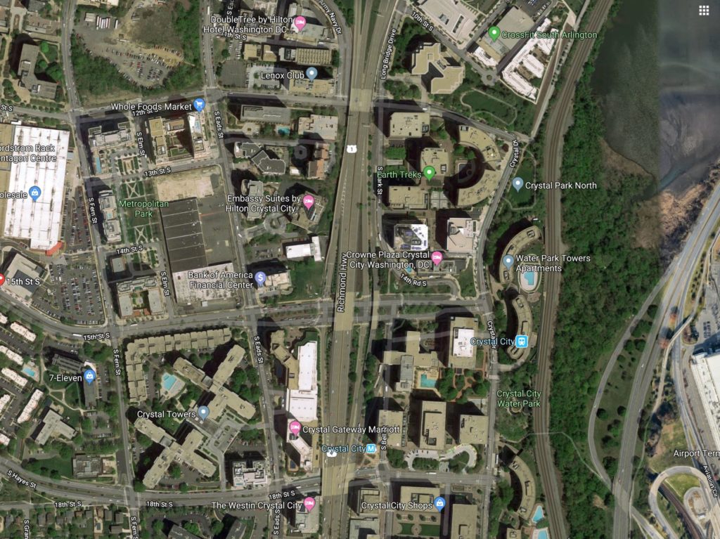
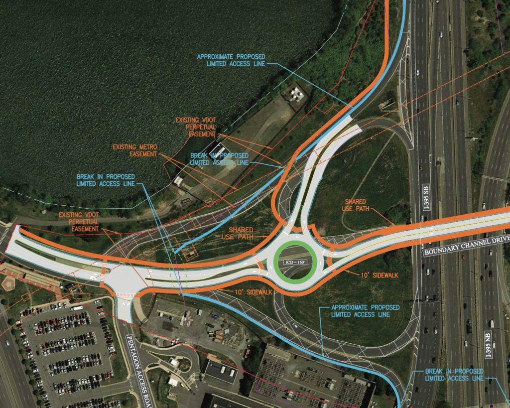
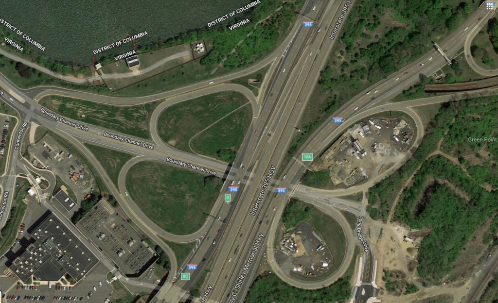
Officials are considering lowering Route 1 in Crystal City to ground level after Amazon moves in.

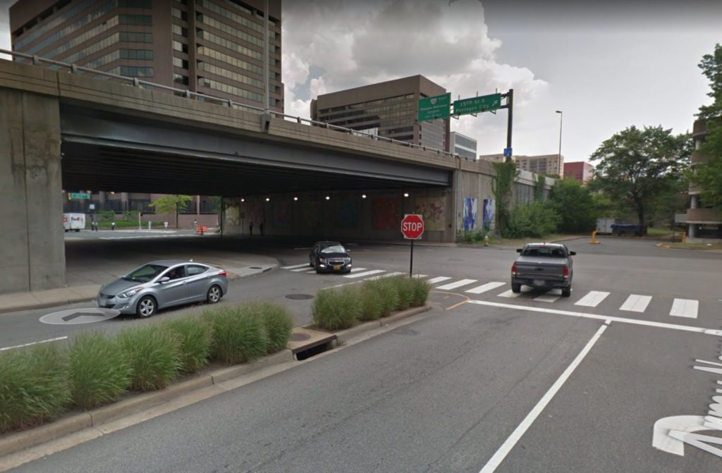
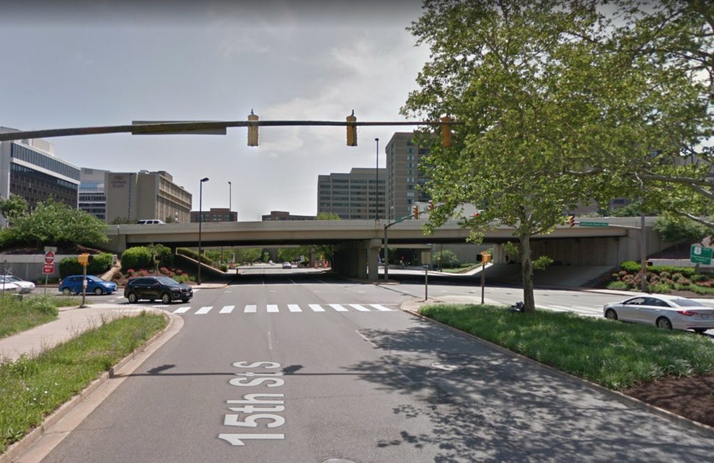
Details remain scant, but officials appear to considering a plan to remove several highway overpasses that span over roads from 12th Street S. to 18th Street S. in favor of at-grade intersections with traffic signals. Currently, the Virginia Department of Transportation (VDOT) is studying the project.

“The study for Route 1 is still in very preliminary stages, where VDOT and Arlington County are looking at feasibility of different concepts, and the best potential balance to accommodate all modes of travel — buses, pedestrians, bicycles, vehicles, etc,” VDOT spokeswoman Jennifer McCord told ARLnow Monday.

When asked, McCord said VDOT did not yet have a cost estimate for the potential project. However, a 2018 Virginia Economic Development Partnership presentation and an entry in the state’s Six-Year Improvement Plan indicate work could cost some $250 million.

McCord noted that the ongoing study for the project is funded with $2 million from the state.

Theoretically the changes wouldn’t affect the commuter route’s vehicle throughput, given that there are already traffic signals up and down Route 1 from Alexandria to Arlington. Pedestrians, however, would have to cross Route 1 at grade along 18th Street to get from the Crystal City Metro station entrance to points west.

Authorities are considering several changes to the streetscape around its HQ2 like a protected bike lane on S. Eads Street and new bus stops. As part of the state and local incentive package used to woo the company to Arlington, officials also pledged to fund a slew of transportation projects which could include this Route 1 revamp.

The 2018 presentation noted that $138.4 million (55%) of the projected cost could be paid for by the state as part of the incentive package for Amazon’s new second headquarters.

Lowering the (newly renamed) Richmond Highway predates Amazon with a reference in the 2010 Crystal City Sector Plan to turn the highway “into an asset of the overall multimodal transportation network.”

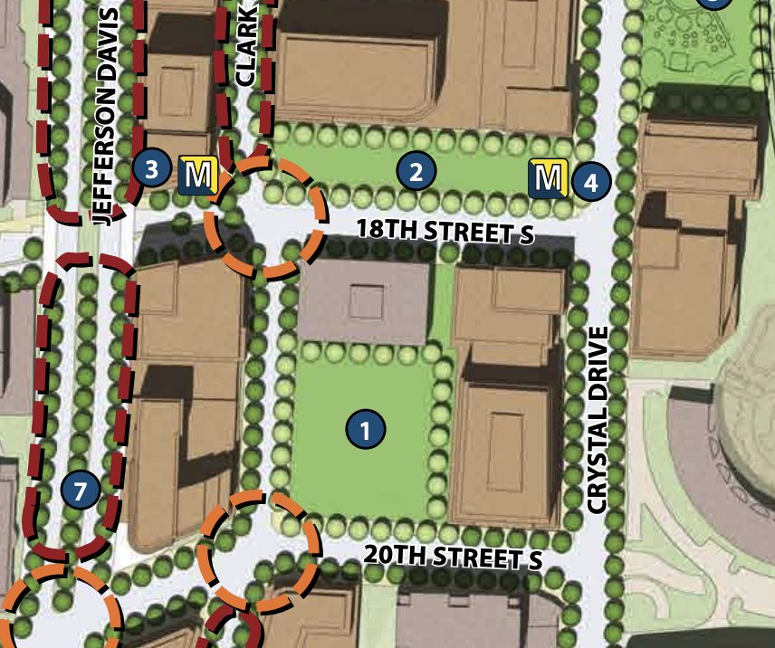
A diagram in the plan depicts Route 1 as more of an urban boulevard, lined with trees.

Tracy Sayegh Gabriel, head of the Crystal City Business Improvement District, said Monday that the way the highway cuts through the area “forms a physical and psychological barrier separating Crystal City and Pentagon City.”

The BID is expanding its boundaries and is currently considering renaming itself “National Landing” to reflect a unified identity of the Crystal City, Pentagon City and Potomac Yard neighborhoods, which are poised for significant growth with the additions of HQ2 and a new Virginia Tech campus just over the Alexandria border in Potomac Yard.

“As various public and private projects are developed throughout the area, there is an even greater need for enhanced connectivity and a safer way to move between the neighborhoods,” said Gabriel, of the possible Route 1 changes.

“Transforming the roadway into a multi-modal, pedestrian-friendly, and urban-oriented boulevard presents the largest and most comprehensive opportunity to create a truly walkable, connected, urban downtown,” she added.

When discussing the plan back in November, Arlington County Board Chair Christian Dorsey said it could “lead to the total reimagining of Route 1.”

Image 1 via Arlington County, Images 2-5 via Google Maps


(Updated at 3:40 p.m.) Planned climate change protests in D.C. may cause major disruptions during Monday morning’s commute.

Arlington County Police are warning those driving into the District to expect delays. Also expected: an increased police presence in Arlington.

“The National Capital Region may experience traffic disruptions during the morning commute on Monday, September 23, 2019, due to protests in Washington D.C.,” ACPD said in an advisory Friday afternoon. “Commuters are encouraged to follow local news reports and adjust travel as necessary. Police will monitor conditions and the public can expect to see an increased law enforcement presence throughout Arlington County.”

Protesters affiliated with the group Shut Down DC plan to block key roads and intersections to “bring traffic and business as usual to a standstill.” Their goal, according to Washingtonian, is “creating major havoc… to get people in power to pay attention and enact change” to address climate change.

“Shut Down says its blockades are being strategically placed to impact the most powerful in DC: the intersections chosen will all be near places of money or power; the group is staying out of the way of public transportation,” Washingtonian reported.

Monday’s planned action follows a worldwide climate change strike today. Millions took to the streets in some 150 countries around the globe, organizers said, while a youth-organized event in Arlington drew dozens to the Courthouse area.


(Updated at 9:05 a.m.) A crash along S. Glebe Road is snarling late morning rush hour traffic near the I-395 interchange.

The crash between a pickup truck and a rental van happened at the intersection of S. Glebe Road and 26th Road S.

The pickup suffered heavy front-end damage and, as of 9 a.m., was still in the middle of the intersection, blocking at least one lane of each road. The force of the collision appears to have pushed the van partially onto the sidewalk.

No serious injuries have been reported. Drivers should expect delays in the area.


A $17.2 million overhaul of the Boundary Channel Drive interchange along I-395 is in the works.

Plans call for overhauling the existing, difficult-to-navigate interchange near the Pentagon and Crystal City with two rotaries, to be installed on either side of I-395.

The 150 and 160-foot wide rotaries aim to merge traffic from Boundary Channel Drive and the Pentagon Access Road on the left, and the Boundary Channel and Long Bridge Drive on the right. The project would remove I-395’s two southbound loop ramp, and add a new multi-use trail, shared by cyclists and pedestrians, connecting the Mt. Vernon Trail to Long Bridge Park.

The project will be managed by the Virginia Department of Transportation (VDOT) and is expected to cost around $17 million.

The Arlington County Board will review an agreement for the project during its upcoming meeting this Saturday. As of Tuesday, the project was featured on the Board’s consent agenda, a place usually reserved for items expected to pass without debate.

Officials hope the redesign will better connect to the long awaited Long Bridge Park Aquatics Center and better serve area commuters, as staff noted in a report to the Board:

The Interchange serves the Pentagon (five million square foot office building with 25,000 employees), Pentagon City (12.7 million square feet of office, 2.3 million square feet of retail and over 13,000 residential units), Crystal City, Long Bridge Park plus its future park expansion and the future Aquatics & Fitness Center, which is expected to draw regional visitors from Maryland and the District of Columbia, as well as from the areas south and west of Arlington in Virginia. The existing interchange design is dated and will need to be redesigned to better serve the transportation needs of the existing and future land uses in the area.

The county held public meetings to showcase the designs in 2015, during which staff noted feedback “varied greatly.” The points staff said residents agreed on included:

  • There needs to be fewer ramps onto I-395
  • Rotary islands need to be designed to not allow cars to speed
  • Pedestrian crossings need to be designed to reduce conflicts with cars and bicycles

County staff also noted that plan for the trail meets goals set by the newly-upgraded bike element of the Arlington County Master Transportation Plan to make it easier for cyclists and pedestrians to use the Mt. Vernon Trail.

“The Mount Vernon Trail connection is an extremely critical part of the project and will create a much-needed link between Long Bridge Park and the trail,” the staff report said.

Image 3 via Google Maps


Tonight and through the end of next week, drivers can expect delays along I-66 in Rosslyn from nighttime lane closures on both eastbound and westbound sides.

Crews will work until Thursday, September 26 — minus this coming Friday and Saturday nights — to set up concrete panels and a debris shield alongside the N. Lynn Street overpass as part of the Lynn Street Esplanade and Custis Trail Improvements project, according to a Virginia Dept. of Transportation press release.

Eastbound closures will occur on I-66 between the Exit 73 ramp to northbound Route 29 (Lee Highway) and Route 110 (Exit 75), while the westbound closures will go from the North Lynn Street ramp (Exit 73) to the western end of the Rosslyn Tunnel.

The timing of the closures are as follows, per VDOT:

  • Eastbound I-66 right lane: Sunday night, Sept. 15, Monday night, Sept. 16 and Tuesday night, Sept. 17 from 9:30 p.m. each night until 5 a.m. the following morning
  •  Eastbound I-66 left lane: Wednesday night, Sept. 18 and Thursday night, Sept. 19 from 9:30 p.m. each night until 5 a.m. the following morning
  • Westbound I-66 left lane: Sunday night, Sept. 22, Monday night, Sept. 23 and Tuesday night, Sept. 24 from 10 p.m. each night until 5 a.m. the following morning.
  • Westbound I-66 right lane: Wednesday night, Sept. 25 and Thursday night, Sept. 26 from 10 p.m. each night until 5 a.m. the following morning.

During construction drivers should expect delays and are advised to take alternate routes. Real-time traffic information and lane closure locations are available online.

The $9.3 million project will ultimately improve bicycle and pedestrian conditions along North Lynn Street with wider sidewalks, upgraded curb ramps, traffic signals, and more. Final completion is expected in spring 2020.

Flickr pool photo by Michael Coffman


Three months after it closed, N. Edgewood Street is now open once again.

The street, which connects Clarendon and Wilson boulevards, in front of the Clarendon Whole Foods, can get busy, especially during times when the Whole Foods is busy.

Edgewood Street was closed in June to facilitate construction at the Loft Office at Market Common redevelopment project on the west side of the street. After demolition work earlier this year, construction crews seem to be at work on the frame of the building, which will ultimately be a four-story mix of office and retail space. The expanded and renovated building is expected to reopen in the second quarter of 2020.

N. Edgewood Street reopened earlier this week with a disclaimer from Arlington’s Dept. of Environmental Services saying Whole Foods “has plenty of Beaufort D’Ete. No need to speed.”


Route 1 may have a new name, but users of Apple Maps still need to enter the old name lest they be led astray.

Arlington County placed new “Richmond Highway” signs along Route 1 in Crystal City last week. During a ceremony marking the occasion, Arlington County Board Chair Christian Dorsey and Del. Mark Levine stomped on the old signs honoring Confederate President Jefferson Davis.

However, the vestige of the Old South remains alive and well on Apple Maps. Users of Apple’s mapping app need to keep using “Jefferson Davis Highway” for now as it doesn’t yet recognize the new “Richmond Highway” name for the stretch of Route 1 in Arlington.

When entering a Richmond Highway address into the app today, Apple Maps redirected users to either Route 1 in Alexandria or a Richmond Street in Hopewell, Virginia.

The confusion comes 8 months after Google Maps unilaterally re-named Arlington’s Route 1 stretch as “Richmond Highway,” and a year after Alexandria officially renamed its portion of Route 1. Apple Maps does list Richmond Highway addresses along the Alexandria section of the road.

Apple did not respond to requests for comment.

State and local officials vied for years to strip the Confederate name from Crystal City’s main commuter thoroughfare, renewing efforts last fall in the wake of Amazon’s arrival. This year, Virginia Attorney General Mark Herring issued an opinion allowing local leaders to sidestep state legislators and perform the change on their own, with approval from Virginia’s Commonwealth Transportation Board.

Image via Apple Maps and Google Maps


Drivers should expect delays on I-395 this weekend as a series of weekend lane and HOV closures continue.

The closures are the result of bridge work associated with the 395 Express Lanes project. Crews have also been at work building sound walls along much of the highway in Arlington.

More on the closures and the bridge work, from VDOT:

Motorists are advised that lane closures will continue on the general purpose lanes along north- and southbound I-395 this weekend, Sept. 6-8, from King Street (Exit 5) to S. Washington Boulevard (Exit 8A) for bridge rehabilitation work. The HOV lanes will also close to accommodate this bridge work starting Friday night and through the weekend. All lanes will reopen, including the HOV lanes in the northbound direction, in time for Monday morning’s commute.

Drivers traveling to D.C. this weekend are urged to use alternative routes or plan extra travel time. Local traffic may still use the general purpose lanes, but should expect closures.

What Drivers Should Expect:

  • A single general purpose lane on I-395 North will close from 7 p.m. Friday through 5 a.m. Monday. Double lane closures will occur during nighttime hours Friday, Saturday and Sunday.
  • One HOV lane will close beginning at 9 p.m. on Friday, followed by the closure of both HOV lanes at 11 p.m. All lanes will reopen in the northbound direction on Monday at 4:30 a.m.
  • Ramp from northbound Glebe Road to I-395 South will close from 11 p.m. Friday until 5 a.m. Sunday. Motorists should follow detour signs to I-395 South.
  • Single and double lane closures will occur along I-395 South during nighttime hours.
    Weekly updates with specific closure information will be available at: ExpressLanes.com and VDOT’s 395 Express Lanes Web Page.
  • The reversible 95 Express Lanes, from near Edsall Road to past Garrisonville Road in Stafford, will operate according to their normal schedule.

The 395 Express Lanes, an eight-mile extension of the 95 Express Lanes to the Washington D.C. line, are scheduled to open this fall. Learn how Express Lanes work and how to get an E-ZPass at www.ExpressLanes.com.


(Updated at 2 p.m.) Police and firefighters are on scene of a cyclist struck by a driver in the Pentagon City area.

The incident happened around 1 p.m. at the intersection of 15th Street S. and S. Fern Street, across from the Costco parking lot.

The cyclist could be seen lying on the sidewalk next to the bike, while a passerby stood nearby and called for help. A Jeep could also be seen nearby, but it is unclear if that was the striking vehicle.

Initial reports suggest that the victim’s injuries are non-life threatening. Fern Street and a lane of 15th Street were temporarily closed at the scene.

A local bicycling advocacy group has called for a protected bike lane along 15th Street S.


(Updated at 5:15 p.m.) Another evening rush hour crash is causing significant backups, this time on N. George Mason Drive, south of Ballston.

A reported “head-on” crash on George Mason, near the intersection of 2nd Road N., has prompted police to close the northbound lanes of George Mason Drive at Route 50.

Two ambulances have been dispatched to the scene for reports of non-life-threatening injuries.

A witness said via Twitter that one of the vehicles “jumped the median and hit a car traveling northbound at 2nd Road N.”


A crash involving at least two vehicles, including one with heavy front-end damage, is causing significant backups in the Crystal City area.

The crash happened around 3:30 p.m. at the busy intersection of Richmond Highway (Route 1) and S. Glebe Road. Multiple lanes of southbound Route 1 and eastbound Glebe are blocked and early rush hour traffic on Route 1 is backed up to the airport ramp.

A flatbed tow truck is on scene, working to clear the wreck, while police direct traffic. No word yet on injuries.


View More Stories