Storm clouds seen from the Air Force Memorial on Sept. 3, 2020 (Staff Photo by Jay Westcott)

Arlington and much of the D.C. area is under both a Tornado Watch and a Flood Watch today.

Strong storms with damaging wind, large hail and torrential downpours are possible today, forecasters say.

“A Tornado Watch is in effect for much of the area until 2pm this afternoon,” the National Weather Service says. “In addition to the threat for tornadoes, damaging wind gusts and large hail will also be possible.”

While the tornado risk will end mid-afternoon, forecasters suggest, the flood risk will run well into the evening, with the watch set to expire at 11 p.m.

More from NWS:

433 AM EDT Fri May 27 2022

…FLOOD WATCH REMAINS IN EFFECT FROM 11 AM EDT THIS MORNING THROUGH THIS EVENING…

* WHAT…Flash flooding caused by excessive rainfall continues to be possible. […]

* WHEN…From 11 AM EDT this morning through this evening.

* IMPACTS…Excessive runoff may result in flooding of rivers, creeks, streams, and other low-lying and flood-prone locations.

* ADDITIONAL DETAILS…
– Multiple rounds of showers and thunderstorms are likely starting this morning and continuing through this evening. Locations could receive 1 to 2 inches of rain in a short period of time. Localized rainfall totals of 1 to 3 inches are expected, though locations that experience multiple rounds of thunderstorms could exceed 3 inches.
– Please visit http://www.weather.gov/safety/flood for safety information.

PRECAUTIONARY/PREPAREDNESS ACTIONS…

You should monitor later forecasts and be prepared to take action should Flash Flood Warnings be issued.


Update at 10 a.m. — More than 2,000 Dominion customers are still without power in Arlington.

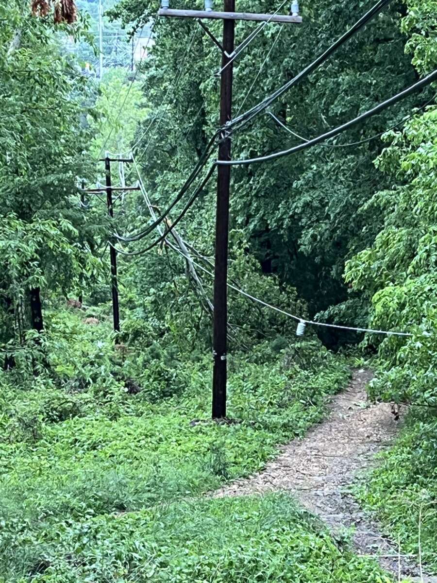
Update at 11 p.m. — The number of Dominion customers still in the dark is down modestly, to 7,378. A company spokeswoman said “the storms left a lot damage” and “crews will work thru the night as quickly & safely as possible.” More than 20,000 customers are without power throughout Northern Virginia.

Meanwhile, a transformer explosion was recently reported in the Barcroft neighborhood, likely complicating restoration efforts.

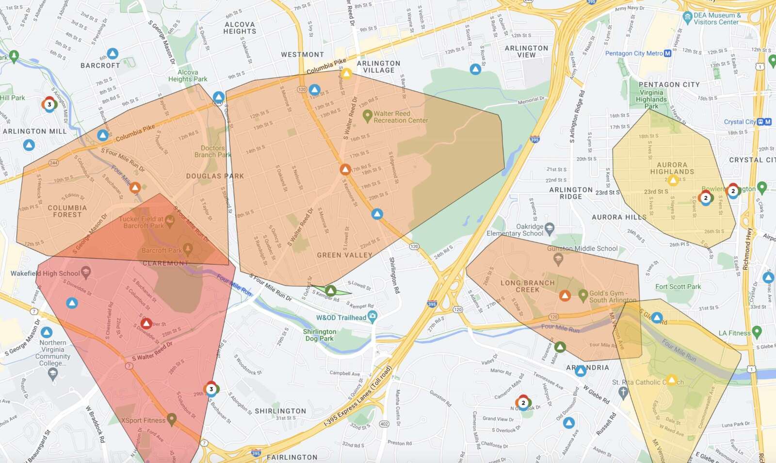
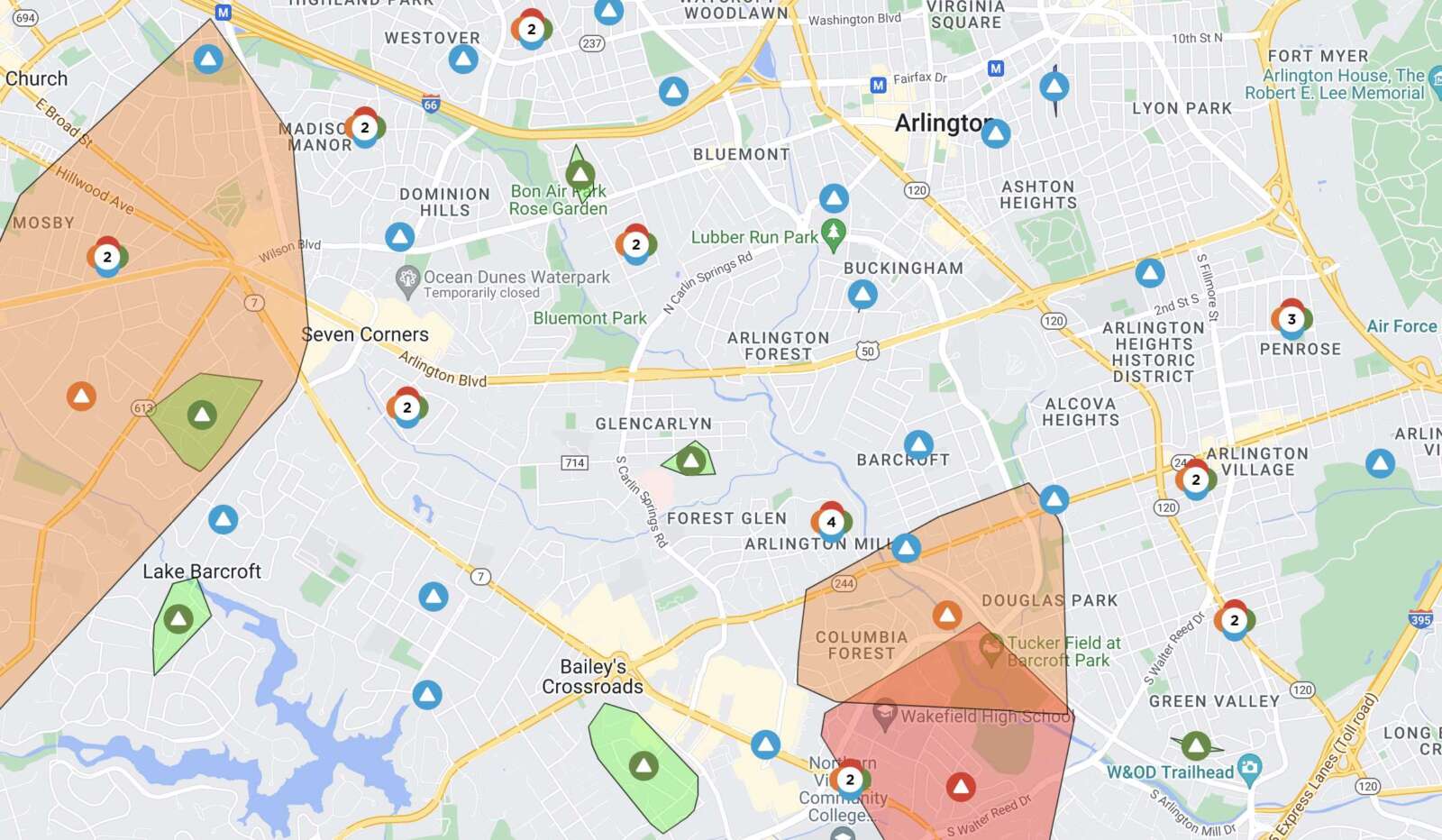
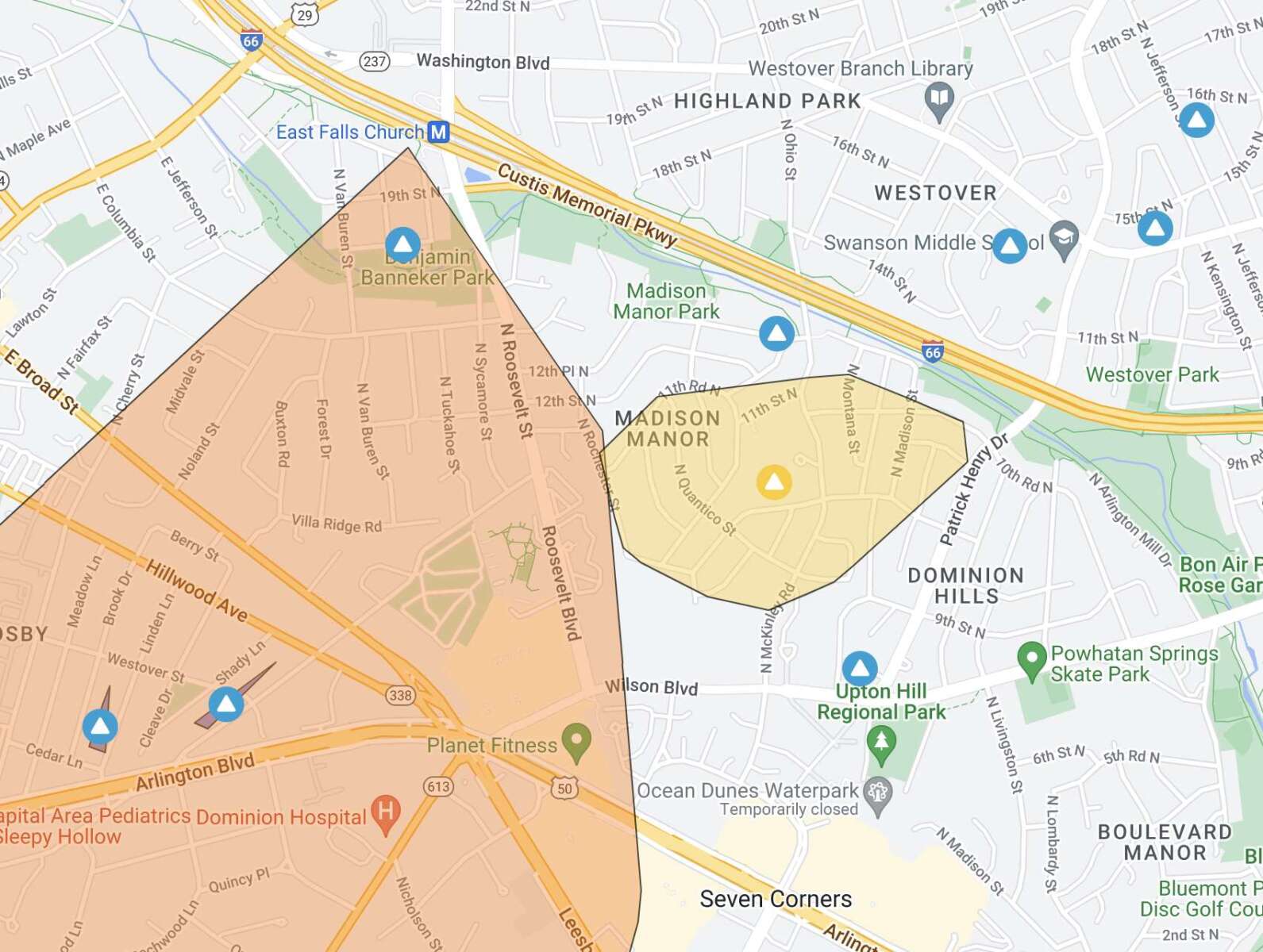
Update at 8:40 p.m. — There are 8,295 Dominion customers without power in Arlington, according to the utility company. Outages have been reported in the East Falls Church, Madison Manor, Columbia Forest, Claremont, Douglas Park, Green Valley, Long Branch Creek and Aurora Highlands neighborhoods, among others.

Update at 7:25 p.m. — A Flood Warning has been issued as well.

718 PM EDT Sun May 22 2022

…FLOOD WARNING IN EFFECT UNTIL 115 AM EDT MONDAY…

* WHAT…Flooding caused by excessive rainfall is expected.

* WHERE…Portions of DC, central Maryland and northern Virginia, including the following counties: District of Columbia. In central Maryland, Montgomery and Prince Georges. In northern Virginia, Arlington, City of Alexandria, City of Fairfax, City of Falls Church, and Fairfax.

* WHEN…Until 115 AM EDT.

* IMPACTS…Flooding of rivers, creeks, streams, and other low-lying and flood-prone locations is imminent or occurring.

* ADDITIONAL DETAILS…

– At 716 PM EDT, Doppler radar indicated heavy rain due to thunderstorms. Flooding is expected to begin shortly in the warned area. Between 0.5 and 1 inch of rain has fallen.
– Additional rainfall amounts of 0.5 to 1.5 inches are possible in the warned area.
– Some locations that will experience flooding include… Arlington… Alexandria… Bethesda… Reston… Annandale… Springfield… College Park… Fairfax… Langley Park… Beltsville… Vienna… Falls Church… Huntington… Coral Hills… Bladensburg… Mantua… Pimmit Hills… Mclean… Rosslyn… American Legion Bridge…

PRECAUTIONARY/PREPAREDNESS ACTIONS…

Turn around, don’t drown when encountering flooded roads. Most flood deaths occur in vehicles.

Update at 7:10 p.m. — Get ready for round two. Arlington is under another Severe Thunderstorm Warning, this time until 8 p.m.

From the National Weather Service:

BULLETIN – IMMEDIATE BROADCAST REQUESTED
Severe Thunderstorm Warning
National Weather Service Baltimore MD/Washington DC
704 PM EDT Sun May 22 2022

The National Weather Service in Sterling Virginia has issued a

* Severe Thunderstorm Warning…

* Until 800 PM EDT.

* At 703 PM EDT, severe thunderstorms were located along a line extending from near Damascus to 13 miles north of Mineral, moving east at 30 mph.

HAZARD…60 mph wind gusts.

SOURCE…Measured gust to 58 mph at Dulles Airport.

IMPACT…Damaging winds will cause some trees and large branches to fall. This could injure those outdoors, as well as damage homes and vehicles. Roadways may become blocked by downed trees. Localized power outages are possible. Unsecured light objects may become projectiles.

* Locations impacted include… Arlington, Alexandria, Stafford, Columbia, Germantown, Centreville, Dale City, Rockville, Bethesda, Gaithersburg, Reston, Leesburg, Annandale, Olney, Springfield, College Park, Fredericksburg, South Riding, Fort Washington and Herndon.

PRECAUTIONARY/PREPAREDNESS ACTIONS…

For your protection move to an interior room on the lowest floor of a building.

The earlier storm packed hail, strong winds and flooding downpours in parts of Arlington.

(more…)


After a relatively cool spring, the D.C. area is going to get a blast of mid-summer temperatures this weekend, and forecasters want residents to prepare.

The National Weather Service has issued a Special Weather Statement for D.C., Arlington and the region, cautioning about “early season heat” that could cause heat illness “unless proper precautions are taken.”

The mercury is expected to rise above 90 degrees over the next three days, including an expected high temperature of 95 on Saturday, which would tie the record from 1934.

The full statement from NWS is below.

203 PM EDT Thu May 19 2022

…EARLY SEASON HEAT FRIDAY THROUGH SUNDAY…

Temperatures will rise into the 90s Friday, Saturday, and Sunday for the first time since last Autumn. Friday will be the first 90 degree day in the Baltimore and Washington Metropolitan Areas since last September. Saturday is forecast to be the hottest day of the weekend, with many locations reaching the mid-90s and heat indices approaching 100. This level of heat will continue through Sunday.

The abrupt beginning of hot temperatures early in the season after a relatively cool spring brings an increased risk of heat illnesses unless proper precautions are taken for those working or recreating outdoors.

Since many outdoor events are planned this weekend in the region, be aware of the heat, and take extra precautions if you work or spend time outside this weekend. Reschedule strenuous activities to early morning or evening. Plan to wear lightweight and loose fitting clothing, and seek shade from the sun. Schedule frequent… breaks in shaded or air conditioned environments and stay hydrated with non-alcoholic beverages.


Storm clouds over Rosslyn (staff photo by Jay Westcott)

Update at 4:15 p.m. — A Severe Thunderstorm Warning has now been issued for most of Arlington.

BULLETIN – IMMEDIATE BROADCAST REQUESTED
Severe Thunderstorm Warning
National Weather Service Baltimore MD/Washington DC
407 PM EDT Mon May 16 2022

The National Weather Service in Sterling Virginia has issued a

* Severe Thunderstorm Warning…

* Until 445 PM EDT.

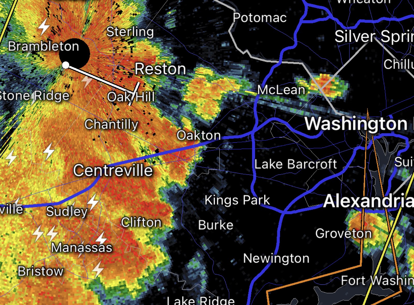
* At 407 PM EDT, a severe thunderstorm was located over Bull Run, or 8 miles southwest of Centreville, moving east at 40 mph.

HAZARD…70 mph wind gusts and half dollar size hail.

SOURCE…Radar indicated.

IMPACT…Damaging winds will cause some trees and large branches to fall. This could injure those outdoors, as well as damage homes and vehicles. Roadways may become blocked by downed trees. Localized power outages are possible. Unsecured light objects may become projectiles.

* Locations impacted include… Arlington, Alexandria, Centreville, Waldorf, Dale City, Annandale, Clinton, Springfield, Fort Washington, Fairfax, Fort Hunt, Vienna, Groveton, Falls Church, Huntington, Coral Hills, Mantua, Fort Belvoir, Woodbridge and National Harbor.

PRECAUTIONARY/PREPAREDNESS ACTIONS…

For your protection move to an interior room on the lowest floor of a building.

Earlier: Arlington and surrounding areas are now under a Severe Thunderstorm Watch.

The watch is in effect until 9 p.m.

Severe storms are possible late this afternoon into the evening, forecasters say. The storms could pack damaging winds and hail.

More from social media:


Storms bring heavy rain, wind and flooding (file photo)

Update at 7:55 a.m. — The Flood Warning is now in effect until 4 p.m. as the rain continues throughout most of the day.

Earlier: Flooding is expected to take place in parts of Arlington overnight due to an extended period of heavy rain and storms.

The National Weather Service issued a Flood Warning for Arlington County and surrounding areas just before midnight.

From NWS:

1148 PM EDT Fri May 6 2022

…FLOOD WARNING IN EFFECT UNTIL 745 AM EDT SATURDAY…

* WHAT…Flooding caused by excessive rainfall is expected.

* WHERE…Washington DC, central Maryland and northern Virginia, including the following counties: in DC, District of Columbia. In central Maryland, Montgomery and Prince Georges. In northern Virginia, Arlington, City of Alexandria, City of Fairfax, City of Falls Church, City of Manassas, City of Manassas Park, Fairfax, Loudoun and Prince William.

* WHEN…Until 745 AM EDT Saturday.

* IMPACTS…Flooding of creeks, streams, urban areas, and other low-lying and flood-prone locations is imminent or occurring.

* ADDITIONAL DETAILS…

– At 1145 PM EDT, Doppler radar indicated heavy rain due to showers and isolated thunderstorms. Flooding is ongoing or expected to begin shortly in the warned area. Between 0.5 and 1 inch of rain has fallen.

– Additional rainfall amounts of 1 to 3 inches are possible in the warned area.

PRECAUTIONARY/PREPAREDNESS ACTIONS…

Turn around, don’t drown when encountering flooded roads. Most flood deaths occur in vehicles.


Rainy day in Aurora Highlands along 23rd St. S. (Staff Photo by Jay Westcott)

Arlington is under a Flood Watch until early Saturday.

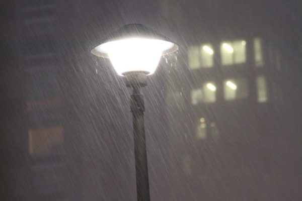
Rain, which will be heavy at times, will fall throughout most of the day, raising the possibility of flooding, particularly near streams and low-lying areas.

The Flood Watch is in effect until 2 a.m.

More from the National Weather Service, below.

…FLOOD WATCH IN EFFECT FROM THIS AFTERNOON THROUGH LATE TONIGHT…

WHAT…Flooding caused by excessive rainfall is possible.

WHERE…DC and portions of Maryland and northern Virginia, including the following areas: the District of Columbia. In Maryland, Anne Arundel, Central and Southeast Howard, Central and Southeast Montgomery, Northwest Howard, Northwest Montgomery, Prince Georges and Southern Baltimore. In northern Virginia, Arlington/Falls Church/Alexandria, Eastern Loudoun, Fairfax, Northern Fauquier, Prince William/Manassas/Manassas Park and Western Loudoun.

WHEN…From this afternoon through late tonight.

IMPACTS…Excessive runoff may result in flooding of rivers, creeks, streams, and other low-lying and flood-prone locations.

ADDITIONAL DETAILS… – Widespread rainfall totals of 1-3 inches are expected through tonight. This may lead to localized instances of flooding. – http://www.weather.gov/safety/flood

PRECAUTIONARY/PREPAREDNESS ACTIONS… You should monitor later forecasts and be alert for possible Flood Warnings. Those living in areas prone to flooding should be prepared to take action should flooding develop.


Frost on plants (staff photo)

The calendar says spring but mother nature has other plans.

After a chilly and windy Sunday, it could get cold enough overnight to form frost, which in turn could kill sensitive plants. That’s according to the National Weather Service, which has issued a Frost Advisory for Arlington and much of the D.C. area.

The advisory, which goes into effect at midnight and is set to lift at 9 a.m., advises residents to “take steps now to protect tender plants from the cold.”

More from NWS:

336 PM EDT Sun Apr 10 2022

…FROST ADVISORY IN EFFECT FROM MIDNIGHT TONIGHT TO 9 AM EDT MONDAY…

* WHAT…Temperatures around 33 to 36 degrees will result in frost formation.

* WHERE…The Washington and Baltimore Metropolitan areas, northern and central Maryland as well as northern and central Virginia.

* WHEN…From midnight tonight to 9 AM EDT Monday.

* IMPACTS…Frost could kill sensitive outdoor vegetation if left uncovered.


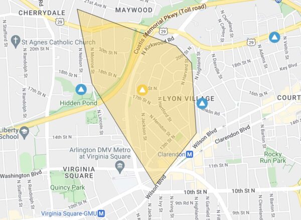
Power outage in Clarendon (map via Dominion)

(Updated at 2:05 p.m.) More than 800 Dominion customers are without power in parts of Clarendon, Lyon Village and Cherrydale.

The outage was reported around 1:30 p.m. Police are on scene along Wilson Blvd in Clarendon, helping to direct traffic that backed up as a result of stop lights going dark.

Dominion says the cause of the outage is a “circuit out.”

Rain and wind have been picking up this afternoon, ahead of potential severe weather later today. The National Weather Service has now issued both a Severe Thunderstorm Watch and a Wind Advisory for Arlington — as well as much of the region.

Forecasters say that wind gusts up to 50 mph may bring down trees and large branches. From NWS:

141 PM EDT Thu Mar 31 2022

…WIND ADVISORY IN EFFECT UNTIL 8 PM EDT THIS EVENING…

* WHAT…South winds 15 to 25 mph with gusts up to 50 mph expected.

* WHERE…District of Columbia, and portions of central, northern and southern Maryland, central and northern Virginia and panhandle West Virginia.

* WHEN…Until 8 PM EDT this evening.

* IMPACTS…Gusty winds could blow around unsecured objects. Isolated tree damage and a few power outages may result.

PRECAUTIONARY/PREPAREDNESS ACTIONS…

Use extra caution when driving, especially if operating a high profile vehicle. Secure outdoor objects.

Peggy Fox, a spokeswoman for the power company, said this morning that residents should charge their mobile devices in anticipation of the expected windy weather.


Rainy night (Flickr pool photo by Kevin Wolf)

Arlington County is now under a Flood Watch, until 6 a.m. Thursday.

The watch was issued just after 11 p.m. Storms and periods of heavy rain are expected overnight, leading to the possibility of flooding in the area.

From the National Weather Service:

1104 PM EDT Wed Mar 23 2022

…FLOOD WATCH IN EFFECT UNTIL 6 AM EDT THURSDAY…

* WHAT…Flooding caused by excessive rainfall is possible.

* WHERE…Portions of DC, Maryland and northern Virginia, including the following areas: in DC, District of Columbia. In Maryland, Anne Arundel, Central and Southeast Howard, Central and Southeast Montgomery, Charles, Northern Baltimore, Northwest Howard, Prince Georges and Southern Baltimore. In northern Virginia, Arlington/Falls Church/Alexandria, Eastern Loudoun, Fairfax, Prince William/Manassas/Manassas Park, Southern Fauquier and Stafford.

* WHEN…Until 6 AM EDT Thursday.

* IMPACTS…Flooding may occur in poor drainage and urban areas.

* ADDITIONAL DETAILS…
– Rainfall rates of 1-2 inches an hour overnight may result in localized flooding of roadways.
– http://www.weather.gov/safety/flood

PRECAUTIONARY/PREPAREDNESS ACTIONS…

You should monitor later forecasts and be alert for possible Flood Warnings. Those living in areas prone to flooding should be prepared to take action should flooding develop.

More via social media:


Fog in Fairlington (file photo)

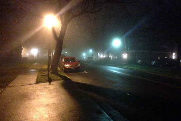
It’s going to be a foggy night.

Arlington and much of the region is now under a Dense Fog Advisory. The advisory is in effect until 10 a.m. Friday.

Forecasters warn of “visibility down to one quarter mile in dense fog” and “hazardous driving conditions due to low visibility.”

“If driving, slow down, use your headlights, and leave plenty of distance ahead of you,” said the National Weather Service.


Update at 3 p.m. — Snow is starting to taper off. Roads are mostly clear, after just over an inch of snow fell on Arlington.

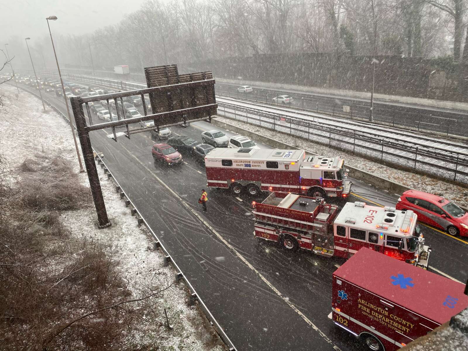
Update at 9 a.m. — Snow continues to fall amid strong winds, reducing visibility and causing slick conditions on some paved surfaces. All lanes of westbound I-66 are currently closed at Spout Run due to a crash. It’s unclear whether the crash is weather related.

Earlier: Frozen precipitation is now falling on Arlington and forecasters warn that things are going to get a lot worse before they get better.

Rain is changing over to snow as temperatures fall and strong wind gusts whip up, thanks to a strong cold front and storm system making its way up the East Coast.

In addition to the earlier Winter Weather Advisory and Wind Advisory, the National Weather Service this morning issued a Special Weather Statement urging extra caution on the road if you absolutely must travel during the “near blizzard conditions” expected later this morning.

646 AM EST Sat Mar 12 2022

…RAPIDLY DETERIORATING CONDITIONS THIS MORNING…

Rain will change to snow over the Washington and Baltimore Metropolitan areas as well as northeastern Maryland by 9 AM this morning from northwest to southeast. Snowfall rates around one to two inches per hour are expected through late this morning along with rapidly falling temperatures below freezing. Despite the recent warm conditions, snow is expected to stick on many surfaces, causing travel disruptions.

Strong northwest winds with gusts around 45 to 55 mph are expected during this time, causing snow and possible blowing snow to reduce visibility below one-half mile at times. Near blizzard conditions are expected.

Please use extra caution if you have to travel.

More from the Capital Weather Gang:


View More Stories