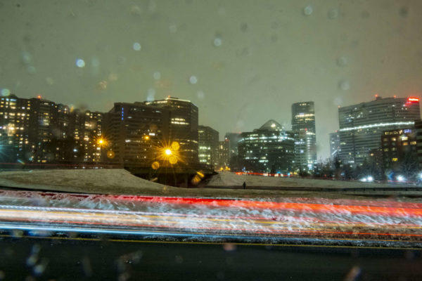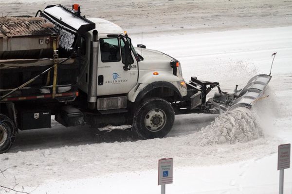
Arlington is under a Winter Storm Watch from Wednesday night until Thursday night.

The watch was issued shortly before 3 p.m. Tuesday. Forecasters say five or more inches of snow, plus some ice accumulation, is possible in the D.C. area during that timeframe.

More from the National Weather Service:

250 PM EST TUE FEB 16 2021

…WINTER STORM WATCH IN EFFECT FROM LATE WEDNESDAY NIGHT THROUGH LATE THURSDAY NIGHT…

* WHAT…TOTAL SNOW ACCUMULATIONS OF 5 OR MORE INCHES AND TOTAL ICE ACCUMULATIONS OF A QUARTER INCH OR MORE ARE POSSIBLE.

* WHERE…THE WASHINGTON, BALTIMORE, AND FREDERICKSBURG METROPOLITAN AREAS.

* WHEN…FROM LATE WEDNESDAY NIGHT THROUGH LATE THURSDAY NIGHT.

* IMPACTS…POWER OUTAGES AND TREE DAMAGE ARE LIKELY DUE TO THE ICE. TRAVEL COULD BE NEARLY IMPOSSIBLE. THE HAZARDOUS CONDITIONS COULD IMPACT THE MORNING OR EVENING COMMUTE.

PRECAUTIONARY/PREPAREDNESS ACTIONS…

MONITOR THE LATEST FORECASTS FOR UPDATES ON THIS SITUATION.

Arlington’s emergency management office is encouraging residents to prepare for a possible snowstorm and — when it snows — to help neighbors shovel if need be.


(Updated at 4:20 p.m.) Authorities are urging Arlington residents and others in the D.C. area to stay home today amid an extended bout of freezing rain.

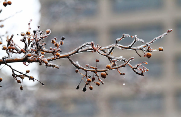
Sidewalks and many roads are reported to be very slick. The ice is expected to build as the day goes on.

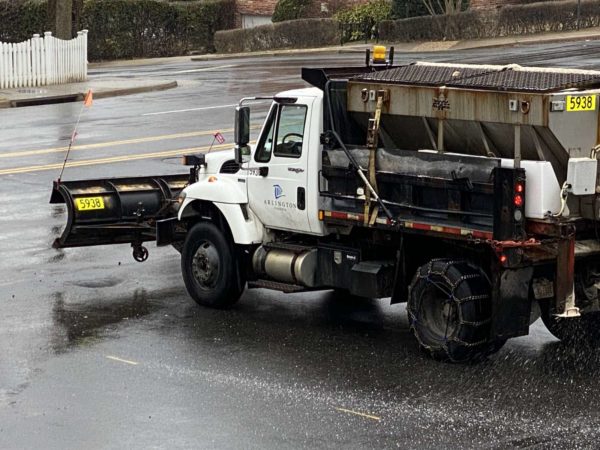
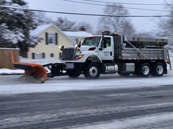
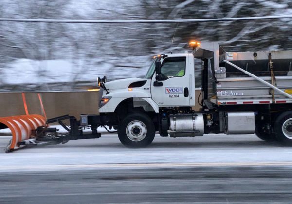
County and VDOT crews are out spreading salt, but even treated surfaces can become icy as rain falls amid sub-freezing surface temperatures. At least two bridges in the Courthouse area were closed due to slick conditions.

“Due to icy conditions the 10th Street bridge and Courthouse Rd bridge of Route 50 have been closed,” an Arlington Alert said at 9:30 a.m.

The earlier Winter Weather Advisory was upgraded to an Ice Storm Warning as of 2 p.m. Saturday. As of 3 p.m., the National Weather Service reported more than a tenth of an inch of ice accumulation in Arlington.

More from NWS:

156 PM EST SAT FEB 13 2021

…ICE STORM WARNING IN EFFECT UNTIL 7 AM EST SUNDAY…

* WHAT…TWO TO THREE TENTHS OF AN INCH OF SLEET AND FREEZING RAIN CAUSING SIGNIFICANT ICING IMPACTS.

* WHERE…THE DISTRICT OF COLUMBIA, AND PORTIONS OF CENTRAL MARYLAND AND NORTHERN VIRGINIA.

* WHEN…UNTIL 7 AM EST SUNDAY.

* IMPACTS…DIFFICULT TRAVEL CONDITIONS.

* ADDITIONAL DETAILS…ROADWAYS ARE BECOMING VERY ICY AND DANGEROUS. AVOID ALL UNNECESSARY TRAVEL.

PRECAUTIONARY/PREPAREDNESS ACTIONS…

TRAVEL IS STRONGLY DISCOURAGED. IF YOU MUST TRAVEL, KEEP AN EXTRA FLASHLIGHT, FOOD AND WATER IN YOUR VEHICLE IN CASE OF AN EMERGENCY. PREPARE FOR POSSIBLE POWER OUTAGES.

WHEN VENTURING OUTSIDE, WATCH YOUR FIRST FEW STEPS TAKEN ON STEPS, SIDEWALKS, AND DRIVEWAYS, WHICH COULD BE ICY AND SLIPPERY, INCREASING YOUR RISK OF A FALL AND INJURY.

In an email earlier this morning, VDOT said those who absolutely must travel should “use extreme caution.”

Significant icing is anticipated with the next wave of inclement weather. With prolonged freezing rain and low pavement temperatures expected through the day Saturday, VDOT strongly advises against nonessential travel. Those who must drive should closely monitor weather and road conditions, and use extreme caution. Even on treated roads, slick pavement will be possible. […]

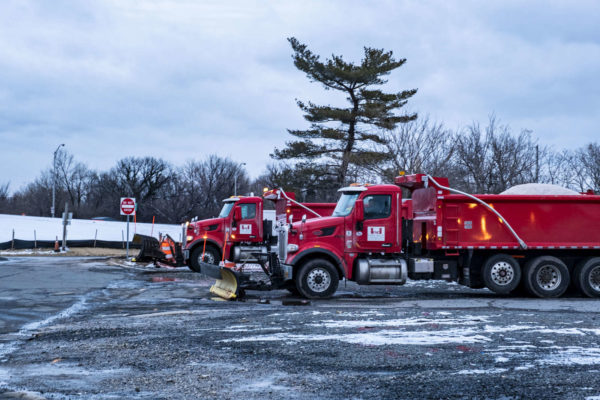
Crews have positioned materials and equipment, and will apply treatment such as sand and salt as needed to icy patches and trouble spots to improve traction. Tree crews are ready to trim and remove branches weighed down or broken by ice, and to support utility companies on potential downed or entangled lines.

Numerous crashes have been reported around Arlington since this morning, including on treated roads. Virginia State Police say the VSP division that serves Arlington and other parts of Northern Virginia has responded to 83 crashes and 29 disabled vehicles as of 4 p.m.

“Virginia State Police continues to discourage Virginians from driving through Sunday (Feb. 14) due to extremely icy and treacherous conditions across much of Central, Southeastern and Northern Virginia,” a spokeswoman said via email.

More from social media:

https://twitter.com/jenkochan/status/1360593888415797254


(Updated at 5 p.m.) Arlington County is under a Winter Weather Advisory for Saturday into Sunday.

The National Weather Service says wintry precipitation starting Saturday morning may lead to slippery roads, with ice accumulation up to a fifth of an inch or so.

An earlier Winter Storm Watch was downgraded to an advisory Friday afternoon.

More from NWS:

310 PM EST Fri Feb 12 2021

…WINTER WEATHER ADVISORY IN EFFECT FROM 10 AM SATURDAY TO 7 AM EST SUNDAY…

* WHAT…Freezing rain, mixed with sleet at times. Storm total ice accumulations of one tenth to two tenths of an inch.

* WHERE…The District of Columbia, and portions of central and southern Maryland and central, northern and northwest Virginia.

* WHEN…From 10 AM Saturday to 7 AM EST Sunday.

* IMPACTS…Prepare for difficult travel conditions.

* ADDITIONAL DETAILS…Even a small amount of ice on untreated surfaces can make travel treacherous.

PRECAUTIONARY/PREPAREDNESS ACTIONS…

Slow down and use caution while traveling. Prepare for possible power outages.

When venturing outside, watch your first few steps taken on steps, sidewalks, and driveways, which could be icy and slippery, increasing your risk of a fall and injury.

In a sign of what may be to come, Metro is planning to operate on a moderate snow service plan to start the day on Saturday.

It does not take much ice buildup on roadways to create very dangerous conditions. On Thursday morning, an icy highway in Fort Worth, Texas caused a massive pileup that killed six people and involved more than 100 vehicles.


(Updated at 11:15 a.m.) Another round of wintry weather is on tap, starting late night.

A Winter Weather Advisory was issued this morning for Arlington and other parts of the region, with forecasters calling for 1-3 inches of snow accumulation through Thursday morning. Additional rounds of snowfall are expected in the days ahead.

More on tonight’s snow event, from the National Weather Service.

…WINTER WEATHER ADVISORY IN EFFECT FROM 7 PM THIS EVENING TO 10 AM EST THURSDAY…

* WHAT…SNOW EXPECTED. TOTAL SNOW ACCUMULATIONS OF 1 TO 3 INCHES.

* WHERE…PORTIONS OF THE DISTRICT OF COLUMBIA, CENTRAL, NORTH CENTRAL, NORTHEAST AND NORTHERN MARYLAND, NORTHERN AND NORTHWEST VIRGINIA AND PANHANDLE WEST VIRGINIA.

* WHEN…FROM 7 PM THIS EVENING TO 10 AM EST THURSDAY.

* IMPACTS…PLAN ON SLIPPERY ROAD CONDITIONS. THE HAZARDOUS CONDITIONS COULD IMPACT THE MORNING OR EVENING COMMUTE.

PRECAUTIONARY/PREPAREDNESS ACTIONS…

SLOW DOWN AND USE CAUTION WHILE TRAVELING.

WHEN VENTURING OUTSIDE, WATCH YOUR FIRST FEW STEPS TAKEN ON STEPS, SIDEWALKS, AND DRIVEWAYS, WHICH COULD BE ICY AND SLIPPERY, INCREASING YOUR RISK OF A FALL AND INJURY.

Arlington County crews have been pre-treating local roads and trails with brine lines in anticipation of the snow. VDOT crews are also pre-treating highways and major commuter routes in Arlington.

https://twitter.com/VaDOT/status/1359536658564145153


Arlington residents should “take steps today to prepare for winter weather,” the county’s emergency management office says.

Snow is in the forecast for seven of the next eight days, and the National Weather Service is cautioning of a winter storm threat from Thursday into Friday. (See below.)

Via social media, county officials this morning recommended “picking up a few extra non perishable foods,” along with sand for icy sidewalks. Residents should also check on “neighbors who may need help,” the emergency management office said.

An early trip to the grocery store may avoid crowds, while an early online grocery delivery order may avoid a lack of available delivery windows.

Arlington’s Dept. of Environmental Services, meanwhile, says it is “watching the developing forecast through Friday” and is prepared to pre-treat local roads with brine.

Via social media:


Despite temperatures expected to reach 50 degrees today, Arlington is mere hours from the start of a winter storm with snowfall that may exceed that of last weekend.

A Winter Storm Warning has been issued for Arlington and surrounding communities, with forecasters calling for 3-6 inches of accumulation. The warning is in effect from 3 a.m.-noon on Super Bowl Sunday.

Periods of heavy snow are expected Sunday morning, making travel treacherous, but warming temperatures should allow those with plans for the big game to get around with few issues later in the afternoon.

Snow crews are getting ready to do battle with the elements once again

“VDOT Northern Virginia crews are ready for a quick-hitting winter storm expected to impact the district early Sunday,” VDOT said today. “Today, crews are pre-treating bridges, ramps, overpasses and other trouble spots throughout Arlington, Fairfax, Loudoun, and Prince William counties, to help prevent ice and snow from bonding to the pavement at the onset of the storm.”

“Residents are asked to monitor forecasts, plan ahead to avoid nonessential travel during the storm, and be aware of the potential for slick spots overnight Sunday.” the transportation agency noted.

The City of Falls Church, meanwhile, is activating its snow emergency routes at 9 p.m. tonight (Saturday).

More from the National Weather Service:

…WINTER STORM WARNING REMAINS IN EFFECT FROM 3 AM TO NOON EST SUNDAY…

* WHAT…HEAVY SNOW EXPECTED. TOTAL SNOW ACCUMULATIONS OF 3 TO 6 INCHES.

* WHERE…THE DISTRICT OF COLUMBIA, AND PORTIONS OF CENTRAL AND SOUTHERN MARYLAND AND NORTHERN VIRGINIA.

* WHEN…FROM 3 AM TO NOON EST SUNDAY.

* IMPACTS…TRAVEL COULD BE VERY DIFFICULT.

* ADDITIONAL DETAILS…SNOW IS EXPECTED TO BEGIN BETWEEN 3 AM AND 5 AM, AND MAY BRIEFLY MIX WITH RAIN AT FIRST. THE HEAVIEST SNOW IS EXPECTED BETWEEN 6 AM AND 10 AM, WHEN VISIBILITY MAY BE REDUCED TO A QUARTER MILE AND SNOWFALL RATES COULD REACH ONE INCH PER HOUR.

PRECAUTIONARY/PREPAREDNESS ACTIONS…

IF YOU MUST TRAVEL, KEEP AN EXTRA FLASHLIGHT, FOOD, AND WATER IN YOUR VEHICLE IN CASE OF AN EMERGENCY.

WHEN VENTURING OUTSIDE, WATCH YOUR FIRST FEW STEPS TAKEN ON STEPS, SIDEWALKS, AND DRIVEWAYS, WHICH COULD BE ICY AND SLIPPERY, INCREASING YOUR RISK OF A FALL AND INJURY.


Arlington County and much of the D.C. region is under a Winter Storm Watch, with close to a half-foot of snow possible over the weekend.

The National Weather Service issued the watch this afternoon, saying that the snow will fall from late Saturday night through the afternoon of Super Bowl Sunday. That’s despite today’s relative warmth, in the mid-50s.

The Washington Post’s Capital Weather Gang is a bit more conservative in its forecast, currently calling for 1-3 inches.

More from NWS:

313 PM EST FRI FEB 5 2021

…WINTER STORM WATCH IN EFFECT FROM LATE SATURDAY NIGHT THROUGH SUNDAY AFTERNOON…

* WHAT…HEAVY SNOW POSSIBLE. TOTAL SNOW ACCUMULATIONS OF 5 OR MORE INCHES POSSIBLE.

* WHERE…THE DISTRICT OF COLUMBIA, AND PORTIONS OF CENTRAL AND SOUTHERN MARYLAND, NORTHERN VIRGINIA, AND EASTERN WEST VIRGINIA.

* WHEN…FROM LATE SATURDAY NIGHT THROUGH SUNDAY AFTERNOON.

* IMPACTS…PLAN ON SLIPPERY ROAD CONDITIONS.

PRECAUTIONARY/PREPAREDNESS ACTIONS…

MONITOR THE LATEST FORECASTS FOR UPDATES ON THIS SITUATION.


This morning, in western Pennsylvania, Punxsutawney Phil saw his shadow and thus prognosticated six more weeks of winter.

If you were to only count the couple of hours after the prediction in Arlington, the groundhog was spot on.

Arlington residents woke up to another snow globe scene outside of their windows, with flakes flying from a narrow band of snow that seemingly targeted the I-95 corridor.

As of 8:30 a.m., the National Weather Service reported that 2.4 inches of snow has accumulated in the county over the past 24 hours. NWS also extended the Winter Weather Advisory that covers Arlington through 1 p.m.

807 AM EST Tue Feb 2 2021

…WINTER WEATHER ADVISORY NOW IN EFFECT UNTIL 1 PM EST THIS AFTERNOON…

* WHAT…Snow. Additional snow accumulations of up to two inches.

* WHERE… The District of Columbia, central, north central, northeast, northern and southern Maryland and central and northern Virginia.

* WHEN… Until 1 PM EST this afternoon.

* IMPACTS…Plan on slippery road conditions. The hazardous conditions could impact the morning commute.

PRECAUTIONARY/PREPAREDNESS ACTIONS…

Slow down and use caution while traveling.

When venturing outside, watch your first few steps taken on steps, sidewalks, and driveways, which could be icy and slippery, increasing your risk of a fall and injury.

Across Arlington, plow crews largely kept pace with the falling snow. Most local roads remain wet, with only patches of snow.

“Crews continue to treat roadways this morning with hundreds of tons of salt but the weather still does its thing,” Arlington’s Dept. of Environmental Services said this morning on social media. “Avoid travel if possible. If not, go extra slow.”

Arlington’s schools are closed today in favor of all virtual learning. ART buses are running on a limited schedule due to the weather. More snow is possible throughout the day.

Kids are not the only ones enjoying playing in the snow. This morning, School Board member Barbara Kanninen posted a video of a playful fox frolicking through the snow in north Arlington.


(Updated at 2:15 p.m.) Freezing temperatures and frozen precipitation overnight has made for slippery conditions around Arlington Monday morning.

With many locals working from home already, traffic around Arlington is light. Thanks to the efforts of snow crews, main roads are mostly wet and side streets have been treated. Few crashes have been reported since sunrise, but that might also be attributable to people staying at home.

Still, caution is being urged.

“Overnight crews have been treating known slick areas but caution is advised for those who must drive this morning. Go slow,” wrote Arlington’s Dept. of Environmental Services this morning.

County crews are currently in Phase 4 of the snow removal effort, “following up on problem areas, schools and other county facilities.” Many sidewalks, including those maintained by the county, are icy and treacherous.

https://twitter.com/NicoleMerleneVA/status/1356253856959750146

Both Arlington Transit and Metro buses are operating on modified schedules.

Due to the wintry conditions, residential trash and recycling collection has been cancelled today. Collection will resume tomorrow and take place a day after one’s normal waste collection day.

Another cancellation today: vaccine appointments. While the county worked throughout the weekend to reschedule the appointments of those formerly set to receive vaccines from Virginia Hospital Center, another round of cancellations is taking place today due to the weather.

“Due to the impending winter weather, the Arlington vaccine clinics scheduled for Monday, February 1 have been cancelled in the interest of client and staff safety,” says the county’s website. “ALL individuals who have scheduled times for Monday WILL be rescheduled as early as possible.”

That prompted the following Twitter exchange with County Board Chair Matt de Ferranti this morning.

Arlington Public Schools, meanwhile, has been mostly operating remotely, but even virtual students are not attending classes today as a result of a pre-scheduled grade preparation day. APS buildings, nonetheless, are closed for sports and other activities due to the weather.

While the bulk of the precipitation fell on Sunday, Arlington may see a bit more later today. A Winter Weather Advisory has been extended until 9 a.m. Tuesday, with forecasters warning of continued slippery conditions outside.

More from the National Weather Service:

…WINTER WEATHER ADVISORY NOW IN EFFECT UNTIL 9 AM EST TUESDAY…

* WHAT…MIXED PRECIPITATION. ADDITIONAL SNOW ACCUMULATIONS OF UP TO TWO INCHES AND ICE ACCUMULATIONS OF UP TO ONE TENTH OF AN INCH.

* WHERE…THE DISTRICT OF COLUMBIA, PORTIONS OF CENTRAL, NORTHERN AND SOUTHERN MARYLAND AND NORTHERN VIRGINIA.

* WHEN…UNTIL 9 AM EST TUESDAY.

* IMPACTS…PLAN ON SLIPPERY ROAD CONDITIONS. THE HAZARDOUS CONDITIONS COULD IMPACT THE MORNING OR EVENING COMMUTE.

PRECAUTIONARY/PREPAREDNESS ACTIONS…

SLOW DOWN AND USE CAUTION WHILE TRAVELING.

WHEN VENTURING OUTSIDE, WATCH YOUR FIRST FEW STEPS TAKEN ON STEPS, SIDEWALKS, AND DRIVEWAYS, WHICH COULD BE ICY AND SLIPPERY, INCREASING YOUR RISK OF A FALL AND INJURY.

Yesterday’s snowfall was Arlington’s biggest in two years, despite clocking in at a disappointing two inches of accumulation. It did, however, lead to plenty of outdoor fun for cooped-up kids, and some beautiful scenes across the county, like the one below.


Arlington, D.C. and much of the region is now under a Winter Storm Warning.

The county is expected to receive 4-8 inches of snow accumulation from the incoming winter storm, likely the biggest in two years. The flakes are expected to start falling Sunday morning before the nor’easter finally pulls out Monday night, as it makes its way up the East Coast.

Arlington County and VDOT crews have been pre-treating roads and trails ahead of the winter weather, and snowplows will operate in shifts as the snow accumulates.

“Crews will finish pretreating roads in Arlington, Fairfax, Loudoun, and Prince William counties today, to help prevent ice and snow from bonding to the pavement at the onset of the storm,” VDOT said today. “More than 1,850 trucks will be staged by the onset of the storm ready to treat roads, and will begin to plow once two inches of snow have accumulated. Additional equipment and crews are ready as needed, including tree crews to handle downed branches from ice.”

“Monitor the forecast closely and prepare to stay off roads when the storm begins to allow crews room to work. Plan to avoid travel Sunday and into Monday,” the state transportation agency added. “Park in driveways or a single side of the street to allow a wider path for plows. If you must drive, ensure gas and wiper fluid tanks are full, be prepared with an emergency kit and be familiar with these winter driving tips.”

Metrobuses will operate under a “moderate snow plan” on Sunday. Metrorail will operate under a normal weekend schedule, though changes may be make if the snow accumulates more than 6 inches. Arlington Transit buses are also likely to operate under some form of limited service.

Nearby Falls Church is activating its snow emergency routes at 9 a.m. Sunday.

In parts of Arlington today, some grocery shelves were bare as shoppers stocked up before the multi-day storm. While the pandemic has nixed most local events, some that are still being held, including the Columbia Pike Farmers Market, have been cancelled.

The snow, meanwhile, isn’t the only weather threat to monitor. Gusty winds from Monday into Tuesday could, in combination with the wet snowfall, cause tree branches to fall, resulting in power outages.

More on the Winter Storm Warning, from the National Weather Service:

230 PM EST SAT JAN 30 2021

…WINTER STORM WARNING REMAINS IN EFFECT FROM 1 AM SUNDAY TO MIDNIGHT EST SUNDAY NIGHT…

* WHAT…HEAVY SNOW EXPECTED. SNOW ACCUMULATIONS THROUGH SUNDAY NIGHT AROUND 3 TO 6 INCHES WITH ICE ACCUMULATIONS AROUND ONE TENTH OF AN INCH.

* WHERE…THE WASHINGTON METROPOLITAN AREA.

* WHEN…FROM 1 AM SUNDAY TO MIDNIGHT EST SUNDAY NIGHT. SNOW WILL OVERSPREAD THE AREA BETWEEN 3 AND 5 AM EARLY SUNDAY MORNING. THE STEADIEST SNOW WILL FALL THROUGH SUNDAY AFTERNOON BEFORE  TAPERING OFF TO AN INTERMITTENT MIX OF LIGHT SNOW, SLEET, AND FREEZING RAIN. ADDITIONAL SNOW IS EXPECTED MONDAY THROUGH MONDAY NIGHT WITH ADDITIONAL ACCUMULATIONS MOST LIKELY AROUND 1 TO 3 INCHES, BRINGING THE STORM TOTAL ACCUMULATIONS AROUND 4 TO 8 INCHES.

* IMPACTS…TRAVEL WILL BE VERY DIFFICULT SUNDAY THROUGH TUESDAY MORNING DUE TO A PROLONGED PERIOD OF SNOW AND WINTRY PRECIPITATION WITH TEMPERATURES NEAR OR BELOW FREEZING.

PRECAUTIONARY/PREPAREDNESS ACTIONS…

IF YOU MUST TRAVEL, KEEP AN EXTRA FLASHLIGHT, FOOD, AND WATER IN YOUR VEHICLE IN CASE OF AN EMERGENCY.

WHEN VENTURING OUTSIDE, WATCH YOUR FIRST FEW STEPS TAKEN ON STEPS, SIDEWALKS, AND DRIVEWAYS, WHICH COULD BE ICY AND SLIPPERY, INCREASING YOUR RISK OF A FALL AND INJURY.

Two snowfall maps, from NWS and the Capital Weather Gang, are below.


(Updated at 3:45 p.m.) Arlington is preparing for what could be the most snow the county and the region has seen in more than two years.

The region is likely to see at least 4-8 inches, with snow starting to fall Sunday morning, according to Capital Weather Gang. This afternoon, the National Weather Service issued a Winter Storm Watch for the region.

From NWS:

WINTER STORM WATCH IN EFFECT FROM LATE SATURDAY NIGHT THROUGH LATE SUNDAY NIGHT…

* WHAT…HEAVY SNOW POSSIBLE. POTENTIAL FOR 5 OR MORE INCHES OF SNOW.

* WHERE… THE DISTRICT OF COLUMBIA, AND PORTIONS OF CENTRAL AND SOUTHERN MARYLAND, CENTRAL AND NORTHERN VIRGINIA, AND THE EASTERN PANHANDLE OF WEST VIRGINIA.

* WHEN…FROM LATE SATURDAY NIGHT THROUGH LATE SUNDAY NIGHT.

* IMPACTS…TRAVEL COULD BE VERY DIFFICULT.

PRECAUTIONARY/PREPAREDNESS ACTIONS…

MONITOR THE LATEST FORECASTS FOR UPDATES ON THIS SITUATION.

State and county agencies have already started preparing the roads for the wintery weather.

Arlington’s Dept. of Environmental Services tells ARLnow that they began pre-treating streets with brine — a salt and water mixture — yesterday.

That pre-treatment process is continuing today. Full deployment of the county’s snow plow teams will start early Sunday, a DES spokesperson says, with 92 drivers and 46 trucks equipped with salt spreaders and plows.

There will be staggered shifts the operations center due to COVID-19 protocols.

DES is asking residents to re-familiarize themselves with snow removal processes, which includes plowing only after snow depth hits at least two inches. In addition, they are requesting residents who park on narrow roads to put vehicles elsewhere so that plows can make their way through.

In fact, they are making a competition out of it and are asking folks to post pictures of their creative parking skills.


A number of major Arlington roads are maintained by the Virginia Department of Transportation, including Lee Highway, Arlington Blvd, Glebe Road, and others.

VDOT spokesperson Ellen Kamilakis tells ARLnow that residents should be seeing brine tankers out right now. The current cold and clear conditions are perfect for spraying brine.

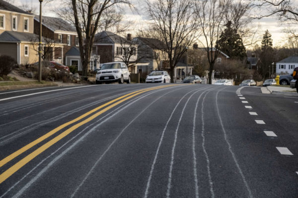
“The goal is for it to evaporate and leave the salt residue, those white brine lines,” she says. “Today is perfect to be doing it. People are going to be seeing them everywhere.”

She cautions that they often work in pairs, a tanker and a trailing vehicle, and move slowly. The crews make a lot of U-turns, she says, so drivers should avoid getting between them.

Kamilakis says that there are about 130 trucks deployed right now covering Arlington County and the interstates that cut through the county.

With the region having not seen snowfall like what is being predicted in a while, she says that residents may “not have their snow legs yet” and have forgotten what it’s like to drive in the snow.

Kamilakis cautions folks to monitor the forecast, drive carefully and slowly, and brake earlier. If VDOT puts out the call to stay off the roads, to do so.

“If we’re asking you to stay off the roads, it’s serious enough for us to ask that,” she said.

Another thing Arlington residents should take note of: the county’s snow removal ordinance, which requires that sidewalks be shoveled within 24 hours of the end of a snow event with six inches or less of accumulation, or 36 hours for storms that drop more than six inches.


View More Stories