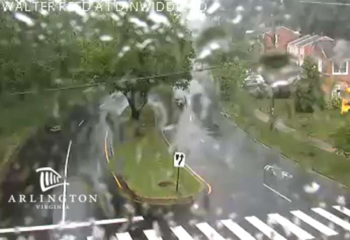
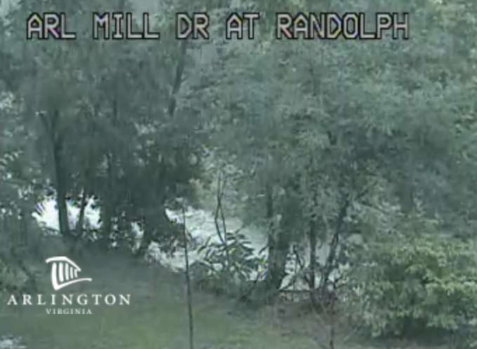
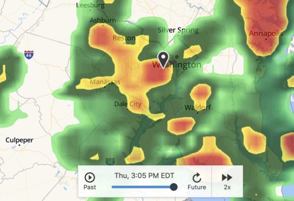
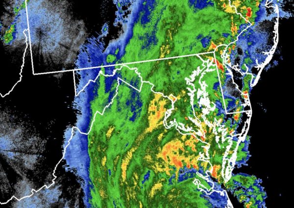
A Flash Flood Watch has been issued for Arlington, set to take effect early tomorrow morning.

The watch is in effect from 2 a.m.-8 p.m. Thursday. Forecasters say expected heavy rain could result in flash flooding.

More from the National Weather Service:

…FLASH FLOOD WATCH IN EFFECT FROM 2 AM EDT THURSDAY THROUGH  THURSDAY EVENING…

THE NATIONAL WEATHER SERVICE IN STERLING VIRGINIA HAS EXPANDED THE

* FLASH FLOOD WATCH TO INCLUDE PORTIONS OF DC… MARYLAND AND NORTHERN VIRGINIA, INCLUDING THE FOLLOWING AREAS: IN DC, DISTRICT OF COLUMBIA. IN MARYLAND, CENTRAL AND SOUTHEAST HOWARD, CENTRAL AND SOUTHEAST MONTGOMERY, SOUTHEAST HARFORD AND SOUTHERN BALTIMORE. IN NORTHERN VIRGINIA, ARLINGTON/FALLS CHURCH/ALEXANDRIA, FAIRFAX AND PRINCE WILLIAM/MANASSAS/MANASSAS PARK.

* FROM 2 AM EDT THURSDAY THROUGH THURSDAY EVENING

* NUMEROUS SHOWERS AND A FEW THUNDERSTORMS WILL CONTINUE TO DEVELOP ACROSS THE AREA, WITH LOCALLY HEAVY RAIN MOST LIKELY FROM LATE TONIGHT THROUGH THURSDAY AFTERNOON. AVERAGE RAINFALL AMOUNTS OF ONE TO TWO INCHES ARE EXPECTED, WITH ISOLATED HIGHER AMOUNTS POSSIBLE.

* HEAVY RAINFALL MAY RESULT IN RAPID RISES OF WATER IN SMALL CREEKS AND STREAMS, AS WELL AS IN URBAN AND POOR DRAINAGE AREAS.

PRECAUTIONARY/PREPAREDNESS ACTIONS…

A FLASH FLOOD WATCH MEANS THAT CONDITIONS MAY DEVELOP THAT LEAD TO FLASH FLOODING. FLASH FLOODING IS A VERY DANGEROUS SITUATION. YOU SHOULD MONITOR LATER FORECASTS AND BE PREPARED TO TAKE ACTION SHOULD FLASH FLOOD WARNINGS BE ISSUED.



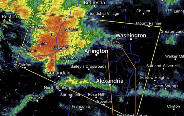
Northern and eastern portions of Arlington County are now under a Severe Thunderstorm Warning.

The tail end of a strong storm that brought high winds and possibly tornadoes to Montgomery County is expected to blow through part of the county.

From the National Weather Service:

BULLETIN – IMMEDIATE BROADCAST REQUESTED
SEVERE THUNDERSTORM WARNING
NATIONAL WEATHER SERVICE BALTIMORE MD/WASHINGTON DC
527 PM EDT THU SEP 3 2020

THE NATIONAL WEATHER SERVICE IN STERLING VIRGINIA HAS ISSUED A

* SEVERE THUNDERSTORM WARNING FOR…
THE DISTRICT OF COLUMBIA…
SOUTH CENTRAL ANNE ARUNDEL COUNTY IN CENTRAL MARYLAND…
SOUTH CENTRAL MONTGOMERY COUNTY IN CENTRAL MARYLAND…
NORTHWESTERN CALVERT COUNTY IN SOUTHERN MARYLAND…
CENTRAL PRINCE GEORGES COUNTY IN CENTRAL MARYLAND…
ARLINGTON COUNTY IN NORTHERN VIRGINIA…
EAST CENTRAL FAIRFAX COUNTY IN NORTHERN VIRGINIA…

* UNTIL 630 PM EDT.

* AT 527 PM EDT, A SEVERE THUNDERSTORM WAS LOCATED OVER FRIENDSHIP VILLAGE, OR NEAR FORT TOTTEN, MOVING EAST AT 35 MPH.

HAZARD…60 MPH WIND GUSTS AND QUARTER SIZE HAIL.

SOURCE…RADAR INDICATED.

IMPACT…DAMAGING WINDS WILL CAUSE SOME TREES AND LARGE BRANCHES TO FALL. THIS COULD INJURE THOSE OUTDOORS, AS WELL AS DAMAGE HOMES AND VEHICLES. ROADWAYS MAY BECOME BLOCKED BY DOWNED TREES. LOCALIZED POWER OUTAGES ARE POSSIBLE. UNSECURED LIGHT OBJECTS MAY BECOME PROJECTILES.

* LOCATIONS IMPACTED INCLUDE… ARLINGTON, BETHESDA, BOWIE, CLINTON, FORESTVILLE, LARGO, CORAL HILLS, BLADENSBURG, MAYO, SHADY SIDE, CHESAPEAKE BEACH, DEALE, UPPER MARLBORO, NATIONALS PARK, FEDEX FIELD, HOWARD UNIVERSITY, RHODE RIVER, GALLAUDET UNIVERSITY, FORT TOTTEN AND REAGAN NATIONAL AIRPORT.

PRECAUTIONARY/PREPAREDNESS ACTIONS…

A TORNADO WATCH REMAINS IN EFFECT UNTIL 1000 PM EDT FOR DISTRICT OF COLUMBIA…CENTRAL AND SOUTHERN MARYLAND…AND NORTHERN VIRGINIA.

FOR YOUR PROTECTION MOVE TO AN INTERIOR ROOM ON THE LOWEST FLOOR OF A BUILDING.


Arlington and much of the region is under a Tornado Watch from now through 10 p.m.

Forecasters say storms now forming to the west could pack strong winds and even some tornadoes. Those in the watch zone are urged to keep an eye on the sky, and to take cover if necessary.

More from the National Weather Service:

URGENT – IMMEDIATE BROADCAST REQUESTED
Tornado Watch Number 485
NWS Storm Prediction Center Norman OK
340 PM EDT Thu Sep 3 2020

The NWS Storm Prediction Center has issued a

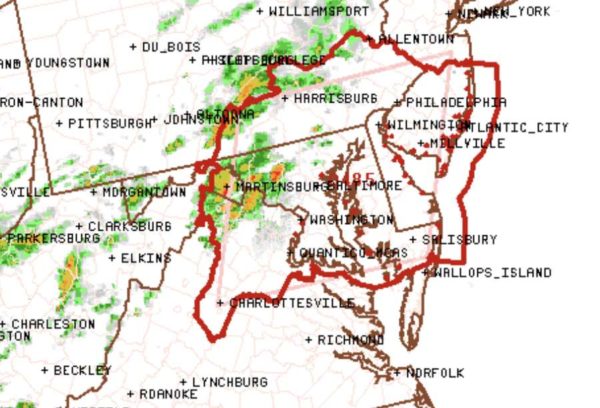
* Tornado Watch for portions of District Of Columbia, Delaware, Maryland, Southern New Jersey, Southeast Pennsylvania, Northern Virginia, Eastern West Virginia Panhandle, Coastal Waters

* Effective this Thursday afternoon and evening from 340 PM until 1000 PM EDT.

* Primary threats include… A few tornadoes likely. Scattered damaging winds likely with isolated significant gusts
to 75 mph possible.

SUMMARY…Multiple supercells will likely develop near and north of the greater Washington D.C. area and spread east as a cluster across the coastal plain through mid-evening. A few tornadoes and swaths of damaging winds are likely.

The tornado watch area is approximately along and 85 statute miles east and west of a line from 45 miles north northwest of Wilmington DE to 30 miles west southwest of Patuxent River MD…

PRECAUTIONARY/PREPAREDNESS ACTIONS…

REMEMBER…A Tornado Watch means conditions are favorable for tornadoes and severe thunderstorms in and close to the watch area. Persons in these areas should be on the lookout for threatening weather conditions and listen for later statements and possible warnings.


Update at 10:15 p.m. — Another Flash Flood Warning has been issued, covering portions of Arlington south of I-66.

Update at 7 p.m. — Perhaps as a result of the storms, a large power outage has been reported in the Fairlington area. Dominion is reporting 1,258 customers currently without power in Arlington County, in addition to those without power across the border in Alexandria.

Updated at 6:55 p.m. — A Flash Flood Warning has been issued for portions of Arlington County along and south of Lee Highway. The warning is in effect until 10:45 p.m. Those walking or driving should avoid flood waters, which could rapidly rise as a result of heavy rain.

Update at 6:20 p.m. — A Flood Warning has now been issued and is set to remain in effect until just after midnight.

THE NATIONAL WEATHER SERVICE IN STERLING VIRGINIA HAS ISSUED A

* FLOOD WARNING FOR… THE NORTHWESTERN DISTRICT OF COLUMBIA… ARLINGTON COUNTY IN NORTHERN VIRGINIA… THE CITY OF FALLS CHURCH IN NORTHERN VIRGINIA… NORTHEASTERN FAIRFAX COUNTY IN NORTHERN VIRGINIA… THE CITY OF ALEXANDRIA IN NORTHERN VIRGINIA…

* UNTIL 1215 AM EDT.

* AT 616 PM EDT, DOPPLER RADAR INDICATED THUNDERSTORMS PRODUCING HEAVY RAIN WHICH WILL CAUSE FLOODING. UP TO ONE INCH OF RAIN HAS ALREADY FALLEN. ADDITIONAL RAINFALL AMOUNTS OF ONE TO TWO INCHES ARE POSSIBLE.

* SOME LOCATIONS THAT WILL EXPERIENCE FLOODING INCLUDE… ARLINGTON, ALEXANDRIA, ANNANDALE, SPRINGFIELD, VIENNA, FALLS CHURCH, HUNTINGTON, MANTUA, PIMMIT HILLS, AMERICAN LEGION BRIDGE, REAGAN NATIONAL AIRPORT, MCLEAN, ROSSLYN, CRYSTAL CITY, POTOMAC, BURKE, OAKTON, LINCOLNIA, TYSONS CORNER AND FRANCONIA.

PRECAUTIONARY/PREPAREDNESS ACTIONS…

TURN AROUND, DON’T DROWN WHEN ENCOUNTERING FLOODED ROADS. MOST FLOOD DEATHS OCCUR IN VEHICLES.

Update at 5:50 p.m. — A Severe Thunderstorm Warning was just issued for all of Arlington County until 6:30 p.m. A storm with high winds and possible hail is now rumbling into the county.

Update at 5:40 p.m. — A Flash Flood Watch has also been issued for Arlington and much of the area.

…FLASH FLOOD WATCH IN EFFECT UNTIL 4 AM EDT SATURDAY…

THE NATIONAL WEATHER SERVICE IN STERLING VIRGINIA HAS ISSUED A

* FLASH FLOOD WATCH…

* UNTIL 4 AM EDT SATURDAY

* SCATTERED TO NUMEROUS SHOWERS AND THUNDERSTORMS ARE EXPECTED THIS EVENING INTO THE OVERNIGHT HOURS. SOME OF THE SHOWERS AND THUNDERSTORMS WILL PRODUCE HEAVY RAINFALL, WITH LOCALIZED AMOUNTS BETWEEN 2 AND 4 INCHES LIKELY.

* POTENTIAL IMPACTS INCLUDE RAPID RISES OF WATER, FLOODED ROADS, AND FLOODING OF STRUCTURES IN LOW LYING AREAS NEAR STREAMS.

PRECAUTIONARY/PREPAREDNESS ACTIONS…

A FLASH FLOOD WATCH MEANS THAT CONDITIONS MAY DEVELOP THAT LEAD TO FLASH FLOODING. FLASH FLOODING IS A VERY DANGEROUS SITUATION.

YOU SHOULD MONITOR LATER FORECASTS AND BE PREPARED TO TAKE ACTION SHOULD FLASH FLOOD WARNINGS BE ISSUED.
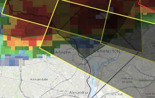
Earlier: Strong storms are possible this evening, prompting the National Weather Service to issue a Severe Thunderstorm Watch for Arlington and the region through 8 p.m.

Forecasters say storms may pack quarter-sized hail, damaging wind gusts and frequent lightning.

Some flooding is also possible. More from NWS:

A SEVERE THUNDERSTORM WATCH IS IN EFFECT UNTIL 8 PM FOR A MAJORITY OF THE WASHINGTON AND BALTIMORE METROPOLITAN AREAS. THE PRIMARY THREAT IS DAMAGING WINDS.

THUNDERSTORMS MAY ALSO PRODUCE ISOLATED INSTANCES OF FLOODING THROUGH THIS EVENING.


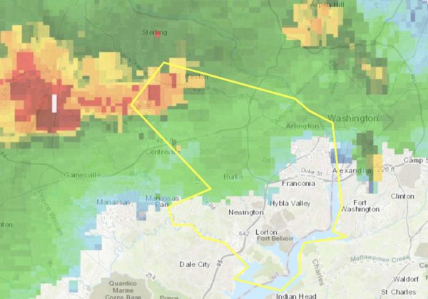
Arlington County is under a Severe Thunderstorm Warning through 7:45 p.m.

Forecasters say a strong storm is approaching the county from the northwest, bringing with it wind gusts of up to 60 mph.

More from the National Weather Service:

BULLETIN – IMMEDIATE BROADCAST REQUESTED
SEVERE THUNDERSTORM WARNING
NATIONAL WEATHER SERVICE BALTIMORE MD/WASHINGTON DC
657 PM EDT TUE AUG 25 2020

THE NATIONAL WEATHER SERVICE IN STERLING VIRGINIA HAS ISSUED A

* SEVERE THUNDERSTORM WARNING…

* UNTIL 745 PM EDT.

* AT 657 PM EDT, A SEVERE THUNDERSTORM WAS LOCATED NEAR RESTON, MOVING SOUTHEAST AT 30 MPH.

HAZARD…60 MPH WIND GUSTS.

SOURCE…RADAR INDICATED.

IMPACT…DAMAGING WINDS WILL CAUSE SOME TREES AND LARGE BRANCHES TO FALL. THIS COULD INJURE THOSE OUTDOORS, AS WELL AS DAMAGE HOMES AND VEHICLES. ROADWAYS MAY BECOME BLOCKED BY DOWNED TREES. LOCALIZED POWER OUTAGES ARE POSSIBLE. UNSECURED LIGHT OBJECTS MAY BECOME PROJECTILES.

* LOCATIONS IMPACTED INCLUDE… ARLINGTON, ALEXANDRIA, RESTON, ANNANDALE, SPRINGFIELD, FORT WASHINGTON, HERNDON, FAIRFAX, FORT HUNT, VIENNA, GROVETON, FALLS CHURCH, HUNTINGTON, MANTUA, FORT BELVOIR, PIMMIT HILLS, WOODBRIDGE, MCLEAN, REAGAN NATIONAL AIRPORT AND ROSSLYN.

PRECAUTIONARY/PREPAREDNESS ACTIONS…

FOR YOUR PROTECTION MOVE TO AN INTERIOR ROOM ON THE LOWEST FLOOR OF A BUILDING.


Arlington and the entire D.C. region is now under a Severe Thunderstorm Watch through 11 p.m.

Forecasters say strong storms packing damaging winds, large hail and torrential rainfall are likely this evening, though the storms may be scattered as they approach from the northwest.

More from the National Weather Service:

URGENT – IMMEDIATE BROADCAST REQUESTED
Severe Thunderstorm Watch Number 451
NWS Storm Prediction Center Norman OK
335 PM EDT Tue Aug 25 2020

The NWS Storm Prediction Center has issued a

* Severe Thunderstorm Watch for portions of District Of Columbia, Delaware, Extreme northeast Kentucky, Maryland, New Jersey, Eastern Pennsylvania, Central and northern Virginia, Southern West Virginia, Coastal Waters

* Effective this Tuesday afternoon and evening from 335 PM until 1100 PM EDT.

* Primary threats include… Scattered damaging wind gusts to 70 mph likely

Isolated large hail events to 1.5 inches in diameter possible

SUMMARY…Clusters of severe thunderstorms will move southeast through this evening with a risk for damaging wind gusts and isolated instances of large hail.

The severe thunderstorm watch area is approximately along and 55 statute miles north and south of a line from 35 miles west of Beckley WV to 50 miles east of Dover DE…

PRECAUTIONARY/PREPAREDNESS ACTIONS…

REMEMBER…A Severe Thunderstorm Watch means conditions are favorable for severe thunderstorms in and close to the watch area. Persons in these areas should be on the lookout for threatening weather conditions and listen for later statements and possible warnings. Severe thunderstorms can and occasionally do produce tornadoes.

Flickr pool photo by John Sonderman


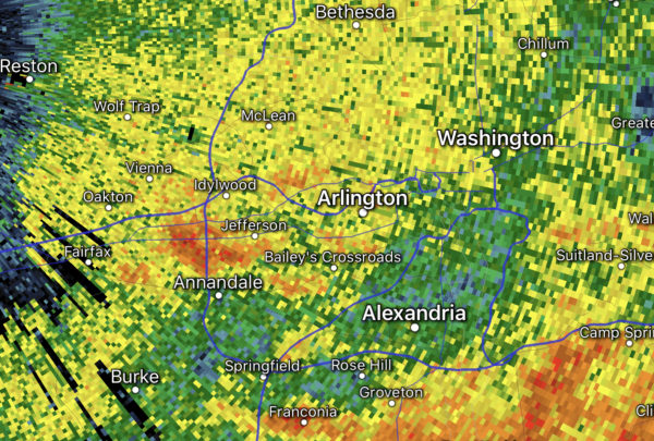
Arlington is under a Flash Flood Watch for the second day in a row.

After nary a raindrop fell in Arlington yesterday, today is starting out with steady rain and a bit of thunder — and there’s more rain on the way.

The National Weather Service says that the rain could be heavy at times and cause flash flooding. Flooding is already being reported south and west of Arlington this morning, in Prince William, Fauquier and Spotsylvania counties.

The Flash Flood Watch is in effect throughout the day today for most of the D.C. area More from NWS:

…FLASH FLOOD WATCH IN EFFECT THROUGH THIS EVENING…

The National Weather Service in Sterling Virginia has expanded the Flash Flood Watch to include portions of central Maryland, The District of Columbia, and Virginia, including the following areas, in central Maryland, Anne Arundel and Prince Georges. The District of Columbia. In Virginia, Albemarle, Arlington/Falls Church/Alexandria, Augusta, Central Virginia Blue Ridge, Culpeper, Eastern Highland, Fairfax, Greene, King George, Nelson, Northern Fauquier, Orange, Prince William, Rappahannock, Rockingham, Southern Fauquier, Spotsylvania, Stafford, and Western Highland.

Through this evening slow moving thunderstorms capable of producing heavy rainfall may develop today. Heavy rainfall from thunderstorms may lead to flash flooding. Potential impacts include rapid rises of water, flooded roads and flooding of structures in low lying areas near streams. Landslides and washouts are also possible.

PRECAUTIONARY/PREPAREDNESS ACTIONS…

A Flash Flood Watch means that conditions may develop that lead to flash flooding. Flash flooding is a very dangerous situation. You should monitor later forecasts and be prepared to take action should Flash Flood Warnings be issued.


After an early morning storm, Arlington is expecting more heavy rain today.

The region is under a Flash Flood Watch starting at noon. Forecasters say slow-moving storms could dump several inches of rain, potentially causing flash flooding.

More from the National Weather Service:

…FLASH FLOOD WATCH REMAINS IN EFFECT FROM NOON EDT TODAY THROUGH THIS EVENING…

* A COLD FRONT WILL MOVE INTO THE AREA WEDNESDAY AND THEN STALL OUT. NUMEROUS SLOW MOVING SHOWERS AND THUNDERSTORMS WILL POSE A RISK OF FLASH FLOODING. THUNDERSTORMS COULD PRODUCE ONE TO TWO INCHES OF RAIN WITH ISOLATED AMOUNTS UP TO FOUR INCHES POSSIBLE.

PRECAUTIONARY/PREPAREDNESS ACTIONS…

A FLASH FLOOD WATCH MEANS THAT CONDITIONS MAY DEVELOP THAT LEAD TO FLASH FLOODING. FLASH FLOODING IS A VERY DANGEROUS SITUATION.

YOU SHOULD MONITOR LATER FORECASTS AND BE PREPARED TO TAKE ACTION SHOULD FLASH FLOOD WARNINGS BE ISSUED.

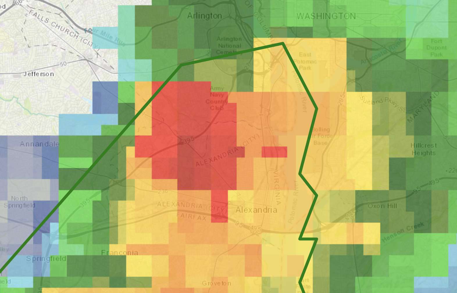
A portion of southern Arlington County is now under a Flood Warning, as a slow-moving storm drenches areas south of Route 50.

The warning is in effect until 8:45 p.m. An inch or so of rain has fallen and flooding is imminent, the National Weather Service says.

A Flash Flood Watch, meanwhile, remains in effect until 6 a.m.

More from NWS:

BULLETIN – IMMEDIATE BROADCAST REQUESTED
FLOOD WARNING
NATIONAL WEATHER SERVICE BALTIMORE MD/WASHINGTON DC
453 PM EDT THU AUG 6 2020

THE NATIONAL WEATHER SERVICE IN STERLING VIRGINIA HAS ISSUED A

* FLOOD WARNING FOR… SOUTHEASTERN ARLINGTON COUNTY IN NORTHERN VIRGINIA… SOUTHEASTERN FAIRFAX COUNTY IN NORTHERN VIRGINIA… THE CITY OF ALEXANDRIA IN NORTHERN VIRGINIA…

* UNTIL 845 PM EDT.

* AT 452 PM EDT, DOPPLER RADAR INDICATED THUNDERSTORMS PRODUCING HEAVY RAIN WHICH WILL CAUSE FLOODING. UP TO ONE INCH OF RAIN HAS ALREADY FALLEN. ADDITIONAL RAINFALL AMOUNTS OF UP TO ONE INCH ARE POSSIBLE.

* SOME LOCATIONS THAT WILL EXPERIENCE FLOODING INCLUDE… ARLINGTON, ALEXANDRIA, SPRINGFIELD, FORT WASHINGTON, FORT HUNT, GROVETON, HUNTINGTON, FORT BELVOIR, CRYSTAL CITY, LINCOLNIA, LORTON, FRANCONIA, HYBLA VALLEY, NEWINGTON, WEST SPRINGFIELD, MOUNT VERNON, HAYFIELD AND MASON NECK.

PRECAUTIONARY/PREPAREDNESS ACTIONS…

TURN AROUND, DON’T DROWN WHEN ENCOUNTERING FLOODED ROADS. MOST FLOOD DEATHS OCCUR IN VEHICLES.

EXCESSIVE RUNOFF FROM HEAVY RAINFALL WILL CAUSE FLOODING OF SMALL CREEKS AND STREAMS, URBAN AREAS, HIGHWAYS, STREETS AND UNDERPASSES AS WELL AS OTHER DRAINAGE AREAS AND LOW LYING SPOTS.


(Updated at 1:35 p.m.) After getting drenched by a storm early this morning, Arlington may be getting another round of heavy rain tonight.

The county and the D.C. region is currently under a Flash Flood Watch. Slow-moving storms are expected to form this afternoon, dumping torrential rainfall on ground already saturated by the morning storm and Isaias earlier this week — a recipe for flooding.

The watch is now in effect until 6 a.m. Friday; it was originally set to expire at midnight but was extended Thursday afternoon.

More from the National Weather Service:

…FLASH FLOOD WATCH IN EFFECT THROUGH THIS EVENING…

Through this evening… Numerous slow moving showers and thunderstorms continue to develop across the region and should expand and redevelop with time. Locations which are repetitively affected could receive multiple-inch rainfall totals. This could lead to rapid rises on streams and flash flooding of low lying areas.

PRECAUTIONARY/PREPAREDNESS ACTIONS… A Flash Flood Watch means that conditions may develop that lead to flash flooding. Flash flooding is a very dangerous situation. You should monitor later forecasts and be prepared to take action should Flash Flood Warnings be issued.

Image via The Weather Channel


Isaias made landfall in North Carolina last night as a Category 1 hurricane and is now approaching the D.C. area as a tropical storm.

Wind from the storm is expected to ramp up locally over the next hour, but the main threat remains heavy rain.

The National Weather Service issued a Flood Warning this morning for Arlington, Alexandria, Falls Church and parts of Fairfax. Several additional inches of rain are likely to fall and cause flooding, forecasters say.

More from NWS:

BULLETIN – IMMEDIATE BROADCAST REQUESTED
FLOOD WARNING
NATIONAL WEATHER SERVICE BALTIMORE MD/WASHINGTON DC
701 AM EDT TUE AUG 4 2020

THE NATIONAL WEATHER SERVICE IN STERLING VIRGINIA HAS ISSUED A

* FLOOD WARNING FOR…
THE CITY OF FAIRFAX IN NORTHERN VIRGINIA…
ARLINGTON COUNTY IN NORTHERN VIRGINIA…
THE CITY OF FALLS CHURCH IN NORTHERN VIRGINIA…
EASTERN FAIRFAX COUNTY IN NORTHERN VIRGINIA…
THE CITY OF ALEXANDRIA IN NORTHERN VIRGINIA…

* UNTIL 100 PM EDT.

* AT 700 AM EDT, DOPPLER RADAR AND AUTOMATED RAIN GAUGES INDICATED THAT HEAVY RAIN WAS FALLING OVER THE AREA. THE HEAVY RAIN WILL CAUSE FLOODING. UP TO ONE INCH OF RAIN HAS ALREADY FALLEN.ADDITIONAL RAINFALL AMOUNTS OF SEVERAL INCHES ARE POSSIBLE, AND FLASH FLOOD WARNINGS COULD BE REQUIRED LATER TODAY. FOR NOW, THOUGH, FLOODING WILL BE RELATIVELY SLOW TO DEVELOP.

* SOME LOCATIONS THAT WILL EXPERIENCE FLOODING INCLUDE… ARLINGTON, ALEXANDRIA, RESTON, ANNANDALE, SPRINGFIELD, FORT WASHINGTON, FAIRFAX, FORT HUNT, VIENNA, GROVETON, FALLS CHURCH, HUNTINGTON, MANTUA, FORT BELVOIR, PIMMIT HILLS, NATIONAL HARBOR, MCLEAN, REAGAN NATIONAL AIRPORT, ROSSLYN AND CRYSTAL CITY.

PRECAUTIONARY/PREPAREDNESS ACTIONS…

TURN AROUND, DON’T DROWN WHEN ENCOUNTERING FLOODED ROADS. MOST FLOOD DEATHS OCCUR IN VEHICLES.

A FLOOD WARNING MEANS THAT FLOODING IS IMMINENT OR OCCURRING. ALL INTERESTED PARTIES SHOULD TAKE NECESSARY PRECAUTIONS IMMEDIATELY.


View More Stories