Update at 4:15 p.m. — See the latest snow updates and photos here.

Update at 12:55 p.m. — Arlington County government offices and facilities are remaining open for the time being, but parks department programs in school and park facilities are cancelled after 2 p.m., the county says.

Update at 11:35 a.m. — Arlington Public Schools is dismissing two hours early tonight, as the onset of snow may be earlier than originally expected. From APS:

All APS schools and offices will close two hours early today. All essential employees should work their usual shifts. The Extended Day Program will stay open until 4 p.m.  Extracurricular activities, games, team practices, field trips, adult education classes, and programs in schools and on school grounds are canceled.

Update at 11 a.m. — Arlington County says it’s salting bridges and hills in anticipation of the snow. The Office of Personnel Management, meanwhile, says federal offices will have an early dismissal by 1 p.m. today.

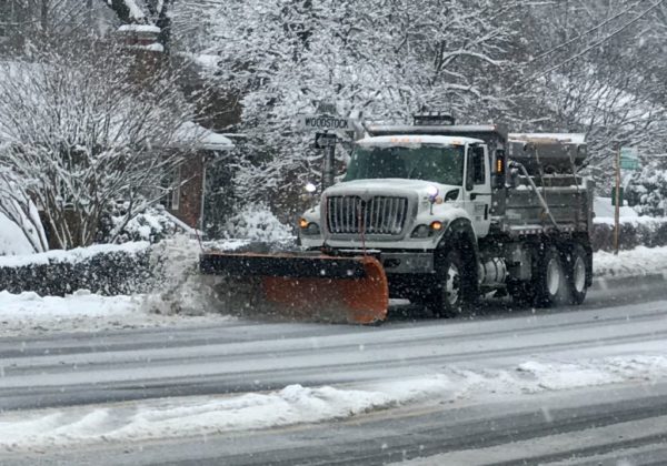
Earlier: A Winter Weather Advisory is in effect from noon to 7 p.m. today, as the D.C. region braces for the first significant snowfall of the season.

The snow is expected to start falling this afternoon and to impact the evening rush hour. Fairfax County and other school systems have announced early dismissals today, though as of 9:45 a.m. Arlington had not made any such announcement.

Some 1-2 inches of snow is expected locally.

More from the National Weather Service:

…WINTER WEATHER ADVISORY IN EFFECT FROM NOON TODAY TO 7 PM EST THIS EVENING… * WHAT…WET SNOW EXPECTED. TOTAL SNOW ACCUMULATIONS AN INCH OR TWO. * WHERE…IN DISTRICT OF COLUMBIA, DISTRICT OF COLUMBIA. IN VIRGINIA, ARLINGTON/FALLS CHURCH/ALEXANDRIA. * WHEN…FROM NOON TO 7 PM EST TUESDAY. THE HEAVIEST SNOW IS EXPECTED BETWEEN 3 PM AND 6 PM TUESDAY AFTERNOON INTO EARLY TUESDAY EVENING. * IMPACTS…SNOW COVERED AND SLIPPERY ROADS ARE EXPECTED, ESPECIALLY NORTHWEST OF INTERSTATE 95 INTO THE EVENING COMMUTE. * ADDITIONAL DETAILS…SNOW RATES COULD EXCEED ONE INCH PER HOUR WITH VISIBILITY AROUND ONE-HALF MILE AT TIMES. PRECAUTIONARY/PREPAREDNESS ACTIONS… SLOW DOWN AND USE CAUTION WHILE TRAVELING. WHEN VENTURING OUTSIDE, WATCH YOUR FIRST FEW STEPS TAKEN ON STEPS, SIDEWALKS, AND DRIVEWAYS, WHICH COULD BE ICY AND SLIPPERY, INCREASING YOUR RISK OF A FALL AND INJURY. &&

VDOT says it is pretreating local roads and highways. The transportation agency is advising drivers to be careful on the roads tonight and to consider leaving work early.

VDOT Asks Drivers To:

Continue to closely monitor weather, as forecasts can improve or worsen quickly. Stay tuned to local media for the real-time status of weather bands before traveling, due to the likelihood for limited visibility.

If road conditions become hazardous, delay travel for your safety and to give trucks time to treat roads. Leave earlier or delay trips to avoid driving during the height of the storm.

Before traveling, check road conditions along your route at www.511virginia.org, on the free app for Apple and Android, or call 511 from any phone in Virginia.

Be aware of the potential for slick spots on areas prone to freezing such as bridges, ramps and overpasses.

Allow extra time for trips, brake lightly and allow plenty of following distance. Ensure enough gas and plenty of wiper fluid, proper tires, medication, an emergency car kit, and always use your headlights.

Give trucks plenty of room to work, because they are large, heavy and slow.

More via social media:


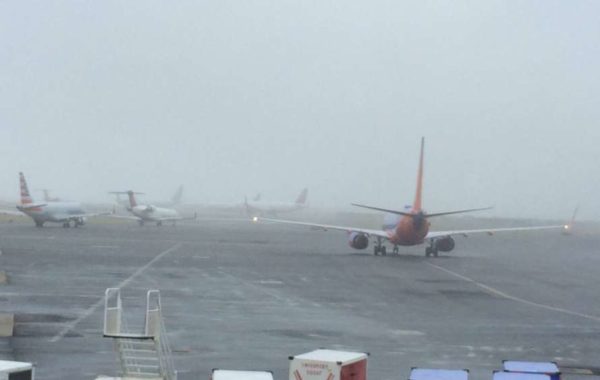
(Updated at 3:10 p.m.) The worst of today’s fog is starting to lift after an earlier Dense Fog Advisory that was in effect for Arlington and surrounding areas

The fog has prompted delays at Reagan National Airport.

“Due to Low Ceilings, traffic is experiencing Gate Hold and Taxi delays between 16 minutes and 30 minutes in length and increasing,” said the FAA’s flight delay maps.

More of the advisory, from the National Weather Service:

…DENSE FOG ADVISORY REMAINS IN EFFECT UNTIL 4 PM EST THIS AFTERNOON… * WHAT…VISIBILITY ONE QUARTER MILE OR LESS IN DENSE FOG. * WHERE…PORTIONS OF THE DISTRICT OF COLUMBIA, CENTRAL, NORTH CENTRAL, NORTHERN AND SOUTHERN MARYLAND AND CENTRAL AND NORTHERN VIRGINIA. * WHEN…UNTIL 4 PM EST THIS AFTERNOON. * IMPACTS…HAZARDOUS DRIVING CONDITIONS DUE TO LOW VISIBILITY. PRECAUTIONARY/PREPAREDNESS ACTIONS… IF DRIVING, SLOW DOWN, USE YOUR HEADLIGHTS, AND LEAVE PLENTY OF DISTANCE AHEAD OF YOU. &&

On Twitter, Reagan National Airport tweeted earlier this afternoon that the fog completely hid its tower, as seen from nearby Crystal City.

https://twitter.com/Reagan_Airport/status/1207014684588740616

File photo (top) via Twitter/@Reagan_Airport


If you’re outside, on the road, or looking out of a window tonight, you won’t be able to see very far in front of you.

The National Weather Service has issued a Dense Fog Advisory for Arlington and the region, warning about hazardous driving conditions due to low visibility.

The advisory is in effect until midnight. More from NWS:L

URGENT – WEATHER MESSAGE
NATIONAL WEATHER SERVICE BALTIMORE MD/WASHINGTON DC
459 PM EST FRI DEC 13 2019

…DENSE FOG ADVISORY IN EFFECT UNTIL MIDNIGHT EST TONIGHT…

* WHAT…AREAS OF DENSE FOG WITH VISIBILITY AROUND ONE-QUARTER MILE.

* WHERE…THE WASHINGTON AND BALTIMORE METROPOLITAN AREAS, CENTRAL MARYLAND, NORTHERN VIRGINIA, PORTIONS OF CENTRAL VIRGINIA AND EASTERN WEST VIRGINIA.

* WHEN…UNTIL MIDNIGHT EST TONIGHT.

* IMPACTS…HAZARDOUS DRIVING CONDITIONS DUE TO LOW VISIBILITY.

PRECAUTIONARY/PREPAREDNESS ACTIONS…

IF DRIVING, SLOW DOWN, USE YOUR HEADLIGHTS, AND LEAVE PLENTY OF DISTANCE AHEAD OF YOU.

Flickr pool photo by Eric


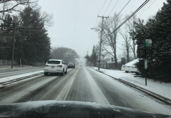
(Updated at 3:55 p.m.) Though it’s likely to be more wet than wild in Arlington, Wednesday morning’s commute may still be made more difficult by snow.

Up to an inch of snow is expected to fall overnight, though temperatures are expected to stay above freezing. Roads are expected to remain mostly clear locally, but the first snowfall of the season may nonetheless cause some concerns for motorists during the morning rush.

More from the National Weather Service:

…POTENTIAL WINTER COMMUTING HAZARD FOR THE BALTIMORE MD/WASHINGTON DC METRO AREAS WEDNESDAY MORNING…

There is a potential for hazardous commuting conditions for the Wednesday morning commute. A period of accumulating snow is POSSIBLE Wednesday morning across the Baltimore MD/Washington DC metro areas, with up to an inch of snow accumulation possible on area roads, with the highest chances north and west of Interstate 95.

If this threat does materialize during the Wednesday morning rush-hour, many roads could quickly turn slippery and visibility may be reduced. This could lead to dangerous traveling conditions, multiple accidents, and extensive delays.

If commuting Wednesday morning, be aware of the POSSIBILITY of significant travel disruptions. Plan ahead by allowing for extra travel time, and consider using public transportation and telework options.

VDOT and Arlington County’s Dept. of Environmental Services say crews are not able to pre-treat roads due to today’s rain, but will begin mobilizing tonight in preparation of the snow.

“Salt crews will standby overnight to treat bridges and steep slope arterials if necessary,” said DES via Twitter.

VDOT is urging drivers to be cautious once the flakes starts falling.

https://twitter.com/VaDOT/status/1204492818359758848

The worst of the weather is expected north of the immediate metro area. Arlington is outside the area of a Winter Weather Advisory issued Tuesday afternoon.


Much of the D.C. region, including Arlington, will be under a Wind Advisory starting tonight.

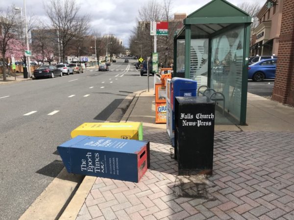
Strong winds with gusts up to 50 mph are expected to start whipping up Wednesday night and will continue through Thursday afternoon, making for a blustery Thanksgiving holiday.

Forecasters caution that the wind gusts could topple trees and power lines, causing widespread power outages. Drivers — including those taking last minute trips on one of the busiest travel days of the year — should also take caution.

More from the National Weather Service:

NATIONAL WEATHER SERVICE BALTIMORE MD/WASHINGTON DC
156 PM EST WED NOV 27 2019

…WIND ADVISORY IN EFFECT FROM 8 PM THIS EVENING TO 1 PM EST THURSDAY…

* WHAT…WEST TO NORTHWEST WINDS 20 TO 30 MPH WITH GUSTS AROUND 50 MPH EXPECTED.

* WHERE…THE WASHINGTON AND BALTIMORE METROPOLITAN AREAS, CENTRAL MARYLAND, AND PORTIONS OF NORTHERN VIRGINIA.

* WHEN…FROM 8 PM THIS EVENING TO 1 PM EST THURSDAY.

* IMPACTS…DAMAGING WINDS COULD BLOW DOWN TREES AND POWER LINES. WIDESPREAD POWER OUTAGES ARE POSSIBLE. TRAVEL COULD BE  DIFFICULT, ESPECIALLY FOR HIGH PROFILE VEHICLES.

PRECAUTIONARY/PREPAREDNESS ACTIONS…

USE EXTRA CAUTION WHEN DRIVING, ESPECIALLY IF OPERATING A HIGH PROFILE VEHICLE. SECURE OUTDOOR OBJECTS.


Arlington County and surrounding areas are under a Freeze Warning starting at 2 a.m. Saturday morning.

Freezing temperatures, which could kill crops and some vegetation, are possible overnight in Arlington, D.C. and other parts of Northern Virginia and Maryland.

In addition to protecting sensitive plants, residents are also advised to drain in-ground sprinkler systems and turn off the valves to ourdoor spigots and plumbing.

More from the National Weather Service:

…FREEZE WARNING IN EFFECT FROM 2 AM TO 9 AM EDT SATURDAY… * WHAT…SUB-FREEZING TEMPERATURES AS LOW AS 30 EXPECTED. * WHERE…THE DISTRICT OF COLUMBIA, PORTIONS OF CENTRAL, NORTHERN AND SOUTHERN MARYLAND AND CENTRAL AND NORTHERN VIRGINIA. * WHEN…FROM 2 AM TO 9 AM EDT SATURDAY. * IMPACTS…FROST AND FREEZE CONDITIONS WILL KILL CROPS, OTHER SENSITIVE VEGETATION AND POSSIBLY DAMAGE UNPROTECTED OUTDOOR PLUMBING. PRECAUTIONARY/PREPAREDNESS ACTIONS… TAKE STEPS NOW TO PROTECT TENDER PLANTS FROM THE COLD. TO PREVENT FREEZING AND POSSIBLE BURSTING OF OUTDOOR WATER PIPES THEY SHOULD BE WRAPPED, DRAINED, OR ALLOWED TO DRIP SLOWLY. THOSE THAT HAVE IN-GROUND SPRINKLER SYSTEMS SHOULD DRAIN THEM AND COVER ABOVE- GROUND PIPES TO PROTECT THEM FROM FREEZING. &&

Flickr pool photo by ksrjghkegkdhgkk)


Update at 10:45 p.m. — Power has been restored to most of the outage area, but additional outages are possible overnight. On the heels of a Severe Thunderstorm Warning that just expired, a Wind Advisory is now in effect until 4 a.m.:

…WIND ADVISORY IN EFFECT UNTIL 4 AM EDT FRIDAY… * WHAT…WEST WINDS 15 TO 30 MPH WITH GUSTS UP TO 50 MPH EXPECTED. * WHERE…PORTIONS OF THE DISTRICT OF COLUMBIA, CENTRAL, NORTH CENTRAL, NORTHERN AND SOUTHERN MARYLAND, NORTHERN AND NORTHWEST VIRGINIA AND PANHANDLE WEST VIRGINIA. * WHEN…FROM 6 PM THIS EVENING TO 4 AM EDT FRIDAY. * IMPACTS…GUSTY WINDS COULD BLOW AROUND UNSECURED OBJECTS. TREE LIMBS COULD BE BLOWN DOWN AND A FEW POWER OUTAGES MAY RESULT. PRECAUTIONARY/PREPAREDNESS ACTIONS… USE EXTRA CAUTION WHEN DRIVING, ESPECIALLY IF OPERATING A HIGH PROFILE VEHICLE. SECURE OUTDOOR OBJECTS. &&

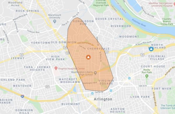
Earlier: Some 2,250 Dominion customers are in the dark this stormy Halloween night, even though the bulk of the storm has yet to move through.

The outage extends from Ballston to the south to the Donaldson Run neighborhood in the north. Power flickered even farther north of the outage area earlier tonight.

The cause of the outage is pending investigation, according to Dominion’s outage map, though breezy conditions have preceded the storm over the past two hours.


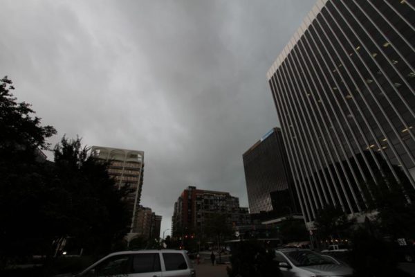
A Tornado Watch has been issued for Arlington and the D.C. region as severe storms threaten dangerous conditions amid tonight’s Halloween festivities.

The Tornado Watch is in effect until midnight.

Forecasters warn that a line of storms packing rain and gusty winds will reach Arlington around 9 p.m. Trick-or-treaters and Halloween partiers should seek shelter ahead of the storms.

The National Weather Service issued a special statement about the storm threat:

…DAMAGING LINE OF THUNDERSTORMS LIKELY TO MOVE EAST ACROSS THE AREA BETWEEN MID AFTERNOON AND MIDNIGHT…

A LINE OF THUNDERSTORMS IS EXPECTED TO MOVE EAST ACROSS THE REGION. THESE STORMS WILL BRING THE POSSIBILITY OF DAMAGING WIND  GUSTS AND ISOLATED TORNADOES. PLEASE BE SHELTERED WHEN THESE  THUNDERSTORMS PASS THROUGH YOUR AREA.

THE MOST LIKELY TIMING OF THE LINE RANGES FROM MID TO LATE AFTERNOON FOR THE POTOMAC HIGHLANDS, TO THE EVENING FOR THE BALTIMORE/WASHINGTON METROS, TO BETWEEN 9PM AND MIDNIGHT FOR AREAS EAST OF I-95 TO THE CHESAPEAKE BAY. THE STORMS WILL LIKELY LAST AN HOUR OR LESS IN MOST AREAS.

STAY INFORMED. FOR MORE EXACT TIMING FOR YOUR LOCATION, CONSULT THE FORECAST FOR YOUR COMMUNITY AT OUR WEBSITE WEATHER.GOV OR OUR FACEBOOK OR TWITTER FEEDS FOR NATIONAL WEATHER SERVICE BALTIMORE/WASHINGTON.

More via social media:


A Wind Advisory has just been issued for Arlington County.

The advisory says that gusty winds up to 45 mph may cause falling tree limbs and power outages. The advisory is in effect until 6 p.m.

More from the National Weather Service:

…WIND ADVISORY IN EFFECT UNTIL 6 PM EDT THIS EVENING… * WHAT…WEST WINDS 15 TO 20 MPH WITH GUSTS UP TO 45 MPH. * WHERE…THE DISTRICT OF COLUMBIA, CENTRAL AND SOUTHERN MARYLAND AND NORTHERN VIRGINIA. * WHEN…UNTIL 6 PM EDT THIS EVENING. * IMPACTS…GUSTY WINDS COULD BLOW AROUND UNSECURED OBJECTS. TREE LIMBS COULD BE BLOWN DOWN AND A FEW POWER OUTAGES MAY RESULT. PRECAUTIONARY/PREPAREDNESS ACTIONS… USE EXTRA CAUTION WHEN DRIVING, ESPECIALLY IF OPERATING A HIGH PROFILE VEHICLE. SECURE OUTDOOR OBJECTS. &&


Arlington County is now under a Severe Thunderstorm Warning through 5:45 p.m.

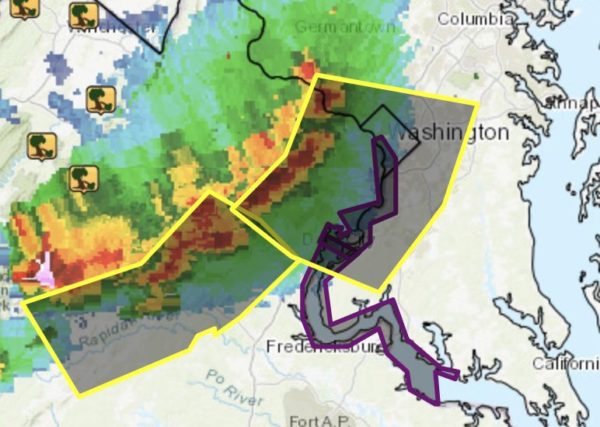
A line of severe storms is approaching the Beltway from the northwest, packing potentially damaging winds and hail.

More from the National Weather Service:

BULLETIN – IMMEDIATE BROADCAST REQUESTED
SEVERE THUNDERSTORM WARNING
NATIONAL WEATHER SERVICE BALTIMORE MD/WASHINGTON DC
457 PM EDT WED SEP 11 2019

THE NATIONAL WEATHER SERVICE IN STERLING VIRGINIA HAS ISSUED A

* SEVERE THUNDERSTORM WARNING…

* UNTIL 545 PM EDT.

* AT 457 PM EDT, SEVERE THUNDERSTORMS WERE LOCATED ALONG A LINE EXTENDING FROM NEAR GREAT FALLS TO FAIRFAX TO NEAR BULL RUN, MOVING EAST AT 25 MPH.

HAZARD…60 MPH WIND GUSTS AND QUARTER SIZE HAIL.

SOURCE…RADAR INDICATED.

IMPACT…DAMAGING WINDS WILL CAUSE SOME TREES AND LARGE BRANCHES TO FALL. THIS COULD INJURE THOSE OUTDOORS, AS WELL AS DAMAGE HOMES AND VEHICLES. ROADWAYS MAY BECOME BLOCKED BY DOWNED TREES. LOCALIZED POWER OUTAGES ARE POSSIBLE. UNSECURED LIGHT OBJECTS MAY BECOME PROJECTILES.

* LOCATIONS IMPACTED INCLUDE… ARLINGTON, ALEXANDRIA, CENTREVILLE, WALDORF, DALE CITY, ROCKVILLE, BETHESDA, RESTON, BOWIE, ANNANDALE, CLINTON, SPRINGFIELD, COLLEGE PARK, FORT WASHINGTON, GREENBELT, FAIRFAX, LANGLEY PARK, BELTSVILLE, FORT HUNT AND VIENNA.

PRECAUTIONARY/PREPAREDNESS ACTIONS…

FOR YOUR PROTECTION MOVE TO AN INTERIOR ROOM ON THE LOWEST FLOOR OF A BUILDING.


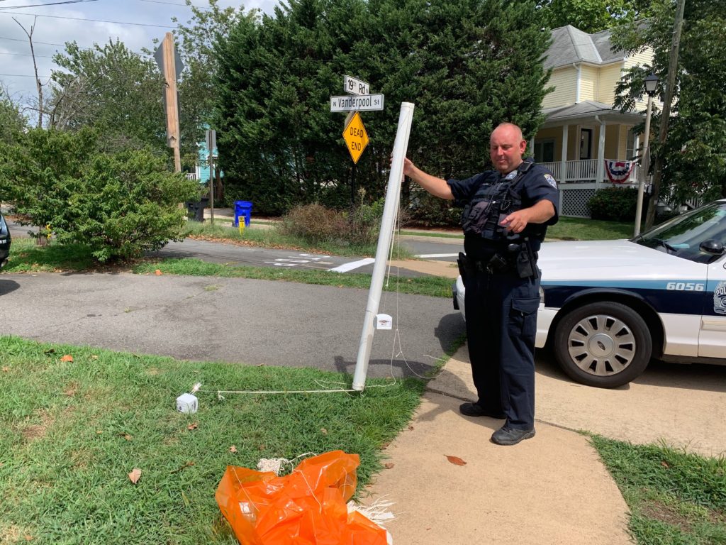
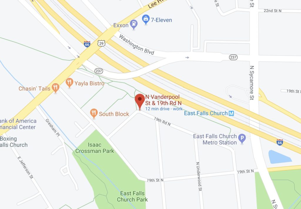
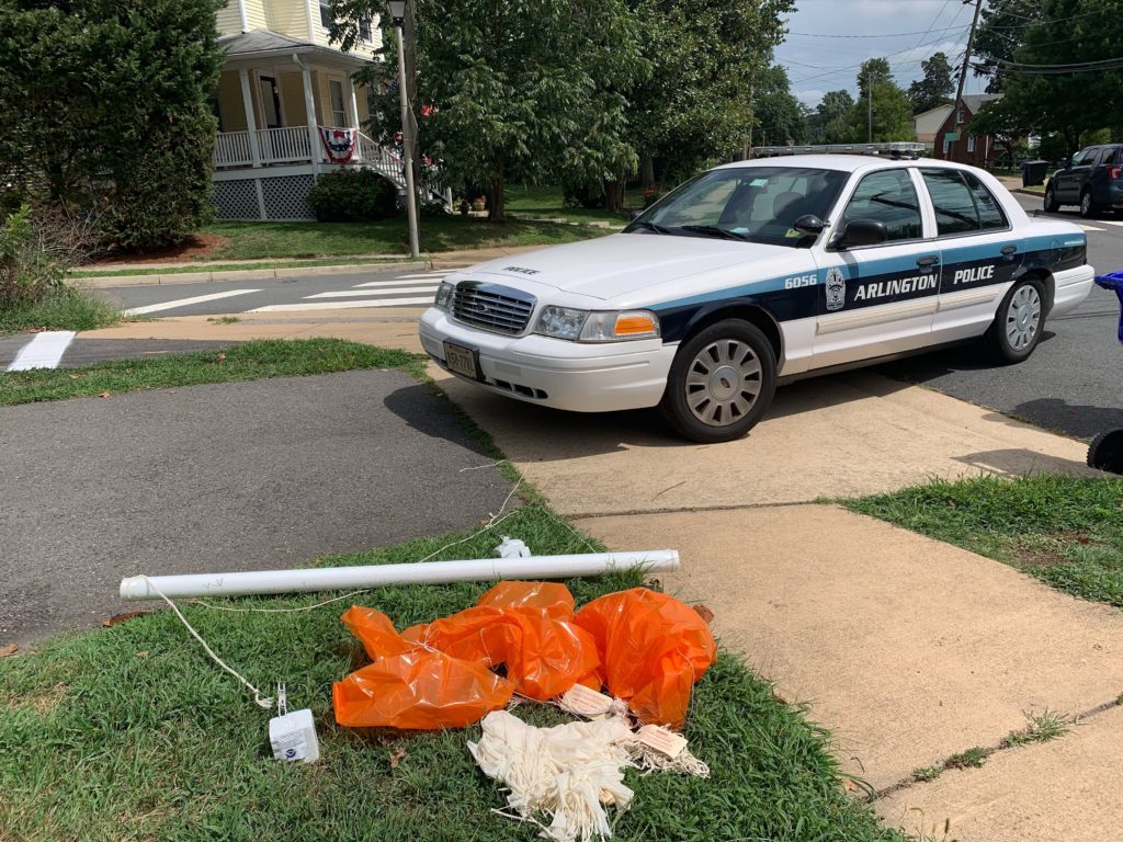
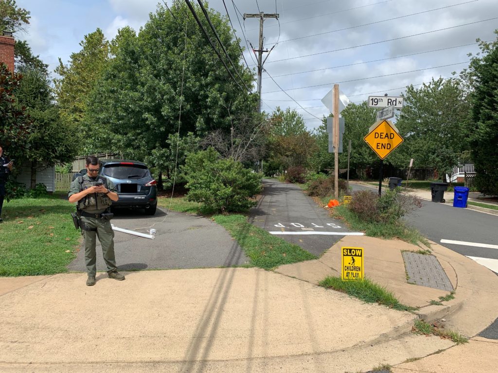
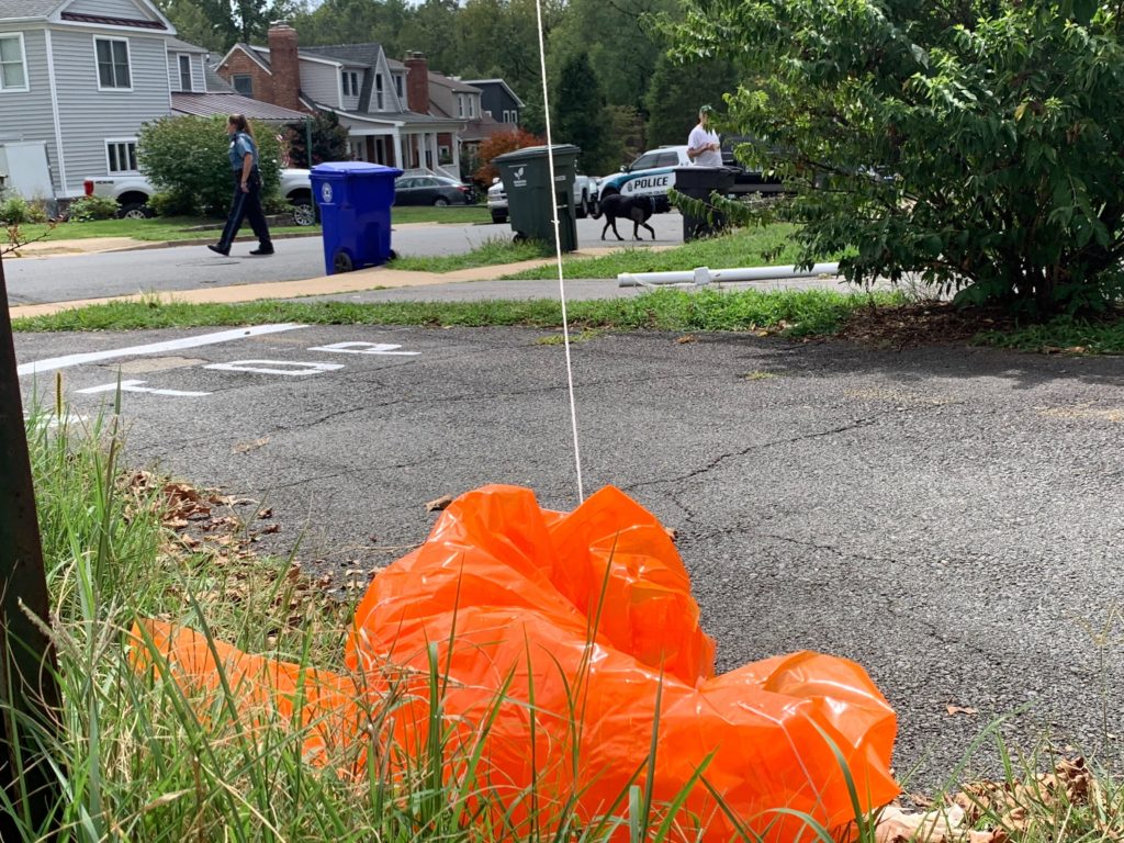
A wayward weather balloon landed in a neighborhood near the East Falls Church Metro station today, frightening some residents and prompting the bomb squad to be called to the scene.

Police and Arlington County’s bomb squad were dispatched to the 6800 block of 19th Road N. just before 2 p.m. today, after a resident reported finding a tube with blinking lights in the front yard of a home, near an entrance to the W&OD Trail.

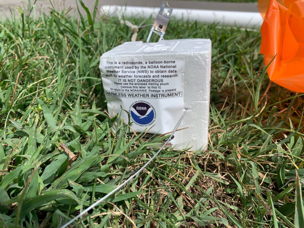
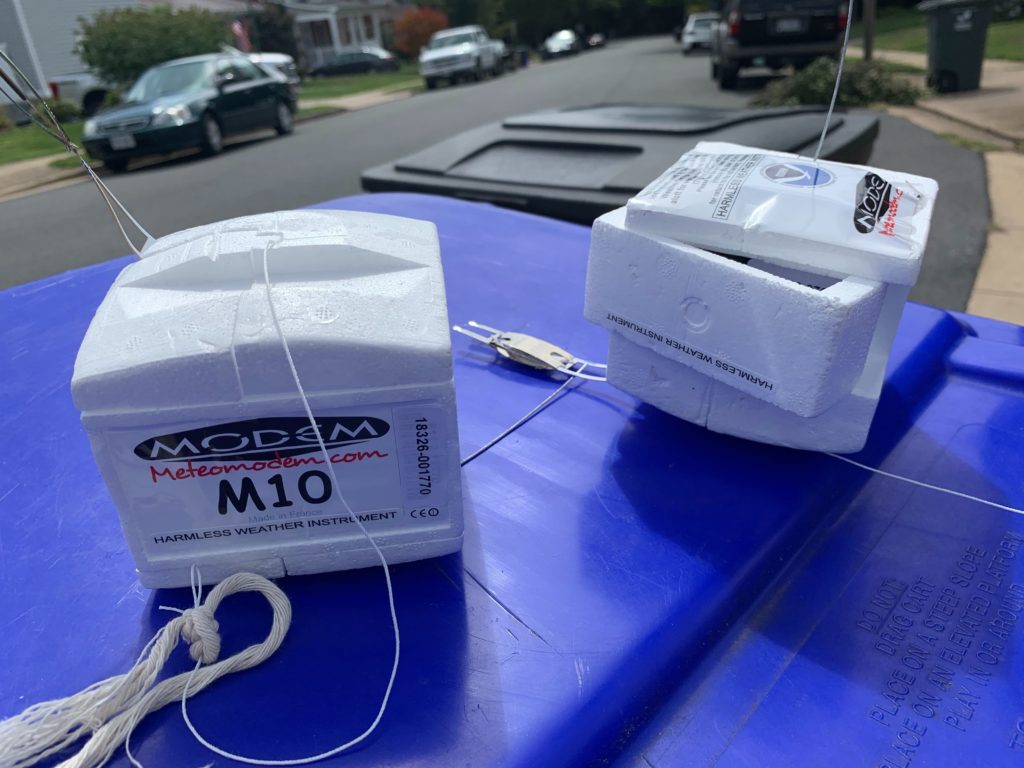
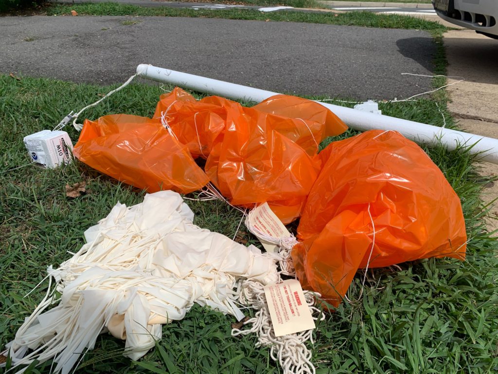
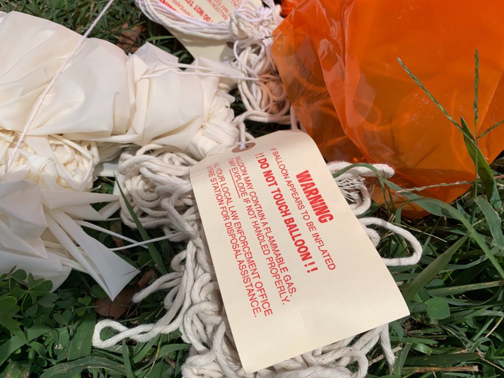
The entire package, which was deemed suspicious, consisted of a tube, two small boxes and an orange parachute. The bomb squad response was scaled back, however, after a police officer reported finding the words “harmless weather instrument” and information about its origin — which checked out. A bomb-sniffing dog also checked out the devices but did not finding anything of concern, according to scanner traffic.

No one was hurt by the device’s landing, though one cyclist nearly struck it while heading to the trail.

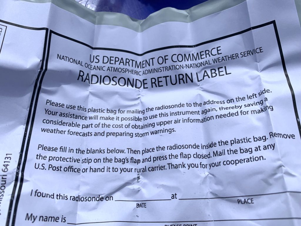
The styrofoam boxes attached to the balloon were wrapped with information about the device — which turned out to be a radiosonde that measures and broadcasts weather conditions from the various layers of the atmosphere back to the offices of the National Weather Service. The data is used to help computer models generate weather forecasts.

Ray Martin, a meteorologist with the Baltimore/Washington NWS office in Sterling, Va., said the office launches balloons twice a day. As the balloon gains altitude, it expands and then finally pops, sending it back down to the ground, slowed by an attached parachute.

Often the balloons are found in remote areas, but landings in the immediate D.C. metro area are not uncommon.

“It definitely happens,” Martin said, noting that the balloon was most likely launched by the Sterling office, though forecasters do not track the exact location balloons after launch. Sometimes the balloon payloads land a far distance away, he said.

Weather balloons and the instruments they carry are nontoxic and disposable, Martin said, though the one that landed in East Falls Church carried a prepaid postal pouch for it to be returned to the National Weather Service. Residents who find the remnants of popped weather balloons need not be alarmed, said Martin, and they can even keep what they find as a unique souvenir if they want.

Vernon Miles contributed to this report. Map via Google Maps.


View More Stories