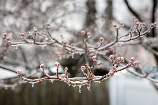
The National Weather Service is warning of the potential for icy roads Saturday morning.

Rain falling on sub-freezing pavement — the raindrops are expected to start falling around 8-9 a.m. — may turn to ice and make driving hazardous.

More from an NWS Special Weather Statement:

…POTENTIAL FOR PATCHY ICY CONDITIONS EARLY SATURDAY MORNING ALONG AND WEST OF INTERSTATE 95 IN THE BALTIMORE METROPOLITAN AREA AND NEAR INTERSTATE 95 AROUND WASHINGTON DC AND SPOTSYLVANIA COUNTY IN VIRGINIA… RAINFALL IS EXPECTED TO START AROUND DAYBREAK SATURDAY MORNING IN THE GREATER BALTIMORE/WASHINGTON VICINITY. THE RECENT COLD SNAP HAS CAUSED ELEVATED ROADWAYS, BRIDGES, AND OVERPASSES TO BE AT OR BELOW FREEZING FOR AN EXTENDED PERIOD OF TIME. DESPITE FORECAST AIR TEMPERATURES BEING ABOVE FREEZING EARLY ON SATURDAY MORNING IN DOWNTOWN BALTIMORE AND WASHINGTON, THERE MAY BE RESIDUAL AREAS AT GROUND LEVEL WHICH WILL CONTINUE TO BE BELOW FREEZING. THIS WILL CREATE THE POTENTIAL FOR PATCHY AREAS OF ICE TO ACCUMULATE BETWEEN DAWN AND 10 AM ON SATURDAY MORNING. THE GREATEST POTENTIAL FOR THIS PATCHY ICE WILL BE IN THE NORTHWEST SUBURBS OF BALTIMORE, NEAR WASHINGTON DC AND SPOTSYLVANIA COUNTY IN VIRGINIA. PLEASE CHECK BACK OVERNIGHT FOR UPDATED FORECASTS, INCLUDING THE POTENTIAL EXPANSION OF WINTER WEATHER ADVISORIES FURTHER EAST INTO MAJOR METROPOLITAN AREAS.


The first TV commercials started around Halloween. Mall storefronts began to change over around the same time.

Yes, Christmas starts early these days. But not everyone likes the mid-autumn kickoff to the holiday season.

One sure sign of having the holiday spirit is when one starts listening to holiday music. Locally, WASH-FM switched to all Christmas music on Nov. 16, while SiriusXM turned on its Holiday Traditions channel on Nov. 1.

With Thanksgiving just one day away, and Christmas tree sales two days away, we were wondering when Arlingtonians decide it’s the Most Wonderful Time of the Year to tune in to holiday tunes.


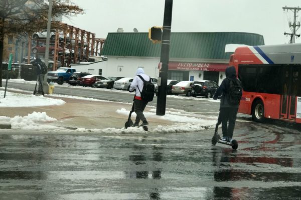
(Updated at 3:35 p.m) After a controversial on-time start that led to a treacherous morning on local roads and sidewalks, Arlington Public Schools is not taking any chances tonight.

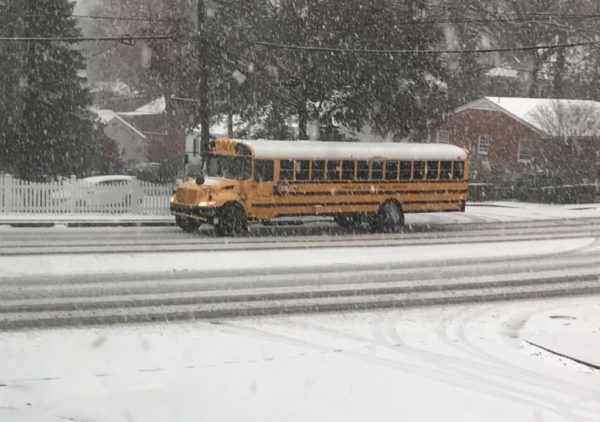
Both parents and school bus drivers had trouble getting to school this morning on the roads. According to an APS spokesman, 12 out of around 160 school buses became stuck due to slippery road conditions, and one bus was involved in a “very minor” crash. The spokesman did not have an exact tally of how many buses were late arriving to school

“Our drivers are instructed to drive slow and take all precautions when driving,” said Frank Bellavia.

Following the morning mess, APS canceled all after school and evening activities. The school system announced the cancellations in a tweet just after 1:30 p.m.


Marymount University, meanwhile, is also closing early because of the weather.

While most of the frozen precipitation is over for Arlington, there are still a number of concerns for this evening, including remaining snow on local roads and a possible re-freeze overnight.

More from VDOT:

A mixed bag of precipitation is affecting much of the Commonwealth Thursday, and Virginia Department of Transportation (VDOT) crews are responding to adverse road conditions where needed. Snow, sleet, and heavy rain are expected across Virginia through the afternoon and overnight hours.

Some portions of Virginia are experiencing the first taste of winter in the 2018-2019 season. In affected regions, VDOT crews are deployed to treat roads to melt icy areas. Icy conditions could cause downed trees and debris in roadways. Travelers should exercise caution during the afternoon rush hour and overnight, as road conditions may be wet and slushy.

Portions of the state are experiencing heavy rain. Crews are monitoring road conditions and responding to reports of high water and debris in roadways.

Motorists are encouraged to closely monitor travel conditions in local areas and adjust travel as needed. In wet and icy conditions, allow extra time to reach destinations, lower speed and keep a safe distance from other vehicles.

Another concern: the potential for flooding as a result of melting snow and heavy rain. Arlington and much of the rest of the region is currently under a Flood Watch.

From the National Weather Service:

…FLOOD WATCH REMAINS IN EFFECT THROUGH THIS EVENING… THE FLOOD WATCH CONTINUES FOR * PORTIONS OF MARYLAND, THE DISTRICT OF COLUMBIA, AND VIRGINIA, INCLUDING THE FOLLOWING AREAS, IN MARYLAND, ANNE ARUNDEL, CALVERT, CENTRAL AND SOUTHEAST HOWARD, CENTRAL AND SOUTHEAST MONTGOMERY, CHARLES, PRINCE GEORGES, SOUTHEAST HARFORD, SOUTHERN BALTIMORE, AND ST. MARYS. THE DISTRICT OF COLUMBIA. IN VIRGINIA, ARLINGTON/FALLS CHURCH/ALEXANDRIA, FAIRFAX, KING GEORGE, PRINCE WILLIAM/MANASSAS/MANASSAS PARK, SPOTSYLVANIA, AND STAFFORD. * THROUGH THIS EVENING * A PERIOD OF MODERATELY HEAVY RAIN IS EXPECTED THIS AFTERNOON AND EVENING. ONE AND A HALF TO TWO INCHES OF RAIN IS EXPECTED WITH ISOLATED HIGHER AMOUNTS POSSIBLE. THIS MAY LEAD TO FLOODING OF AREA CREEKS AND STREAMS AS WELL AS IN URBAN AND POOR DRAINAGE AREAS. PRECAUTIONARY/PREPAREDNESS ACTIONS… A FLOOD WATCH MEANS THERE IS A POTENTIAL FOR FLOODING BASED ON CURRENT FORECASTS. YOU SHOULD MONITOR LATER FORECASTS AND BE ALERT FOR POSSIBLE FLOOD WARNINGS. THOSE LIVING IN AREAS PRONE TO FLOODING SHOULD BE PREPARED TO TAKE ACTION SHOULD FLOODING DEVELOP. &&


(Updated at 9:55 a.m.) While Fairfax County cancelled school today, Arlington Public Schools opened on time despite the snow.

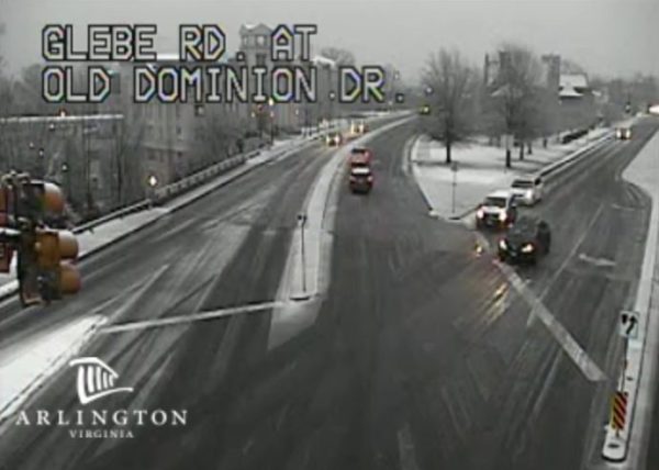
About an inch of wet snow has fallen, covering roads and sidewalks. A number of crashes have been reported around the county, per scanner traffic, and at least one school bus has gotten stuck on a snow-covered street. Another crash involving a bus has been reported on S. George Mason Drive in front of the National Guard center.

Several streets have been closed due to slick conditions, including N. Harrison Street at Little Falls Road, near Yorktown High School, the large S. Walter Reed Drive hill north of S. Four Mile Run Drive, N. George Mason Drive at Park Drive and N. George Mason Drive at Wilson Blvd.

ART buses, meanwhile, have been delayed due to the winter precipitation. Per ART:

ART Routes 41,45,62,75,77,and 84 are experiencing delays/operating issues due to icy/slippery road conditions.  Road Supervisors, Safety and Maintenance Technicians are assisting Operators. We apologize for the inconvenience.

The federal government is also open on time today, with the option for some employees to telework.

Arlington County Police and other agencies are urging drivers to be careful on the road.

More from social media:


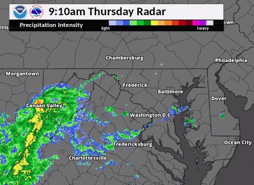
Arlington County will be under a Winter Weather Advisory Thursday as a mix of snow, sleet, rain and freezing rain fall, causing a potentially slippery morning commute.

The National Weather Service says residents should “be very careful if you venture outside tomorrow.”

More from NWS:

…WINTER WEATHER ADVISORY IN EFFECT FROM 4 AM TO 1 PM EST THURSDAY… * WHAT…MIXED PRECIPITATION EXPECTED. TOTAL SLEET AND SNOW ACCUMULATION OF UP TO ONE INCH, AND ICE GLAZE ACCUMULATIONS OF UP TO A TENTH OF AN INCH EXPECTED. * WHERE…PORTIONS OF THE DISTRICT OF COLUMBIA, CENTRAL MARYLAND AND NORTHERN AND NORTHWEST VIRGINIA. * WHEN…FROM 4 AM TO 1 PM EST THURSDAY. * ADDITIONAL DETAILS…PLAN ON SLIPPERY ROAD AND SIDEWALK CONDITIONS IN SOME AREAS. THE HAZARDOUS CONDITIONS COULD IMPACT THE MORNING COMMUTE. PRECAUTIONARY/PREPAREDNESS ACTIONS… BE VERY CAREFUL IF YOU VENTURE OUTSIDE TOMORROW. WATCH YOUR FIRST FEW STEPS IN PARTICULAR AS YOUR STEP OR PATH MAY BE COATED WITH ICE. A WINTER WEATHER ADVISORY MEANS THAT PERIODS OF SNOW, SLEET OR FREEZING RAIN WILL CAUSE TRAVEL DIFFICULTIES. EXPECT SLIPPERY ROADS AND LIMITED VISIBILITIES, AND USE CAUTION WHILE DRIVING. THE LATEST ROAD CONDITIONS FOR THE STATE YOU ARE CALLING FROM CAN BE OBTAINED BY CALLING 5 1 1. &&

AAA Mid-Atlantic is also cautioning motorists to take it easy on local roads and consider delaying non-essential trips.

Brace yourselves. We are likely in for a slippery commute tomorrow morning. People in the Washington, D.C. metro area will be waking up to a wintry mix Thursday morning, the National Weather Service and area meteorologists are forecasting. The forecast calls for a mix of “sleet, snow, and rain, and freezing rain.” Motorists and commuters should be especially careful on their morning commute and throughout the day, AAA Mid-Atlantic is urging, as the precipitation is expected to continue, either changing to rain or snow in the region.

Winter doesn’t officially arrive until the “Winter Solstice,” which falls on Friday, December 21, 2018. Although the Washington metro averages a blizzard “once every four to six years,” the District has an annual snowfall average of 15.5 inches, and we had snow in the forecast on the first day of Spring this year. Yet when it comes to rainfall, the city experiences an average of 115 days per year with precipitation. A “wintry mix” of precipitation can cause a big mess and pose special problems for area commuters.

“Thursday morning’s predicted wintry mix of precipitation will make for slippery conditions on roadways in our region,” said John B. Townsend II, Public and Government Affairs Manager for AAA Mid-Atlantic. “Roads that are slick or ice-covered can create a worst-case scenario for commuters. The first rule of safe driving during wet weather is to slow down to improve tire traction. Plus, given the darker morning and evening commutes, be especially cautious and look out for pedestrians.”

Hazardous storms and inclement weather are a factor in more than half a million crashes and more than 2,000 road deaths every winter, according to research from the AAA Foundation for Traffic Safety. Given the weather forecast, AAA Mid-Atlantic is encouraging drivers to be prepared and offers the below tips:

Avoid braking and turning at the same time. Brake first, then turn, then accelerate. Accelerate and decelerate more slowly than you would on dry roads.

  • Leave plenty of space between your car and the car ahead of you. Increase following distances to at least 6 seconds.
  • Drive with your low-beam headlights on, even during daylight.
  • Be predictable. Use turn signals, make sure lanes are clear before changing and leave plenty of time to stop.
  • Avoid using cruise control, which can reduce traction.
  • If you start to skid, don’t slam on the brakes. Continue to look and steer in the direction you want the car to go.
  • Avoid puddles when it’s safe to do so.
  • Always wear your seat belt.
  • Stay alert and minimize distractions. Don’t text, talk on the phone or drive under the influence of alcohol or drugs.
  • In snow and ice, try not to stop when heading up a steep hill. After you’ve stopped, applying extra gas to get started again may only spin your wheels. Get some momentum going on a flat road as you approach the hill to help you reach the top, then reduce your speed and drive down the hill slowly.
  • If your visibility is so limited you can’t see in front of you, carefully pull off to the side of the road and stop completely.

File photo


Arlington, D.C. and other points east will be under a Freeze Warning Saturday and Sunday.

The National Weather Service says a mass of cold air will bring freezing temperatures to the area, potentially damaging or killing sensitive plants.

More from NWS:

…FREEZE WARNING IN EFFECT FROM 10 PM SATURDAY TO 9 AM EST SUNDAY… THE NATIONAL WEATHER SERVICE IN BALTIMORE MD/WASHINGTON HAS ISSUED A FREEZE WARNING, WHICH IS IN EFFECT FROM 10 PM SATURDAY TO 9 AM EST SUNDAY. * TEMPERATURES…THE UPPER 20S AND LOWER 30S. * IMPACTS…FREEZING TEMPERATURES WILL LIKELY DAMAGE OR KILL SENSITIVE VEGETATION. PRECAUTIONARY/PREPAREDNESS ACTIONS… A FREEZE WARNING MEANS SUB-FREEZING TEMPERATURES ARE IMMINENT OR HIGHLY LIKELY. THESE CONDITIONS WILL KILL CROPS AND OTHER SENSITIVE VEGETATION. &&


Arlington, the District and other surrounding areas are under a Frost Advisory for Monday morning.

Forecasters say temperatures will dip to the mid-30s and could damage sensitive outdoor plants.

More from the National Weather Service:

…FROST ADVISORY REMAINS IN EFFECT FROM MIDNIGHT TONIGHT TO 10 AM EDT MONDAY… * TEMPERATURES…AS LOW AS 35. * IMPACTS…FROST COULD HARM SENSITIVE OUTDOOR VEGETATION. PRECAUTIONARY/PREPAREDNESS ACTIONS… A FROST ADVISORY MEANS THAT WIDESPREAD FROST IS EXPECTED. SENSITIVE OUTDOOR PLANTS MAY BE KILLED IF LEFT UNCOVERED. &&


A Frost Advisory is in effect for Arlington and surrounding areas overnight tonight.

The National Weather Service says near-freezing temperatures early Friday morning could harm sensitive plants that are left uncovered.

More from NWS:

…FROST ADVISORY IN EFFECT FROM 1 AM TO 9 AM EDT FRIDAY… THE NATIONAL WEATHER SERVICE IN BALTIMORE MD/WASHINGTON HAS ISSUED A FROST ADVISORY, WHICH IS IN EFFECT FROM 1 AM TO 9 AM EDT FRIDAY. * TEMPERATURES…IN THE MID 30S. * IMPACTS…FROST COULD HARM SENSITIVE OUTDOOR VEGETATION. PRECAUTIONARY/PREPAREDNESS ACTIONS… A FROST ADVISORY MEANS THAT WIDESPREAD FROST IS EXPECTED. SENSITIVE OUTDOOR PLANTS MAY BE KILLED IF LEFT UNCOVERED. TAKE STEPS NOW TO PROTECT TENDER PLANTS FROM THE COLD. &&


Arlington and much of the D.C. region is under a Flood Watch today as another big batch of rain moves into the area.

With the ground already saturated, any significant rainfall can cause ponding or even more serious flooding.

More from the National Weather Service:

…FLOOD WATCH IN EFFECT FROM THIS EVENING THROUGH LATE TONIGHT… THE NATIONAL WEATHER SERVICE IN STERLING VIRGINIA HAS ISSUED A * FLOOD WATCH FOR PORTIONS OF MARYLAND, THE DISTRICT OF COLUMBIA, AND VIRGINIA, INCLUDING THE FOLLOWING AREAS, IN MARYLAND, CARROLL, CENTRAL AND SOUTHEAST HOWARD, CENTRAL AND SOUTHEAST MONTGOMERY, NORTHWEST HOWARD, AND NORTHWEST MONTGOMERY. THE DISTRICT OF COLUMBIA. IN VIRGINIA, ALBEMARLE, ARLINGTON/FALLS CHURCH/ALEXANDRIA, CENTRAL VIRGINIA BLUE RIDGE, CULPEPER, EASTERN LOUDOUN, FAIRFAX, GREENE, MADISON, NELSON, ORANGE, PRINCE WILLIAM/MANASSAS/MANASSAS PARK, SOUTHERN FAUQUIER, AND STAFFORD. * FROM THIS EVENING THROUGH LATE TONIGHT * A WAVE OF LOW PRESSURE WILL RIDE NORTHEAST ALONG A STALLED FRONT LATER TODAY AND TONIGHT. SEVERAL INCHES OF RAIN IS POSSIBLE, AND WITH THE GROUND ALREADY SATURATED, FLOODING IS POSSIBLE. PRECAUTIONARY/PREPAREDNESS ACTIONS… A FLOOD WATCH MEANS THERE IS A POTENTIAL FOR FLOODING BASED ON CURRENT FORECASTS. YOU SHOULD MONITOR LATER FORECASTS AND BE ALERT FOR POSSIBLE FLOOD WARNINGS. THOSE LIVING IN AREAS PRONE TO FLOODING SHOULD BE PREPARED TO TAKE ACTION SHOULD FLOODING DEVELOP. &&

Arlington and surrounding areas are under a Severe Thunderstorm Watch tonight (Wednesday).

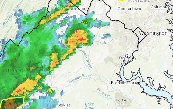
A line of potentially severe storms is approaching the D.C. region from the west. Forecasters say the storms could bring gusty winds, frequent lighting and hail.

More from the National Weather Service:

Photo (top) via National Weather Service


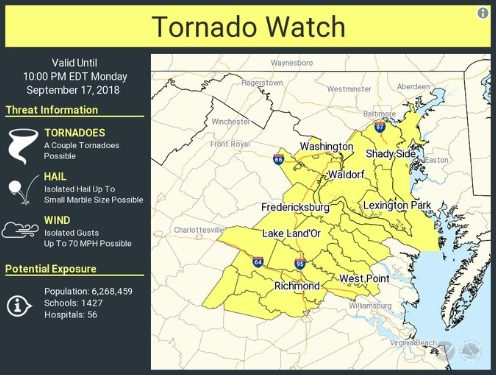
Arlington County is now under a Tornado Watch in addition to the earlier Flash Flood Watch.

With the remnants of Hurricane Florence moving past the area, conditions are favorable for the development of tornadoes. Within the past half hour, a possible tornado was reported near Fredericksburg.

The Tornado Watch is in effect until 10 p.m.


View More Stories