Frozen leaf (photo courtesy Philliefan99)

It’s time to protect those sensitive plants and drain that outdoor plumbing.

Arlington is expected to get its first freeze of the season overnight tonight. The county and most of the D.C. region is under a Freeze Warning as a result.

From the National Weather Service:

226 AM EDT Wed Nov 1 2023

…FREEZE WARNING IN EFFECT FROM 11 PM THIS EVENING TO 10 AM EDT THURSDAY…

* WHAT…Sub-freezing temperatures as low as 25 expected.

* WHERE…Portions of central, northern, northeast, and southern Maryland, The District of Columbia, central and northern Virginia, and the eastern panhandle of West Virginia.

* WHEN…From 11 PM this evening to 10 AM EDT Thursday.

* IMPACTS…Frost and freeze conditions will kill crops, other sensitive vegetation and possibly damage unprotected outdoor plumbing.

PRECAUTIONARY/PREPAREDNESS ACTIONS…

Take steps now to protect tender plants from the cold. To prevent freezing and possible bursting of outdoor water pipes they should be wrapped, drained, or allowed to drip slowly. Those that have in-ground sprinkler systems should drain them and cover above-ground pipes to protect them from freezing.


Frost on an autumn leaf (Flickr pool photo by Michael Coffman)

After earlier being excluded from a Frost Advisory for most of the region, Arlington and D.C. are now said to be at risk for frost tonight.

The following was just issued by the National Weather Service.

…FROST ADVISORY IN EFFECT FROM 2 AM TO 10 AM EDT TUESDAY…

* WHAT…Temperatures as low as 36 will result in frost formation.

* WHERE…In District of Columbia, District of Columbia. In Virginia, Arlington/Falls Church/Alexandria.

* WHEN…From 2 AM to 10 AM EDT Tuesday.

* IMPACTS…Frost could kill sensitive outdoor vegetation if left uncovered.

Those with gardens should take steps today to protect vulnerable plants.


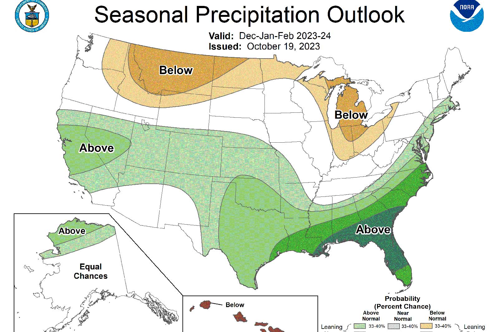
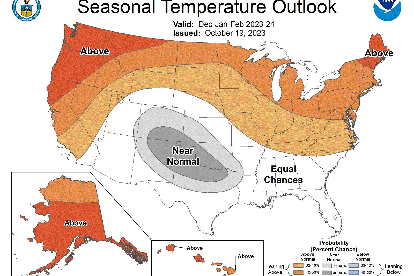
Long-range weather outlooks are predicting an overall milder winter with more precipitation — which may or may not include more snow.

The National Weather Service and Old Farmer’s Almanac recently released their winter outlooks and there’s hope for Arlington snow lovers — though another rainy, snow-starved winter remains a possibility.

NWS is predicting above average precipitation and above average temperatures for the D.C. area., though the confidence for both is below 50%.

The Farmer’s Almanac, meanwhile, agrees that it will be an overall milder winter, but thinks that a colder start to 2024 will bring more snow than usual. From its Atlantic Corridor forecast:

Winter precipitation and snowfall will be above normal (2 to 3 inches above monthly averages). The snowiest periods will occur at the end of December, late January, and mid-February. We don’t expect a white Christmas. […]

Winter temperatures will be above normal overall. Specifically, December is slightly above average temps; temperatures for January and February are below average. The coldest spell will run from late January into mid-February.

Making the forecast tricky for meteorologists is the expected presence of El Niño, the atmospheric phenomenon linked to warm ocean temperatures in the Pacific.

The Washington Post’s Capital Weather Gang notes that while some El Niño winters end up as snow busts, others bring blizzards.

One recent forecast called for the current El Niño to become a “super” El Niño this winter. Super El Niños are those that produce the most intense ocean warming and often the most extreme weather impacts worldwide.

“Washington’s least snowy winters — 1997-1998 and 1972-1973 — both came during super El Niños,” added Capital Weather Gang’s Ian Livingston. “A similar strength event in 2015-2016 was mainly snowless, but punctuated by a historic blizzard in January.”

After a weak season for snow last year — and below-average snowfall six of the past seven years — ARLnow readers say they’re ready for a winter wonderland. Some 62% of respondents to our poll last month said “bring on the snow” when asked about the prospect of a big winter storm.

The Capital Weather Gang and local TV stations typically release their Washington winter outlooks around mid-November.


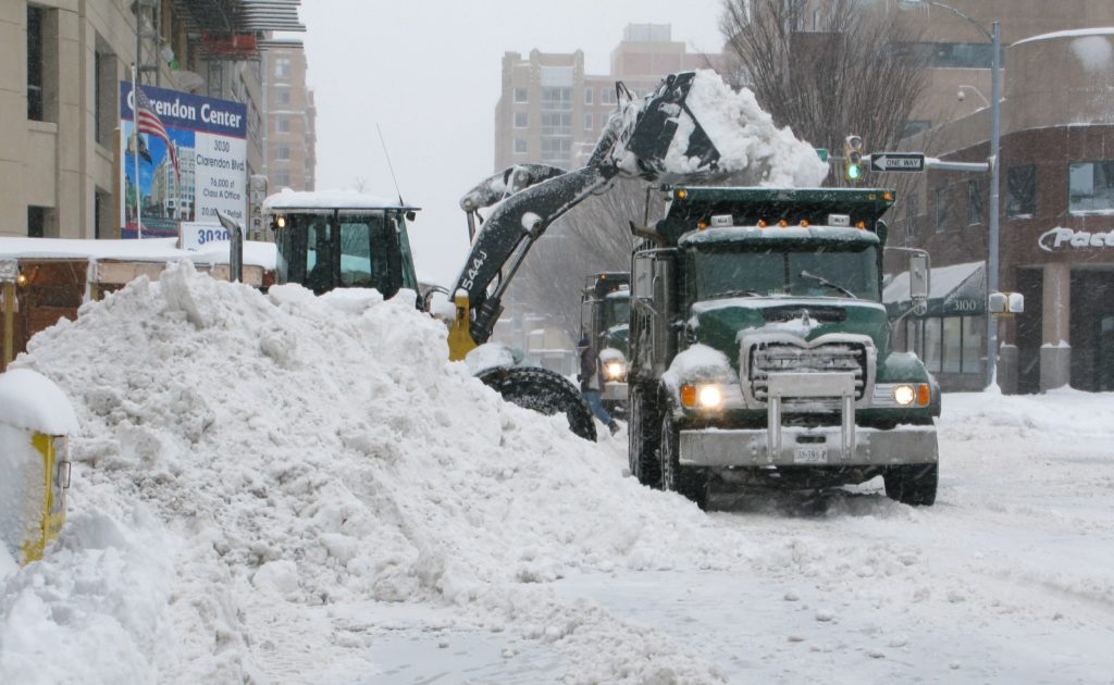
Snow removal in Clarendon on Feb. 6, 2010 (file photo)

After several years of relatively meager winters, could this upcoming season have a big snowstorm on tap for us?

There’s some early suggestion of an elevated chance of large coastal winter storms between January and March, owing in part to a particularly intense El Niño climate pattern.

Of course, such a pattern could also leave Arlington high and dry again.

“Of the seven strong El Niño winters since 1950, four have been associated with well above normal snowfall while snowfall was virtually absent in the other three winters,” the National Weather Service wrote about winters in metro D.C. and Baltimore.

Climate prognosticating — it’s an inexact science, just ask the groundhog — has been raising the hopes of snow lovers this month, with some models suggesting a cold and snowy winter is likely for the Mid-Atlantic region.

The last really big winter storm to hit Arington was the Jan. 22-23, 2016 blizzard. The three large snow events of the winter of 2009-2010, meanwhile, are still fresh in the minds of many locals who lived through them.

What do you think? Would you welcome another big snowstorm this winter or do you prefer the mostly snowless winters of late?


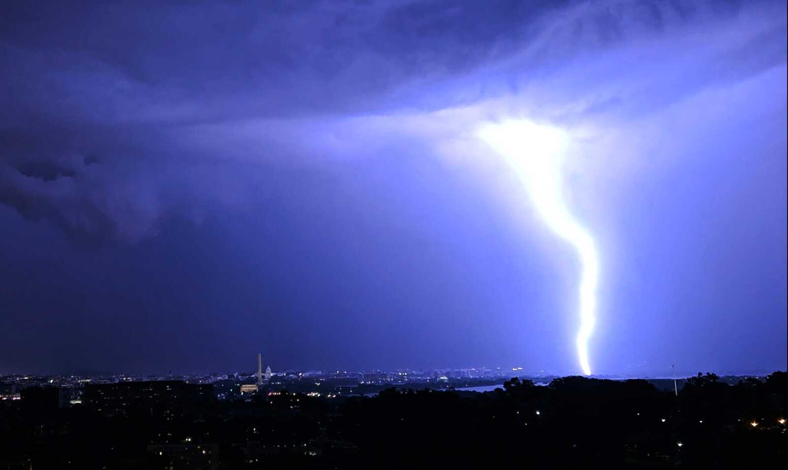
Lightning bolt from Friday night thunderstorm (photo courtesy James Mahony)

Update at 4:30 p.m. — Arlington is now also under a Severe Thunderstorm Watch until 11 p.m.

Earlier: As storms move in, Arlington is now under a Flood Watch until midnight tonight.

The watch was issued around 2:45 p.m. for the county and much of the D.C. area. Forecasters say several rounds of slow-moving storms may cause flooding in low-lying areas and near creeks and streams.

The Rosslyn Jazz Festival, meanwhile, has been paused while this round of storms moves through.

More from the National Weather Service:

Flood Watch
National Weather Service Baltimore MD/Washington DC
243 PM EDT Sat Sep 9 2023…FLOOD WATCH IN EFFECT UNTIL MIDNIGHT EDT TONIGHT…

* WHAT…Flash flooding caused by excessive rainfall continues to be possible.

* WHERE…Portions of DC, including the following , District of Columbia. Portions of Maryland, including the following areas, Anne Arundel, Central and Southeast Howard, Central and Southeast Montgomery, Northern Baltimore, Northwest Howard, Northwest Montgomery, Prince Georges and Southern Baltimore. Portions of northern Virginia, including the following areas, Arlington/Falls Church/Alexandria, Central and Southeast Prince William/Manassas/Manassas Park, Eastern Loudoun, Fairfax and Northwest Prince William.

* WHEN…Until Midnight EDT tonight.

* IMPACTS…Excessive runoff may result in flooding of rivers, creeks, streams, and other low-lying and flood-prone locations. Flooding may occur in poor drainage and urban areas.

* ADDITIONAL DETAILS…
– Several rounds of slow moving showers and thunderstorms are possible through this evening. Rainfall rates of 1 to 2 inches in an hour may lead to flash flooding, especially in poor drainage and urban areas.
– Please visit www.weather.gov/safety/flood for flood safety and preparedness information.

PRECAUTIONARY/PREPAREDNESS ACTIONS…

You should monitor later forecasts and be prepared to take action should Flash Flood Warnings be issued.


A window washer works as storm clouds loom over Ballston (staff photo by Jay Westcott)

Yesterday’s Severe Thunderstorm Watch resulted in nary a raindrop for Arlington — but Friday evening might be different.

Another Severe Thunderstorm Watch has been issued for the county, for D.C., and for much of the region. It’s in effect until 11 p.m. tonight.

“[The] main hazards for these storms will be heavy rain, damaging winds and large hail,” the National Weather Service says. “Additionally, isolated instances of flooding rainfall are
possible, mainly in urban areas.”

The scattered storms are expected to arrive locally at or after dinnertime and, like yesterday, could miss Arlington entirely.

More from social media:


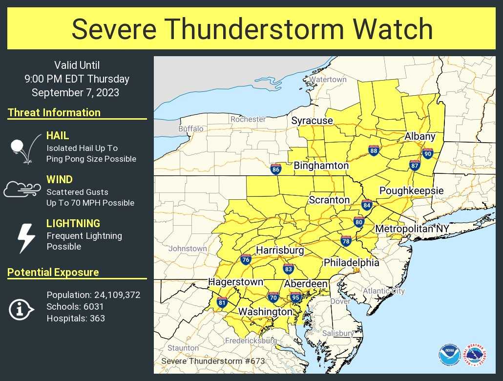
Severe Thunderstorm Watch graphic (via National Weather Service)

Arlington — along with D.C., Alexandria, Fairfax County and other neighboring jurisdictions — is under a Severe Thunderstorm Watch.

Amid temperatures in the mid-90s and several Severe Thunderstorm Warnings to the west, the National Weather Service issued the watch around 1:15 p.m. It is in effect until 9 p.m. and includes much of eastern Pennsylvania and portions of New York State.

Forecasters say that scattered strong storms are likely later today in the immediate D.C. area.

“Scattered to numerous severe storms are possible this afternoon and evening,” the National Weather Service said. “Damaging wind gusts are the primary threat. Isolated instances of considerable wind damage from severe thunderstorms are possible. Isolated instances of large hail are possible as well.”

After the line of storms passes things should quiet down for the rest of the night, but another round of severe weather is expected Friday, forecasters say.


Haze and heat over the National Mall, seen from the Netherlands Carillon (file photo by Jay Westcott)

Today marks the halfway point of a five-day September heat wave.

A high temperature of 98 is forecast today, with “feels like” temperatures reaching into the 100s. Relief is expected Friday, as high temperatures dip into the upper 80s.

A Heat Advisory is in effect starting at noon today. From the National Weather Service:

730 AM EDT Tue Sep 5 2023

…HEAT ADVISORY IN EFFECT FROM NOON TODAY TO 8 PM EDT THIS EVENING…

* WHAT…Heat index values of 100 to 105 expected.

* WHERE…Portions of northern and central Maryland, The District of Columbia, and northern Virginia.

* WHEN…From noon today to 8 PM EDT this evening.

* IMPACTS…Hot temperatures and high humidity may cause heat illnesses to occur.

PRECAUTIONARY/PREPAREDNESS ACTIONS…

Drink plenty of fluids, stay in an air-conditioned room, stay out of the sun, and check up on relatives and neighbors. Young children and pets should never be left unattended in vehicles under any circumstances.

Take extra precautions if you work or spend time outside. When possible reschedule strenuous activities to early morning or evening. Know the signs and symptoms of heat exhaustion and heat stroke. Wear lightweight and loose fitting clothing when possible. To reduce risk during outdoor work, the Occupational Safety and Health Administration recommends scheduling frequent rest breaks in shaded or air conditioned environments. Anyone overcome by heat should be moved to a cool and shaded location. Heat stroke is an emergency! Call 9 1 1.

Usually, one might expect the start of meteorological fall to be more temperate, amid pools closing, white pants getting packed away and and pumpkin spice lattes being served with increasing frequency. Not this year.

What do you think of the late bout of hot weather?


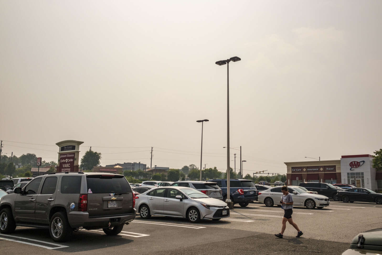
Haze above a local shopping center parking lot (staff photo by Jay Westcott)

After a sunny and pleasant late summer weekend, mother nature is dialing up the heat and the air pollution today.

A Code Orange air quality alert is in effect today due to both ground-level ozone and more Canadian wildfire smoke wafting down to the D.C. area. That’s on top of a predicted high temperature of 95.

From the National Weather Service:

Fairfax-Western Loudoun-Eastern Loudoun-Northwest Prince William-
Central and Southeast Prince William/Manassas/Manassas Park-
Arlington/Falls Church/Alexandria-
440 PM EDT Sun Aug 20 2023

…AIR QUALITY ALERT IS IN EFFECT FOR MONDAY AUGUST 21 2023…

The Virginia Department of Environmental Quality has issued a Code ORANGE Air Quality Alert Monday for Northern Virginia.

A Code Orange Air Quality Alert means that air pollution concentrations within the region may become unhealthy for sensitive groups. Sensitive groups include children, people suffering from asthma, heart disease or other lung diseases, and the elderly. The effects of air pollution can be minimized by avoiding strenuous activity or exercise outdoors.

For more information on ground-level ozone and fine particles, visit the Virginia DEQ air quality Website at www.deq.virginia.gov.

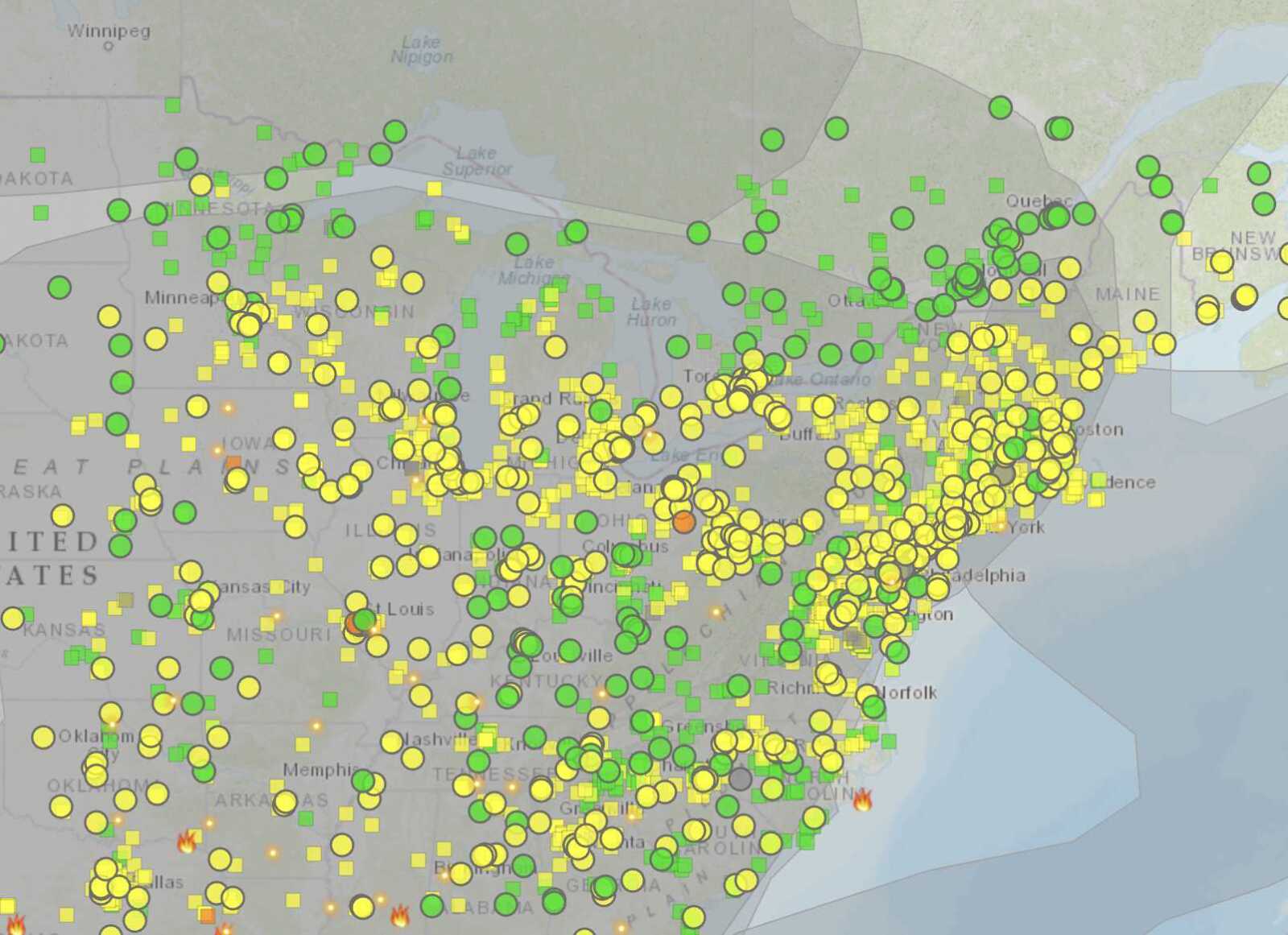
Despite the current haze, the air quality level in Arlington is listed as moderate (yellow), according to AirNow, but that is expected to deteriorate to Code Orange later in the day.

Eastern U.S. wildfire smoke map (via AirNow.gov)

A flooded Four Mile Run running high near Dominion Hills (staff photo by Jay Westcott)

(Updated at 2:15 p.m.) For the second day in a row Arlington is under a Flood Watch.

The National Weather Service says that “anomalous moisture coupled with the potential for multiple slow moving thunderstorms will result in the potential for flash flooding.” The storms are expected to arrive later this afternoon, with the Flood Watch set to expire at 8 p.m.

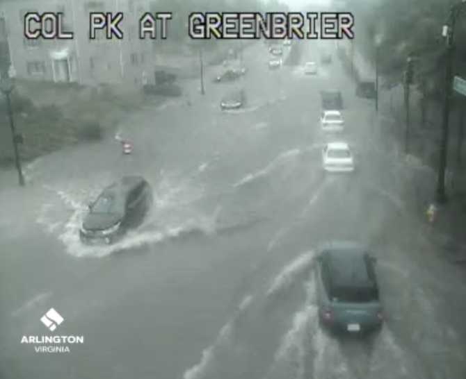
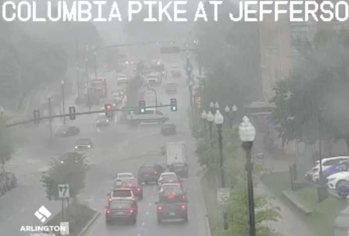
The flood potential follows storms yesterday (Monday) that prompted Tornado, Severe Thunderstorm and Flash Flood warnings all in the span of about 10 minutes. The heavy rain also flooded a busy intersection along Columbia Pike.

Later Tuesday afternoon a Severe Thunderstorm Watch was issued as well.

More on today’s Flood Watch, below, from NWS.

Flood Watch
National Weather Service Baltimore MD/Washington DC
1229 PM EDT Tue Aug 15 2023

…Flash flooding will be possible this afternoon into the early evening, particularly for areas which were hit on Monday by very heavy rainfall…

…FLOOD WATCH IN EFFECT UNTIL 8 PM EDT THIS EVENING…

* WHAT…Flash flooding caused by excessive rainfall is possible.

* WHERE…Portions of DC, Maryland and northern Virginia, including the following areas: in DC, District of Columbia. In Maryland, Anne Arundel, Central and Southeast Howard, Central and Southeast Montgomery, Northwest Howard, Northwest Montgomery, Prince Georges and Southern Baltimore. In northern Virginia, Arlington/Falls Church/Alexandria and Fairfax.

* WHEN…Until 8 PM EDT this evening.

* IMPACTS…Excessive runoff may result in flooding of rivers, creeks, streams, and other low-lying and flood-prone locations. Flooding may occur in poor drainage and urban areas.

* ADDITIONAL DETAILS…
– Given the antecedent conditions in place across portions of the D.C. metro area, additional heavy rainfall today will enhance the threat for further flash flooding issues. Hourly rainfall rates of 1.50 to 2.00 inches are possible in the heaviest downpours. Thunderstorms may be slow to move initially before becoming more progressive later in the afternoon.
– Please visit weather.gov/safety/flood for flood safety and preparedness information

PRECAUTIONARY/PREPAREDNESS ACTIONS…

You should monitor later forecasts and be prepared to take action should Flash Flood Warnings be issued.

More on the Severe Thunderstorm Watch, below.


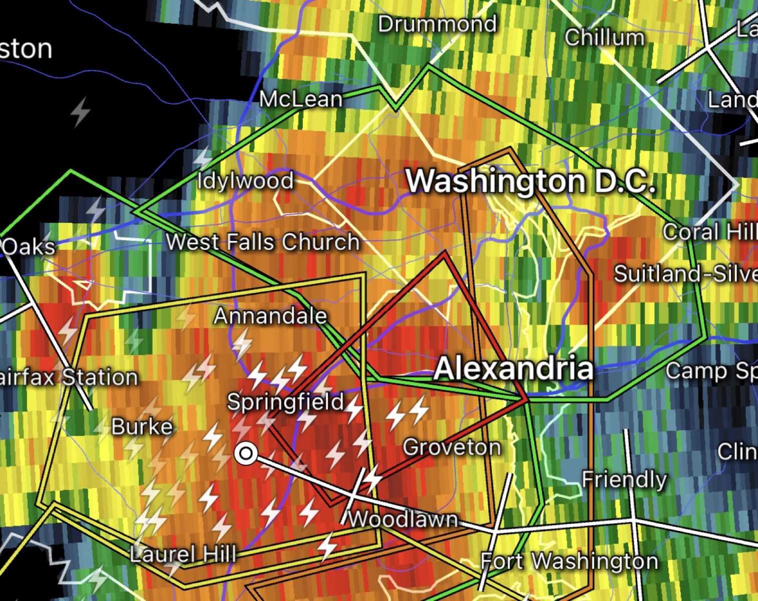
(Updated at 5:25 p.m.) A Tornado Warning was issued for part of Arlington and the entire county is under Flash Flood and Severe Thunderstorm warnings.

The warnings were all initially issued between about 4:15-4:25 p.m., with forecasters saying there was imminent danger of a tornado in parts of South Arlington and flash flooding throughout the county.

The Tornado Warning was cancelled shortly after 4:30 p.m., though the other warnings remained in effect and have since been updated with newer information.

As of 4:50 p.m. flooding could be seen occurring on Columbia Pike at S. Greenbrier Street — a frequent problem spot — with high standing water in the roadway and some motorists trying to drive through it while others were seen turning around. As of 5 p.m. much of the water had receded.

Ponding was also seen in the usual problem spots on I-395.

More on the flash flooding from the National Weather Service:

The National Weather Service in Sterling Virginia has issued a

* Flash Flood Warning for… Southeastern Arlington County in northern Virginia… Southeastern Fairfax County in northern Virginia… The City of Alexandria in northern Virginia…

* Until 745 PM EDT.

* At 436 PM EDT, emergency management reported thunderstorms producing heavy rain in in the Springfield area. Between 1 and 3 inches of rain have fallen. Additional rainfall amounts of 0.5 to 1 inch are possible in the warned area. Flash flooding is already occurring.
HAZARD…Life threatening flash flooding. Thunderstorms producing flash flooding.
SOURCE…Emergency management reported.
IMPACT…Life threatening flash flooding of creeks and streams, urban areas, highways, streets and underpasses.

Also from NWS, as of 5 p.m., on the storms:

…THE SEVERE THUNDERSTORM WARNING FOR THE DISTRICT OF COLUMBIA… SOUTHERN MONTGOMERY…WEST CENTRAL PRINCE GEORGES…ARLINGTON…AND EAST CENTRAL FAIRFAX COUNTIES AND THE CITY OF ALEXANDRIA WILL EXPIRE AT 500 PM EDT…

The storm which prompted the warning has moved out of the area. Therefore, the warning will be allowed to expire. However gusty winds and heavy rain are still possible with this thunderstorm. To report severe weather, contact your nearest law enforcement agency. They will relay your report to the National Weather Service Sterling Virginia.


View More Stories