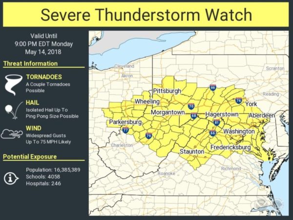
Update at 5:55 p.m. — Arlington and much of the D.C. and Baltimore region is now under a Severe Thunderstorm Watch.

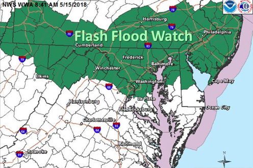
Earlier: Arlington County and surrounding areas are currently under a Flash Flood Watch due to expected storms tonight.

Forecasters say heavy rain may lead to flash flooding, as it did last night along Four Mile Run.

More from the National Weather Service:

…FLASH FLOOD WATCH IN EFFECT FROM 3 PM EDT THIS AFTERNOON THROUGH LATE TONIGHT…

A FRONT WILL SAG ACROSS THE REGION THIS AFTERNOON INTO THIS EVENING. A COUPLE ROUNDS OF THUNDERSTORMS ARE EXPECTED TO ACCOMPANY THE FRONT AND SHOULD MOVE ACROSS THE MASON-DIXON REGION LATE AFTERNOON. THESE THUNDERSTORMS SHOULD PUSH FARTHER SOUTH AND EAST INTO EASTERN WEST VIRGINIA, NORTHERN VIRGINIA AND PORTIONS OF NORTHERN MARYLAND DURING THE EVENING. HEAVY RAINFALL AND LIGHTNING WILL BE THE MAIN THREATS WITH THE POTENTIAL OF ENCOUNTERING DAMAGING WINDS AND HAIL IN THE STRONGEST THUNDERSTORMS. RAINFALL AMOUNTS COULD AVERAGE 1 TO 3 INCHES LATER THIS AFTERNOON AND THIS EVENING. FLASH FLOODING IS POSSIBLE, ESPECIALLY IN SLOW-MOVING THUNDERSTORMS.

FLASH FLOODING RISK IS FOR SMALL STREAMS PARTICULARLY IN URBAN AREAS LIKE BALTIMORE AND HAGERSTOWN. PRECAUTIONARY/PREPAREDNESS ACTIONS… A FLASH FLOOD WATCH MEANS THAT CONDITIONS MAY DEVELOP THAT LEAD TO FLASH FLOODING. FLASH FLOODING IS A VERY DANGEROUS SITUATION. YOU SHOULD MONITOR LATER FORECASTS AND BE PREPARED TO TAKE ACTION SHOULD FLASH FLOOD WARNINGS BE ISSUED.


Update at 7:45 p.m. — There have been reports of downed trees, branches and power lines in Arlington, but no major power outages have been reported by Dominion. Flights are Reagan National Airport are resuming.

No major flooding issues have been reported, though ARLnow.com’s office sprung a leak during the storm.

Update at 7:01 p.m. — The Severe Thunderstorm Warning has been extended until 7:30 p.m.

Update at 6:58 p.m. — A Flash Flood Warning has also been issued for Arlington.

The National Weather Service in Sterling Virginia has issued a

* Flash Flood Warning for…
The District of Columbia…
South central Montgomery County in central Maryland…
Arlington County in northern Virginia…
The City of Falls Church in northern Virginia…
Northeastern Fairfax County in northern Virginia…
The City of Alexandria in northern Virginia…

* Until 1000 PM EDT.

* At 654 PM EDT, Doppler radar indicated thunderstorms producing
heavy rain across the area. Around an inch of rain has fallen, and
an additional 1 to 2 inches of rain is possible over the next 1
to 2 hours leading to flash flooding in the metro area.

PRECAUTIONARY/PREPAREDNESS ACTIONS…

Turn around, don’t drown when encountering flooded roads. Most flood
deaths occur in vehicles.

(Updated at 6:55 p.m.) The National Weather Service has issued a Severe Thunderstorm Warning for Arlington as a powerful line of storms rolls through the county.

More from the National Weather Service:

…A SEVERE THUNDERSTORM WARNING REMAINS IN EFFECT UNTIL 700 PM EDT FOR THE DISTRICT OF COLUMBIA…SOUTHERN MONTGOMERY…NORTHWESTERN PRINCE GEORGES…SOUTHEASTERN LOUDOUN…FAIRFAX…EAST CENTRAL FAUQUIER…PRINCE WILLIAM…AND ARLINGTON COUNTIES…THE CITY OF FALLS CHURCH…THE CITY OF MANASSAS PARK…THE CITY OF MANASSAS…THE CITY OF FAIRFAX AND THE CITY OF ALEXANDRIA…

At 646 PM EDT, severe thunderstorms were located along a line extending from Bethesda to Newington to 11 miles east of Bealeton, moving southeast at 35 mph.

HAZARD…70 mph wind gusts and quarter size hail.

SOURCE…Radar indicated.

IMPACT…Damaging winds will cause some trees and large branches to fall. This could injure those outdoors, as well as damage homes and vehicles. Roadways may become blocked by downed trees. Localized power outages are possible. Unsecured light objects may become projectiles.

Locations impacted include…
Arlington, Alexandria, Germantown, Centreville, Dale City, Rockville, Bethesda, Gaithersburg, Reston, Annandale, Springfield, College Park, South Riding, Fort Washington, Herndon, Greenbelt, Fairfax, Langley Park, Fort Hunt and Vienna.

PRECAUTIONARY/PREPAREDNESS ACTIONS…

Prepare immediately for large hail and damaging winds. People outside should move to a shelter, inside a strong building and away from windows.

Reagan National Airport, meanwhile, has imposed a ground stop on flights due to the severe weather.

Photo (top) courtesy Milan


Update at 2:25 p.m. — Forecasters warn that a derecho is possible tonight. The last such wind event to hit the region caused significant damage on June 29, 2012.

Earlier: Arlington County and much of the D.C. region is under a Severe Thunderstorm Watch today.

The National Weather Service says severe storms are possible later today (Monday)

“Scattered severe thunderstorms with damaging wind gusts and large hail are possible this afternoon and evening,” NWS said in a Hazardous Weather Outlook statement.

Photo via @NWS_BaltWash


Arlington and much of the D.C. region will be under a Wind Advisory starting at 10 a.m. Wednesday.

Forecasters say that a line of showers and thunderstorms in the morning will give way to gusty winds through Wednesday evening. The wind gusts may damage trees and cause power outages.

More from the National Weather Service:

…WIND ADVISORY IN EFFECT FROM 10 AM TO 7 PM EDT WEDNESDAY… THE NATIONAL WEATHER SERVICE IN BALTIMORE MD/WASHINGTON HAS ISSUED A WIND ADVISORY, WHICH IS IN EFFECT FROM 10 AM TO 7 PM EDT WEDNESDAY. * TIMING…STRONG WINDS WILL INCREASE WEDNESDAY MORNING AHEAD OF A STRONG COLD FRONT AND CONTINUE INTO EARLY WEDNESDAY EVENING. A LINE OF SHOWERS WILL BE ASSOCIATED WITH THE FRONTAL PASSAGE WHICH COULD BRING LOCALIZED WIND GUSTS TO 50 MPH OR GREATER. FOLLOWING THE PASSAGE OF THE FRONT, WIDESPREAD WEST WINDS GUSTING 40 TO 50 MPH WILL OCCUR THROUGH WEDNESDAY AFTERNOON BEFORE DIMINISHING IN THE EARLY EVENING. * WINDS…WEST 20 TO 30 MPH WITH GUSTS UP TO 50 MPH. * IMPACTS…GUSTY WINDS WILL BLOW AROUND UNSECURED OBJECTS. TREE LIMBS COULD BE BLOWN DOWN AND A FEW POWER OUTAGES MAY RESULT. PRECAUTIONARY/PREPAREDNESS ACTIONS… A WIND ADVISORY MEANS THAT WINDS OF 45 TO 55 MPH ARE EXPECTED. WINDS THIS STRONG CAN MAKE DRIVING DIFFICULT, ESPECIALLY FOR HIGH PROFILE VEHICLES. &&


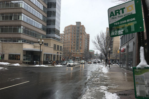
Meltwater from the wet spring snow that fell today may refreeze overnight, leading to treacherous conditions Thursday morning.

That’s the message from VDOT, which issued the following press release this evening.

As snow tapers off across northern Virginia and temperatures hover at or below freezing, the Virginia Department of Transportation asks drivers to be aware of potential icy conditions overnight and through tomorrow.

Crews will continue working overnight to clear roads, providing a passable path in neighborhoods as well as retreating all roads for refreeze. VDOT asks drivers to use extreme caution or delay overnight trips if possible, to ensure crews are able to work safely and efficiently.

Drivers are asked to continue to monitor weather and to use extreme caution if driving. Low temperatures over the next several days will mean potential for continued refreeze, slick spots and varying road conditions.

Drivers are reminded:

  • Stay tuned to weather conditions (see latest from National Weather Service).
  • If existing conditions refreeze and roads become icy, delay trips for safety, or allow plenty of extra time and reduce speeds significantly.
  • Assume any “wet” pavement could be slick. Even previously treated roads become slick quickly with low pavement and air temperatures.
  • Take it slow on bridges, ramps, overpasses, and other known trouble spots.
  • Ensure gas tanks and wiper fluid tanks are full and completely clean off vehicles before traveling.

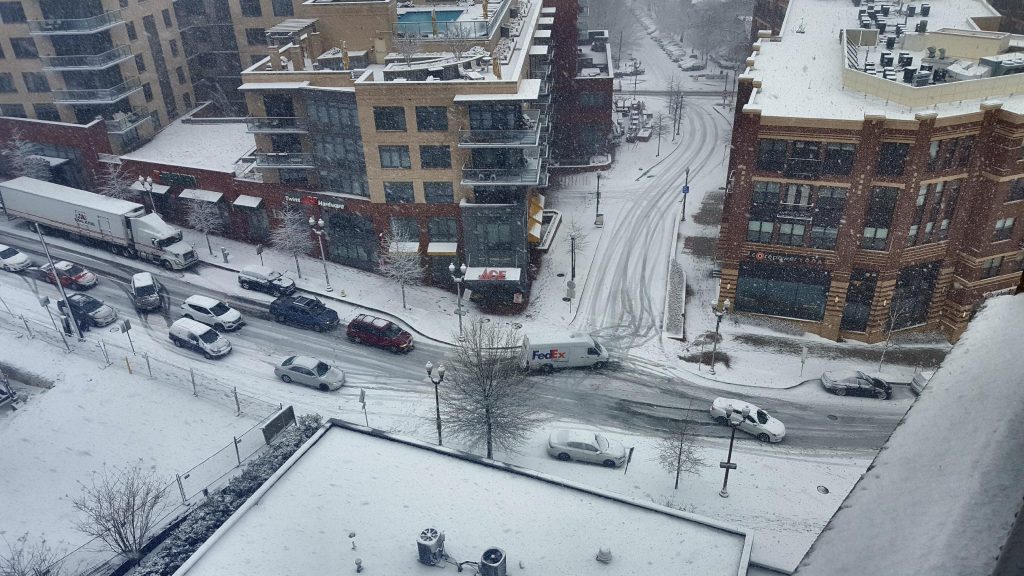
Four inches of snow has fallen in Arlington, according to the 2 p.m. snowfall total at Reagan National Airport.

The snow has led to slippery roadways and numerous closures. Though above-average temperatures and dogged work by Arlington and VDOT crews has resulted in many main roads being more wet than snow-covered as of mid-afternoon, a number of accidents and spinouts have been reported.

On a hilly stretch between Rosslyn and Courthouse this morning, at least a half dozen vehicles were stuck for upwards of 15 minutes after one driver slid down the hill, according to a witness.

Across the county, firefighters were told this afternoon to put tire chains on their vehicles to help with traction, according to scanner traffic.

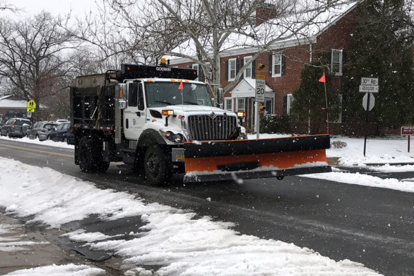
Photo (top) courtesy Chris Warner


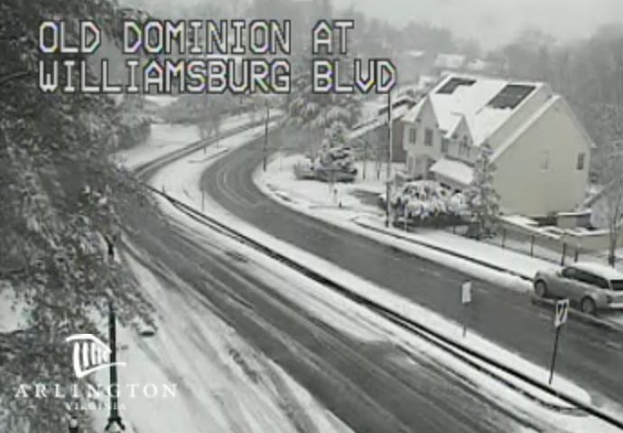
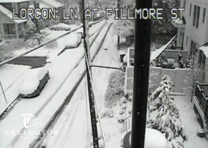
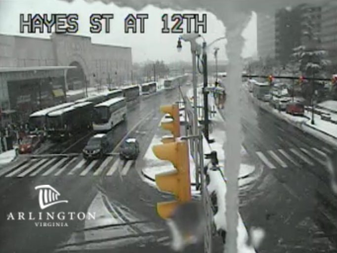
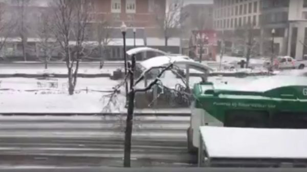
Most roads in Arlington have become snow-covered throughout the course of the morning as the D.C. area’s first — and likely last — big snowstorm of the season continues.

A look at traffic cameras in various parts of the county shows light traffic and — for the most part — snowy but still drivable roads. Drivers are, however, having difficulty getting up and down some hilly streets.

Authorities have been urging those who do not absolutely have to get somewhere to keep their cars parked today.

Mass transit is still running, but at reduced service levels. WMATA made the following announcement around 10:30 a.m.

Due to deteriorating weather conditions, Metro is announcing the following service changes, effective as of 10:30 a.m. Wednesday:

Metrobus service is transitioning to a Severe Snow Plan, which will further limit service to major roadways only. Due to current road conditions, buses are subject to significant delays systemwide, and customers should travel only if absolutely necessary. For details about the Severe Snow Plan, visit: https://www.wmata.com/rider-guide/weather/bus/severe.cfm

MetroAccess service is no longer accepting “outbound” trips due to current weather conditions. Service will continue to be provided only for customers who need to be transported back to their residences.

Metrorail continues to operate on a modified schedule. Trains are operating about every 12-15 minutes on each line. There are no issues to report on the rail system at this time.

Arlington Transit buses, meanwhile, are also operating at “severe service” levels.

More via social media:

UPDATE: Traffic is light and most roads around Arlington appear to be snow-covered, though major arteries are being treated

Posted by Arlington Now on Wednesday, March 21, 2018

Video (above) by Dwayne Stewart


(Updated at 3:45 p.m.) A Winter Storm Warning is set to take effect overnight tonight, as a snowstorm bears down on the D.C. area.

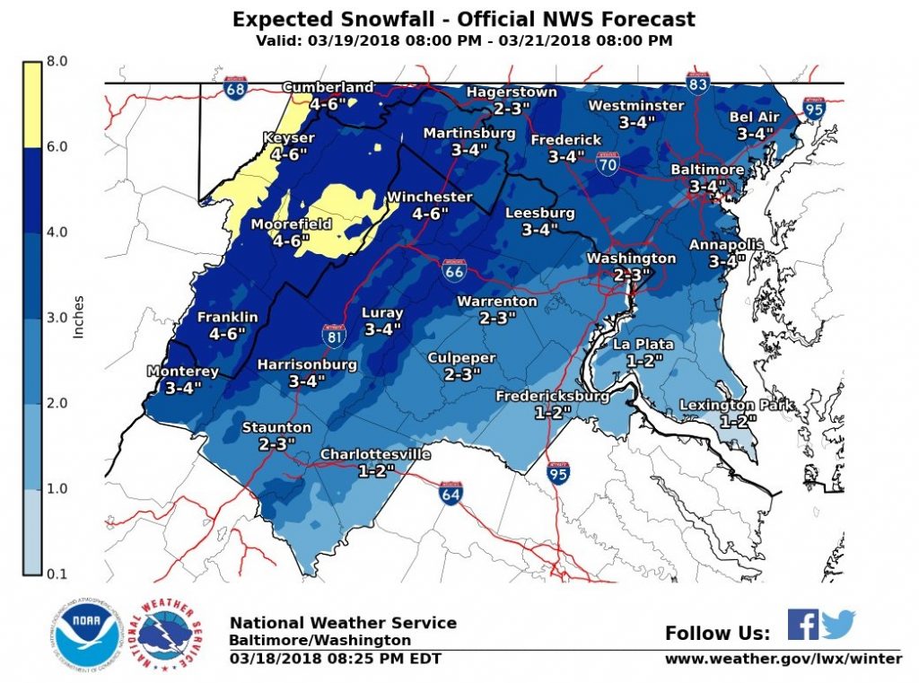
Forecasters say 4-8 inches of heavy snow accumulation is likely for Arlington and the immediate metro area, though even snow is possible.

From the National Weather Service:

…WINTER STORM WARNING IN EFFECT FROM 2 AM TO 8 PM EDT WEDNESDAY… * WHAT…HEAVY SNOW EXPECTED. TOTAL SNOW ACCUMULATIONS OF 4 TO 8 INCHES ARE EXPECTED. * WHERE…THE DISTRICT OF COLUMBIA, PORTIONS OF CENTRAL AND NORTHERN MARYLAND AND NORTHERN AND NORTHWEST VIRGINIA. * WHEN…FROM 2 AM TO 8 PM EDT WEDNESDAY. * ADDITIONAL DETAILS…PLAN ON DIFFICULT TRAVEL CONDITIONS. BE PREPARED FOR SIGNIFICANT REDUCTIONS IN VISIBILITY AT TIMES. PRECAUTIONARY/PREPAREDNESS ACTIONS… A WINTER STORM WARNING FOR SNOW MEANS SEVERE WINTER WEATHER CONDITIONS WILL MAKE TRAVEL VERY HAZARDOUS OR IMPOSSIBLE. IF YOU MUST TRAVEL, KEEP AN EXTRA FLASHLIGHT, FOOD AND WATER IN YOUR VEHICLE IN CASE OF AN EMERGENCY. THE LATEST ROAD CONDITIONS FOR THE STATE YOU ARE CALLING FROM CAN BE OBTAINED BY CALLING 5 1 1. &&


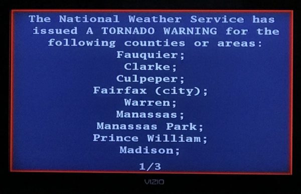
Throughout Virginia today, TVs and weather radios broadcast a test Tornado Warning as part of the annual Statewide Tornado Drill.

Anyone watching cable TV saw programming interrupted by Emergency Alert System message. A computerized voice said the Tornado Warning was just a test, but in a real weather emergency anyone seeing the EAS message should get to a basement or other secure location.

More from Virginia Dept. of Emergency Management:

The Statewide Tornado Drill is a yearly opportunity to prepare Virginians for tornado emergencies and to test public warning systems.

Save the date! The 2018 Statewide Tornado Drill will take place on Tornado Preparedness Day, Tuesday, March 20, 2018, at 9:45 a.m. (If widespread severe weather threatens the Commonwealth on that date, then the drill will be on  Wednesday, March 21, at 9:45 a.m.)

At approximately 9:45 a.m., the National Weather Service will send a test tornado warning over NOAA Weather Radios. This test signal will sound a tone alert, show a test message or flash to indicate a message, simulating what people would hear or see during an actual tornado warning. Local radio stations, TV stations and cable outlets will also broadcast the test message via the Emergency Alert System.

The drill takes place annually on the first day of spring.

The Arlington Dept. of Public Safety Communications & Emergency Management also participated in the drill and live tweeted it.

https://twitter.com/ReadyArlington/status/976092550674214913


(Updated at 5:15 p.m.) A Winter Storm Watch has been issued for the D.C. area as Arlington County crews prepare for several inches of snow.

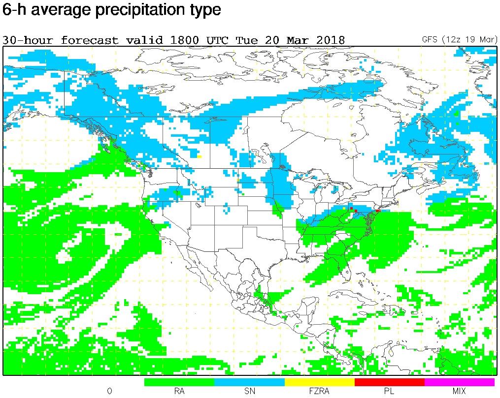
The storm is expected to start as rain tomorrow, the first day of spring, before transitioning to snow. The National Weather Service noted on its Twitter page that there is “lots of uncertainty” in terms of the type of precipitation.

More from NWS:

…WINTER STORM WATCH IN EFFECT FROM LATE TUESDAY NIGHT THROUGH WEDNESDAY EVENING…

* WHAT…Heavy wet snow possible, with a total wet snow accumulation of 5 inches or more.

* WHERE…Metropolitan Baltimore and Washington areas, as well as the northern and central Shenandoah Valley.

* WHEN…From late Tuesday night through Wednesday evening.

* ADDITIONAL DETAILS…Plan on difficult travel conditions. Significant reductions in visibility are possible.

PRECAUTIONARY/PREPAREDNESS ACTIONS…

A Winter Storm Watch means there is potential for significant snow, sleet or ice accumulations that may impact travel. Continue to monitor the latest forecasts.

Via Twitter, the Virginia Department of Transportation said crews will not be pretreating the roads because of the expected rain on Tuesday. An Arlington Department of Environmental Services representative confirmed that the county will not be pretreating for the same reasons, but added that trucks are “ready to treat arterials and any trouble spots should they appear overnight.”

More from VDOT:

The first day of Spring in northern Virginia is forecast to bring snow and sleet and Virginia Department of Transportation crews will be ready. The National Weather Service has already issued a Winter Weather Advisory and Winter Storm Watch for the area. Drivers should continue to monitor the weather and be prepared to stay off the roads if the timing and intensity of this storm impacts rush hours.

Overnight Monday, plow trucks will be staged and ready to treat roads with salt and sand at the beginning of the storm. After two inches have fallen, crews will be able to begin to push snow and/or continuously treat affected areas.

Drivers are asked to:

  • Stay closely tuned to weather forecasts (see National Weather Service) throughout the day Tuesday and Wednesday.
  • Consider adjusting trips around the forecast for safety.
  • Assume any “wet” pavement to be slick. Bridges, ramps, overpasses and lower-volume roads may get slippery first, and even previously treated roads will become slick quickly with the low pavement temperatures.
  • Ensure gas and wiper fluid tanks are full, and have a good emergency kit. Here’s how: www.ready.gov/car.
  • Be aware that low temperatures will mean continued potential for refreeze and slick road conditions.

Via social media:


A wintry precipitation mix is expected to hit the region this evening (March 6) and continue into tomorrow morning, which Virginia Department of Transportation officials say could impact the morning commute.

Crews are treating the roads and are preparing for any necessary snow removal, though a tweet from the Capital Weather Gang notes that it is unlikely that much will stick. It’s more likely that there will be a buildup of slush.

VDOT has the following tips for the anticipated precipitation:

  • Stay closely tuned to weather forecasts (see National Weather Service) overnight and through the day tomorrow.
  • Consider teleworking or adjusting trips around the forecast. If roads are slick, delay trips for safety.
  • Bridges, ramps, overpasses and lower-volume roads may become slick quickly with low pavement temperatures.
  • Ensure gas and wiper fluid tanks are full, and have a good emergency kit. Here’s how: www.ready.gov/car.
  • Be aware that low temperatures will mean continued potential for refreeze and slick road conditions.


View More Stories