Forecasters are warning of the potential for wintry weather and a hazardous Friday evening commute.

The snow threat prompted the National Weather Service to issue the following Special Weather Statement around 11 p.m. Thursday.

…POTENTIAL WINTER COMMUTING HAZARD FOR THE BALTIMORE / WASHINGTON METRO AREAS FRIDAY AFTERNOON…

There is a potential for hazardous commuting conditions for the Friday afternoon commute. Light snow (with potential large impact due to sub-freezing road temperatures) is POSSIBLE between 1pm and 5pm Friday afternoon. There is a 50 percent chance of snow for Washington and Baltimore. If there is accumulation, it is expected to be less than an inch.

If this threat of light snow on frigid roads does materialize Friday afternoon, the Friday afternoon rush-hour could quickly turn icy on untreated road surfaces. This could lead to hazardous traveling conditions, multiple accidents, and extensive delays.

If you plan on commuting Friday afternoon, be aware of the POSSIBILITY of travel disruptions and icy roads. Plan ahead by allowing for extra travel time, and consider using public transportation and telework options.

Stay tuned for updates on this potential winter weather episode.

The local NWS office also included a link to the following video, with more information about the threat.


A Winter Weather Advisory is in effect, as of midnight, for Arlington and much of the rest of the D.C. area.

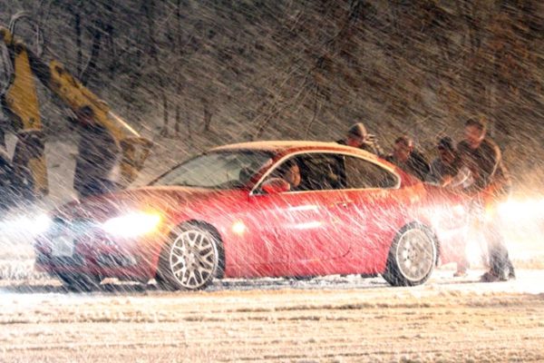
The National Weather Service says 4-6 inches of snow is possible throughout the day today (Saturday) inside the Beltway, but other forecasters say we could see as little as an inch.

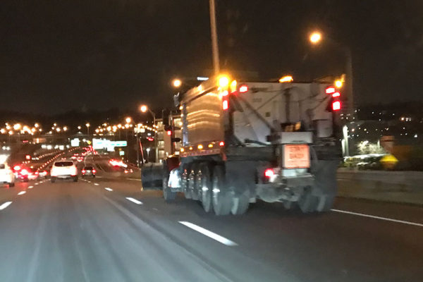
Road crews were busy pre-treating local roads and highways Friday in anticipation of the snow, which is expected to begin falling soon.

Via Twitter:

The advisory from NWS:

… WINTER WEATHER ADVISORY REMAINS IN EFFECT UNTIL 4 PM EST SATURDAY… * WHAT… SNOW, HEAVY AT TIMES SATURDAY MORNING. PLAN ON DIFFICULT TRAVEL CONDITIONS. TOTAL SNOW ACCUMULATIONS OF 3 TO 5 INCHES. * WHERE… PORTIONS OF THE DISTRICT OF COLUMBIA, CENTRAL AND NORTHERN MARYLAND AND NORTHERN VIRGINIA. * WHEN… UNTIL 4 PM EST SATURDAY. THE HEAVIEST SNOWFALL WILL BE BETWEEN DAWN AND NOON ON SATURDAY. * ADDITIONAL DETAILS… BE PREPARED FOR REDUCED VISIBILITIES AT TIMES. PRECAUTIONARY/PREPAREDNESS ACTIONS… A WINTER WEATHER ADVISORY FOR SNOW MEANS PERIODS OF SNOW WILL CAUSE PRIMARILY TRAVEL DIFFICULTIES. BE PREPARED FOR SNOW COVERED ROADS AND LIMITED VISIBILITIES, AND USE CAUTION WHILE DRIVING. THE LATEST ROAD CONDITIONS FOR THE STATE YOU ARE CALLING FROM CAN BE OBTAINED BY CALLING 5 1 1.


Arlington County and the wider D.C. region could receive its first dusting of snow this winter, as early as tonight.

The Capital Weather Gang reports that as Friday night wears on, the chances of light snow, or a mix of snow and rain, will increase. A mix of snow and rain is likely to fall during Saturday, with as much as an inch or two expected to accumulate depending on the severity of the storm.

County government has been planning all year for any winter weather, including budgeting $1.4 million for snow removal, stockpiling 9,200 tons of salt and spending 1,950 hours training snow crews. The team is made up of 92 drivers and 46 trucks.

Crews from the county’s Department of Environmental Services were out this morning with liquid de-icer to pre-treat some county streets.

Work on snow-affected roads is broken into four phases, per a county press release:

  • Phase 1: Snow crews pre-treat main roads before a storm.
  • Phase 2: During the storm, the priority is to keep main arteries passable for emergency vehicles and public transportation.
  • Phase 3: Plowing of residential streets and trails begins. It’s important to know that these streets may only be passable with one lane and you may not see bare pavement.
  • Phase 4: After the storm, cleanup operations begin, which includes treating ice on the roadways.

As well as more than 1,000 lane miles of county streets, crews will also clear nearly 350 bus stops and shelters, 35 miles of sidewalks and 21 pedestrian bridges or overpasses. Ten miles of trails and three miles of protected bike lanes also will be cleared.

And residents can play their part in helping make snow clearing as easy as possible:

  • Coordinate with neighbors to park cars on one side of the street, where feasible, or avoid on-street parking so snowplow operators can efficiently clear more of the streets
  • Don’t park “head in” on cul-de-sacs so plows have more room to maneuver
  • Clear your sidewalks and scoop snow towards your house, not the street, BUT
  • Wait for snow plows to come by before clearing snow from the front of driveways, to minimize the amount pushed back by plows
  • Stay home, telework or use mass transit to reduce the number of potentially stranded vehicles
  • Apply only the recommended amount of chemical de-icers on sidewalks to attain a safe and passable way
  • Stay connected through the Snow and Ice Central webpage and DES social media platforms for updates on snow phases, transportation, trash and other important notifications. Follow on Twitter @ArlingtonDES and on Facebook at Arlington County Department of Environmental Services.

Crews from the Virginia Department of Transportation will also be pre-treating roads ahead of any snow. VDOT urged drivers to give their trucks room to work.


The National Weather Service has issued a Wind Advisory for Arlington and much of the rest of the D.C. area.

Strong, gusty winds this morning and afternoon may knock down tree branches and power lines, forecasters say.

More from NWS:

… WIND ADVISORY REMAINS IN EFFECT UNTIL 3 PM EST THIS AFTERNOON… * TIMING… STRONG WIND GUSTS WILL CONTINUE THROUGH THIS AFTERNOON. THE WINDS WILL BE STRONGEST THROUGH NOON. * WINDS… WEST 20 TO 30 MPH WITH GUSTS UP TO 55 MPH. * IMPACTS… STRONG WINDS MAY BLOW DOWN LIMBS, TREES, AND POWER LINES. SCATTERED POWER OUTAGES ARE EXPECTED. PRECAUTIONARY/PREPAREDNESS ACTIONS… A WIND ADVISORY MEANS THAT WINDS OF 45 TO 55 MPH ARE EXPECTED. WINDS THIS STRONG CAN MAKE DRIVING DIFFICULT, ESPECIALLY FOR HIGH PROFILE VEHICLES. &&


Arlington County and the D.C. region will be under a freeze watch from Friday evening until Saturday morning as cold temperatures descend on the area.

An Arctic blast of cold air arriving tonight (Thursday) will bring temperatures in the 20s on Friday night and Saturday morning.

The National Weather Service said sensitive plants may be damaged or killed, and NWS recommends protecting from the cold.

From the National Weather Service:

FREEZE WATCH REMAINS IN EFFECT FROM FRIDAY EVENING THROUGH SATURDAY MORNING… * TEMPERATURES… LOWS AROUND 20 INLAND AREAS, MID 20S FOR THE URBAN CENTERS AND ALONG THE WESTERN SHORE OF THE CHESAPEAKE BAY AND TIDAL POTOMAC RIVER * IMPACTS… FROST AND FREEZE CONDITIONS WILL DAMAGE OR KILL SENSITIVE VEGETATION ON FRIDAY NIGHT. TAKE STEPS NOW TO PROTECT TENDER PLANTS FROM THE COLD. PRECAUTIONARY/PREPAREDNESS ACTIONS… A FREEZE WATCH MEANS SUB-FREEZING TEMPERATURES ARE POSSIBLE. THESE CONDITIONS COULD KILL CROPS AND OTHER SENSITIVE VEGETATION.


Arlington County and much of the surrounding D.C. area is under a Wind Advisory.

The advisory, which is in effect until 6 a.m., cautions that an approaching line of gusty showers may produce damaging winds.

From the National Weather Service:

… WIND ADVISORY REMAINS IN EFFECT UNTIL 6 AM EDT TUESDAY… * TIMING… TONIGHT INTO EARLY TUESDAY MORNING. THE GREATEST CONCERN WILL BE FOCUSED MORE IN THE EVENING NEAR I-81, AND NEAR OR AFTER MIDNIGHT ALONG I-95. * WINDS… SOUTH 15 TO 30 MPH, WITH GUSTS UP TO 50 MPH. * IMPACTS… SCATTERED TREE AND POWER LINE DAMAGE. DIFFICULTY DRIVING HIGH PROFILE VEHICLES. PRECAUTIONARY/PREPAREDNESS ACTIONS… A WIND ADVISORY MEANS THAT WINDS OF 45 TO 55 MPH ARE EXPECTED. WINDS THIS STRONG CAN MAKE DRIVING DIFFICULT, ESPECIALLY FOR HIGH PROFILE VEHICLES. &&


Arlington and other parts of the D.C. area are under a Frost Advisory tonight.

Temperatures are expected to dip into the mid-30s early Wednesday morning, potentially damaging sensitive plants.

From the National Weather Service:

… FROST ADVISORY REMAINS IN EFFECT FROM 1 AM TO 9 AM EDT WEDNESDAY… * TEMPERATURES… DROPPING INTO THE MID 30S BY DAWN, ESPECIALLY AWAY FROM LARGER BODIES OF WATER AND URBAN AREAS. * IMPACTS… A FROST ADVISORY MEANS THAT WIDESPREAD FROST IS EXPECTED. SENSITIVE OUTDOOR PLANTS MAY BE KILLED IF LEFT UNCOVERED. PRECAUTIONARY/PREPAREDNESS ACTIONS… A FROST ADVISORY MEANS THAT WIDESPREAD FROST IS EXPECTED. SENSITIVE OUTDOOR PLANTS MAY BE KILLED IF LEFT UNCOVERED.


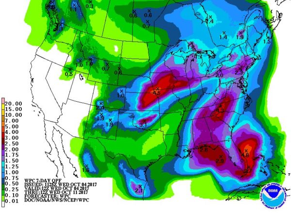
Forecasters say Arlington could break its rainless streak next week, depending on what happens with Tropical Depression 16, which is expected to turn into Tropical Storm Nate.

The storm has the potential to intensify rapidly and could strike the Gulf Coast as a strong tropical storm or Category 1 hurricane this weekend. The storm is expected to make its way north just as a cold front is pushing into the East Coast.

The rain could arrive in Arlington by late Sunday night, but timing depends on how quickly the front moves through and its clash with the depression. That also would affect how much rain falls, but the Capital Weather Gang predicts it could be several inches.

The National Hurricane Center predicts that this storm will bring “torrential rain” to Central America, but cautions that it’s too early to determine any further impacts this early.


Those enjoying summer’s muggy extended stay in our area are set for a letdown tomorrow.

Hot and humid afternoons and warm evenings will give way to seasonably cooler weather early Thursday, according to the National Weather Service.

Mr. Autumn Man can break out the flannel and sip a maple latte or pumpkin beer on a fall crisp day, rather than sweating over shorts-clad passersby questioning the meteorological appropriateness of said beverages.

Is the return of autumnal weather a good thing or bad thing, in your opinion?


Update at 2:30 p.m. — Arlington is now also under a Severe Thunderstorm Watch.

Update at 12:40 p.m. — A Flash Flood Watch has just been issued.

Earlier: Today (Friday) is expected to run the gamut of summer weather.

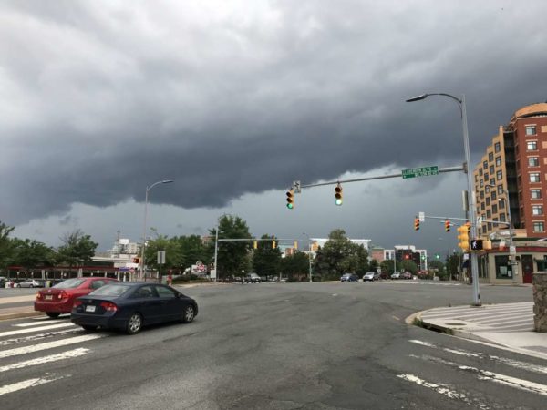
Forecasters say high humidity may push Heat Index values as far north at 105 degrees. After roasting this afternoon, strong to potentially severe thunderstorms are expected to cool things down a bit this evening.

The National Weather Service has issued a Heat Advisory from Arlington, D.C. and the surrounding area. More from NWS:

HEAT ADVISORY IN EFFECT FROM 11 AM THIS MORNING TO 8 PM EDT THIS EVENING… THE NATIONAL WEATHER SERVICE IN BALTIMORE MD/WASHINGTON HAS ISSUED A HEAT ADVISORY, WHICH IS IN EFFECT FROM 11 AM THIS MORNING TO 8 PM EDT THIS EVENING. * HEAT INDEX VALUES… AROUND 105 DEGREES DUE TO TEMPERATURES IN THE LOWER 90S AND DEWPOINTS IN THE MID TO UPPER 70S. * IMPACTS… THE HEAT AND HUMIDITY MAY CAUSE HEAT STRESS DURING OUTDOOR EXERTION OR EXTENDED EXPOSURE. PRECAUTIONARY/PREPAREDNESS ACTIONS… A HEAT ADVISORY MEANS THAT A PERIOD OF HIGH TEMPERATURES IS EXPECTED. THE COMBINATION OF HIGH TEMPERATURES AND HIGH HUMIDITY WILL CREATE A SITUATION IN WHICH HEAT ILLNESSES ARE POSSIBLE. TAKE EXTRA PRECAUTIONS IF YOU WORK OR SPEND TIME OUTSIDE. WHEN POSSIBLE, RESCHEDULE STRENUOUS ACTIVITIES TO EARLY MORNING OR EVENING. KNOW THE SIGNS AND SYMPTOMS OF HEAT EXHAUSTION AND HEAT STROKE. WEAR LIGHT WEIGHT AND LOOSE FITTING CLOTHING WHEN POSSIBLE AND DRINK PLENTY OF WATER. TO REDUCE RISK DURING OUTDOOR WORK, THE OCCUPATIONAL SAFETY AND HEALTH ADMINISTRATION RECOMMENDS SCHEDULING FREQUENT REST BREAKS IN SHADED OR AIR CONDITIONED ENVIRONMENTS. ANYONE OVERCOME BY HEAT SHOULD BE MOVED TO A COOL AND SHADED LOCATION. HEAT STROKE IS AN EMERGENCY – CALL 911.


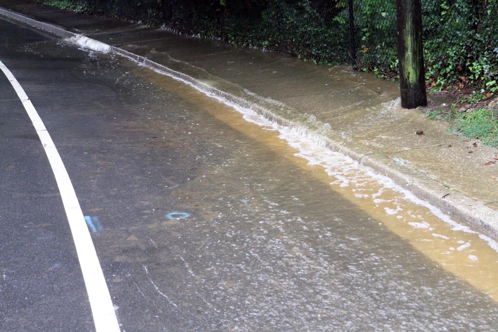
Tuesday’s heavy rains caused some flooding around Arlington, especially in the northern reaches of the county.

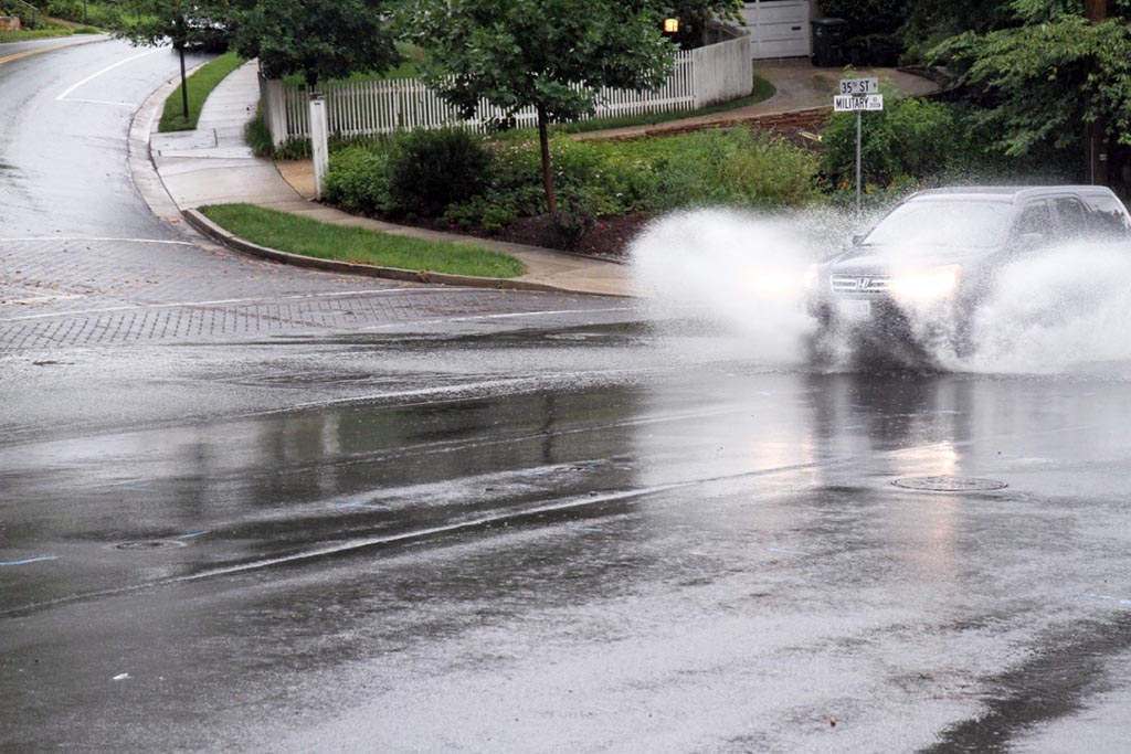
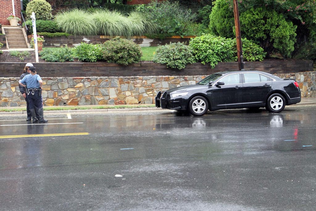
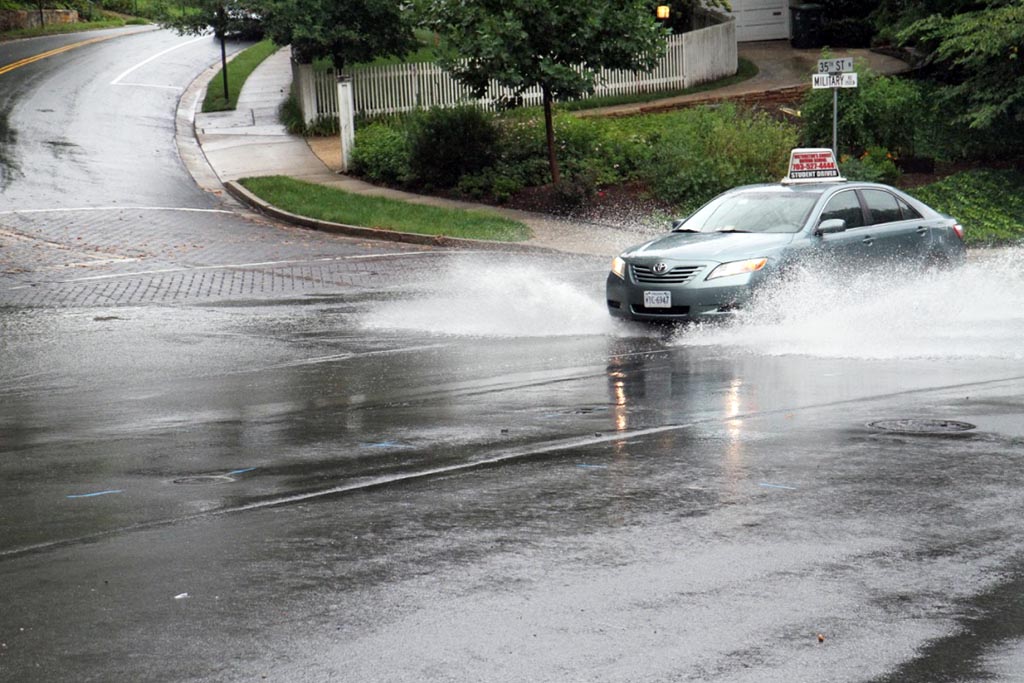
An overflowing storm drain brought elevated water levels to the intersection of Military Road and 35th Street N., where drivers had to contend with significant standing water following a slug of heavy rain this morning. Police were on scene, but there were no road closures.

An earlier report suggested higher, more hazardous water levels along Military Road while the rain was still falling.

Other areas of reported flooding included the area of Glebe Road and Chain Bridge and the intersection of Yorktown Blvd and N. Harrison Street — though no standing water was observed there when an ARLnow.com reporter drove by.

The National Weather Service warned earlier today about flash floods in the region, with the threat running through early afternoon. The heavy rain that brought flooding to Arlington appeared to bring more severe conditions to Northwest D.C., where residents posted photos and videos (below) of roads turned into fast-moving streams.

Arlington’s Dept. of Public Safety Communications & Emergency Management, meanwhile, reminded residents to “turn around and don’t drown” when encountering flooded roadways.


View More Stories