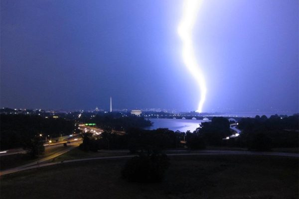
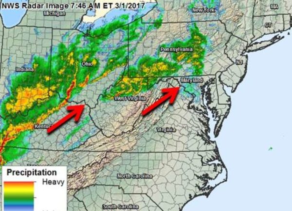
(Updated at 1:30 p.m.) A Severe Thunderstorm Warning has been issued for Arlington County.

From the National Weather Service:

* Severe Thunderstorm Warning

* Until 200 PM EDT

* At 111 PM EDT, severe thunderstorms were located along a line extending from near Warrenton to 6 miles west of Dale City to Triangle, moving northeast at 50 mph.

HAZARD…60 mph wind gusts and quarter size hail.

SOURCE…Radar indicated.

IMPACT…Damaging winds will cause some trees and large branches to fall. This could injure those outdoors, as well as damage homes and vehicles. Roadways may become blocked by downed trees. Localized power outages are possible. Unsecured light objects may become projectiles.

* Locations impacted include… Arlington, Alexandria, Germantown, Centreville, Dale City, Rockville, Bethesda, Gaithersburg, Reston, Leesburg, Annandale, Olney, Springfield, College Park, South Riding, Fort Washington, Herndon, Greenbelt, Fairfax and Langley Park.

PRECAUTIONARY/PREPAREDNESS ACTIONS…

Get indoors to protect yourself from wind and lightning. Trees around you may be downed from damaging winds, so if you are near large trees, move to an interior room on the lowest floor. Don’t drive underneath trees or in wooded areas until the threat has passed.

A Severe Thunderstorm Watch is also in effect, until 5 p.m.


(Updated at 9:55 a.m.) It’s going to be a rainy day in Arlington and the D.C. area, with heavy rain and scattered storms likely.

The rain may cause some minor flooding problems on the roadways and along streams, forecasters say.

“Rain will be locally heavy at times through this evening,” said the National Weather Service. “Localized flooding of small streams and creeks as well as urban areas is possible late this morning into this evening.”

More from NWS:

At 907 AM EDT, radar indicated showers with isolated thunderstorms were located along a line extending from Ashburn to Aquia Creek. Movement was northeast at 40 mph.

Locally heavy rainfall can be expected.

Locations impacted include…
Arlington, Alexandria, Stafford, Columbia, Germantown, Centreville, Waldorf, Dale City, Rockville, Bethesda, Gaithersburg, Reston, Leesburg, Annandale, Clinton, Olney, Springfield, College Park, South Riding and Fort Washington.

Locally heavy rainfall is also occurring with these showers, and may cause ponding of water on roadways and cause small streams to go out of their banks. Be alert for the potential of standing water and hydroplaning.

The weather is already causing problems on the roads and at the airport:


Arlington County and other D.C. area jurisdictions are under a Dense Fog Advisory this morning.

From the National Weather Service:

… DENSE FOG ADVISORY NOW IN EFFECT UNTIL NOON EDT TODAY… * VISIBILITIES… ONE QUARTER MILE OR LESS. * IMPACTS… AREAS OF DENSE FOG WILL CAUSE SUDDEN REDUCTIONS IN VISIBILITY AND RAPIDLY CHANGING CONDITIONS. PRECAUTIONARY/PREPAREDNESS ACTIONS… A DENSE FOG ADVISORY MEANS VISIBILITIES WILL FREQUENTLY BE REDUCED TO LESS THAN ONE QUARTER MILE. IF DRIVING, SLOW DOWN, USE YOUR HEADLIGHTS, AND LEAVE PLENTY OF DISTANCE AHEAD OF YOU. &&

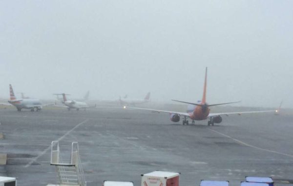
The fog is causing some delays at Reagan National Airport, the airport tweeted this morning.


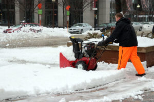
Workers clear sidewalks during snowstorm in BallstonIf you have a house or business in Arlington and there’s a public sidewalk in front of it, you have fewer than three hours to clear it of snow and ice.

Arlington’s snow removal ordinance requires that sidewalks be shoveled within 24 hours of the end of a snow event with six inches or less of accumulation. As far as the county is concerned, Tuesday’s snowstorm ended at 2 p.m., and thus the sidewalk deadline today is 2 p.m.

If you’ve procrastinated, you might be in for a tough task. Temperatures in the low 20s means that uncleared snow and sleet has turned into a barely penetrable mat of ice.

Via Twitter:


Frigid, icy conditions have prompted Arlington Public Schools to open on a two-hour delay today.

From APS:

All APS schools and offices will open two hours late today. The Extended Day program will also open two hours late and morning field trips are canceled. Essential employees and food service workers should report to work at their regularly scheduled time. All other employees should report to work two hours past their usual start time. For updates about Pool Operations, go to www.apsva.us/aquatics. For information about Arlington County operations go to www.arlingtonva.us.

Arlington County government and the federal government, meanwhile, are opening on time. Metrorail and Metrobus, likewise, were operating on a normal weekday schedule as of 5 a.m. Certain Arlington County Parks and Rec programs, however, have been cancelled or delayed.

From the parks department:

  • All Congregate Meal Programs are cancelled for the day.
  • All Early Childhood Programs (Preschool and Co-op) are cancelled.
  • All Enjoy Arlington Classes, 55+ classes, Trips, Nature Center Programs and sports league activities with a scheduled start time prior to 11:59 a.m. today are cancelled in all APS and DPR buildings.
  • All Enjoy Arlington Classes, 55+ classes, Trips, Nature Center Programs and sports league activities with a scheduled start time of Noon or later will proceed as scheduled.
  • All afternoon and evening Enjoy Arlington Classes, 55+ classes, Trips, Nature Center Programs and sports league activities will proceed as scheduled.
  • All community centers and senior centers locations will open on time as scheduled.

In addition to very cold temperatures, a Wind Advisory has been issued for Arlington and the D.C. region. Forecasters are warning of 45-50 mile per hour gusts which could blow down branches, trees and power lines.

From the National Weather Service:

… WIND ADVISORY IN EFFECT FROM 8 AM THIS MORNING TO 6 PM EDT THIS EVENING… THE NATIONAL WEATHER SERVICE IN BALTIMORE MD/WASHINGTON HAS ISSUED A WIND ADVISORY, WHICH IS IN EFFECT FROM 8 AM THIS MORNING TO 6 PM EDT THIS EVENING. * TIMING… AFTER DAYBREAK THROUGH THIS AFTERNOON. HIGHEST GUSTS EXPECTED LATE THIS MORNING INTO THIS AFTERNOON. * WINDS… NORTHWEST 20 TO 30 MPH WITH GUSTS AROUND 45 TO 50 MPH. * IMPACTS… STRONG WINDS MAY BLOW DOWN LIMBS, TREES, AND POWER LINES. ICE AND SNOW COVERED LIMBS, TREES AND POWER LINES ARE MORE SUSCEPTIBLE TO DAMAGE. SCATTERED POWER OUTAGES ARE EXPECTED. PRECAUTIONARY/PREPAREDNESS ACTIONS… A WIND ADVISORY MEANS THAT WINDS OF 45 TO 55 MPH ARE EXPECTED. WINDS THIS STRONG CAN MAKE DRIVING DIFFICULT, ESPECIALLY FOR HIGH PROFILE VEHICLES. &&


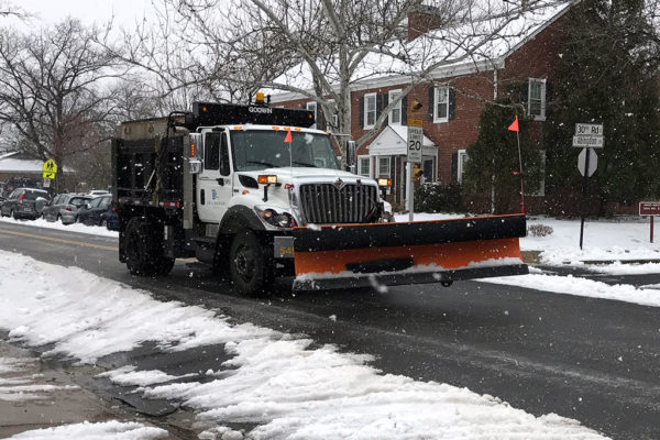
Arlington County snow plow in Fairlington 3/14/17

A refreeze overnight will turn what melted following this morning’s snow and sleet storm into a hazard on roads and sidewalks.

Despite efforts to plow and salt the streets, VDOT is warning that barely-visible black ice could cause accidents during the Wednesday morning commute.

Metro, meanwhile, says Metrobuses will start the day on a “moderate” snow service plan due to anticipated slippery conditions. Service will be upgraded “as conditions permit.”

More from VDOT:

Road conditions across northern Virginia are improving as Virginia Department of Transportation crews plowed and treated roads around the clock. This evening though, snow and slush that melted through the day will refreeze.

Overnight, crews will focus on retreating icy areas with salt and sand, clearing shoulders, ramps and drainage areas, and continue to make passes through neighborhood streets as needed.

Drivers should limit any unnecessary travel tonight to avoid black ice, and give crews room to make their rounds. Make plans now for a cautious Wednesday commute.

If you must drive this evening and tomorrow morning:

  • Stay focused and drive defensively.
  • Reduce speeds significantly. Give yourself more than enough time to get to where you’re going.
  • Brake gently to avoid skidding and hydroplaning.

Snow and sleet covered roads in Ballston 3/14/17A mix of sleet, snow and ice is making for slick driving conditions outside and has prompted the closure of Arlington Public Schools and government offices.

Local roads remain partially snow and slush covered, though traffic is very light. ART buses are operating on a “severe” service schedule, while Metrobuses are operating on a “moderate” snow plan. The Metrorail system is open and operating on a Saturday schedule.

APS announced just after 4 a.m. that it would be closed today.

All APS schools and offices will be closed today. Essential personnel should report to work at their scheduled time. All custodians report at 6 a.m. regardless of your regular shift. Extracurricular activities, interscholastic games, team practices, field trips, adult education classes, and programs in schools and on school grounds are canceled. For updates about Pool Operations, go to www.apsva.us/aquatics. For information about Arlington County programs and operations go to www.arlingtonva.us.

Arlington County announced that it was closed for the day just after 5 a.m.

Arlington County government offices, programs, courts, & facilities are closed today, Tuesday, March 14, 2017. If possible, stay off the roads while snow and ice removal efforts continue throughout the day.

VDOT is asking drivers to stay off the roads if at all possible.

Crews and almost 4,500 pieces of equipment worked through the night and continue to treat roads with salt and sand, and to plow in areas where there is enough accumulation.

Interstates and primary roads have stretches of slush and ice as snow and sleet continue to accumulate between plow passes.

Secondary roads and neighborhood streets remain mostly snow-covered.

HOV restrictions are lifted this morning on I-66, I-395 and the Dulles Toll Road.

Drivers are advised to continue to stay off the roads. If you absolutely must go out this morning, reduce speeds, use extreme caution and be alert to icy and inclement conditions. Road temperatures are expected to remain below freezing all day with potential for continued refreeze.

Virginia State Police say they’re dealing with a number of crashes in Northern Virginia.

Virginia State Police are currently on the scene of 10 traffic crashes throughout Northern Virginia. Only two involve injuries – minor – and the remainder of them involve damage to vehicles. From midnight Tuesday through 7 a.m., Virginia State Police have responded to 15 traffic crashes – all of which involved damage to vehicles only and no injuries.

Motorists are reminded to give extra time for travel, slow their speed for conditions, not to tailgate – to provide additional stopping distance in slick conditions, and to always buckle up.

The federal government, meanwhile, will be opening today on a three-hour delay. From the Office of Personnel Management:

Federal agencies in the Washington, DC area are OPEN under 3 hours DELAYED ARRIVAL and employees have the OPTION FOR UNSCHEDULED LEAVE OR UNSCHEDULED TELEWORK. Employees should plan to arrive for work no more than 3 hours later than they would be expected to arrive.


Snow plow on Jan. 24, 2016Update at 4:20 p.m. Metro has released its latest service plan for Monday night into Tuesday. The Metrorail system will be open Tuesday and will operate on a Saturday schedule. Buses will start the day operating on a severe service plan, according to WMATA.

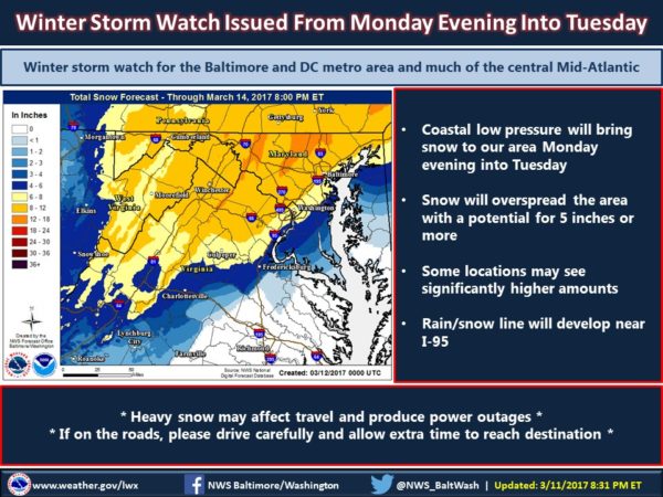
Arlington County, Virginia State Police and other local jurisdictions and agencies are bracing for the late-season snowstorm that’s expected to bring several inches of snow and sleet to our region starting tonight.

After-school activities and sporting events are being cancelled en masse tonight and officials are preparing for what may be a messy commute at best or major travel disruptions at worst tomorrow. In addition to problems on the roads, widespread flight cancellations are also expected at local airports.

From Kathryn O’Brien at Arlington’s Dept. of Environmental Services:

Arlington County will fully-mobilize crews this afternoon to combat the snow beginning tonight into Tuesday. In preparation for the storm, crews pretreated roads over the weekend.

During the storm, our priority is to keep main arteries passable for emergency vehicles and public transportation. After the storm, cleanup operations begin, which includes treating ice on the roadways. Plowing generally begins when snow is two-four inches deep. If more than six inches of snow falls, we will plow some residential areas at the same time as arterial roadways in phase two. (Learn more about our phases).

The County’s Snow Removal Ordinance requires all Arlington property owners to clear snow and ice from public sidewalks adjacent to their property within a certain time frame. Here are some other ways residents can help with our snow removal efforts:

  • Coordinate with neighbors to park cars on one side of the street, where feasible, or avoid on-street parking so snowplow operators can efficiently clear more of the streets
  • Don’t park “head in” on cul-de-sacs so that plows have more room to maneuver
  • Clear your sidewalks and scoop snow towards your house, not the street
  • Wait for snow plows to come by before clearing snow from the front of driveways, to minimize the amount pushed back by plows
  • Stay home, telework or use mass transit to reduce the number of potentially stranded vehicles
  • Apply only the recommended amount of chemical de-icers on sidewalks to attain a safe and passable way

We encourage residents to stay connected through our Snow and Ice Central webpage and our DES social media platforms for updates on snow phases, transportation, trash and other important notifications. Follow us on Twitter @ArlingtonDES and on Facebook at Arlington County Environmental Services.

Virginia Gov. Terry McAuliffe, meanwhile, has declared a State of Emergency in advance of the storm, saying that “Virginians should take the necessary precautions now to ensure they are prepared for travel disruptions and possible power outages during a cold weather period.”

From Virginia State Police:

Virginia State Police will have all available troopers and supervisors working in advance of and the duration of the storm as it makes its way across the Commonwealth. To prevent unnecessary traffic crashes from occurring on Virginia’s highways during the storm, state police advises residents to postpone travel plans and avoid driving, when possible.

If having to travel during the storm, drivers are reminded to do the following:

  • Use headlights. Increasing your visibility helps you to avoid slick and dangerous spots on the road, to include standing water and/or flooding. Headlights also help other drivers see you better.
  • Slow your speed. Though state police works closely with the Virginia Department of Transportation (VDOT) to identify problem areas on Virginia’s highways during a storm, drivers still must drive for conditions. Slowing your speed gives you more time to safely react and avoid a crash. Drive your vehicle based on your ability to properly maintain control of your vehicle.
  • Don’t tailgate. You need increased stopping distance on slick road surfaces. Give yourself more space between vehicles traveling ahead of you in order to avoid rear end collisions.
  • Buckle Up. Most crashes that occur during inclement weather are caused by vehicles sliding off the road or other vehicles. Wearing your seat belt protects you from being thrown around the inside of your vehicle and suffering serious injury in a crash.
  • Put down your phone. Having to drive in severe snow or rain requires a driver’s full, uninterrupted attention. Do not text and drive or shoot video of the bad conditions while driving, as these actions put you, your passengers and other vehicles at extreme risk of a crash and/or injury.
  • Check Your Vehicle. Make sure your vehicle is in good working order for the conditions. Fill up the tank in advance. Check windshield wipers, windshield wiper fluid, tire tread, battery life, etc.
  • Don’t leave home without a window scraper, blanket, bottled water, snack, cell phone charger and flashlight.

For the latest in road conditions and updates, please call 511 on a cell phone, download the App or go online to the VDOT Virginia Traffic Information Website at www.511virginia.org.

More via Twitter:


(Updated at 6:25 p.m.) Arlington and a large portion of the D.C. area is now under a Winter Storm Warning.

A “monster nor’easter” could bring a half foot of snow or more to the area from Monday night into Tuesday. Other coastal northeastern cities are also in the storm’s path.

From the National Weather Service:

… WINTER STORM WARNING IN EFFECT FROM 7 PM MONDAY TO 2 PM EDT TUESDAY… THE NATIONAL WEATHER SERVICE IN BALTIMORE MD/WASHINGTON HAS ISSUED A WINTER STORM WARNING FOR SNOW, WHICH IS IN EFFECT FROM 7 PM MONDAY TO 2 PM EDT TUESDAY. THE WINTER STORM WATCH IS NO LONGER IN EFFECT. * PRECIPITATION TYPE… SNOW… POSSIBLY MIXED WITH SLEET AT TIMES MONDAY NIGHT. * ACCUMULATIONS… SNOW ACCUMULATION OF 6 TO 10 INCHES. * TIMING… SNOW WILL OVERSPREAD THE AREA MONDAY EVENING AND PERSIST THROUGH TUESDAY MORNING. * IMPACTS… THE HEAVY SNOW WILL CREATE DIFFICULT TRAVEL CONDITIONS AND MAY PRODUCE SCATTERED POWER OUTAGES. * WINDS… NORTHEAST 5 TO 15 MPH WITH GUSTS UP TO 30 MPH. * TEMPERATURES… IN THE LOWER 30S. PRECAUTIONARY/PREPAREDNESS ACTIONS… A WINTER STORM WARNING FOR HEAVY SNOW MEANS SEVERE WINTER WEATHER CONDITIONS ARE EXPECTED OR OCCURRING. SIGNIFICANT AMOUNTS OF SNOW ARE FORECAST THAT WILL MAKE TRAVEL DANGEROUS. ONLY TRAVEL IN AN EMERGENCY. IF YOU MUST TRAVEL, KEEP AN EXTRA FLASHLIGHT, FOOD, AND WATER IN YOUR VEHICLE IN CASE OF AN EMERGENCY. &&

More via Twitter:


Update at 5:45 p.m. — A Wind Advisory has been issued for Arlington and the region. From the National Weather Service:

… WIND ADVISORY IN EFFECT FROM 10 PM THIS EVENING TO 10 AM EST THURSDAY… THE NATIONAL WEATHER SERVICE IN BALTIMORE MD/WASHINGTON HAS ISSUED A WIND ADVISORY, WHICH IS IN EFFECT FROM 10 PM THIS EVENING TO 10 AM EST THURSDAY. * TIMING… LATE THIS EVENING THROUGH MID-MORNING THURSDAY. * WINDS… WEST TO NORTHWEST 20 TO 30 MPH WITH GUSTS AROUND 50 TO 55 MPH. * IMPACTS… STRONG WINDS MAY BLOW DOWN LIMBS, TREES, AND POWER LINES. SCATTERED POWER OUTAGES ARE POSSIBLE. PRECAUTIONARY/PREPAREDNESS ACTIONS… A WIND ADVISORY MEANS THAT WIND GUSTS OF 50 TO 55 MPH ARE EXPECTED. WINDS THIS STRONG CAN MAKE DRIVING DIFFICULT, ESPECIALLY FOR HIGH PROFILE VEHICLES. &&

(more…)


Hourly forecast for 2017 Clarendon Mardi Gras parade (via Weather.com)

(Updated at 5:45 p.m.) Organizers are hoping for a Mardi Gras miracle, but it looks like tonight’s parade in Clarendon will be a soggy one.

The 18th annual Clarendon-Courthouse Mardi Gras Parade is slated to kick off at 7 p.m., making its way up Wilson Boulevard from N. Barton Street to N. Irving Street.

2013 Clarendon Mardi Gras paradeAn hourly forecast suggests rain may begin shortly before the parade begins, but Matt Hussmann, executive director of the Clarendon Alliance, says it will go on rain or shine — unless there is lightning in the area.

“We’re going forward and hoping the weather holds off,” said Hussmann. “The Mardi Gras Ball will go on irrespective.”

The annual parade has not had the best luck with weather. It was postponed in 2010, postponed and then cancelled in 2014, and postponed again in 2015 — all due to snow. It rained during the rescheduled 2015 parade.

Screen capture (top) via Weather.com. Photo (bottom) courtesy Jason Dixson Photography.


View More Stories