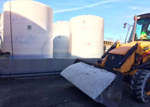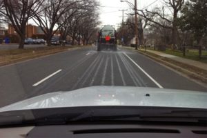
Arlington County crews pretreating S. Glebe Road with brine (file photo)(Update at 2:15 p.m.) Arlington County is preparing for the possibility of snow, sleet and freezing rain on Saturday, though the exact forecast is still far from certain.

“Crews began pretreating roads yesterday and will continue today to prepare for the expected icy weather conditions on the roadways,” Arlington Dept. of Environmental Services spokeswoman Katie O’Brien told ARLnow.com Friday morning.

“Due to the low confidence of this forecast, we are still analyzing the level of response that will be required” on Saturday, O’Brien continued. “A determination of resource levels and time of activation will be made this afternoon.”

VDOT, meanwhile, is encouraging drivers to stay off the roads in Northern Virginia on Saturday.

Virginia Department of Transportation and contract crews are preparing for plummeting temperatures and a gamut of winter weather forecast for northern Virginia this weekend, from early Saturday morning through Sunday morning.

Drivers are asked to monitor weather reports for the latest updates to avoid being on the road during periods of limited visibility or icy conditions. Stay off roads Saturday or delay trips until Sunday if possible, to avoid being caught in deteriorating conditions as weather transitions between snow, sleet and freezing rain through the day.

Crews began pretreating roads yesterday and will be staged roadside in the region by 10 p.m. tonight. Throughout Fairfax, Loudoun, Prince William and Arlington* counties (*Arlington maintains own secondary roads) crews treat about 5,200 lane miles of interstates and other high-volume roads with liquid magnesium chloride or brine when conditions allow for winter weather. Learn more about northern Virginia’s snow preparations.

Why does VDOT ask drivers to stay home?

  • Visibility will be limited during periods of snow.
  • Freezing rain causes an ice glaze that is difficult to see. Black ice often looks like pavement that is simply wet, making it extremely hazardous for driving or walking.
  • Four-wheel drive vehicles cannot stop any better than two-wheel drive vehicles on ice.

It could be deja vu if the weather does trend toward more freezing rain. Icy weather caused a number of crashes and other problems on the roads in Arlington less than a month ago, on Saturday, Dec. 17.


All the salt spread on local roads and sidewalks for Thursday night’s snow non-event may come in handy after all.

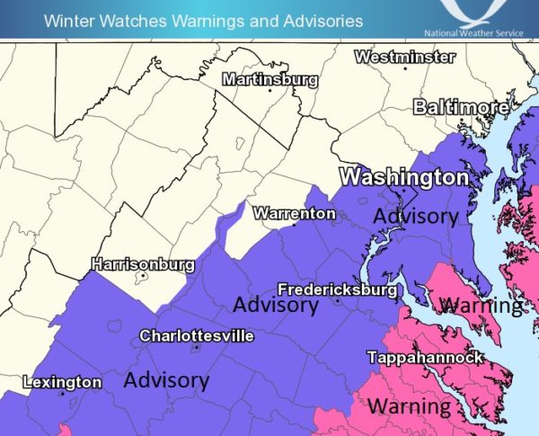
The National Weather Service has included Arlington in a Winter Weather Advisory. Up to three inches of snow are expected to fall Saturday morning.

From the NWS:

… WINTER WEATHER ADVISORY IN EFFECT FROM 1 AM TO 1 PM EST SATURDAY… THE NATIONAL WEATHER SERVICE IN BALTIMORE MD/WASHINGTON HAS ISSUED A WINTER WEATHER ADVISORY FOR SNOW… WHICH IS IN EFFECT FROM 1 AM TO 1 PM EST SATURDAY. * PRECIPITATION TYPE… SNOW. * ACCUMULATIONS… SNOW ACCUMULATION OF 1 TO 3 INCHES. * TIMING… LATE TONIGHT THROUGH EARLY SATURDAY AFTERNOON. * IMPACTS… SNOW ON ROADS WILL RESULT IN TRAVEL IMPACTS. * WINDS… NORTH 10 TO 15 MPH WITH GUSTS UP TO 20 MPH. * TEMPERATURES… IN THE MID 20S. PRECAUTIONARY/PREPAREDNESS ACTIONS… A WINTER WEATHER ADVISORY FOR SNOW MEANS THAT PERIODS OF SNOW WILL CAUSE PRIMARILY TRAVEL DIFFICULTIES. BE PREPARED FOR SNOW COVERED ROADS AND LIMITED VISIBILITIES… AND USE CAUTION WHILE DRIVING. &&


Arlington County crews pretreating S. Glebe Road with brine (file photo)It’s expected to start snowing tomorrow night and crews are already treating local roads and highways.

Arlington County brine trucks could be seen pretreating roads around Clarendon earlier this afternoon. VDOT, meanwhile, says it’s preparing for a potentially messy Thursday evening and Friday morning commute.

“Road crews are conducting anti-icing activities today and tomorrow,” VDOT said in a press release. “Please watch for crews as they stage along roads prior to the storm. Crews will treat roads with salt and sand as needed once the storm begins Thursday afternoon, plow in areas where and if snow totals reach two inches, and will remain on duty throughout the course of the storm.”

The snow is not expected to amount to much — maybe just a dusting to an inch. But even a small amount of snow could cause slippery conditions and virtual gridlock.

Via Twitter:

It might not be necessary with this storm, but Arlington County is urging residents this year to park in a parking lot or on the odd numbered side of local streets when it snows.

The county recently released the following video on the topic.


Forecasters are warning of a messy mix of wintry precipitation Saturday morning.

A Winter Weather Advisory is in effect starting at midnight tonight.

From the National Weather Service:

WINTER WEATHER ADVISORY REMAINS IN EFFECT FROM MIDNIGHT TONIGHT TO 9 AM EST SATURDAY… * PRECIPITATION TYPE… SNOW… SLEET AND FREEZING RAIN. * ACCUMULATIONS… SNOW AND SLEET ACCUMULATIONS OF LESS THAN A HALF-INCH… ALONG WITH AROUND A TENTH OF AN INCH OF GLAZE ICE. * TIMING… PERIODS OF SNOW AND SLEET WILL OVERSPREAD THE REGION AFTER MIDNIGHT TONIGHT… THEN CHANGE TO FREEZING RAIN BEFORE DAWN SATURDAY MORNING. FREEZING RAIN WILL CHANGE TO RAIN AROUND MID-MORNING SATURDAY. * IMPACTS… HAZARDOUS TRAVEL IS EXPECTED DUE TO ICY ROADS AND WALKWAYS. * WINDS… SOUTH 10 TO 15 MPH WITH GUSTS UP TO 20 MPH. * TEMPERATURES… IN THE UPPER 20S LATER TONIGHT… RISING INTO THE 30S ON SATURDAY MORNING. PRECAUTIONARY/PREPAREDNESS ACTIONS… A WINTER WEATHER ADVISORY MEANS THAT PERIODS OF SNOW… SLEET… OR FREEZING RAIN WILL CAUSE TRAVEL DIFFICULTIES. BE PREPARED FOR SLIPPERY ROADS AND LIMITED VISIBILITIES… AND USE CAUTION WHILE DRIVING. &&

Arlington County, meanwhile, says crews will be pre-treating roads ahead of the storm.


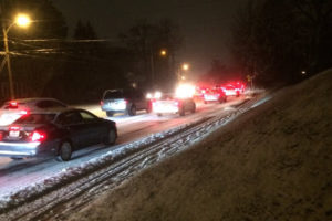
Traffic in Arlington during a light surprise snowfall on Jan. 20, 2016The National Weather Service is warning of the potential for lightly accumulating snowfall tonight.

Luckily, the snow is not expected to start until well after rush hour — we all remember what happened the last time a light snowfall caught the region by surprise during the evening commute.

Regardless of the timing, it may be a good idea to stay off the roads during this first (potential) snow of the season.

From NWS:

Special Weather Statement…UPDATED
National Weather Service Baltimore MD/Washington DC
1110 AM EST Wed Dec 14 2016

…POTENTIAL FOR LIGHT SNOW ACCUMULATION IN THE WASHINGTON AND
BALTIMORE METROPOLITAN AREAS LATE THIS EVENING AND OVERNIGHT…

Snow showers are possible late this evening into the overnight across the Washington and Baltimore Metropolitan areas. Snow may coat the ground in some locations… and with temperatures near freezing this may cause slippery conditions. The best chance for snow will be between 10 PM and 2 AM late this evening into the overnight.

Update at 1:10 p.m. — VDOT says it is preparing for wintry weather tonight.

Crews are taking advantage of conditions today and Thursday to treat roads with anti-icing materials in northern Virginia, in anticipation of low temperatures through the rest of week and the potential for wintry precipitation over the weekend.

Throughout Fairfax, Loudoun, Prince William and Arlington* counties (*Arlington maintains own secondary roads) crews treat about 5,200 lane miles with liquid magnesium chloride or brine in advance of winter weather. This includes interstate, primary and high-volume secondary road roads, particularly ramps, bridges, and other critical areas prone to freezing.

The Virginia Department of Transportation asks drivers to keep an eye on the forecast for freezing conditions and precipitation. Before venturing out this weekend, VDOT reminds drivers to fill their gas tanks, slow down, to be aware of potential slick spots such as shaded areas and bridges, and to use the following resources:

  • Check http://www.511virginia.org/ or the 511 mobile app before you go for traffic conditions and lane closures
  • Follow @VaDOTNOVA on Twitter
  • Visit www.virginiadot.org/ novaemergency for the latest updates and resources from VDOT in northern Virginia
  • Get more details on snow removal in northern Virginia

This is also the perfect time to place or update an emergency kit in your car. Recommended items include:

  • Water and food
  • Shovel
  • Ice scraper/brush
  • Gloves and boots
  • Phone charger
  • First aid kit
  • Flashlight
  • Flares
  • Ice melt/cat litter

More information at: www.ready.gov/car


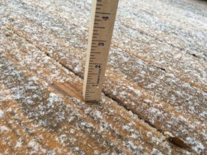
Unmeasurable snow (Flickr pool photo by Kevin Wolf)An Arctic blast will drop temperatures into the teens and 20s in the D.C. area starting mid-week.

The cold air is expected to push into the area Wednesday night, and will bring with it wind and the possibility of some light snow.

The last time we saw snow in Arlington was when the remains of a giant snow pile in Ballston, left over from the January blizzard, finally melted. Unlike some past years, to our knowledge no flakes fell in November this year.

Are you looking forward to the first flakes of the season?

(See some local tips for preparing for winter weather, published last week, here.)

Flickr pool photo by Kevin Wolf


The National Weather Service has issued a Dense Fog Advisory for Arlington and the D.C. area.

The advisory is in effect through 7 a.m. Wednesday. Drivers should use caution and expect low visibility on their morning commutes, forecasters say.

From NWS:

… DENSE FOG ADVISORY IN EFFECT UNTIL 7 AM EST WEDNESDAY… THE NATIONAL WEATHER SERVICE IN BALTIMORE MD/WASHINGTON HAS ISSUED A DENSE FOG ADVISORY… WHICH IS IN EFFECT UNTIL 7 AM EST WEDNESDAY. * VISIBILITIES… AROUND ONE-QUARTER MILE. * IMPACTS… AREAS OF DENSE FOG WILL CAUSE SUDDEN REDUCTIONS IN VISIBILITY AND DANGEROUS DRIVING CONDITIONS. PRECAUTIONARY/PREPAREDNESS ACTIONS… A DENSE FOG ADVISORY MEANS VISIBILITIES WILL FREQUENTLY BE REDUCED TO LESS THAN ONE QUARTER MILE. IF DRIVING… SLOW DOWN… USE YOUR HEADLIGHTS… AND LEAVE PLENTY OF DISTANCE AHEAD OF YOU. &&


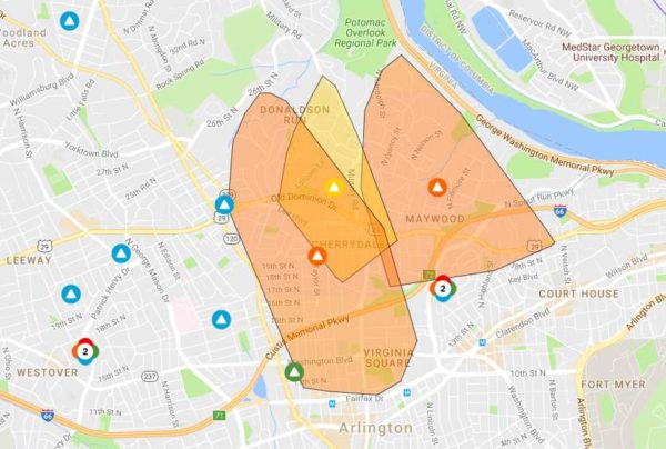
Dominion power outage map Nov. 20

Update at 11:30 p.m. — Power has been mostly restored. Dominion is currently reporting only 87 customers without power in Arlington.

On a windy Sunday night, power outages are being reported around large parts of north Arlington.

The outages are so far being reported in the Virginia Square, Ballston, Cherrydale, Maywood and Donaldson Run neighborhoods.

As of 9:15 p.m. there are were 5,677 customers without power, according to Dominion’s outage map. There was no estimate as to when power might be restored.

Via Twitter:

File photo


Arlington and other parts of the D.C. area are under a Frost Advisory tonight.

Temperatures are expected to tip into the 30s early Tuesday morning, potentially damaging sensitive plants.

From the National Weather Service:

FROST ADVISORY IN EFFECT FROM 2 AM TO 8 AM EST TUESDAY… THE NATIONAL WEATHER SERVICE IN BALTIMORE MD/WASHINGTON HAS ISSUED A FROST ADVISORY… WHICH IS IN EFFECT FROM 2 AM TO 8 AM EST TUESDAY. * TEMPERATURES… IN THE UPPER 30S. * IMPACTS… POTENTIAL DAMAGE TO SENSITIVE PLANTS. PRECAUTIONARY/PREPAREDNESS ACTIONS… A FROST ADVISORY MEANS THAT WIDESPREAD FROST IS EXPECTED. SENSITIVE OUTDOOR PLANTS MAY BE KILLED IF LEFT UNCOVERED.


Frost-covered leaf (Flickr pool photo by ksrjghkegkdhgkk)In case there was any doubt, after nearly two months of Oktoberfest beers on shelves and Pumpkin Spice Lattes in Starbucks, autumn is now in full effect.

Arlington’s first Frost Advisory of the season has been issued. The National Weather Service warns that near-freezing temperatures could damage plants overnight tonight.

Well north and west of Arlington, meanwhile, freeze warnings are in effect.

From NWS:

FROST ADVISORY FROM 3AM EDT WED UNTIL 9AM EDT WED

… FROST ADVISORY IN EFFECT FROM 3 AM TO 9 AM EDT WEDNESDAY…

THE NATIONAL WEATHER SERVICE IN BALTIMORE MD/WASHINGTON HAS ISSUED A FROST ADVISORY… WHICH IS IN EFFECT FROM 3 AM TO 9 AM EDT WEDNESDAY.

* TEMPERATURES… 32 TO 36 DEGREES OUTSIDE OF DOWNTOWN WASHINGTON AND DOWNTOWN BALTIMORE.

* IMPACTS… POTENTIAL DAMAGE TO SENSITIVE PLANTS.

PRECAUTIONARY/PREPAREDNESS ACTIONS…

A FROST ADVISORY MEANS THAT WIDESPREAD FROST IS EXPECTED. SENSITIVE OUTDOOR PLANTS MAY BE KILLED IF LEFT UNCOVERED.

Flickr pool photo by ksrjghkegkdhgkk


Batten down the hatches, it’s windy out there.

It’s so windy that the National Weather Service has issued a Wind Advisory, effective through 5 p.m. tonight.

WIND ADVISORY UNTIL 5PM EDT SAT

… WIND ADVISORY IN EFFECT UNTIL 5 PM EDT THIS AFTERNOON…

THE NATIONAL WEATHER SERVICE IN BALTIMORE MD/WASHINGTON HAS ISSUED A WIND ADVISORY… WHICH IS IN EFFECT UNTIL 5 PM EDT THIS AFTERNOON.

* TIMING… ONGOING. STRONG WINDS WILL CONTINUE THROUGH THE AFTERNOON BEFORE DIMINISHING THIS EVENING.

* WINDS… NORTHWEST WINDS WITH GUSTS OF 45 TO 50 MPH POSSIBLE.

* IMPACTS… SCATTERED TREE AND POWER LINE DAMAGE. DIFFICULTY DRIVING HIGH PROFILE VEHICLES.

PRECAUTIONARY/PREPAREDNESS ACTIONS…

A WIND ADVISORY MEANS THAT WINDS OF 45 TO 55 MPH ARE EXPECTED. WINDS WILL BE STRONG ENOUGH TO MAKE DRIVING DIFFICULT… ESPECIALLY FOR HIGH PROFILE VEHICLES. DRIVE CAUTIOUSLY.


View More Stories