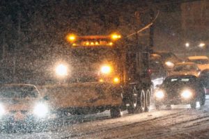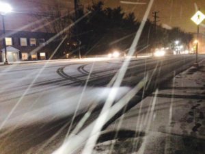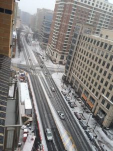
Snow falling in Ballston (photo courtesy @SDfromDC)(Updated at 7:30 p.m.) Snowflakes have started flying across Arlington, marking the beginning of what’s expected to be a significant snowstorm.

A Winter Storm Warning is now in effect, with forecasters calling for 6-10 inches of snow through noon tomorrow (Tuesday).

As of 4:20 p.m., Arlington County said it’s transitioning from a “Phase 1” to a “Phase 2” snow response.

“Snow crews began pre-treating primary and secondary routes earlier today with brine,” according to Arlington Dept. of Environmental Services spokeswoman Shannon Whalen McDaniel. “Most streets had residual brine from Saturday’s event, which will help with the initial snowfall this afternoon. Trucks were also hooked up with plows, chains and spreaders in preparation.”

“We’ll be on full-deployment with approximately 50 trucks until the snow stops tomorrow,” Whalen McDaniel said.

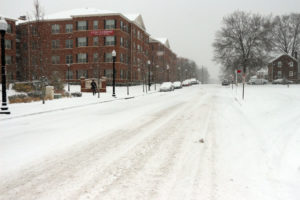
Thanks to frigid temperatures throughout the weekend, snow is sticking on pavement and grassy surfaces. Authorities are asking residents to stay home during the snowstorm, if possible, and plan for treacherous driving conditions in the days following the storm.

Long lines at the Harris Teeter store at Pentagon Row“Virginia State Police is advising all motorists to delay travel plans for tonight and/or Tuesday morning, as roads will be treacherous,” VSP said in a press release. “With the forecasted freezing temperatures, any snow and ice accumulations are expected to stick around for a few days. So it is important to prepare your home, family, and vehicle in advance.”

Long lines are being reported at various Arlington grocery stores. The Harris Teeter at Shirlington, meanwhile, is temporarily closed due to a burst pipe.

MetroAccess service is being suspended as of 6:00 p.m. Monday and will remain suspended Tuesday, according to WMATA. Metrobuses are suspended from 1:00 to 5:00 a.m., then will operate under Metro’s severe snow plan. Metrorail will operate on a Saturday schedule on Tuesday.

Arlington County Police say several accidents have been reported since the snow started falling.

Photo (top) courtesy @SDfromDC

Snowy scene along Columbia Pike (from 1/26/11)(Updated at 4:30 p.m.) The Winter Storm Watch issued for Arlington and the rest of the D.C. area Sunday afternoon has been upgraded to a Winter Storm Warning.

As of Monday morning, forecasters said 6-10 inches of snow may fall overnight. The snow is expected to begin Monday afternoon and wrap up Tuesday morning.

From the National Weather Service:

… WINTER STORM WARNING NOW IN EFFECT UNTIL NOON EST TUESDAY…

* PRECIPITATION TYPE… SNOW.
* ACCUMULATIONS… 6 TO 10 INCHES… WITH LOCALLY HIGHER AMOUNTS EXPECTED ACROSS PORTIONS OF LOWER SOUTHERN MARYLAND.
* TIMING… SNOW WILL INCREASE IN INTENSITY THROUGH THE EVENING HOURS. HEAVIEST SNOW IS EXPECTED LATE TONIGHT INTO EARLY TUESDAY MORNING.
* TEMPERATURES… MID TEENS TO LOWER 20S.
* WINDS… EAST 5 TO 10 MPH.
* IMPACTS… BEGINNING THIS EVENING… ROADS WILL BECOME SNOW COVERED AND SLIPPERY WITH VISIBILITIES BEING REDUCED TO ONE HALF MILE OR LESS AT TIMES. THE COMBINATION OF SNOW COVERED ROADS AND LOW VISIBILITY WILL MAKE TRAVELING DANGEROUS.

PRECAUTIONARY/PREPAREDNESS ACTIONS…

A WINTER STORM WARNING FOR HEAVY SNOW MEANS SEVERE WINTER WEATHER CONDITIONS ARE EXPECTED OR OCCURRING. SIGNIFICANT AMOUNTS OF SNOW ARE FORECAST THAT WILL MAKE TRAVEL DANGEROUS. ONLY TRAVEL IN AN EMERGENCY. IF YOU MUST TRAVEL… KEEP AN EXTRA FLASHLIGHT… FOOD… AND WATER IN YOUR VEHICLE IN CASE OF AN EMERGENCY.


Forecasters are warning that a strong cold front could bring snow squalls and even thundersnow to the area tonight (Saturday).

Expect dangerous, rapidly-changing conditions outside as snow, high wind and bitter cold push in from the west.

The National Weather Service has issued the following Special Weather Statement.

… HAZARDOUS WINTER CONDITIONS THIS EVENING…

AN STRONG ARCTIC COLD FRONT WILL MOVE ACROSS THE MID-ATLANTIC THIS EVENING. THROUGH 8 PM EXPECT SNOW SHOWERS AND SQUALLS AND WINDY CONDITIONS AS THE FRONT MOVES THROUGH… ALONG WITH POSSIBLE THUNDERSNOW.

BURSTS OF HEAVY SNOW COULD PRODUCE A QUICK COATING TO AN INCH OF SNOW ACCUMULATION IN A SHORT PERIOD OF TIME. WHITEOUT CONDITIONS AND THUNDERSNOW HAVE ALREADY BEEN REPORTED IN WESTERN MARYLAND.

ROADS WILL BECOME SNOW COVERED AND SLICK THIS EVENING. ALSO… WINDS ACCOMPANYING THE SNOW SHOWERS AND SQUALLS WILL BECOME STRONG… GUSTING 40 TO 50 MPH. THE COMBINATION OF SNOW SHOWERS AND STRONG WINDS WILL LEAD TO VISIBILITIES OF ONE HALF MILE OR LESS. THESE LOW VISIBILITIES WILL DEVELOP SUDDENLY.

TRAVELERS ACROSS THE REGION ARE ADVISED TO USE EXTREME CAUTION THROUGH THIS EVENING. BE PREPARED FOR RAPIDLY CHANGING CONDITIONS AS THE ARCTIC FRONT MOVES THROUGH. BURSTS OF HEAVY SNOW WITH SUDDEN VISIBILITY RESTRICTIONS COULD MAKE FOR DANGEROUS DRIVING CONDITIONS.

AFTER THE SNOW ENDS LATE THIS EVENING… VERY COLD AIR WILL MOVE INTO THE MID-ATLANTIC. THE VERY COLD AIR WILL ALLOW ANY SNOW OR SLUSH ON AREA ROADS TO FREEZE… RESULTING IN ICY CONDITIONS. WIND CHILLS WILL QUICKLY FALL INTO THE SINGLE DIGITS THIS EVENING.


Arlington County and the surrounding D.C. area is under a Wind Chill Advisory this morning and a High Wind Watch starting Saturday night.

The National Weather Service says frigid temperatures — 15 degrees as of 7:30 a.m. — combined with wind gusts up to 30 miles per hour will make being outside potentially hazardous this morning.

… WIND CHILL ADVISORY REMAINS IN EFFECT UNTIL 10 AM EST THIS MORNING…

* WIND CHILL… AROUND 5 BELOW ZERO THROUGH MID-MORNING TODAY.
* TEMPERATURES… LOW TO MIDDLE TEENS THIS MORNING.
* WINDS… NORTHWEST 10 TO 20 MPH WITH GUSTS UP TO 30 MPH.
* IMPACTS… THE COMBINATION OF STRONG WINDS AND COLD TEMPERATURES MAY CAUSE HYPOTHERMIA AND FROST BITE.

PRECAUTIONARY/PREPAREDNESS ACTIONS…

A WIND CHILL ADVISORY MEANS THAT VERY COLD AIR AND STRONG WINDS WILL COMBINE TO GENERATE LOW WIND CHILLS. THIS WILL RESULT IN FROST BITE AND LEAD TO HYPOTHERMIA IF PRECAUTIONS ARE NOT TAKEN. IF YOU MUST VENTURE OUTDOORS… MAKE SURE YOU WEAR A HAT AND GLOVES.

From Saturday evening through Sunday morning, meanwhile, the area will be under a High Wind Watch. Damaging wind gusts up to 60 miles per hour are possible.

From the NWS:

… HIGH WIND WATCH IN EFFECT FROM SATURDAY EVENING THROUGH SUNDAY MORNING…

THE NATIONAL WEATHER SERVICE IN BALTIMORE MD/WASHINGTON HAS ISSUED A HIGH WIND WATCH… WHICH IS IN EFFECT FROM SATURDAY EVENING THROUGH SUNDAY MORNING.

* TIMING… NORTHWEST WINDS WILL INCREASE BEHIND A STRONG COLD FRONT SATURDAY EVENING THROUGH SUNDAY MORNING.
* WINDS… POSSIBLE 60 MPH NORTHWEST GUSTS.
* IMPACTS… DOWNED TREES… POWERLINES… AND MINOR STRUCTURAL DAMAGE. DRIVING HIGH PROFILE VEHICLES IN THESE CONDITIONS IS DANGEROUS.

PRECAUTIONARY/PREPAREDNESS ACTIONS…

A HIGH WIND WATCH MEANS THERE IS THE POTENTIAL FOR A DAMAGING HIGH WIND EVENT. SUSTAINED WINDS OF AT LEAST 40 MPH… OR GUSTS OF 58 MPH OR STRONGER MAY OCCUR. PREPARE FOR POWER OUTAGES. CONTINUE TO MONITOR THE LATEST FORECASTS.


Water and ice (Flickr pool photo by ksrjghkegkdhgkk)Joining communities to the north and west, Arlington is now under a Winter Weather Advisory tonight (Thursday).

Rain is falling around Arlington as of 4:15 p.m.. Forecasters say sleet, freezing rain and snow are possible as temperatures drop this evening.

Already, Dulles International Airport and other parts of Northern Virginia are reporting sleet and freezing rain — raising the possibility of a messy evening commute.

From the National Weather Service:

…WINTER WEATHER ADVISORY IN EFFECT UNTIL 9 PM EST THIS EVENING…

THE NATIONAL WEATHER SERVICE IN BALTIMORE MD/WASHINGTON HAS ISSUED A WINTER WEATHER ADVISORY FOR FREEZING RAIN…SLEET AND SNOW… WHICH IS IN EFFECT UNTIL 9 PM EST THIS EVENING.

* PRECIPITATION TYPE…FREEZING RAIN…SLEET AND SNOW.

* ACCUMULATIONS…SNOW AND SLEET ACCUMULATION LESS THAN ONE HALF INCH. ICE ACCUMULATION AROUND A TRACE.

* TIMING…THIS AFTERNOON AND EARLY EVENING. THE BEST CHANCE FOR FREEZING RAIN WILL BE BETWEEN 4 PM AND 8 PM THIS AFTERNOON AND EVENING.

* TEMPERATURES…IN THE LOWER 30S…ESPECIALLY OUTSIDE OF DOWNTOWN WASHINGTON.

* WINDS…SOUTH 5 TO 10 MPH WITH GUSTS AROUND 15 MPH.

* IMPACTS…UNTREATED ROADS AND SIDEWALKS MAY BECOME ICY. THERE IS THE POTENTIAL FOR HAZARDOUS TRAVEL DURING THE EVENING RUSH.

PRECAUTIONARY/PREPAREDNESS ACTIONS…

A WINTER WEATHER ADVISORY MEANS THAT PERIODS OF SNOW…SLEET…OR FREEZING RAIN WILL CAUSE TRAVEL DIFFICULTIES. BE PREPARED FOR SLIPPERY ROADS AND LIMITED VISIBILITIES…AND USE CAUTION WHILE DRIVING.

Flickr pool photo by ksrjghkegkdhgkk


Arlington Public Schools are opening on a two hour delay this morning due to concerns about icy conditions.

From APS:

APS schools and offices will open two hours late today and all schools will end at the normal dismissal time. Essential school employees should report on time. The Extended Day program will also open two hours late. There will be no early release and all morning field trips are canceled. For updates about Pool Operations, go to www.apsva.us/aquatics. For information about Arlington County operations go to www.arlingtonva.us.

Snow on Columbia Pike Monday nightAPS joins D.C. and Alexandria, among others, in setting a two hour delay. Fairfax and Montgomery County schools have closed for the day.

Arlington’s STAR paratransit system, meanwhile, is opening at 10:00 a.m. and all rides before that are canceled, except for those that are for dialysis.

So far, few accidents are being reported on the roads around Arlington. The county says it’s treating both main roads and residential area this morning.

The National Weather Service is reporting 0.5-1.7 inches of snow accumulation around Arlington since Sunday night.

Photo courtesy @ezequieeeel


vdot-logoExpect a sloppy evening commute, the Virginia Dept. of Transportation is telling Northern Virginia residents.

Forecasters say accumulating snow may start falling by mid-to-late afternoon. VDOT says its crews are out in force treating roads, but drivers should consider leaving work early.

From a press release:

The Virginia Department of Transportation is asking northern Virginia drivers to prepare for today’s afternoon commute, which is expected to be much more difficult than this morning as rain and wintry mix increases to snow throughout the day.

Drivers are asked to commute and travel in the early afternoon if possible, prior to 4 p.m., to get ahead of increasing precipitation and dropping pavement temperatures expected this evening.

Between the morning and afternoon rush hours today, crews will apply a light application of salt, or mix of salt and liquid magnesium chloride, to problem spots such as bridges, ramps, hills and overpasses on main roads and in neighborhoods. Crews will continue to treat roads through the evening rush and overnight tonight.

Bridge and pavement temperatures are forecasted to be at or below freezing from 6 p.m. today through mid-day Tuesday. Drivers are asked to use caution, particularly in neighborhoods where slick conditions may develop this evening.

About 900 trucks will remain on duty this evening throughout Loudoun, Fairfax, Prince William and Arlington counties.

Reminders and resources:

  • Slow down and allow for extra time to reach your destination
  • Be aware of potentially icy areas such as bridges, ramps, curves and overpasses
  • Check www.511virginia.org for road conditions
  • Get more details on snow removal in northern Virginia
  • Follow VDOT Northern Virginia on Twitter: @vadotnova

Snow falls on 3/25/14 (file photo)A mixture of rain and snow is falling on Arlington as forecasters warn of a couple of inches of accumulation through Tuesday.

The snow expected in Arlington is nothing compared to the blizzard expected in New York City and other northeastern locales  — which has prompted numerous flight cancellations at Reagan National Airport this morning.

(Students had no such luck — Arlington Public Schools started on time.)

Forecasters say Arlington might get enough snow to make tonight’s evening rush hour and tomorrow’s morning rush hour a bit tricky.

The National Weather Service has issued the following Winter Weather Advisory for the region.

… WINTER WEATHER ADVISORY NOW IN EFFECT UNTIL 10 AM EST TUESDAY…

* PRECIPITATION TYPE… SNOW.
* ACCUMULATIONS… 2 TO 4 INCHES.
* TIMING… SNOW WILL MIX WITH RAIN AT TIMES THROUGH MID-AFTERNOON. PRECIPITATION WILL CHANGE TO ALL SNOW LATE THIS AFTERNOON. THE HEAVIEST SNOW IS EXPECTED TONIGHT BEFORE ENDING TUESDAY MORNING.
* TEMPERATURES… IN THE LOWER 30S.
* WINDS… NORTHEAST 10 TO 15 MPH TODAY… BECOMING NORTH TONIGHT INTO TUESDAY WITH GUSTS AROUND 25 MPH.
* IMPACTS… ROADS WILL BE SNOW COVERED AND SLIPPERY WITH VISIBILITIES BEING REDUCED TO NEAR ONE-QUARTER MILE AT TIMES. THE COMBINATION OF SNOW COVERED ROADS AND LOW VISIBILITY WILL MAKE TRAVELING DANGEROUS

PRECAUTIONARY/PREPAREDNESS ACTIONS…

A WINTER WEATHER ADVISORY FOR SNOW MEANS THAT PERIODS OF SNOW WILL CAUSE PRIMARILY TRAVEL DIFFICULTIES. BE PREPARED FOR SNOW COVERED ROADS AND LIMITED VISIBILITIES… AND USE CAUTION WHILE DRIVING.

In preparation for the snow, AAA Mid-Atlantic issued a press release urging drivers to be careful on the roads. The automobile association went so far as to admit that “most Washingtonians really don’t know how to drive in the snow.”

From AAA:

… watch out on unplowed side streets in residential areas, and slow down when approaching ramps, culverts, bridges and elevated overpasses, which tend to freeze first and thaw last…

If you are out there, avoid passing snowplows or salt trucks unless it is absolutely safe and necessary. If you have to go, drive in cleared lanes. Changing lanes unnecessarily puts you at greater risk of hitting a patch of ice or large areas of snow between lanes that could easily cause you to lose control of the vehicle.

It is an old joke, but it rings so true. Most Washingtonians really don’t know how to drive in the snow. First of all, if you don’t have to venture out, stay put and delay your commute. If you are a federal worker, stay alert for current operating status announcements from the U.S. Office of Personnel Management (OPM). Secondly, if you must go, reduce your driving speed to a third of your normal pace, and keep your low beams on. Thirdly, give the car ahead of you extra space. Stay at least one car length behind it for every 10 miles per hour on your speedometer, and anticipate turns and possible stops.

Fourthly, be sure to carry a cold weather emergency kit outfitted with jumper cables, first aid kit, a few tools, a shovel, sand, kitty litter, or traction mats, a flashlight with extra batteries, emergency flares or reflectors, and a fully-charged cell phone with a car charger. Then pack some essential supplies including blankets, food, and water to comfort you–and possibly save you–if you’re delayed or stranded in a snowstorm.


The National Weather Service has issued a Winter Weather Advisory for Arlington and much of the D.C. area through 8:00 a.m. Thursday.

Forecasters say freezing drizzle and fog may make for a slippery morning commute.

… WINTER WEATHER ADVISORY NOW IN EFFECT UNTIL 8 AM EST THURSDAY…

* PRECIPITATION TYPE… AREAS OF FREEZING DRIZZLE AND FREEZING FOG.
* ACCUMULATIONS… TRACE AMOUNTS OF ICE.
* TIMING… EARLY THURSDAY MORNING.
* TEMPERATURES… LOWER 30S.
* WINDS… LIGHT AND VARIABLE.
* IMPACTS… ROADS AND SIDEWALKS THAT ARE UNTREATED WILL BECOME SLIPPERY… CAUSING THE POTENTIAL FOR HAZARDOUS TRAVELING CONDITIONS.

PRECAUTIONARY/PREPAREDNESS ACTIONS…

WINTER WEATHER ADVISORY MEANS THAT AREAS OF FREEZING FOG WILL CAUSE SLIPPERY CONDITIONS. BE PREPARED FOR SLIPPERY ROADS AND LIMITED VISIBILITIES BELOW ONE-HALF MILE AT TIMES… AND USE CAUTION WHILE DRIVING.


Winter storm hits Arlington Jan. 6, 2015(Updated at 6:20 p.m.) The National Weather Service has issued a winter weather advisory for tomorrow, Wednesday, from 6:00 a.m. to 6:00 p.m.

The advisory calls for 1-3 inches of snow in the D.C. metro area, with the flakes starting to fall tomorrow morning and continuing through the afternoon, possibly affecting the evening rush. The heaviest snow is predicted to fall in the late morning and early afternoon.

Although temperatures are hovering in the mid-to-high-40s this afternoon, they’re expected to drop to right around freezing overnight. The weather could prove tricky for morning commutes and school buses.

The Washington Post’s Capital Weather Gang says the 1-3 inch prediction is likely “overdone” but a band of stronger snow in areas is possible.

Arlington Public Schools is not likely to make a decision on a delay or cancellation until early Wednesday morning. The National Weather Service issued a similar winter weather advisory prior to the Jan. 6 snowfall that caused numerous traffic issues, leading APS to issue an apology the next day for not delaying the start of school.

According to the Arlington Dept. of Environmental Services spokeswoman Jessica Baxter, snow crews are on alert, “hooking up trucks today and will be prepared to brine streets early tomorrow morning.”

… WINTER WEATHER ADVISORY IN EFFECT FROM 6 AM TO 6 PM EST WEDNESDAY…

THE NATIONAL WEATHER SERVICE IN BALTIMORE MD/WASHINGTON HAS ISSUED A WINTER WEATHER ADVISORY FOR SNOW… WHICH IS IN EFFECT FROM 6 AM TO 6 PM EST WEDNESDAY.

* PRECIPITATION TYPE… SNOW.
* ACCUMULATIONS… 1 TO 3 INCHES. LOCALLY HIGHER AMOUNTS POSSIBLE.
* TIMING… SNOW IS EXPECTED TO DEVELOP EARLY WEDNESDAY MORNING… AND CONTINUE THROUGH THE DAYTIME ON WEDNESDAY. THE HEAVIEST SNOW IS EXPECTED FROM LATE MORNING THROUGH MID AFTERNOON.
* TEMPERATURES… IN THE LOWER TO MID 30S.
* WINDS… EAST 5 TO 10 MPH.
* IMPACTS… TEMPERATURES WILL LIKELY BE BELOW FREEZING WEDNESDAY MORNING… ALLOWING SNOW TO ACCUMULATE ON ROADWAYS AND OTHER SURFACES. THIS WILL RESULT IN HAZARDOUS DRIVING CONDITIONS DURING THE MORNING COMMUTE. SLIPPERY CONDITIONS COULD PERSIST INTO THE LATE AFTERNOON.

PRECAUTIONARY/PREPAREDNESS ACTIONS…

A WINTER WEATHER ADVISORY FOR SNOW MEANS THAT PERIODS OF SNOW WILL CAUSE PRIMARILY TRAVEL DIFFICULTIES. BE PREPARED FOR SNOW COVERED ROADS AND LIMITED VISIBILITIES… AND USE CAUTION WHILE DRIVING.

File photo


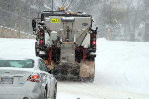
A salt truck drives on N. Park Drive with its plow up

(Updated at 6:05 p.m.) Crews will be out pre-treating major and secondary roads tonight and early tomorrow morning in advance of another winter weather system threatening the area.

Arlington snow crews are already treating primary and secondary roads with brine, according to Dept. of Environmental Services spokeswoman Jessica Baxter, and those efforts will continue tonight. Those efforts will continue throughout the morning if snow begins to fall and accumulate.

The Virginia Department of Transportation, which has jurisdiction over I-66, I-395, Route 50 and Washington Blvd, will also be pre-treating roads starting at 4:00 a.m. tomorrow. VDOT sent out an advisory this afternoon telling motorists to expect a “longer than normal commute.”

Early Tuesday evening, the National Weather Service issued a Winter Weather Advisory.

… WINTER WEATHER ADVISORY IN EFFECT FROM 4 AM TO NOON EST WEDNESDAY…

THE NATIONAL WEATHER SERVICE IN BALTIMORE MD/WASHINGTON HAS ISSUED A WINTER WEATHER ADVISORY FOR SNOW… WHICH IS IN EFFECT FROM 4 AM TO NOON EST WEDNESDAY.

* PRECIPITATION TYPE… SNOW.
* ACCUMULATIONS… AROUND ONE INCH.
* TIMING… ONSET AROUND 4 TO 6 AM… CONTINUING INTO THE LATE MORNING HOURS… BEFORE MIXING WITH PERIODS OF SLEET AND DISSIPATING BY EARLY AFTERNOON.
* TEMPERATURES… MIDDLE 20S DURING THE PREDAWN HOURS… INCREASING TO LOW 30S LATER IN THE MORNING.
* WINDS… NORTH AT 5 TO 10 MPH.
* IMPACTS… SNOW WILL LIKELY DEVELOP EARLY IN THE MORNING COMMUTE. THIS COUPLED WITH ROAD AND AIR TEMPERATURES WELL BELOW FREEZING WILL CAUSE ACCUMULATION OF SNOWFALL ON ROADWAYS. THIS WILL RESULT IN HAZARDOUS DRIVING CONDITIONS.

PRECAUTIONARY/PREPAREDNESS ACTIONS…

A WINTER WEATHER ADVISORY FOR SNOW MEANS THAT PERIODS OF SNOW WILL CAUSE PRIMARILY TRAVEL DIFFICULTIES. BE PREPARED FOR SNOW COVERED ROADS AND LIMITED VISIBILITIES… AND USE CAUTION WHILE DRIVING.


View More Stories