Arlington Public Schools will be closed Friday due to the winter weather.

APS made the announcement just after 5:00 p.m. School offices will open on a two-hour delay. From APS Director of Communications Jennifer Harris:

Essential personnel are to report to work at their scheduled time. Unscheduled leave is available for 12-month employees. Extracurricular activities, interscholastic contests, team practices, field trips, adult and community education classes, and programs in schools and on school grounds are canceled.  For updates about Pool Operations, go to www.apsva.us/aquatics.  For information about Arlington County programs and operations go to www.arlingtonva.us.


Update at 9:25 a.m. — One lane of the GW Parkway is now open in each direction, according to U.S. Park Police. All sites and parking areas along the parkway are closed.

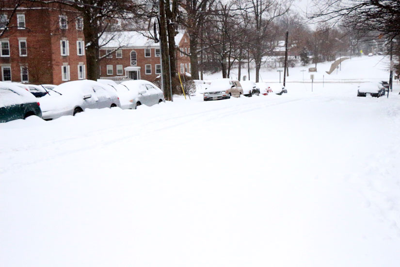
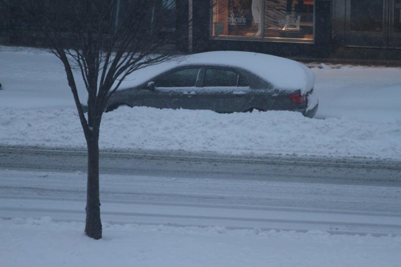
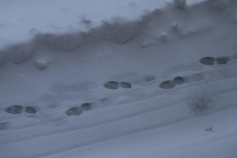
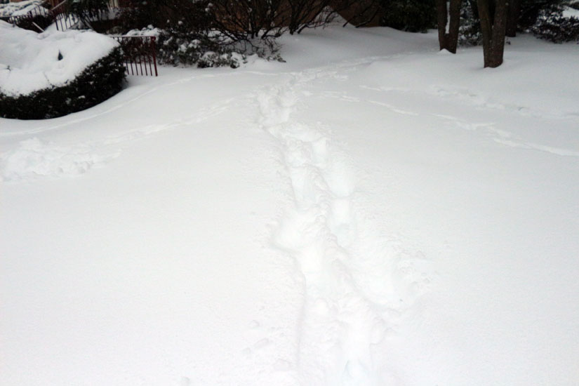
Arlington residents are waking up to almost 9 inches of snow on the ground this morning.

Snow, sleet and rain are expected to continue falling before tapering off around 11:00 a.m., according to the National Weather Service. The blanket of snow that’s already on the ground is making travel hazardous and forcing local governments and transit agencies to cancel services.

The county government is closed, but even trash collection service in Arlington, a local stalwart that often operates in bad weather and on major holidays, has been canceled today due to road conditions.

All STAR, ART bus and Metrobus service is currently suspended until further notice. Metrorail service is running, but with schools out and the federal government closed, there are few riders taking advantage of it.

“[We’re] running trains every 6-10 minutes, not because there’s lots of riders, but because it’s the best way to keep snow down and bounce back after storm,” Metro said in a tweet.

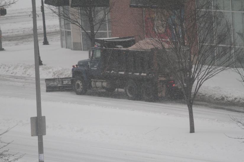
Major roads in Arlington are snowy but passable; however, drivers should not expect to be able to drive on side streets. An earlier report of an abandoned vehicle in the middle of Washington Blvd at 2nd Street turned out to be a case of a motorist who had run out of gas.

The GW Parkway was closed this morning due to severe conditions. The last report was that southbound lanes are open but northbound lanes are closed. U.S. Park Police tweeted around 7:45 a.m. to say that numerous abandoned vehicles on the Parkway had been towed away.

“Tractor trailer and abandoned vehicles have been removed from GW Parkway. All vehicles relocated to USPP Substation at Turkey Run Park,” Park Police said. “Use caution traveling on Parkway… NPS maintenance working diligently to clear quickly and safely.”

Virginia State Police say their Fairfax Division, which serves Arlington and other close-in Northern Virginia suburbs, responded to 44 crashes, 64 disabled vehicles and 258 calls for service between 4:00 p.m. Wednesday and 4:00 a.m. Thursday.

“The majority of crashes investigated by state police have only involved damage to vehicles and no injuries,” according to state police spokeswoman Corinne Geller. “Virginians are still advised to stay off the roads this morning and through today until conditions improve.”

Virginia Hospital Center is asking volunteers with four-wheel-drive vehicles to help pick up doctors and nurses. Prospective volunteers can 703-558-6868 for more information.

All runways at Reagan National Airport, meanwhile, are currently closed.

“Snow crews continue working to clear and reopen runways,” the airport said via Twitter.

“Travel conditions will become problematic as snow and ice move into the Washington Metro area, which means travelers who would have boarded planes and planes and driven distances should closely monitor the weather forecasts and formulate a backup plan,” said AAA Mid-Atlantic spokesman John B. Townsend II. “Air travelers are advised to check the status of their flight directly with their airline and make alternative bookings where appropriate.”

(more…)


Overnight snow in Pentagon CityArlington Public Schools and federal government offices are closed Thursday due to the winter storm that has been dumping heavy snow on the D.C. area overnight.

All school extracurricular activities, adult education classes and Dept. of Parks and Recreation classes are canceled.

Most ART bus service in the morning has been canceled, although Arlington Transit will try to keep ART 51 service running between Ballston Metro station and Virginia Hospital Center. “ART will restore other service tomorrow as street conditions permit,” the agency said.

Metro says it will try to run trains every 6-10 minutes during the morning, as conditions allow. Metrobus service will be limited to major arteries only.


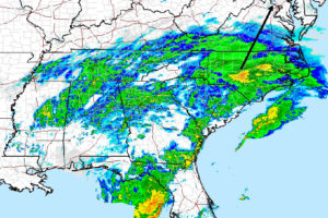
Radar at 2:45 p.m. Wednesday of massive snow storm (via NWS)Arlington County and the Virginia Department of Transportation are asking area residents to make preparations for the snowstorm expected to hit tonight.

The National Weather Service has placed Arlington under a Winter Storm Warning, Virginia Gov. Terry McAuliffe (D) has declared a state of emergency and the latest weather models from the Capital Weather Gang predicts 5-10 inches of snow for the immediate D.C. region by the end of the day Thursday, with 4-8 inches falling by 7:00 a.m.

WMATA has already announced that late-night bus service — after 1:00 a.m. — tonight has been cancelled and MetroAccess service for the disabled has been suspended tomorrow.

The county’s transit agencies, ART and STAR, will “continue to provide normal scheduled services as conditions permit.” The agencies will update their websites and send out alerts if and when service needs to be reduced or suspended.

County and state crews are already pre-treating the roads as predictions come in for not only heavy snow, but sleet and freezing rain in the morning on Thursday.

“The County’s snow crews and Office of Emergency Management are gearing up, and residents and businesses should, too,” Arlington County Manager Barbara Donnellan said in a press release. “If you don’t have to drive during this storm, which is expected to be the most significant we’ve had this winter, please stay off the roads and let crews do their work. Check on neighbors who are housebound.”

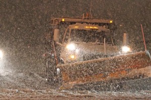
Salt truck The county is asking residents to move their cars off the street where possible, or to “coordinate with your neighbors and/or civic association to move all cars to one side of the street,” since plows need 15 feet to plow a road. If there is a power outage or trees down, the county is asking residents to use their website to report weather-related issues.

VDOT says that by midnight, more than 4,000 trucks will be stationed in Northern Virginia, ready to plow state-maintained highways and streets, like I-66, I-395 and Route 50.

No closures have been announced yet for school or the government — county and federal — but residents should continue to check throughout the night once the snow begins to fall.

Arlington is also reminding residents of the county’s snow removal ordinance.

The County’s Snow Removal Ordinance requires all Arlington property owners to clear snow and ice from public sidewalks adjacent to their property within a designated time period. The ordinance also prohibits transferring or depositing snow and ice from private property onto public property. Individual homeowners who are physically incapable of complying with the Ordinance are exempt. Visit the County website for more information on the Snow Removal Ordinance. Remember to clear snow from cars and sidewalks into the adjacent yard, not the street.

Residents can use the “Report a Snow Issue” form 24 hours after snowfall has stopped to report snow removal issues or areas that need attention. County staffers monitor the requests, but are unable to respond to every message.

Update at 4:20 p.m. — Arlington County has announced all facilities and programs, including those in schools, will close tonight at 9:00 p.m. The status for school tomorrow remains undetermined.


(Updated at 9:45 a.m.) The National Weather Service has issued a Winter Storm Warning for the D.C. region.

The warning, issued last night, revises down the snow forecast for Arlington to 4-8 inches.

… WINTER STORM WARNING REMAINS IN EFFECT FROM 8 PM THIS EVENING TO 3 PM EST THURSDAY…

* PRECIPITATION TYPE… HEAVY SNOW AND SLEET.

* ACCUMULATIONS… 4 TO 8 INCHES.

* TIMING… SNOW WILL OVERSPREAD THE AREA FROM THE SOUTH BETWEEN 8 PM AND 10 PM THIS EVENING. SNOW WILL BE HEAVY AT TIMES TONIGHT INTO THURSDAY MORNING. SNOW IS EXPECTED MIX WITH SLEET AND RAIN LATE THURSDAY MORNING INTO THURSDAY AFTERNOON.

* TEMPERATURES… IN THE MID 20S TONIGHT… SLOWLY RISING INTO THE LOWER TO MIDDLE 30S THURSDAY AFTERNOON.

* WINDS… NORTHEAST 5 TO 15 MPH THIS EVENING… BECOMING NORTH AND INCREASING TO 10 TO 20 MPH WITH GUSTS TO 35 MPH LATE TONIGHT AND THURSDAY.

* IMPACTS… ROADS WILL BECOME SNOW AND SLEET COVERED AND SLIPPERY. TRAVEL WILL BE DANGEROUS TONIGHT AND THURSDAY. HEAVY WET SNOW COUPLED WITH GUSTY WINDS COULD LEAD TO SOME POWER OUTAGES.

PRECAUTIONARY/PREPAREDNESS ACTIONS…

A WINTER STORM WARNING FOR HEAVY SNOW MEANS SEVERE WINTER WEATHER CONDITIONS ARE EXPECTED OR OCCURRING. SIGNIFICANT AMOUNTS OF SNOW ARE FORECAST THAT WILL MAKE TRAVEL DANGEROUS. ONLY TRAVEL IN AN EMERGENCY. IF YOU MUST TRAVEL… KEEP AN EXTRA FLASHLIGHT… FOOD… AND WATER IN YOUR VEHICLE IN CASE OF AN EMERGENCY.


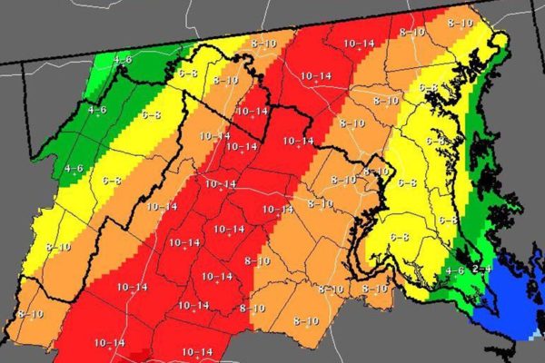
Snow forecast map 2/11/14

Virginia Gov. Terry McAuliffe (D) has declared a state of emergency ahead of the winter storm that’s expected to dump 8-10 inches of snow on Arlington tomorrow (Wednesday) night through Thursday.

The press release from McAuliffe’s office:

Governor Terry McAuliffe declared a state of emergency today, an action that authorizes state agencies to be ready to assist local governments in responding to the major snow storm that is forecast to hit the Commonwealth starting tomorrow.

In declaring a state of emergency, the governor authorizes state agencies to identify and position resources for quick response anywhere they are needed in Virginia.

“Now is the time for Virginia to get ready for this storm,” said Governor McAuliffe. “This state of emergency declaration will empower the Virginia Department of Emergency Management, the Department of Transportation, the Virginia National Guard, and our electric and cable utilities to prepare for a storm that is predicted to create power outages and significant travel challenges across the Commonwealth over the next few days.

“Just as state government is preparing for this storm, I urge every Virginian to take proper preparations. Prepare to limit unnecessary travel during the storm, have emergency supplies on hand and be ready in the event that power in your area goes out.”

To prepare for the storm:

  • The Virginia Emergency Operations Center has additional response team members to coordinate the state’s response to the storm.
  • The Virginia Department of Emergency Management is coordinating conference calls between the National Weather Service, state agencies and local governments. 
  • The Virginia Department of Transportation is treating roads in some parts of the Commonwealth, and crews will be out in full force for snow removal as the storm arrives. Roads with the highest traffic volumes are cleared first.  VDOT has adequate supplies for this storm.  
  • The Virginia National Guard has been authorized to bring up to 300 personnel on state active duty to support emergency response operations.  Virginia Guard personnel will be alerted to begin staging and expect to be in place Wednesday so they are able to rapidly respond if needed. 
  • The Virginia State Police will extend shifts and have additional troopers on patrol to expedite response times to traffic crashes and disabled motorists. 

Citizens should:

  • Be prepared to take care of yourself and your family for at least 72 hours, in case roads are blocked and/or there are power outages.
  • A three-day supply of food includes a gallon of water per person per day and food that does not require electricity to prepare it.
  • Have a battery powered and/or hand-crank radio and extra batteries for emergency information. Listen to local weather forecasts and instructions from local officials.
  • Always run generators outside in well-ventilated areas. Never use a portable generator in any enclosed or partially enclosed space.
  • Only travel if absolutely necessary. Roads can become very hazardous very quickly. Always wear a seatbelt, and know road conditions before you leave. Road condition information is available 24/7 by calling 511 or going to www.511Virginia.gov
  • Have emergency supplies in your vehicle. If you are stranded you will need water, food, blankets, flashlight and extra batteries at a minimum.
  • Avoid overexertion while shoveling snow and cleaning up from the storm, no matter your age or physical condition. Shoveling snow or pushing a car can bring on a heart attack or make other medical conditions worse.
  • If you need help for an elderly or disabled person during the storm, need information on warming shelters or are concerned about an unsheltered individual or family, call 211 or visit www.211virginia.org. When you call 211, a trained professional will suggest sources of help using one of the largest databases of health and human services in your community and statewide.
  • Get winter weather preparedness information at www.ReadyVirginia.gov and download the new Ready Virginia app for iPhones and Android devices.

The National Weather Service has issued a Winter Storm Watch for Arlington and the rest of the D.C. region.

Forecasters say more than five inches of snow and sleet are possible Wednesday night into Thursday.

… WINTER STORM WATCH IN EFFECT FROM WEDNESDAY EVENING THROUGH THURSDAY EVENING…

THE NATIONAL WEATHER SERVICE IN BALTIMORE MD/WASHINGTON HAS ISSUED A WINTER STORM WATCH… WHICH IS IN EFFECT FROM WEDNESDAY EVENING THROUGH THURSDAY EVENING.

* PRECIPITATION TYPE… SNOW AND SLEET

* ACCUMULATIONS… THE POTENTIAL FOR 5 OR MORE INCHES OF SNOW AND SLEET.

* TIMING… SNOW IS EXPECTED TO MOVE IN FROM THE SOUTH WEDNESDAY EVENING. SNOW MAY MIX WITH SLEET AND RAIN LATE WEDNESDAY NIGHT AND THURSDAY. THE SNOW COULD BE HEAVY AT TIMES WEDNESDAY NIGHT AND THURSDAY.

* TEMPERATURES… IN THE MID TO UPPER 20S 20S WEDNESDAY NIGHT… SLOWLY RISING INTO THE LOWER AND MIDDLE 30S THURSDAY AFTERNOON.

* WINDS… NORTH 15 TO 25 MPH WITH GUSTS UP TO 35 MPH.

* IMPACTS… ROADS MAY BECOME SNOW AND SLEET COVERED AND SLIPPERY. TRAVEL MAY BE DANGEROUS WEDNESDAY NIGHT AND THURSDAY. HEAVY WET SNOW COULD LEAD TO SOME POWER OUTAGES.

PRECAUTIONARY/PREPAREDNESS ACTIONS…

A WINTER STORM WATCH MEANS THERE IS A POTENTIAL FOR SIGNIFICANT SNOW AND SLEET ACCUMULATIONS THAT MAY IMPACT TRAVEL. CONTINUE TO MONITOR THE LATEST FORECASTS.


The National Weather Service has issued a Freezing Rain Advisory for Arlington and the surrounding region.

Forecasters say up to a tenth of an inch of ice could fall between 7:00 tonight and tomorrow morning.

… FREEZING RAIN ADVISORY IN EFFECT FROM 7 PM THIS EVENING TO 6 AM EST WEDNESDAY…

THE NATIONAL WEATHER SERVICE IN BALTIMORE MD/WASHINGTON HAS ISSUED A FREEZING RAIN ADVISORY… WHICH IS IN EFFECT FROM 7 PM THIS EVENING TO 6 AM EST WEDNESDAY.

* PRECIPITATION TYPE… FREEZING RAIN.

* ACCUMULATIONS… UP TO ONE-TENTH INCH OF ICE FROM FREEZING RAIN.

* TIMING… FREEZING RAIN WILL BEGIN THIS EVENING AND CONTINUE OVERNIGHT. PRECIPITATION WILL THEN CHANGE TO RAIN WEDNESDAY MORNING.

* TEMPERATURES… NEAR 30 THIS EVENING RISING INTO THE LOWER 30S LATE TONIGHT. TEMPERATURES WILL RISE ABOVE FREEZING BY WEDNESDAY MORNING.

* WINDS… NORTHEAST 5 TO 10 MPH.

* IMPACTS… UNTREATED ROADS AND SIDEWALKS WILL BECOME SLIPPERY FROM ICE. TRAVEL MAY BECOME DIFFICULT DURING THIS TIME.

PRECAUTIONARY/PREPAREDNESS ACTIONS…

A FREEZING RAIN ADVISORY MEANS THAT PERIODS OF FREEZING RAIN OR FREEZING DRIZZLE WILL CAUSE TRAVEL DIFFICULTIES. BE PREPARED FOR SLIPPERY ROADS. SLOW DOWN AND USE CAUTION WHILE DRIVING.


The National Weather Service has issued a hazardous weather outlook for the D.C. region tonight as forecasters are calling for an inch of snow with below-freezing temperatures.

The NWS expects accumulation of about an inch of snow with an 80 percent chance of precipitation, starting in the early evening but “mainly after 9:00 p.m.” Combined with a predicted low temperature around 12 degrees, the NWS predicts potentially hazardous road conditions.

From NWS:

…ARLINGTON/FALLS CHURCH/ALEXANDRIA-STAFFORD-SPOTSYLVANIA- KING GEORGE-

300 PM EST TUE JAN 28 2014

THIS HAZARDOUS WEATHER OUTLOOK IS FOR THE MARYLAND PORTION OF THE CHESAPEAKE BAY…TIDAL POTOMAC RIVER…AND ADJACENT COUNTIES IN CENTRAL MARYLAND AND NORTHERN VIRGINIA AS WELL AS THE DISTRICT OF COLUMBIA.

.DAY ONE…THIS AFTERNOON AND TONIGHT

LOW PRESSURE WILL PASS SOUTH OF THE REGION TONIGHT. A PERIOD OF ACCUMULATING SNOW IS LIKELY ACROSS MUCH OF THE OUTLOOK AREA. THE HIGHEST SNOWFALL ACCUMULATIONS APPEAR THAT THEY WILL BE ACROSS SOUTHERN MARYLAND INTO THE VIRGINIA PIEDMONT. A WINTER WEATHER ADVISORY IS IN EFFECT FOR THE VIRGINIA PIEDMONT AND FOR OTHER LOCATIONS EAST OF INTERSTATE 95. UNCERTAINTY REMAINS HIGH REGARDING THE EXACT TRACK OF THIS STORM AND HOW FAR NORTHWEST ACCUMULATING SNOW MAY REACH. PLEASE CONTINUE TO MONITOR THE LATEST FORECASTS…


This week’s frigid temperatures could be deadly, even inside your home.

The Arlington County Fire Department warns that carbon monoxide incidents typically increase during cold weather as home heating units kick into overdrive. The department issued the following press release, with carbon monoxide safety tips.

As the frequency of Carbon Monoxide (CO) incidents increases during colder winter months, the Arlington County Fire Department reminds all residents to install CO alarms and practice safe heating practices. In 2012, Arlington experienced 47 carbon monoxide incidents and 56 in 2013. These incidents occurred in all types of homes, including single family homes, townhouses, garden apartments and high-rise occupancies.

The silent killer

Carbon monoxide is known as the “silent killer” because it is an invisible, odorless, colorless gas that can cause sudden illness or death.  At lower levels of exposure, CO causes mild effects that are often mistaken for the flu. These symptoms include headaches, dizziness, disorientation, nausea and fatigue. Eventually carbon monoxide poisoning will lead to unconsciousness home, elevated levels of CO can kill you before you are aware there is a problem. However, if CO alarms are installed properly, they will alert the occupants before symptoms even start. CO alarms are an inexpensive way to protect yourself and your family.

CO is produced when fuels, such as gasoline, wood, coal, natural gas, propane, oil, and methane, burn incompletely. While individual apartments may not have these types of appliances in their unit, CO can seep into their unit from another source in the building. Common causes of carbon monoxide in the home include gas furnaces, water heaters, gas stoves, fireplaces, wood stoves, space heaters, portable generators and automobiles idling in a closed or attached garage.

General carbon monoxide precautions:

  • Install carbon monoxide alarms in a central location outside each sleeping area and on every level of the home. For the best protection, interconnect all carbon monoxide alarms throughout the home. Follow the manufacturer’s instructions for placement and mounting height.
  • If the carbon monoxide alarm sounds, immediately move to fresh air and call 9-1-1.
  • If the audible trouble signal sounds, check for low batteries. If the alarm still sounds after the batteries are replaced, call 9-1-1.
  • Do not leave the car engine running in the garage, fumes can quickly build-up and seep through door cracks into the home.
  • Do not use a gas stove or oven to heat your home.
  • Ensure all fuel-burning appliances are checked regularly by a trained and certified professional. This includes appliances such as furnaces, gas heaters, ovens, fireplaces etc.
  • During and after a snowstorm, make sure vents for the dryer, furnace, stove, and fireplace are clear of snow build-up.
  • A generator should be used in a well-ventilated location outdoors away from windows, doors and vent openings.
  • Only use gas or charcoal grills outside.

More information on how to prevent carbon monoxide poisoning, visit the fire department’s website.


The National Weather Service has issued a Wind Chill Advisory for the Arlington and the D.C. region starting early tomorrow morning.

Forecasters say wind chills as low as 10 below zero are possible Tuesday morning.

WIND CHILL ADVISORY IN EFFECT FROM 1 AM TO 10 AM EST TUESDAY…

THE NATIONAL WEATHER SERVICE IN BALTIMORE MD/WASHINGTON HAS ISSUED A WIND CHILL ADVISORY… WHICH IS IN EFFECT FROM 1 AM TO 10 AM EST TUESDAY.

* WIND CHILLS… 5 TO 10 BELOW ZERO.

* TEMPERATURES… SINGLE DIGITS TO LOWER TEENS LATE TONIGHT INTO EARLY TUESDAY MORNING.

* WINDS… NORTHWEST 10 TO 15 MPH WITH GUSTS UP TO 25 MPH.

* IMPACTS… LOW WIND CHILLS MAY LEAD TO HYPOTHERMIA OR FROST BITE ON EXPOSED SKIN.

PRECAUTIONARY/PREPAREDNESS ACTIONS…

A WIND CHILL ADVISORY MEANS THAT VERY COLD AIR AND STRONG WINDS WILL COMBINE TO GENERATE LOW WIND CHILLS. THIS WILL RESULT IN FROST BITE AND LEAD TO HYPOTHERMIA IF PRECAUTIONS ARE NOT TAKEN. IF YOU MUST VENTURE OUTDOORS… MAKE SURE YOU WEAR A HAT AND GLOVES.


View More Stories