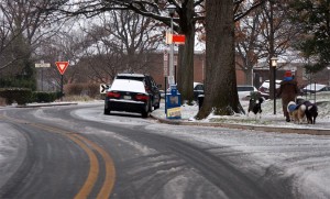
Icy road (Flickr photo by fcreativ)Update at 10:10 a.m. — Washington Boulevard is closed between N. Edison and Dinwiddie Streets due to a downed tree.

Update at 9:30 a.m. — Glebe Road is shut down between Military Road and Chain Bridge Road due to a downed tree.

Update at 9:15 a.m. — The number of Dominion customers without power in Arlington has climbed to nearly 1,700. Meanwhile, Washington Boulevard is closed at Powhatan Street due to a downed tree and live power lines.

Arlington Public Schools are closed today due to icy conditions on the roads.

School administrative offices are open for APS employees, but with a liberal leave policy. Arlington joins Alexandria, Fairfax and Loudoun counties in closing for the day due to the ice storm.

The federal government, meanwhile, is open under a two hour delay. Federal employees also have the option for unscheduled leave or telework.

Arlington County government offices and courts are open, with an unscheduled leave and telework option. ART buses are operating normally, as are Metro buses and Metrorail.

“Please use caution while traveling through the Metrorail system as wet platforms and escalators can be slippery,” said WMATA, in a tweet.

Local roads are reported to be slick, but main arteries have been treated with salt and are simply wet.

“Arlington County roads are passable, but drivers are urged to use caution,” according to an Arlington Alert email.

The ice coating has brought down tree branches, which have in turn knocked down some power lines. As of 7:15 a.m. about 1,100 Dominion customers in Arlington were without power.

Flickr photo by fcreativ


Snow on Dec. 8, 2013 by J. SonderRoads around Arlington are reported to be icy and treacherous as more freezing rain is expected to fall overnight.

The area is under a Winter Storm Warning through 10:00 a.m. Monday as forecasters call for a quarter inch of ice. Via Twitter, readers have reported slick roads, especially on neighborhood streets. A Domino’s delivery driver in south Arlington told ARLnow.com that side streets were “very bad,” and that another driver had been involved in an accident. Bridges were also said to be particularly icy.

VDOT, which is responsible for maintaining highways and certain major roads in Arlington, says Monday’s morning rush hour could be impacted by the slick conditions.

“Crews are plowing as well as heavily salting roads and will continue to do so through tomorrow morning’s rush hours,” VDOT said in a tweet.

Arlington canceled evening activities and closed all schools and government buildings at 6:00 p.m. tonight (Sunday).

Freezing temperatures might have been responsible for a water main break near Lee Highway. The water main break happened at 20th Road N. and N. Woodstock Street.

Fairfax and Loudoun County schools will be closed Monday. So far, there has been no announcement from Arlington Public Schools.

Flickr pool photo by J. Sonder


The National Weather Service has issued a Winter Storm Watch for the greater D.C. region.

Forecasters say 1-2 inches of snow and a quarter inch of ice accumulation is likely.

…WINTER STORM WATCH IN EFFECT FROM SUNDAY MORNING THROUGH MONDAY MORNING…

THE NATIONAL WEATHER SERVICE IN BALTIMORE MD/WASHINGTON HAS ISSUED A WINTER STORM WATCH…WHICH IS IN EFFECT FROM SUNDAY MORNING THROUGH MONDAY MORNING.

* PRECIPITATION TYPE…SNOW AND SLEET WILL CHANGE OVER TO FREEZING RAIN SUNDAY AFTERNOON. FREEZING RAIN IS EXPECTED TO LAST UNTIL LATE SUNDAY NIGHT OR MONDAY MORNING BEFORE CHANGING TO RAIN.

* ACCUMULATIONS…1 TO 2 INCHES OF SNOW AND SLEET AND A QUARTER INCH OR MORE OF ICE ACCUMULATION IS POSSIBLE.

* TIMING…SNOW AND SLEET ARE EXPECTED TO BEGIN SUNDAY MORNING. A CHANGEOVER TO FREEZING RAIN IS EXPECTED MIDDAY SUNDAY AND WILL CONTINUE INTO THE NIGHT BEFORE CHANGING OVER TO RAIN LATE SUNDAY NIGHT OR MONDAY MORNING.

* TEMPERATURES…AROUND 30 DEGREES.

* WINDS…LIGHT NORTHERLY WINDS.

* IMPACTS…HAZARDOUS TRAVEL CONDITIONS ARE PROBABLE DUE TO SLICK ROADS AND ICY CONDITIONS SUNDAY AND POSSIBLY INTO MONDAY. INCREASED POWER OUTAGES ARE POSSIBLE.

PRECAUTIONARY/PREPAREDNESS ACTIONS…

A WINTER STORM WATCH MEANS THERE IS A POTENTIAL FOR SIGNIFICANT SNOW…SLEET…AND ICE ACCUMULATIONS THAT MAY IMPACT TRAVEL. CONTINUE TO MONITOR THE LATEST FORECASTS.


Bitter cold, gusty winds and possible snow flurries are on tap for today, weather-wise.

Forecasters say an Arctic cold front is bringing unseasonably cold temperatures — in the 30s and 40s — to the area. Are you ready to see snow flakes flying, or is it too early in the fall for your tastes?


Arlington and the surrounding D.C. region is under a Flood Watch through midnight tonight.

Forecasters say 3-6 inches of rain has fallen since Wednesday and another 1-3 inches is expected tonight, raising the possibility of flooding. From the National Weather Service:

…FLOOD WATCH IN EFFECT UNTIL MIDNIGHT EDT TONIGHT…

THE NATIONAL WEATHER SERVICE IN STERLING VIRGINIA HAS EXPANDED
THE

* FLOOD WATCH TO INCLUDE PORTIONS OF MARYLAND…THE DISTRICT OF
COLUMBIA AND VIRGINIA…INCLUDING THE FOLLOWING AREAS…IN
MARYLAND…ANNE ARUNDEL…CALVERT…CHARLES…HOWARD…
MONTGOMERY…PRINCE GEORGES AND ST. MARYS. THE DISTRICT OF
COLUMBIA. IN VIRGINIA…ARLINGTON/FALLS CHURCH/ALEXANDRIA…
CULPEPER…FAIRFAX…GREENE…KING GEORGE…LOUDOUN…
MADISON…NORTHERN FAUQUIER…ORANGE…PRINCE
WILLIAM/MANASSAS/MANASSAS PARK…RAPPAHANNOCK…SOUTHERN
FAUQUIER…SPOTSYLVANIA AND STAFFORD.

* UNTIL MIDNIGHT EDT TONIGHT

* THREE TO SIX INCHES OF RAIN HAS ALREADY FALLEN SINCE WEDNESDAY
ACROSS THE GREATER WASHINGTON DC METRO AREA…CENTRAL MARYLAND
AND THE NORTHERN PIEDMONT REGION OF VIRGINIA. STEADY MODERATE TO
HEAVY RAIN CURRENTLY OVER NORTHERN VIRGINIA WILL SLOWLY SHIFT
SOUTHWARD THROUGH MIDNIGHT.

* ADDITIONAL AMOUNTS OF ONE TO LOCALLY THREE INCHES ARE POSSIBLE
THROUGH THIS EVENING. THIS AMOUNT OF RAINFALL WOULD CAUSE
FLOODING OF SMALL STREAMS AND URBAN AREAS.

PRECAUTIONARY/PREPAREDNESS ACTIONS…

A FLOOD WATCH MEANS THERE IS A POTENTIAL FOR FLOODING BASED ON
CURRENT FORECASTS.

YOU SHOULD MONITOR LATER FORECASTS AND BE ALERT FOR POSSIBLE
FLOOD WARNINGS. THOSE LIVING IN AREAS PRONE TO FLOODING SHOULD BE
PREPARED TO TAKE ACTION SHOULD FLOODING DEVELOP.


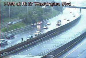
Rainy accident on I-395 at Washington Boulevard (file photo)Numerous accidents have been reported around Arlington today as continued rainy weather is making for slick conditions on the roads.

AAA Mid-Atlantic is reminding motorists to drive carefully in wet weather.

The association sent out the following press release this afternoon.

As the coastal storm continues through the Washington metro area today, motorists will face hazardous driving conditions during their evening commute due to rain and standing water, warns AAA Mid-Atlantic.  The auto club is advising motorists to exercise caution when driving.

“Commuters heading home tonight will face the same hazardous weather conditions as this morning’s drive to work,” said John B. Townsend II, AAA Mid-Atlantic’s Manager of Public and Government Affairs.  “When driving in wet weather remember to buckle up, slow down, and keep a safe distance from the car in front of you. Also, remember, it’s the law in the District of ColumbiaMaryland and Virginia to turn your headlights on if your windshield wipers are in use.”

To minimize the hazards associated with wet weather driving, AAA Mid-Atlantic recommends the following precautions for navigating in heavy rain, reduced visibility and slick pavement:

  • Slow down and increase following distances. Speed limits are set for ideal road conditions. When it rains, visibility is reduced and braking distances increase. On dry pavement, a safe following distance permits two to three seconds for stopping; that should be increased to eight seconds on slippery roads. Train your eyes farther down the road than normal, so you can anticipate changes and adjust your course gradually.
  • Do not attempt to drive through standing water on the roads that look too deep. Avoid bridges and roads that are known to flood. When driving on pothole-filled roads, hold the steering wheel firmly to avoid losing control. Just a few inches of water can turn your vehicle into a boat, and could put your life, and the lives of those around you, at great risk. Turn around; find another way to get to your destination.
  • Watch out for hydroplaning. No car is immune from hydroplaning on wet surfaces, including four-wheel drive vehicles. Just because brakes work under normal conditions doesn’t mean they will react the same on slippery roads where tires roll with far less traction.
  • Alert drivers behind you that you’re slowing with your brake lights. Without anti-lock brakes, squeeze the brakes until they are about to lock up and then release. With anti-lock brakes, use the same move – but don’t pump the brakes, which would work against the operation of the ABS system. Slow down as you approach a pothole. However, do not brake when your vehicle is directly over a pothole.
  • Use the central lanes. When driving during heavy rain, use center lanes of the road (without straddling the yellow line). Avoid outside lanes where the water collects at curbside.
  • Use low-beam headlights to help other drivers see your car and increase visibility.
  • Use your defroster with your air conditioning to keep the air dry and prevent windows from fogging.
  • Do not drive around barricades. Many lives have been lost when drivers disregard official orders and find themselves trapped in rising waters.
  • Turn off the cruise control in wet weather driving. The use of cruise control on wet roads can cause hydroplaning.
  • If conditions worsen to the point where there is any doubt about your safety, take the nearest exit and find a safe location.  Don’t just stop on the shoulder or under a bridge where you may feel less anxiety. If your visibility is compromised, other drivers may be struggling too.
  • Watch for slick spots on the road. Fumes and oil leaks that build up on dry pavement rise to the surface of the road when it rains, making the road far slicker than it may seem.

Arlington County and much of the rest of the D.C. region is under a Tornado Watch through 5:00 p.m.

Forecasters say an incoming cold front could produce strong storms and possibly tornados. From the National Weather Service:

A STRONG COLD FRONT WILL MOVE INTO THE MID-ATLANTIC STATES TODAY. SHOWERS AND ISOLATED THUNDERSTORMS COULD PRODUCE A PERIOD HEAVY RAINFALL THIS AFTERNOON WITH LOCALIZED FLOODING MAINLY IN URBAN LOCATIONS. AN ISOLATED TORNADO AND LOCALLY DAMAGING WIND GUSTS ARE POSSIBLE WITH ANY THUNDERSTORMS THAT DEVELOP.


Stormy sky over Rosslyn on 9/12/13

Arlington County is under a Severe Thunderstorm Watch until 10:00 p.m. tonight, according to the National Weather Service.

Forecasters say severe storms may form as a cold front approaches the area. From Arlington County:

The NWS has issued a Severe Thunderstorm Watch for the NCR, Northern Virginia, and Maryland, effective until 2200 tonight. A cold front will approach the area today and will produce numerous thunderstorms. A few of these storms will be capable of producing locally damaging wind gusts and large hail.

Update at 4:25 p.m. — The county is now under a Severe Thunderstorm Warning.

THE NATIONAL WEATHER SERVICE IN STERLING VIRGINIA HAS ISSUED A

* SEVERE THUNDERSTORM WARNING FOR… THE DISTRICT OF COLUMBIA… SOUTHEASTERN MONTGOMERY COUNTY IN CENTRAL MARYLAND… CITY OF FAIRFAX IN NORTHERN VIRGINIA… CITY OF FALLS CHURCH IN NORTHERN VIRGINIA… ARLINGTON COUNTY IN NORTHERN VIRGINIA… CITY OF ALEXANDRIA IN NORTHERN VIRGINIA… WESTERN PRINCE GEORGES COUNTY IN CENTRAL MARYLAND… CENTRAL FAIRFAX COUNTY IN NORTHERN VIRGINIA…

* UNTIL 500 PM EDT

* AT 416 PM EDT…A SEVERE THUNDERSTORM WAS DETECTED NEAR POTOMAC… AND ANOTHER OVER FAIRFAX CITY. THOSE STORMS ARE FORECAST TO COMBINE OVER THE DISTRICT AS THE MOVE EAST AT 10 MPH. THESE STORMS ARE CAPABLE OF PRODUCING DAMAGING WINDS IN EXCESS OF 60 MPH.

* LOCATIONS IMPACTED INCLUDE… THE DISTRICT OF COLUMBIA… BETHESDA… AMERICAN UNIVERSITY… CHEVY CHASE… GEORGETOWN… TAKOMA PARK… LANGLEY PARK… WHITE OAK… HILLANDALE…

PRECAUTIONARY/PREPAREDNESS ACTIONS…

THIS IS A DANGEROUS STORM. IF YOU ARE IN ITS PATH…MOVE INDOORS TO A STURDY BUILDING AND STAY AWAY FROM WINDOWS. WHEN IT IS SAFE TO DO SO…REPORT SEVERE WEATHER TO LOCAL LAW ENFORCEMENT OR TO THE NATIONAL WEATHER SERVICE.

THIS STORM IS PRODUCING FREQUENT CLOUD TO GROUND LIGHTNING. IF YOU CAN HEAR THUNDER…YOU ARE CLOSE ENOUGH TO BE STRUCK BY LIGHTNING. MOVE INDOORS IMMEDIATELY.

Update at 4:35 p.m. — Reagan National Airport is currently under a ground stop due to storms.


Sunny Sunday in Rosslyn (photo by Katie Pyzyk)You would be forgiven if you stepped outside this morning and thought it was late September.

The low temperature at Reagan National Airport this morning was a chilly 60 degrees. Despite lots of sunshine, we’ll be lucky to reach 80 degrees this afternoon.

It’s a continuation of yesterday’s fall-like weather, which tied for the 4th-coolest Aug. 14 in recorded D.C. history, according to the Capital Weather Gang.

Some may be cheering the mild temperatures, while others may be mourning what feels like an early end to summer. What do you think?


Arlington and the D.C. region is currently under an excessive heat warning. The National Weather Service says it will be dangerously hot today.

EXCESSIVE HEAT WARNING IN EFFECT FROM NOON TODAY TO 8 PM EDT THIS EVENING…

THE NATIONAL WEATHER SERVICE IN BALTIMORE MD/WASHINGTON HAS ISSUED AN EXCESSIVE HEAT WARNING… WHICH IS IN EFFECT FROM NOON TODAY TO 8 PM EDT THIS EVENING. THE HEAT ADVISORY IS NO LONGER IN EFFECT.

* HEAT INDEX VALUES… AROUND 110 DEGREES DUE TO THE COMBINATION OF TEMPERATURES IN THE UPPER 90S TO AROUND 100 DEGREES AND DEWPOINTS IN THE MIDDLE 70S.

* IMPACTS… HIGH RISK OF HEAT STROKE OR OTHER HEAT-RELATED ILLNESS FOR THOSE WITHOUT AIR-CONDITIONING OR THOSE OUTDOORS FOR ANY EXTENDED PERIOD.

PRECAUTIONARY/PREPAREDNESS ACTIONS…

AN EXCESSIVE HEAT WARNING MEANS THAT A PROLONGED PERIOD OF DANGEROUSLY HIGH TEMPERATURES WILL OCCUR. THE COMBINATION OF EXTREME TEMPERATURES AND HIGH HUMIDITY WILL CREATE A DANGEROUS SITUATION IN WHICH HEAT ILLNESSES ARE EXPECTED. CHECK IN ON RELATIVES AND NEIGHBORS.

TAKE EXTRA PRECAUTIONS IF YOU WORK OR SPEND TIME OUTSIDE. WHEN POSSIBLE… RESCHEDULE STRENUOUS ACTIVITIES TO EARLY MORNING OR EVENING. KNOW THE SIGNS AND SYMPTOMS OF HEAT EXHAUSTION AND HEAT STROKE. WEAR LIGHT WEIGHT AND LOOSE FITTING CLOTHING WHEN POSSIBLE AND DRINK PLENTY OF WATER.

TO REDUCE RISK DURING OUTDOOR WORK… THE OCCUPATIONAL SAFETY AND HEALTH ADMINISTRATION RECOMMENDS SCHEDULING FREQUENT REST BREAKS IN SHADED OR AIR CONDITIONED ENVIRONMENTS. ANYONE OVERCOME BY HEAT SHOULD BE MOVED TO A COOL AND SHADED LOCATION. HEAT STROKE IS AN EMERGENCY – CALL 9 1 1.


District Taco on Lee HighwayDistrict Taco’s location at 5723 Lee Highway had to shut down Tuesday after the heat caused its air conditioning to break.

The restaurant reopened Wednesday morning with temporary A/C units, District Taco owner Osiris Hoil said in an email. The county’s health department told the restaurant to close Tuesday after it was determined that food was being stored in an environment that was too warm.

“The A/C was a contributing factor, but not the reason for closure,” said Department of Human Services spokesman Kurt Larrick. “With the A/C not working, the refrigerator was overburdened and wasn’t able to keep the food cool enough.”

Hoil said he had already submitted plans to the county for approval to install a permanent replacement for the air conditioning unit. Temperatures reached 96 degrees Tuesday afternoon in Arlington, according to Weather.com.

“We couldn’t work and it was not safe for our food to be exposed in the restaurant,” Hoil said in an email. “So we had to transfer everything at our commissary where we have the toritos (taco stands) because we do have a lot of refrigeration there.”

During Wednesday’s lunch rush, the previous day’s shutdown did not seem to have an adverse effect. The restaurant crowded and warm, as the temporary A/C units struggled to keep the crowded space cool.


View More Stories