Update at 11:00 a.m. — WMATA has announced that passengers on Metrorail and Metrobus will be permitted to carry water in sealable, reusable bottles or containers until Friday. 

Arlington and the surrounding region is under a heat advisory this afternoon.

Forecasters say the temperature will rise to the upper 90s, while the heat index will reach 105. Those who must be outside today are advised to take appropriate safety precautions. The dangerous heat is expected to linger through at the end of the work week.

From the National Weather Service.

… HEAT ADVISORY IN EFFECT FROM NOON TO 7 PM EDT TUESDAY…

THE NATIONAL WEATHER SERVICE IN BALTIMORE MD/WASHINGTON HAS ISSUED A HEAT ADVISORY… WHICH IS IN EFFECT FROM NOON TO 7 PM EDT TUESDAY.

* HEAT INDEX VALUES… AROUND 105 DEGREES WITH TEMPERATURES IN THE MID TO UPPER 90S… AND DEWPOINTS IN THE LOW 70S.

* IMPACTS… RISK OF HEAT-RELATED ILLNESS FOR THOSE WITHOUT AIR- CONDITIONING OR THOSE OUTDOORS FOR AN EXTENDED PERIOD.

PRECAUTIONARY/PREPAREDNESS ACTIONS…

A HEAT ADVISORY MEANS THAT A PERIOD OF HIGH TEMPERATURES IS EXPECTED. THE COMBINATION OF HIGH TEMPERATURES AND HIGH HUMIDITY WILL CREATE A SITUATION IN WHICH HEAT ILLNESSES ARE POSSIBLE.

TAKE EXTRA PRECAUTIONS IF YOU WORK OR SPEND TIME OUTSIDE. WHEN POSSIBLE… RESCHEDULE STRENUOUS ACTIVITIES TO EARLY MORNING OR EVENING. KNOW THE SIGNS AND SYMPTOMS OF HEAT EXHAUSTION AND HEAT STROKE. WEAR LIGHT WEIGHT AND LOOSE FITTING CLOTHING WHEN POSSIBLE AND DRINK PLENTY OF WATER.

TO REDUCE RISK DURING OUTDOOR WORK… THE OCCUPATIONAL SAFETY AND HEALTH ADMINISTRATION RECOMMENDS SCHEDULING FREQUENT REST BREAKS IN SHADED OR AIR CONDITIONED ENVIRONMENTS. ANYONE OVERCOME BY HEAT SHOULD BE MOVED TO A COOL AND SHADED LOCATION. HEAT STROKE IS AN EMERGENCY – CALL 9 1 1.


This article was written by Audrey Batcheller

Flooding in Arlington on 9/8/11 (courtesy Brendan L.)So far this summer, Arlington has been subject to flash floods and flash flood warnings. While flash floods are obviously harmful to those who live in or are trying to navigate through a flooded area, the floods can actually be harmful to the ecology of the flooded waterway itself.

A flash flood is a weather condition defined by the National Weather Service as “a rapid and extreme flow of high water into a normally dry area, or a rapid water level rise in a stream or creek above a predetermined flood level, beginning within six hours of the causative event.” In other words, a tremendous amount of water in a short amount of time caused by thunderstorms or heavy rainfall.

These types of storms are most common in Arlington during the spring and summer months due to the weather and climate of the area, which explains why the flood threats have picked up recently.

The effects of flash floods depend on factors such as the amount of previous rainfall the area has experienced and how much rainfall can be absorbed in the area. Flash floods, therefore, affect all areas and environments differently and there’s no blanket formula to predict how a storm will affect a given area.

Part of the Mt. Vernon Trail is closed due to flooding (file photo)Aside from the potential danger presented from this type of extreme weather condition, heavy rainfall and flash floods can have negative impacts on our local streams and surrounding environments.

“When rainfall runs from developed surfaces in Arlington to local streams, it washes any nutrients on the surface into the watershed,” explains WJLA meteorologist and Arlington Public Schools high school science teacher Ryan Miller.

These nutrients can include fertilizer, pet waste, and gasoline, and when they infiltrate runoff heading towards local tributaries, they eventually end up in the Potomac River and ultimately the Chesapeake Bay. Waterways suffer from the introduction of these pollutants which catalyze a harmful process called eutrophication.

Eutrophication occurs when algae blooms in a body of water deplete the dissolved oxygen levels in the water. This loss of oxygen creates what is referred to as anoxic water and typically results in an environment unsuitable for living organisms.

The harmful effects of eutrophication and runoff can be augmented by flash flooding, considering the abundance of water washing into local streams such as Four Mile Run or Long Branch.

(more…)


(Updated at 4:15 p.m.) The National Weather Service has upgraded the Severe Thunderstorm Watch for Arlington and surrounding areas to a Severe Thunderstorm Warning. It is in effect until 4:30 p.m.

From NWS:

* SEVERE THUNDERSTORM WARNING FOR…
THE DISTRICT OF COLUMBIA…
SOUTHERN MONTGOMERY COUNTY IN CENTRAL MARYLAND…
NORTHEASTERN CITY OF FAIRFAX IN NORTHERN VIRGINIA…
CITY OF FALLS CHURCH IN NORTHERN VIRGINIA…
ARLINGTON COUNTY IN NORTHERN VIRGINIA…
CITY OF ALEXANDRIA IN NORTHERN VIRGINIA…
WESTERN PRINCE GEORGES COUNTY IN CENTRAL MARYLAND…
EASTERN FAIRFAX COUNTY IN NORTHERN VIRGINIA…

* UNTIL 400 PM EDT

* AT 328 PM EDT…A SEVERE THUNDERSTORM WAS DETECTED NEAR LAKE
BARCROFT…OR NEAR FALLS CHURCH…AND WAS MOVING EAST AT 20 MPH.
THIS STORM IS CAPABLE OF PRODUCING DAMAGING WINDS IN EXCESS OF 60
MPH.

* LOCATIONS IMPACTED INCLUDE…
CRYSTAL CITY…
ROSSLYN…
GEORGETOWN…
THE WOODROW WILSON BRIDGE…
REAGAN NATIONAL AIRPORT…
ADAMS MORGAN…
NATIONAL HARBOR…
NATIONALS PARK…
ANACOSTIA…
US CAPITOL…

PRECAUTIONARY/PREPAREDNESS ACTIONS…

THIS IS A DANGEROUS STORM. IF YOU ARE IN ITS PATH…PREPARE
IMMEDIATELY FOR DAMAGING WIND GUSTS AND FREQUENT CLOUD TO GROUND
LIGHTNING. MOVE INDOORS TO A STURDY BUILDING AND STAY AWAY FROM
WINDOWS.

NWS has also issued a Flash Flood Warning until 6:00 p.m. Drivers are cautioned not to attempt to cross standing water, as it may be deeper than it appears.

More strong storms are possible tonight, and the area remains under a Severe Thunderstorm Watch until 9:00 p.m.


In light of strong storms that are expected to blow through the area this afternoon and evening, the National Weather Service has issued a Tornado Watch for the D.C. metro area, including Arlington. It is in effect until 10:00 p.m.

From NWS:

TORNADO WATCH 377 IS IN EFFECT UNTIL 1000 PM EDT FOR THE
FOLLOWING LOCATIONS

VA
. VIRGINIA COUNTIES INCLUDED ARE

ARLINGTON FAIRFAX LOUDOUN

VIRGINIA INDEPENDENT CITIES INCLUDED ARE

FAIRFAX

Storms could bring strong winds and flooding tonight and tomorrow. More from NWS:

LOW PRESSURE AND ITS ASSOCIATED COLD FRONT WILL LIKELY TRIGGER
SHOWERS AND THUNDERSTORMS THIS AFTERNOON AND EVENING. SOME
THUNDERSTORMS WILL BE CAPABLE OF PRODUCING DAMAGING WIND
GUSTS…LARGE HAIL AND HEAVY RAINFALL THAT COULD LEAD TO ISOLATED
FLASH FLOODING. AN ISOLATED TORNADO CANNOT BE RULED OUT IN THE
STRONGER STORMS…ESPECIALLY ACROSS NORTHEASTERN MARYLAND.

A SMALL CRAFT ADVISORY REMAINS IN EFFECT FOR THE MARYLAND PORTION OF
THE CHESAPEAKE BAY AND LOWER TIDAL POTOMAC RIVER FROM 10 AM TODAY
THROUGH TONIGHT.

.DAYS TWO THROUGH SEVEN…FRIDAY THROUGH WEDNESDAY

NUMEROUS THUNDERSTORMS WILL DEVELOP ONCE AGAIN ON FRIDAY. A FEW OF
THESE STORMS MAY BE SEVERE…PRODUCING DAMAGING WINDS GUSTS.

LOCALIZED FLASH FLOODING WILL BE POSSIBLE SUNDAY THROUGH TUESDAY
DUE TO REPEATED SHOWERS AND THUNDERSTORMS ACROSS THE REGION.


Arlington is currently under a Severe Thunderstorm Watch as storms develop to the west of the immediate Metro area.

The watch is in effect through 10:00 p.m. From the National Weather Service:

CLUSTERS OF THUNDERSTORMS CAN BE EXPECTED THIS AFTERNOON AND EVENING. SOME OF THESE STORMS WILL BE CAPABLE OF BECOMING SEVERE…PRODUCING DAMAGING WIND GUSTS AND LARGE HAIL.


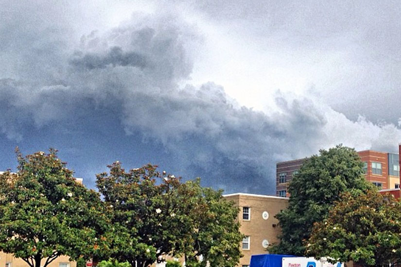
The National Weather Service has issued a Severe Thunderstorm Warning for Arlington and the surrounding region.

A line of strong storms is approaching the area from the north. From the NWS:

THE NATIONAL WEATHER SERVICE IN STERLING VIRGINIA HAS ISSUED A

* SEVERE THUNDERSTORM WARNING FOR… THE DISTRICT OF COLUMBIA… SOUTHEASTERN MONTGOMERY COUNTY IN CENTRAL MARYLAND… NORTHERN CHARLES COUNTY IN SOUTHERN MARYLAND… CITY OF FAIRFAX IN NORTHERN VIRGINIA… CITY OF FALLS CHURCH IN NORTHERN VIRGINIA… ARLINGTON COUNTY IN NORTHERN VIRGINIA… CITY OF ALEXANDRIA IN NORTHERN VIRGINIA… PRINCE GEORGES COUNTY IN CENTRAL MARYLAND… ANNE ARUNDEL COUNTY IN CENTRAL MARYLAND… FAIRFAX COUNTY IN NORTHERN VIRGINIA…

* UNTIL 1130 PM EDT

* AT 1028 PM EDT… SEVERE THUNDERSTORMS WERE DETECTED ALONG A LINE EXTENDING FROM 7 MILES NORTHWEST OF LAUREL TO 7 MILES NORTHWEST OF CENTREVILLE… AND WERE MOVING SOUTHEAST AT 35 MPH. THIS LINE OF STORMS IS CAPABLE OF PRODUCING DAMAGING WINDS IN EXCESS OF 60 MPH.

* LOCATIONS IMPACTED INCLUDE… WHITE OAK… THE AMERICAN LEGION BRIDGE… LAUREL… FAIRLAND… FORT MEADE… PIMMIT HILLS… TAKOMA PARK… LANGLEY PARK… MANTUA… FORT TOTTEN…

PRECAUTIONARY/PREPAREDNESS ACTIONS…

THIS IS A DANGEROUS LINE OF STORMS. IF YOU ARE IN ITS PATH… PREPARE IMMEDIATELY FOR DAMAGING WIND GUSTS. MOVE INDOORS TO A STURDY BUILDING AND STAY AWAY FROM WINDOWS.

THIS LINE OF STORMS HAS A HISTORY OF PRODUCING DAMAGING WIND GUSTS. SEEK SHELTER INSIDE A STURDY STRUCTURE AND STAY AWAY FROM WINDOWS.


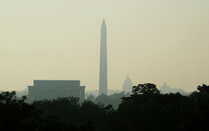
Hazy Day by Philliefan99With temperatures expected to reach into the low- to mid-90s today and tomorrow, now’s a good time to review some hot weather safety tips and some of the cooling assistance programs offered by Arlington County.

Arlington’s Agency on Aging offers free fans to low-income seniors. The program, sponsored by Dominion and the Va. Dept. for the Aging, is open to Arlington residents 60 or over, with income at or below 150 percent of the federal poverty level, and a home without air conditioning or fans.

Arlington also administers Virginia’s Cooling Assistance Program. Qualifying households can apply for the program, which assists with the purchase of cooling equipment and/or the electricity to power that equipment, between June 15 and Aug. 15. For more information, Arlington residents can call 703-228-1350.

The county maintains a “Hot Tips for Keeping Cool” page on its website. Among the tips for staying safe in hot weather:

  • Drink plenty of fluids (non-alcoholic), even if you’re not thirsty.
  • Wear light-weight, loose-fitting clothing.
  • Stay cool indoors.
  • Schedule outdoor activities carefully and wear sunscreen.
  • If you exercise outdoors, go in the morning or evening hours.
  • Eat light, regular meals — avoid hot foods and heavy meals.
  • Never leave anyone — infants, children, or pets — in a parked car.
  • Know the signs of heat related illness.
  • All County facilities — including community centers and libraries — are air-conditioned and open to the public.

Flickr photo by Philliefan99


Arlington and the surrounding D.C. region is under a Severe Thunderstorm Watch.

The National Weather Service issued the watch just after 2:45 p.m. It expires at 10:00 p.m.

Forecasters say scattered thunderstorms are expected this afternoon and evening, and the storms may produce “locally damaging wind gusts and large hail.”


The National Weather Service has included Arlington County in a Flash Flood Watch. The watch is in effect until 6:00 p.m.

From NWS:

THE NATIONAL WEATHER SERVICE IN STERLING VIRGINIA HAS EXPANDED
THE

* FLASH FLOOD WATCH TO INCLUDE PORTIONS OF MARYLAND…THE
DISTRICT OF COLUMBIA AND VIRGINIA…INCLUDING THE FOLLOWING
AREAS…IN MARYLAND…ANNE ARUNDEL…CALVERT…CHARLES…
HARFORD…HOWARD…MONTGOMERY…PRINCE GEORGES AND SOUTHERN
BALTIMORE. THE DISTRICT OF COLUMBIA. IN VIRGINIA…
ARLINGTON/FALLS CHURCH/ALEXANDRIA…CULPEPER…FAIRFAX…
LOUDOUN…NORTHERN FAUQUIER…ORANGE…PRINCE
WILLIAM/MANASSAS/MANASSAS PARK…SOUTHERN FAUQUIER…
SPOTSYLVANIA AND STAFFORD.

* UNTIL 6 PM EDT THIS EVENING

* SHOWERS AND THUNDERSTORMS WILL CONTINUE TO PRODUCE MODERATE TO
HEAVY RAINFALL THROUGH THE REST OF THE AFTERNOON. ONE TO THREE
ADDITIONAL INCHES COULD CAUSE FLOODING OR FLASH FLOODING.

PRECAUTIONARY/PREPAREDNESS ACTIONS…

A FLASH FLOOD WATCH MEANS THAT CONDITIONS MAY DEVELOP THAT LEAD
TO FLASH FLOODING. FLASH FLOODING IS A VERY DANGEROUS SITUATION.

YOU SHOULD MONITOR LATER FORECASTS AND BE PREPARED TO TAKE ACTION
SHOULD FLASH FLOOD WARNINGS BE ISSUED.


All storm warnings and watches have been cancelled in Arlington, but more than a thousand Dominion customers are without power.

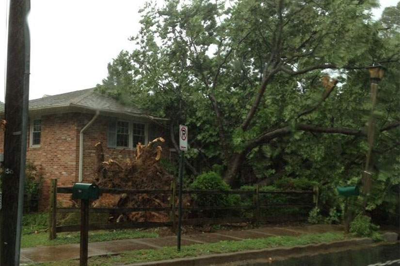
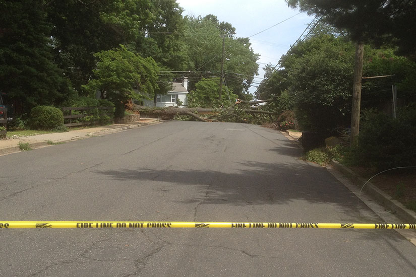
A line of storms with strong, gusty winds made a mad dash across the county this afternoon, downing some trees and utility lines but not packing quite the punch that many feared.

As of 4:45 p.m., Dominion was reporting 1,327 customers without power in Arlington.

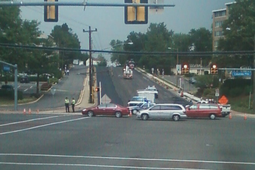
Among other reported road hazards, a utility pole was down on Carlin Springs Road just north of Columbia Pike, blocking the road and detouring bus routes. A number of other trees and lines were reported down in various parts of the county.


View More Stories