Update at 8:00 p.m. — The number of Dominion customers without power in Arlington has dipped below 50,000 — as of 7:55 p.m. it stands at 49,921 — for the first time since the storm. That’s down from the peak of 68,000 customers without power in the county immediately after the Friday night storm.

County Manager Barbara Donnellan earlier released a statement about the cleanup effort.

“It will take several days for life to get back to normal,” she said. “We urge people to stay out of the heat, stay hydrated, drive safely and check on their neighbors.”

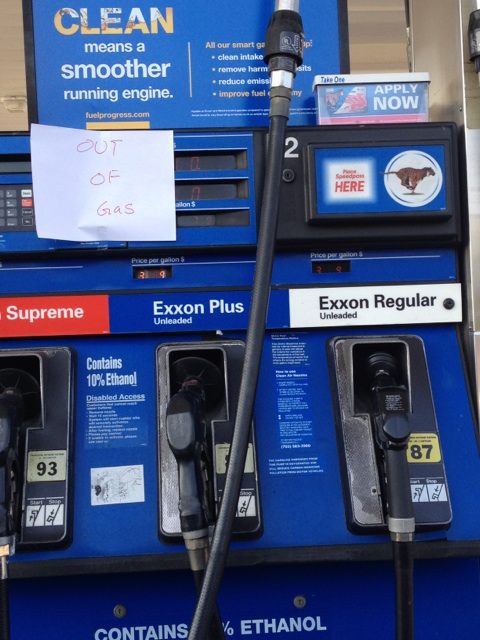
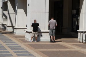
Update at 4:55 p.m. — Long lines have been reported at local gas stations, with at least two stations even reportedly running out of gas. Many local grocery stores have also sold out of ice. The Pentagon City food court was very crowded as of 2:00 this afternoon, with many using it as a refuge.

Update at 4:35 p.m. — Arlington County is urging residents to check on neighbors, especially “those who are elderly or who have limited mobility.” If their homes are hot due to a lack of air conditioning, the county recommends taking them to a local cooling center (see list, below).

Also, the county is advising those without phone service to go to a local fire station if unable to dial 911. 

County Manager Barbara Donnellan declared a local emergency for Arlington around 12:30 p.m.

Earlier: The powerful storm that ripped through the region last night has left about 60 percent of Arlington County without power, according to authorities.

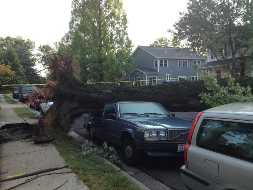
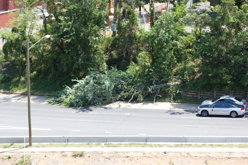
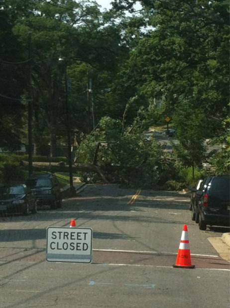
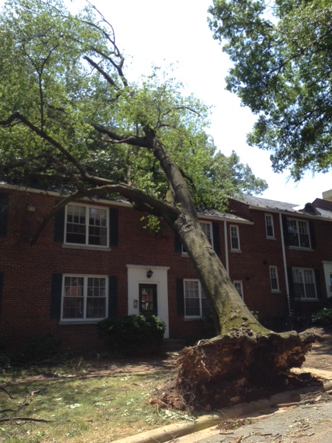
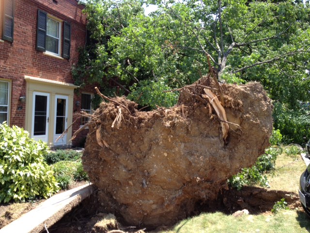
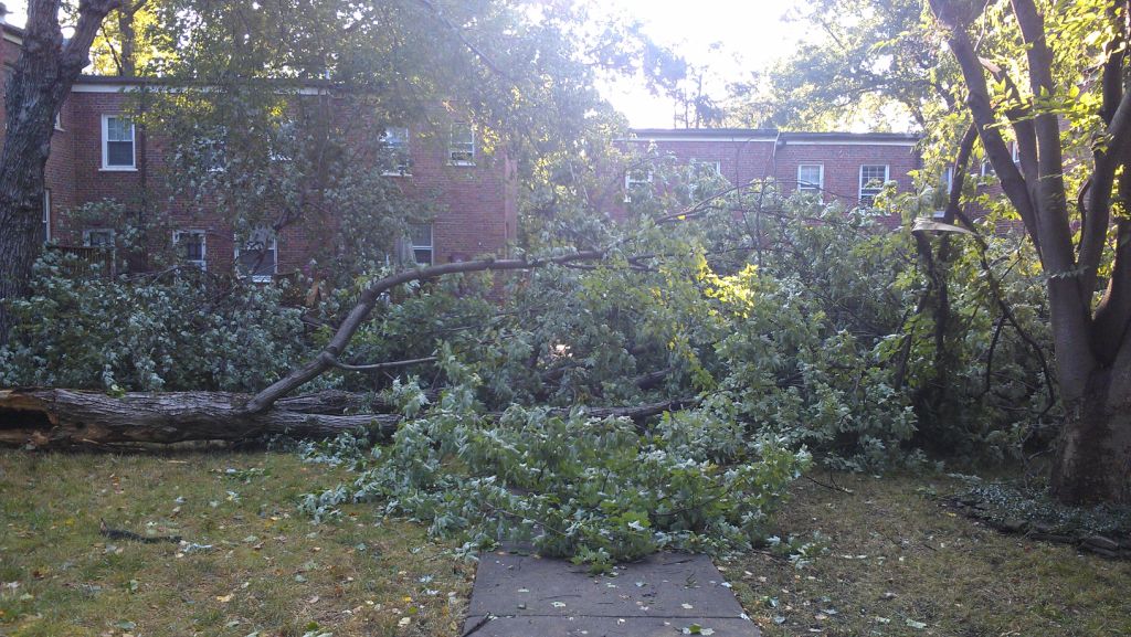
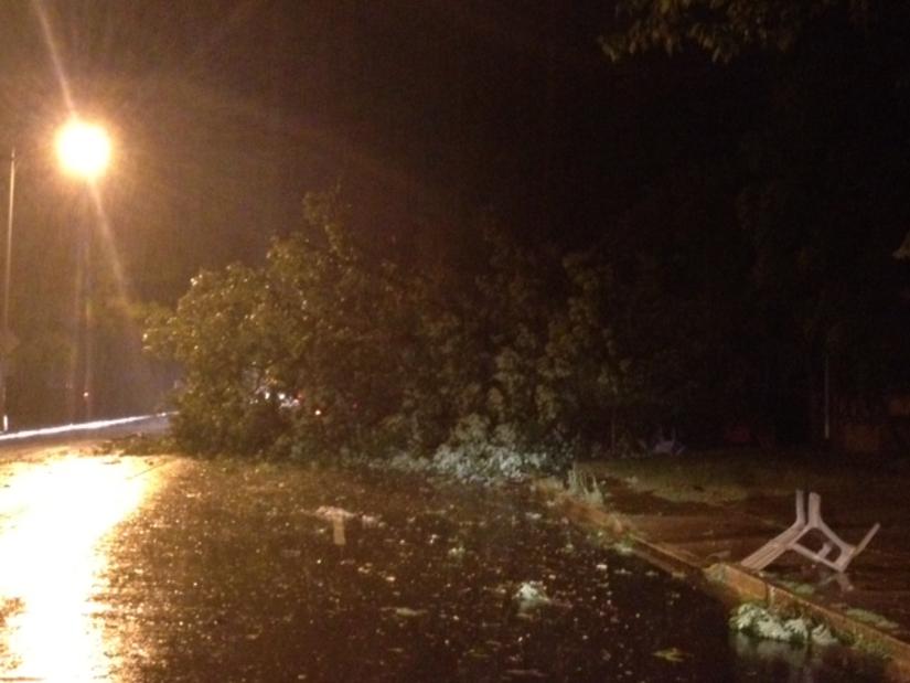
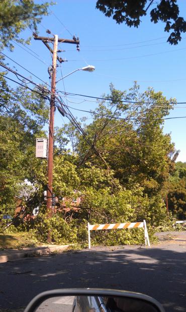
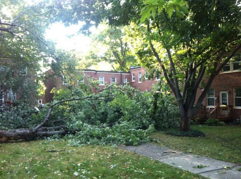
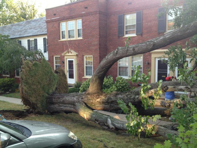
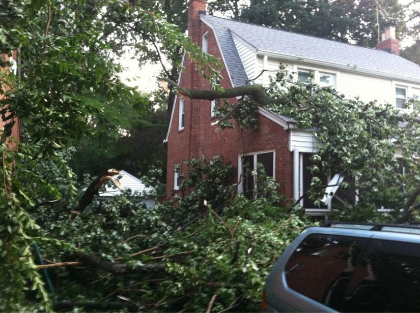
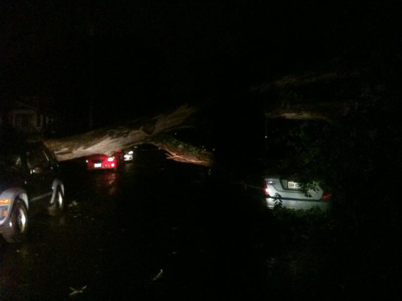
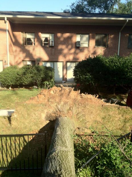
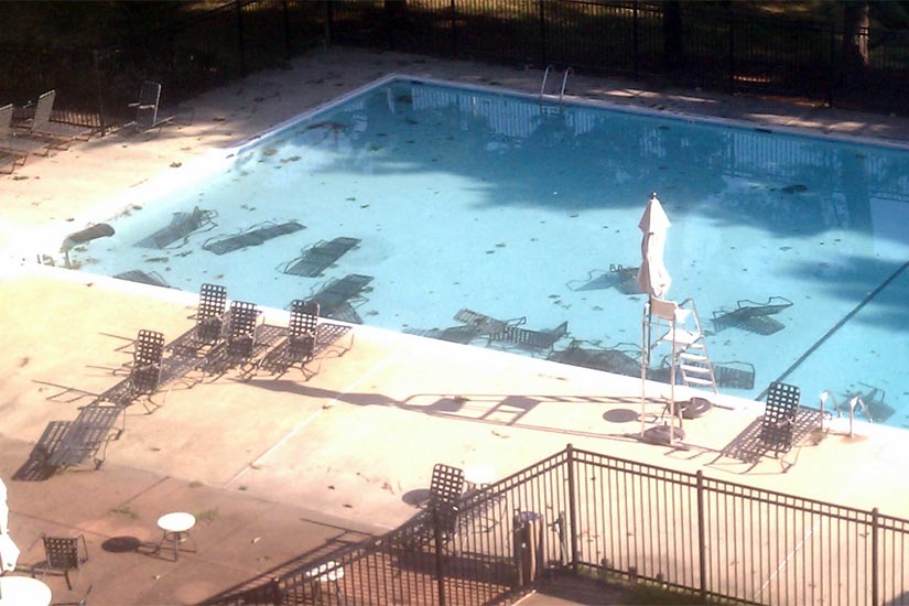
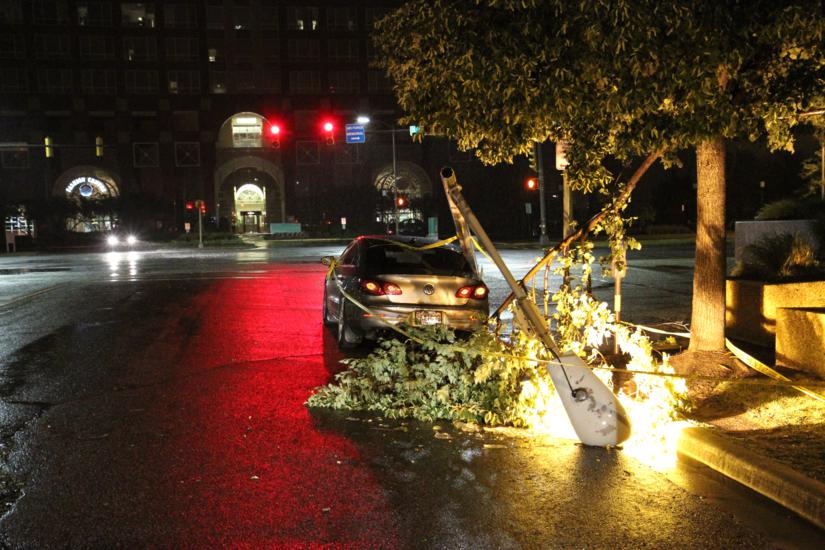
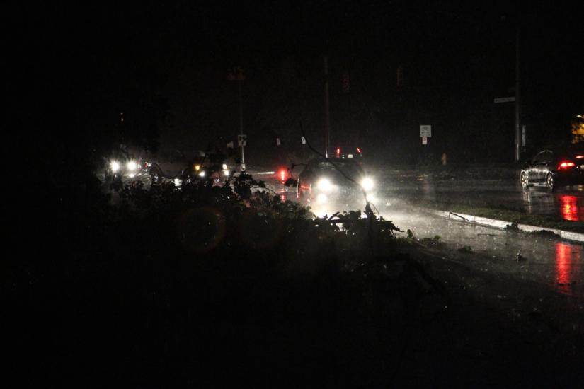
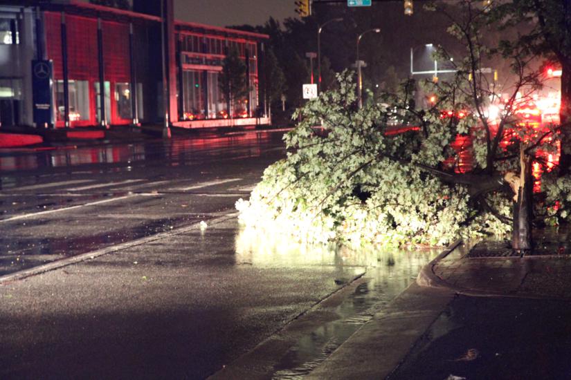
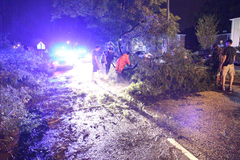
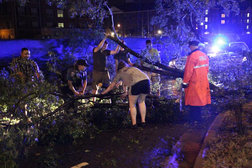
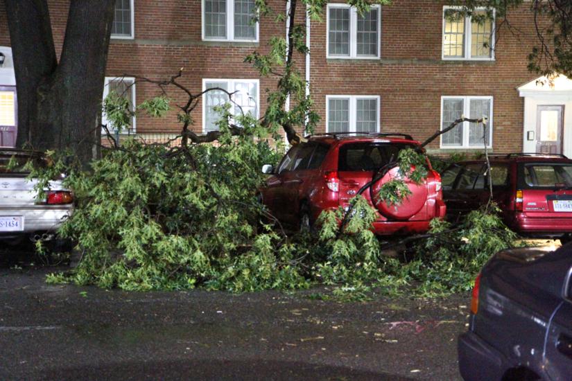
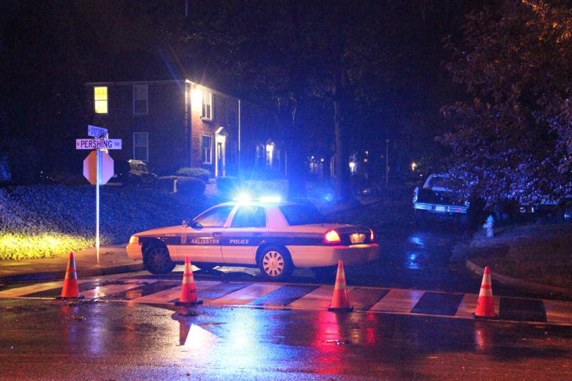
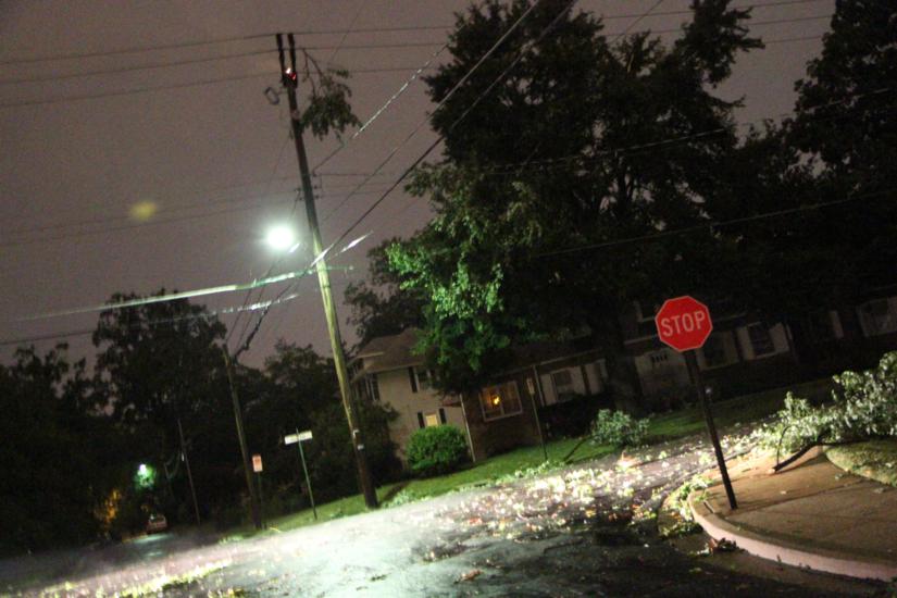
Winds of up to 70 miles per hour caused widespread damage across Arlington last night. Trees and large branches fell across roads and highways, utility lines were knocked down, newspaper boxes and other debris was blown into streets, and some roofs were damaged. Facing hundreds of calls, police and firefighters were often limited to simply placing cones, police tape and flares around downed trees in the roadway. In one instance, however, a half dozen residents helped two police officers remove a tree from the southbound lanes of George Mason Drive near Pershing Drive.
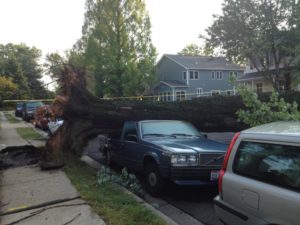
As of 4:30 p.m., Dominion was reporting 51,101 customers without power in Arlington, down from 58,878 customers just after noon. Though Dominion was not providing estimates of when power will be restored, county officials said it could be a while.

“It appears that it may be a number of days before power is fully restored,” the county told reporters. As a result of the power outages, Arlington has closed all three of its publicly-accessible pools. Some 80 traffic signals were dark as of this morning; drivers are reminded to treat non-functioning traffic lights as a four-way stop.

The power outages and downed trees are also affecting Metro. While WMATA says most of the Metro system is operating normally, a power outage at Courthouse station has prompted Metro to close the station and set up bus service between Rosslyn and Clarendon. Some Metrobus service has been detoured or delayed by downed trees, including the 7A, 7F, 16A and 16B lines.

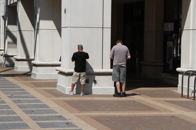
Cell phone service was also spotty in parts of the county — including the Courthouse, Clarendon and Columbia Pike areas — and a number of Twitter users were reporting a loss of cable and landline phone service. Arlington County says its non-emergency number (703-558-2222) is experiencing problems, but is still encouraging residents to call 911 only in the event of an emergency.

With another heat advisory in effect today (see below), Arlington has started compiling a list of cooling centers for residents without power. Along the places to take refuge are:

  • Artisphere (1101 Wilson Blvd)
  • Walter Reed Community Center (2909 16th Street S.)
  • Madison Community Center (3829 N. Stafford Street)
  • Dept. Parks & Rec Trades Center (S. Taylor Street, just off S. Arlington Mill Dr.)
  • Pentagon City Mall (1250 S. Hayes St.)
  • Aurora Hills Library (735 S. 18th St.)
  • Central Library (1015 N. Quincy St.)

The National Weather Service issued the following Heat Advisory for today:

HEAT ADVISORY IN EFFECT UNTIL 9 PM EDT THIS EVENING… … EXCESSIVE HEAT WARNING IS CANCELLED…

THE NATIONAL WEATHER SERVICE IN BALTIMORE MD/WASHINGTON HAS ISSUED A HEAT ADVISORY… WHICH IS IN EFFECT UNTIL 9 PM EDT THIS EVENING. THE EXCESSIVE HEAT WARNING HAS BEEN CANCELLED.

* HEAT INDEX VALUES… 100 TO 105 DEGREES.

* TEMPERATURES… IN THE MID TO UPPER 90S.

* IMPACT… RISK OF HEAT EXHAUSTION OR OTHER HEAT-RELATED ILLNESS FOR THOSE WITHOUT AIR-CONDITIONING OR THOSE SPENDING TIME OUTDOORS FOR AN EXTENDED PERIOD.

PRECAUTIONARY/PREPAREDNESS ACTIONS…

A HEAT ADVISORY MEANS THAT A PERIOD OF HOT TEMPERATURES IS EXPECTED. THE COMBINATION OF HOT TEMPERATURES AND HIGH HUMIDITY WILL CREATE A SITUATION IN WHICH HEAT ILLNESSES ARE POSSIBLE. DRINK PLENTY OF FLUIDS… STAY IN AN AIR-CONDITIONED ROOM… STAY OUT OF THE SUN… AND CHECK IN ON RELATIVES AND NEIGHBORS.

TAKE EXTRA PRECAUTIONS IF YOU WORK OR SPEND TIME OUTSIDE. WHEN POSSIBLE… RESCHEDULE STRENUOUS ACTIVITIES TO EARLY MORNING OR EVENING. KNOW THE SIGNS AND SYMPTOMS OF HEAT EXHAUSTION AND HEAT STROKE. WEAR LIGHTWEIGHT AND LOOSE-FITTING CLOTHING WHEN POSSIBLE AND DRINK PLENTY OF WATER.

TO REDUCE RISK DURING OUTDOOR WORK… THE OCCUPATIONAL SAFETY AND HEALTH ADMINISTRATION RECOMMENDS SCHEDULING FREQUENT REST BREAKS IN SHADED OR AIR-CONDITIONED ENVIRONMENTS. ANYONE OVERCOME BY HEAT SHOULD BE MOVED TO A COOL AND SHADED LOCATION. HEAT STROKE IS AN EMERGENCY – CALL 9 1 1.

According to the Capital Weather Gang, another line of severe storms is possible later today.

Virginia Gov. Bob McDonnell has declared a State of Emergency for the state. According to the governor’s office, 2.5 million people are without power throughout Virginia — the largest non-hurricane power outage in Virginia history. The governor’s office also confirmed six fatalities as a result of falling trees during the storm.

Photos below courtesy Brian W., Brendan L., Jason G., Breandan M., @maureenhoch, @Aggathug, @Wink303, @acsjacobson, @Greg_Hudson, @whitae4000, Keith H., @snowbrdchick99, @SRod17, @KenHagemann, @gogogaryo


(Updated at 3:00 p.m.) The Metropolitan Washington Council of Governments has declared that the region’s air quality has reached the level of “Code Red” for today, meaning an unhealthy level of ozone pollution.

From a COG press release:

On Code Red days, active children and adults, and people with lung disease, such as asthma, should avoid prolonged or heavy exertion outdoors. Everyone else, especially children, should reduce prolonged or heavy exertion outdoors.

COG also advises that all area residents take the following actions:

  • Sign up for air quality alerts at www.cleanairpartners.net
  • Turn off lights and electronics when not in use
  • Avoid lawn mowing or use an electric mower
  • Use public transit
  • Do not use chemicals on your lawn and garden

As of 2:50 p.m., the official temperature in D.C. reached 104 degrees. According to the Capital Weather Gang, that sets a new daily record and breaks the area’s all-time record for the month of June.


The National Weather Service has issued a heat advisory for the region today. Temperatures are now expected to climb as high as 103 today and 102 tomorrow, according to forecasters.

From Arlington Alerts:

The National Weather Service has issued a Heat Advisory, effective from 11AM to 9PM on Friday (today). This Heat Advisory replaces the Excessive Heat Watch. Humidity will increase, and Heat Index values are forecast to meet or exceed 105 degrees. The high temperature is expected to be in the upper 90s to 100. Additionally, there is a 30% possibility of thunderstorms, most likely in the mid afternoon through the evening, on Friday, Saturday, and Sunday.

Citizens should prepare for the possibility of excessive heat occuring on any day between now and late next week.  Precautions for heat:

* Drink plenty of fluids
* Stay indoors in an air-conditioned room whenever possible
* Stay out of direct sunlight
* Do not leave children or pets in vehicles
* Check up on neighbors, particularly the elderly and sick
* Wear light colored, lightweight and loose-fitting clothing
* Watch for heat cramps, heat exhaustion, and heat stroke
(further info: http://bit.ly/heatillness )

Metro will allow bottled water on trains, on buses, and in stations through at least Monday: http://bit.ly/MetroHeat

An Excessive Heat Watch is also in effect for Saturday. From the National Weather Service:

THE NATIONAL WEATHER SERVICE IN BALTIMORE MD/WASHINGTON HAS ISSUED AN EXCESSIVE HEAT WATCH… IN EFFECT FROM SATURDAY MORNING THROUGH SATURDAY EVENING.

* HEAT INDEX VALUES… AROUND 105 DEGREES THIS AFTERNOON. UP TO 110 DEGREES SATURDAY AFTERNOON.

* TEMPERATURES… AROUND 100 DEGREES THIS AFTERNOON AND SATURDAY AFTERNOON.

* IMPACT… RISK OF HEAT EXHAUSTION OR OTHER HEAT-RELATED ILLNESS FOR THOSE WITHOUT AIR-CONDITIONING OR THOSE SPENDING TIME OUTDOORS FOR AN EXTENDED PERIOD.

PRECAUTIONARY/PREPAREDNESS ACTIONS…

AN EXCESSIVE HEAT WATCH MEANS THAT A PROLONGED PERIOD OF HOT TEMPERATURES IS EXPECTED. A HEAT ADVISORY MEANS THAT A PERIOD OF HOT TEMPERATURES IS EXPECTED. THE COMBINATION OF HOT TEMPERATURES AND HIGH HUMIDITY WILL CREATE A SITUATION IN WHICH HEAT ILLNESSES ARE POSSIBLE. DRINK PLENTY OF FLUIDS… STAY IN AN AIR-CONDITIONED ROOM… STAY OUT OF THE SUN… AND CHECK IN ON RELATIVES AND NEIGHBORS.

TAKE EXTRA PRECAUTIONS IF YOU WORK OR SPEND TIME OUTSIDE. WHEN POSSIBLE… RESCHEDULE STRENUOUS ACTIVITIES TO EARLY MORNING OR EVENING. KNOW THE SIGNS AND SYMPTOMS OF HEAT EXHAUSTION AND HEAT STROKE. WEAR LIGHT WEIGHT AND LOOSE FITTING CLOTHING WHEN POSSIBLE AND DRINK PLENTY OF WATER.

TO REDUCE RISK DURING OUTDOOR WORK… THE OCCUPATIONAL SAFETY AND HEALTH ADMINISTRATION RECOMMENDS SCHEDULING FREQUENT REST BREAKS IN SHADED OR AIR-CONDITIONED ENVIRONMENTS. ANYONE OVERCOME BY HEAT SHOULD BE MOVED TO A COOL AND SHADED LOCATION. HEAT STROKE IS AN EMERGENCY – CALL 9 1 1.


An “Excessive Heat Watch” has been issued for Friday as the region braces for a sweltering weekend.

Forecasters are warning of a “prolonged period of hot temperatures” and humidity which will “create a dangerous situation in which heat illnesses are possible.

The predicted high temperatures for Friday, Saturday and Sunday are 99, 97 and 100 respectively. From the National Weather Service.

… EXCESSIVE HEAT WATCH REMAINS IN EFFECT FROM FRIDAY MORNING THROUGH FRIDAY EVENING…

* HEAT INDEX VALUES… UP TO 110 DEGREES.

* TEMPERATURES… UPPER 90S TO AROUND 100 DEGREES.

* IMPACT… RISK OF HEAT EXHAUSTION OR OTHER HEAT-RELATED ILLNESS FOR THOSE WITHOUT AIR-CONDITIONING OR THOSE SPENDING TIME OUTDOORS FOR AN EXTENDED PERIOD.

PRECAUTIONARY/PREPAREDNESS ACTIONS…

AN EXCESSIVE HEAT WATCH MEANS THAT A PROLONGED PERIOD OF HOT TEMPERATURES IS EXPECTED. THE COMBINATION OF HOT TEMPERATURES AND HIGH HUMIDITY WILL CREATE A DANGEROUS SITUATION IN WHICH HEAT ILLNESSES ARE POSSIBLE. DRINK PLENTY OF FLUIDS… STAY IN AN AIR- CONDITIONED ROOM… STAY OUT OF THE SUN AND CHECK UP ON RELATIVES AND NEIGHBORS.


(Updated at 4:05 p.m.) Today’s heat advisory has been extended through 10:00 p.m. on Thursday. From the National Weather Service:

… HEAT ADVISORY REMAINS IN EFFECT UNTIL 10 PM EDT THURSDAY…

* HEAT INDEX VALUES… 100 TO 105 DEGREES TODAY AND AROUND 105 DEGREES THURSDAY. OVERNIGHT HEAT INDEX REMAINING ABOVE 80 DEGREES IN THE SUBURBS AND NEAR 90 DEGREES IN THE URBAN CENTERS.

* TEMPERATURES… HIGH TEMPERATURES TODAY AND THURSDAY IN THE UPPER 90S TO AROUND 100. LOW TEMPERATURES TONIGHT IN THE MID 70S AND LOWER 80S.

* IMPACT… THOSE OUTDOORS FOR AN EXTENDED PERIOD OF TIME AS WELL AS THOSE PARTICULARLY SENSITIVE TO THE HEAT WILL BE AT RISK FOR HEAT EXHAUSTION AND OTHER HEAT-RELATED ILLNESS.

Arlington County has a list of “hot tips for keeping cool” on its website.

WMATA announced this morning that it is making an exception to its “no drinking” policy to allow customers to drink water on the Metro system.


The National Weather Service has issued a flash flood Arlington for the region, specifically mentioning Arlington as an area that might be impacted by heavy rains from a line of thunderstorms.

THE NATIONAL WEATHER SERVICE IN STERLING VIRGINIA HAS ISSUED A

* FLASH FLOOD WARNING FOR… THE DISTRICT OF COLUMBIA… SOUTHEASTERN MONTGOMERY COUNTY IN CENTRAL MARYLAND… CITY OF FAIRFAX IN NORTHERN VIRGINIA… CITY OF FALLS CHURCH IN NORTHERN VIRGINIA… NORTHERN CITY OF MANASSAS IN NORTHERN VIRGINIA… ARLINGTON COUNTY IN NORTHERN VIRGINIA… CITY OF MANASSAS PARK IN NORTHERN VIRGINIA… CITY OF ALEXANDRIA IN NORTHERN VIRGINIA… CENTRAL PRINCE WILLIAM COUNTY IN NORTHERN VIRGINIA… NORTHERN PRINCE GEORGES COUNTY IN CENTRAL MARYLAND… FAIRFAX COUNTY IN NORTHERN VIRGINIA…

* UNTIL 830 PM EDT

* AT 527 PM EDT… NATIONAL WEATHER SERVICE DOPPLER RADAR INDICATED FLASH FLOODING FROM THUNDERSTORMS ALONG A LINE EXTENDING FROM RESTON TO ALEXANDRIA… MOVING NORTHEAST AT 40 MPH.

* SOME LOCATIONS THAT WILL CONTINUE TO BE AFFECTED BY THE HEAVY RAIN INCLUDE WASHINGTON DC… ARLINGTON… ALEXANDRIA… AND FAIRFAX.

PRECAUTIONARY/PREPAREDNESS ACTIONS…

RAINFALL AMOUNTS OF 1 TO 2 INCHES HAVE FALLEN AND ADDITIONAL RAINFALL AMOUNTS OF 1 TO 2 INCHES ARE POSSIBLE IN THE WARNED AREA.

EXCESSIVE RUNOFF FROM HEAVY RAINFALL WILL CAUSE FLOODING OF SMALL CREEKS AND STREAMS… URBAN AREAS… HIGHWAYS… STREETS AND UNDERPASSES AS WELL AS OTHER DRAINAGE AREAS AND LOW LYING SPOTS.

DO NOT DRIVE YOUR VEHICLE INTO AREAS WHERE THE WATER COVERS THE ROADWAY. THE WATER DEPTH MAY BE TOO GREAT TO ALLOW YOUR CAR TO CROSS SAFELY. MOVE TO HIGHER GROUND.


Update at 6:30 p.m. — The ground stop at Reagan National has been lifted, but major delays are being reported. From the FAA:

Due to WEATHER / THUNDERSTORMS, there is a Traffic Management Program in effect for traffic arriving Ronald Reagan Washington National Airport, Washington, DC (DCA). This is causing some arriving flights to be delayed an average of 3 hours and 27 minutes. To see if you may be affected, select your departure airport and check “Delays by Destination”.

Earlier: Due to severe weather in the area, Reagan National Airport is under a “ground stop” — meaning no flights are arriving or departing.

Dulles International Airport and Baltimore-Washington International Airport are also under a ground stop.

Travelers heading to any local airport should expect significant delays as storms continue to move through the region.


(Updated at 2:50 p.m.) A strong thunderstorm may be heading in our direction over the next 45 minutes. The National Weather Service has issued a Severe Thunderstorm Warning, urging residents to stay alert and seek shelter if necessary.

THE NATIONAL WEATHER SERVICE IN STERLING VIRGINIA HAS ISSUED A

* SEVERE THUNDERSTORM WARNING FOR… SOUTHERN MONTGOMERY COUNTY IN CENTRAL MARYLAND… CITY OF FAIRFAX IN NORTHERN VIRGINIA… CITY OF FALLS CHURCH IN NORTHERN VIRGINIA… NORTHWESTERN ARLINGTON COUNTY IN NORTHERN VIRGINIA… EASTERN PRINCE WILLIAM COUNTY IN NORTHERN VIRGINIA… CENTRAL FAIRFAX COUNTY IN NORTHERN VIRGINIA…

* UNTIL 330 PM EDT

* AT 242 PM EDT… NATIONAL WEATHER SERVICE DOPPLER RADAR INDICATED A SEVERE THUNDERSTORM CAPABLE OF PRODUCING DAMAGING WINDS IN EXCESS OF 60 MPH. THIS STORM WAS LOCATED NEAR LAKE RIDGE… OR 6 MILES NORTH OF DALE CITY… AND MOVING NORTHEAST AT 30 MPH.

* LOCATIONS IMPACTED INCLUDE… BURKE… MERRIFIELD… MANTUA… FAIRFAX… ANNANDALE… MERRIFIELD… THE I66 AND I495 INTERCHANGE… VIENNA… FALLS CHURCH… PIMMIT HILLS…

PRECAUTIONARY/PREPAREDNESS ACTIONS…

A TORNADO WATCH IS IN EFFECT FOR THE WARNED AREA.

THIS IS A DANGEROUS STORM. IF YOU ARE IN ITS PATH… MOVE INDOORS TO A STURDY BUILDING AND STAY AWAY FROM WINDOWS. WHEN IT IS SAFE TO DO SO… REPORT SEVERE WEATHER TO LOCAL LAW ENFORCEMENT OR TO THE NATIONAL WEATHER SERVICE.

An earlier Special Weather Statement warned of the possibility of rapidly deteriorating weather conditions.

STORM INTENSITY IS INCREASING… AND SEVERE WEATHER MAY DEVELOP RAPIDLY. REMAIN ALERT… AND BE PREPARED TO TAKE ACTION IF WARNINGS ARE ISSUED.

WIND GUSTS IN EXCESS OF 50 MPH ARE EXPECTED WITH THIS STORM. WINDS THIS STRONG CAN BRING DOWN LARGE TREE BRANCHES. TAKE SHELTER UNTIL THE STORM HAS PASSED


The National Weather Service has issued a Tornado Watch for Arlington and the rest of the D.C. region. The watch is in effect through 9:00 p.m.

The Arlington Office of Emergency Management issued the following statement about the impending severe weather earlier today:

The National Weather Service has advised that the metropolitan area can expect pop up spotty scattered showers/thunderstorms from mid to late afternoon today.  This evening as the cold front approaches, the storm system will be more organized as it moves East.  Between 7 and 10 pm, there is a better potential for large hail, 60 mph winds and possible tornado activity especially in those areas that see multiple thunderstorms. Rain totals will be 1-1/2 inches in those areas where multiple storms occur.  Flooding may  occur in those areas.

During a power outage Dominion Virginia Power has a toll free service number for reporting power outages.  1-866-366-4357. Call if you lose power and use the automated reporting system for fastest access.

Today is also the beginning of hurricane season. It is critical that everyone understand something about a hurricane.  There are some simple, low-cost steps each of us and our families can take to get ready for hurricanes or any disaster: Be Informed, Make a Plan, Prepare an emergency kit, and Get Involved.

If you have a smart phone, download the free Arlington Prepares app. There is information about how to prepare, how to respond to specific emergencies and you may download your own personal and contact information.  To get started, go to www.arlingtonva.us/oem.

Be Informed:

You already receive Arlington Alerts, but the other ways to get emergency information are through the County’s web site, www.arlingtonva.us, 1700 AM radio, AVN Comcast 25 or Verizon 40 and local media.

Make a Plan:

Making a family disaster plan involves discussing the hazards and threats for your area and what your family would do during an actual emergency. As you create your plan, decide on a meeting place if your family cannot return home, designate an out-of-town friend or relative as a point-of-contact and plan for the specific needs of your household, such as an evacuation shelter for pets or transportation for medical equipment.  For more information, visit www.arlingtonva.us/oem.

Prepare an Emergency Kit:

An emergency supply “Go Bag” kit includes, among other things, essential items to last at least three days such as a battery-powered radio and extra batteries, food and water, flashlights, a first aid kit and medications.  For more specific information on what to include in your “go bag”, visit www.arlingtonva.us/oem.  The Virginia Department of Emergency Management also has information on preparation for emergencies at www.vaemergency.com

Get Involved:

There are several opportunities to become involved in emergency preparedness activities, including assisting should a hurricane hit Arlington.  Become a CERT (Community Emergency Response Team) member.  The Medical Reserve Corps (MRC) and Volunteer Emergency Support Team (VEST) uses volunteers in emergencies. For information on these volunteer programs, visit www.arlingtonva.us

Tips for Homeowners:

Now is a good time to stroll around your property and prune any dead branches from trees.  Treat all downed lines and anything touching them as energized and dangerous! dlp/oem


The National Weather Service has issued a flash flood warning due to a line of thunderstorms approaching the area.

Forecasters say the storms could bring torrential rainfall of up to 1 to 2 inches.

THE NATIONAL WEATHER SERVICE IN STERLING VIRGINIA HAS ISSUED A

* FLASH FLOOD WARNING FOR… CITY OF FAIRFAX IN NORTHERN VIRGINIA… CITY OF FALLS CHURCH IN NORTHERN VIRGINIA… WESTERN ARLINGTON COUNTY IN NORTHERN VIRGINIA… CENTRAL FAIRFAX COUNTY IN NORTHERN VIRGINIA…

* UNTIL 1115 PM EDT

* AT 805 PM EDT… NATIONAL WEATHER SERVICE DOPPLER RADAR INDICATED THUNDERSTORMS PRODUCING TORRENTIAL RAINFALL ALONG A LINE EXTENDING FROM GREAT FALLS TO FAIRFAX… OR ALONG A LINE EXTENDING FROM THE AMERICA LEGION BRIDGE TO FAIRFAX… MOVING EAST AT 15 MPH.

* SOME LOCATIONS THAT WILL CONTINUE TO BE AFFECTED BY THE HEAVY RAIN INCLUDE ANNANDALE… ARLINGTON… BALLSTON… FAIRFAX… FALLS CHURCH… GREAT FALLS… LAKE BARCROFT… LINCOLNIA… MCLEAN… MERRIFIELD… OAKTON… THE I66 AND I495 INTERCHANGE… TYSONS CORNER… VIENNA… WOLF TRAP… MANTUA AND PIMMIT HILLS.

PRECAUTIONARY/PREPAREDNESS ACTIONS…

THIS INCLUDES THE FOLLOWING STREAMS AND DRAINAGES… NICHOLS RUN… DIFFICULT RUN… PIMMIT RUN… BULL RUN… ACCOTINK CREEK… ROCKY RUN… POPES HEAD CREEK… CASTLE CREEK… RABBIT BRANCH… SIDEBURN BRANCH… HOLMES RUN… TRIPPS RUN… BACKLICK RUN… INDIAN RUN… FOUR MILE RUN… LONG BRANCH… LITTLE PIMMIT RUN… BULLNECK RUN… ROCKY RUN… WOLFTRAP CREEK… ANGELICO BRANCH AND SOUTH RUN.

RAINFALL AMOUNTS OF 1 TO 2 INCHES ARE POSSIBLE IN THE WARNED AREA.

EXCESSIVE RUNOFF FROM HEAVY RAINFALL WILL CAUSE FLOODING OF SMALL CREEKS AND STREAMS… URBAN AREAS… HIGHWAYS… STREETS AND UNDERPASSES AS WELL AS OTHER DRAINAGE AREAS AND LOW LYING SPOTS.


View More Stories