Update at 6:25 p.m. — Another ACFD unit has been dispatched to a swift water rescue at the intersection of Braddock Road and Little River Turnpike in Lincolnia.

Update at 4:50 p.m. — At this point we’ve heard at least three four ACFD units dispatched to assist with swift water rescues.

Several squads from the Arlington County Fire Department have been dispatched to Fairfax County to assist with swift water rescues.

The first mutual aid call came in just after 3:00 p.m. Units have been dispatched to locations like Oakton and Great Falls.

While Arlington has remained fairly dry for much of the afternoon, a line of heavy rains has been soaking parts of Fairfax County for several hours. Via Twitter, there have been several reports of flooding on portions of Route 50, Route 123 and the Dulles Toll Road.


A flash flood warning has been issued as heavy rain and thunderstorms continue to move through the area.

Forecasters warn that already-saturated ground may lead to flooding, especially in low-lying areas.

THE NATIONAL WEATHER SERVICE IN STERLING VIRGINIA HAS ISSUED A

* FLASH FLOOD WARNING FOR… THE DISTRICT OF COLUMBIA… WESTERN PRINCE GEORGES COUNTY IN CENTRAL MARYLAND… CITY OF ALEXANDRIA IN NORTHERN VIRGINIA… EASTERN CITY OF FALLS CHURCH IN NORTHERN VIRGINIA… ARLINGTON COUNTY IN NORTHERN VIRGINIA… EASTERN FAIRFAX COUNTY IN NORTHERN VIRGINIA… CENTRAL CHARLES COUNTY IN SOUTHERN MARYLAND…

* UNTIL 145 PM EDT

* AT 1046 AM EDT… NATIONAL WEATHER SERVICE DOPPLER RADAR INDICATED A NORTH TO SOUTH BAND OF HEAVY RAINFALL EXTENDING FROM WASHINGTON SOUTHWARD TO NEAR PORT TOBACCO… MOVING NORTH ACROSS THE SAME AREAS. HEAVY RAINFALL OVER TWO INCHES IS LIKELY WITHIN THIS BAND OF RAIN.

* SOME LOCATIONS THAT WILL CONTINUE TO BE AFFECTED BY THE HEAVY RAIN INCLUDE ALEXANDRIA… ARLINGTON… BALLSTON… FORT BELVOIR… FRANCONIA… HYBLA VALLEY… LAKE BARCROFT… LINCOLNIA… MCLEAN… ROSSLYN… BLADENSBURG… CAMP SPRINGS… CHEVERLY… COLLEGE PARK… CORAL HILLS… FRIENDLY… HYATTSVILLE… INDIAN HEAD… LA PLATA… LANGLEY PARK… MARLOW HEIGHTS… OXON HILL… ST. CHARLES… ADAMS MORGAN… ANACOSTIA… AMERICAN UNIVERSITY… GEORGETOWN… KENILWORTH… DOWNTOWN WASHINGTON… US CAPITOL… FORT WASHINGTON… FORT TOTTEN… GALLAUDET UNIVERSITY… GROVETON… HOWARD UNIVERSITY… HUNTINGTON… NATIONAL HARBOR AND PORT TOBACCO RIVER.

PRECAUTIONARY/PREPAREDNESS ACTIONS…

EXCESSIVE RUNOFF FROM HEAVY RAINFALL WILL CAUSE FLOODING OF SMALL CREEKS AND STREAMS… URBAN AREAS… HIGHWAYS… STREETS AND UNDERPASSES AS WELL AS OTHER DRAINAGE AREAS AND LOW LYING SPOTS.


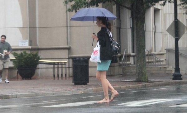
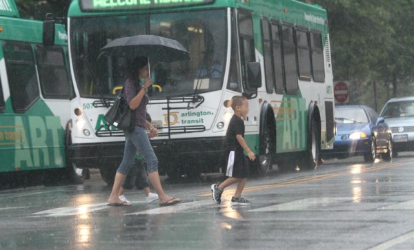
A line of heavy rain showers is on its way out of moving through the area, leaving behind big puddles of water on local roads. Meanwhile, more rain from the remnants of Tropical Depression Lee is expected tonight.

The National Weather Service issued a flash flood watch for the region earlier today.

… FLASH FLOOD WATCH REMAINS IN EFFECT THROUGH WEDNESDAY AFTERNOON…

THE FLASH FLOOD WATCH CONTINUES FOR

* THE WASHINGTON AND BALTIMORE METROPOLITAN AREAS… NORTH-CENTRAL AND LOWER SOUTHERN MARYLAND… AND NORTHERN AND CENTRAL VIRGINIA.

* THROUGH WEDNESDAY AFTERNOON

* GULF AND ATLANTIC MOISTURE ASSOCIATED WITH THE REMNANTS OF TROPICAL DEPRESSION LEE WILL CONTINUE TO INTERACT WITH A NEARLY STATIONARY BOUNDARY… PRODUCING WIDESPREAD RAIN ACROSS THE AREA. ADDITIONAL RAINFALL AMOUNTS THROUGH WEDNESDAY WILL AVERAGE 1 TO 2 INCHES… WITH ISOLATED AMOUNTS OVER 3 INCHES POSSIBLE. HEAVY RAIN MAY CONTINUE WEDNESDAY NIGHT AND THURSDAY.

* VERY HEAVY RAIN MAY CAUSE RAPID RISES IN CREEKS AND STREAMS… AS WELL AS SIGNIFICANT PONDING IN URBAN AREAS. DO NOT DRIVE THROUGH ROADWAYS COVERED WITH WATER.

PRECAUTIONARY/PREPAREDNESS ACTIONS…

A FLASH FLOOD WATCH MEANS THAT CONDITIONS MAY DEVELOP THAT LEAD TO FLASH FLOODING. FLASH FLOODING IS A VERY DANGEROUS SITUATION.

YOU SHOULD MONITOR LATER FORECASTS AND BE PREPARED TO TAKE ACTION SHOULD FLASH FLOOD WARNINGS BE ISSUED.


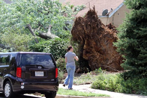
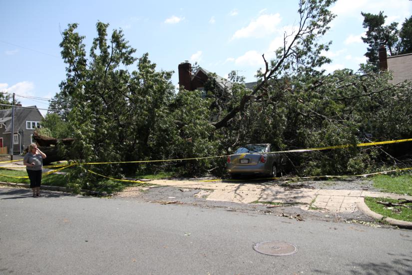
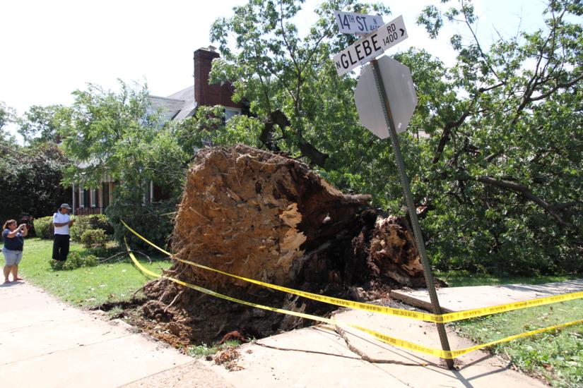
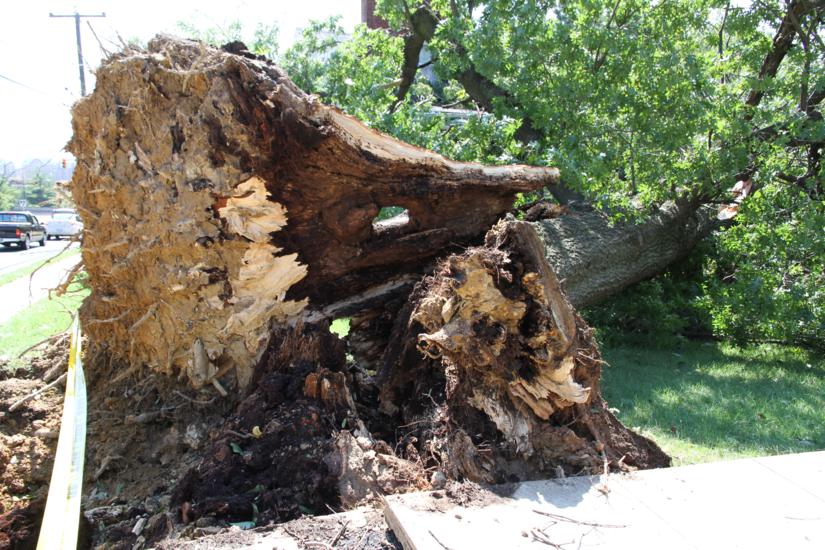
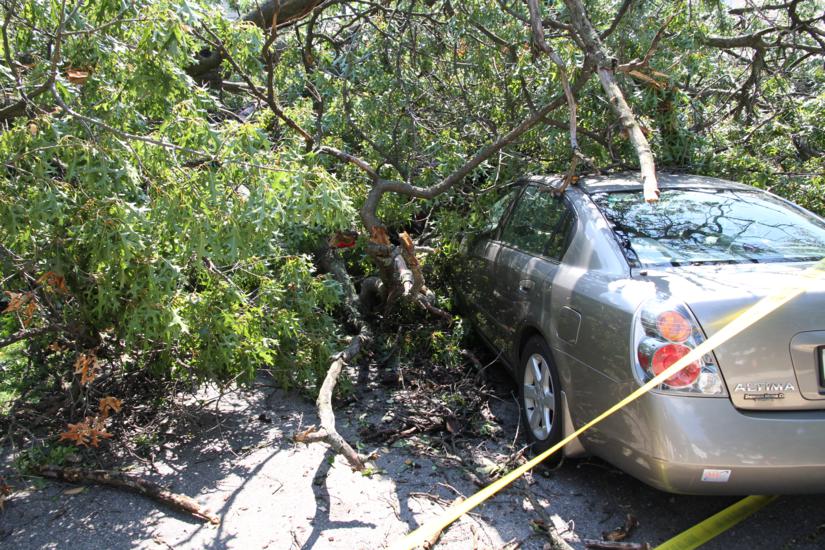
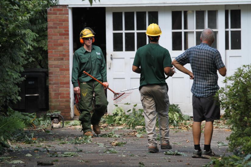
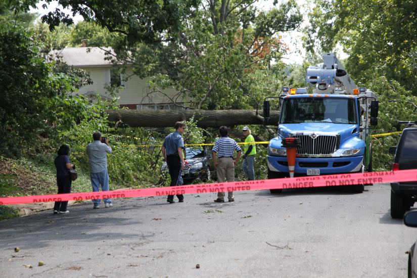
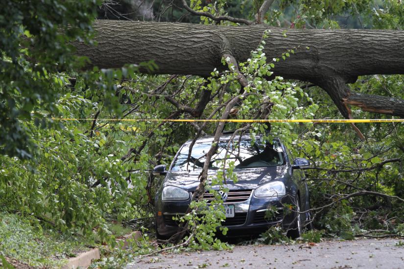
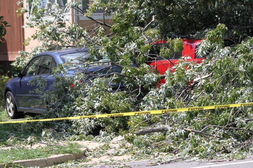
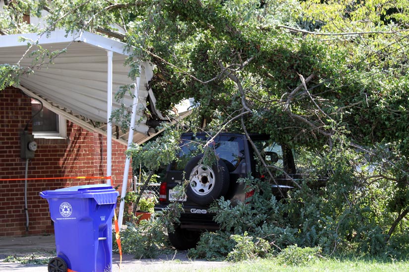
Arlington residents woke up this morning to power outages and scores of downed trees and tree branches, thanks to the high winds and torrential rains of Hurricane Irene.

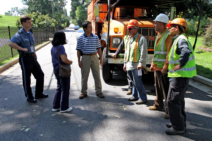
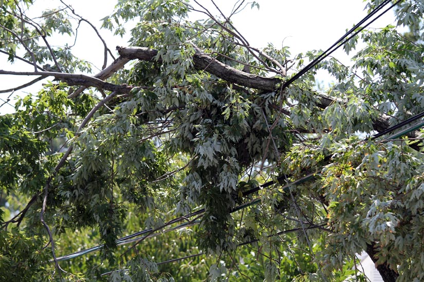
“It’s just terrible,” said County Board member Walter Tejada as he toured some of the worst scenes of destruction around the county with Acting County Manager Marsha Allgeier and Deputy Police Chief Michael Dunne. While many areas escaped with just a few downed tree limbs, some areas remain blocked and without power due to large trees that fell across roads and power lines.

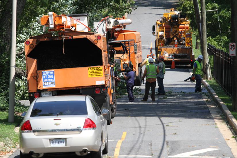
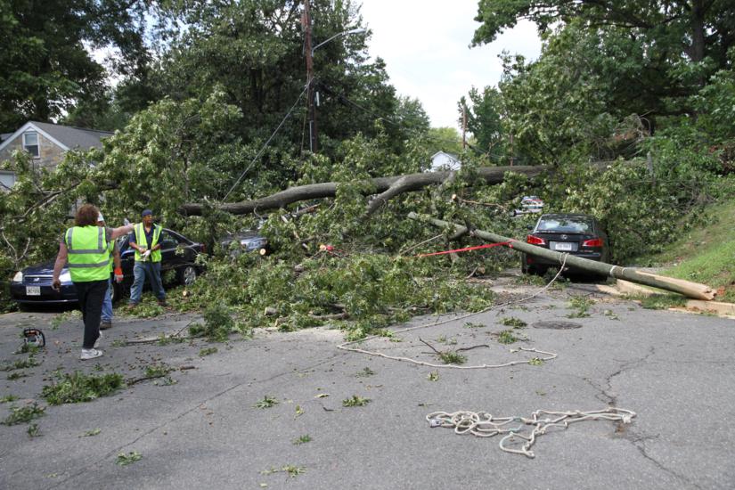
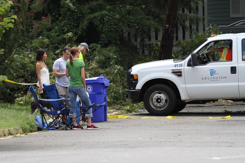
County and private tree crews, along with crews from Dominion Power, have been working around the clock to clear debris and get power lines back up. As of 3:25 p.m., more than 4,800 Dominion customers were still without power in Arlington.

Arlington County has posted additional damage photos on a dedicated Flickr page.


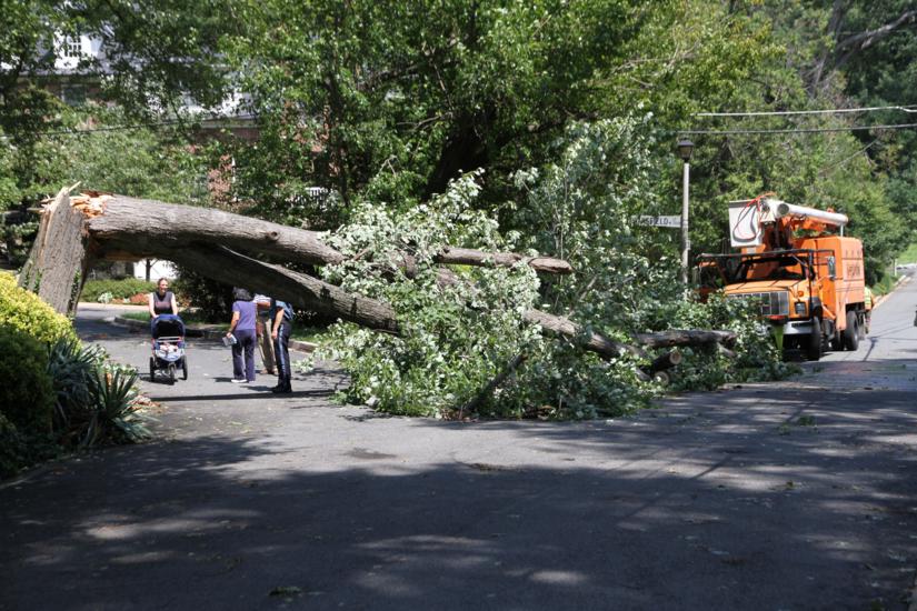
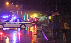
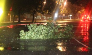
(Updated at 12:25 p.m.) Tropical storm-force winds from Hurricane Irene, combined with a steady, soaking rain, brought down at least 75 trees throughout Arlington last night, completely or partially blocking at least 35 streets, authorities said.

The falling trees blocked main roads, like Columbia Pike and westbound I-66, and knocked out power to various parts of the county. The 100 block of N. Liberty Street, Rock Spring Road and N. Wakefield Street, N. Quantico and N. 18th Street and N. Edison and Little Falls Road all remain blocked this afternoon, according to authorities and residents. County crews with chainsaws are helping to remove fallen trees and tree limbs from the roadway.

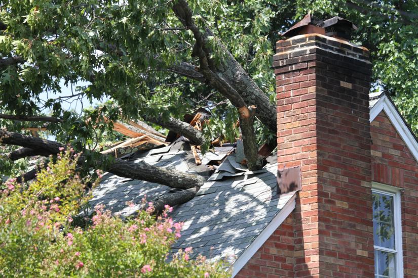
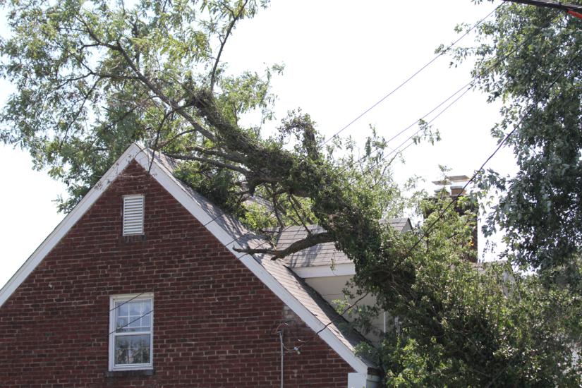
Some trees fell onto power lines and the roofs of houses, courtesy of wind gusts up to 59 miles per hour. A tree also fell onto the Blue Line tracks near Arlington National Cemetery, forcing Metro trains to single-track through the area.

Dominion was reporting more than 14,000 customers without power in Arlington as of 6:00 a.m. Numerous traffic lights were either dark or flashing as power flickered in many parts of the county overnight. The number of reported power outages dropped to just below 8,000 by noon on Sunday.

So far, only one minor storm-related injuries has been reported, according to Arlington County spokeswoman Jennifer K. Smith.


Update at 6:20 p.m. — The National Weather Service has issued a flash flood warning for Arlington County. Heavy rains are causing ponding on roadways and producing the risk of dangerous flooding, especially in low-lying areas.

From Arlington County:

What to expect in Arlington from Irene: A Tropical Storm Warning and Flash Flood Watch is in effect for Arlington County.

  • Rain bands from the hurricane will start hitting this area in the early to mid-afternoon.
  • Heavy rain, winds will start at around 6 p.m.
  • Heaviest rain and winds between 8 pm Sat. and 2 am Sun.
  • During this period we will likely experience sustained winds of up to 40 MPH, gusts between 40 and 50 MPH.
  • 2-4 inches of total rain expected, with higher amounts further east.
  • Due to ground saturation and winds, we are likely to experience some downed trees.

The county has rolled out a live “Arlington Irene-cam” for residents to watch the effects of the storm outside the county office building at 2100 Clarendon Boulevard in Courthouse.


Arlington County has released a list of important phone numbers for residents during Hurricane Irene.

  • POWER OUTAGES: Dominion Virginia Power 1-866-DOM-HELP (1-866-366-4357)
  • NATURAL GAS EMERGENCIES: Washington Gas 703-750-1400 or 800-752-7520. If you smell gas, leave and call 9-1-1.
  • TREES DOWN: 703-228-6525
  • STREET FLOODING, water, sewer and storm-sewer: 703-228-6555
  • TRAFFIC SIGNAL OUTAGES: 703-228-6511

Update at 11:20 a.m. on 8/27/2011 — An Arlington County spokeswoman says the county is not distributing sandbags, despite information provided to ARLnow.com yesterday.

Arlington County has declared a local emergency in advance of the arrival of Hurricane Irene.

Today, Acting County Manager Marsha Allgeier has signed a Declaration of Local Emergency for Arlington County in response to Hurricane Irene. The declaration was made because Hurricane Irene is a powerful storm with potentially damaging winds, rainfall, and storm surge that could cause flooding and other hazardous conditions in Arlington.

This declaration provides for increased coordination with state resources, and provides increased administrative authority permitting the County to take necessary actions to prepare for and respond to the storm. At this time, the County reminds residents to be prepared. For emergency preparedness information, storm updates, and information on cancellations and closings, visit the County website.

All county facilities — including libraries and community centers — will close at noon on Saturday and remain shuttered through Sunday. Artisphere will be closed all day Saturday. The lobby of the Arlington County jail will be open as a shelter of last resort for homeless individuals.

An emergency exercise scheduled to take place at Pentagon City mall on Sunday morning, meanwhile, has been canceled. In addition, the Columbia Pike outdoor movie scheduled for Saturday night, has been rescheduled for Saturday, Sept. 17 at 8:00 p.m. Also, we’re told that tomorrow morning’s Courthouse farmers market will be reduced in scope, as 14th Street and part of the county surface parking, where the market is held, will be reserved for emergency vehicle parking.


We spotted some apparent earthquake damage in the Country Club Manor section of N. Arlington that may be at risk of getting worse if winds from Hurricane Irene are high enough.

The chimney of a stately brick house suffered significant structural damage near the top of the home’s roof after Tuesday’s quake. No word on whether it will be repaired or secured by Saturday evening, when the effects of the hurricane are expected to be felt in the metro D.C. area.


Metro is preparing for the flooding and wind damage that may accompany the weekend arrival of Hurricane Irene.

The agency says it is calling in additional support personnel, who will be “on duty throughout the weekend to respond to any situations that may arise.”

WMATA is supplying chain saws to Metro drivers, “for use in the event of downed trees.” Metrobuses and MetroAccess vehicles may be detoured around fallen trees and flooded areas, as necessary. Metro is also checking all drainage pumps and clearing out debris from drainage areas near Metro stations.

“Supervisors will monitor critical locations, such as bus garages, parking garages, and flood-prone areas throughout the weekend,” Metro said in a press release.

Metro has placed more than 2,000 sandbags around the escalators of Metrorail stations that have a history of flooding, including the Foggy Bottom and King Street stations. None of the listed stations are in Arlington.

“We’re putting all of our resources in place to address any issues that arise out of the extreme weather conditions this weekend,” said Metro General Manager and CEO Richard Sarles. “We will be updating our customers through our website, Twitter, email alerts and the media.”

See our earlier post on Arlington County’s hurricane preparations here.


Update at 11:55 a.m. — Virginia Governor Bob McDonnell has declared a state of emergency in advance of the hurricane.

Arlington County is bracing for impacts from Hurricane Irene.

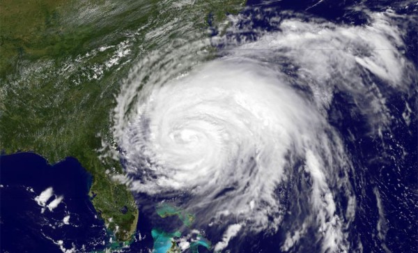
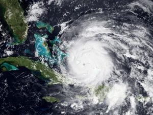
Irene, which is expected to be the strongest hurricane to hit the Northeast in decades, could bring torrential rains and high winds to the Mid-Atlantic region Saturday night and throughout the day on Sunday. In anticipation of the storm, the county is “mobilizing both people and equipment,” according to Jack Brown, Director of Emergency Management for Arlington County.

The police, fire and parks departments will be bringing in additional personnel this weekend, Brown told ARLnow.com. The county’s 911 call center will also have additional employees on hand, and the Office of Emergency Management will be staffed throughout the weekend.

County crews are cleaning out drains to ensure the expected heavy rains will be able to flow into storm sewers. The parks department is removing picnic tables and other equipment from areas near streams and river beds, in anticipation of flooding. The county is also “developing plans for shelters, if the need arises,” according to Brown.

The county and Dominion Power both say they’re preparing for downed trees and power lines in the hurricane’s wake. The county has backup communications systems — including satellite phones and amateur radio stations — in case cell phones or existing radio systems go down during the storm.

“It could be challenging, yes, but since 9/11 a lot of steps have been taken to ensure better communications,” Brown said.

Most importantly, says Brown, Arlington is working to get information about hurricane preparedness out to the public.

“The first concern is the public safety,” he said. “If we do have impacts from this storm, people need to be prepared for that… It’s all about personal and family preparedness.”

Brown said any sort of evacuation of Arlington looks unlikely at this point. In fact, he’s encouraging people to stay at home.

“In most cases, people are better off just staying home and hunkering down,” Brown advised. “Don’t go out on the road… just have enough food and supplies to weather the storm.”

“We don’t want people out in the middle of a crisis getting in the way,” he added.

Additional hurricane preparedness tips can be found from FEMA, the National Hurricane Center and the Virginia Department of Emergency Management.


View More Stories