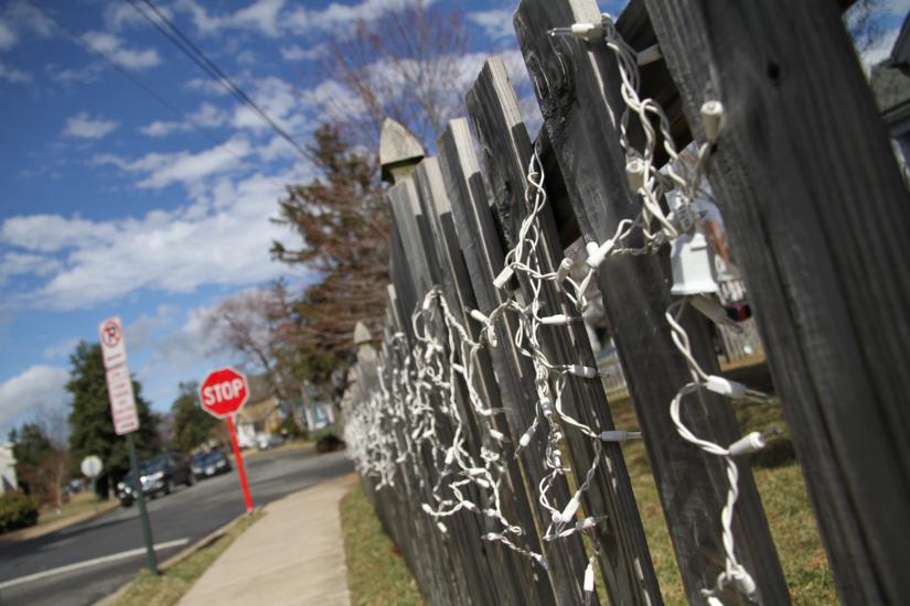
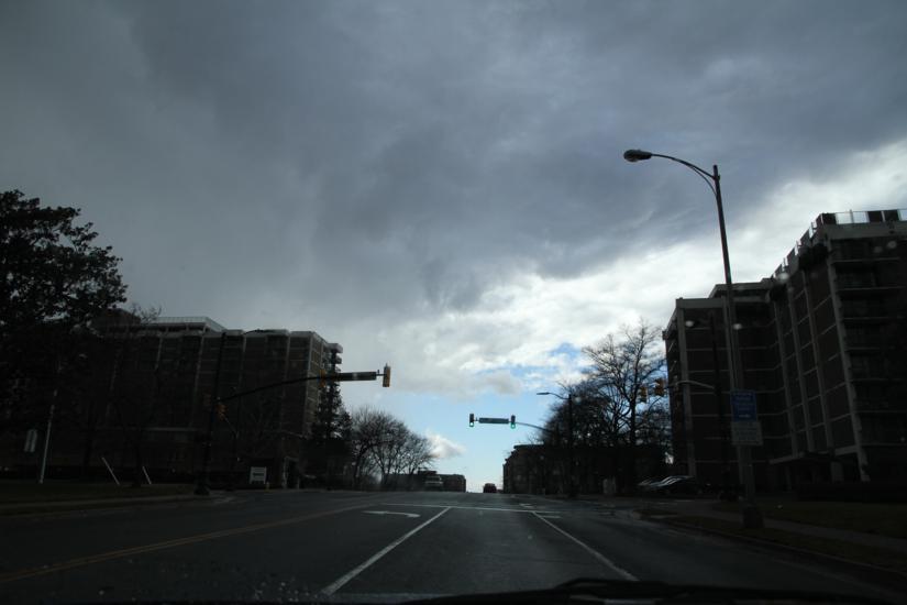
A flood watch will take effect at 6:00 tonight as heavy rains move into our area from the southwest.

A steady, soaking, all-day rain and and gusty winds should make for an unpleasant Thursday. Officials are warning anyone who lives in low-lying or flood-prone areas to be “prepared to take action should flood develop.”

FLOOD WATCH REMAINS IN EFFECT FROM 6 PM EST THIS EVENING THROUGH THURSDAY EVENING…

THE FLOOD WATCH CONTINUES FOR

* PORTIONS OF NORTHERN AND EASTERN MARYLAND… THE DISTRICT OF COLUMBIA AND NORTHERN VIRGINIA… EAST OF THE BLUE RIDGE.

* FROM 6 PM EST THIS EVENING THROUGH THURSDAY EVENING

* PERIODS OF MODERATE TO HEAVY RAIN WILL MOVE INTO THE REGION AHEAD OF A COLD FRONT THIS EVENING INTO THURSDAY. BY THE TIME THE FRONT CLEARS THE AREA THURSDAY NIGHT… UP TO 3 INCHES OF RAIN WILL BE POSSIBLE.

* THE FORECASTED RAINFALL AMOUNTS LIKELY WILL CAUSE FLOODING OF LOW LYING AREAS… AS WELL AS CAUSE SMALL STREAMS AND CREEKS TO RISE OUT OF THEIR BANKS. THE RUNOFF WOULD THEN CREATE SIGNIFICANT RISES ON AREA RIVERS.

PRECAUTIONARY/PREPAREDNESS ACTIONS…

A FLOOD WATCH MEANS THERE IS A POTENTIAL FOR FLOODING BASED ON CURRENT FORECASTS.

YOU SHOULD MONITOR LATER FORECASTS AND BE ALERT FOR POSSIBLE FLOOD WARNINGS. THOSE LIVING IN AREAS PRONE TO FLOODING SHOULD BE PREPARED TO TAKE ACTION SHOULD FLOODING DEVELOP.


Miserable weather led to scattered problems across Arlington last night.

Steady rains caused some localized flooding in parts of the county. Police reportedly had to block off 11th Street at North Kennebec Street last night due to water in the roadway. A big pool of standing water also caused a traffic hazard on the northbound lanes of Glebe Road, just before Wilson Boulevard.

Local streams filled with fast-moving water as a result of the rain. This video shows a normally-peaceful section of Four Mile Run that turned into a raging rapid near Shirlington.

Elsewhere in Arlington, gusty winds brought down trees and power lines.

A brief period of sleet, meanwhile, made its way through the area around midnight. There was no noticeable accumulation in Arlington.


Update at 12:50 p.m. — The tornado watch has been canceled.

Warm temperatures are going to give way to strong storms as a cold front moves through the region later today.

The National Weather Service just issued a Tornado Watch, warning that the storms could include tornadic activity. The watch is in effect until 4:00 p.m.


Forecasters are warning of high winds that will be blowing into our area tomorrow morning and afternoon.

The winds come less than a week after Saturday’s wind storm, which knocked down large trees and power lines.

HIGH WIND WATCH NOW IN EFFECT FROM FRIDAY AFTERNOON THROUGH FRIDAY EVENING…

THE HIGH WIND WATCH IS NOW IN EFFECT FROM FRIDAY AFTERNOON THROUGH FRIDAY EVENING.

* TIMING… FRIDAY 11 AM TO 7 PM.

* WINDS… WEST-NORTHWEST 20 TO 30 MPH WITH GUSTS UP TO 60 MPH POSSIBLE.

* IMPACT… BE PREPARED FOR THE POSSIBILITY OF POWER OUTAGES… AND DOWNED TREES AND LARGE BRANCHES. ENSURE LOOSE OBJECTS ON YOUR PROPERTY ARE SECURED OR BROUGHT INSIDE.

PRECAUTIONARY/PREPAREDNESS ACTIONS…

A HIGH WIND WATCH MEANS THERE IS THE POTENTIAL FOR A HAZARDOUS HIGH WIND EVENT. SUSTAINED WINDS OF AT LEAST 40 MPH… OR GUSTS OF 58 MPH OR STRONGER MAY OCCUR. CONTINUE TO MONITOR THE LATEST FORECASTS.


Last night’s sleet and snow seems to have pulled off the trick of actually improving traffic.

Right now it’s clear sailing in Arlington on I-395, I-66, Route 1, Route 50 and Columbia Pike. Traffic volume has remained light and no major problems are reported.

Many side streets are still covered in a thin frozen glaze, but are passable.

The storm, which left less than an inch of accumulation, prompted Arlington Public Schools to open on a two-hour delay. The county and federal governments are open with an option for unscheduled leave or telework.


Update at 4:20 p.m. — Crews are now planning on treating Arlington’s roads starting at some point between 9:00 and 10:00 tonight, as rain changes to sleet. Officials say commuters should expect wet main roads and slushy side roads in time for the morning rush. The warmth over the past couple of days means that road temperatures are well above freezing, which should help to melt some of the accumulation, officials say.

The National Weather Service has issued a Winter Weather Advisory as a storm closes in on the Washington area. Local accumulations of 2-5 inches are expected as rain changes over to sleet and snow overnight.

An Arlington County official tells ARLnow.com that crews are preparing for a “light snow” event. So far, there is no plan in place to pre-treat roads. The response may be upgraded now that the advisory has been issued.

A WINTER WEATHER ADVISORY REMAINS IN EFFECT FROM 9 PM THIS EVENING TO 7 AM EST TUESDAY.

* PRECIPITATION TYPE… WINTRY MIX OF RAIN AND SLEET CHANGING OVER TO SNOW.

* ACCUMULATIONS… 2 TO 5 INCHES OF SNOW AND SLEET.

* TIMING… A MIX OF RAIN AND SLEET WILL BEGIN LATE THIS EVENING… THEN CHANGE OVER TO ALL SNOW AROUND MIDNIGHT… AND CONTINUE THROUGH DAWN. HEAVIEST SNOWFALL WILL BE BETWEEN 1 AM AND 4 AM.

* TEMPERATURES… TEMPERATURES IN THE MIDDLE 30S THIS EVENING… DROPPING TO THE UPPER 20S BY TUESDAY MORNING.

* WINDS… NORTHEAST 15 TO 25 MPH.

PRECAUTIONARY/PREPAREDNESS ACTIONS…

A WINTER WEATHER ADVISORY MEANS THAT PERIODS OF SNOW… SLEET… OR FREEZING RAIN WILL CAUSE TRAVEL DIFFICULTIES. BE PREPARED FOR SLIPPERY ROADS AND LIMITED VISIBILITIES… AND USE CAUTION WHILE DRIVING.


The National Weather Service has issued a Fire Weather Watch and a High Wind Watch for tomorrow. Today’s warm weather will give way to colder, windy weather tomorrow. Gusts could reach as high as 60 miles per hour, forecasters say.

HIGH WIND WATCH IN EFFECT FROM LATE TONIGHT THROUGH SATURDAY EVENING…

THE NATIONAL WEATHER SERVICE IN BALTIMORE MD/WASHINGTON HAS ISSUED A HIGH WIND WATCH…WHICH IS IN EFFECT FROM LATE TONIGHT THROUGH SATURDAY EVENING.

* TIMING…HIGH WINDS WILL BEGIN THIS EVENING…WITH THE STRONGEST WINDS BETWEEN 5 AM AND 7 PM.

* WINDS…GUSTS UP TO 60 MPH WILL BE POSSIBLE…ESPECIALLY ACROSS THE RIDGES.

PRECAUTIONARY/PREPAREDNESS ACTIONS…

A HIGH WIND WATCH MEANS THERE IS THE POTENTIAL FOR A HAZARDOUS HIGH WIND EVENT. SUSTAINED WINDS OF AT LEAST 40 MPH…OR GUSTS OF 58 MPH OR STRONGER MAY OCCUR. CONTINUE TO MONITOR THE LATEST FORECASTS.

Together with low humidity, the high winds will produce weather favorable for the rapid spread of brush fires.

(more…)


Punxsutawney Phil Doesn’t See His Shadow — Does that mean there will be an early spring in our area? Meteorologists, as usual, are skeptical. [Capital Weather Gang]

Falls Church Admits Debt to Arlington — Falls Church admits that it does, in fact, owe Arlington $2.2 million for shared use of the Arlington County jail. The city did not say how much of the debt it actually plans to pay. [Washington Examiner]

Complaints About Westover Beer Garden Continue — The Westover Market is moving forward with its plan to build a restaurant and bar, despite the fact that people in the neighborhood continue to complain about everything from noise to smoke coming from fire pits in the market’s outdoor beer garden. [TBD]


After last Wednesday’s wintry weather caused a traffic disaster of truly epic proportions, VDOT is wasting no time warning drivers of the light freezing rain predicted tonight.

“Another bout of sleet and freezing rain is expected after 7 p.m., and the Virginia Department of Transportation urges motorists to be alert to changing road conditions in northern Virginia tonight,” VDOT said in a statement. “With rain, sleet, and freezing temperatures also forecasted for 4 a.m. tomorrow, drivers are asked to monitor forecasts carefully and postpone or limit travel during the morning rush.”

To help keep roadways clear, the agency has 1,600 trucks staging along Northern Virginia roadways.

By 3 p.m. today, about 1,600 trucks will begin staging along interstates and major roads throughout Arlington, Fairfax, Loudoun and Prince William counties for quick response.

Crews pre-treated trouble spots today on interstates 66, 95, 395, and 495—including bridges and ramps prone to freezing such as the Springfield interchange, I-66 at Route 29 and the Capital Beltway interchange at Route 1—with liquid magnesium chloride. Problem spots on other major roads, such as the Fairfax County Parkway and routes 1, 7, 28, 29, 50 and 123, were pre-treated with salt brine.

Although forecasters say tonight’s freezing rain should be light, they also caution that some slick spots could develop, particularly in the early morning hours. A separate threat of wintry weather on Tuesday night/Wednesday morning is expected to produce mostly rain in Arlington and the District, according to the Capital Weather Gang.


With many side streets still snow-covered, with power still out in many areas, and with a refreeze predicted tonight, Arlington County Schools have decided to remain closed Friday.

It’s the third day in a row that schools have been affected by weather. Schools were closed Thursday and let out two hours early on Wednesday.

Although schools will be closed, administrative offices remain open.


View More Stories