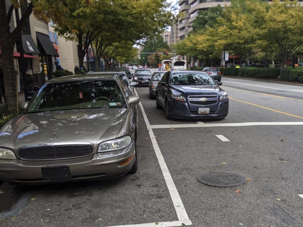
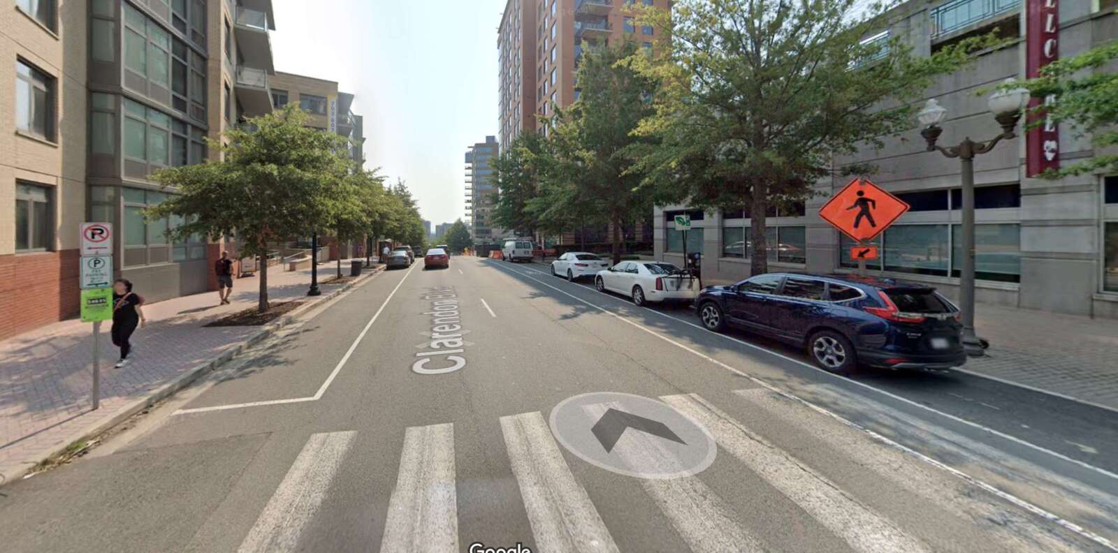
Many drivers have circled around blocks in Arlington, looking for a quick parking spot to slide into and pick up a mobile food order.

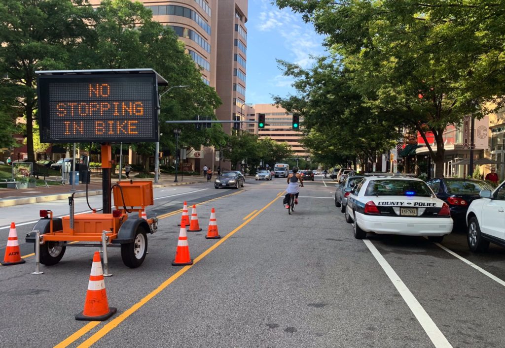
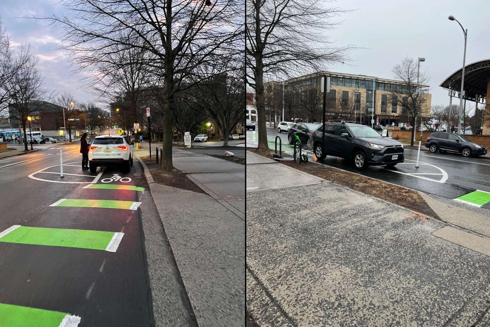
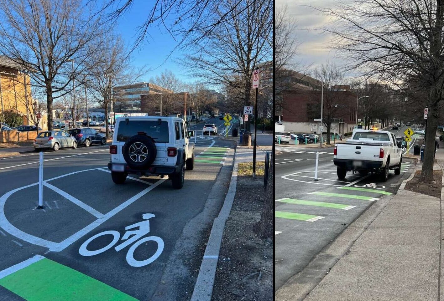
Or they may have skirted around a car double parked in a bike or vehicle travel lane, hazards flashing, rather than waiting for a spot to appear.

During the pandemic, the county created temporary “pick-up, drop-off spots.” Coming out of the emergency, most of these spots were converted to short-term parking spaces, with input from business improvement districts and neighborhood stakeholders, Dept. of Environmental Services spokeswoman Katie O’Brien tells ARLnow.

Still, food deliveries and contactless ordering options are likely here to stay. Some businesses that are now more reliant on takeout and delivery are concerned they’ll soon lose revenue as curbside parking spots are repurposed for, among other uses, protected bike lanes.

The county says one solution could be adjusting parking times, armed with data that will be collected through new parking pilot program.

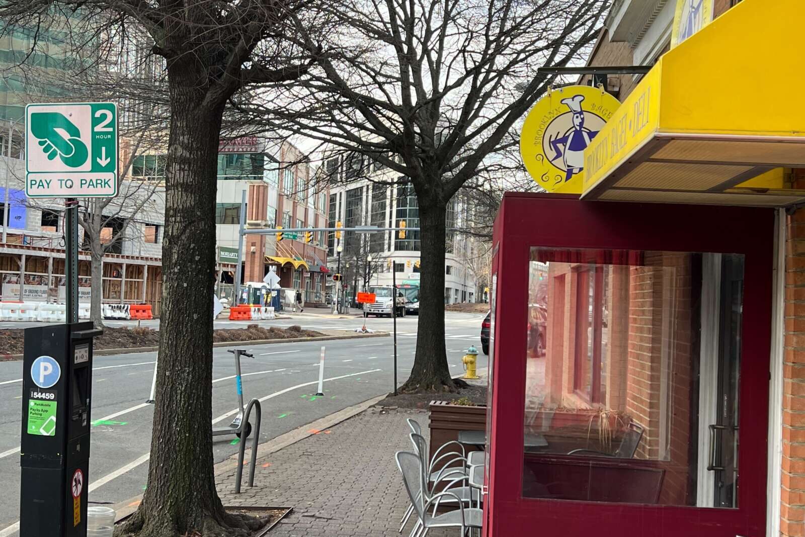
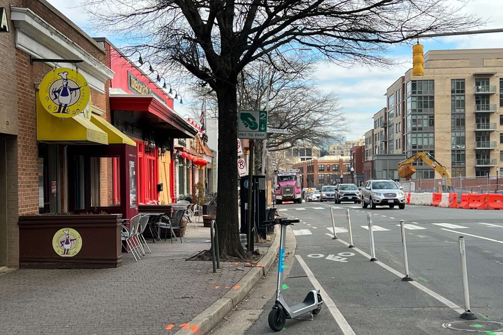
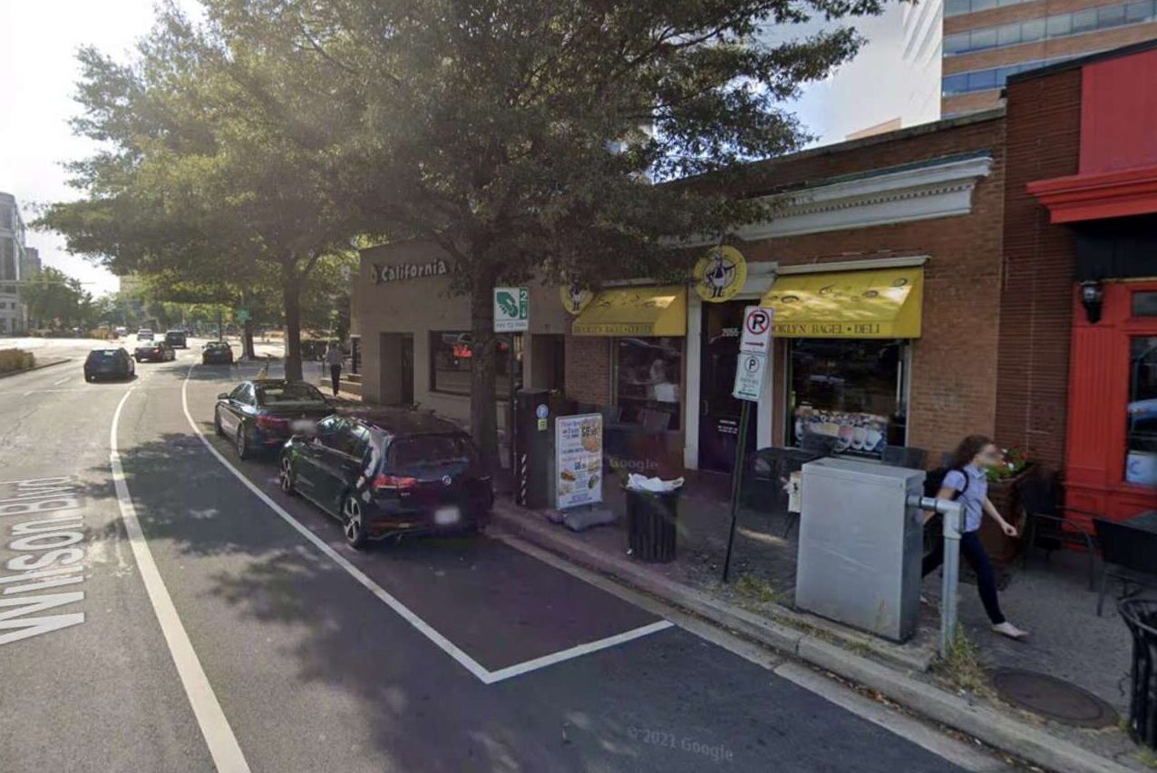
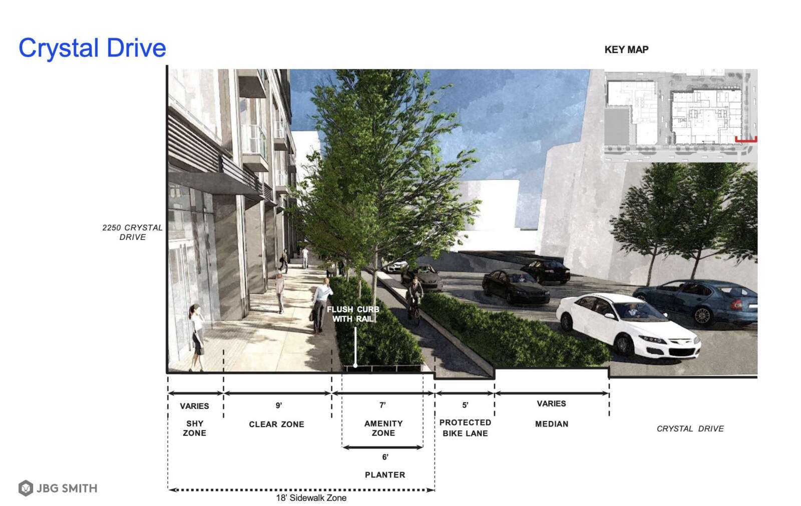
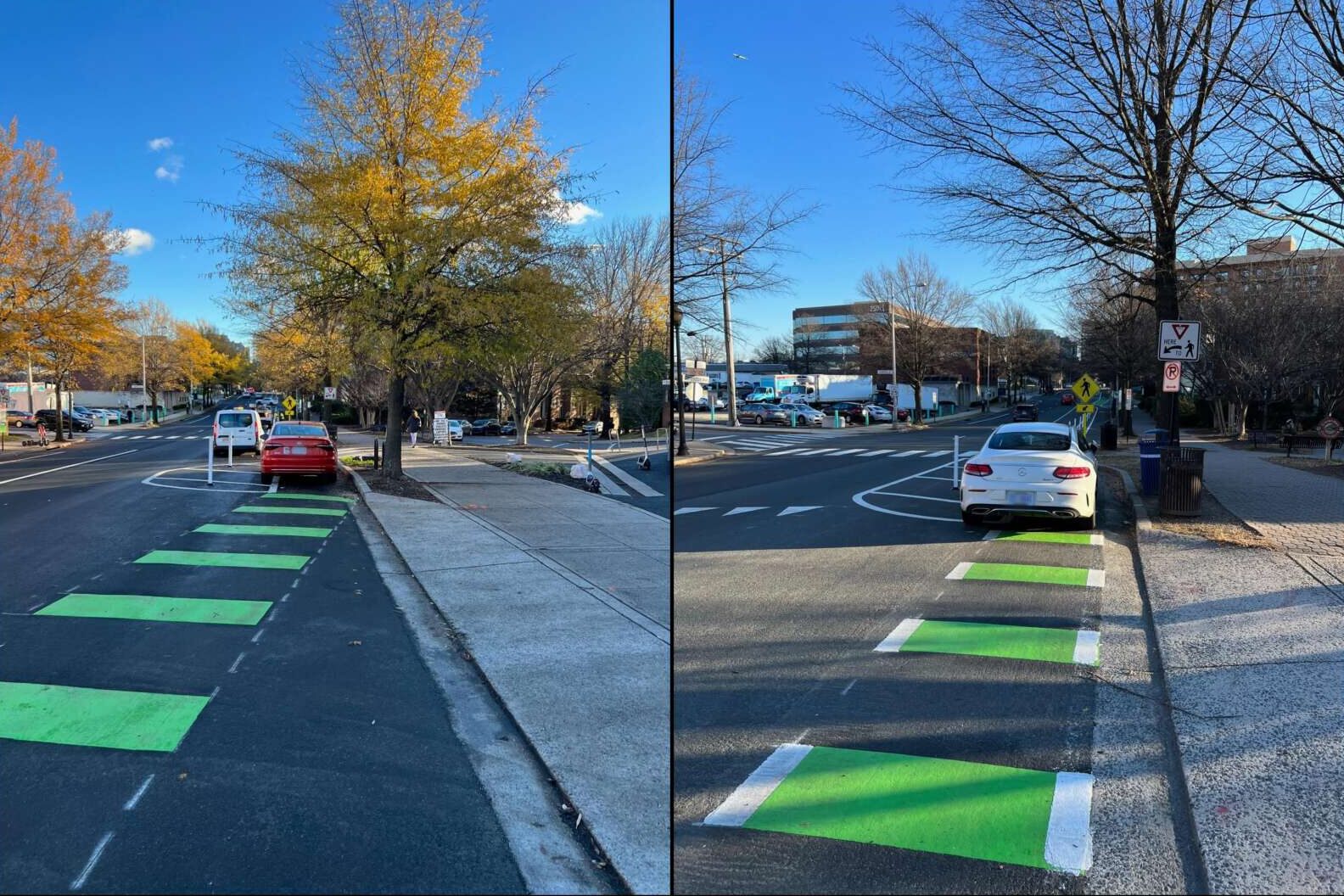
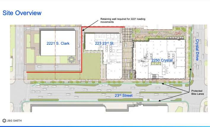
Brooklyn Bagel Bakery in Courthouse (2055 Wilson Blvd), for instance, says it has lost four spots to a bike lane that developer Greystar agreed to install during construction for the “Landmark” block redevelopment project across the street.

(There is also a small private parking lot behind the retail strip.)

Speaking on behalf of Brooklyn Bagel — as well as neighboring businesses Courthouse Kabob, California Tortilla and TNR Cafe — Dawn Houdaigui asked the Board on Jan. 21 for a compromise.

“We believe in the protected bike lanes that have already gone in, that are blocking our spaces now, but we need to understand how we can share the space in front of us and how things can be reconsidered,” she said during the public comment period. “This is super important to the businesses who changed our business model after Covid. We have a lot of deliveries, we have people who come run in out front.”

She asked for more notice of proposed changes as well as notice when spots will be lost.

“A letter went out — supposedly it was hand-delivered by someone having lunch at our bagel store — and supposedly an email went out the same day,” she said. “We missed the meeting. Only one person from the businesses were there.”

County Board Chair Christian Dorsey and County Manager Mark Schwartz referred her to the county’s ombudsman and constituent services.

In general, the county is looking into the twin issues of temporary parking and combatting double-parking both systematically and on a case-by-case basis, O’Brien said.

As for specific cases, like Brooklyn Bagel’s, the county follows a six-step public engagement process for projects that impact neighbors, businesses and property owners.

(more…)


Two 30-story apartment towers proposed for Crystal City received a green light from the Arlington County Board on Saturday.

The proposal from JBG Smith will redevelop a block at the intersection of 23rd Street S. and Crystal Drive that is currently home to a vacant office building from the 1960s and, until demolition started earlier this year, a strip of one-story retail that included the restaurant Jaleo.

The west tower (223 23rd Street S.) will have 613 units and 8,000 square feet of retail. The east tower (2250 Crystal Drive) will have 826 units and 14,929 square feet of retail. A north-south vehicular access will run between the two towers and is intended to take parking and retail loading off the nearby streets.

This project also includes an approximately 8,025-square-foot interim public green space, which the Crystal City Sector Plan envisions becoming a 13,000-square-foot open space.

A 5,574-square-foot walkway lined with planters and seating will run east to west and connect pedestrians to a relocated entrance to the Crystal City Shops, an underground mall, as well as retail at the base of the 2250 Crystal Drive building.

JBG Smith will rebuild 23rd Street S. from Crystal Drive to Richmond Highway, adding 1,600 new linear feet of protected bike lanes across Crystal Drive and 23rd Street S. The developer will also add a mid-block crossing where the north-south connector intersects with 23rd Street S. and floating bus stops on either side of the street.

The project is set to achieve LEED Gold certification. JBG Smith will contribute more than $8 million to affordable housing and set aside 34 off-site affordable units at one of its existing Riverhouse apartment buildings in Pentagon City. Open space in the development is set to be redeveloped in the near future.

References to Missing Middle — which was the next item for discussion — broke into comments from County Board members.

“The big picture here is 1,400 additional units that are in one of our transit corridors. This is an example of the type of project that across perspectives, most everyone supports,” said Board member Matt de Ferranti. “This is part of smart policy to prevent further ex-urban development. It’s part of good policy for our community.”

Board member Takis Karantonis hailed it as “a very good project.”

“This is between one of the nation’s most vibrant innovation districts, [Amazon’s] HQ2, the anchor, and everything that comes around it, and the Virginia Tech campus a few blocks down the street,” he said.

He went on to connect the project to the Missing Middle housing proposal, which was discussed in public comments for more than five hours after Board members voted on JBG Smith’s redevelopment plans.

“These people will live there and after a while, we would like them to have more opportunities to stay in Arlington and continue to be productive residents at the core of our economic growth machine,” he said.

Board members and Planning Commission representative Jim Lantelme applauded JBG Smith’s plans to reuse unoccupied parking garage spaces for residents.

“That’s something we encourage and would like to see more of,” Lantelme said.

Staff and Lantelme mentioned changes JBG Smith made in response to comments from advisory commissions and staff. They said these changes improved the pedestrian experience by setting the height of the towers farther back from the street and redesigning the larger public plazas to include more plantings and a pet relief area.

Board Vice-Chair Libby Garvey thanked JBG Smith the changes made.

“The fact that we don’t have a lot of speakers here to tell us how bad the plan is shows that the work has really been well done, ” he said. “Arlingtonians are not shy about letting us know if there’s something they don’t like.”


Drivers have been blocking a new PBL in search of the perfect PSL.

Last November, as part of a 2022 Complete Streets project, Arlington’s Dept. of Environmental Services replaced two parking spots with a protected bike lane, or “PBL,” on the east side of Clarendon Blvd. It also added new free, 15-minute parking spots at N. Danville Street, to accommodate those who would have used the two former spots when picking up their coffee order from the nearby Starbucks.

“All those legally parked automobiles are actually protecting bikers who are using the bike lane to the right,” noted DES spokesman Peter Golkin.

But illegally parked vehicles caused a different problem. Flouting a no-parking sign, cars — and even a county pickup truck — parked where the spots used to be, partially or completely blocking the bike lane. Local cyclist Jeff Hopp said he saw cars blocking the bike lane “all day, every day,” to access the Starbucks location across the street from the Whole Foods.

“In the area near Starbucks, [the county] created a hazard to cyclists instead of a safe PBL,” he said. “The county removed two parking spaces in the area when creating the PBL but the design of the PBL at this spot allows for drivers to drive into and park in the PBL while they ‘run in’ to Starbucks to grab their drinks.”

Public feedback helped guide the designs, Golkin says, but in response to the reality on the ground, the county recently made it harder to park there.

“Extra bollards were added this month to make such an abuse less tempting and to encourage drivers to look for the free and pay spaces just a few feet down the road,” Golkin said.

Hopp, who had notified the county about the issue, says he appreciates the changes.

“I feel the county was responsive to a conversation about a solution and, in the end, I feel they made the right decision to install additional bollards around the edges,” he said. “With these additional bollards, vehicles will not have enough room to pull into the PBL in this area — unless drivers just mow them down, which I’ll bet has happened before.”


The Rosslyn farmers market (staff photo by Jay Westcott)

Student Organizes Concert for Ukraine — “The granddaughter of a refugee from Ukraine who was forced to leave her home due to World War II, Sofia Parfomak knows all too well what millions of present-day Ukrainians are going through since the Russian invasion began in February. Parfomak, a dual enrollment student at Marymount University and Bishop O’Connell High School, has taken the crisis to heart.” [Marymount University]

Synetic Prepares for New Season — “Arlington-based Synetic Theater has announced plans for its 2022-23 season, which will explore ‘otherness’ and relationships to those who are different. ‘When I first came to this country as a refugee, I did not speak the language; it was disorienting but also magical,’ said Paata Tsikurishvili, cofounder and artistic director of the troupe.” [Sun Gazette]

Video: Drivers Blocking Bike Lanes — “Photo came out in ARLnow that police put a lighted sign to stay out of bike lanes so pulled a few clips from yesterday’s ride, which could be from any day I ride. I don’t even use the bikes lanes much then drivers get mad at me. Am sure drivers will give the sign all the attention it deserves.” [YouTube]

Nearby: Falls Church Transforming — “Under the guidance of the Falls Church City Council, the recent developments have increased City property tax receipts to fund such civic projects as constructing the new Meridian High School, renovating and expanding the Mary Riley Styles Library and updating and expanding City Hall, all while reducing the city’s property tax rate by roughly nine cents per thousand dollars of assessed valuation.” [Northern Virginia Association of Realtors]

It’s Friday — Clear throughout the day. High of 85 and low of 70. Sunrise at 5:57 am and sunset at 8:34 pm. [Weather.gov]


Five “Complete Streets” roadway project designs are ready for community feedback.

As part of Arlington County’s Complete Streets program, the projects aim to improve safety and access on local roads. The changes are usually made in conjunction with repaving projects and mostly involve re-striping the roadway, sometimes at the expense of parking or through lanes.

According to the project website, the five stretches of roadway that are up for improvements this year are:

  • Wilson Boulevard — N. George Mason Drive to N. Vermont Street (Bluemont)
  • Clarendon Boulevard — N. Garfield Street to N. Adams Street (Clarendon / Courthouse)
  • Clarendon Boulevard — Courthouse Road to N. Scott Street (Courthouse / Rosslyn)
  • S. Abingdon Street / 34th Street S. — Bridge over I-395 (Fairlington)
  • N. Ohio Street — 12th Road N. to Washington Boulevard (Madison Manor / Highland Park-Overlee Knolls / Dominion Hills)

Those interested in giving feedback on the designs can fill out an online form on the project website through Wednesday, July 6. The final plans are expected to be released in late summer or fall.

S. Abingdon Street bridge

The design plan for the bridge over I-395 in Fairlington (via Arlington County)

The county’s Department of Environmental Services plans to remove under-utilized parking from the S. Abingdon Street bridge over I-395 in Fairlington.

The project would add buffer zones to the bike lanes to improve access for cyclists and safety for those using the sidewalks, while narrowing the travel lanes for speed control, according to its concept design summary.

Residents previously expressed concern about drivers speeding on the bridge while students walk to and from school.

The bridge is also part of a planned VDOT rehabilitation project, which will include adding concrete protective barriers and replacing bearings.

Wilson Blvd between N. George Mason Drive to N. Vermont Street

A portion of the design plan that adjusts turn lanes on Wilson Blvd (via Arlington County)

The segment of Wilson Blvd in Bluemont between N. George Mason Drive and N. Vermont Street, near Ballston, could see additional high contrast markings at high conflict crosswalks, according to the designs.

The plan is to reduce Wilson Blvd to one travel lane in each direction, with a center turn lane into N. George Mason Drive to better control vehicle speed.

The design plan also includes modifying markings to extend the left turn lane near N. George Mason Drive. The project would also add bike lanes and a continuous center turn lane east of the fire station.

The section of Wilson Blvd between George Mason and the Safeway grocery store saw similar changes last year.

Clarendon Blvd from N. Garfield Street to N. Adams Street

A portion of the design plan of the project on Clarendon Blvd near N. Garfield Street (via Arlington County)

A segment of Clarendon Blvd is set for changes between N. Garfield Street and N. Adams Street, in the Clarendon and Courthouse area, including the removal of nine parking spots.

Apart from reducing parking spaces, the project team also plans to add high contrast markings at high conflict crosswalks. A bike box is set to be added at Clarendon Boulevard’s intersection with N. Garfield Street to make turning easier for cyclists.

The plan will also add parking protection to the bike lane between N. Garfield Street and N. Edgewood Street. A county summary says residents in the area expressed concern about speeding, unsafe pedestrian crossings and double parking in the bike lane.

(more…)


Demolition of the former Jaleo restaurant building in Crystal City began this week, as the site plan review process for a redevelopment on the block kicked off earlier this month.

The proposal by JBG Smith is making its way through the county approval process to turn the 2250 Crystal Drive and 223 23rd Street S. buildings into two apartment towers with ground floor retail and an underground parking garage.

The two 30-story apartment towers replacing the former restaurant space and the aging 11-story “Crystal Plaza 5” office building would include:

  • A “West Tower” at 223 23rd Street S. that would be 309 feet tall and have 613 dwelling units, 4,379 square feet of retail and 184 parking spaces
  • An “East Tower” at 2250 Crystal Drive that would be 304 feet tall, and have 827 dwelling units, 13,059 square feet of retail and 249 total parking spaces

An underground garage structure would serve both buildings, averaging 0.3 spaces per unit, and connect to the existing parking structure on the block, county planner Michael Cullen said in a presentation earlier this month.

JBG Smith also proposes moving the plaza and pedestrian access to a collection of underground shops and corridors to the northwest corner of the east tower.

Once approved and constructed, the buildings would make the block, called “Block M” in the 2010 Crystal City Sector Plan, 80% residential. Most of the buildings on Block M are owned by JBG Smith.

There was one adjustment in JBG’s most recent presentation to the Site Plan Review Committee (SPRC).

Along the east-west connection, JBG Smith added a park option based on community feedback at the Long Range Planning Committee, said Madhvi Shukla with JBG Smith. In both options, the whole east-west connection, which links Crystal Drive and another path to 23rd Street S., would be publicly accessible.

“The section that isn’t chosen for the park would have a public access easement to ensure whichever park space is chosen has public access to both Crystal Drive and to the underground entry,” she said.

A graphic of the east-west connection for the 2250 Crystal Drive project shows a new location option for a park on the right (via JBG Smith)

Three park spaces are incorporated in the plan, which ultimately will total 26,000 square feet, but one of the spaces will be phased into its final size over time, Shukla said.

The 13,000-square-foot park envisioned in the 2010 Crystal City Sector Plan would not be fully finished unless JBG Smith redevelops the Crystal Plaza 6 apartments at 2221 S. Clark Street. In the interim, the park will total about 8,000 square feet on the site’s southwest corner, and an alley between the two towers will be a dead end.

The north-south connection between 23rd Street and the east-west connection would be designed to prioritize pedestrians, with 8 and 9-foot sidewalks, elevated planters for protection and string lights to signal it’s a pedestrian-first zone, Shukla said.

On 23rd Street, there will be protected bike lanes going in both directions, Shukla said, as well as a protected bike lane on Crystal Drive. While the 23rd Street realignment will narrow the roadway, it will have the same number of lanes without a median.

A rendering shows what 23rd Street S. will look like with protected bike lanes and without a median (via JBG Smith)

On June 13 and July 21, there will be virtual SPRC meetings to discuss the project. Planning Commission meetings and a County Board vote are expected this fall.


A longtime project to make pedestrian, cycling and transit upgrades to Army Navy Drive has taken the next step forward.

Arlington County has sent the project out for bidding by contractors, while staff continue to acquire the easements needed for construction.

“Project staff expect the easement process to be wrapped up by the time the construction contract appears before the County Board for approval — anticipated later this summer,” Dept. of Environmental Services spokesman Nate Graham said.

Construction could start this fall and be completed in the summer of 2025, according to the project webpage. Initially, the county had expected construction to begin in spring 2020 and be complete this spring, but extra tasks required to receive federal aid dragged out the planning process by a few years.

A coalition of local transit advocates celebrated the news, which has been seven years in the making.

Crashes are a frequent occurrence along Army Navy Drive. The $16.87 million project aims to reduce conflicts among cars, buses, bikes and pedestrians with narrower lanes — to slow down vehicle traffic — as well as bus-only lanes, protected left turns and signalized right turns, clearer sidewalks and shorter crosswalks.

The south side of Army Navy Drive will have a two-way bike lane protected by a line of trees. This will link to a future two-way bicycle lane planned for S. Clark Street, between 12th Street S. and 15th Street S. and the planned protected bike lanes on S. Eads Street, which will run past both phases of Amazon’s HQ2.

Bike lanes on Army Navy Drive are visible in this 2021 rendering of Amazon’s HQ2 Phase 2 campus (via NBBJ/Amazon)

“The project will rebuild Army Navy Drive within the existing right-of-way as a multimodal complete street featuring enhanced bicycle, transit, environmental and pedestrian facilities,” the county says. “The goal of the project is to improve the local connections between the Pentagon and the commercial, residential and retail services in Pentagon City and Crystal City.”

The new Army Navy Drive will be reduced to two through lanes in each direction, narrowing to one lane east of S. Eads Street.

The reduction will accommodate a bus lane between S. Joyce Street and S. Hayes Street so that buses will not block traffic while loading passengers. This dedicated transit lane will help extend an existing network of bus lanes from the City of Alexandria to Crystal City into Pentagon City.

Plans for Army Navy Drive (via Arlington County)

Additional improvements include replacing raised medians with planted ones and planting greenery to reduce stormwater runoff. Five intersections will get new traffic signal equipment.

The project’s early phases kicked off in the summer of 2015 with a traffic analysis evaluating how biking, walking, scooting and driving conditions would be impacted in 2020 and 2040 by the ongoing redevelopment of Pentagon City and Crystal City. That has since been expedited by the ongoing construction of HQ2.


Part of the proposed resurfacing changes for N. Lynn Street (via Arlington County)

Arlington County plans to resurface a stretch of N. Lynn Street in Rosslyn to improve the driving and cycling experience.

The project is part of the county’s annual effort to resurface about 100 lane miles of roadway, prioritizing those in the most need of upgrades and those adjacent to development, schools or county-led capital projects. It is the second of two “complete streets” resurfacing projects proposed for 2021, the other being changes to Wilson Blvd in the Bluemont neighborhood.

The plans for N. Lynn Street extend from the exit ramp for Arlington Blvd (Route 50) to Wilson Blvd. Proposed changes include adding “sharrows” — encouraging drivers to share the road with cyclists — connecting with existing bike lanes, plus buffering existing bike lanes, improving markings for a bus stop, and adding markings where drivers have to cross a bike lane to turn right.

This concept design accommodates the existing traffic by maintaining the same vehicular lane configurations, it adds additional separation between people driving and biking with protected and buffered bike lanes, it enhances the network connectivity with improved bike markings, and it improves visibility of right turn conflicts with the application of green markings,” said county transportation planner Catherine Seebauer during a recorded presentation.

A segment of N. Lynn Street that will be resurfaced (via Arlington County)

Right after the Arlington Blvd exit ramp, the county proposes adding northbound bike “sharrows” — markings indicating where cyclists and vehicles have to share the road — that will link up to the existing bike lane after the intersection with Fairfax Drive.

“That exit ramp is a VDOT-controlled road, so Arlington County is somewhat limited in what changes we can make there, but a reconfiguration of those on-off ramps is being looked at as part of [Core of Rosslyn Transportation Study], so long-term changes are in development for that intersection,” Seebauer said.

The vehicle lanes will be narrowed after Fairfax Drive, though they will still meet the county’s standard width of 11 feet, she said.

“The extra room allows us to provide more room for other facilities,” she said, including upgrading the existing bike lanes to be protected bike lanes. “They will be separated from vehicle lanes by parked vehicles and a small buffer strip.”

A segment of N. Lynn Street that will be resurfaced (via Arlington County)

Where the bike lane merges with an existing bus stop, the bus stop markings will be improved. Further up, close to the intersection with Wilson Blvd, green paint and bollards will alert drivers and cyclists about a conflict point, where drivers have to cross the bike lane to make a right turn.

From the exit ramp to Wilson Blvd, four parking spaces will be removed to improve sightlines, Seebauer said.

An online comment period for the project closed yesterday (Tuesday). The resurfacing work will be done later this summer and fall.


Peak Heat, Statistically Speaking — “Based on history, we are now at the hottest point of the summer. While it can still be brutally hot in the weeks ahead (and probably will be at times), we are about to begin our gradual descent into winter, using average temps.” [Capital Weather Gang, Twitter]

Arlington Home Prices Keep Rising — “A total of 369 properties went to closing last month, up 62 percent from 228 in June 2020… The average price of single-family homes in the county was $1,217,376 last month, up 9.8 percent from $1,109,179.” [Sun Gazette]

Protected Bikes Lanes for HQ2? — “Amazon.com Inc.’s newest PenPlace design would add protected bike lanes along a key roadway adjacent to the 11.6-acre campus and a new bike share station near the planned ‘Helix’ tower. During Arlington’s Long Range Planning Committee’s virtual meeting Tuesday, Amazon’s HQ2 landscape architect Scape presented its revised vision for the site’s 2.1 acres of open space and transportation networks.” [Washington Business Journal]

Woman Finds Bullet Hole in Window — “3900 block of Columbia Pike. At approximately 6:09 a.m. on July 13, police were dispatched to the report of suspicious circumstances. Upon arrival, it was determined that the victim was awoken at approximately 10:00 p.m. on July 12 to a loud pop sound. The following morning, she discovered a bullet hole in her window.” [ACPD]

Affordable Apartments Set for Renovation — “Arlington County is backing away from plans to buy part of the Park Shirlington apartment complex in South Arlington as the developers are instead pitching a full renovation of the affordable community. The county is set to deliver a $22.7 million loan to power the rehabilitation of all 293 units on the 15.7-acre parcel.” [Washington Business Journal]

Arlington Is a ‘Top Digital County’ — “Arlington County is once again ranked among the top digital counties in the nation. The Center for Digital Government and National Association of Counties has named Arlington to the No. 2 spot for their 2021 awards in the 150,000-249,999 population category.” [Arlington County]

New Record for W-L IB Program — “W-L students surpassed their worldwide peers in diploma pass rate, average score pass rate, and the average points earned by diploma candidates. In addition, the overall pass rate for all W-L students participating in [International Baccalaureate] classes, including Diploma Candidates and Course Candidates, is the highest in the 25-year history of IB at W-L at 92.6%.” [Arlington Public Schools]

‘Arlington Tech’ Students Earn Degree — “Seven Arlington Tech Class of 2021 graduates are the first APS students to earn Associates Degrees by taking courses offered through both Arlington Tech and the Career Center.” [Arlington Public Schools]


A major redevelopment proposal in Rosslyn is facing pushback from those who think it doesn’t do enough for cyclists and pedestrians.

McLean-based Jefferson Apartment Group is proposing a 27-story mixed-use residential complex with 424 units at 1901 N. Moore Street, replacing the 1960s-era RCA building. Two towers will be connected at the top by a penthouse and at the base with ground floor retail.

But as the project moves through the public review process, some have expressed concerns a number of transportation-related issues: the proposed unprotected bike lanes along 19th Street N., the project’s parking ratio, and the pedestrian experience along the block.

These three topics are likely to resurface during a follow-up Site Plan Review Committee meeting on Monday, March 15 — and perhaps later this spring, when the project will go before the Planning Commission and the County Board.

“We’ve been identifying issues, responding to citizen comments, and having very good discussions with surrounding community groups,” said Andrew Painter, an attorney with land use firm Walsh Colucci, during the first SPRC meeting last month.

Staff members are considering some protections for the proposed 19th Street bike lanes in response to public input.

“It may be possible to provide an additional level of protection in one direction” on the block from N. Lynn to N. Moore streets, said Principal Planner Dennis Sellin, adding that staffers “don’t see the capacity to do it in both directions.”

Arlington Transportation Commission Chair Chris Slatt said 19th Street N. has enough traffic to qualify it for protected or buffered bike lanes.

Another hot issue was the parking ratio of .625 spaces per residential unit. Jefferson is proposing 290 total spaces, split among 265 residential spaces, 15 retail and 10 visitor spaces, according to a staff report.

“The goal is to right-size the garage to meet the market demand but not provide extra that incentivizes people to drive,” Painter said.

Although the proposal is within county guidelines, Sellin said “we would certainly accept a lower ratio.” The minimum is .2 spaces per unit but the lowest Sellin said he has seen proposed is .38 spaces per unit.

North Rosslyn Civic Association representative Terri Prell said people, particularly the elderly, still need cars for tasks such as grocery shopping.

“You have to understand this is a residential community, not a business community,” she said.

Lowering the ratio would attract people who want to lead a car-free lifestyle, Slatt said, asking for data on space utilization rates.

The parking needs to be built partially above ground due to “particularly dense rock” and Metro tunnels. To conceal the parking above the retail and below the residential units — and add public art — the architect is exploring adding graphics by local artists, said architect Shalom Baranes.

The Metro tunnels add another complication: a longer expected demolition process.

As for the pedestrian experience, some members were concerned that the block will be too long and there will be no opportunities for cutting through it. Sellin said the block is comparable to others at 400 feet long.

SPRC Chair Sara Steinberger said knowing the length “may not change the community’s feelings on what feels like a longer stretch of block when you have large buildings covering a greater area.”

In 2017, Weissberg Investment Corp., which developed the RCA building in the 1960s, filed plans to redevelop the RCA site — but those plans were put on hold indefinitely in 2018. Jefferson started filing application materials in May 2020.


Thanks to some push from local advocates and the county’s Transportation Commission, a new mixed-use development at 1900 Crystal Drive could be required to include protected bike lanes on Crystal Drive, a long time sore spot for bicyclists in the area.

There are bicycle lanes on Crystal Drive, but motorists notoriously ignore the lane markers and drive or park in the lanes designated for bicycle traffic.

“It’s almost a hoax on bicycle riders to say there’s a bike lane here when as a practical matter there isn’t,” said Transportation Commissioner Jim Lantelme.

At the Transportation Commission meeting Thursday night, the Commission recommended that developer JBG Smith be required to turn the existing bicycle lanes into protected lanes while adding new protected bike lanes to 18th Street S.

“First the Commission recommended that the County Board require JBG Smith to build protected bike lanes on 18th Street either as part of their upcoming 1900 Crystal Drive development or as part of the already-approved Central District Retail development,” Transportation Commission Chair Chris Slatt said in a press release. “Furthermore the Commission recommended that the County Board direct staff to study an appropriate cross-section for Crystal Drive that would safeguard those on bikes and scooters and, if schedules permit, incorporate the results of that study into the public space designs for 1900 Crystal Drive and any other unbuilt development approved along the Crystal Drive corridor.”

The last recommendation from the Transportation Commission was that the County and JBG develop a temporary southbound protected bike lane on Crystal Drive if the public process isn’t completed in time to be incorporated into the 1900 Crystal Drive plans.

County staff said in their report that making the lanes protected would require further traffic studies and analysis, with staff noting that a new bike lane would carve out part of the street and would have an impact on open space, traffic, or parking. That kind of impact would require a public process that would take additional time.

The developer said they hope to start construction at the end of March, with the streetscape being one of the last parts of the project to be completed.

“I worry there is the possibility we would not have a final decision-ready on Crystal Drive ready before this window closes,” Slatt said.

“There’s a lot of good, new information heard tonight,” said Gillian Burgess, chair of the Bicycle Advisory Committee. “Crystal Drive bike lanes are blocked so often that they’ve become the test case for new apps and data collection that seek to test how often bike lanes are blocked.”

With three site plans in the area, Burgess said the County has a rare opportunity to improve the conditions for cyclists and other road users there.

The 1900 Crystal Drive proposal is set to be discussed by the Planning Commission tonight (Monday).

Photo via Google Maps


View More Stories