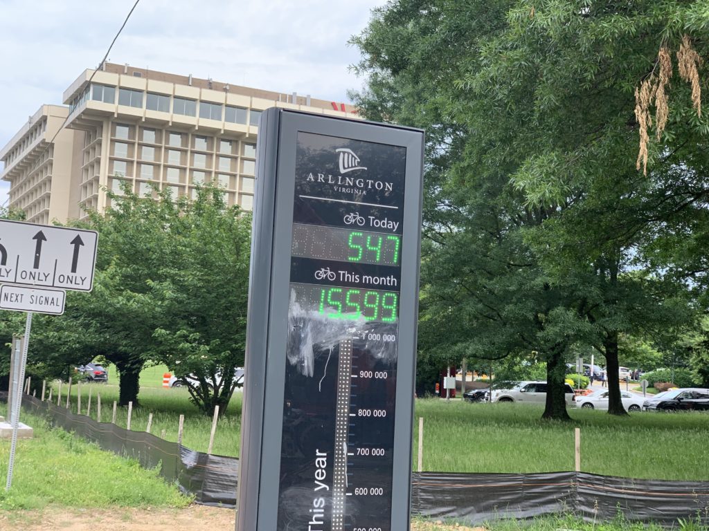
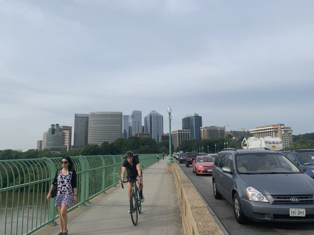
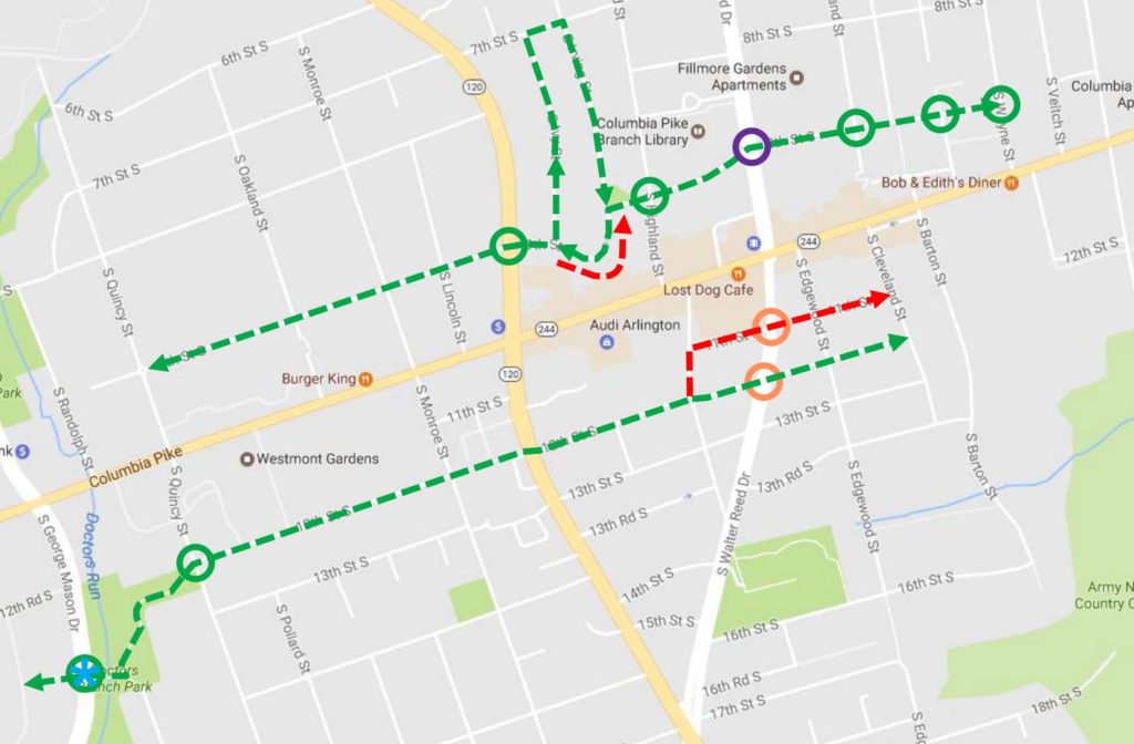
Modern Mobility is a biweekly opinion column. The views expressed are solely the author’s.

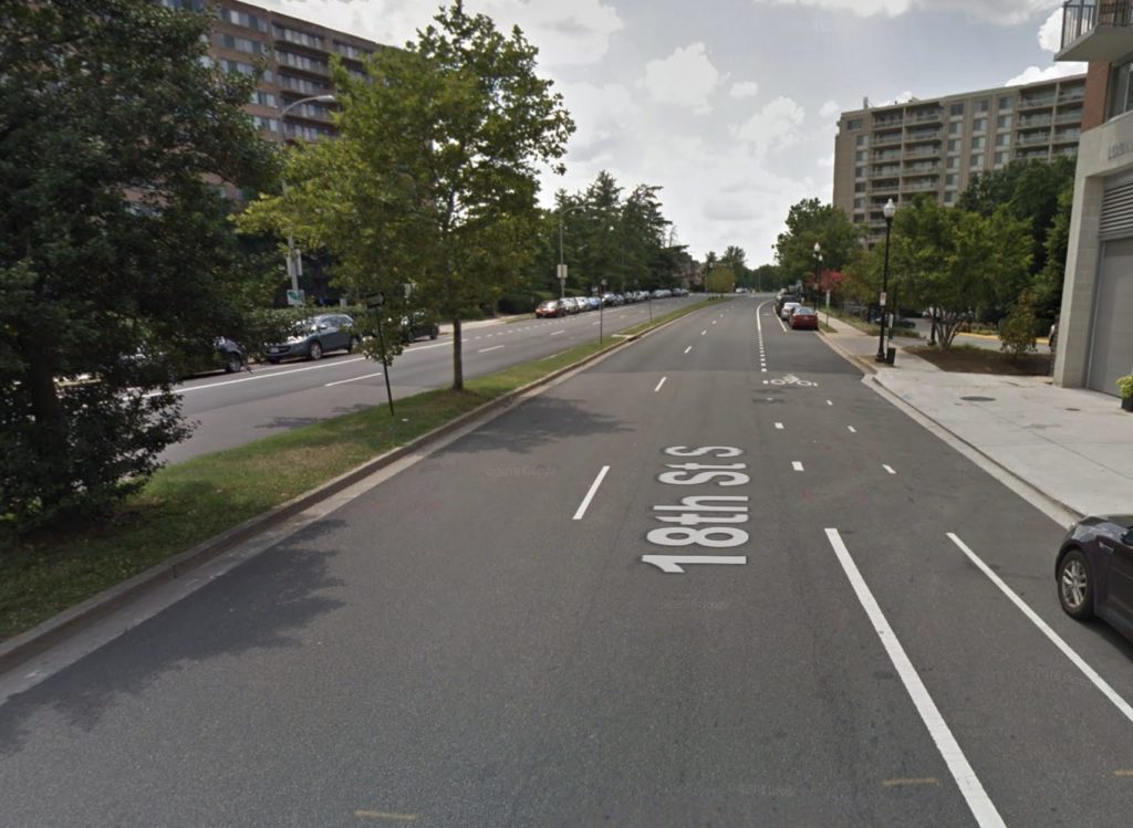
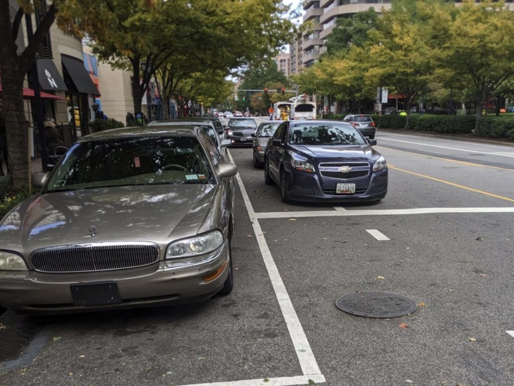
At this point, the bike lane blocking problems on Crystal Drive are well understood. The combination of popular retail establishments, standard painted bike lanes and entitled drivers leads to non-functional bike lanes.

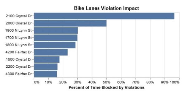
The parkingdirty.com data-gathering effort I led back in 2016 found that they are blocked between 50% and 64% of waking hours.

The “data-protected bike lane” effort last year by the folks at OurStreets found that during morning rush, evening rush and lunch time, the Crystal Drive lane was blocked nearly 90% of the time.

The situation on Hayes Street by the Pentagon City Metro entrance is similarly dire, though less well-studied. Parkingdirty.com found they were blocked between 51% and 63% of waking hours and it is a common complaint area on Twitter.

Now a development project is moving forward that is currently on-track to duplicate these same mistakes. JBG Smith’s 1900 Crystal Drive project proposes to build two large residential towers on Crystal Drive between 18th and 20th Streets. The project will upgrade the sidewalks on its street frontage and provide new on-street parking spaces, but it proposes unprotected, paint-only bike lanes on both Crystal Drive and 18th Street.

To make matters worse, the project proposes significant new retail all along Crystal Drive and the corner of 18th and Crystal Drive will eventually be home to a 2nd entrance to the Crystal City Metro Station. The Metro station entrance and the new retail will generate significant pick-up and drop-off activity; where will people do this pick-up and drop-off? Where will people park for “just a minute” while they run into the retail? Our experience on Crystal Drive and Hayes Street give us the answer: in the bike lane.

Calls during the Site Plan Review (SPRC) process to provide a protected bike lane along the street frontages have not been accepted by staff, at least as of the last SPRC meeting. Staff acknowledges that the Crystal Drive bike lanes are a problem, but maintain that two blocks of protected bike lane in front of this one development aren’t helpful and that instead the County must find a comprehensive solution for this entire stretch and that the curb-to-curb width being provided by the development is sufficient for this.

Unfortunately, they have not provided a plan to find this comprehensive solution. They have not indicated a timeline for finding this comprehensive solution. They have not identified a funding source for this comprehensive solution.

(more…)


Rail Project Will Include New Pedestrian Bridge — “As part of the Long Bridge project, a stand-alone bike and pedestrian bridge would be built upstream from the new rail bridge, allowing people to walk or bike across the Potomac River between the D.C. waterfront and Crystal City in Arlington. Virginia officials said the state plans to build that pedestrian and bike bridge.” [Washington Post]

Weekend Propane Leak in Ballston — Per the Arlington County Fire Department: “FD and Haz-Mat units are on scene in the 4000 blk of Fairfax Dr investigating a report of a large propane [tank] leaking… Crews located a large propane tank leaking at a building under construction. The leak has been controlled and units are remaining on scene to [perform] air monitoring.” [Twitter]
ACPD Increasing Bike Lane Enforcement — “The county… says that Arlington police are stepping up their enforcement of bike lane violations. Cycling advocate Gillian Burgess says that she has seen evidence of more police presence, though she believes that the problem will ultimately be solved by better street design, not enforcement.” [WAMU]

Rosslyn Startup Gets Big Investment — “Arlington-based Advantia Health, a growing national provider of women’s healthcare, announced a $45 million investment by BlueMountain Capital Management, LLC (BlueMountain), a subsidiary of Assured Guaranty Ltd. This funding comes after a year of rapid growth.” [Advantia Health via Potomac Tech Wire]


Arlington could be extending a protected bike lane in Crystal City, a block from Amazon’s future home.

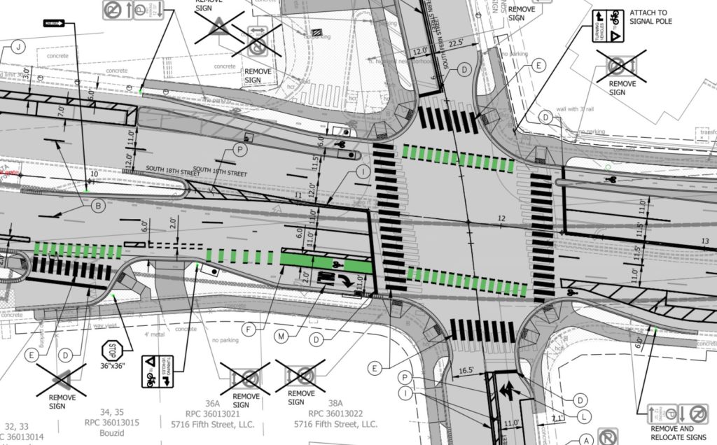
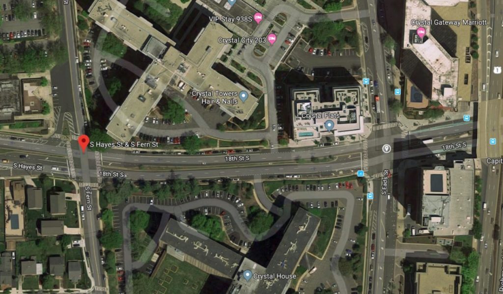
The county posted on its website that intends to “rebuild 18th Street South between Fern and Eads Streets in order to continue the existing South Hayes Street protected bike lane further east.”

Designs on the website show the current unprotected bike lanes being converted to protected lanes without a loss of vehicle travel lanes. Additional pedestrian-safety upgrades are also planned.

A group of residents advocating for eliminating single occupant car commuting at Amazon’s future headquarters celebrated the news. On Twitter, the group thanked DES and wrote the planned infrastructure was “GOOD NEWS!”

https://twitter.com/CarFreeHQ2/status/1191824320194060288?s=20

“The project will improve the safety of the South Fern Street and 18th Street South intersection by removing the southbound right turn slip lane and building curb extensions on all four corners of the intersection to reduce pedestrian crossing distances,” said Department of Environmental Services (DES) spokesman Eric Balliet.

“It will also extend the existing protected bike lanes on South Hayes Street (west of the Fern St/18th St intersection) along 18th Street from South Fern to South Eads Street,” he added.

The project will include features for pedestrians, like high visibility crosswalks. Per the county website:

Additionally, the intersection of 18th Street South and South Fern Street will be rebuilt to decrease crossing distances and decrease the existing impervious area. This will improve pedestrian, bicycle and vehicle safety at the intersection.
The project will also add stormwater retention, replace a water main and upgrade the streetscape, helping improve the connection between the core of Pentagon City and Crystal City.

The work is part of the 18th Street S. Complete Streets project and is expected to cost the county $5.3 million, which will be paid for by funds earmarked in the Capital Improvement Plan for fiscal years 2017-2026 and a Crystal City transportation infrastructure fund.

Near Amazon’s HQ2, cycling advocates have also successfully pushed for more protected bike lanes.

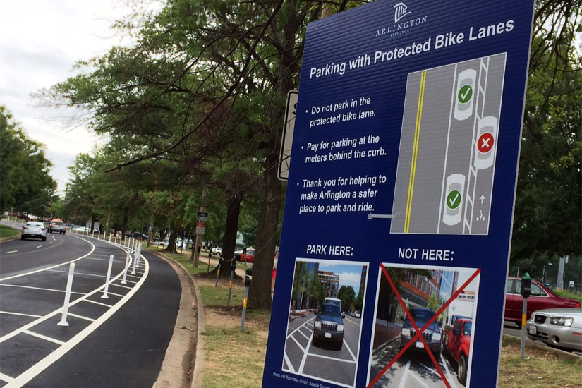
Arlington first added plastic bollards and moved out the parking area along S. Hayes Street in 2014 to physically protect cyclists from cars. Since then, DES has tested out more protected bike lanes, adding two in Ballston and Courthouse.

However, transit advocates have pushed for the county to pick up the pace, citing the dangers of cars blocking unprotected lanes which forces cyclists into dangerous, busy roads. In addition to cyclists, bike lanes are also used by e-scooter riders.

Balliet said the department expects construction on the 18th Street S. project to begin next fall.

Images via Arlington County & Google Maps 


More than 300 instances of vehicles blocking bike lanes were recorded during yesterday’s data collection project in Rosslyn, Ballston and Crystal City.

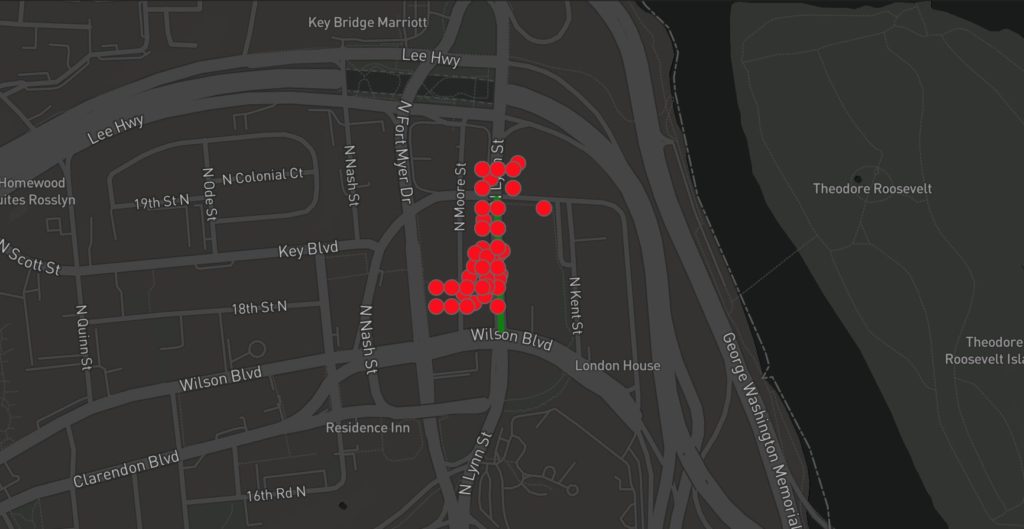
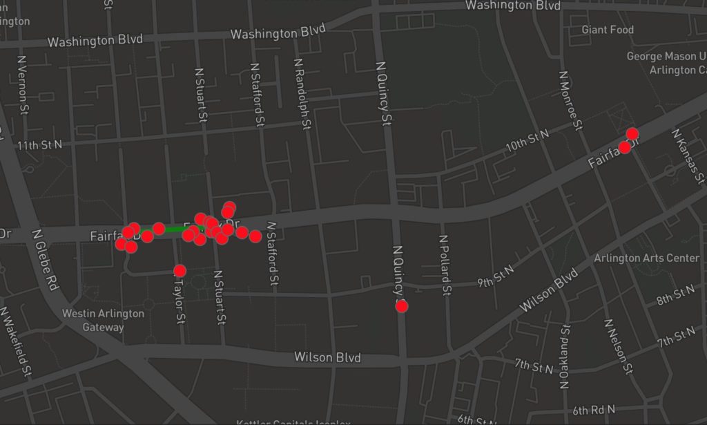
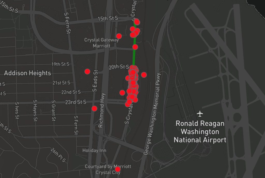
A map of the violations from the D.C.-based ‘How’s My Driving?’ app indicates volunteers spotted 307 bike lane violations on sections of N. Lynn Street in Rosslyn, Fairfax Drive in Ballston, and Crystal Drive in Crystal City yesterday (Thursday).

“We knew the bike lanes monitored yesterday were a problem anecdotally, but now we have data to back up those claims that will hopefully help drive changes to enforcement practices and improve built infrastructure,” app co-creator Mark Sussman told ARLnow.

Most of the violations appear to have occurred along Crystal Drive.

Vehicles parked in bike lanes can force cyclists to swerve into traffic on the street, creating dangers for cyclists and drivers.

Arlington’s County Code prohibits people who “stop, stand or park a motor vehicle in a bicycle lane, nor shall any person drive a motor vehicle in a bicycle lane for a distance of more than one hundred (100) feet.”

Despite some targeted enforcement efforts, the county has long-struggled to consistently enforce the rule, and activists have increasingly pushed for more protected bike lanes to prevent the problem, while criticizing new transit plans for not prioritizing cyclists’ safety.

In the meantime, engineers have also tested new lane-protecting barriers, and ACPD has conducted enforcement “blitzes” as recently as July.

Sussman previously told ARLnow he’d like to expand his crowd reporting app to Arlington after the the D.C. service attracted thousands of submissions for cars blocking bike lanes.

A particularly popular part is a Twitter bot that fetches DMV data on how many fines the cars in question have racked up. But this feature won’t work for Arlington drivers until the county allows Sussman and his partner Daniel Schep access to the public databases.

Three years ago, Arlington Transportation Commission Chair Chris Slatt created a crowdsourced reporting tool — ParkingDirty.com — for bike lane blockages that relied on users monitoring traffic cameras. On one day, it found that a stretch of bike lane along Crystal Drive was blocked about 65% of the time.


(Updated at 1:10 p.m.) The “How’s My Driving” cycling safety app is planning an event in Arlington tomorrow to collect data on bike lane violations.

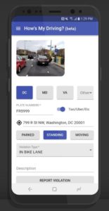
App co-creator Mark Sussman told ARLnow that a team of about 40 people are gearing up to hit streets in Crystal City, Ballston, and Rosslyn on Thursday to count the number of times vehicles block bike lanes. The volunteers will track the bike lane violations on S. Crystal Drive, Fairfax Drive, and N. Lynn Street by reporting blockages through the app, which will share the data through a live dashboard.

“Crystal Drive and Lynn Street are just consistently blocked,” said Sussman. “The problem is that we don’t understand the size and the scope of the problem.”

Video recently posted to Twitter shows multiple stopped vehicles blocking the Crystal Drive bike lane. An Arlington County Police tweet from this summer showed a similar violation on Crystal Drive leading to a traffic ticket.

Sussman and his partner and co-creator Daniel Schep, a software engineer, are hoping data collected by volunteers tomorrow during the morning and evening rush hours and lunchtime can help fix that.

Currently, only app users in the District can report violations through the app and see how many other violations the driver has racked up on that vehicle — courtesy of a bot that fetches the DMV data. But Susan and Schep have been eyeing expansion into Arlington for months as the app gained popularity and people began reporting violations across the Potomac, too.

The pair say they’re hoping Thursday acts as a demonstration of what kind of real-time data officials could have access to if they contract with “How’s My Driving” in the future.

Volunteers are also out collecting bike lane blockage data today in Pittsburgh. Previously, people helped with a data collection day in D.C. which yielded 700 violations, and another one for bus lane blockages that tracked 300 violations.

“When you get that amount of data, patterns really start to emerge. You can use that data in aggregate both for enforcement purpose and transportation planning,” said Sussman.

However the app creator emphasized that these data collection days are not designed for enforcement purposes, and act as more of a proof of concept.

“No one is getting citations. No one is reporting to authorities,” said Sussman. “The data is only reported in aggregate in a presentation to the county. It would never be used to call out for specific vehicles.” 

“The overall effort is not to shame or expose particular violators,” he added. 

Photo by Sal Ferro


Advocates want Amazon to help build a protected bike lane in Pentagon City as part of the development of its second headquarters.

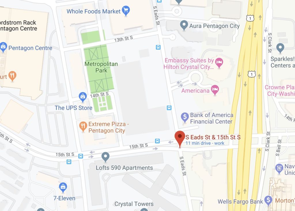
Advocacy group Sustainable Mobility for Arlington County wants Amazon pay for the new protected bike lane in exchange for added density for the two office towers the company is planning for the Metropolitan Park site along S. Eads Street. The group is asking the county to consider the request as part of the site plan process for this first phase of HQ2.

“The thought is that we expect major development to mitigate its impacts to the extent possible,” said the organization’s founder and Arlington Transportation Commission chair Chris Slatt.

“They are going to be doing construction there anyway, and doing additional construction is much cheaper than mobilizing a contractor from scratch,” he said. “As long as they are pouring concrete and moving dirt and making changes to the streetscape anyway, we think part of it should be upgrading that bike lane to a protected bike lane.”

Currently, the stretch of 15th Street S. bordering the future headquarters features an unprotected bike lane, meaning there are no buffers between vehicles and bikes except the line of paint demarking the lane. Slatt said this is especially dangerous on 15th Street considering Virginia Department of Transportation estimates that an average of 16,000 cars drive along the street every weekday.

Sustainable Mobility is also calling for upgrades to the existing protected bike lane on S. Eads Street, and for the county to install floating bus stop “islands” on 15th Street to prevent buses from pulling into the bike lane to pick up riders.

“What we mean by protected is something that will slow down or stop a car… and eliminate bus-bike conflict,” said Slatt.

Last month, the Arlington County Board approved a street safety resolution to end bicycle and pedestrian deaths — although some criticized the measure for lacking a specific plan.

Eric Balliet, a spokesman for the Department of Environmental Services, declined to comment on the bike lane proposal, citing the ongoing review of the site plan. A spokeswoman for Amazon also declined to comment.

“Members of the community who are interested in the Met Park proposal should continue to provide comments as part of the upcoming Site Plan Review Committee meetings on Sept. 23 and Oct. 14, or submit them to Mr. Schulz,” Balliet said, referring to county planner Peter Schulz.

Amazon is expected to eventually hire some 25,000 employees for HQ2, prompting some fears of Arlington experiencing Seattle’s traffic woes. Virginia and Arlington wooed Amazon with the promise of millions in nearby transportation updates, but Slatt says a protected bike lane outside HQ2 could also encourage bike commuting, thus reducing the number of car trips and helping to ease traffic.

“It will help,” he said. “The tough thing about building a network is the impact of each little piece is often small, but without each little piece the overall [bike] network isn’t enticing.”

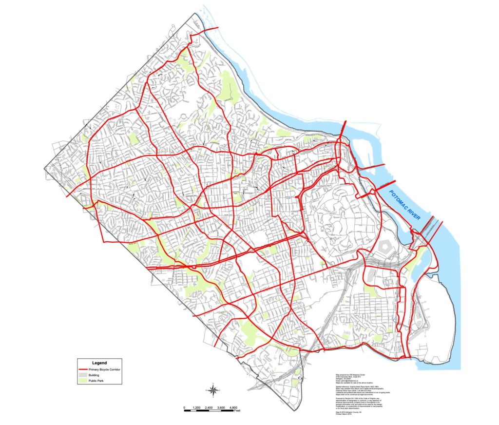
Earlier this year, the county called for 75 miles of bike infrastructure to be added to Arlington over the next 20 years, however only 2.5 miles of that is currently slated to become protected bike lanes.

“I think the new bike plan is very clear that our goal for every part of our bike network is that it be low stress and for all ages and abilities,” Slatt said, “and that the new bike plan is very clear that we look for an opportunity to make that happen with every new development.”

Images via Google Maps


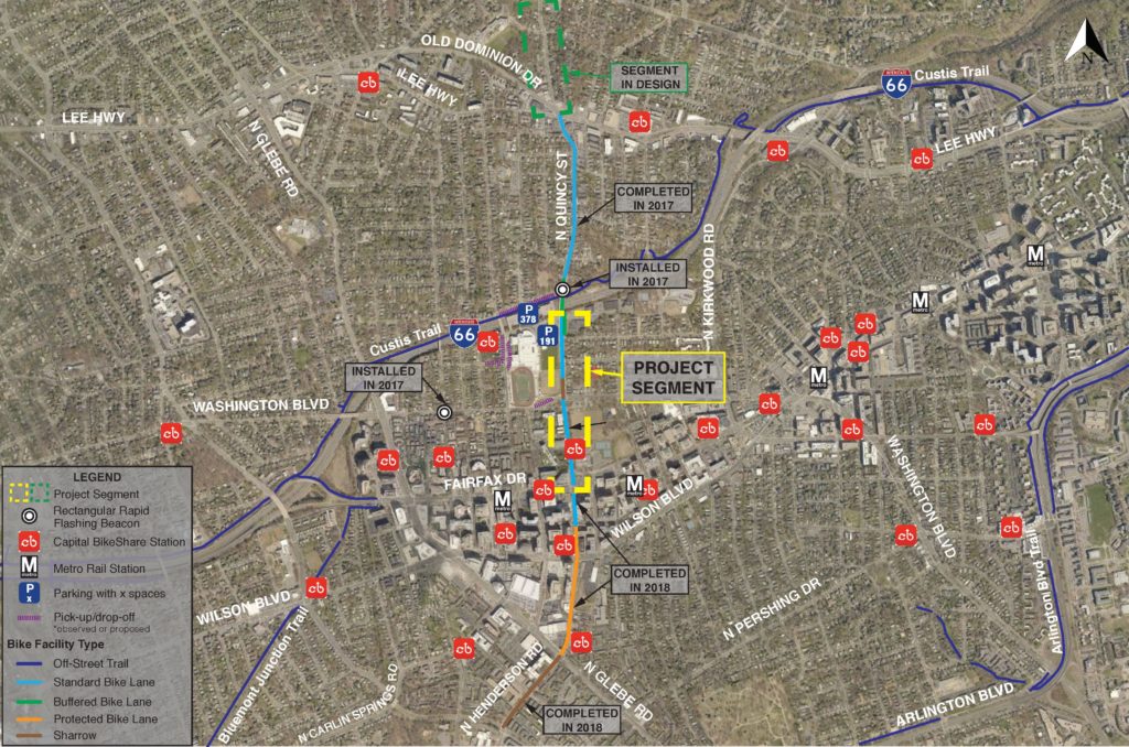
A portion of N. Quincy Street is slated for a makeover this summer with new pavement and a bike lane.

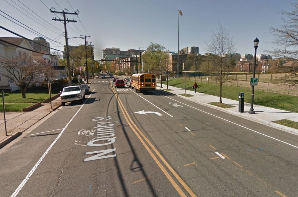
Officials aim to repave the stretch of N. Quincy Street between the I-66 overpass and Fairfax Drive, near Washington-Liberty High School, and potentially approve one of three designs for a new bike lane that could eliminate parking spaces.

Arlington’s Department of Environmental Services polled residents about the three bike lane designs in a recent survey. The department will host an open house about the project on Tuesday, July 9, from 6-7:30 p.m., at Washington-Liberty (1301 N. Stafford Street).

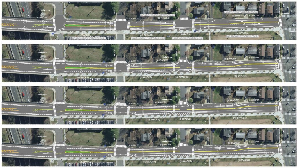
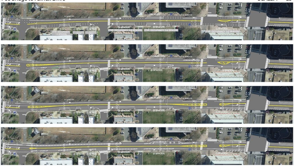
The three bike lane configurations the department is considering are:

  • Concept A: A buffered bike lane along both sides of N. Quincy Street in the northern section close to I-66. Adding the lane would eliminate 22 parking spaces along Quincy near the Buck site entrance where several single family homes sit.
  • Concept B: A buffered bike lane that runs in the middle of N. Quincy Street, which removes only 10 parking spaces in the northern section close to I-66.
  • Concept C: A buffered bike lane along the entire street, which would remove 42 parking spaces on the northern section of the street and 31 spaces on the south section.
“It’s almost like a mix and match,” DES Project Planner Christine Sherman told ARLnow. “Concept A shows parking on a block [of N. Quincy Street], concept B shows parking on a different block. Concept C shows the highest level of bike protection.”

All three concepts also add a crosswalk at the intersection of Quincy and 11th Street N. and at the entrance of the Buck property.

Sherman said DES will weigh the survey responses against engineering recommendations about safety and hopes to start the paving work later this summer.

DES tweeted about the (now closed) project survey last week, along with a reference to presidential candidate and meme-machine Marianne Williamson.
The  recently-updated bike element portion of the county’s master transportation plan proposes N. Quincy Street become part of a north-south bike corridor.
The bike element proposes several miles of bike lanes “wherever feasible” on N. Quincy Street to provide safer passage through Ballston and Virginia Square, and to connect the Arlington Forest and Chain Bridge areas.

“We have buffered and expanded bike lanes to the north of this segment and have protected bike lanes to the south,” said Sherman. “It’s an opportunity we see to create the north-south connection in the county.”

The work is also part of a larger streetscape project along Quincy Street, with repaving already completed in the sections between the I-66 overpass and Lee Highway, and between George Mason Drive and Fairfax Drive.

In August, the county finished a new bike lane on N. Quincy Street connecting the Quincy corridor to the Custis Trail. Two months before that, the county also converted parking on 5th Road N. between Quincy and N. Pollard Street to back-in, angle style parking.

Image 1, 3-5 via Arlington County, image 2 via Google Maps


(Updated at 4:05 p.m.) The co-creator of the popular car violation tracking app “How’s My Driving?” is eyeing an expansion across the Potomac.

Mark Sussman is the data scientist behind the app, along with his partner and co-creator Daniel Schep, a software engineer. Sussman told ARLnow today that he’s considering expanding the service from D.C. to Arlington because of the demand he’s seen over the past few months.

“It’s almost been an aggressive demand from some Arlington folks,” he said, laughing. “We obviously have folks who live in Arlington and work in D.C. and have been wanting to use it.”

https://twitter.com/hmdappio/status/1136690997252038657?s=20

Sussman and Schep built a Twitter bot last July that lets Twitter users tweet problems like vehicles parked in bike lanes or blocking sidewalks. If a user tweets a moving or parking violation at the bot with the vehicle’s license plate number, the bot fetches data from the D.C. DMV on how many outstanding citations or violations the driver has racked up on that vehicle.

The developers later announced they’d be beta-testing a smartphone app version of the service. Since then Sussman says about 1,200 people have volunteered to test it. The app automatically tweets the citation information that results from people’s reports to D.C. parking enforcement authorities in an effort to encourage enforcement.

Several Arlingtonians have joined the beta-testing group, despite the fact that “How’s My Driving?” isn’t yet connected to any Arlington database that could show the number of violations.

This summer, Sussman said he and Schep are planning to start talking to authorities in Arlington about whether the app can help with traffic enforcement in the county, and whether they can integrate it with the current record-keeping systems for citations. Parking citations are publicly available with license plate numbers in Arlington. But unlike D.C., Arlington app users need a citation number in order to look up moving violations, such as speeding.

The record amount for the most outstanding fines accrued by a single vehicle in D.C. flagged by the bot so far is $36,594. The majority of the fines for the Virginia-registered vehicle were from speeding violations.

“If that information was provided to officers on the front end instead of having them have to look it up, then they’d be much more likely to do the right thing,” said Sussman. “While it may seem like a benign to some [to report] standing in a bike lane, it’s a proxy for more dangerous behavior.”

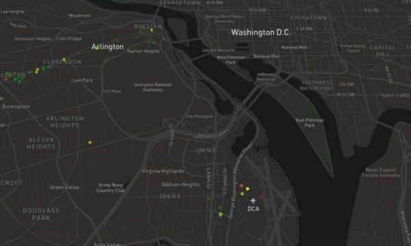
So far, users have reported 74 parking and moving violations in Arlington, with the majority clustered in Clarendon and around Reagan National Airport.

The locations made sense to Sussman. “A third of these violations are for bike lane violations,” he said. “These are notoriously abused bike lanes.”

Due to a dedicated community of pedestrians and cyclists who report violations spotted around town, the bot has exploded in popularity since starting last year. “Currently, we’ve had a little over 7,000 submissions that represent over $2 million in the District of Columbia,” Sussman said, of the total fines reported.

In the future, Sussman said he and Schep are considering doing away with the Twitter bot altogether to avoid gaining a reputation as “vigilante social media shamers” and focus more on integration with government systems, to help with their main goal of improving enforcement.

Twitter users would, of course, still be able to tweet about what they find out from the app on their own.

“We just don’t want it to be the main vehicle that people use for enforcement,” he said.

Image via Marc Sussman/Twitter


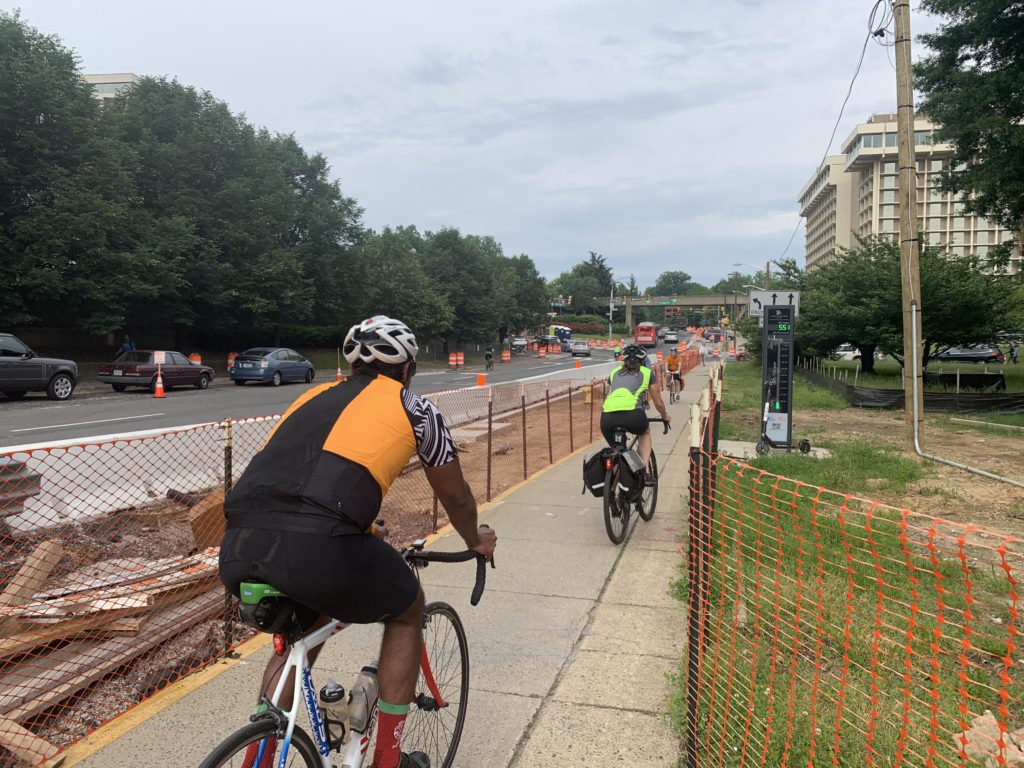
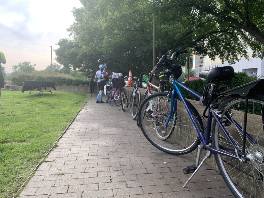
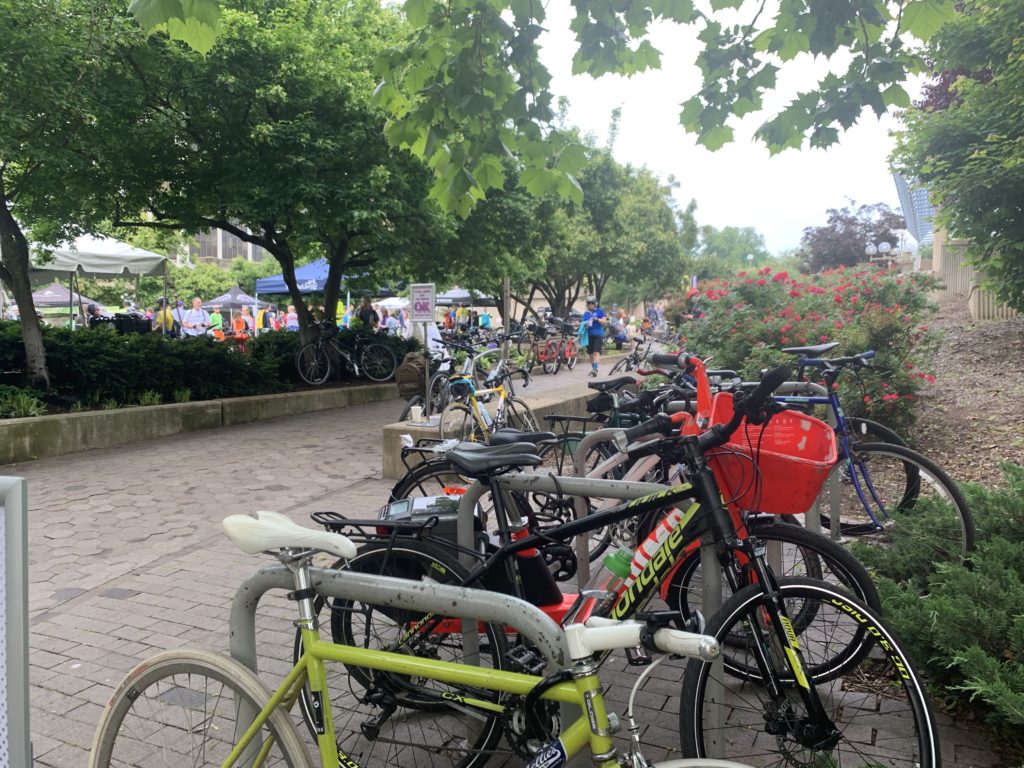
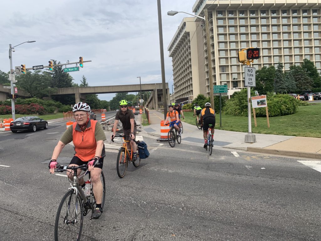
(Updated at 3:40 p.m.) It was clear skies for commuters this morning (Friday) celebrating Bike to Work Day.

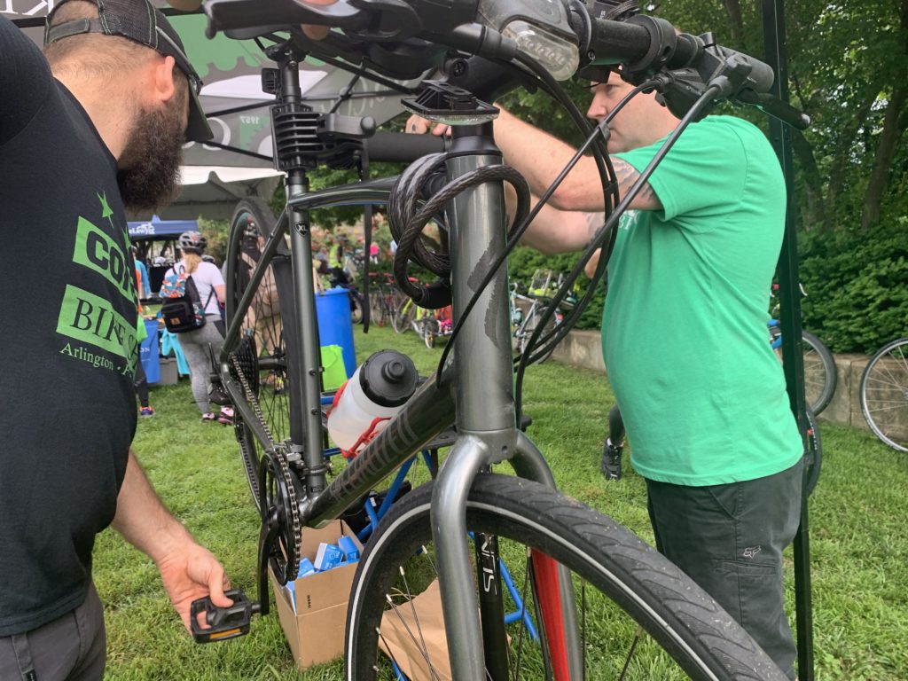
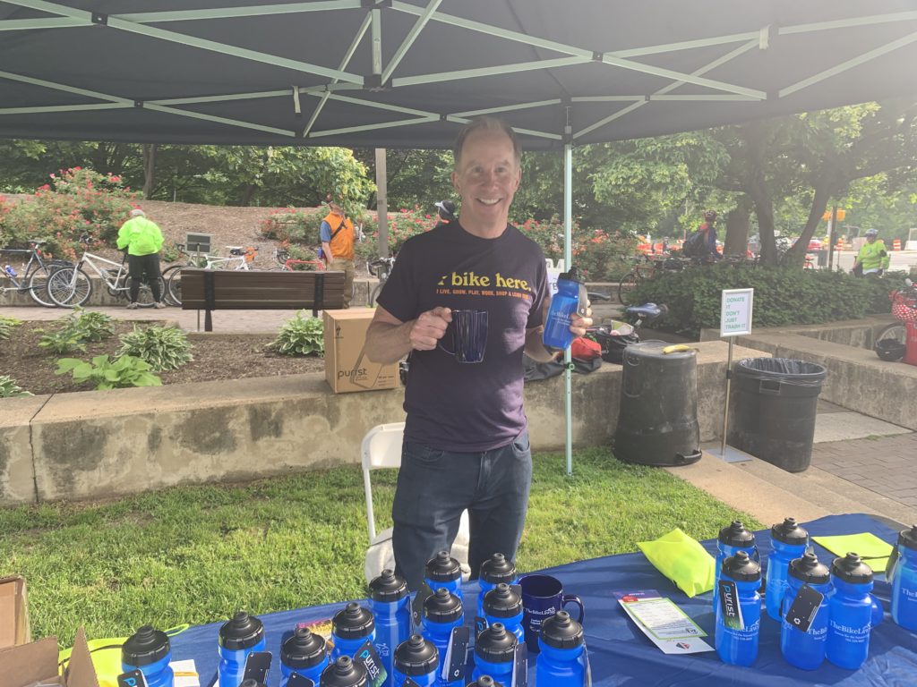
The annual tradition encourages commuters to ditch their cars and ride their bikes to and from work. In Arlington, 10 pit stops and themed celebrations were sprinkled across the county.

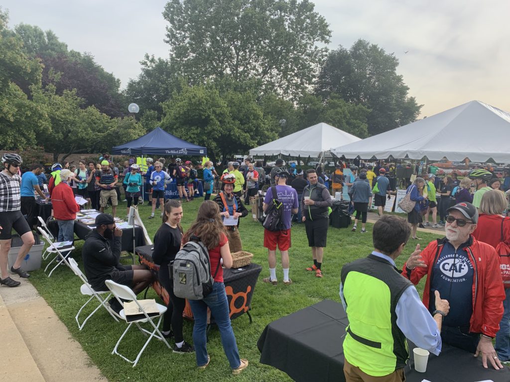
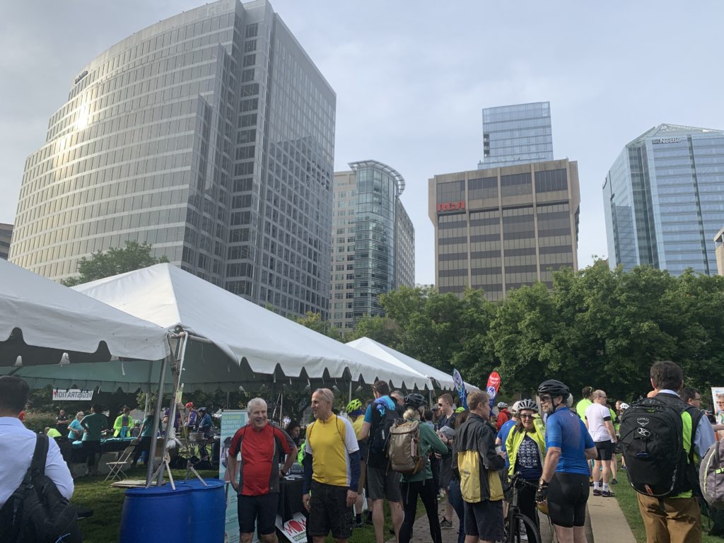
The Bike to Work event at Rosslyn’s Gateway Park filled the park with spandex-clad cyclists mingling and expressing exuberance at the perfect weather. In the tight-knit community of cyclists, there were frequent reunions between riders throughout the park.

“It was a great ride today,” said Henry Dunbar, director of active transportation for Bike Arlington and a coordinator of the event. “This is about as ideal as it gets.”

Dunbar said the event caters to the one-third of riders who are first-time bicycle commuters. Dunbar said the goal is to teach them about bicycle safety and encourage them to make bicycle commuting a daily habit.

For new riders, Dunbar said the best thing to do is find a more experienced rider and tag along with them.

“Ride with experienced cyclists,” Dunbar said. “All the brochures in the world aren’t as good as someone guiding you through that one tricky intersection on your way into work.”

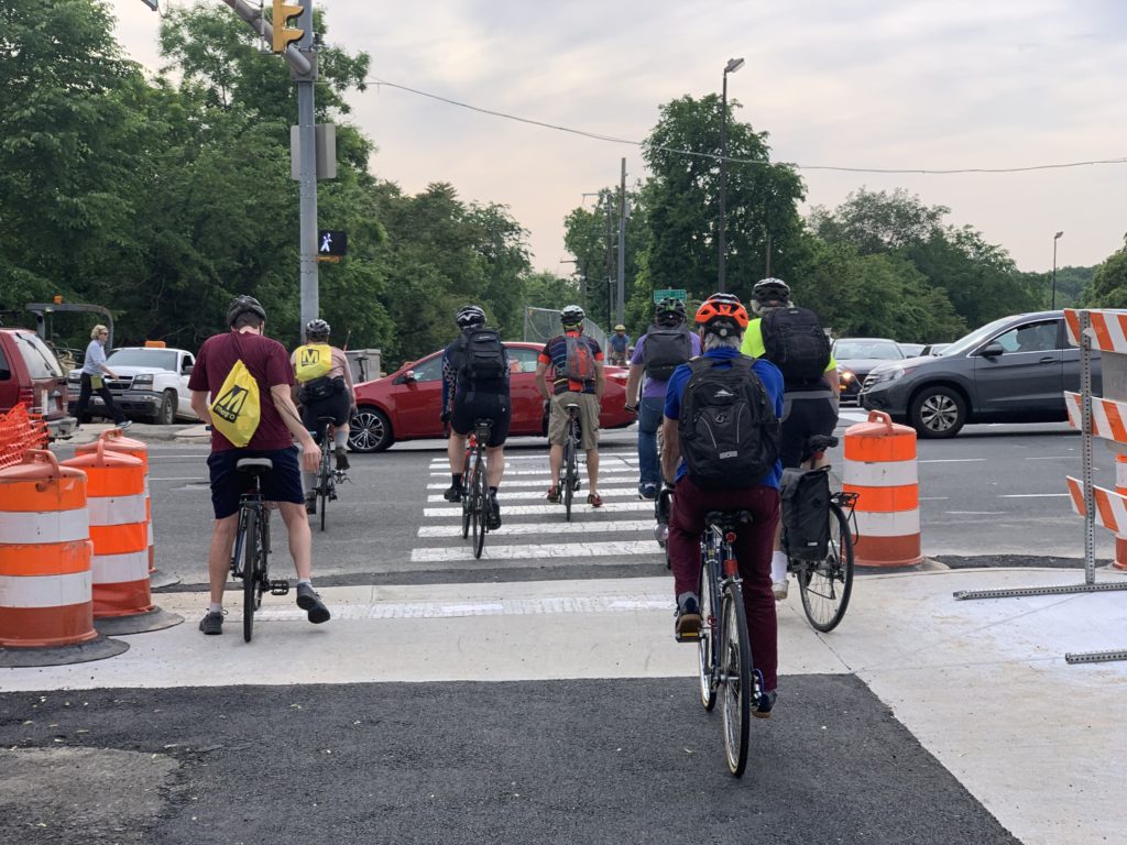
Dunbar nodded over to the N. Lynn Street and Lee Highway intersection — a crossing regularly packed with cyclists, pedestrians and cars. The crowding is exacerbated by construction around the intersection that’s part of the Custis Trail improvements — construction Dunbar said is likely to continue for another full year.

Several bicycling-focused organizations had stands set up in Rosslyn to help encourage a car-free lifestyle. Robert Santana attended on behalf of the Arlington Car-Free Diet campaign and distributed information about the impending Metro closures.

“I was worried we’d be talking mostly to people who were already car-free,” Santana said, “but people have seemed really interested.”

Tents were set up around the park, with businesses like Nando’s Peri-Peri offering free meals or other local organizations offering bicycle-specific services.

“Today has been fantastic,” said Bruce Deming, a “bike lawyer” who specializes in representing injured cyclists. “There’s a huge crowd, just tremendous turnout. I’m proud to be a part of this event.”

(more…)


Three safety and beautification projects are coming to western Arlington streets.

This Saturday the County Board is scheduled to vote on $2.8 million in construction contracts for Neighborhood Conservation projects. The three projects are all at the western edge of Arlington, near Falls Church.

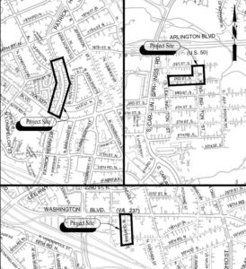
The project at Patrick Henry Drive near Westover Apartments will add dedicated bike lanes from Washington Boulevard to 16th Street N.

The other two projects — 2nd Street South at S. Kensington Street and N. Quintana Street — will add new sidewalks. The N. Quintana Street project will also add streetlights.

The projects are all planned to:

  • Improve pedestrian connectivity
  • Provide disability accessible routes
  • Rehabilitate existing roadways
  • Improve drainage

The projects are 32 percent more expensive ($883,379) than when they were first proposed in 2017, which staff attributed to inflation in construction costs and higher construction standards enacted by the county since then.

Photo via Google Maps


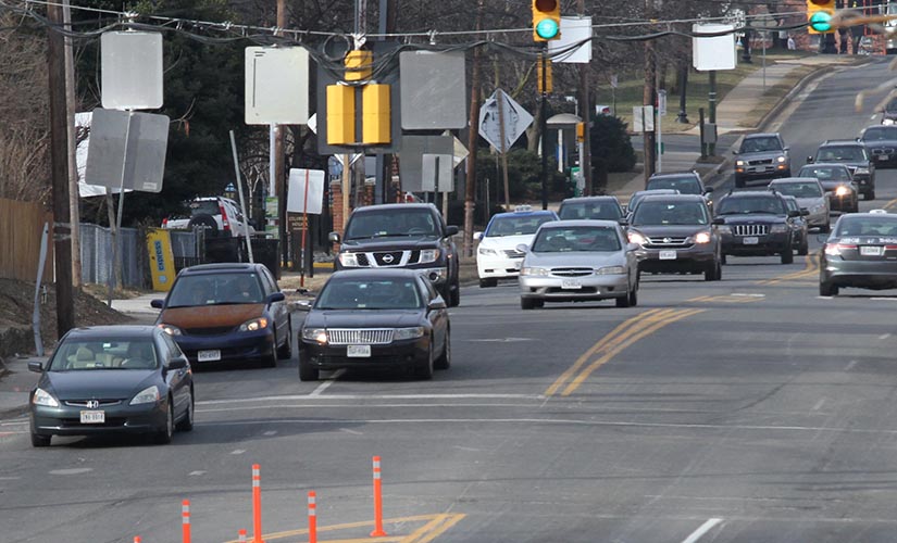
The county is moving forward with long-held plans to narrow lanes and widen sidewalks on Columbia Pike near the Penrose neighborhood, but not everyone is on board.

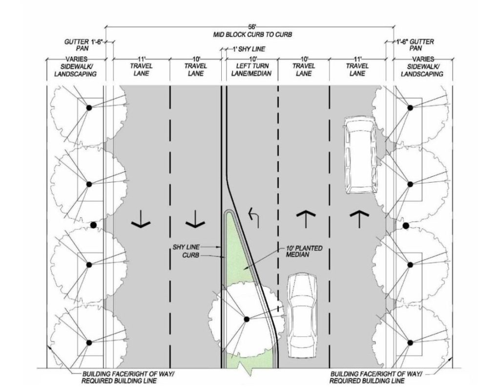
County staff presented an updated version of the plan last week to the Penrose Neighborhood Association. It calls for narrowing the lefthand travel lanes on the Pike east of S. Wayne Street down to 10 feet, and narrowing the righthand lanes, next to the sidewalk, to 11 feet.

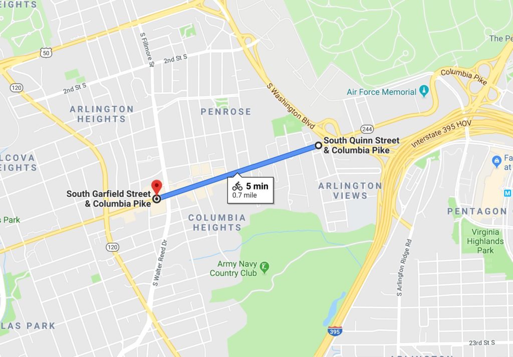
The project is slated for the section of the Pike between S. Garfield Street and S. Quinn Street, staff told ARLnow, and the total Columbia Pike right-of-way width is expected to remain 56 feet width.

It’s also part of a years-long plan to improve the Pike and add more room for pedestrians and bicyclists. However, attendees at the meeting said they fear tighter lanes could mean trickier turning and more accidents for cars.

“The goal of the project is to make Columbia Pike a safer, more accessible route for all users by creating a balance between pedestrian, bicycle, transit and vehicle spaces,” said county transportation spokesman Eric Balliet in an email Monday.

Even after the presentation by the county, some local residents remained skeptical.

“No satisfactory or convincing reason was offered by the county regarding the plan to reduce the lane size,” said one man. “It is quite concerning that a main hub such as Columbia Pike is expected to suffer significant lane reductions that will likely create traffic backups and accidents.”

“At the meeting we discussed many scenarios, like could a school bus pass a garbage truck, could a Giant delivery truck make the turn into Adams Street, could an 18 wheeler pass a bus on the left,” Penrose Association President Maria “Pete” Durgan said, adding that county staff agreed to look into the questions.

Bailliet said the plan is based on “urban street design guidelines from the National Association of City Transportation Officials,” which “recommend that lanes should not be greater than 11 feet as they may cause unintended speeding and assume valuable right of way at the expense of other modes.”

Bailliet says the new lane widths have also already been rolled out in other parts of the Pike, including on the sections between:

  • Four Mile Run and S. Wakefield Street
  • S. Oakland Street and S. Garfield Street
  • Washington Blvd and Columbia Pike interchange

The plan was listed in the the bike component of the county’s Master Transportation Plan, which the County Board updated last week. In it, the county said it intends to build “wide multi-use trails, or wide sidewalks, along at least one side of Columbia Pike in the areas east of S. Wayne Street and west of Four Mile Run” for bikes and pedestrians to share.

“It is tackling a tough question,” the Penrose Neighborhood Association’s website said of the revised lanes. “With only a limited amount of right-of-way, how should that space be allocated? Turn lanes? Street Trees? Wider sidewalks? Bike lanes?”

The reason to widen the sidewalks, Bailliet said, was in part to allow a more vibrant and business-friendly streetscape, but also partially to provide a way for cyclists to connect with the designated bike boulevards that run parallel the Pike.

(more…)


View More Stories