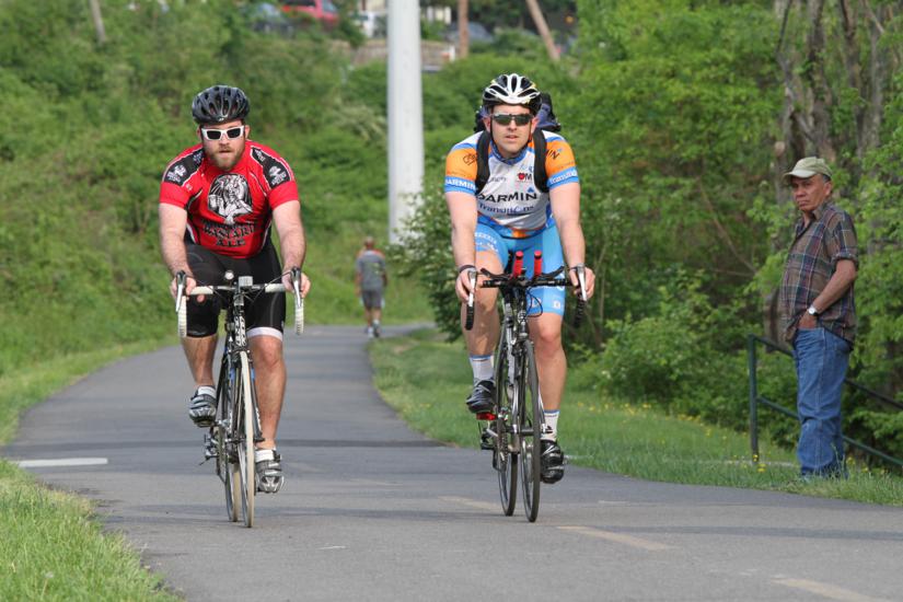
Arlington cyclists can now ride e-bikes on NOVA Parks trails, including the popular W&OD Trail, thanks to a new change in the rules.

“Last Thursday, the NOVA Parks Board adopted the attached changes to our regulations that now allow for electric assist bikes on our trails, including but not limited to the W&OD Trail,” NOVA Parks Executive Director Paul Gilbert told ARLnow.

“This is for all NOVA Parks properties which is 12,200 acres over three counties and three cities,” he said.

The trails span Arlington, as well as parts of Fairfax and Falls Church. However, each jurisdiction has their own regulations for e-bikes on their local trails.

A spokesperson for Arlington’s Department of Environmental Services confirmed Arlington does not currently allow the electric bikes on local county trails but change could be coming down the road.

“Regarding allowing e-bikes on County trails, we’ll look at it this summer during the evaluation of our shared mobility devices demonstration project,” said department spokesman Eric Baillet.

It’s a direction that pleases William Shatner, of Star Trek fame, who took Arlington to task for making its trails one of the final frontiers for local e-bike riders.

Arlington’s Department of Environmental Services had tagged the e-bike-enthused actor in November during an exchange about the bikes were banned from trails. It was a policy Shatner called “barbaric” at the time.

“Remember this?” Shatner tweeted Wednesday with a link to the November conversation, “Now I can!”

https://twitter.com/WilliamShatner/status/1110950688635260928

“See you and your e-bike on the W&OD, Bill,” the department responded. “As to getting it on the non-NOVA trails around here, stay tuned for a rule review in coming months.”

NOVA Parks’ new regulations apply to pedal bikes with electric  motors that assist riders, but not mopeds, per a copy of the amendments tweeted by NOVA Parks Board Chairman Michael Nardolilli.

The regional parks authority proposed lifting the ban back in February, after the regional authority commissioned a study on the impact e-bikes in Prince William County, San Jose, California, and Sweden.

The study, conducted by Silver Spring-based Toole Design Group, said it found that e-bike riders displayed “nearly identical safety behaviors.”

Toole Design also found that although e-bike riders typically travel faster than regular bicycles on roadways, e-bike riders  travelled slower than regular cyclists on shared bike paths.

Toole Design Group concluded that:

Research indicates that E-bikes pose no significant safety concerns when compared with regular bicycles, and that E-bikes make cycling more accessible and attractive to a larger segment of the population. Specifically, E-bikes may help attract cyclists that are less able-bodied and more utilitarian in their cycling preferences, which could help explain why many studies seem to show a decrease in potentially risky behavior when E-cyclists are around other vulnerable road users.

The Virginia General Assembly approved legislation in 2013 allowing “electric power-assisted bicycles” on bike paths.

The Fairfax County Park Authority has since amended their local park regulations to allow e-bikes on local trails, according to Gilbert.

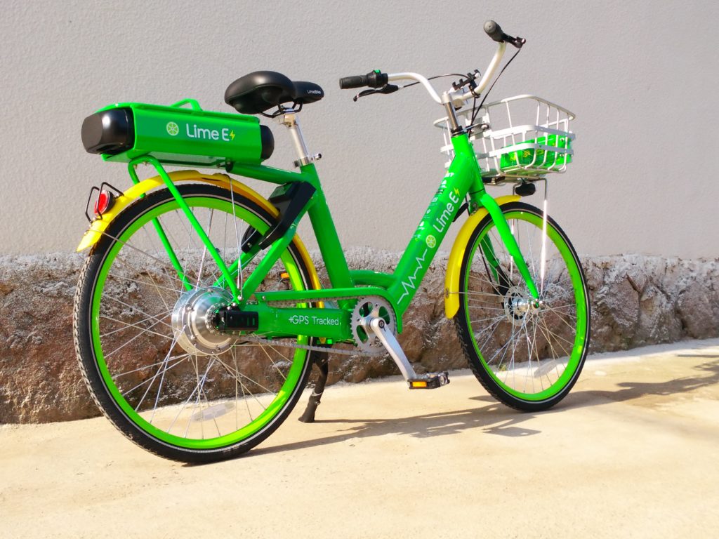
Electric bikes are growing in popularity with companies Lime and JUMP both offering them in Arlington, as well as a new e-bike initiative from Capital Bikeshare.

Photos courtesy of JUMP and Lime


Bicyclists in Potomac Yard and Crystal City might’ve noticed some funky new protected bike lanes around town — but some of them won’t be sticking around for long.

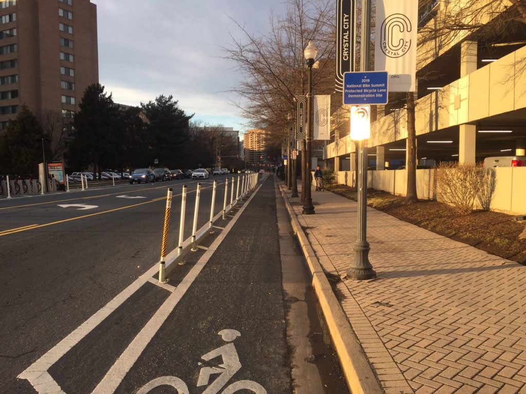
The lanes popped up this week to coincide with the “National Bike Summit,” a gathering of cycling activists held at the Hyatt Regency Crystal City.

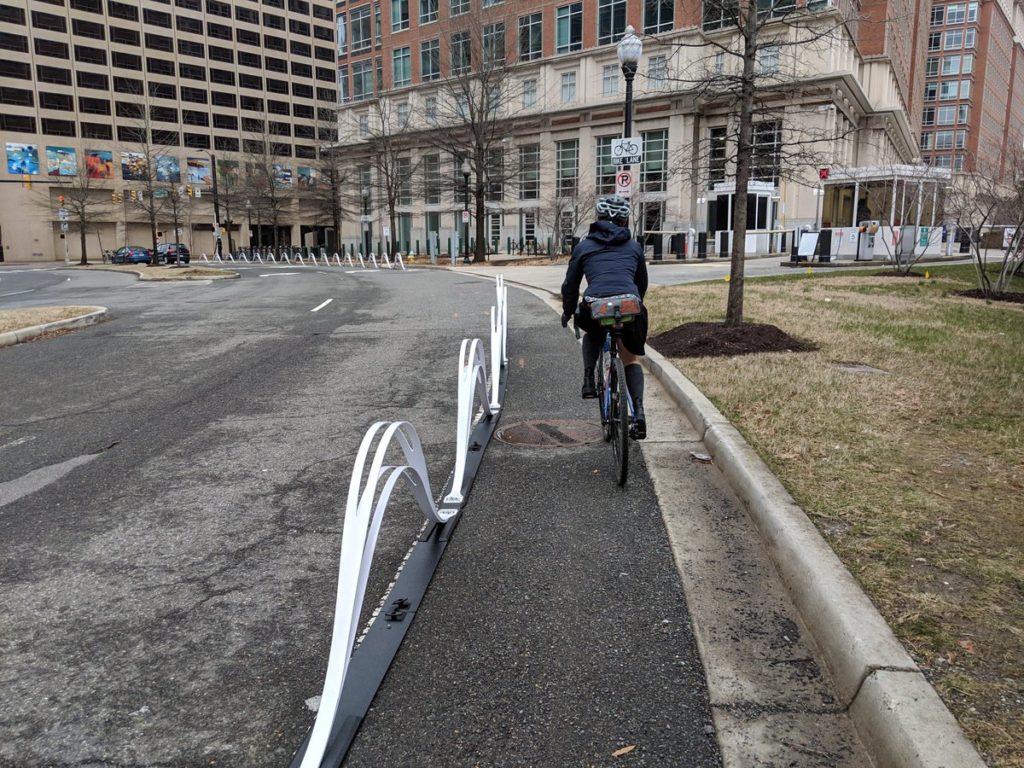
Some of the protected lanes are located along S. Eads Street in Crystal City, near the road’s intersection with 22nd Street S. They’re part of the “BikeRail” product backed by Minneapolis-based firm Dero, and are a bit sturdier than the plastic poles the county has installed along other protected bike lanes.

The Crystal City Business Improvement District says Dero donated the BikeRails for pilot program purposes, and county staff installed them this week. They may not stay in their current locations, but the county plans to keep them a little longer, at least.

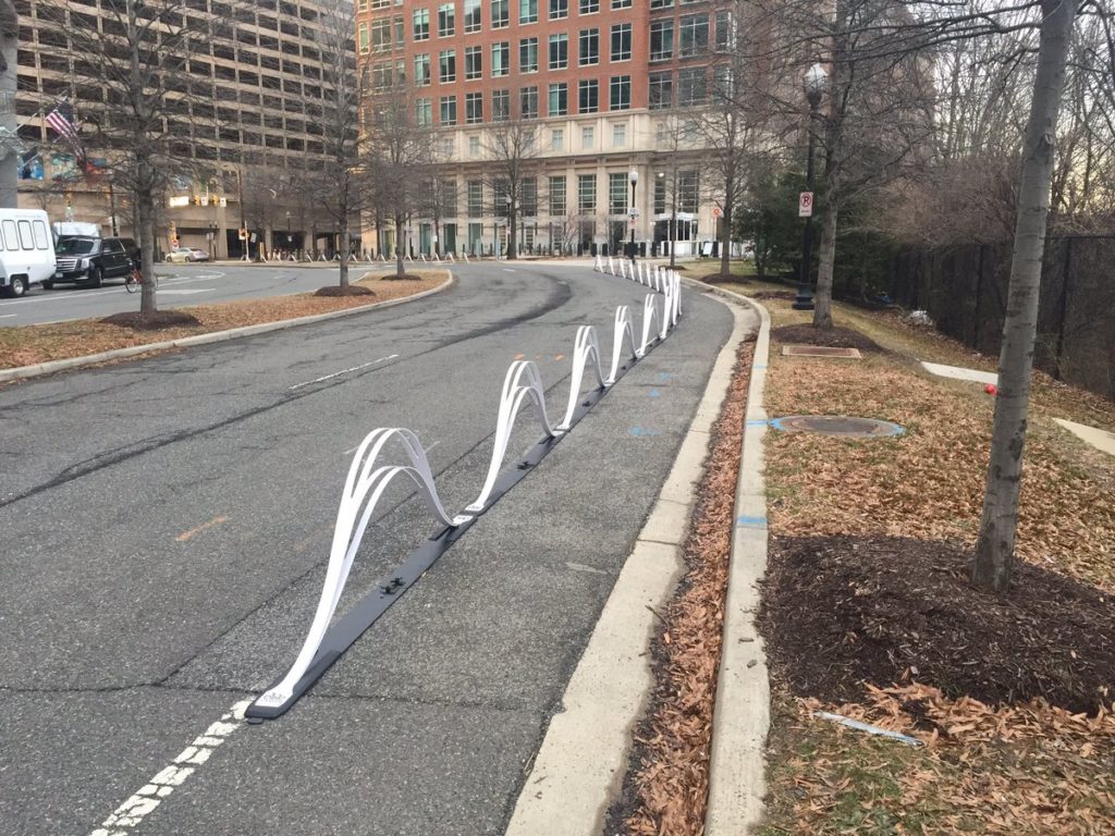
Another bike company sponsoring the conference, Bike Fixation, donated some even more unusual looking lanes for cyclists to try out.

The county set up the wave-shaped barriers along a stretch of S. Potomac Avenue in Potomac Yard, leading up to where the bike conference was held.

Those, however, are merely temporary, according to the League of American Bicyclists (which sponsored the conference). They could be gone as soon as sometime this week.

Photo 1 via @mttrgrs, photos 2 and 3 via @juddlumberjack


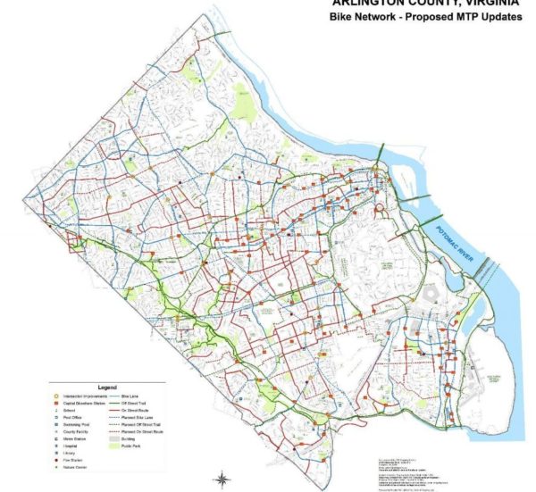
Arlington transportation planners are weighing major revisions to the guiding document for the future of the county’s bike infrastructure, sketching out a wish list of new trails and bike lanes they want to see over the coming years.

County officials have recently begun circulating a draft version of an updated “bicycle element” to Arlington’s “Master Transportation Plan.” The document was last updated a decade ago, and a working group has spent more than a year crafting potential changes for the plan.

In all, it contains 26 new pieces of cycling infrastructure from the last time the plan was revised, including a bevy of new trail segments, additional on-street lanes and trail renovations. The county is now soliciting public feedback on the draft in the form of a community survey, with additional engagement efforts to come.

But the document also includes some broad goals for county officials to pursue to meet the needs of cyclists over the coming decades, with a special focus on how Arlington can make people feel safer while riding their bikes on local streets.

“Many residents have identified that they do not have suitable bicycle facilities within their neighborhoods or ones that connect to the local destinations that they want to travel to,” the draft document reads. “Other bicyclists do not feel comfortable riding with or amongst motor vehicle traffic and they feel that some on-street bikeways do not provide sufficient separation from motor vehicles. While the County has developed many on-street bikeways in recent years, their distribution and connectedness across the Arlington is currently uneven.”

To that end, the updated plan calls for plenty of infrastructure improvements to meet that goal. The county’s budget squeeze, however, will make it a challenge for the County Board to find finding for many of these projects, at least in the near term.

But the document does identify several improvements that have already been funded in the county’s long-term construction plans, including three additions from the plan’s last update. Those include:

McKinley Road Buffered Bicycle Lanes – Revise the roadway markings on McKinley Road between the Custis Trail and Wilson Boulevard to include buffered bicycle lanes. Undertake the roadway marking along with construction of crossing enhancement to provide for improved access to McKinley Elementary School and the Custis Trail.

S. Clark Street Cycle Track – Construct an off-street cycle track that connects the planned Army Navy Drive protected bicycle lane at 12th Street South to 18th Street S. and the Crystal City Metrorail station.

Shirlington Road Bridge – Reconstruct the Shirlington Road bridge, and adjacent sidewalks, to provide an enhanced, wide bicycle and pedestrian path along the west side of the roadway that links the W&OD and Four Mile Run trails.

As for the rest, some the new planned changes only impact small sections of trails or roadways, requiring only small funding commitments. Others are substantially more ambitious.

Among the bigger asks are requests for the renovation of the entirety of the W&OD Trail as it runs through Arlington, and the portion of the Four Mile Run Trail south of W. Glebe Road, totaling about 5.5 miles in all.

“Improvements may include: trail widening, minor realignments, new pavement markings, wayfinding signage and consideration of the addition of trail lighting,” the document reads.

When it comes to new and improved trails, other planned projects include upgrades for the entirety of the Bluemont Junction Trail and and the construction of a new, half-mile long bike and pedestrian trail connecting the site of the former Northern Virginia Community Hospital in Glencarlyn to the nearby Forest Hills neighborhood.

Some of the plan’s more substantial on-street projects include the construction of bike lanes and other improvements along “the entirety of S. George Mason Drive,” stretching about 2.1 miles in all. The document also envisions new bike lanes along N. Highland and N. Herndon streets, between Key Boulevard and 7th Street N., to allow for easier access to the Clarendon Metro station.

Additionally, the document recommends the creation of some new “bike boulevards,” or coordinated infrastructure improvements to give cyclists an alternative to bypass busy roads for quieter side streets.

The county’s previously constructed some off Columbia Pike, and the plan envisions one along the Rosslyn-Ballston corridor (on Key Boulevard, N. Jackson Street and 13th Street N. between N. Rhodes and N. Quincy streets) and another connecting Ashton Heights and Lyon Park (on 5th, 6th, 7th and N. Fillmore streets to connect Henderson Road to Pershing Drive as it meets Washington Blvd).

The county is planning an open house to collect in-person feedback on the new bicycle element on Jan. 14 at Phoenix Bikes (909 S. Dinwiddie Street), set to run from 6-7:30 p.m.

Photo via Arlington County


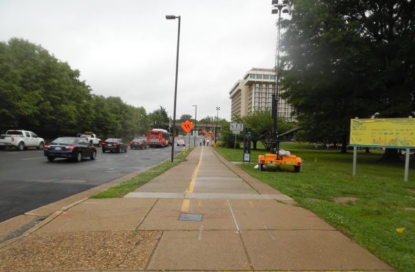
Starting this week, construction to improve the intersection of Lee Highway and N. Lynn Street in Rosslyn will significantly narrow a portion of the Custis Trail.

The Custis Trail will be restricted to six feet wide for the section between N. Fort Meyer Drive and Lynn Street, as crews work to transform one lane of Lee Highway into additional trail width and buffer space.

The trail narrowing will last for nine to 10 months while construction takes place on the south side of the trail.

Construction on the two-year, $9.3 million project officially kicked off in May and will happen in phases to reduce impacts on pedestrians, bicyclists and drivers, according to the county.

Workers will add wider sidewalks, on-street bike lanes and improved curb ramps as the northbound and southbound sections of Lee Highway meet Lynn Street.

The project will also include improvements to the Custis Trail as it runs alongside Lee Highway, including bicycle and pedestrian facility upgrades, lane reconfiguration and widening of the trail.

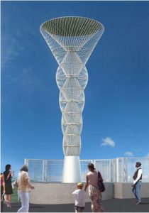
For street beautification efforts, the “Corridor of Light” public art installation will get added to each of the four corners of the Interstate 66 bridge.

The county is helping to fund the construction. The project, expected to wrap up in spring 2020, will require some lane and sidewalk closures.

Photo via VDOT and rendering via Arlington County


County officials are planning some improvements along Fairfax Drive and 10th Street N. as the roads run from Ballston to Clarendon, with a special focus on ways to make the corridor safer for drivers, pedestrians and cyclists alike.

Arlington transportation planners are circulating a survey seeking feedback on how the roads should change, as the county weighs a series of modest improvements over the next few months. In all, the study area stretches from Fairfax Drive’s intersection with N. Glebe Road in Ballston to 10th Street N.’s intersection with N. Barton Street in Lyon Park.

The county is envisioning changes along the 1.5-mile-long stretch of road as “short-term, quick-build projects to enhance safety and mobility on the corridor.” Officials hope to eventually commission more expansive changes, after it took over management of the roads from the state this summer, but the county’s budget crunch means that options are limited, for now.

But, in the near term, the county plans to examine “multimodal traffic volume data, curbspace use, crash data, and transit service data” in addition to the community’s feedback to chart out small-scale changes, according to a project webpage.

The advocates with the group Sustainable Mobility for Arlington County certainly have some suggestions for the corridor. The group sent an email to its members urging them to advocate for the transformation of Fairfax Drive into a “low-stress biking corridor, even if it requires re-purposing space from motor vehicles,” in addition to other cycling improvements.

“The existing Fairfax Drive bike lanes are narrow, frequently blocked, and fail to be low-stress due to fast-moving traffic,” the advocates wrote. “The existing, short two-way protected bike lane should be extended all the way from Glebe Road to Clarendon Circle.”

The group also argues that 10th Street N. and Fairfax Drive both lack safe road crossings, particularly as the corridor runs from N. Barton Street in Lyon Park to N. Monroe Street in Virginia Square.

“This makes the corridor a barrier,” they wrote. “Additional safe crossings should be provided and these crossings must be simple and easy to use for cyclists as well as pedestrians.”

The county survey on road improvements will be open for submissions through Dec. 16. Officials hope to have short-term recommendations ready by sometime early next year, then install those by the spring or summer of 2019.

Photo via Arlington County


Plans to make Rosslyn a bit easier to navigate for pedestrians and bicyclists are coming together, though county officials are concerned that some of the proposed changes might further snarl traffic in the area.

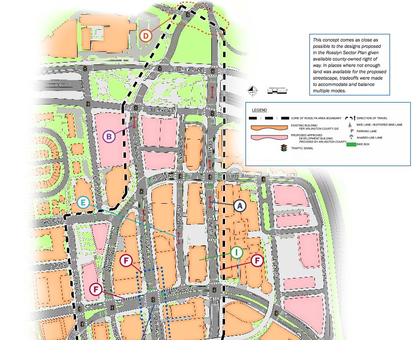
The county unveiled its latest designs for future of the “Core of Rosslyn” at a public meeting last Tuesday (Oct. 2), which includes plans to convert several streets around the Rosslyn Metro station into two-way roads, remove the Fort Myer Drive tunnel under Wilson Blvd and add a host of new connections for cyclists and walkers.

However, transportation planners worry that these alterations will produce “significant increases in gridlock” over the next decade or so, according to meeting documents.

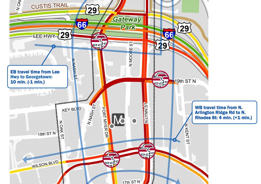
In all, they’re projecting that the proposals will increase wait times at intersections in the neighborhood by a total of 19 minutes during the morning rush hour (with especially acute problems at the already jammed intersection of the Key Bridge, G.W. Parkway and Lee Highway) and a total of six minutes during the evening rush. They’re hoping to refine these designs in the coming months to address those issues, while maintaining the positive parts of the plan.

Certainly, planners expect the changes will result in substantial improvements in Rosslyn’s offerings for people who aren’t relying on cars to get around. The designs included 14 new or improved crosswalks for pedestrians, and more than 1.3 miles of new protected bike lanes included in the design. The lanes, largely set to run along Fort Myer Drive, N. Moore Street and N. Nash Street, are designed to ease bike connections to the Key Bridge and Mt. Vernon and Custis Trails.

The plans also keep alive the county’s long-considered possibility of building a car-free, “pedestrian corridor” running from 18th Street N.’s intersection with N. Oak Street to N. Kent Street, a change that would replace the Rosslyn skywalk system to make the Metro station more accessible.

Yet the county expects that this design would create some new challenges for walkers and cyclists as well. In particular, allowing two-way access on roads like N. Fort Myer Drive, N. Lynn Street and N. Kent Street will create a host of new “conflict points,” where cars are turning across crosswalks, prompting further delays for all involved.

That’s why Arlington officials are still accepting feedback on tweaks to the design.

Among the questions they want answered is whether people actually want to see the Fort Myer Drive tunnel filled in and transformed into a regular, signalized intersection with Wilson Blvd. The change would prompt additional delays at the intersections, and would involve “extensive construction costs and [a] long timeframe,” but could make it substantially easier for people to access the Rosslyn Metro station.

Similarly, planners want to know if making N. Lynn Street a two-way road is worth the extra traffic headaches it might entail. The county projects that the change “reduces confusion and allows for more direct routing” if it’s put in place, but it would also force officials to find new access points to the G.W. Parkway, I-66 and the Key Bridge.

The county plans to finish collecting feedback by Friday (Oct. 12), then unveil revised designs in the coming months. Officials hope to have final study recommendations for the area ready by sometime this winter.


Pentagon Declares War on Scooters — “The Pentagon hates your little scooters, too. In fact, DoD would like you and your ride-sharing company to know that if you leave your rental scooters or shared-bicycles anywhere on Pentagon property, they will be impounded, right quick.” [Defense One]

ACPD Ticketing Bike Lane Blockers — Arlington County police have been ticketing delivery truck drivers who block protected bike lanes — including the new bike lanes on N. Quincy Street in Ballston — as part of an “enforcement and education” effort. [Twitter]

Ballston Farmers Market to Extend Season — “Arlington County Board members on Sept. 22 are expected to vote to permit the Ballston Farmers’ Market to operate through the end of November each year, an extension of one month from earlier years.” [InsideNova]

Stuck Window Washer Rescues Self — A large fire department response to a report of a window washer trapped outside the sixth floor of a high-rise building in Rosslyn turned out to be for naught; the worker was able to “self-extricate” before the technical rescue team arrived. [Twitter]

Reminder: Free ART Bus Rides Today — “In celebration of ART’s 20th Anniversary, we’re letting everyone ride ART for free on Thursday, September 20! It’s our way of saying thank you to our loyal customers for riding ART and also an invitation for those who have never been on ART to give it a try.” [Arlington Transit]

Photo courtesy Dennis Dimick


Arlington’s opened up another protected bike lane, this time connecting Rosslyn and Courthouse.

This newest lane runs along Wilson Blvd, between N. Quinn Street and N. Courthouse Road near the post office in the area. The county previously built a protected lane between N. Oak and N. Quinn Streets back in 2016.

In the early going, at least, the new lane seems to be a hit for cyclists and scooter fans alike.

The county’s added several new protected bike lanes this summer, including one along N. Veitch Street near this latest addition, as part of summer paving work around Arlington.

Photo via @juddlumberjack


Bicycling advocates are blasting newly revealed plans to simultaneously expand Arlington National Cemetery and realign Columbia Pike, arguing that the proposed changes could make cycling along the roadway more dangerous.

The advocacy group “Sustainable Mobility for Arlington County” claims the cemetery’s current expansion plans, designed to someday add 70 acres to the burial ground, “will squander a major opportunity to improve the bike connection between Columbia Pike and Pentagon City and arguably make cycling less pleasant and less safe.”

In a message to its mailing list, the group urged concerned cyclists to speak in opposition to the cemetery’s plans at a public meeting on the subject in Pentagon City tonight (Wednesday).

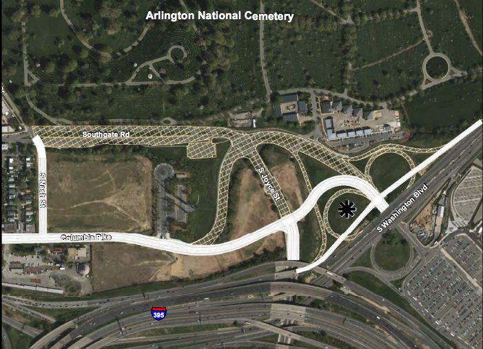
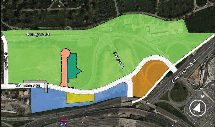
The organization, founded by county transportation commission chair Chris Slatt, is primarily concerned that the cemetery only plans to add a 10-foot-wide sidewalk along the pike’s north side when it realigns the road. Army officials are currently hoping to add space for as many as 60,000 new interments to the cemetery’s south, absorbing the former Navy annex site and several other acres of land controlled by the county near S. Joyce Street and Washington Blvd, prompting some changes to the pike in the area.

The project also calls for the removal of Southgate Road in its entirety as it runs through area, which Slatt’s group describes as “a relatively quiet street that cyclists currently use to avoid that stretch of Columbia Pike.” The organization has made improving conditions for cyclists on the pike a central part of its mission, and it’s warning that eliminating an alternative to biking along the road would be a major step backward for the area.

“By replacing Southgate Road with just a sidewalk, this project is arguably a downgrade in cycling infrastructure,” the group wrote. “This portion of Columbia Pike has no reasonable nearby alternative. It needs great bike infrastructure.”

Spokespeople for the cemetery did not immediately respond to a request for comment on the organization’s criticisms. But a draft environmental assessment of the project prepared by the U.S. Army Corps of Engineers suggests that the changes represent “the upgrade of Columbia Pike into a multimodal facility.”

“The alignment for the future Columbia Pike has the necessary geometry for a high capacity regional multimodal transportation corridor,” the corps wrote.

The corps wrote that planners also considered building the “wall trail” along the cemetery’s eastern boundary as part of this work, a bit of cycling infrastructure long hoped for by county officials to link the Foxcroft Heights neighborhood to Memorial Avenue. Yet the corps said it determined that it “appears to have severe space constraints due to aboveground utilities along the proposed route,” and didn’t consider it any further.

Instead, Slatt’s group would rather see the Army build a “bidirectional bike lane” on the north side of the pike to connect with additional improvements to the west of the area. If that’s not feasible, the organization would also accept a widening of the planned sidewalk into a trail “providing demarcated areas for pedestrians and cyclists marked with paint, signage or differentiated materials.”

Tonight’s meeting on the project is scheduled for the Sheraton Pentagon City hotel (900 S. Orme Street) from 5-8 p.m. The Army expects roadway construction associated with the expansion could start as soon as 2021.


Workers recently put the finishing touches on a new protected bike lane through Ballston.

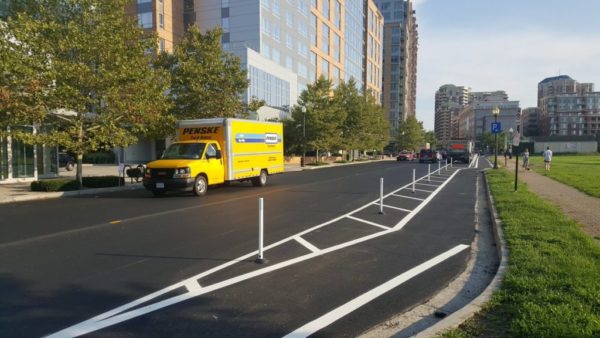
The new lane runs along N. Quincy Street, stretching from N. Glebe Road to 9th Street N. The lane was installed as the county’s embarked on some summer paving work, and workers took the opportunity to add protected lanes in several spots around the county.

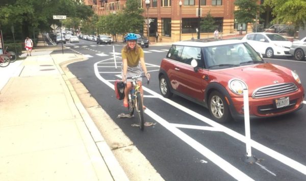
Protected bike lanes contribute to making our streets calmer, easier to understand, and more useable for people from ages eight to 80,” Erin Potter of Bike Arlington explained in a March blog post. “Well-designed protected bike lanes establish more order and predictability on the streets. Cyclists tend to behave themselves and do a better job of following the rules when they are using properly designed and separated facilities. Drivers also appreciate a sense of order and clarity that the separation provides.”

However, the change has taken some getting used to for some Ballston drivers.

The paving work has also involved some parking changes along 5th Road N. between N. Quincy Street and N. Pollard Street, adjacent to Mosaic Park, changing the parking there to back-in spots on an angle.

Photo via @Blacknell


Arlington is kicking off a new phase of construction along the Custis Trail near Rosslyn, as workers add a bevy of safety improvements to the area.

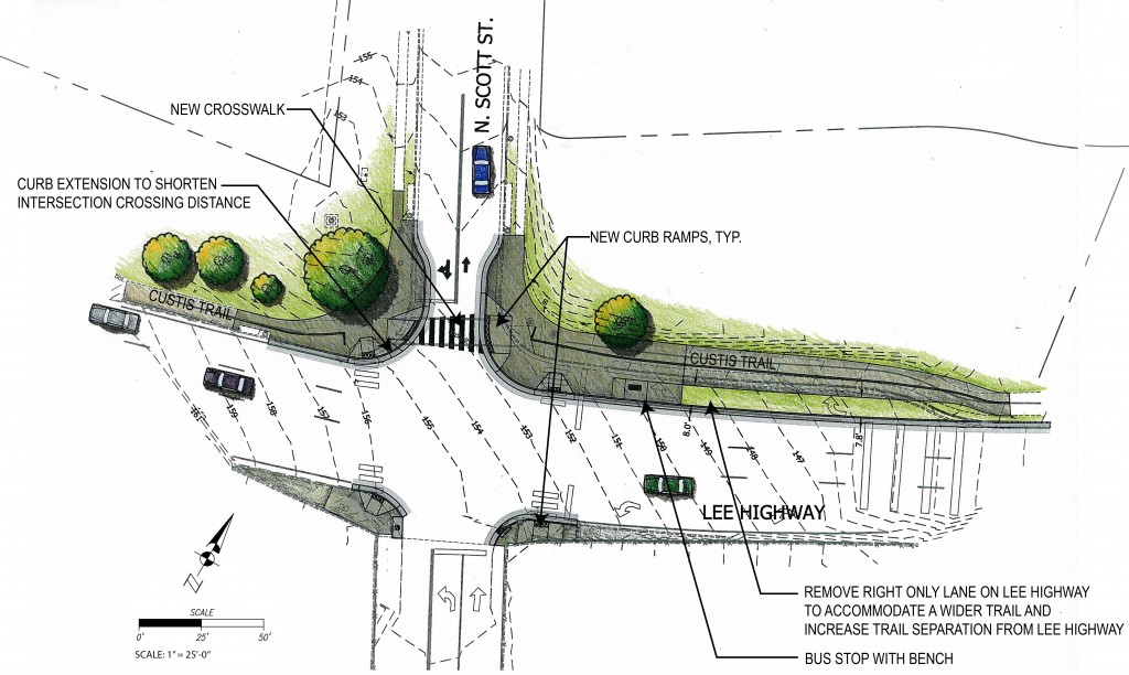
The county’s contractor plans to kick off work at the intersection of N. Scott Street and Lee Highway on Monday (Aug. 13), so long as the weather cooperates.

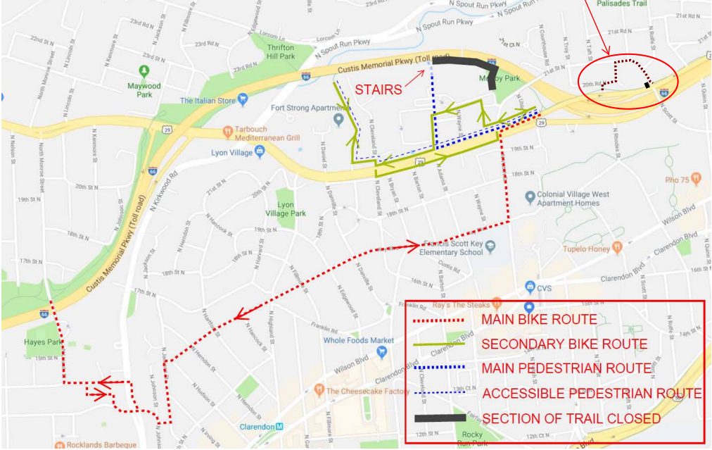
Anyone using the trail will need to follow a short detour onto N. Scott Street as it meets 21st Street N., but the county hopes the detour will only last about a week.

Earlier this year, the county kicked off bike safety improvements along Lee Highway, widening the trail itself, improving some trail crosses and crosswalks and adding curb extensions. County contractors are also reconfiguring the bike lanes on both N. Scott and N. Quinn Streets as part of the construction, resulting in some road closures in the area.

The county also plans to add new traffic signals at Lee Highway’s intersection with N. Scott Street, but planners predict they’ll only be installed “after completion of major construction activities”, likely “in the latter half of 2018.”

Workers are also busy repairing the trail as it runs alongside I-66 between N. Adams Street and McCoy Park, necessitating another detour in the area set to last through the end of the month.


View More Stories