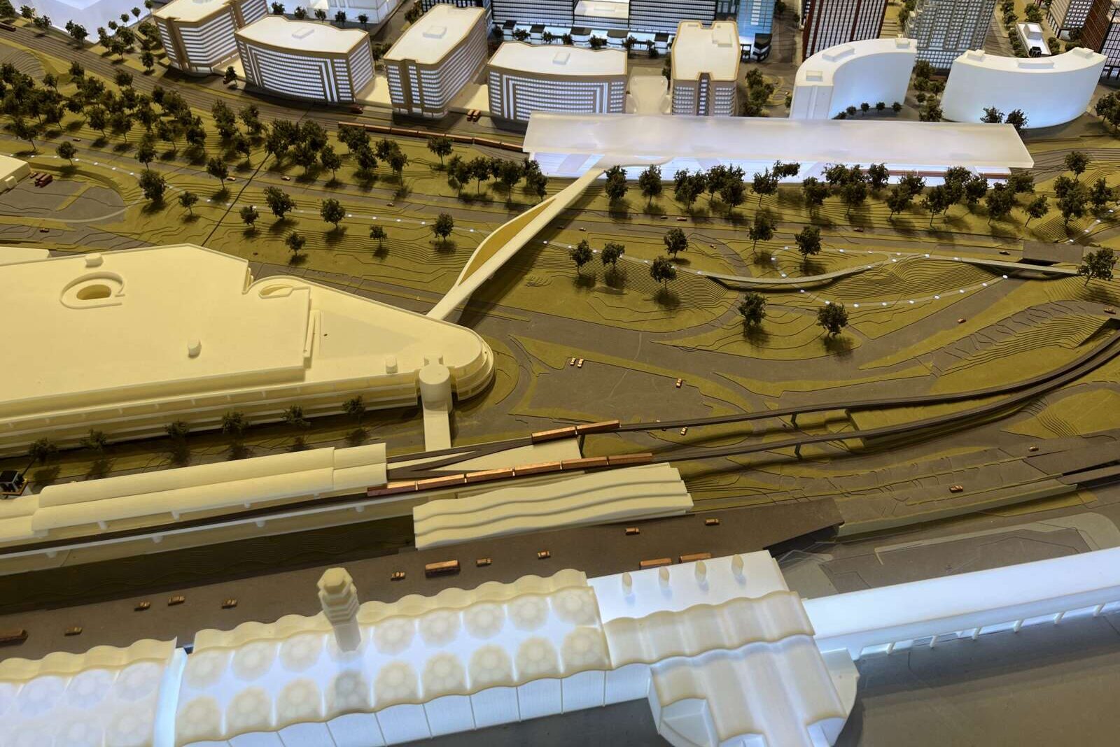
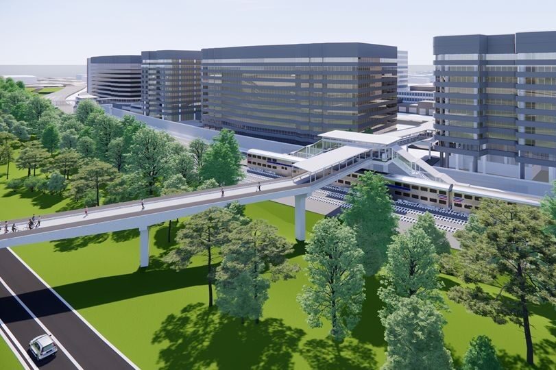
Arlington County will be setting aside $1.6 million for improvement projects on national parkland in the crosshairs of a future pedestrian bridge between Crystal City and National Airport.

The long-discussed bridge, dubbed CC2DCA, is about to clear a major milestone: completion of a federally mandated review of its adverse impacts to the environment and historic properties.

While environmental effects were deemed minimal, several National Park Service-controlled historic resources were flagged for impacts, according to a county report, including the George Washington Memorial Parkway and the Mount Vernon Trail.

The parks service and the county have settled on three improvement projects to mitigate this predicted impact. Once a design contract for the project is awarded, the county will transfer money to NPS for the work. Funding will come from the Crystal City Tax Increment Financing fund, which pays for infrastructure improvements that revitalize Crystal City, Pentagon City and Potomac Yard.

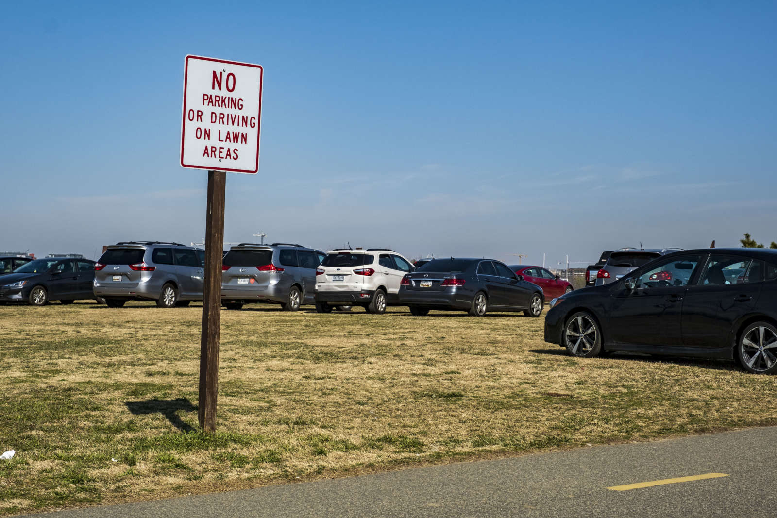
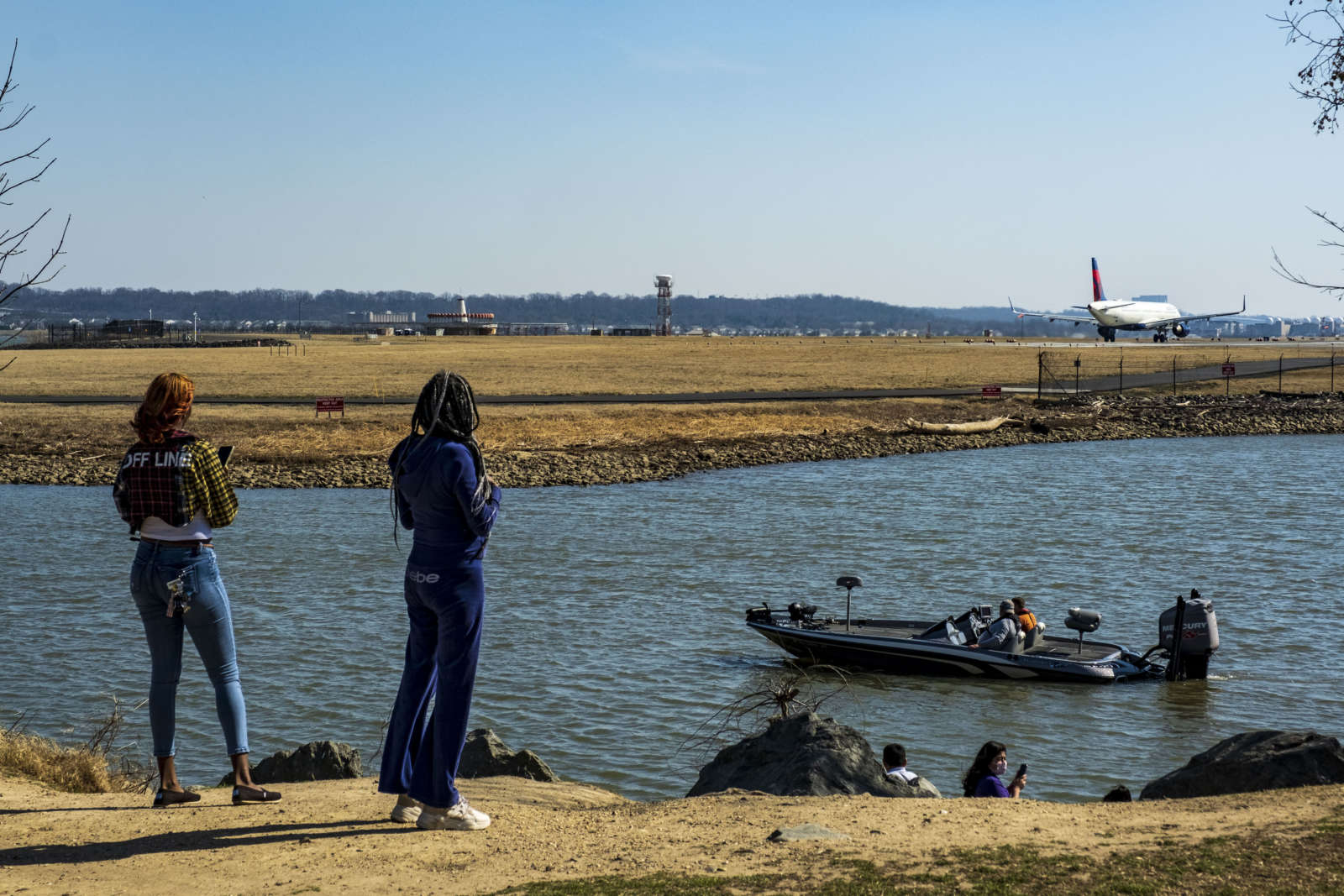
The biggest chunk, $1 million, will go toward planning and implementing improvements at Gravelly Point, as this public area could see more users traveling to and from the CC2DCA bridge via the Mount Vernon Trail.

The site could see a new parking lot, a rehabilitated boat launch — complete with an accessible canoe and kayak launch — relocated public restrooms and improved aesthetics of public-use areas.

“The Gravelly Point site is the closest major Mount Vernon Trail hub to the project area; the new CC2DCA bridge is less than a mile from Gravelly Point,” it continued. “The site rehabilitation will benefit trail users by improving the public amenities and repair deteriorated infrastructure that is in danger of further deterioration with the additional usage generated by CC2DCA.”

Next, $500,000 will fund maintenance activities by the Friends of the Mount Vernon Trail over five years, including edging the trail, replacing boardwalk bridge components like decking, cutting back vegetation overgrowth, grinding out asphalt root heaves and power washing scum from bridge decks.

Lastly, $150,000 to fund planning work to add interpretive signage to the GW Parkway highlighting underrepresented stories from Abingdon Plantation and Arlington House.

These projects are outlined in an agreement between the county and NPS, which the Arlington County Board approved during its Saturday, Dec. 16 meeting.

This agreement also requires the county to give NPS opportunities to review and give input as CC2DCA designs take shape and holds Arlington to executing a plan to protect and restore vegetation along the GW Parkway. The impact on scenic views for drivers, as well as vegetation removal, is expected to be relatively minimal, with about 146 trees removed.

The Board also approved an agreement with the county, NPS, the Federal Highway Administration, the Virginia Dept. of Transportation and the Virginia Historic Preservation Officer. This agreement is one of the final steps in the federally mandated environmental assessment study.

Originally proposed in 2017, CC2DCA was one of the transportation projects identified after Amazon announced plans to build its second headquarters in Arlington.

The last four years have been spent on design work, public engagement and the environmental study. Arlington and VDOT reviewed 16 possible bridge alignments and whittled them down to one that was picked earlier this year.

“Throughout the NEPA study, there has been overwhelming support for a direct multimodal connection between Crystal City and DCA,” the county report said. “During each public engagement period, the vast majority of individuals surveyed indicated they would use a CC2DCA connection if constructed.”

If CC2DCA comes to fruition, construction is expected to begin in late 2027 and last for two years, working around separate plans from the Metropolitan Washington Airports Authority to redo roadways and add more parking, new car rental facility and office space at DCA.


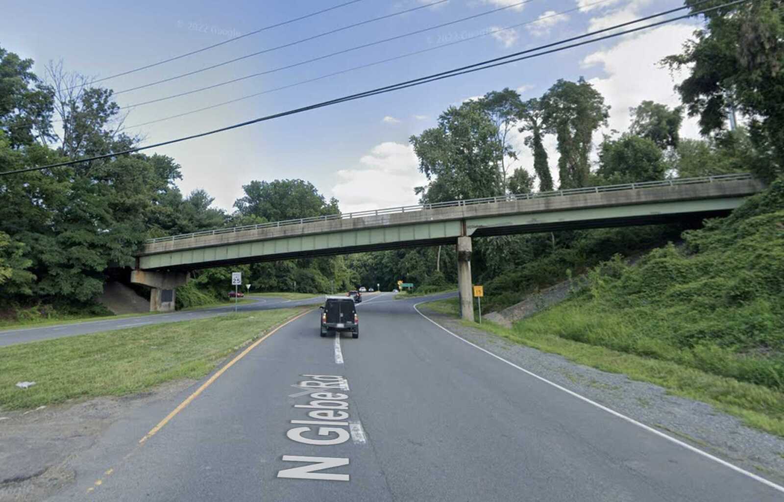
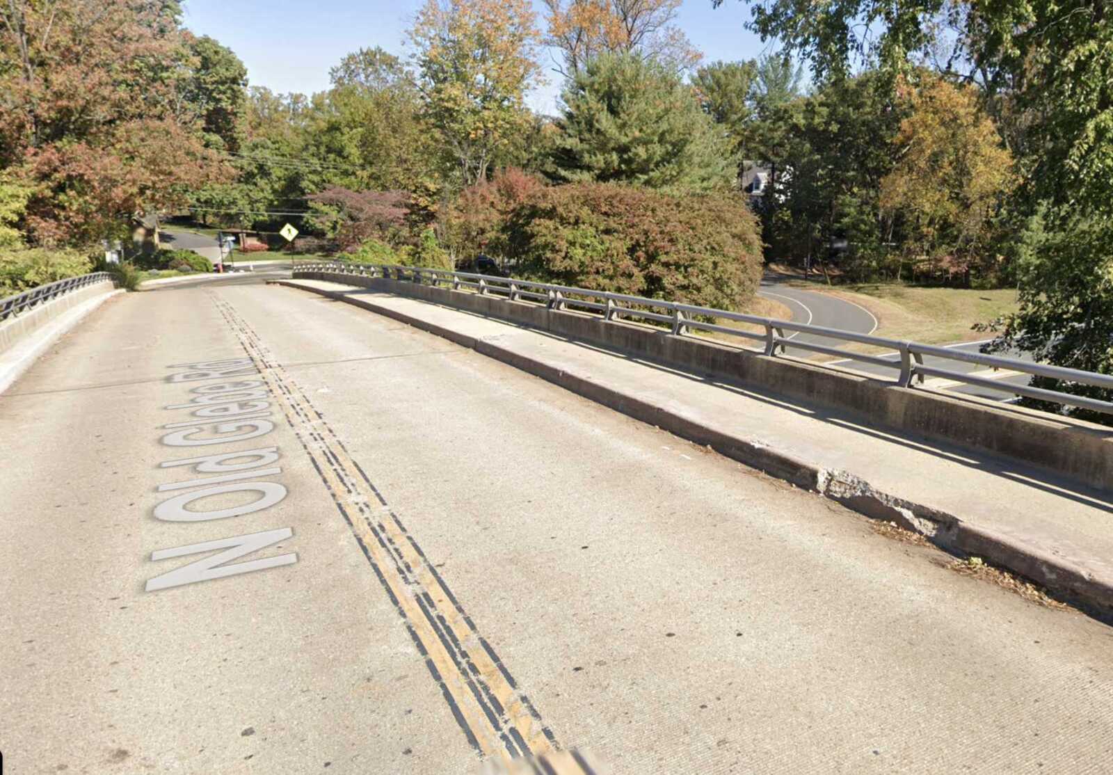
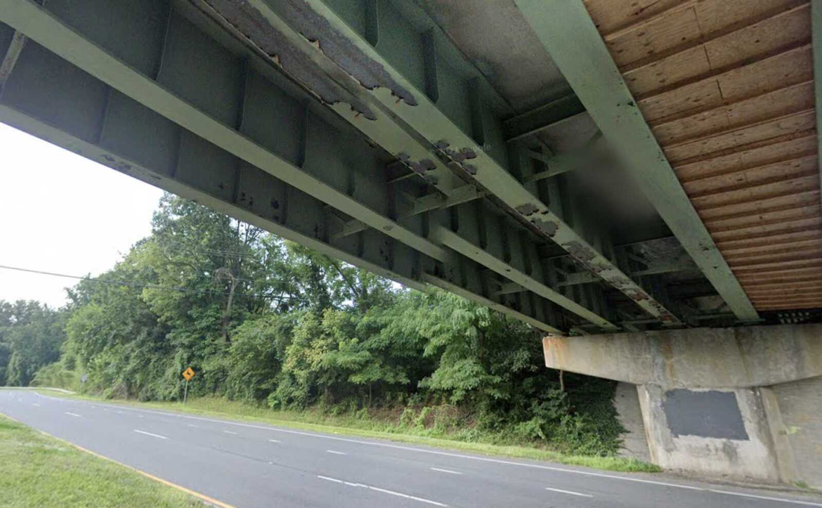
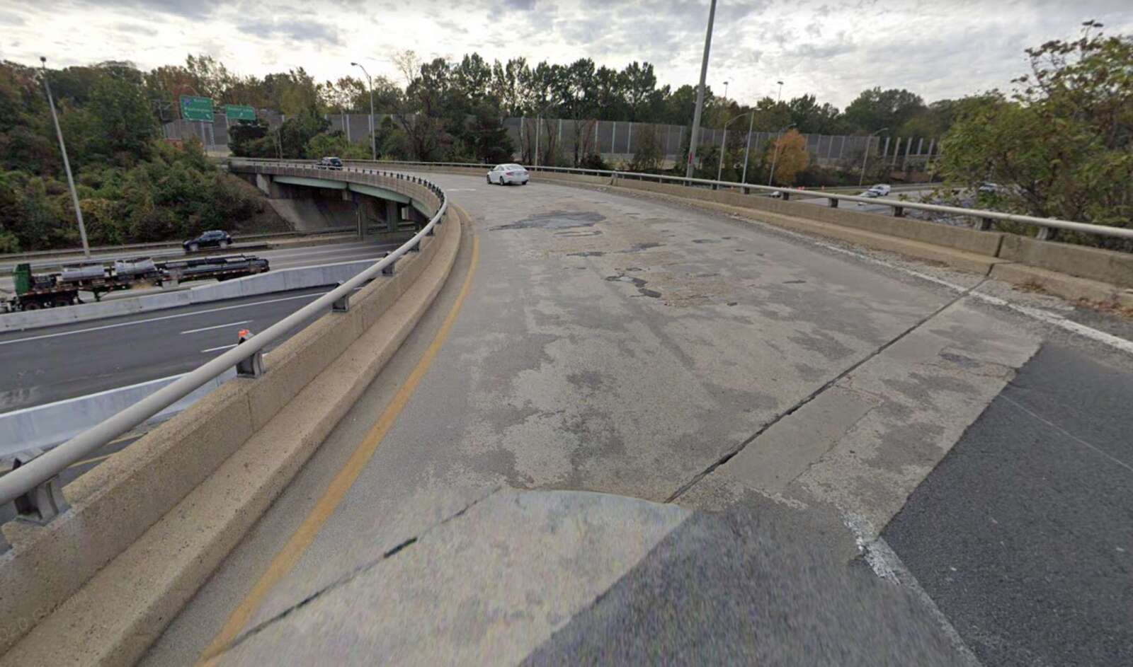
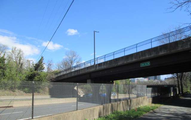
A nearly 60-year-old bridge over N. Glebe Road is slated for replacement.

The circa-1964 Old Glebe Road bridge, which spans the north-south artery just before the steep hill down to Chain Bridge, would be too costly to repair, VDOT says. The state transportation agency is instead planning a $15 million project to replace it.

About 7,000 vehicles per day use the bridge, VDOT says. A virtual public meeting is planned this Wednesday at 7 p.m. to discuss the project.

VDOT’s current timeline calls for a public meeting late next year to discuss the design of the new bridge, followed by construction starting in mid-2027.

More, below, from a VDOT email.

The Virginia Department of Transportation will hold a virtual public information meeting Wednesday, Oct. 18 on the planned replacement of the North Old Glebe Road bridge over North Glebe Road (Route 120). The bridge, which averages 7,000 vehicles a day, was built in 1964.

A new bridge will be constructed due to the estimated rehabilitation cost of the existing bridge exceeding 65% of the estimated cost to replace the bridge.

The new bridge will feature a wider sidewalk on the eastern side and an additional sidewalk on the western side.

Get Involved

In lieu of an in-person meeting, VDOT invites residents and travelers to learn more, participate in the virtual meeting and give feedback in the following ways through Nov. 1:

  • Attend the Oct. 18 online meeting. Register for the meeting or to participate without registering in listen-only mode, call 844-992-4726 (use access code 2484-673-7292 and password 1234). The project team will make a short presentation beginning at 7 p.m. and answer questions after the presentation. In case an alternate date is needed, the meeting will be held Nov. 1.
  • Provide comments via the online comment form or by email to [email protected].
  • Mail comments to Ms. Dipali Patel, P.E., Virginia Department of Transportation, 4975 Alliance Drive, Fairfax, VA 22030.

Meeting materials and the presentation will be available online at virginiadot.org/OldGlebe, including the recorded presentation after the meeting.


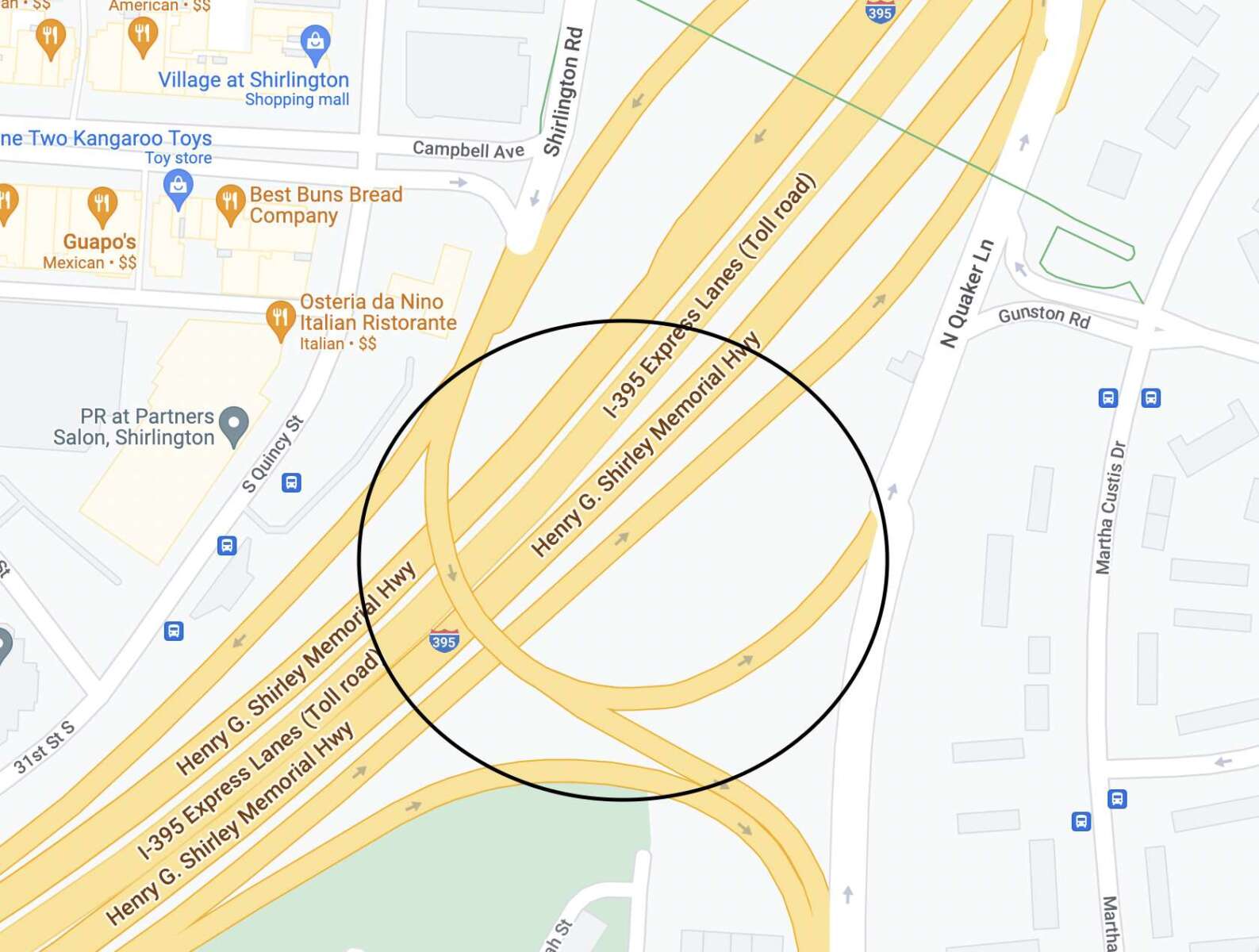
VDOT is repairing this bridge over I-395 near Shirlington (via Google Maps)

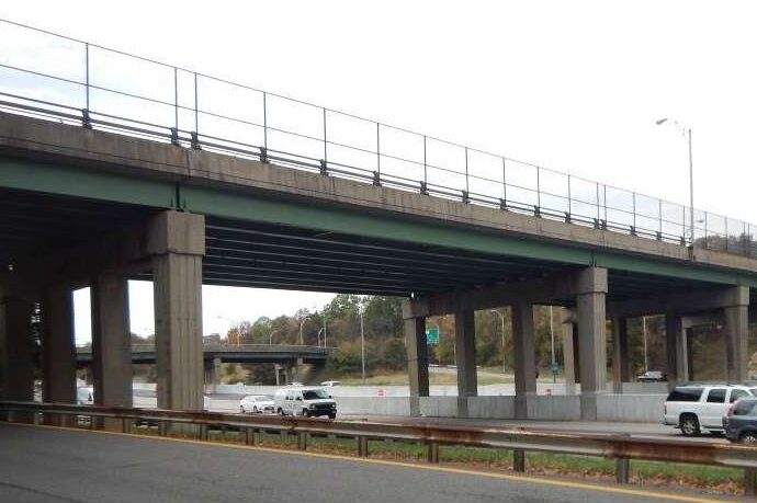
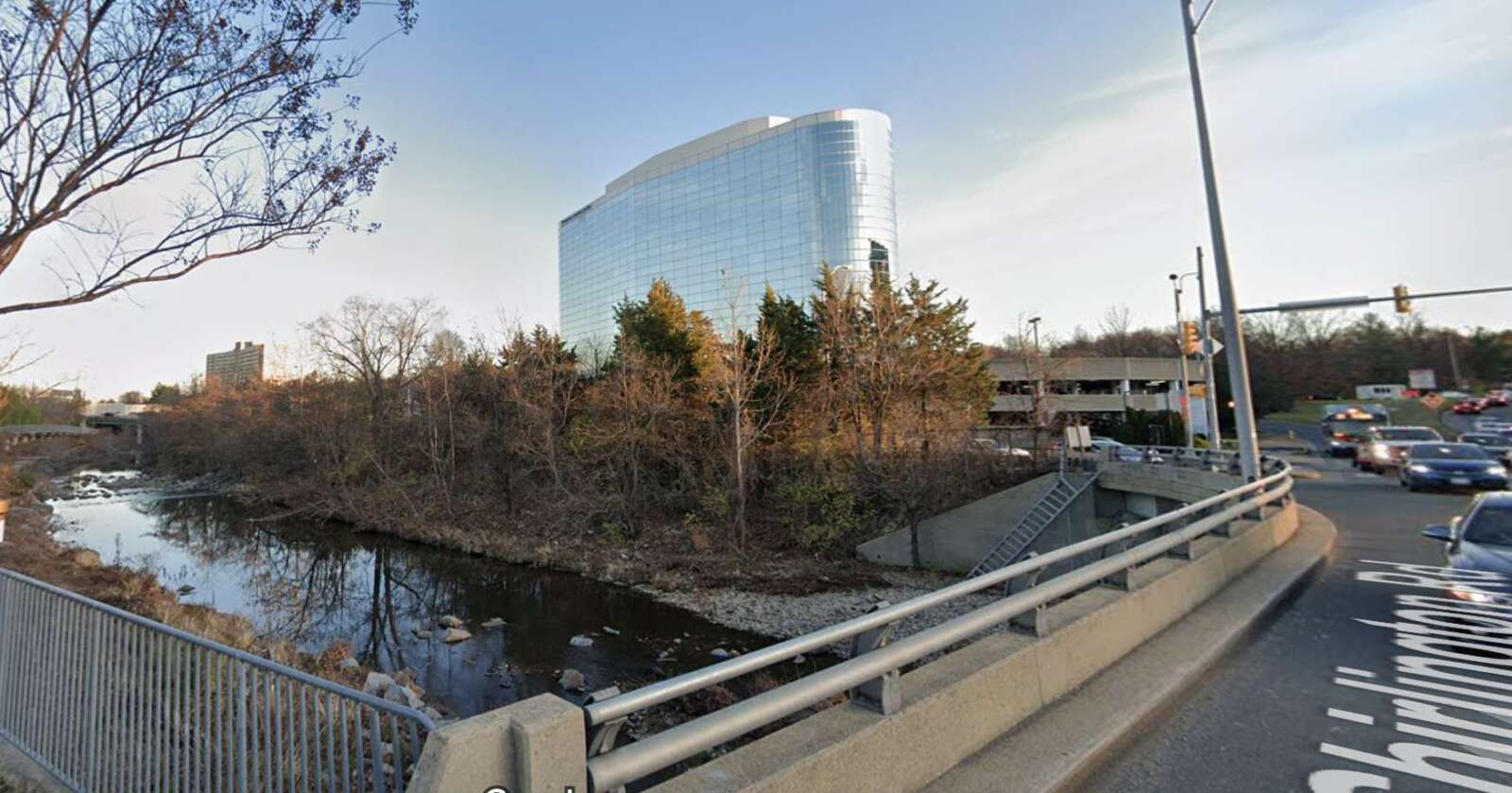
Work on a 50-year-old bridge over I-395 near Shirlington is underway, the Virginia Department of Transportation announced yesterday.

The bridge connects the southbound I-395 collector-distributor lanes and southbound Shirlington Road to N. Quaker Lane at the I-395 Exit 6 interchange.

Built in 1973, the bridge — crossed by about 7,400 vehicles daily — now needs needs safety improvements and upgrades to extend its overall life, according to VDOT.

The $5.5 million project, slated to wrap up in mid-2025, involves:

  • resurfacing the concrete bridge deck
  • closing deck joints
  • repairing steel beams
  • adding protective concrete barriers adjacent to piers
  • replacing bearings
  • cleaning and recoating the bridge
  • upgrading guardrails adjacent to the bridge

During construction, there may be daytime and overnight lane closures, as well as closures to segments of the I-395 general purpose and Express Lanes beneath the bridge, VDOT says.

The bridge over I-395 in Shirlington slated for repairs (via Google Maps)

The work is financed with state and federal funding, including VDOT State of Good Repair funds used for bridges. It appears the budget has increased from last year, when the project estimate stood at $4.3 million.

“Drivers are reminded to use caution when traveling in active work zones,” says VDOT. “Be alert to new traffic patterns and limit distractions.”


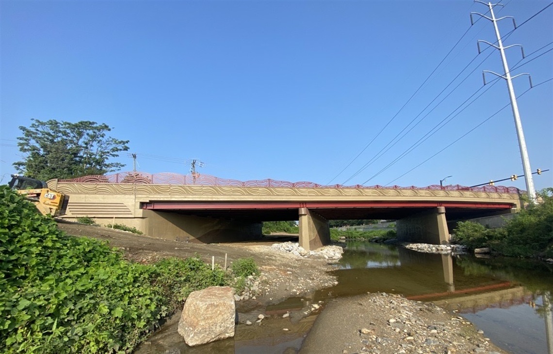
The updated West Glebe Road bridge between Arlington and Alexandria (via Arlington County)

Tomorrow, Arlington County officials will officially mark the reopening of the West Glebe Road Bridge after a year-long rehabilitation project.

Tuesday’s event comes after the bridge opened to pedestrians and cyclists last month, though it reopened to vehicular traffic this March.

In May of 2022, the county embarked on a $10 million project to shore up the 67-year-old bridge linking Arlington and Alexandria near the I-395 ramps to and from S. Glebe Road.

Deemed “structurally deficient” in 2018, the bridge had severely deteriorated since its construction in 1952, requiring partial closures over the years. In April of 2021, the Arlington County Board approved plans to make structural upgrades, improve the lighting and add dedicated lanes for cyclists and pedestrians.

To beautify the bridge, the county once again commissioned stylistic improvements by artist Vicki Scuri, who has adorned other county bridges — notably the bridges over Route 50 in the Courthouse area — with artwork.

Arlington and Alexandria split the project’s costs but Arlington County has taken on sole responsibility for inspecting and maintaining the bridge.

“This project was a partnership between Arlington County and the City of Alexandria to maintain safe passage between the two communities for all residents regardless of mode of transportation,” a county press release said.

More details on the ribbon-cutting, which is open to the public, are below.

When: Tuesday, Sep. 12, 2 p.m.

Where: Pizza Hut, 1049 W Glebe Rd, Alexandria, VA 22305 (this event will be held outdoors. In the case of inclement weather, the event will move into the Pizza Hut)

How to Get There:

  • By bus: ART 87 (Arlington side only); DASH 36AB, 103; Metrobus 23AB
  • Limited parking available onsite

Who:

  • Christian Dorsey, Chair, Arlington County Board
  • Justin Wilson, Mayor, City of Alexandria
  • Greg Emanuel, Director, Arlington County Department of Environmental Services
  • Vicki Scuri, Artist

Plans to build the future pedestrian bridge from Crystal City to National Airport are firming up.

A new report outlines the impact the bridge could have on the environment. It also details how the project will relate to separate plans to redo roadways and add more parking, new car rental facility and office space.

The environmental assessment says the impact on scenic views for drivers on the GW Parkway, as well as vegetation removal, is expected to be relatively minimal. Up to 146 trees could be removed for construction and the area would later be replanted.

Now through Oct. 3, community members can comment online on the report, Arlington Dept. of Environmental Services spokeswoman Erin Potter tells ARLnow. They can also attend a public hearing on Sept. 19 at the Aurora Hills Recreation Center (735 18th Street S.).

Even with the pedestrian bridge, the Metropolitan Washington Airports Authority (MWAA), which governs DCA and Dulles International Airport, says it does not project reduced vehicle traffic to and from the airport. As such, it is designing significant upgrades for drivers.

“The overall number of passengers and employees shifting to the multi-modal access would not have a notable effect on the forecast traffic demand on the Airport roadway network or the demand for on-Airport passenger and employee parking,” a report for the MWAA project says.

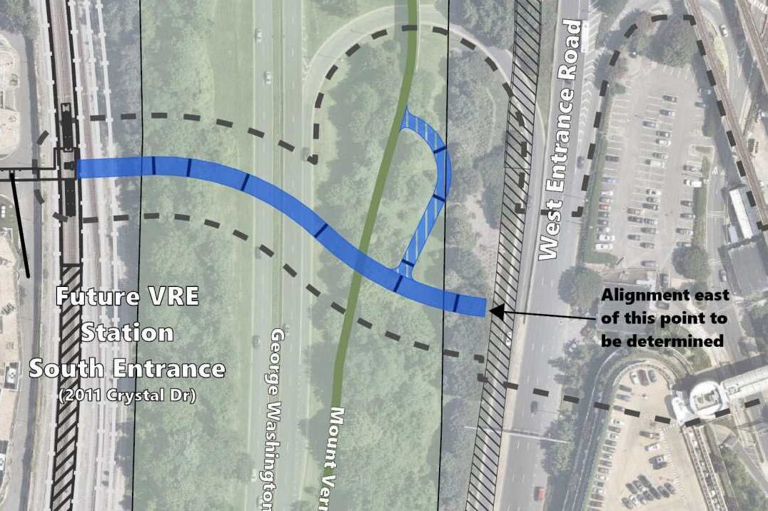
While MWAA is not leading the bridge project, it did have input on where the pedestrian bridge could go, the report says. It notes that where the bridge goes and what angle it is at will not alter the project’s environmental impacts.

MWAA asked Arlington County and the Virginia Dept. of Transportation to move the bridge to reduce impacts on existing parking and accommodate a proposed elevated ramp west of the West Entrance Road, the report says.

“Arlington County and the CC2DCA project team have been working closely with MWAA staff to coordinate delivery of the safety and access improvements provided by both projects,” says Potter.

Construction on the CC2DCA bridge is expected to begin construction in late 2027 and last for two years, Potter said. Since MWAA is still finalizing a timeline for its road improvements, VDOT and Arlington are blocking off an area where the bridge could go and deciding on a final alignment later.

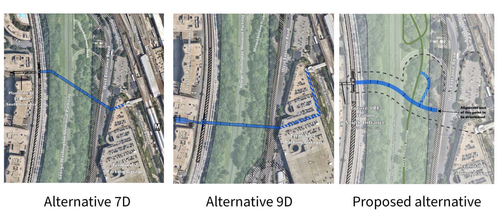
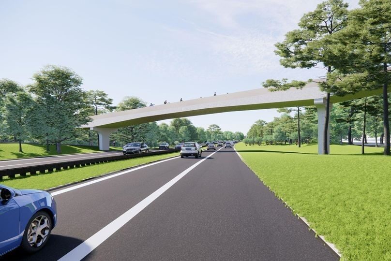
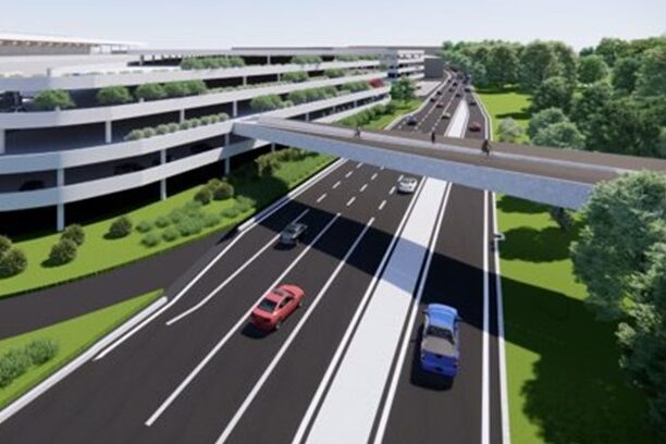
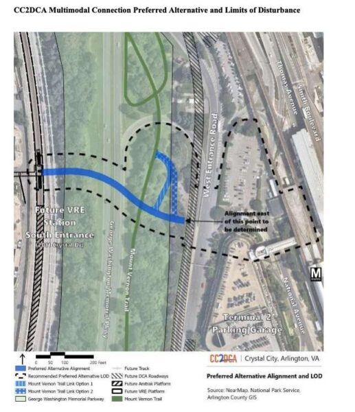
The new report describes how the preferred option marries two other alternatives: one that crossed the GW Parkway and Mount Vernon Trail at a significant angle and another that provided a straight shot. The new renderings also show that, of the two Mount Vernon Trail link options, a more curved path was chosen.

CC2DCA pedestrian bridge alternatives (by ARLnow)

As planning efforts continue for projects at DCA, the surrounding area is set to see changes, too.

An airport access road is set to be removed to make way for a redevelopment project proposed by JBG Smith. Near the Crystal City-side of the bridge, a second entrance to the Crystal City Metro station and a new Virginia Railway Express station and Amtrak platform are being built.

Meanwhile, the Mount Vernon Trail is set to be widened to 11 feet, a planned Crystal City bicycle network could be completed next year and the bus rapid transit network will be extended to Pentagon City.


VDOT has started planned rehabilitation work on a bridge over I-66.

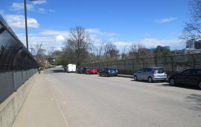
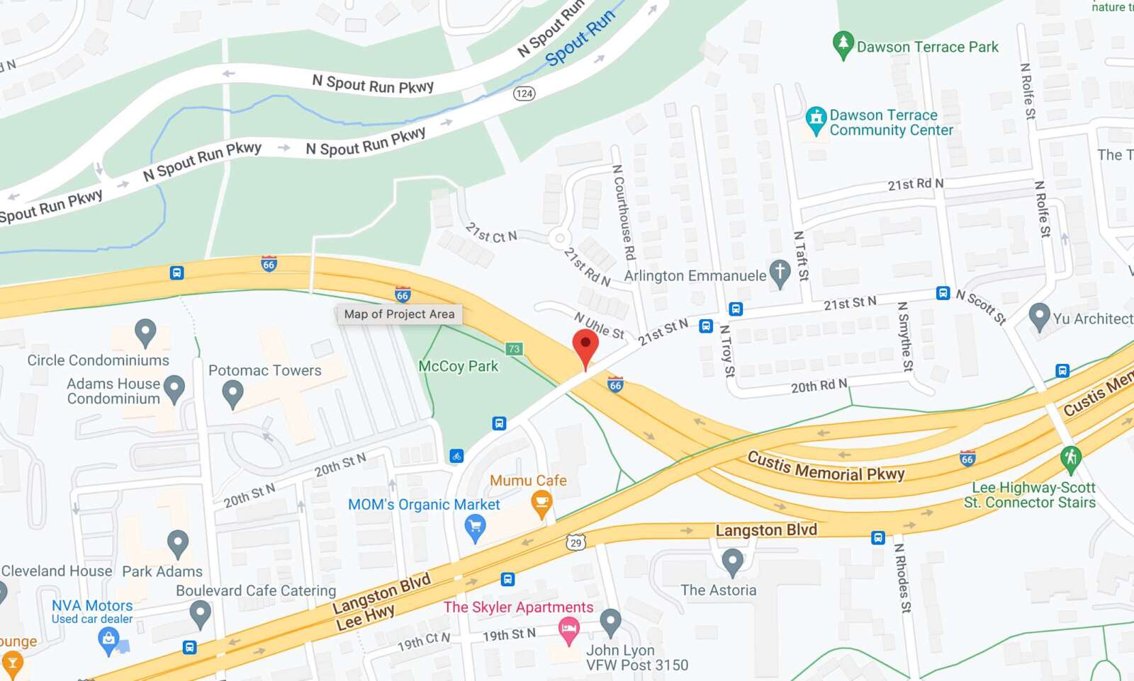
The state transportation department says the 21st Street N. bridge, built in 1980, is “deteriorating” and needs concrete repairs and other TLC. The bridge is located near the Mom’s Organic Market along Langston Blvd; it connects drivers going between Courthouse, the North Highlands neighborhood, and Rosslyn.

The $4.1 million project will prompt some temporary lane closures on I-66 during construction, as well as temporary closures of a sidewalk along the bridge.

More, below, from a VDOT press release.

Work is underway to rehabilitate the 21st Street North bridge over I-66 to improve driver, bicyclist and pedestrian safety and extend the overall life of the bridge, according to the Virginia Department of Transportation. The bridge, located between the Spout Run Parkway (Exit 72) and eastbound I-66 Route 29 Rosslyn/Key Bridge (Exit 73) interchanges, was built in 1980.

The project includes:

  • Resurfacing the concrete bridge deck
  • Closing deck joints
  • Repairing concrete piers and abutments
  • Replacing bearings
  • The width of the existing lanes and sidewalks on the bridge will remain the same.

During construction:

  • Daytime lane closures may be scheduled along I-66 and 21st Street North
  • Overnight lane closures may be scheduled on I-66
  • When one sidewalk along the bridge is closed, pedestrians will be detoured to the sidewalk on the opposite side
  • The Custis Trail under the bridge will remain open to bicyclists and pedestrians
  • Parking will not be allowed on the bridge or approaches

Starting in mid-2024, 21st Street North will be temporarily reduced to one lane on the bridge and open to northbound traffic only. Further information will be provided closer to the start of the partial bridge closure, which will be in place for several months while work occurs on the bridge deck.

The $4.1 million 21st Street North over I-66 Bridge Rehabilitation Project is financed with federal and state funding, including State of Good Repair funds used for bridges. The project is scheduled for completion in late 2024.

Drivers, bicyclists and pedestrians are reminded to use caution when traveling in active work zones. Be alert to new traffic patterns and limit distractions.


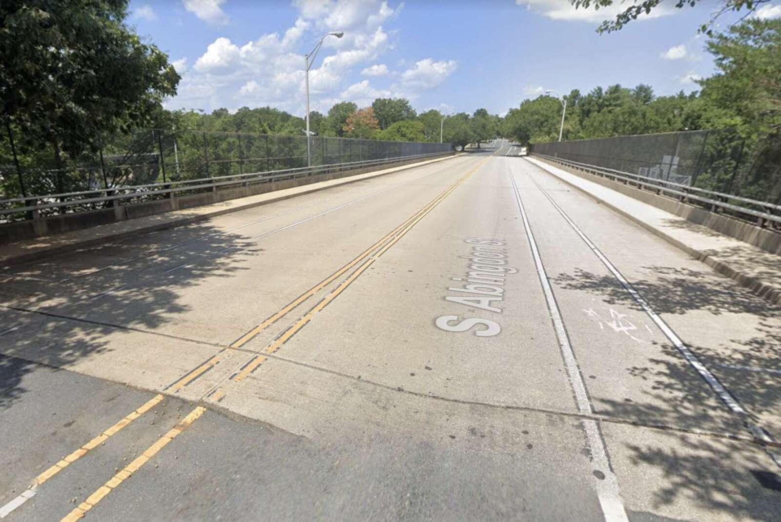
Work is underway to make a 53-year-old bridge S. Abingdon Street bridge over I-395 safer and extend its overall life, per the Virginia Dept. of Transportation.

The 53-year-old bridge is located between the I-395 interchanges for King Street and Shirlington Circle in the Fairlington neighborhood. It was last rehabilitated in 1994 and is in need of attention, according to a press release from the state transportation department.

The planned repairs will use $8.4 million in federal and state funding and will wrap up in late 2024, the press release said.

Work includes rehabilitating the bridge deck, repairing deteriorating concrete, replacing all steel bearings and eliminating bridge joints, per a project overview video.

Arlington County also identified S. Abingdon Street, from 34th Street S. to Fire Station 7, for resurfacing. It is coordinating with the state on those changes, including a buffered bike lane to improve the cycling experience and narrower travel lanes to manage vehicle speeds.

Bridge deck rehabilitation work will last about 12 weeks and occur in three stages, the video says.

In the first phase, all traffic will be shifted to the east side of the bridge, with two shared bicycle and traffic lanes and one five-foot-wide sidewalk. A temporary crosswalk will be added near 36th Street S. In the second phase, all traffic will be shifted to west side of the bridge.

In the third stage, traffic will be split on both sides of the work zones and the crosswalk will be removed.

“When one sidewalk along the bridge is closed, pedestrians will be detoured to the sidewalk on the opposite side,” VDOT said in the press release. “Drivers, bicyclists and pedestrians are reminded to use caution when traveling in active work zones. Be alert to new traffic patterns and limit distractions.”

The I-395 main and express lanes may see periodic daytime and overnight lane closures, VDOT says.

“Most of the work below the bridge will be performed during nighttime operation to avoid impact to normal daytime traffic particularly peak hour traffic,” the project video says.


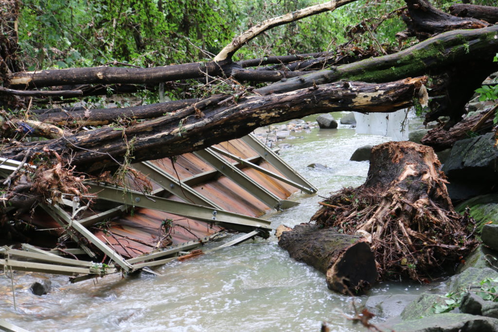
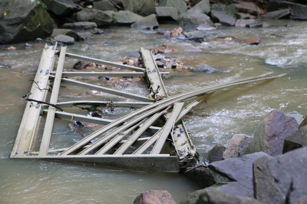
Arlington County is working on a replacement for the two bridges over Lubber Run destroyed in severe flash flooding four years ago.

The Arlington County Board is set to discuss a $360,000 construction contract for a new pedestrian bridge at its meeting this weekend.

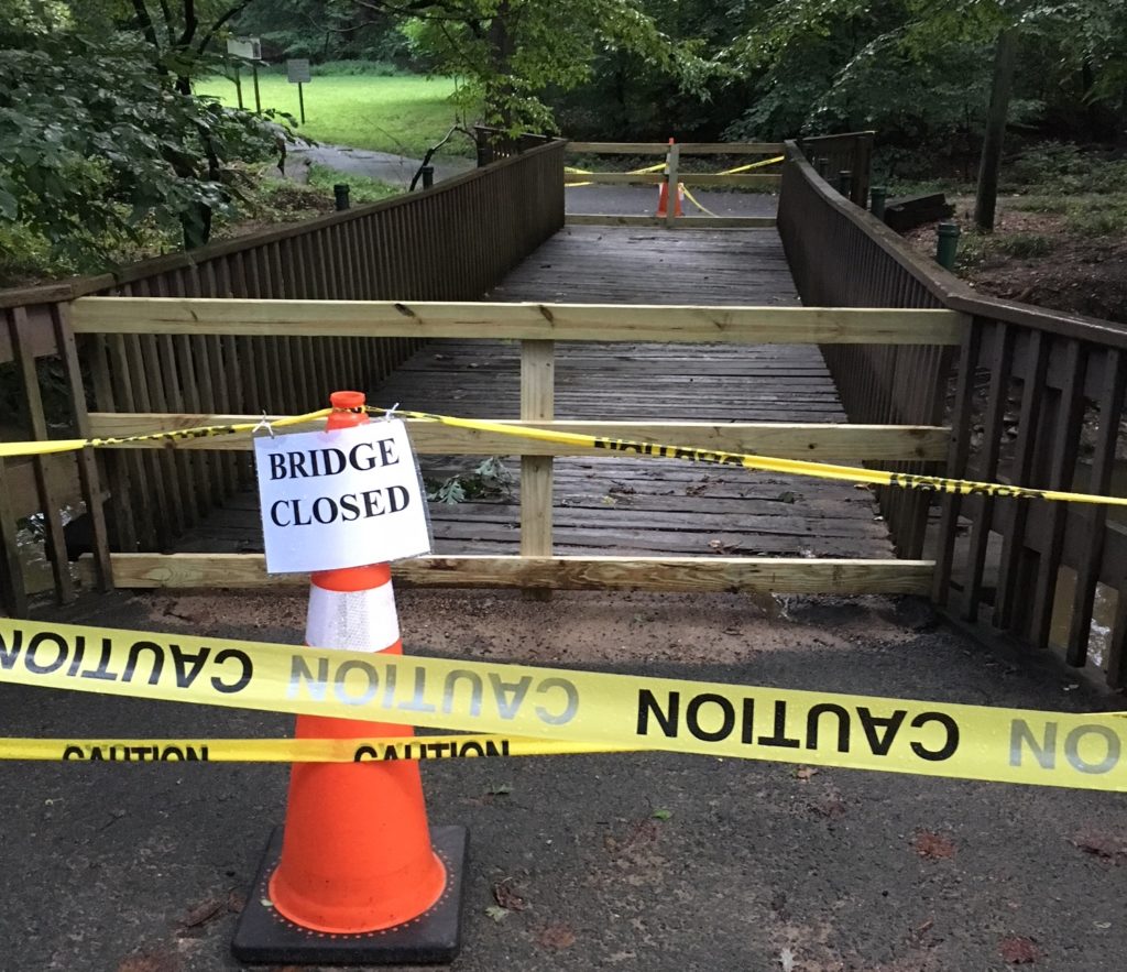
Flash flooding in 2019 washed away six pedestrian bridges in Arlington, including two in Lubber Run Park and four in Glencarlyn Park. The overall damage to county property was estimated at $6 million at the time.

On Saturday, the Board will consider approving the new bridge in Lubber Run, in place of the two that were destroyed. The contract — of about $329,000 with a $33,000 contingency — is expected to go to Fairfax-based Bright Masonry.

A lower bidder — by just over $30,000 — was “deemed nonresponsive” by county staff, according to a report to the Board.

The project’s goal is to “design one new bridge in the most suitable location for enhancing accessibility around the park,” the staff report said.

One of the bridges in Glencarlyn Park that was washed away was replaced in February of last year.

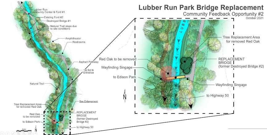
The proposed construction for Lubber Run involves building one new bridge in the southwest portion of the park to replace the previous two, as explained in the county’s project webpage.

“Through our community engagement and engineers’ analysis, we have found that this location will provide a significant, positive impact on park users and supports the community’s interest,” the webpage noted.

For parkgoers, the proposed bridge will provide access from Lubber Run to Edison Park, staff said. The bridge would also provide a connection between the southwest portion of the park and its east side.

Construction is estimated by staff to take around 12 months and seeks to minimize environmental harm.

“One tree, with exposed roots on the bank, will need to be removed. It already has a very low chance of survival due to its current condition,” the project webpage said. “We will plant healthy trees in the same general areas, which will better support our tree canopy in the long term.”


A plan for a pedestrian bridge between Crystal City and Reagan National Airport is headed to the Arlington County Board for endorsement this weekend.

Specifically, the Board is set to bless a girder-style bridge that will connect a future southern entrance to the Virginia Railway Express station at 2011 Crystal Drive to the airport’s Terminal 2. It is also slated to approve more funding for an engineering firm to further develop designs for the bridge, dubbed the CC2DCA multimodal connection.

“The goal of the project is to create an intermodal connection designed to meet the needs of a broad range of pedestrians, bicyclists, and micro-mobility users of all ages and abilities between the core of Crystal City, the Mount Vernon Trail, and DCA,” per a county report.

Currently, getting from Crystal City to DCA on foot or bike involves navigating a series of trails and crossings the county has previously described as “circuitous.”

“Once completed, the journey from the foot of the bridge to the newly constructed security checkpoint at DCA would be about 1,300 feet,” the National Landing Business Improvement District said in a pamphlet published last winter. “Once completed, the new CC2DCA Multimodal Connector would make National Landing the only downtown in the country with its main street within a comfortable 5-minute walk from a major airport.”

After endorsing the project on Saturday, the Board is set to approve a new $4.2 million contract with Boston-based civil engineering firm Vanasse Hangen Brustlin, Inc. (VHB) so it can begin drafting preliminary designs. This includes nearly $386,000 in contingency.

CC2DCA preferred alternative and limits of land disturbance (via Arlington County)

Although it may seem incremental, the county says these signs of progress are important milestones in the years-long project, which the county projects could be completed in 2028.

First, this step forward means that a conceptual design phase and environmental review process led by the civil engineering firm VHB are wrapping up.

The County Board approved its first contract with the engineering firm in the spring of 2021 for design work.

Since then, the county, VHB and state and federal agencies winnowed down 16 initial bridge and tunnel connections to a “preferred alternative” and a runner-up bridge proposal, both unveiled last October.

The county says the U.S. Army Corps of Engineers, the Environmental Protection Agency and the National Parks Service signed off on the “preferred alternative” this February.

(more…)


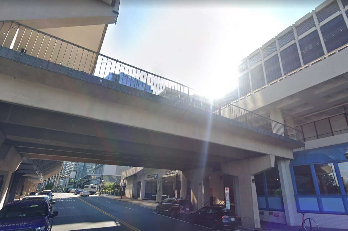
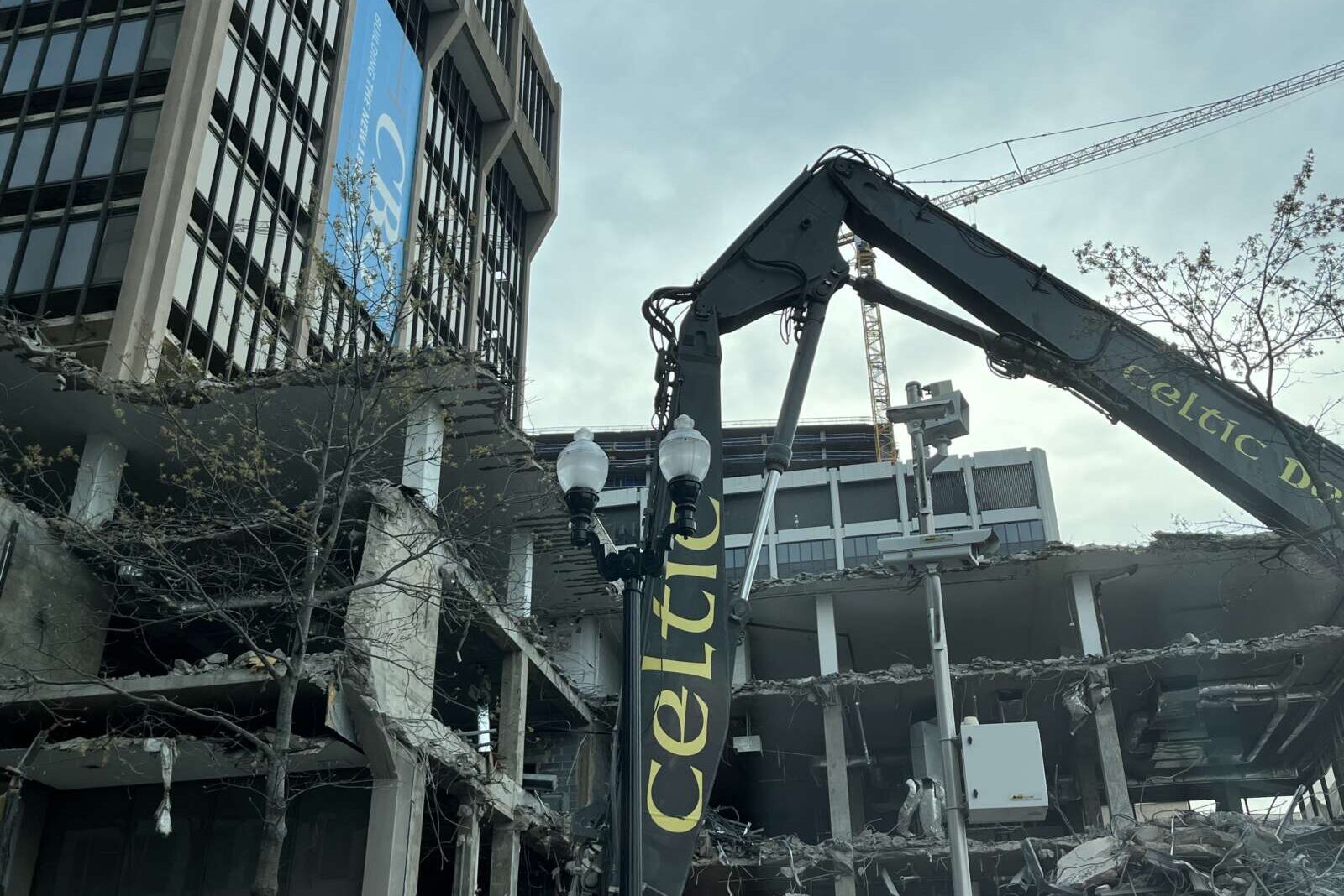
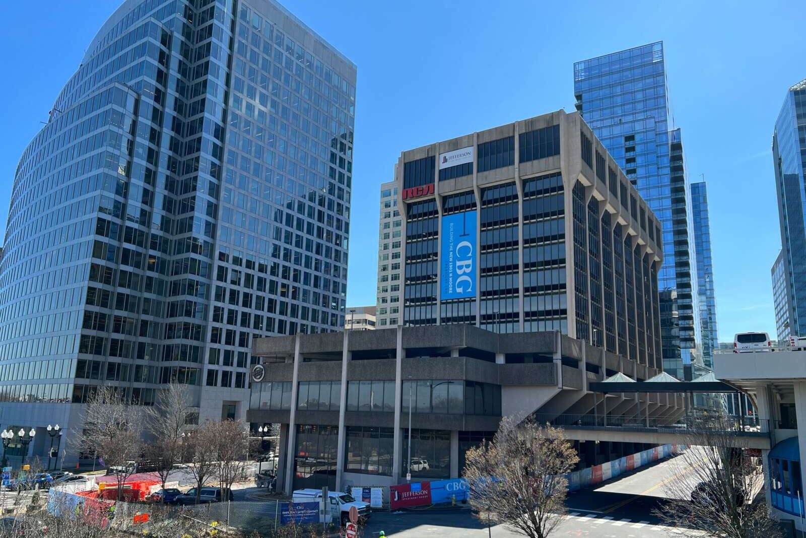
The pedestrian bridge connecting the Rosslyn’s RCA building to another building (and bar) across N. Moore Street is set to be demolished soon.

The demolition process will start on Saturday and last two weekends: April 29-30 and May 6-7, per a letter to residents of the Central Place apartments, shared with ARLnow.

Jefferson Apartment Group, one of the developers leading a joint venture to redevelop the RCA property at 1901 N. Moore Street as an apartment tower, confirmed that the information shared was correct. The letter provided some details about expected traffic impacts as a result of the demolition.

“Please note that North Moore Street will be completely closed off to pedestrian and bus traffic during this period, except for cars that need to access the garage entrance for 1911 Fort Myer Drive,” the letter said.

The bridge connects the old office building to the retro pool hall Continental. Demolition could impact the buses and shuttles that pick up people in front of the bar’s beer garden and take them to D.C., such as the shuttle between Georgetown University and the Rosslyn Metro station.

“All parties of bus routes that stop at the corner of North Moore Street and 19th Street N. have been notified of the work, and they will notify all customers of any route changes,” the note to residents said.

Demolition began earlier this month, Axios reported. Rather than an implosion, Jefferson Apartment Group previously told ARLnow that the building will be dismantled bit by bit.

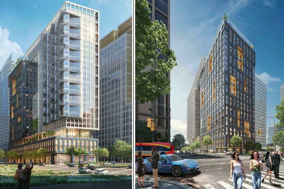
The county approved plans to replace the concrete-cladded office building with a 27-story, 423-unit apartment building in June 2021. Construction is expected to take three years.

Like the RCA building itself, pedestrian bridges in Rosslyn are relics of a mid-century planning belief that bridges make pedestrians more comfortable by separating them from vehicular traffic, noted a 2014 Washington Business Journal article.

Forty years later, these were already out of vogue, per a scathing passage in a 1999 study of Rosslyn.

“To the planners of the early 50’s and 60’s, presumably it seemed orderly and logical to separate the pedestrian flow with its erratic, unpredictable movements, from the fast-moving steel machines of the road,” wrote the local architecture firm the Lukmire Partnership in the study.

Publications from that time illustrated these passageways as wide, open, landscaped spaces that were somehow “strikingly devoid” of any signs of a vibrant urban streetscape, the report continued.

“Buried in the back of the planners’ minds perhaps lingered images of the piazza at San Marco in Venice or those of Rome,” Lukmire Partnership concluded. “If so, in the instance of Rosslyn, something was lost in translation.”


The County Board is set to vote this weekend on a contract to build a long-awaited pedestrian bridge.

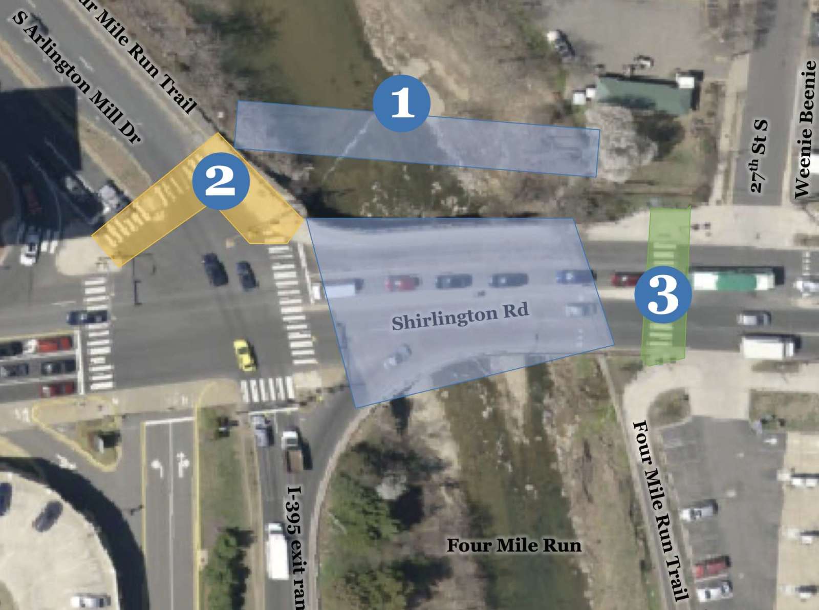
On Saturday, it is expected that the Arlington County Board will approve a $1.6 million contract to construct the Shirlington Road Pedestrian Bridge. The 15-foot-wide prefabricated steel bridge will run the length of Four Mile Run and parallel to the road with the purpose of providing safer bicycle and pedestrian access.

It will connect Shirlington and S. Arlington Mill Drive to Jennie Dean Park and the Green Valley neighborhood. It will also serve local users of the heavily-used Four Mile Run and W&OD trails nearby.

Work on the bridge could begin in the second half of this year if the contract is approved over the weekend, Arlington Dept. of Environmental Services spokesperson Claudia Pors told ARLnow. That would mean a completion date in mid to late 2024.

“The existing Shirlington Road vehicular bridge primarily funnels vehicles to/from I-395 and lacks safe, comprehensive accommodations for pedestrians and bicyclists traveling through this area,” the report to the Board says.

“This project will provide a key missing link in the County’s bicycle network by providing a north-south protected bicycle facility that will link up with the existing Four Mile Run Trail along South Arlington Mill Drive to the west and along Four Mile Run in the City of Alexandria to the east of the bridge,” the report adds.

The bridge has been under discussion for two decades and has been the topic of conversation among county staff and the public for years.

It will be constructed in two parts, per Pors. First, the span will be built offsite, a process that will take about nine months, while abutments will be added at S. Arlington Mill Drive and Jennie Dean Park where each end of the bridge will go. Around this time, the bridge’s walls will be built and the sidewalk and crosswalk at S. Arlington Mill Drive will be shuttered. Bike and pedestrian traffic will be detoured.

The bridge, then, will be lifted by a crane and installed.

“It’s possible that lanes on the existing bridge will close to accommodate this installation, and the public would be given notice of any detours,” Pors noted.

New street lighting on each end of the bridge will be installed as well, plus median, sidewalk and crosswalk retrofits. A new Rectangular Rapid Flashing Beacon will be installed in the median as well.

The work is set to be done by D.C.-based Milani Construction, whose $1.38 million bid (plus $277,000 in contingency costs) actually came in under the county engineer’s estimated construction cost.

Last year, work was completed on the parallel vehicle bridge on Shirlington Road. That included resurfacing, routine maintenance, widening the sidewalk by several feet on the west side of the bridge, widening curb ramps, and adding a median at the mid-block crosswalk near 27th Street S.

A number of these improvements came as a result of public feedback.

Additionally, the county is set to study the feasibility of adding another crossing at the intersection of S. Arlington Mill Drive and Shirlington Road.

“County staff have begun study efforts and anticipate reaching out to the public for input this fall,” Pors said.


View More Stories