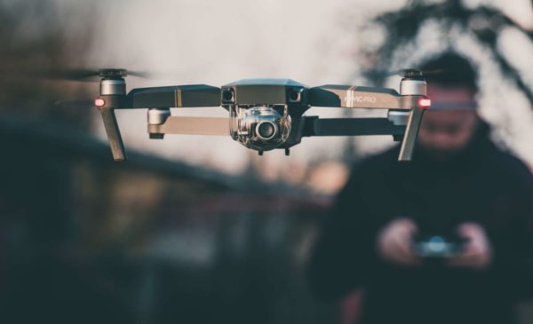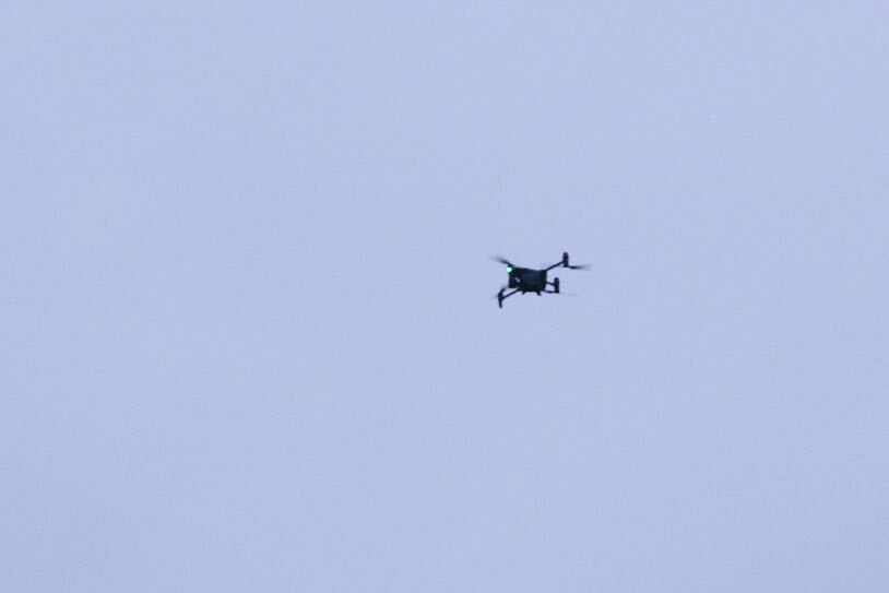
Drone seen flying near former Key Bridge Marriott (staff photo by Jay Westcott)

Drones could soon figure into the future of public safety in Arlington.

Arlington’s police and fire departments, the Sheriff’s Office and the Dept. of Public Safety Communications and Emergency Management are developing a joint program to use drones when responding to public safety and emergency incidents.

Now through New Year’s Day, people can comment on their draft policies regulating the training, operations and oversight of the “Unmanned Aircraft Systems program,” or UAS.

“All comments provided will be reviewed and evaluated for incorporation into the policies,” a county press release says. “Implementation of the program is anticipated in early 2024 following the completion, review, and incorporation of community feedback on the draft policies.”

Law enforcement could use drones for situational awareness: for instance, one was seen during the large public safety agency presence at the Key Bridge Marriott when it was condemned. Drones could also help collect evidence, conduct search and rescue operations and monitor public events.

The county has posted draft policies for ACPD, ACFD and the Dept. of Public Safety Communications and Emergency Management online for people to review. Much of the language is the same across all three policies.

More on the purpose of the program, from ACPD’s policy:

The UAS program shall be used only to support the missions of participating agencies and for legitimate purposes such as situational awareness of public safety incidents, search and rescue operations, and evidence collection, in accordance with applicable state and federal laws and regulations.

These drones will not be equipped with weapons. Only those assigned to the program, with proper training, can operate them, in accordance with the Fourth Amendment — which prohibits unlawful searches and seizures — and other applicable laws.

If approved, there would be monthly audits reviewing the number and length of flights, their efficacy, any safety or equipment concerns and potential violations of policy or law, the policy says.

ACPD will let the public know about all pre-planned drone deployments and it will publish an annual report with the total number of flights, the time, date, location of and reason for each flight. Exceptions would be made when this information would jeopardize personnel safety or a criminal investigation.

These aircraft could help these agencies work more efficiently and safely with fewer staff. ACPD, for instance, has had to scale back services amid ongoing challenges with recruiting and retaining officers.

Improved officer safety could, in turn, bolster staffing levels, Arlington’s police and fire chiefs said earlier this year, in a preliminary discussion with the Arlington County Board about drones.

More from a press release:

The draft policies were developed after an extensive review of model policies and recommendations by the International Association of Chiefs of Police (IACP), Department of Justice Community Oriented Policing Services (COPS), Department of Homeland Security (DHS), the American Civil Liberties Union (ACLU), and policies of police departments across the country with established UAS programs. The goal is to create model policies for Arlington County, utilizing established best practices while ensuring compliance with all applicable laws and regulations. […]

Unmanned Aircraft Systems Program Background
Unmanned Aircraft Systems (UAS) provide enhanced operational capability, safety, and situational awareness for first responders in support of public safety. The UAS Program will only be utilized for specific public safety missions and will be operated only by trained and authorized personnel in compliance with all applicable laws and regulations. For additional information on the UAS program, including answers to frequently asked questions, visit our website.


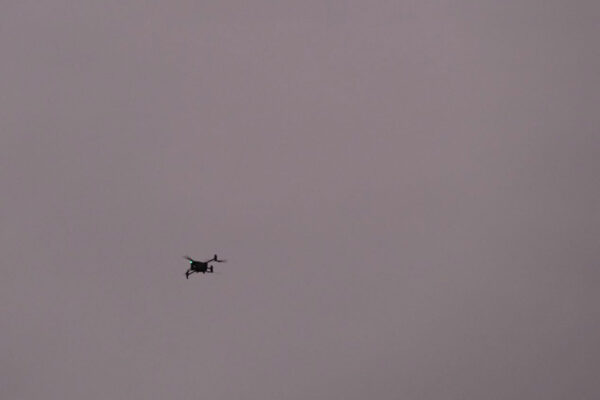
Drone seen flying near former Key Bridge Marriott this morning (staff photo by Jay Westcott)

Public safety in Arlington County is poised to be increasingly automated and unmanned, with more traffic enforcement cameras and drones potentially coming soon.

The updates came during a work session on County Manager Mark Schwartz’s proposed budget, attended by County Board members and heads of public safety departments yesterday (Thursday).

Installing new speed cameras and adding more red-light cameras are part of the county’s Vision Zero initiative to reduce serious injury and fatal crashes, as well as a recommended way to reduce potentially adverse interactions between officers and civilians during traffic stops.

Cameras and drones could also help the Arlington County Police Department work more efficiently with fewer officers, as ACPD has had to scale back services amid ongoing challenges with recruiting and retaining officers.

More than a year ago, the County Board approved the installation of speed cameras in school and work areas to reduce speed-related crashes in these areas as part of the Vision Zero campaign to eliminate traffic fatalities and injuries. Now, according to Police Chief Andy Penn, a contract with a speed camera vendor could be ready this spring.

Last fall, the county told ARLnow that there would be more signs of progress, including camera installation and community messaging, once a contract is finalized this spring. Penn told the County Board yesterday that a request for proposal for both speed cameras and more red-light cameras will close next week.

“My hope is that we’ll have a contract for both of those in the next couple of months,” Penn said.

Meanwhile, the police department is working with the Virginia Dept. of Transportation to expand locations with red-light cameras, according to Penn.

“We’re almost at the finish line with VDOT on the PhotoRED expansions, there’s a couple intersections… we should be there soon,” he said.

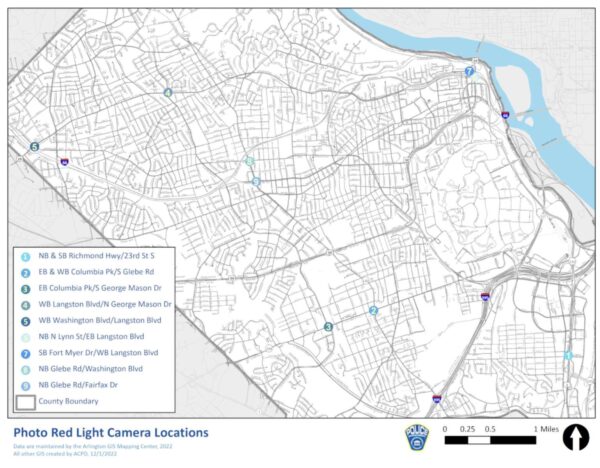
There are nine intersections that currently use PhotoRED cameras, according to the county’s website. These intersections are located along major corridors including Columbia Pike, Route 1, Glebe Road and Langston Blvd.

A map of intersections with red-light cameras (via Arlington County)

Arlington is also considering deploying drones, which could be a safety tool for both police and fire departments. Penn and Fire Chief Dave Povlitz told the Board they are focused on improving employee safety and wellbeing, which could bolster staffing levels.

“While we’re on equipment, drones? Are we thinking about drones?” asked Board Vice-Chair Libby Garvey. “It’d be a lot safer to send a drone in than a person into a burning building.”

After working with other jurisdictions in the region and conducting a survey, a comprehensive proposal on drones could be ready for Board review in “the next couple of months,” according to County Manager Mark Schwartz.

“They are fantastic additions to any fleet,” he said. “We absolutely would, in many cases, prefer — not just for fire but police and also for our building inspections — to have the ability to have drones.”

Police may already be using drones locally in some cases. One could be seen flying near the former Key Bridge Marriott in Rosslyn this morning as part of a large public safety agency presence at the aging building, which the county condemned amid the continued presence of squatters.

Two hurdles to greater drone use could be privacy and flight regulations governing drones in the region, Schwartz said.

“We want to make sure we address the privacy concerns, which I think have been successfully handled in other jurisdictions,” he said.

Unmanned aircraft flights, including drones, are heavily restricted within a 30-mile radius of Reagan National Airport, according to rules the Federal Aviation Administration put in place after 9/11. Drones need FAA authorization and have to operate under certain restrictions.


A drone hovering near the Pentagon (courtesy of Dave Statter)

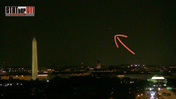
The beacon of light in the Arlington sky early Sunday morning wasn’t a UFO, but an authorized Pentagon drone flight.

At about 2:41 a.m. this past Sunday (Aug. 7) morning, some people spotted a dot of light hovering above the general vicinity of Arlington National Cemetery and the Pentagon.

As former-news-reporter-turned-safety-advocate Dave Statter pointed out on social media, the skies above this section of south Arlington are a general no-fly zone for anything other than military aircraft and commercial flights heading to or from National Airport. He, then, theorized that this was an “authorized [drone] flight (or someone really looking for trouble).”

Turns out, he was right about it being an authorized flight.

“I can confirm the drone activity observed in the early morning hours on Aug. 7 and 8 was part of a Pentagon Force Protection Agency (PFPA) security exercise and was approved drone activity,” a Department of Defense spokesperson told ARLnow in an email.

“Due to operations security, we cannot discuss the specifics of the activity,” the spokesperson said, in response to requests for more details about the exercise.

Drone flights, both authorized and not, do happen on occasion here despite the restrictions.

Arlington County used drones to count the deer population, with permission from federal agencies. Just last month, meanwhile, an unauthorized drone flight prompted a ground stop and flight delays at Reagan National Airport.


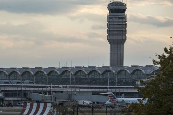
Ronald Reagan Washington National Airport (staff photo by Jay Westcott)

(Updated at 2:45 p.m.) Departures from Reagan National Airport are delayed as a result of a ground stop caused by an unauthorized drone in the area.

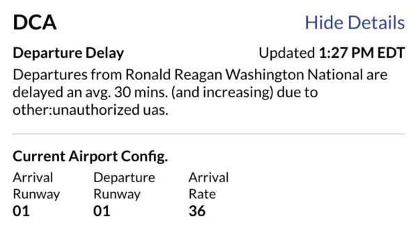
The ground stop went into effect around 1 p.m., according to the Federal Aviation Administration website, though as of 1:45 p.m. it appears to have been lifted.

Departure delays were averaging 30 minutes as of 1:45 p.m. per the FAA.

Information about the DCA ground stop from the FAA

The ground stop and delays follow reports of someone flying a drone in the area. Drone flights are generally prohibited in the airspace surrounding D.C. and in a manner that interferes with airport operations.

The Metropolitan Police Department’s helicopter was seen circling over part of Alexandria, south of the airport, apparently in search of the drone and its operator.

In addition to the departure delays, there have also been reports of arriving flights being diverted to Dulles International Airport.

The airport said on social media that normal operations resumed at 2:15 p.m. following the earlier drone sighting.

Matt Blitz and Alan Henney contributed to this report


Oh deer: Arlington officially has a white-tailed problem.

A study has found that some parts of Arlington have deer populations three to five times greater than what’s considered healthy.

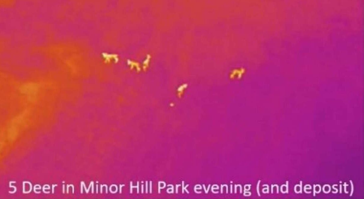
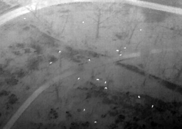
Earlier this year, drones equipped with infrared technology — and permission from federal agencies — flew over Arlington to count the number of deer in the county. The result represents the first ever accurate measure of Arlington’s deer population, according to the county.

From April 8-12, drones registered and the independent firm Steward Green confirmed the presence of 290 deer in Arlington, according to the report. The firm recommends more “management” where populations are the highest and greater monitoring everywhere else.

Following the report’s release in the fall, the county intends to hire a consultant this winter who will determine what that management strategy should be.

While white-tailed deer can contribute to a region’s natural habitat, elevated populations impede the growth of young trees and hurt local flora and fauna, according to the report. They also pose problems for humans, such as vehicle collisions, which have trended down in Arlington since 2020 but are still common in Virginia.

“High deer densities… can lead to intolerable levels of damage to native ecosystems, crops, commercial and residential landscaping, as well as increased safety concerns from deer-vehicle collisions and tick-borne illnesses,” said the report, released this fall.

Deer populations countywide exceed what the land can support, the report says.

“All the areas surveyed in this study have a deer density that is likely beyond the threshold of carrying capacity, have intensified invasive flora, have depleted habitat for (tick eating) ground nesting birds (oven birds, etc.)… and have possible starvation/disease for the deer,” the report said.

Wildlife biologists, ecologists and environmental professionals consider five to 15 deer per square mile to be “healthy,” according to the report. The consultants recommend suburban areas aim for 10 deer per square mile. Arlington has a total of 26 square miles, including both urban and wooded areas.

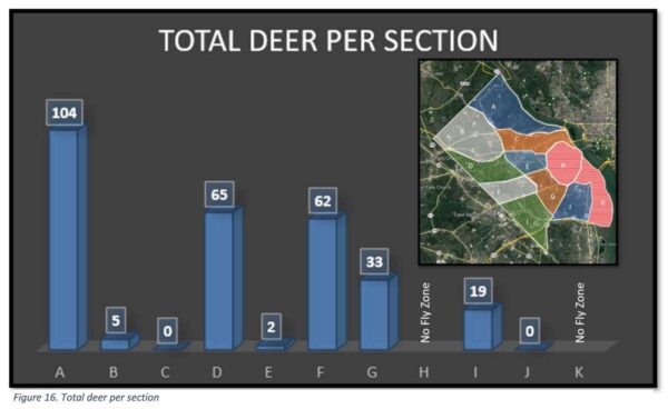
North Arlington, neighborhoods along the western edge of the county and neighborhoods southwest of Arlington National Cemetery had the highest deer populations, according to the study.

In the following sections, which correspond with the map below, densities ranged between 20 and 39 deer per square mile.

Section G, which includes Army Navy Country Club and is bounded by Arlington National Cemetery, Arlington Blvd and I-395, had 20 deer per square mile.

Section D, which includes the neighborhoods near Bluemont Park and Upton Hill Regional Park and is bounded by the western county edge, I-66 and Arlington Blvd, had 28 deer per square mile.

Section A, which includes the neighborhoods of North Arlington near Marymount University, Potomac Overlook Regional Park and Donaldson Run and is bounded by Langston Blvd and Old Dominion Drive, had 33 deer per square mile.

Section F, which includes neighborhoods north of Columbia Pike near the county’s western border, had 39 deer per square mile.

Total deer per section in Arlington (via Arlington County)

The consultant says the 290 figure is likely conservative because of the “challenges of daytime collection,” and recommended future counts obtain clearance to fly at night. The drone had to dodge low-flying helicopters and airplanes and had unclear readings due to the presence of competing heat sources.

(more…)


Book: Bezos Helped Steer HQ2 to Arlington — “According to “Amazon Unbound,” a new book by Brad Stone that looks at the last decade of growth at the company, employees overseeing the HQ2 search winnowed the choices to a top three list that included Chicago, Philadelphia and Raleigh, North Carolina. When it came time to make a final choice, Bezos dismissed months of research by going with his gut and selecting Arlington and Long Island City in Queens.” [Washington Business Journal]

Democratic School Board Caucus Underway — “Voting in the Arlington County Democratic Committee School Board Endorsement Caucus opened at midnight today through a nationally recognized electronic voting platform that will allow Arlingtonians to conveniently, anonymously and securely cast their ballots from mobile devices or computers 24/7 through 11:59 p.m. Sunday (March 23)… Arlington Democrats will also offer 32 hours of in-person voting on May 18, 19 and 22, at four locations across the county.” [Arlington Democrats]

CivFed Studying Arlington’s Form of Gov’t — “The Arlington County Civic Federation’s study of the community’s form of governance will include nearly three months of online meetings to look at issues ranging from how to conduct elections to whether County Board and School Board members should be elected in districts… The effort, agreed to by Civic Federation delegates late last year, is dubbed ‘TiGER’ (Task Force in Governance and Election Reform). It has been assigned to study and possibly proffer changes to the county’s 90-year-old governance structure.” [Sun Gazette]

Layoffs Hit Rosslyn-Based Rosetta Stone — “None of the employees interviewed knew exactly how many people were laid off at the Harrisonburg office. IXL also laid off workers at Rosetta Stone’s Arlington and Seattle offices, as well. Employees told The Citizen that while a few were spared, ‘almost everyone’ in Harrisonburg was let go… Eric Bates, an IXL spokesperson, issued a statement to The Citizen saying, ‘while Rosetta Stone is moving in a new direction, the changes we are making at the company will ultimately help it grow.'” [The Citizen, Geekwire]

Two Hurt in North Arlington Crash — “Police and firefighters on scene of a T-bone type crash at the intersection of Lorcom Lane and Old Dominion Drive, near the Lee Heights Shops. Initial reports suggest two people suffered minor injuries, including a pregnant passenger.” [Twitter]

Secret Service Flying Drones Around Area — “The U.S. Secret Service will be conducting drone flights ‘in the greater Washington, D.C. area’ over the next two weeks, the agency announced Monday. The Secret Service said it will conduct the drone flights in coordination with the Federal Aviation Administration. The drone flights will take place from Monday, May 17 through Monday, May 31.” [Patch]

YouTube Star Responds to DCA Petition — “JoJo Siwa says she’s a big fan of the movement to remove Ronald Reagan’s name from an airport in favor of her … telling us it would be the SICKEST THING EVER!!! We got the YouTube star at Craig’s in WeHo Wednesday night and asked about the petition to change Ronald Reagan Washington National Airport to the JoJo Siwa Washington National Airport. JoJo says she’s on board with the change, telling us it’s the best idea she’s ever heard in her life. The petition’s already got 33,000 signatures and counting.” [TMZ]


A fleet of drones will take to the skies above Arlington next month in an effort to figure out how many deer call the county home.

The drones will be piloted by a firm contracted by the county and overseen by Arlington County police. Normally, drone flights this close to D.C. are strictly prohibited, but Arlington is being granted special permission by the Federal Aviation Administration and other federal agencies. The county is also coordinating with Reagan National Airport.

The drones will look for heat signatures in the woods in order to develop a count of Arlington’s white-tailed deer. This will be “the first accurate measure of Arlington’s deer population,” the county says, noting that “only anecdotal data… currently exists.”

The dones will be launched just before sunrise on Monday, April 5 and the count will continue until just after sunset, for up to two weeks.

The county is careful to note that the drones will only be looking for deer and will “not identify people.”

More from a county press release, below.

Arlington County has hired a contractor to perform a drone survey of heat signatures of the County’s white-tailed deer population. The survey information will assist with the development of the County’s Forestry and Natural Resources Plan. The survey will only collect heat signatures of deer and does not identify people.

“We’ve all seen deer in the County at one time or another,” said Alonso Abugattas, the County’s Natural Resource Manager. “We’d like more than just anecdotal evidence. We want to clearly see how many and where they are so we can mindfully steward our natural resources.”

Thermal and infrared imagery has helped improve counting by relating animals’ unique heat and visibility signatures to precisely count only deer. In one study, it was shown that Unmanned Aerial Vehicles (UAVs), commonly referred to as drones, can be about 43-96% more accurate than ground or human-made observations in counting wildlife. Montgomery County, MD, has conducted UAV deer surveys in locations throughout Montgomery to determine carrying capacity.

The drones will be flying over Arlington beginning a half hour before sunrise April 5 (weather permitting) each day until 30 minutes after sunset, until the survey is completed. They will not be flying at night. The survey could take up to two weeks but is weather dependent. Drones are not permitted to fly over Arlington except for very limited instances. Arlington has coordinated the project with US Department of Homeland Security, Federal Aviation Association (FAA), Transportation Security Administration, Ronald Reagan National Airport, and Arlington County Police Department (ACPD). In accordance with FAA guidelines, ACPD will be onsite monitoring the drone flights.

This will be the first accurate measure of Arlington’s deer population. Only anecdotal data on Arlington currently exists. By 1900, white-tailed deer population had been destroyed in most of Virginia. Through the 1940’s to 1980’s with restocking efforts, laws protecting deer and favorable habitat, deer have rebounded at an exponential rate in Virginia.

Accurate data will determine Arlington’s deer carrying capacity. Deer are important and a necessary aspect of wildlife with important wildlife functions when in balance with the surrounding habitat. Per the Virginia Department of Wildlife Resources, the carrying capacity for deer can vary widely between and within communities. Data from the surveys will help determine Arlington’s carrying capacity.

Photo via Arlington County


If you live in Arlington, the Pentagon — specifically, its police force — wants you to leave drones off your Christmas list this year, at least if you’re planning on flying it locally.

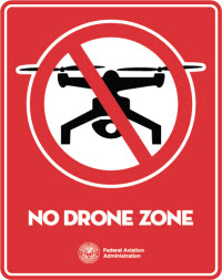
The Pentagon Force Protection Agency yesterday tweeted a reminder that Arlington and the area around the Pentagon is strictly a “No Drone Zone.”

Not only is operating a drone near the Pentagon illegal, your drone could be forcibly brought down if it gets too close.

“Drones flying within the Pentagon Reservation may be subject to counter-UAS measures,” the post notes. That and criminal charges would make for a pretty unhappy holiday, the agency suggests.

Photo by Diana Măceşanu on Unsplash


Making the Case for Amazon in Crystal City — Amazon’s planned second headquarters would find a good home in Crystal City, according to Washingtonian magazine writer Dan Reed. He said the combination of a major airport close by, good transit links from Metro and the fact that it remains “underutilized” after Base Realignment and Closure makes it an attractive option. Reed also suggested Poplar Point on the Anacostia waterfront in D.C. or the Discovery District in College Park, Md. as other places that fit the bill. [Washingtonian]

More Than 40 Drone Flights Detected at Fort Myer — A study to detect unmanned aircraft found that 43 drone flights were picked up over Fort Myer over a 30-day period beginning in August. It is in the middle of a no-drone zone, with flights requiring specific permission from the Federal Aviation Administration. The report suggests the flights could have been from “well-intentioned” tourists at the nearby Arlington National Cemetery and other National Parks. [WTOP]

Leaf Collection Begins Next Week — “The Arlington County government’s vacuum-leaf-collection program is slated to begin November 13 and run through December 22. Each civic-association area is slated to get two passes during the cycle, with signs posted three to seven days before each pass, government officials said. Schedules also will be posted online. Residents wishing leaves to be vacuumed away should place them at the curb by the posted date, but avoid putting them under low-hanging wires or near parked cars.” [Inside NOVA]

APS to Slow Down Planning for Instructional Focus of New High School Seats — Arlington Public Schools and the Arlington School Board agreed to slow down the process of determining an instructional focus for the 500-600 new high school seats at the Education Center until a task force looking at the school’s strategic plan has finished its work. The plan had been for Superintendent Patrick Murphy to bring initial ideas for the site to the Board in December, but staff said slowing down would allow a “big-picture view of all high-school needs in the county.” [Inside NOVA]

Virginia Man Tried to Board Plane With Loaded Gun at Reagan National Airport — A Manassas man tried to board a plane at Reagan National Airport last Thursday with a loaded gun. The Transportation Security Administration detected the 9mm semi-automatic handgun during security checks, confiscated the firearm and cited the man on a weapons charge. It was loaded with seven bullets. [WJLA, WRC]

Flickr pool photo by John Sonderman


Ballston time lapse photo (Flickr pool photo by Kevin Wolf)

Fmr. Arlington Resident John Glenn Dies — John Glenn, the first American to orbit the earth, has died at the age of 95. In an article first published in 2012, the Arlington Public Library blog recounted the five years that Glenn and his family lived on N. Harrison Street in Arlington. [Arlington Public Library]

Soon: Central Place Apartments, Restaurants — Residents are expected to start moving into the new Central Place apartment tower in Rosslyn at some point during the first three months of 2017. Restaurants coming to the ground floor of the building include Sweetgreen, Little Beet, Nando’s Peri-peri and McDonald’s, while Cava Grill and Compass Coffee has signed leases for the Central Place office tower. [Washington Business Journal]

Fort Myer Getting Drone Detector — Officials from Joint Base Myer-Henderson Hall said at a recent Arlington civic association meeting that the base is working to procure a drone detection system. The base commander said he’s worried about “miniaturized tools of terror, specifically drones carrying home-made bombs.” [Pentagram]

Video: Ovi Delivering Pizzas in Arlington — Okay, it’s just a commercial and didn’t really happen. But a new 30-second TV spot from Papa John’s imagines Capitals star Alexander Ovechkin delivering pizzas in Arlington in 2001 as he pursues a childhood dream to become “the best pizza delivery boy in the world.” [Russian Machine Never Breaks]

Local Startup Scores Big Military Contract — Clarendon-based cybersecurity firm Endgame has won a $18.8 million contract from the U.S. Air Force. It’s believed to be “one of the largest endpoint protection software purchases in the Air Force’s history.” [Fedscoop]

Startups Recognized By County — Arlington County recognized four of the county’s fastest-growing companies this week as part of its second-annual “Fast Four” competition. The honorees were the Nicecream Factory ice cream shop in Arlington, Ballston-based Deep Learning Analytics, Clarendon consulting firm Enterprise Knowledge and Ballston-based software company Convoke. [Arlington County]

Flickr pool photo by Kevin Wolf


FAA_NDZ_web(Updated at 10:30 a.m.) Arlington is a “No Drone Zone,” the Federal Aviation Administration is reminding residents and visitors.

The FAA launched a public outreach campaign this week to try to stop the use of unmanned aerial vehicles in the federal restricted airspace around D.C. It comes as a man was detained for flying a drone near the White House for the second time this year.

The area within a 15-mile radius of Reagan National Airport is restricted airspace, and all aircraft must get approval, even the small, remote-controlled kind.

“Anyone visiting the DC area should leave their drone at home,” FAA Administrator Michael Huerta said in a press release. “We want to make sure everyone knows and understands the rules about flying in the National Capital Region.”

The FAA says the D.C. region’s airspace is the most restricted in the county. It’s been tightly controlled since Sept. 11, 2001. Now, the new campaign is aimed at reminding residents and visitors of the area that nothing has changed.

The FAA is rolling out a GPS-enabled smartphone app that tells users when they are out of restricted airspace. They will also be providing materials to local jurisdictions — including Arlington, which sits entirely within the “No Drone Zone” — to educate their residents on the policy.

Image via the FAA


View More Stories