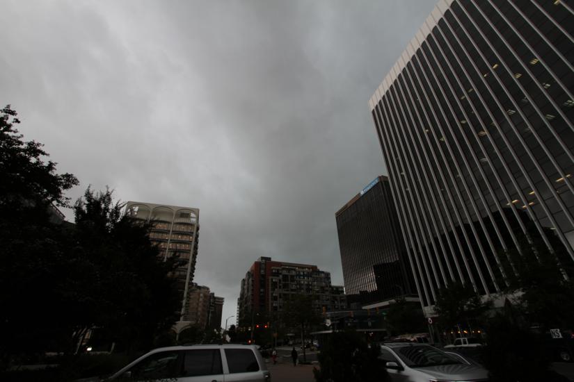
Snow, ice and rain on a road and sidewalk in FairlingtonArlington Public Schools are closed today after an ice storm overnight.

APS announced the cancellation decision around 4:30 a.m, as most roads and sidewalks were still icy from freezing rain. Fairfax County Public Schools and many other local school systems made the same call, although D.C. Public Schools are only on a two hour delay.

From APS:

All APS Schools will be closed and offices will open at Noon. Essential personnel should report to work at their scheduled time. Extracurricular activities, interscholastic games, team practices, field trips, adult education classes, and programs in schools and on school grounds are canceled. For updates about Pool Operations, go to www.apsva.us/aquatics. For information about Arlington County operations go to www.arlingtonva.us.

As of 7:30 a.m., some streets and sidewalks were still treacherous, even as the freezing rain had changed over to plain rain earlier in the morning. As the temperature quickly warms into the 50s, the slick spots are becoming slushy and then melting completely.

The rain will be heavy at times today and some localized flooding is expected. The National Weather Service has issued.

* THROUGH THIS EVENING

* A LOW PRESSURE SYSTEM WILL MOVE ACROSS THE REGION TODAY. THIS WILL RESULT IN RAIN… WHICH WILL BE HEAVY AT TIMES DURING THE FIRST HALF OF THE DAY. RAINFALL TOTALS ACROSS THE WATCH AREA ARE EXPECTED TO RANGE BETWEEN 0.50 TO 1.0 INCHES ACROSS SOUTHERN MARYLAND TO THE INTERSTATE 95 CORRIDOR TO 1.00 TO 1.50 INCHES WEST OF THE INTERSTATE 95 CORRIDOR. THE HEAVIEST RAINS ARE EXPECTED OVER THE BLUE RIDGE MOUNTAINS AND NORTH CENTRAL AND WESTERN MARYLAND. THIS HEAVY RAINFALL COUPLED WITH SNOW MELT WILL LEAD TO THE POTENTIAL OF SMALL STREAMS AND TRIBUTARIES IN THE WATCH AREA TO OVERFLOW THEIR BANKS.

* SMALL STREAMS AND TRIBUTARIES MAY OVERFLOW THEIR BANKS. ADDITIONALLY… URBAN AREAS PRONE TO POOR DRAINAGE WILL BE SUSCEPTIBLE TO FLOODING. THE TIME FOR THE GREATEST THREAT OF FLOODING WILL BE FROM TUESDAY AFTERNOON THROUGH TUESDAY EVENING.

The federal government is under a three hour delay today, with an unscheduled telework option for employees, the Office of Personnel Management announced. Arlington County government and courts, however, are opening on time, with unscheduled leave and telework options for employees, with a supervisor’s approval.

The county’s Dept. of Parks and Recreation, meanwhile, announced the following cancellations and delays.

  • Congregate meal programs located at Arlington Mill, Langston and Walter Reed are canceled.
  • All Early Childhood Programs (Preschool and Co-ops) are canceled.
  • DPR elementary or teen afterschool programs are canceled.
  • All Enjoy Arlington classes, 55+ classes, trips and nature center programs are canceled.
  • Sports league activities in APS standalone buildings are canceled.
  • Sports league activities in County facilities will proceed as scheduled based on weather conditions and the status of snow removal.
  • Gunston Community Center will open at 2 p.m. for normal operating hours.
  • Madison Center will open at 5 p.m. for normal operating hours.
  • Carver and Drew Community Centers will open at 6 p.m. for normal operating hours.
  • All other community centers, including joint use facilities located at Arlington Mill, Carver, Langston and Thomas Jefferson will open at noon.

Flooding and rain on 10/15/14Heavy rain, water-laden ground and melting snow are a recipe for potential flooding today.

The National Weather Service has issued a flood watch for Arlington and much of the D.C. region from noon today to late tonight.

From NWS:

… FLOOD WATCH IN EFFECT FROM NOON EST TODAY THROUGH LATE TONIGHT…

THE NATIONAL WEATHER SERVICE IN STERLING VIRGINIA HAS EXPANDED THE

* FLOOD WATCH TO INCLUDE PORTIONS OF CENTRAL MARYLAND… THE DISTRICT OF COLUMBIA AND NORTHERN VIRGINIA… INCLUDING THE FOLLOWING AREAS… IN CENTRAL MARYLAND… ANNE ARUNDEL… CENTRAL AND SOUTHEAST HOWARD… CENTRAL AND SOUTHEAST MONTGOMERY… NORTHWEST HOWARD… NORTHWEST MONTGOMERY AND PRINCE GEORGES. THE DISTRICT OF COLUMBIA. IN NORTHERN VIRGINIA… ARLINGTON/FALLS CHURCH/ALEXANDRIA… EASTERN LOUDOUN… FAIRFAX… PRINCE WILLIAM/MANASSAS/MANASSAS PARK AND WESTERN LOUDOUN.

* FROM NOON EST TODAY THROUGH LATE TONIGHT

* THE COMBINATION OF MELTING SNOW AND PERIODS OF HEAVY RAIN COULD RESULT IN FLOODING OF URBAN AREAS AND STREAMS THIS AFTERNOON AND TONIGHT. RAINFALL AMOUNTS WILL AVERAGE BETWEEN ONE HALF AND ONE INCH… WITH ISOLATED SPOTS BETWEEN ONE AND TWO INCHES POSSIBLE.

* IN ADDITION… ICE MAY BE ON SOME OF THE SMALL STREAMS WHICH COULD ENHANCE THE FLOODING POTENTIAL.

PRECAUTIONARY/PREPAREDNESS ACTIONS…

A FLOOD WATCH MEANS THERE IS A POTENTIAL FOR FLOODING BASED ON CURRENT FORECASTS. YOU SHOULD MONITOR LATER FORECASTS AND BE ALERT FOR POSSIBLE FLOOD WARNINGS. THOSE LIVING IN AREAS PRONE TO FLOODING SHOULD BE PREPARED TO TAKE ACTION SHOULD FLOODING DEVELOP.


Flooding and rain on 10/15/14Arlington and the rest of the D.C. area is under a Flash Flood Watch today, Christmas Eve.

Forecasters say that following the rain yesterday, a period of heavy rain later today could cause flash flooding.

From the National Weather Service:

… FLASH FLOOD WATCH IN EFFECT FROM 9 AM EST THIS MORNING THROUGH THIS EVENING…

THE NATIONAL WEATHER SERVICE IN STERLING VIRGINIA HAS ISSUED A

* FLASH FLOOD WATCH FOR PORTIONS OF MARYLAND… THE DISTRICT OF COLUMBIA AND NORTHERN VIRGINIA… INCLUDING THE FOLLOWING AREAS… IN MARYLAND… ANNE ARUNDEL… CENTRAL AND SOUTHEAST HOWARD… CENTRAL AND SOUTHEAST MONTGOMERY… PRINCE GEORGES AND SOUTHERN BALTIMORE. THE DISTRICT OF COLUMBIA. IN NORTHERN VIRGINIA… ARLINGTON/FALLS CHURCH/ALEXANDRIA… FAIRFAX AND PRINCE WILLIAM/MANASSAS/MANASSAS PARK.

* FROM 9 AM EST THIS MORNING THROUGH THIS EVENING

* ONE TO TWO INCHES OF RAIN FELL YESTERDAY ACROSS THE BALTIMORE- WASHINGTON METROPOLITAN AREA. THE AIRMASS IS UNUSUALLY MOIST FOR LATE DECEMBER… WITH ANOTHER QUICK INCH OF RAIN POSSIBLE TODAY. GIVEN SATURATED SOIL AND LITTLE VEGETATION… THIS RAINFALL WOULD LEAD TO FLASH FLOODING OF URBAN AREAS AS WELL AS SMALL STREAMS AND CREEKS.

* THERE IS POTENTIAL FOR RAPID RISES OF WATER ON SMALL STREAMS… AND FLOODING OF LOW-LYING AREAS OR ROADWAYS.

PRECAUTIONARY/PREPAREDNESS ACTIONS…

A FLASH FLOOD WATCH MEANS THAT CONDITIONS MAY DEVELOP THAT LEAD TO FLASH FLOODING. FLASH FLOODING IS A VERY DANGEROUS SITUATION.

YOU SHOULD MONITOR LATER FORECASTS AND BE PREPARED TO TAKE ACTION SHOULD FLASH FLOOD WARNINGS BE ISSUED.


Flooding and rain on 10/15/14Arlington’s Dept. of Environmental Services is asking residents to clear leaves from gutters and storm drains today, before expected storms tomorrow.

The remnants of Hurricane Patricia are en route to the D.C. area. We should expect a stormy Wednesday, with 1-1.5 inches of rain and perhaps even some severe storms, says the Capital Weather Gang.

The fact that the rain is coming as leaves are falling off trees could lead to flooding and ponding issues around homes. DES tweeted the following advice this morning:


Columbia Pike is flooded by a downpour / heavy rain (file photo)Get ready for a wet weekend. A coastal nor’easter is expected to bring torrential rainfall throughout most of Friday and Saturday.

The National Weather Service has issued a Flash Flood Watch for Arlington and the rest of the D.C. region, starting Friday morning. More watches and warnings are expected to be issued as Hurricane Joaquin nears, on the back of the nor’easter.

From the NWS:

THE NATIONAL WEATHER SERVICE IN STERLING VIRGINIA HAS ISSUED A

* FLASH FLOOD WATCH
* FROM FRIDAY MORNING THROUGH SATURDAY EVENING.
* RAIN WILL INCREASE IN INTENSITY ACROSS THE AREA FRIDAY INTO SATURDAY. WIDESPREAD RAIN TOTALS OF TWO TO FOUR INCHES ARE EXPECTED… WITH LOCALLY HIGHER AMOUNTS. HEAVY RAIN COULD FALL OVER A SHORT PERIOD OF TIME ON SATURATED SOILS… WHICH COULD LEAD TO FLASH FLOODING.
* THERE IS POTENTIAL FOR RAPID RISES OF WATER ON NUMEROUS SMALL STREAMS… AS WELL AS IN POOR DRAINAGE AREAS. LARGER RIVERS WILL ALSO EXPERIENCE RISES. MUDSLIDES MAY OCCUR IN STEEP TERRAIN.

PRECAUTIONARY/PREPAREDNESS ACTIONS…

A FLASH FLOOD WATCH MEANS THAT CONDITIONS MAY DEVELOP THAT LEAD TO FLASH FLOODING. FLASH FLOODING IS A VERY DANGEROUS SITUATION.

YOU SHOULD MONITOR LATER FORECASTS AND BE PREPARED TO TAKE ACTION SHOULD FLASH FLOOD WARNINGS BE ISSUED.


Rabbit (Flickr pool photo by John Sonderman)

Flash Flood Watch Tonight — Arlington and much of the D.C. area is under a Flash Flood Watch tonight. The watch runs from 4 p.m. to midnight. Forecasters say storms with very heavy rain will pass through the region and may produce flash flooding. [Twitter]

Regional Home Prices Flat — The Washington region saw no year-over-year growth in the median sales price of single family homes in the second quarter of 2015. That comes at a time when 93 percent of metropolitan areas reported increases in median home sales prices. [InsideNova]

Highline Now Offering Sunday BrunchHighline RxR in Crystal City is now offering Sunday brunch service. The bar/restaurant opened in February, in the former Bailey’s space above McCormick and Schmick’s. [Facebook]

Flickr pool photo by John Sonderman


Heavy rain on 7/27/15(Updated at 4:15 p.m.) Arlington County is under a Severe Thunderstorm Warning until 4:30 p.m. and a Flash Flood Warning until 6:45 p.m.

Parts of Arlington were inundated by heavy rain and frequent lightning and thunder this afternoon. There were scattered reports of power outages along Columbia Pike and people trapped in stuck elevators in Virginia Square and other parts of the county.

A wind gust of 58 miles per hour was reported in the Cherrydale neighborhood of Arlington during the storm, according to the National Weather Service. Flooding was reported in the westbound lanes of Washington Blvd, prompting police to close a ramp from Route 50.

From the National Weather Service:

* SEVERE THUNDERSTORM WARNING FOR… THE SOUTHERN DISTRICT OF COLUMBIA… WEST CENTRAL PRINCE GEORGES COUNTY IN CENTRAL MARYLAND… EAST CENTRAL FAIRFAX COUNTY IN NORTHERN VIRGINIA… THE CITY OF ALEXANDRIA IN NORTHERN VIRGINIA… ARLINGTON COUNTY IN NORTHERN VIRGINIA…

* UNTIL 430 PM EDT

* AT 339 PM EDT…DOPPLER RADAR INDICATED A SEVERE THUNDERSTORM CAPABLE OF PRODUCING QUARTER SIZE HAIL AND DAMAGING WINDS IN EXCESS OF 60 MPH. THIS STORM WAS LOCATED OVER CRYSTAL CITY…AND MOVING SOUTHEAST AT 5 MPH.

* LOCATIONS IMPACTED INCLUDE… ARLINGTON…NATIONALS PARK…CRYSTAL CITY…HUNTINGTON…ROSSLYN… GROVETON…BALLSTON…US CAPITOL…ANACOSTIA…GEORGETOWN…HYBLA VALLEY…MARLOW HEIGHTS…FOREST HEIGHTS…ROCK CREEK…THE MALL… BOLLING AIR FORCE…BARCROFT…JEFFERSON MANOR…CHERRYDALE AND WESTOVER.

PRECAUTIONARY/PREPAREDNESS ACTIONS…

SEVERE THUNDERSTORMS PRODUCE DAMAGING WINDS…LARGE HAIL…DEADLY LIGHTNING AND VERY HEAVY RAIN. FOR YOUR PROTECTION…MOVE TO AN INTERIOR ROOM ON THE LOWEST FLOOR OF YOUR HOME OR BUSINESS. HEAVY RAINS FLOOD ROADS QUICKLY SO DO NOT DRIVE INTO AREAS WHERE WATER COVERS THE ROAD.

Also from NWS:

* FLASH FLOOD WARNING FOR… THE CENTRAL DISTRICT OF COLUMBIA… EAST CENTRAL FAIRFAX COUNTY IN NORTHERN VIRGINIA… THE CITY OF ALEXANDRIA IN NORTHERN VIRGINIA… ARLINGTON COUNTY IN NORTHERN VIRGINIA… THE CITY OF FALLS CHURCH IN NORTHERN VIRGINIA…

* UNTIL 645 PM EDT

* AT 344 PM EDT…DOPPLER RADAR INDICATED A THUNDERSTORM PRODUCING HEAVY RAIN ACROSS THE AREA. UP TO ONE INCH OF RAIN HAS ALREADY FALLEN. FLASH FLOODING IS EXPECTED TO BEGIN SHORTLY.

THIS INCLUDES FLOOD PRONE ROADS LOCATIONS MILITARY ROAD AT 36TH ROAD…18TH STREET AT UPTON STREET…17TH STREET NORTH AT NORTH BUCHANAN ST… SOUTH TROY STREET NEAR LONG BRANCH… BRADDOCK ROAD AT WEST STREET… AND RHODE ISLAND AVENUE NORTHEAST BETWEEN 2ND AND CAPI.


Flooding in Arlington on 9/8/11 (courtesy Brendan L.)A Flash Flood Warning has been issued for Arlington County and other D.C. area jurisdictions.

Forecasters say that a prolonged period of heavy rain is likely to cause flash flooding in some low-lying areas and along small streams.

The warning is in effect until 5:30 p.m., while a Flash Flood Watch will remain in effect through early Sunday morning.

From the National Weather Service:

THE NATIONAL WEATHER SERVICE IN STERLING VIRGINIA HAS ISSUED A

* FLASH FLOOD WARNING…

* UNTIL 530 PM EDT

* AT 232 PM EDT… MORE HEAVY RAIN IS MOVING OVER AN AREA THAT WILL TOLERATE LITTLE MORE BEFORE ROADS WILL BEGIN TO BECOME INUNDATED AND SMALL STREAMS WILL BEGIN TO RISE OUT OF THEIR BANKS. FLASH FLOODING IS EXPECTED TO BEGIN SHORTLY.

* SOME LOCATIONS THAT MAY EXPERIENCE FLOODING INCLUDE… ARLINGTON… ROCKVILLE… GAITHERSBURG… COLLEGE PARK… HERNDON… GREENBELT… FAIRFAX… VIENNA… FALLS CHURCH… BLADENSBURG… SPRINGFIELD… SOUTH RIDING… PIMMIT HILLS… MANTUA… DULLES INTERNATIONAL AIRPORT… GALLAUDET UNIVERSITY… NATIONALS PARK… CORAL HILLS… WOODBRIDGE AND BETHESDA.

PRECAUTIONARY/PREPAREDNESS ACTIONS…

TURN AROUND… DONT DROWN BY DRIVING INTO FLOODED ROADS OR ROADS THAT HAVE BEEN CLOSED.

BE VERY CAREFUL DRIVING AS SOME ROADS WILL BE CLOSED… AND LARGE PONDS OF WATER… EVEN ON LARGE INTERSTATES WILL INCREASE YOUR RISK OF LOOSING CONTROL OF YOUR VEHICLE. DRIVE SLOWLY.

WATCH YOUR KIDS TO ENSURE THEY DONT PLAY NEAR FLOOD WATERS.
IF YOU ARE IN A LOW AREA… OR NEAR A DRAINAGE DITCH OR SMALL STREAM… EXPECT RAPID RISES. STAY SAFE AND HEAD TO HIGHER GROUND IF NEEDED.


Storms packing torrential rain are expected to roll though Arlington later this afternoon and tonight.

The National Weather Service has issued a Flash Flood Watch through 6:00 a.m. Tuesday, warning that downpours may lead to flash flooding.

From NWS:

… FLASH FLOOD WATCH REMAINS IN EFFECT THROUGH LATE TONIGHT…

THE FLASH FLOOD WATCH CONTINUES FOR

* PORTIONS OF MARYLAND… MD… THE THE DISTRICT OF COLUMBIA AND NORTHERN VIRGINIA… INCLUDING THE FOLLOWING AREAS… IN MARYLAND… ANNE ARUNDEL… CARROLL… FREDERICK… NORTHERN BALTIMORE… PRINCE GEORGES AND SOUTHERN BALTIMORE. IN MD… CENTRAL AND SOUTHEAST HOWARD… CENTRAL AND SOUTHEAST MONTGOMERY… NORTHWEST HARFORD… NORTHWEST HOWARD… NORTHWEST MONTGOMERY AND SOUTHEAST HARFORD. THE DISTRICT OF COLUMBIA. IN NORTHERN VIRGINIA… ARLINGTON/FALLS CHURCH/ALEXANDRIA.

* THROUGH LATE TONIGHT

* SHOWERS AND THUNDERSTORMS WILL INCREASE IN COVERAGE THIS AFTERNOON AND CONTINUE THROUGH THROUGH MOST OF TONIGHT. SOME OF THE STORMS WILL CONTAIN TORRENTIAL DOWNPOURS WHICH MAY LEAD TO FLASH FLOODING. AVERAGE RAINFALL AMOUNTS BETWEEN ONE TO TWO INCHES ARE EXPECTED… BUT LOCALIZED AMOUNTS IN EXCESS OF THREE INCHES ARE POSSIBLE IN HEAVIER THUNDERSTORMS. RAINFALL RATES AROUND ONE TO TWO INCHES PER HOUR ARE EXPECTED IN HEAVIER THUNDERSTORMS. RECENT RAINFALL HAS SATURATED SOILS WHICH WILL ALSO INCREASE THE THREAT FOR FLASH FLOODING DURING THIS TIME.

* HEAVY RAINFALL IN SHORT PERIODS OF TIME MAY CAUSE RAPID RISES ON CREEKS AND STREAMS AS WELL AS FLASH FLOODING IN URBAN AREAS.

PRECAUTIONARY/PREPAREDNESS ACTIONS…

A FLASH FLOOD WATCH MEANS THAT CONDITIONS MAY DEVELOP THAT LEAD TO FLASH FLOODING. FLASH FLOODING IS A VERY DANGEROUS SITUATION.

YOU SHOULD MONITOR LATER FORECASTS AND BE PREPARED TO TAKE ACTION SHOULD FLASH FLOOD WARNINGS BE ISSUED.


Arlington County and much of the surrounding region is under a Flood Watch tonight through Monday morning.

Forecasters say rain will start falling this evening and continue throughout the night, raising the possibility of flooding in flood-prone areas.

From the National Weather Service:

* FROM 7 PM EDT THIS EVENING THROUGH MONDAY MORNING

* MODERATE TO LOCALLY HEAVY RAIN WILL OVERSPREAD THE REGION THIS EVENING THROUGH TONIGHT… RAINFALL TOTALS AROUND ONE AND A HALF INCHES ARE EXPECTED ACROSS THE GREATER BALTIMORE-WASHINGTON METRO AREA. LOCALLY HIGHER AMOUNTS ARE POSSIBLE… ESPECIALLY ALONG AND IMMEDIATELY EAST OF THE BLUE RIDGE/CATOCTIN MOUNTAIN.

* EXPECT SMALL STREAMS AND CREEKS TO RISE… POSSIBLY OVERFLOWING THEIR BANKS. IN ADDITION… FLOODING MAY OCCUR IN LOW LYING AND POOR DRAINAGE AREAS.

PRECAUTIONARY/PREPAREDNESS ACTIONS…

A FLOOD WATCH MEANS THERE IS A POTENTIAL FOR FLOODING BASED ON CURRENT FORECASTS.

PLEASE MONITOR LATER FORECASTS AND BE ALERT FOR POSSIBLE FLOOD WARNINGS. THOSE LIVING IN AREAS PRONE TO FLOODING SHOULD BE PREPARED TO TAKE ACTION SHOULD FLOODING DEVELOP.


(Updated at 1:15 p.m.) The National Weather Service issued a Tornado Warning for Arlington this afternoon as a dangerous storm system rolled through the area.

The tornado warning has since been canceled, but a flood watch remains in effect through 8:00 p.m. (See below.)

Medics in Arlington responded to at least one report of a person struck by lightning during the storms.

Police reported significant flooding along Four Mile Run in the area of I-395. Flooding was also reported on S. Scott Street near the Wellington apartments, and on Route 50 near Glebe Road.

As of 1:15 p.m., 212 Dominion customers in Arlington County were said to be without power. According to a reader, the Harris Teeter at Lee Highway and N. Harrison Street was among those that had lost power.

…FLOOD WATCH REMAINS IN EFFECT UNTIL 8 PM EDT THIS EVENING…

THE FLOOD WATCH CONTINUES FOR

* PORTIONS OF MARYLAND…THE DISTRICT OF COLUMBIA AND VIRGINIA…

* UNTIL 8 PM EDT THIS EVENING

* A STRONG COLD FRONT WILL IMPACT THE REGION TODAY. A PLUME OF HEAVY RAINFALL IS MOVING SLOWLY ACROSS THE REGION FROM WEST TO EAST THROUGH THIS EVENING. RAINFALL AMOUNTS OF ONE TO THREE INCHES CAN BE EXPECTED WITH LOCALLY HIGHER AMOUNTS POSSIBLE.

* THE HEAVY RAINFALL MAY CAUSE FLOODING OF LOW LYING AREAS… ESPECIALLY IN URBAN AREAS AND LOCATIONS ESPECIALLY PRONE TO FRESHWATER FLOODING. NEVER CROSS ROADS THAT ARE FLOODED. TURN AROUND DON`T DROWN.

PRECAUTIONARY/PREPAREDNESS ACTIONS…

A FLOOD WATCH MEANS THERE IS A POTENTIAL FOR FLOODING BASED ON CURRENT FORECASTS.

YOU SHOULD MONITOR LATER FORECASTS AND BE ALERT FOR POSSIBLE FLOOD WARNINGS. THOSE LIVING IN AREAS PRONE TO FLOODING SHOULD BE PREPARED TO TAKE ACTION SHOULD FLOODING DEVELOP.


View More Stories