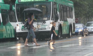
Pedestrians brave heavy rains in Courthouse (file photo)A Flood Watch is in effect tonight for Arlington and the rest of the D.C. region.

Forecasters say heavy, drenching rain is moving up from the south in the form of a nor’easter. The storm may produce localized flooding in low-lying areas through early Thursday.

From the National Weather Service:

… FLOOD WATCH REMAINS IN EFFECT FROM 6 PM EDT THIS EVENING THROUGH LATE TONIGHT…

THE FLOOD WATCH CONTINUES FOR

* PORTIONS OF MARYLAND… THE DISTRICT OF COLUMBIA AND NORTHERN VIRGINIA… INCLUDING THE FOLLOWING AREAS… IN MARYLAND… ANNE ARUNDEL… HARFORD… BALTIMORE… HOWARD… MONTGOMERY… AND PRINCE GEORGES. THE DISTRICT OF COLUMBIA. IN NORTHERN VIRGINIA… ARLINGTON/FALLS CHURCH/ALEXANDRIA AND FAIRFAX.

* FROM 6 PM EDT THIS EVENING THROUGH LATE TONIGHT

* LOW PRESSURE APPROACHING FROM THE SOUTHERN ATLANTIC STATES WILL BRING PERIODS OF MODERATE TO HEAVY RAIN ACROSS PORTIONS OF THE AREA LATE THIS EVENING AND CONTINUE OVERNIGHT. ONE TO TWO INCHES OF RAIN WITH LOCALLY HIGHER AMOUNTS ARE EXPECTED BY EARLY THURSDAY.

* PERSISTENT MODERATE TO LOCALLY HEAVY RAIN MAY CAUSE FLOODING OF LOW LYING AREAS… ESPECIALLY IN URBAN AREAS AND LOCATIONS PRONE TO FRESHWATER FLOODING. NEVER CROSS ROADS THAT ARE FLOODED. TURN AROUND DON’T DROWN.

PRECAUTIONARY/PREPAREDNESS ACTIONS…

A FLOOD WATCH MEANS THERE IS A POTENTIAL FOR FLOODING BASED ON CURRENT FORECASTS.

YOU SHOULD MONITOR LATER FORECASTS AND BE ALERT FOR POSSIBLE FLOOD WARNINGS. THOSE LIVING IN AREAS PRONE TO FLOODING SHOULD BE PREPARED TO TAKE ACTION SHOULD FLOODING DEVELOP.


The National Weather Service has issued a flash flood watch for Arlington and the rest of the D.C. metro area. It remains in effect until 2:00 a.m. on Wednesday.

Rain is expected to continue through the evening and the area may also see thunderstorms.

From NWS:

* SHOWERS…WITH EMBEDDED AREAS OF HEAVY RAINFALL…WILL CONTINUE
THROUGH TONIGHT. ALTHOUGH IT WONT BE RAINING ALL THE TIME…
PERIODS OF HEAVY RAIN WILL LEAVE THE GOUND WATER CLOGGED…
RESULTING IN POTENTIAL FLOODING.

PRECAUTIONARY/PREPAREDNESS ACTIONS…

A FLASH FLOOD WATCH MEANS THAT CONDITIONS MAY DEVELOP THAT LEAD
TO FLASH FLOODING. FLASH FLOODING IS A VERY DANGEROUS SITUATION.

YOU SHOULD MONITOR LATER FORECASTS AND BE PREPARED TO TAKE ACTION
SHOULD FLASH FLOOD WARNINGS BE ISSUED.


The National Weather Service has issued a Flash Flood Watch for Arlington and the D.C. area.

The watch is in effect through midnight. Forecasters say slow-moving storms may result in heavy rain and isolated flooding.

… FLASH FLOOD WATCH IN EFFECT UNTIL MIDNIGHT EDT TONIGHT…

THE NATIONAL WEATHER SERVICE IN STERLING VIRGINIA HAS ISSUED A

* FLASH FLOOD WATCH FOR PORTIONS OF MARYLAND… THE DISTRICT OF COLUMBIA AND NORTHERN VIRGINIA… INCLUDING THE FOLLOWING AREAS… IN MARYLAND… ANNE ARUNDEL… CHARLES… HARFORD… HOWARD… MONTGOMERY… NORTHERN BALTIMORE… PRINCE GEORGES AND SOUTHERN BALTIMORE. THE DISTRICT OF COLUMBIA. IN NORTHERN VIRGINIA… ARLINGTON/FALLS CHURCH/ALEXANDRIA… FAIRFAX AND PRINCE WILLIAM/MANASSAS/MANASSAS PARK.

* UNTIL MIDNIGHT EDT TONIGHT

* SLOW MOVING SHOWERS AND THUNDERSTORMS ARE LIKELY OVER THE AREA THROUGH THIS EVENING. LOCALLY HEAVY RAINFALL IS EXPECTED IN THE STRONGER STORMS WITH RAINFALL RATES IN EXCESS OF 2 INCHES PER HOUR.

* IN TARGETED AREAS THAT RECEIVE HEAVY DOWNPOURS FOR LONGER THAN 30 MINUTES… FLASH FLOODING MAY BEGIN QUICKLY. BE AWARE OF LOW AREAS THAT MAY FLOOD. NEVER CROSS ROADS THAT ARE FLOODED. TURN AROUND DON’T DROWN.

PRECAUTIONARY/PREPAREDNESS ACTIONS…

A FLASH FLOOD WATCH MEANS THAT CONDITIONS MAY DEVELOP THAT LEAD TO FLASH FLOODING. FLASH FLOODING IS A VERY DANGEROUS SITUATION.

YOU SHOULD MONITOR LATER FORECASTS AND BE PREPARED TO TAKE ACTION SHOULD FLASH FLOOD WARNINGS BE ISSUED.


Arlington and the D.C. area is under a flash flood watch tonight.

Forecasters say storms and periods of very heavy rain are expected this afternoon and tonight. The sudden downpours may result in flash flooding.

The rain may also bring some temporary relief from the heat. Today’s high predicted high temperature is 92 degrees.

From the National Weather Service:

* FROM 1 PM EDT THIS AFTERNOON THROUGH LATE TONIGHT

* TROPICAL MOISTURE WILL REMAIN OVER THE AREA THROUGH MOST OF TONIGHT. SHOWERS AND THUNDERSTORMS ARE LIKELY… ESPECIALLY LATE THIS AFTERNOON THROUGH LATE THIS EVENING. RAINFALL RATES IN HEAVIER SHOWERS AND THUNDERSTORMS MAY EXCEED 2 INCHES PER HOUR.

* IN TARGETED AREAS THAT RECEIVE TORRENTIAL RAIN FOR LONGER THAN 30 MINUTES… FLASH FLOODING MAY BEGIN QUICKLY AND IN A VERY LOCALIZED AREA. BE AWARE OF LOW AREAS THAT MAY FLOOD. NEVER CROSS ROADS THAT ARE FLOODED. TURN AROUND DONT DROWN.

PRECAUTIONARY/PREPAREDNESS ACTIONS…

A FLASH FLOOD WATCH MEANS THAT CONDITIONS MAY DEVELOP THAT LEAD TO FLASH FLOODING. FLASH FLOODING IS A VERY DANGEROUS SITUATION.

YOU SHOULD MONITOR LATER FORECASTS AND BE PREPARED TO TAKE ACTION SHOULD FLASH FLOOD WARNINGS BE ISSUED.


Plane above the runway at DCA, Reagan National Airport (Flickr pool photo by John Sonderman)

Another Flash Flood Watch — It’s Friday the 13th and Arlington is under another Flash Flood Watch today. The watch is in effect from noon through 10:00 p.m. Forecasters say an approaching cold front will spawn scattered showers and thunderstorms, some of which will be strong and result in very heavy rain. [National Weather Service]

Library to Launch Tool Lending — Arlington residents will soon be able to use their library cards to borrow garden tools from Arlington Central Library. The library is currently looking for volunteers to run and maintain its new “tool library,” which was established after being set as a priority by the county’s Urban Agriculture Task Force last year. [Arlington Public Library]

Va. Lawmakers Pass Budget After Impasse — Republicans in the Virginia Senate passed a budget Thursday night that thwarts an expansion of Medicaid, which had been sought by Democrats. Republicans were able to pass the budget after a Democratic lawmaker resigned and shifted the balance of power in the Senate to the GOP. [Richmond Times-Dispatch]

‘KidicalMass’ Bike Ride Sunday — For Father’s Day, a group of parents and their kids will be taking part in a “KidicalMass” bike ride from Hayes Park to Larry’s Homemade Ice Cream in Clarendon Sunday evening. [Blogspot]

Blues Fest Road Closures — The annual Columbia Pike Blues Festival will be held Saturday and several road closures, including the closure of Walter Reed Drive north of Columbia Pike, are planned as a result. The road closures will be in effect from about 7:30 a.m. to 10:00 p.m. [Arlington County]

Flickr pool photo by John Sonderman


Morning Stroll (Flickr pool photo by Dennis Dimick)

Flood Watch for D.C. Area — Arlington and the D.C. area is under a flood watch from noon today through later tonight. Another round of showers and thunderstorm with areas of heavy rain is expected today. [National Weather Service]

Bishop Attends School’s Last Mass — Arlington Bishop Paul Loverde attended the final school mass at St. Charles Borromeo Church last week. He “spoke to the palpable presence of both sadness and hope.” The school is closing due to low enrollment. The church’s pastor, meanwhile, is being transferred to another church against his will. [Arlington Catholic Herald]

Micah Edmond Profiled — Micah Edmond, the Republican candidate for congress who will be facing off against Democrat Don Beyer in November, says there is a “realistic way” for him to win the race. Edmond, who is African-American, Jewish, a small business owner and a Marine Corps veteran, says he’ll be “reaching out to communities that are often ignored and listening to their cares and concerns and offering solutions.” [InsideNova*]

Arlington Resident Faces Another Murder Trial — Christopher Deedy, a State Department Special Agent from Arlington who’s accused of murder in the 2011 shooting death of a man in Hawaii, is about to face trial again. Deedy’s trial last year ended in a mistrial. [Associated Press]

Discover Cherrydale Photos — Cherrydale residents came out for an inaugural community event called Discover Cherrydale. Photos have been posted from the event, which was held May 31. [Comcast.net]

* Editor’s Note: This website employs popup ads and, during our visit today, autoplay video ads with audio turned on by default and no option for turning it off. For a better user experience, we have linked to a site that displays the article as plain text.

Flickr pool photo by Dennis Dimick


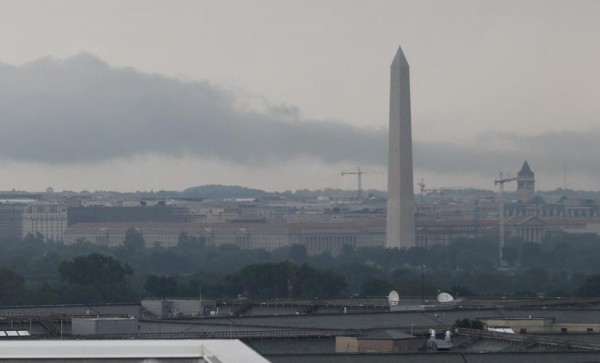
Storm clouds over D.C., as seen from Pentagon City on 6/10/14

A Flash Flood Watch has been issued for Arlington County and much of the surrounding D.C. and Baltimore region.

The watch is in effect from 2:00 p.m. to 2:00 a.m. Wednesday. Forecasters with the National Weather Service say that heavy rain predicted tonight may cause flash flooding.

The watch was issued as Prince George’s County, Md. begins to dry out following torrential rains and dangerous flash flooding this morning.

THE NATIONAL WEATHER SERVICE IN STERLING VIRGINIA HAS ISSUED A

* FLASH FLOOD WATCH FOR PORTIONS OF MARYLAND… THE DISTRICT OF COLUMBIA AND NORTHERN VIRGINIA… INCLUDING THE FOLLOWING AREAS… IN MARYLAND… ANNE ARUNDEL… CARROLL… FREDERICK MD… HARFORD… HOWARD… MONTGOMERY… NORTHERN BALTIMORE… PRINCE GEORGES AND SOUTHERN BALTIMORE. THE DISTRICT OF COLUMBIA. IN NORTHERN VIRGINIA… ARLINGTON/FALLS CHURCH/ALEXANDRIA… FAIRFAX… LOUDOUN AND PRINCE WILLIAM/MANASSAS/MANASSAS PARK.

* THROUGH LATE TONIGHT

* HEAVY RAIN HAS ALREADY FALLEN OVER PORTIONS OF NORTHERN VIRGINIA… CENTRAL MARYLAND… AND WASHINGTON DC TODAY. THERE IS THE POSSIBILITY THAT MORE HEAVY RAIN WILL FALL WITH THUNDERSTORMS THIS AFTERNOON. ANY STORMS THAT FORM WILL HAVE THE POTENTIAL TO PRODUCE FLASH FLOODING.

PRECAUTIONARY/PREPAREDNESS ACTIONS…

A FLASH FLOOD WATCH MEANS THAT CONDITIONS MAY DEVELOP THAT LEAD TO FLASH FLOODING. FLASH FLOODING IS A VERY DANGEROUS SITUATION.

YOU SHOULD MONITOR LATER FORECASTS AND BE PREPARED TO TAKE ACTION SHOULD FLASH FLOOD WARNINGS BE ISSUED.


Arlington and the surrounding area is now under a Flash Flood Warning.

The Flash Flood Warning means that sudden, localized flooding is imminent due to the heavy rains overnight. If you encounter a flooded roadway while driving, you’re strongly encouraged to “turn around, don’t drown.”

THE NATIONAL WEATHER SERVICE IN STERLING VIRGINIA HAS ISSUED A

* FLASH FLOOD WARNING FOR… THE DISTRICT OF COLUMBIA… SOUTHEASTERN MONTGOMERY COUNTY IN CENTRAL MARYLAND… CITY OF FAIRFAX IN NORTHERN VIRGINIA… CITY OF FALLS CHURCH IN NORTHERN VIRGINIA… ARLINGTON COUNTY IN NORTHERN VIRGINIA… CITY OF ALEXANDRIA IN NORTHERN VIRGINIA… EASTERN FAIRFAX COUNTY IN NORTHERN VIRGINIA…

* UNTIL 1015 AM EDT

* AT 709 AM EDT… NATIONAL WEATHER SERVICE DOPPLER RADAR INDICATED VERY HEAVY RAIN HAD FALLEN CAPABLE OF PRODUCING FLASH FLOODING. RADAR ESTIMATES THAT UP TO 3 INCHES OF RAIN HAVE ALREADY FALLEN ACROSS PORTIONS OF THE WARNED AREA. STREAMS ARE RISING EXTREMELY RAPIDLY.

* SOME LOCATIONS THAT ARE AFFECTED BY THE HEAVY RAIN INCLUDE ALEXANDRIA… ANNANDALE… ARLINGTON… BALLSTON… BELLE HAVEN… BURKE… FRANCONIA… HYBLA VALLEY… LAKE BARCROFT… LINCOLNIA… MCLEAN… MERRIFIELD… OAKTON… REAGAN NATIONAL AIRPORT… ROSSLYN… SPRINGFIELD… THE I395 AND I495 INTERCHANGE… THE I66 AND I495 INTERCHANGE… TYSONS CORNER… VIENNA… WOLF TRAP… ASPEN HILL… BETHESDA… CHEVY CHASE… COLESVILLE… FAIRLAND… HILLANDALE… POTOMAC… ROCKVILLE… TAKOMA PARK… THE AMERICAN LEGION BRIDGE… THE WOODROW WILSON BRIDGE… WHITE OAK… ADAMS MORGAN… AMERICAN UNIVERSITY… GEORGETOWN… DOWNTOWN WASHINGTON… US CAPITOL… CRYSTAL CITY… FORT TOTTEN… GALLAUDET UNIVERSITY… GROVETON… HOWARD UNIVERSITY… HUNTINGTON… MANTUA… NATIONALS PARK AND PIMMIT HILLS.

EXCESSIVE RUNOFF FROM HEAVY RAINFALL WILL CAUSE FLASH FLOODING OF SMALL CREEKS AND STREAMS… URBAN AREAS… HIGHWAYS… STREETS… UNDERPASSES AND OTHER DRAINAGE AREAS AND LOW LYING SPOTS.

MOST FLASH FLOOD DEATHS OCCUR IN AUTOMOBILES. NEVER DRIVE YOUR VEHICLE INTO AREAS WHERE WATER COVERS THE ROAD. FLOODWATER USUALLY IS DEEPER THAN IT APPEARS. JUST ONE FOOT OF FLOWING WATER IS POWERFUL ENOUGH TO SWEEP VEHICLES OFF THE ROAD. MAKE THE SMART CHOICE WHEN FLOODED ROADS ARE ENCOUNTERED… TURN AROUND… DONT DROWN.


The National Weather Service has issued a Flash Flood Watch for Arlington and the surrounding D.C. region.

Forecasters say 2-3 inches of rain is expected to fall from Thursday afternoon into Friday. Heavy rain showers and thunderstorms may cause flash flooding, especially along small local rivers and streams.

From the NWS:

… FLASH FLOOD WATCH IN EFFECT FROM LATE THURSDAY NIGHT THROUGH FRIDAY AFTERNOON…

THE NATIONAL WEATHER SERVICE IN STERLING VIRGINIA HAS ISSUED A

* FLASH FLOOD WATCH FOR PORTIONS OF MARYLAND… THE DISTRICT OF COLUMBIA AND VIRGINIA… INCLUDING THE FOLLOWING AREAS… IN MARYLAND… ANNE ARUNDEL… CARROLL… CHARLES… FREDERICK MD… HARFORD… HOWARD… MONTGOMERY… NORTHERN BALTIMORE… PRINCE GEORGES AND SOUTHERN BALTIMORE. THE DISTRICT OF COLUMBIA. IN VIRGINIA… ALBEMARLE… ARLINGTON/FALLS CHURCH/ALEXANDRIA… CULPEPER… FAIRFAX… GREENE… LOUDOUN… MADISON… NELSON… NORTHERN FAUQUIER… ORANGE… PRINCE WILLIAM/MANASSAS/MANASSAS PARK… RAPPAHANNOCK… SOUTHERN FAUQUIER… SPOTSYLVANIA AND STAFFORD.

* FROM LATE THURSDAY NIGHT THROUGH FRIDAY AFTERNOON

* SHOWERS AND THUNDERSTORMS… WITH PERIODS OF HEAVY RAIN… ARE EXPECTED TO DEVELOP THURSDAY AFTERNOON AND CONTINUE THROUGH FRIDAY MORNING. 2 TO 3 INCHES OF RAINFALL IS EXPECTED… WITH LOCALLY HIGHER AMOUNTS. FLASH FLOODING IS POSSIBLE… ESPECIALLY ALONG SMALL RIVERS AND STREAMS.

PRECAUTIONARY/PREPAREDNESS ACTIONS…

A FLASH FLOOD WATCH MEANS THAT CONDITIONS MAY DEVELOP THAT LEAD TO FLASH FLOODING. FLASH FLOODING IS A VERY DANGEROUS SITUATION.

YOU SHOULD MONITOR LATER FORECASTS AND BE PREPARED TO TAKE ACTION SHOULD FLASH FLOOD WARNINGS BE ISSUED.


Flooded Four Mile Run (photo courtesy @gogogaryo)A Flash Flood Warning has been issued for Arlington and much of the rest of the D.C. region. The National Weather Service warns that nearly 3 inches of rain has fallen already today and more heavy rainfall is on the way.

Standing water on roadways has created some dangerous driving conditions in Arlington, and swollen local waterways like Four Mile Run are starting to resemble “class three rapids,” but otherwise few serious problems have been reported around the county so far.

It’s a different story elsewhere in the region. In Montgomery County, cars and their drivers are getting trapped in high standing water.

From the National Weather Service:

THE NATIONAL WEATHER SERVICE IN STERLING VIRGINIA HAS ISSUED A

* FLASH FLOOD WARNING…

* UNTIL 415 PM EDT

* AT 117 PM EDT… NATIONAL WEATHER SERVICE DOPPLER RADAR INDICATED VERY HEAVY RAIN CAPABLE OF PRODUCING FLASH FLOODING. UP TO THREE INCHES OF RAIN HAS FALLEN IN THE LAST 24 HOURS. ADDITIONAL RAINFALL AMOUNTS OF UP TO 1 INCH CAN BE EXPECTED.

* SOME LOCATIONS THAT ARE AFFECTED BY THE HEAVY RAIN INCLUDE ANNANDALE… ARLINGTON… BALLSTON… BULL RUN… BURKE… CENTREVILLE… CHANTILLY… DALE CITY… GREAT FALLS… HERNDON… LAKE BARCROFT… LAKE RIDGE… LINCOLNIA… MCLEAN… MERRIFIELD… OAKTON… RESTON… ROSSLYN… SPRINGFIELD… THE I395 AND I495 INTERCHANGE… THE I66 AND I495 INTERCHANGE… TYSONS CORNER… VIENNA… WOLF TRAP… BETHESDA… CHEVY CHASE… POTOMAC… TAKOMA PARK… THE AMERICAN LEGION BRIDGE… ADAMS MORGAN… AMERICAN UNIVERSITY… GEORGETOWN… MANTUA AND PIMMIT HILLS.

MOST FLASH FLOOD DEATHS OCCUR IN AUTOMOBILES. NEVER DRIVE YOUR VEHICLE INTO AREAS WHERE WATER COVERS THE ROAD. FLOODWATER USUALLY IS DEEPER THAN IT APPEARS. JUST ONE FOOT OF FLOWING WATER IS POWERFUL ENOUGH TO SWEEP VEHICLES OFF THE ROAD. MAKE THE SMART CHOICE WHEN FLOODED ROADS ARE ENCOUNTERED… TURN AROUND… DONT DROWN.

Photo courtesy @gogogaryo


Arlington and the rest of the D.C. area is now under a Flood Warning.

The National Weather Service says urban areas and streams are in danger of flooding as heavy rain continues to fall. Already parts of Old Town Alexandria have flooded and some streams in Arlington are overflowing their banks.

From NWS:

THE NATIONAL WEATHER SERVICE IN STERLING VIRGINIA HAS ISSUED A

* FLOOD WARNING FOR URBAN AREAS AND SMALL STREAMS…

* UNTIL 300 PM EDT

* AT 903 AM EDT… RADAR INDICATED HEAVY RAIN OF UP TO ONE INCH HAD FALLEN IN THE METRO AREA IN THE LAST TWO HOURS. SIMILAR RAINFALL RATES ARE EXPECTED FOR THE NEXT SEVERAL HOURS… WHICH WILL CAUSE STREAMS TO RISE OUT OF THEIR BANKS AND CAUSE FLOODING IN URBAN AREAS.

PRECAUTIONARY/PREPAREDNESS ACTIONS…

A FLOOD WARNING MEANS THAT FLOODING IS IMMINENT OR HAS BEEN REPORTED. STREAM RISES WILL BE SLOW. HOWEVER… ALL INTERESTED PARTIES SHOULD TAKE NECESSARY PRECAUTIONS IMMEDIATELY.

MOST FLOOD DEATHS OCCUR IN AUTOMOBILES. NEVER DRIVE YOUR VEHICLE INTO AREAS WHERE THE WATER COVERS THE ROADWAY. FLOOD WATERS ARE USUALLY DEEPER THAN THEY APPEAR. JUST ONE FOOT OF FLOWING WATER IS POWERFUL ENOUGH TO SWEEP VEHICLES OFF THE ROAD. WHEN ENCOUNTERING FLOODED ROADS MAKE THE SMART CHOICE… TURN AROUND… DONT DROWN.


View More Stories