A flash flood watch has been issued for Arlington County and the surrounding D.C. metro area.

Forecasters expect 3-5 inches of rain to fall between now and Thursday as a storm system soaks the region for much of the week. The deluge may cause local creeks, streams and low-lying areas to flood. From the National Weather Service:

… FLASH FLOOD WATCH IN EFFECT FROM TUESDAY EVENING THROUGH LATE WEDNESDAY NIGHT…

THE NATIONAL WEATHER SERVICE IN STERLING VIRGINIA HAS ISSUED A

* FLASH FLOOD WATCH FOR PORTIONS OF MARYLAND… THE DISTRICT OF COLUMBIA AND VIRGINIA… INCLUDING THE FOLLOWING AREAS… IN MARYLAND… ANNE ARUNDEL… CALVERT… CARROLL… CHARLES… HARFORD… HOWARD… MONTGOMERY… BALTIMORE… PRINCE GEORGES… AND ST. MARYS. IN VIRGINIA… ARLINGTON/FALLS CHURCH/ALEXANDRIA… FAIRFAX… KING GEORGE… PRINCE WILLIAM/MANASSAS/MANASSAS PARK… SOUTHERN FAUQUIER… SPOTSYLVANIA AND STAFFORD… AND THE DISTRICT OF COLUMBIA.

* FROM TUESDAY EVENING THROUGH LATE WEDNESDAY NIGHT

* RAIN WILL CONTINUE THROUGH WEDNESDAY NIGHT… WITH THE HEAVIEST RAIN EXPECTED TUESDAY NIGHT THROUGH WEDNESDAY NIGHT. STORM TOTAL RAINFALL AMOUNTS WILL AVERAGE BETWEEN 3 AND 5 INCHES WITH LOCALLY HIGHER AMOUNTS LIKELY.

* HEAVY AMOUNTS OF RAIN IN SHORT PERIODS OF TIME MAY CAUSE FLASH FLOODING OF CREEKS… STREAMS AND URBAN AREAS.

PRECAUTIONARY/PREPAREDNESS ACTIONS…

A FLASH FLOOD WATCH MEANS THAT THERE IS THE POTENTIAL FOR FLASH FLOODING. FLASH FLOODING IS A VERY DANGEROUS SITUATION. RAPIDLY MOVING WATER IS POWERFUL AND CAN BE A THREAT TO VEHICLES AS WELL AS PEOPLE AND PROPERTY.

YOU SHOULD MONITOR LATER FORECASTS AND BE PREPARED TO TAKE ACTION SHOULD WARNINGS BE ISSUED. A WARNING WOULD MEAN THAT WE HAVE MOVED FROM THE POSSIBILITY OF FLOODING TO A FLOODING SITUATION IN A SPECIFIC AREA.


Arlington and much of the D.C. area will be under a Flood Watch on Saturday as the region prepares for a soaking.

The National Weather Service says 1-2 inches of rain are expected, raising the possibility of localized flooding.

THE NATIONAL WEATHER SERVICE IN STERLING VIRGINIA HAS ISSUED A FLOOD WATCH

* FROM SATURDAY MORNING THROUGH SATURDAY EVENING

* MODERATE TO HEAVY RAIN WILL AFFECT THE WATCH AREA DURING THE DAY ON SATURDAY. TOTAL RAINFALL OF 1 TO 2 INCHES IS EXPECTED… WITH ISOLATED HIGHER AMOUNTS POSSIBLE. THE HEAVIEST RAIN WILL OCCUR ON SATURDAY AFTERNOON. THIS HEAVY RAIN WILL COMBINE WITH COLD AND WET SOILS TO ELEVATE THE THREAT OF FLOODING.

* STREAMS AND CREEKS MAY OVERFLOW THEIR BANKS AS A RESULT OF RUNOFF FROM HEAVY RAINFALL. URBAN AREAS… ESPECIALLY WHERE PRONE TO POOR DRAINAGE… WILL BE SUSCEPTIBLE TO MINOR FLOODING.

PRECAUTIONARY/PREPAREDNESS ACTIONS…

A FLOOD WATCH MEANS THERE IS A POTENTIAL FOR FLOODING BASED ON CURRENT FORECASTS.

YOU SHOULD MONITOR LATER FORECASTS AND BE ALERT FOR POSSIBLE FLOOD WARNINGS. THOSE LIVING IN AREAS PRONE TO FLOODING SHOULD BE PREPARED TO TAKE ACTION SHOULD FLOODING DEVELOP.


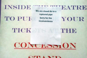
Ballston Regal theater closed due to flooding Ballston Regal theater closed due to flooding

Update at 8:45 p.m. — First Down Sports Bar and Grill had to shut down tonight, also due to a burst water pipe. From the businesses’ Facebook page: “We have had to close down suddenly for tonight because of a water pipe burst. Hopefully, we’ll be back up and running tomorrow. We will have an update on here as soon as we figure it out. Sorry for any inconvenience this may have caused.”

Update at 8:35 p.m. — Tonight’s Arlington County Democratic Committee debate for County Board candidates was briefly evacuated tonight when a reported burst pipe triggered the fire alarm in the National Rural Electric Cooperative Association building.

(Updated at 11:40 p.m.) The Regal Ballston Common 12 theater was closed tonight due to flooding from ruptured water pipes.

Three pipes burst this afternoon, sending water spilling across several floors of the theater, we’re told. A clean-up is underway and the theater is hoping to reopen tomorrow (Thursday).

The water also impacted elevators in the mall building.

“Please be advised this afternoon, the sprinkler pipe broke in the Ballston Mall movie theatre and water is going into the freight elevator,” said a memo sent to workers in the offices above the mall. “As of right now, all elevators are out of service.”

Burst water pipes have plagued homes and businesses across Arlington this week, as temperatures dipped into the teens and single digits. The Trader Joe’s store in Clarendon reopened this morning after a burst water pipe last night. Also last night, the Doorways Family Home in North Arlington, which houses homeless families and victims of domestic violence, was closed when “a sprinkler head in a second floor ceiling burst due to freezing conditions” and flooded the floors down to the basement.

The women and children who were in the home were evacuated to hotels. Restoration crews worked today to make the house habitable again.


Broken water pipe at Trader Joe's in Clarendon Broken water pipe at Trader Joe's in Clarendon

Update at 10:00 a.m. — The store is back open, a tipster tells us.

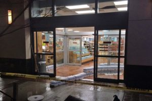
The Clarendon Trader Joe’s store (1109 N. Highland Street) was closed tonight after a water pipe burst near the entrance.

The incident happened between 6:30 and 7:30 p.m. The burst pipe also set off the fire alarm, prompting a response from the Arlington County Fire Department. Water gushed out onto the sidewalk in front of the store and also flooded part of the store.

The water on the sidewalk quickly turned to a sheet of ice. Firefighters cordoned off the area with caution tape to prevent pedestrians from slipping and falling. Employees, meanwhile, could be seen trying to mop up water inside the store.

Trader Joe’s was closed during the clean-up. No word yet on when it will reopen.

Numerous burst pipes have been reported around Arlington today (Tuesday), the apparent result of the frigid temperatures.


Arlington and the surrounding D.C. region is under a Flood Watch through midnight tonight.

Forecasters say 3-6 inches of rain has fallen since Wednesday and another 1-3 inches is expected tonight, raising the possibility of flooding. From the National Weather Service:

…FLOOD WATCH IN EFFECT UNTIL MIDNIGHT EDT TONIGHT…

THE NATIONAL WEATHER SERVICE IN STERLING VIRGINIA HAS EXPANDED
THE

* FLOOD WATCH TO INCLUDE PORTIONS OF MARYLAND…THE DISTRICT OF
COLUMBIA AND VIRGINIA…INCLUDING THE FOLLOWING AREAS…IN
MARYLAND…ANNE ARUNDEL…CALVERT…CHARLES…HOWARD…
MONTGOMERY…PRINCE GEORGES AND ST. MARYS. THE DISTRICT OF
COLUMBIA. IN VIRGINIA…ARLINGTON/FALLS CHURCH/ALEXANDRIA…
CULPEPER…FAIRFAX…GREENE…KING GEORGE…LOUDOUN…
MADISON…NORTHERN FAUQUIER…ORANGE…PRINCE
WILLIAM/MANASSAS/MANASSAS PARK…RAPPAHANNOCK…SOUTHERN
FAUQUIER…SPOTSYLVANIA AND STAFFORD.

* UNTIL MIDNIGHT EDT TONIGHT

* THREE TO SIX INCHES OF RAIN HAS ALREADY FALLEN SINCE WEDNESDAY
ACROSS THE GREATER WASHINGTON DC METRO AREA…CENTRAL MARYLAND
AND THE NORTHERN PIEDMONT REGION OF VIRGINIA. STEADY MODERATE TO
HEAVY RAIN CURRENTLY OVER NORTHERN VIRGINIA WILL SLOWLY SHIFT
SOUTHWARD THROUGH MIDNIGHT.

* ADDITIONAL AMOUNTS OF ONE TO LOCALLY THREE INCHES ARE POSSIBLE
THROUGH THIS EVENING. THIS AMOUNT OF RAINFALL WOULD CAUSE
FLOODING OF SMALL STREAMS AND URBAN AREAS.

PRECAUTIONARY/PREPAREDNESS ACTIONS…

A FLOOD WATCH MEANS THERE IS A POTENTIAL FOR FLOODING BASED ON
CURRENT FORECASTS.

YOU SHOULD MONITOR LATER FORECASTS AND BE ALERT FOR POSSIBLE
FLOOD WARNINGS. THOSE LIVING IN AREAS PRONE TO FLOODING SHOULD BE
PREPARED TO TAKE ACTION SHOULD FLOODING DEVELOP.


This article was written by Audrey Batcheller

Flooding in Arlington on 9/8/11 (courtesy Brendan L.)So far this summer, Arlington has been subject to flash floods and flash flood warnings. While flash floods are obviously harmful to those who live in or are trying to navigate through a flooded area, the floods can actually be harmful to the ecology of the flooded waterway itself.

A flash flood is a weather condition defined by the National Weather Service as “a rapid and extreme flow of high water into a normally dry area, or a rapid water level rise in a stream or creek above a predetermined flood level, beginning within six hours of the causative event.” In other words, a tremendous amount of water in a short amount of time caused by thunderstorms or heavy rainfall.

These types of storms are most common in Arlington during the spring and summer months due to the weather and climate of the area, which explains why the flood threats have picked up recently.

The effects of flash floods depend on factors such as the amount of previous rainfall the area has experienced and how much rainfall can be absorbed in the area. Flash floods, therefore, affect all areas and environments differently and there’s no blanket formula to predict how a storm will affect a given area.

Part of the Mt. Vernon Trail is closed due to flooding (file photo)Aside from the potential danger presented from this type of extreme weather condition, heavy rainfall and flash floods can have negative impacts on our local streams and surrounding environments.

“When rainfall runs from developed surfaces in Arlington to local streams, it washes any nutrients on the surface into the watershed,” explains WJLA meteorologist and Arlington Public Schools high school science teacher Ryan Miller.

These nutrients can include fertilizer, pet waste, and gasoline, and when they infiltrate runoff heading towards local tributaries, they eventually end up in the Potomac River and ultimately the Chesapeake Bay. Waterways suffer from the introduction of these pollutants which catalyze a harmful process called eutrophication.

Eutrophication occurs when algae blooms in a body of water deplete the dissolved oxygen levels in the water. This loss of oxygen creates what is referred to as anoxic water and typically results in an environment unsuitable for living organisms.

The harmful effects of eutrophication and runoff can be augmented by flash flooding, considering the abundance of water washing into local streams such as Four Mile Run or Long Branch.

(more…)


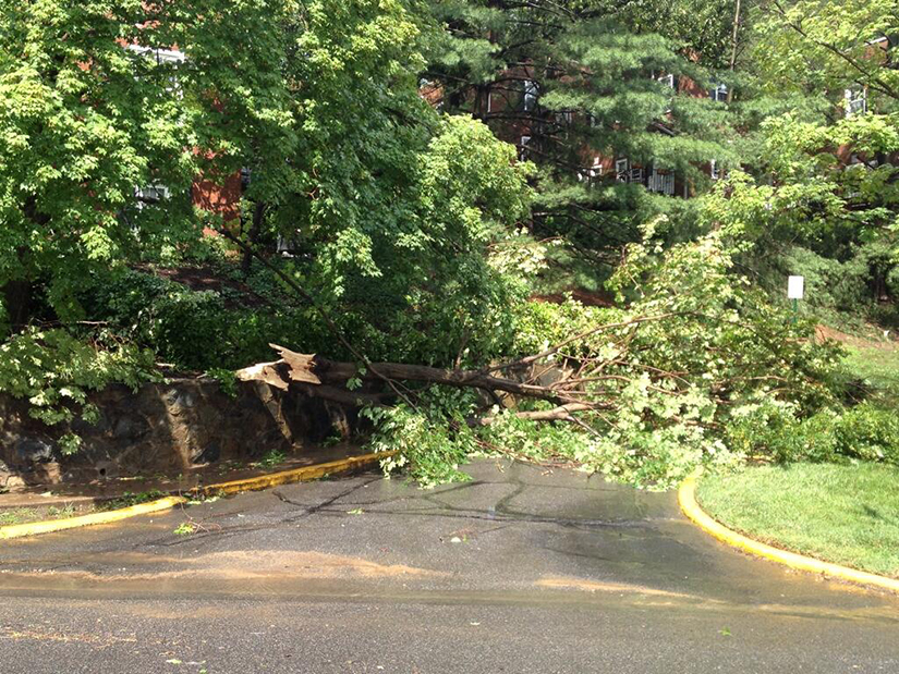
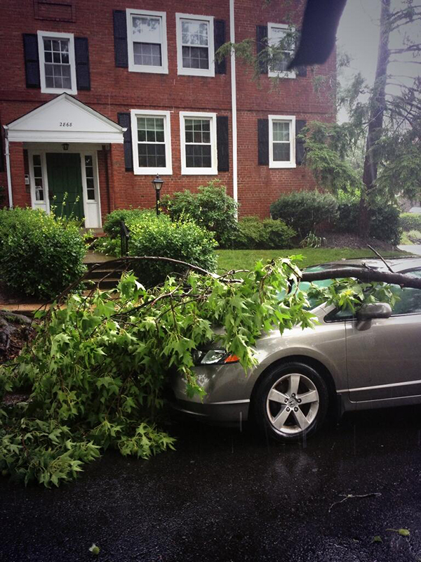
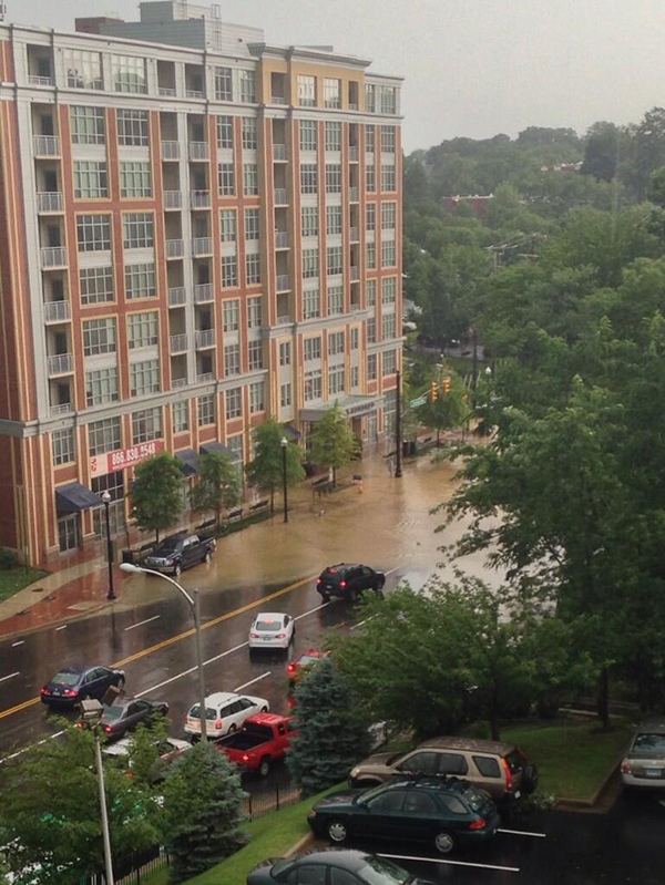
(Updated 6:10 p.m.) A short lived, yet strong, string of storms left patches of destruction and power outages after it whipped through the area this afternoon. Although all parts of the county sustained some damage, the worst reports seem to be coming from South Arlington.

According to Dominion Virginia Power spokesman Chuck Penn, as of 5:45 p.m. there were about 6,500 Arlington customers without electricity. Most of the 33,000 Dominion customers currently without power are in Alexandria. However, Penn noted that “this is a very dynamic, unfolding situation” so numbers are changing almost by the minute.

Crews are out right now determining what is causing outages in each neighborhood and fixing the problems as rapidly as possible. One area hit especially hard is in South Arlington at S. Columbus Street and Chesterfield Road. Penn says multiple power pole cross arms were broken and there are spans of wire down. Dominion crews re-routed the circuit and restored power to a number of customers in the surrounding neighborhoods, but others are still in the dark.

“It’s a rather labor intensive job that our workers are engaged in,” said Penn. “We are very much in the restoration mode right now.”

There are numerous reports of trees down and flooded streets. Motorists are reminded not to attempt driving through standing water, as it may be deeper than it appears. Drivers should also treat any dark traffic lights as a four way stop.

Arlington remains under a Flash Flood Warning until 7:30 p.m. and a Severe Thunderstorm Watch until 9:00 p.m. The Capital Weather Gang predicts storms off and on throughout the evening.

Photos via @Rock_Thrower, @Mrs_Dietz_, @Bruno8a


The National Weather Service has included Arlington County in a Flash Flood Watch. The watch is in effect until 6:00 p.m.

From NWS:

THE NATIONAL WEATHER SERVICE IN STERLING VIRGINIA HAS EXPANDED
THE

* FLASH FLOOD WATCH TO INCLUDE PORTIONS OF MARYLAND…THE
DISTRICT OF COLUMBIA AND VIRGINIA…INCLUDING THE FOLLOWING
AREAS…IN MARYLAND…ANNE ARUNDEL…CALVERT…CHARLES…
HARFORD…HOWARD…MONTGOMERY…PRINCE GEORGES AND SOUTHERN
BALTIMORE. THE DISTRICT OF COLUMBIA. IN VIRGINIA…
ARLINGTON/FALLS CHURCH/ALEXANDRIA…CULPEPER…FAIRFAX…
LOUDOUN…NORTHERN FAUQUIER…ORANGE…PRINCE
WILLIAM/MANASSAS/MANASSAS PARK…SOUTHERN FAUQUIER…
SPOTSYLVANIA AND STAFFORD.

* UNTIL 6 PM EDT THIS EVENING

* SHOWERS AND THUNDERSTORMS WILL CONTINUE TO PRODUCE MODERATE TO
HEAVY RAINFALL THROUGH THE REST OF THE AFTERNOON. ONE TO THREE
ADDITIONAL INCHES COULD CAUSE FLOODING OR FLASH FLOODING.

PRECAUTIONARY/PREPAREDNESS ACTIONS…

A FLASH FLOOD WATCH MEANS THAT CONDITIONS MAY DEVELOP THAT LEAD
TO FLASH FLOODING. FLASH FLOODING IS A VERY DANGEROUS SITUATION.

YOU SHOULD MONITOR LATER FORECASTS AND BE PREPARED TO TAKE ACTION
SHOULD FLASH FLOOD WARNINGS BE ISSUED.


Cat in the 'hood (Flickr pool photo by Ddimick)

Board Approves New Hotel — On Saturday, the Arlington County Board approved a new 168-room hotel on the former Colony House furniture site at 1700 Lee Highway. As part of the site plan approval, developer B.F. Saul agreed to make a $510,000 contribution to the county’s affordable housing fund, $62,546 to the utility undergrounding fund, $75,000 to the public art fund and $70,000 to pay for a widened sidewalk on a portion of N. Quinn Street. [Arlington County]

Diener Murder Case In-Depth — Writer Kris Coronado takes an in-depth look at how Arlington County police cracked the Carl Diener murder case, including how a hunch and DNA evidence played a pivotal role, and how one of the suspects rapped about the case against him. [Arlington Magazine]

County Floodplain Maps Updated — Arlington County has updated its floodplain maps for the first time since 1982. The new maps “reflect the best available data on flood risks,” removing 230 land parcels from the 100-year floodplain while adding 81 parcels. [Arlington County]

Airfare Drops at DCA — The average roundtrip airfare at Reagan National Airport was $370 in 2012. That’s down 4.6 percent from a year prior and down 20.1 percent compared to the year 2000. [Sun Gazette]

AHC Seniors Headed to College — All 11 high school seniors in the AHC Inc. Teen Program graduated this year and are going to college. “Many are the first in their family to achieve this milestone,” said Celia Slater, communications director for the Arlington-based affordable housing developer. “Together, the group earned more than $20,000 in scholarships”. The students’ families are from 9 different countries. [AHC Inc.]

Flickr pool photo by Ddimick


Update at 9:35 a.m. — Departing flights are experiencing a “gate hold” at DCA. Delays of at least 30 minutes should be expected, and could get worse throughout the day.

Update at 8:55 a.m. — There is a ground stop for flights arriving at Reagan National Airport due to the weather. Check with your airline for the status on any outgoing flights.

The National Weather Service has put Arlington and the rest of the metro area under a Severe Thunderstorm Watch until 11:00 a.m. That’s in addition to the Flash Flood watch that went into effect at midnight and will last until 8:00 p.m.

NWS notes several rounds of strong storms could soak the area. That could create trouble due to the level of ground saturation from the heavy rains that caused flooding earlier this week. From NWS:

* SHOWERS AND THUNDERSTORMS WILL LIKELY MOVE ACROSS THE REGION
THIS MORNING AND PRODUCE HEAVY DOWNPOURS. RAINFALL AMOUNTS IN
EXCESS OF 1 INCH ARE POSSIBLE. ANOTHER ROUND OF STORMS MAY BRING
HEAVY RAIN THIS AFTERNOON AND EVENING WITH AN ADDITIONAL 1 TO 2
INCHES POSSIBLE.

* WITH THE GROUND ALREADY SATURATED FROM HEAVY RAINFALL DURING
THE PAST WEEK…ONLY AN INCH OF RAINFALL IN AN HOUR COULD
PRODUCE FLASH FLOODING OF STREAMS AND LOW LYING AREAS.

PRECAUTIONARY/PREPAREDNESS ACTIONS…

A FLASH FLOOD WATCH MEANS THAT CONDITIONS MAY DEVELOP THAT LEAD
TO FLASH FLOODING. FLASH FLOODING IS A VERY DANGEROUS SITUATION.

YOU SHOULD MONITOR LATER FORECASTS AND BE PREPARED TO TAKE ACTION
SHOULD FLASH FLOOD WARNINGS BE ISSUED.

Although the storms have the potential to bring damaging winds and the word “derecho” is being thrown around, the Capital Weather Gang doesn’t expect it to be as strong as the derecho that struck last year.

The Office of Personnel Management has kept all federal offices open, but employees have the option of unscheduled leave or unscheduled telework.


View More Stories