You’ll probably want to pack an umbrella this morning.

Numerous downpour-producing storms are expected to hit the Washington area this afternoon and evening. Forecasters are warning that the storms could cause flash flooding.

…FLASH FLOOD WATCH REMAINS IN EFFECT FROM NOON EDT TODAY
THROUGH LATE TONIGHT…

* A WEAK COLD FRONT WILL DROP INTO A VERY MOIST AND HUMID AIRMASS
FRIDAY. NUMEROUS THUNDERSTORMS ARE EXPECTED TO DEVELOP BY MIDDAY
FRIDAY…AND CONTINUE INTO THE EVENING. RAINFALL RATES WITHIN
THESE THUNDERSTORMS MAY EXCEED 2 INCHES IN LESS THAN AN HOUR.
SEVERAL THUNDERSTORMS POTENTIALLY COULD TRACK ACROSS THE SAME
AREA…RESULTING IN FLASH FLOODING.

PRECAUTIONARY/PREPAREDNESS ACTIONS…

A FLASH FLOOD WATCH MEANS THAT CONDITIONS MAY DEVELOP THAT LEAD
TO FLASH FLOODING. FLASH FLOODING IS A VERY DANGEROUS SITUATION.

YOU SHOULD MONITOR LATER FORECASTS AND BE PREPARED TO TAKE ACTION
SHOULD FLASH FLOOD WARNINGS BE ISSUED.


The National Weather Service has issued a severe thunderstorm watch for the region through 9:00 tonight.

Forecasters say that thunderstorms with high winds, torrential rains, dangerous lighting and large hail are possible tonight.

A flash flood watch is also in effect.


Part of the Mt. Vernon Trail is closed between Roosevelt Island and the Humpback Bridge due to flooding.

The Potomac River is now covering a low-lying section of the trail. This afternoon ducks and debris could be seen floating where humans can usually be seen exercising.

The National Park Service has placed “trail closed” signs on either side of the flooded portion, but joggers and bicyclists are simply diverting to a narrow dirt path that runs dangerously close to the northbound GW Parkway, which has been the scene of two serious accidents in the past week.

Flooding along the banks of the Potomac has also forced evacuations in Georgetown and the rescue of a group of Boy Scouts near White’s Ferry. A tipster tells us the rescued Boy Scouts are from Arlington, but so far we’ve been unable to confirm that.

More photos after the jump.

(more…)


A flood watch will take effect at 6:00 tonight as heavy rains move into our area from the southwest.

A steady, soaking, all-day rain and and gusty winds should make for an unpleasant Thursday. Officials are warning anyone who lives in low-lying or flood-prone areas to be “prepared to take action should flood develop.”

FLOOD WATCH REMAINS IN EFFECT FROM 6 PM EST THIS EVENING THROUGH THURSDAY EVENING…

THE FLOOD WATCH CONTINUES FOR

* PORTIONS OF NORTHERN AND EASTERN MARYLAND… THE DISTRICT OF COLUMBIA AND NORTHERN VIRGINIA… EAST OF THE BLUE RIDGE.

* FROM 6 PM EST THIS EVENING THROUGH THURSDAY EVENING

* PERIODS OF MODERATE TO HEAVY RAIN WILL MOVE INTO THE REGION AHEAD OF A COLD FRONT THIS EVENING INTO THURSDAY. BY THE TIME THE FRONT CLEARS THE AREA THURSDAY NIGHT… UP TO 3 INCHES OF RAIN WILL BE POSSIBLE.

* THE FORECASTED RAINFALL AMOUNTS LIKELY WILL CAUSE FLOODING OF LOW LYING AREAS… AS WELL AS CAUSE SMALL STREAMS AND CREEKS TO RISE OUT OF THEIR BANKS. THE RUNOFF WOULD THEN CREATE SIGNIFICANT RISES ON AREA RIVERS.

PRECAUTIONARY/PREPAREDNESS ACTIONS…

A FLOOD WATCH MEANS THERE IS A POTENTIAL FOR FLOODING BASED ON CURRENT FORECASTS.

YOU SHOULD MONITOR LATER FORECASTS AND BE ALERT FOR POSSIBLE FLOOD WARNINGS. THOSE LIVING IN AREAS PRONE TO FLOODING SHOULD BE PREPARED TO TAKE ACTION SHOULD FLOODING DEVELOP.


Miserable weather led to scattered problems across Arlington last night.

Steady rains caused some localized flooding in parts of the county. Police reportedly had to block off 11th Street at North Kennebec Street last night due to water in the roadway. A big pool of standing water also caused a traffic hazard on the northbound lanes of Glebe Road, just before Wilson Boulevard.

Local streams filled with fast-moving water as a result of the rain. This video shows a normally-peaceful section of Four Mile Run that turned into a raging rapid near Shirlington.

Elsewhere in Arlington, gusty winds brought down trees and power lines.

A brief period of sleet, meanwhile, made its way through the area around midnight. There was no noticeable accumulation in Arlington.


The cleanup is still on-going at Arlington’s courthouse building, which was damaged by a burst hot water pipe early Friday morning.

The pipe burst in a wall of a courtroom on the the third floor of the building. Water leaked down to the second and first floors, as well as the parking garage. Crews worked throughout the weekend to dry out damaged carpets, chairs and other furniture.

Several boxes of documents at the police department’s central records department were damaged, but a county spokesperson said that most of those documents had already been digitized and were waiting to be shredded. Another box of documents, which was intended to be preserved, suffered light water damaged but has since been dried out by a contractor.

“We lost nothing of any significance,” said county spokeswoman Mary Curtius. “The courtroom will reopen tomorrow and most of the offices are functioning already today.”

Damage is expected to exceed the county’s $50,000 insurance deductible, Curtius said.


Reports of isolated pockets of high water and traffic light problems have been trickling in over the past hour as rain continues to fall.

According to scanner traffic, the ramp from westbound Route 50 to westbound Washington Boulevard has been shut down by police due to high water. Likewise, police are checking out a call for high water in the area of North Glebe Road and Chesterbrook Road.

Heavy rain invariably tends to cause problems with traffic lights in the county.

Earlier, it was reported that the lights at the tricky intersection of South Hayes Street and 15th Street were flashing.

Now, police are heading to the equally tricky intersection of Fort Myer Drive and North Lynn Street to direct traffic. Traffic lights are reported to be completely dark in the area. (We’ve moved updates on the power outage in Rosslyn to a separate post.)

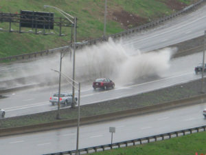
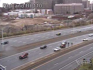
Update at 11:25 a.m. — There’s a large pool of standing water on the HOV lanes of I-395 approaching the 14th Street Bridge. Traffic cameras show that it’s in the same spot as the pool of water left by a spring storm, shown in one of the photos below.

The water caused a car to stall out in the left-hand lane. Police are now on the scene


Heavy rain is expected tomorrow night, and already the National Weather Service is warning of possible flooding.

THE NATIONAL WEATHER SERVICE IN STERLING VIRGINIA HAS ISSUED A FLASH FLOOD WATCH FOR THE WASHINGTON AND BALTIMORE METROPOLITAN AREAS FROM LATE TUESDAY NIGHT THROUGH WEDNESDAY AFTERNOON

A STRONG COLD FRONT WILL SLOWLY APPROACH THE AREA TUESDAY NIGHT BEFORE PASSING THROUGH EARLY WEDNESDAY MORNING. RAIN IS EXPECTED TO OVERSPREAD THE AREA BY TUESDAY EVENING…BUT THE HEAVIEST RAINFALL IS EXPECTED LATE TUESDAY NIGHT THROUGH WEDNESDAY MORNING. RAINFALL AMOUNTS AROUND ONE TO TWO INCHES ARE EXPECTED WITH ISOLATED AMOUNTS UP TO 3 INCHES POSSIBLE IN HEAVIER BANDS OF RAIN AND THUNDERSTORMS. HEAVY AMOUNTS OF RAINFALL MAY CAUSE SMALL STREAMS AND CREEKS TO RISE OUT OF THEIR BANKS.

A FLASH FLOOD WATCH MEANS THAT CONDITIONS MAY DEVELOP THAT LEAD TO FLASH FLOODING. FLASH FLOODING IS A VERY DANGEROUS SITUATION. YOU SHOULD MONITOR LATER FORECASTS AND BE PREPARED TO TAKE ACTION SHOULD FLASH FLOOD WARNINGS BE ISSUED.


(Updated at 3:00 p.m.) Driving rain and high winds knocked out power, flooded roads and led to numerous accidents in Arlington this morning.

Parts of Ballston and the area around Lee Highway and North Glebe Road lost power during the storm. A storm-related electrical fire in the parking garage of the National Science Foundation building caused dozens of workers to be evacuated. As of 2:50 p.m., the Arlington Central Library was still without power.

During the storm, several accidents were reported on I-66 and elsewhere.

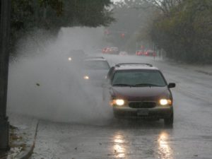
On Washington Boulevard near Utah Street, north of Ballston, standing water in one of the far lanes caused a big splash as cars drove through it. Further up the street, at the intersection with Glebe Road, a backup formed as traffic lights flashed yellow.

The National Weather Service has issued a flash flood warning until 4:15 this afternoon, and a tornado watch until 9:00 tonight.

Update at 3:05 p.m. — Central Library has closed until further notice due to the lack of power and phone service.

Update at 3:55 p.m. — The tornado watch has been canceled.

Update on 10/28 — More about the Ballston power outages here.


So far, we have not heard of any flooding in Arlington as a result of this morning’s deluge. However, Arlington County just issued the following alert:

THE DC AREA IS UNDER A FLASH FLOOD WARNING MEANING IT IS IMMINENT.USE CAUTION. DO NOT DRIVE VEHICLES THROUGH WATER COVERING ROADWAY.DO NOT CROSS BARRICADES.RUSH HOUR LIKELY TO BE AFFECTED.RESIDENTS LIVING IN FLOODING AREAS TAKE IMMEDIATE PRECAUTIONS TO PROTECT LIFE AND PROPERTY.CHECK LOCAL WEATHER SOURCES FOR STATUS REGULARLY.


From Arlington Alert:

FLASH FLOOD WATCH IN EFFECT FOR DC AREA FROM MIDNIGHT WED TO THUR UP TO 11PM. MONITOR FORECASTS. BE PREPARED TO TAKE ACTION SHOULD WARNINGS BE ISSUED. POSSIBLE 1-2 INCHES OF RAINFALL EACH DAY/NIGHT.


View More Stories