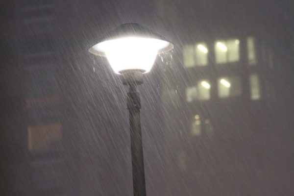
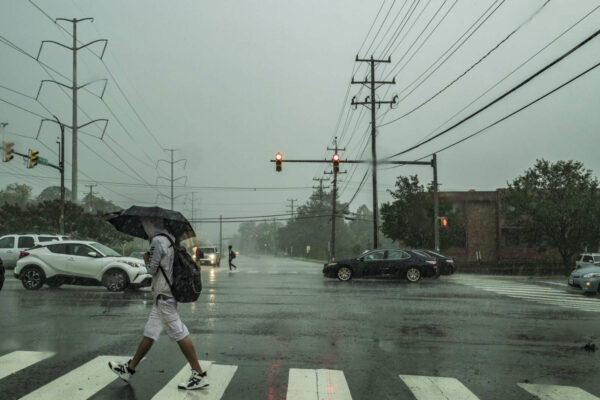
Rainy evening in Crystal City along 23rd Street S. (staff photo by Jay Westcott)

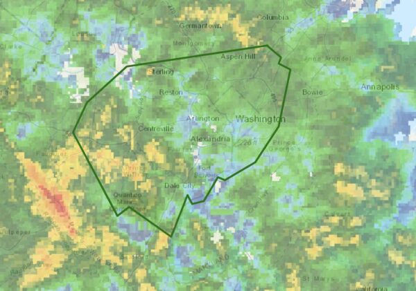
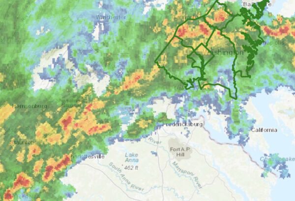
Several rounds of storms packing heavy downpours are possible tonight, leading to a Flood Watch being issued for Arlington and much of the region.

The watch is in effect until 4 a.m. Thursday.

Flash flooding and gusty winds are possible tonight, the National Weather Service says.

In Arlington, flooding is often limited to ponding on roadways and streams overtopping their banks, but some past summer rain storms have resulted in widespread flash flooding and numerous flooded basements.

From NWS:

…FLOOD WATCH IN EFFECT UNTIL 4 AM EDT THURSDAY…

* WHAT…Flash flooding caused by excessive rainfall is possible.

* WHERE…Portions of DC, Maryland, Virginia and panhandle West Virginia, including the following areas: in DC, District of Columbia. In Maryland, Anne Arundel, Central and Southeast Howard, Central and Southeast Montgomery, Frederick MD, Northwest Howard, Northwest Montgomery, Prince Georges and Washington. In Virginia, Arlington/Falls Church/Alexandria, Clarke, Eastern Loudoun, Fairfax, Frederick VA and Western Loudoun. In panhandle West Virginia, Berkeley, Jefferson and Morgan.

* WHEN…Until 4 AM EDT Thursday.

* IMPACTS…Excessive runoff may result in flooding of rivers, creeks, streams, and other low-lying and flood-prone locations.

* ADDITIONAL DETAILS…
– Numerous showers and thunderstorms with heavy rain are expected through this evening and into the overnight. Rainfall rates of 2 inches per hour are possible, leading to the potential for flash flooding especially in areas that see multiple rounds of heavy rain.
– Please visit https://www.weather.gov/safety/flood for flood safety and preparedness information.

PRECAUTIONARY/PREPAREDNESS ACTIONS…

You should monitor later forecasts and be prepared to take action should Flash Flood Warnings be issued.


Storms bring heavy rain, wind and flooding (file photo)

Update at 7:55 a.m. — The Flood Warning is now in effect until 4 p.m. as the rain continues throughout most of the day.

Earlier: Flooding is expected to take place in parts of Arlington overnight due to an extended period of heavy rain and storms.

The National Weather Service issued a Flood Warning for Arlington County and surrounding areas just before midnight.

From NWS:

1148 PM EDT Fri May 6 2022

…FLOOD WARNING IN EFFECT UNTIL 745 AM EDT SATURDAY…

* WHAT…Flooding caused by excessive rainfall is expected.

* WHERE…Washington DC, central Maryland and northern Virginia, including the following counties: in DC, District of Columbia. In central Maryland, Montgomery and Prince Georges. In northern Virginia, Arlington, City of Alexandria, City of Fairfax, City of Falls Church, City of Manassas, City of Manassas Park, Fairfax, Loudoun and Prince William.

* WHEN…Until 745 AM EDT Saturday.

* IMPACTS…Flooding of creeks, streams, urban areas, and other low-lying and flood-prone locations is imminent or occurring.

* ADDITIONAL DETAILS…

– At 1145 PM EDT, Doppler radar indicated heavy rain due to showers and isolated thunderstorms. Flooding is ongoing or expected to begin shortly in the warned area. Between 0.5 and 1 inch of rain has fallen.

– Additional rainfall amounts of 1 to 3 inches are possible in the warned area.

PRECAUTIONARY/PREPAREDNESS ACTIONS…

Turn around, don’t drown when encountering flooded roads. Most flood deaths occur in vehicles.


Rainy day in Aurora Highlands along 23rd St. S. (Staff Photo by Jay Westcott)

Arlington is under a Flood Watch until early Saturday.

Rain, which will be heavy at times, will fall throughout most of the day, raising the possibility of flooding, particularly near streams and low-lying areas.

The Flood Watch is in effect until 2 a.m.

More from the National Weather Service, below.

…FLOOD WATCH IN EFFECT FROM THIS AFTERNOON THROUGH LATE TONIGHT…

WHAT…Flooding caused by excessive rainfall is possible.

WHERE…DC and portions of Maryland and northern Virginia, including the following areas: the District of Columbia. In Maryland, Anne Arundel, Central and Southeast Howard, Central and Southeast Montgomery, Northwest Howard, Northwest Montgomery, Prince Georges and Southern Baltimore. In northern Virginia, Arlington/Falls Church/Alexandria, Eastern Loudoun, Fairfax, Northern Fauquier, Prince William/Manassas/Manassas Park and Western Loudoun.

WHEN…From this afternoon through late tonight.

IMPACTS…Excessive runoff may result in flooding of rivers, creeks, streams, and other low-lying and flood-prone locations.

ADDITIONAL DETAILS… – Widespread rainfall totals of 1-3 inches are expected through tonight. This may lead to localized instances of flooding. – http://www.weather.gov/safety/flood

PRECAUTIONARY/PREPAREDNESS ACTIONS… You should monitor later forecasts and be alert for possible Flood Warnings. Those living in areas prone to flooding should be prepared to take action should flooding develop.


Rainy night (Flickr pool photo by Kevin Wolf)

Arlington County is now under a Flood Watch, until 6 a.m. Thursday.

The watch was issued just after 11 p.m. Storms and periods of heavy rain are expected overnight, leading to the possibility of flooding in the area.

From the National Weather Service:

1104 PM EDT Wed Mar 23 2022

…FLOOD WATCH IN EFFECT UNTIL 6 AM EDT THURSDAY…

* WHAT…Flooding caused by excessive rainfall is possible.

* WHERE…Portions of DC, Maryland and northern Virginia, including the following areas: in DC, District of Columbia. In Maryland, Anne Arundel, Central and Southeast Howard, Central and Southeast Montgomery, Charles, Northern Baltimore, Northwest Howard, Prince Georges and Southern Baltimore. In northern Virginia, Arlington/Falls Church/Alexandria, Eastern Loudoun, Fairfax, Prince William/Manassas/Manassas Park, Southern Fauquier and Stafford.

* WHEN…Until 6 AM EDT Thursday.

* IMPACTS…Flooding may occur in poor drainage and urban areas.

* ADDITIONAL DETAILS…
– Rainfall rates of 1-2 inches an hour overnight may result in localized flooding of roadways.
– http://www.weather.gov/safety/flood

PRECAUTIONARY/PREPAREDNESS ACTIONS…

You should monitor later forecasts and be alert for possible Flood Warnings. Those living in areas prone to flooding should be prepared to take action should flooding develop.

More via social media:


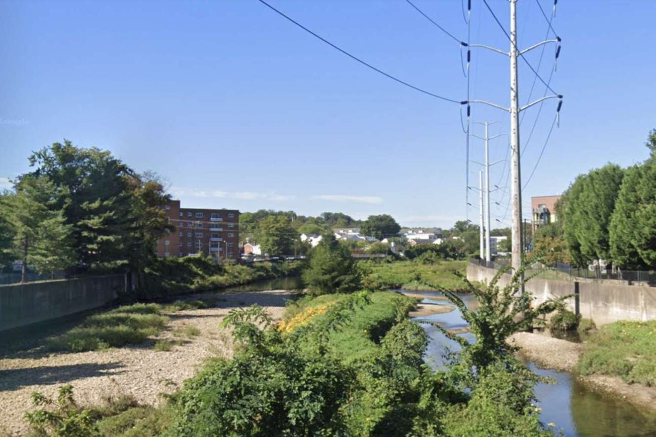
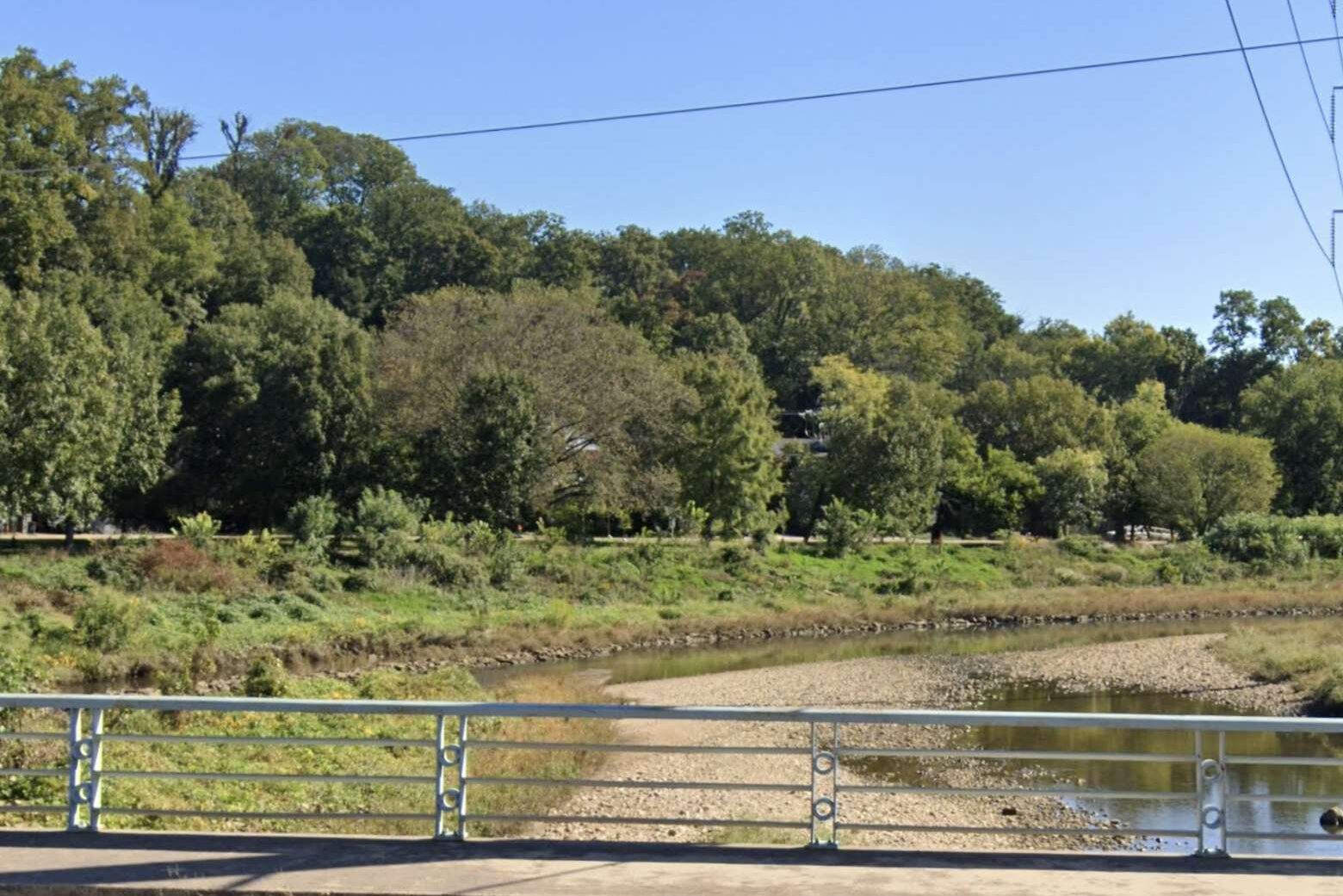
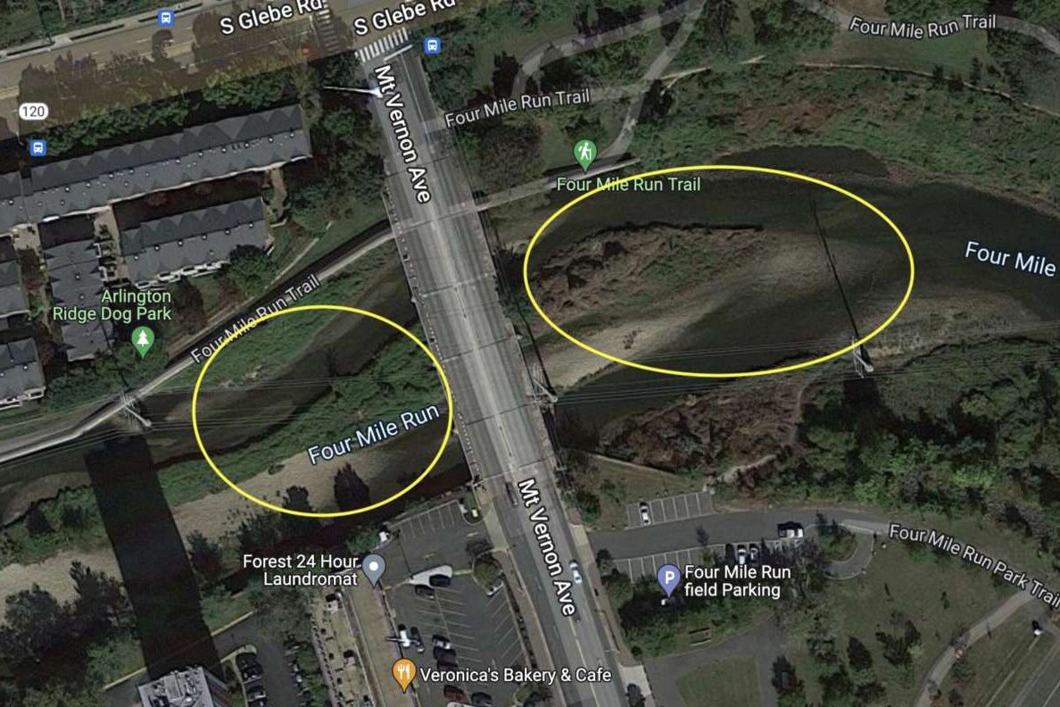
Arlington County plans to dredge stretches of the Four Mile Run and lower Long Branch Creek channels to alleviate potential flooding.

The project targets sections of the waterways near Mt. Vernon Avenue, bordering the City of Alexandria, where U.S. Army Corps of Engineers (USACE) determined soil deposit levels were “unacceptable” for stormwater management.

The Arlington County Board is slated to review the project this Saturday.

The USACE inspection determined the channel had “excessive shoaling” due to shallow water depths. Dredging the soil deposits will address this shoaling and ensure the channel can handle large, once-in-a-century floods, the county says.

As part of the project, erosion damage and degraded stream conditions will also be repaired and debris and vegetation will be cleared. Construction is slated to begin in September and last until February, according to a project webpage.

The maintenance work “addresses maintenance of the Four Mile Run streambed that is required by the USACE, would help alleviate flooding along the Long Branch Tributary and would not significantly change any facilities, program or services provided to the community,” per a county report.

The entire project will take four to six months, Department of Environmental Services spokeswoman Aileen Winquest tells ARLnow. For one month, while work on the Lower Long Branch channel takes place, some access to Troy Park will be limited.

“While the dredging work in Lower Long Branch is underway, there will be a small area at the end of Troy Park (closest to Glebe Road) that will be closed because it will be used for accessing the stream,” Winquist said. “There will be parking restrictions near that end of the park. The majority of the park will remain open and accessible.”

There will be a public meeting about the project in May, she said.

Arlington and the City of Alexandria worked with the USACE to design and build a flood-control channel in this portion of Four Mile Run — not far from where the creek meets the Potomac River — in response to repeated flooding that began in the 1940s. The channel, dubbed the Four Mile Run East and West Levee System, was built between 1974 and 1984. USACE inspects the levee every year to see how well it’s being maintained.

Arlington County will pay for the $5 million project and will receive partial reimbursement from the City of Alexandria, leaving the county on the hook for $2.88 million.


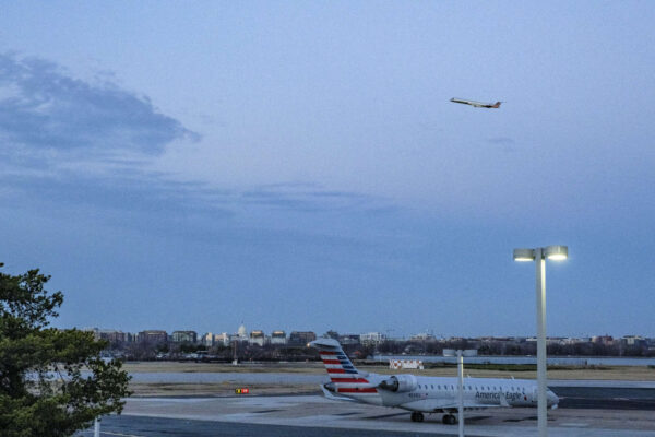
A jet takes off from Reagan National Airport at twilight (staff photo by Jay Westcott)

Whiskey Bar Coming to Clarendon — “Chicken + Whiskey is branching out into Northern Virginia. The Peruvian rotisserie chicken restaurant and whiskey bar, which got its start from a smaller location in Logan Circle in 2017, has inked a deal for a new location near the Clarendon Metro in Arlington County. The 5,708-square-foot restaurant is slated to open late this year or early next at 3033 Wilson Blvd.” [Washington Business Journal]

It’s Flood Awareness Week — “Flooding is the most common and costly natural disaster in the United States and it is becoming more frequent with climate change. As we head into the typical rainy season, Arlington County and Fairfax County are teaming up for Virginia Flood Awareness Week to get out key messages of being informed and prepared.” [Arlington County]

Bill to Limit Gov. Powers — “Five of Arlington’s seven-member General Assembly delegation voted in support of a measure that will limit the power of governors to act unilaterally for an indeterminate period in a crisis. Legislation sponsored by state Sen. David Suetterlein (R-Roanoke) on March 9 cleared the House of Delegates on a 91-8 vote, following earlier passage in the state Senate by a margin of 29-11. Gov. Youngkin is expected to sign the bill.” [Sun Gazette]

Arlington Kids Hold Ukraine Bake Sale — “Our boys and friends wanted to do something to help the people of #Ukraine – they decided on a bake sale. They raised $900+ today and it’s now headed to medical staff that are getting supplies to the Ukraine/Poland border. Nice job kiddos.” [Twitter]

Bishop O’Connell Swimmer Stands Out — “For Kate Bailey, her time to receive deserved recognition as a standout high-school swimmer in Arlington came this season in her final senior campaign. During past winter years, Bailey and other top local swimmers performed in the shadow of 2022 Yorktown High School graduate and Summer Olympian Torri Huske. With Huske now swimming in college at Stanford University, Bailey’s accomplishments this winter drew more attention.” [Sun Gazette]

It’s Monday — Partly cloudy throughout the day. High of 58 and low of 31. Sunrise at 7:22 am and sunset at 7:16 pm. [Weather.gov]


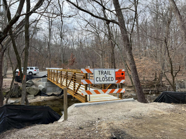
The new bridge in Glencarlyn Park (courtesy Dennis Dimick)

A pedestrian bridge in Glencarlyn Park that washed away during a severe flash flood nearly three years ago has been replaced.

On Monday, a contractor installed a new bridge over Four Mile Run in Glencarlyn Park (301 S. Harrison Street). The installation was completed before noon, Dept. of Parks and Recreation spokeswoman Susan Kalish tells ARLnow.

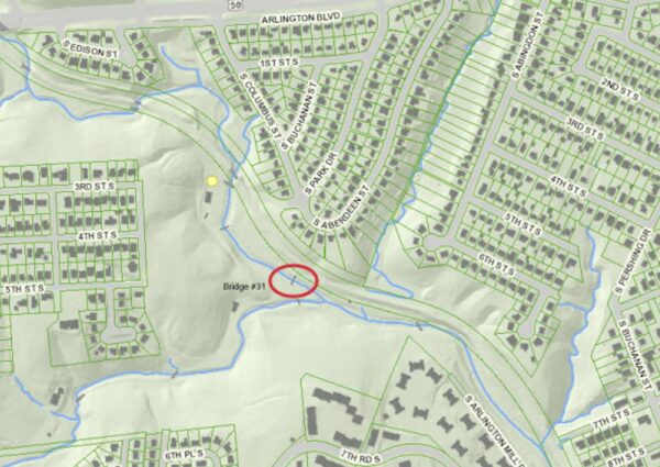
The new bridge is in the same location as the old one, per the project webpage.

Location of the Glencarlyn Park pedestrian bridge (via Arlington County)

Although the new bridge is in place, pedestrians and cyclists can’t walk or bike over it just yet.

“Our contractor has final work to do that is weather dependent,” Kalish said. “The bridge should be open to the public by the end of March.”

https://twitter.com/WalkArlington/status/1493408479435968512

In July 2019, six pedestrian bridges in Arlington were washed away after torrential rain caused heavy flooding. The Glencarlyn bridge suffered some of the worst damage in the storm, along with two bridges at Lubber Run Park.

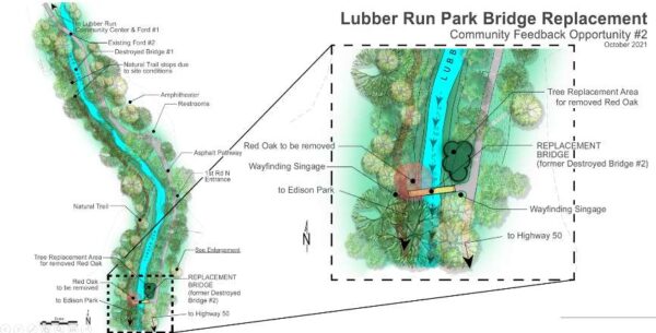
The parks department has funds to replace one bridge at Lubber Run, and selected the bridge at the park’s southern end, per a webpage for the project.

Plans for the replacement are in the design stage, and construction could begin late this summer and end next spring.

An illustration of the new Lubber Run Park pedestrian bridge (via Arlington County)

Boundaries of the Flood Warning that includes Arlington (via NWS)

Arlington and much of the region is now under a Flood Warning as rain continues to fall.

The warning was issued by the National Weather Service just after 12:30 p.m. Arlington is also under an earlier Coastal Flood Warning for significant tidal flooding along the Potomac.

More on the latest warning from NWS:

1234 PM EDT FRI OCT 29 2021

THE NATIONAL WEATHER SERVICE IN STERLING VIRGINIA HAS ISSUED A

* FLOOD WARNING…

* UNTIL 630 PM EDT.

* AT 1234 PM EDT, DOPPLER RADAR INDICATED HEAVY RAIN WITH RAINFALL AMOUNTS AROUND 0.5 AND 1.5 INCHES ACROSS MOST OF THE WARNED AREA. A PERIOD OF HEAVY RAIN IS EXPECTED THIS AFTERNOON THROUGH 3 PM WITH RAINFALL RATES AROUND ONE INCH PER HOUR. THIS WILL CAUSE CREEKS AND STREAMS TO RISE THROUGH LATE THIS AFTERNOON. FLOODING IS EXPECTED TO BEGIN SHORTLY IN THE WARNED AREA.

* SOME LOCATIONS THAT WILL EXPERIENCE FLOODING INCLUDE… ARLINGTON… ALEXANDRIA… CENTREVILLE… DALE CITY… ROCKVILLE… BETHESDA… RESTON… ANNANDALE… CLINTON… SPRINGFIELD… COLLEGE PARK… SOUTH RIDING… FORT WASHINGTON… HERNDON… GREENBELT… FAIRFAX… LANGLEY PARK… BELTSVILLE… FORT HUNT… VIENNA…

ADDITIONAL RAINFALL AMOUNTS OF 1 TO 2.5 INCHES ARE POSSIBLE IN THE WARNED AREA.

PRECAUTIONARY/PREPAREDNESS ACTIONS…

TURN AROUND, DON’T DROWN WHEN ENCOUNTERING FLOODED ROADS. MOST FLOOD DEATHS OCCUR IN VEHICLES.

Via Twitter:

https://twitter.com/ReadyArlington/status/1454127524766752777


It’s going to be nasty, rainy Friday.

Arlington will be under both a Flood Watch and a Coastal Flood Warning tomorrow. On top of that, strong winds and the possibility of some severe thunderstorms are in the forecast.

The Flood Watch takes effect Friday morning. From the National Weather Service:

849 PM EDT Thu Oct 28 2021

…FLOOD WATCH REMAINS IN EFFECT FROM FRIDAY MORNING THROUGH FRIDAY AFTERNOON…

The Flood Watch continues for

* Portions of DC, Maryland and northern Virginia, including the following areas: in DC, District of Columbia. In Maryland, Anne Arundel, Central and Southeast Howard, Central and Southeast Montgomery, Prince Georges and Southern Baltimore. In northern Virginia, Arlington/Falls Church/Alexandria, Fairfax and Prince William/Manassas/Manassas Park.

* From Friday morning through Friday afternoon.

* Rainfall amounts around 1 to 2 inches are most likely with isolated amounts of 2 to 4 inches possible.

* Heavy amounts of rain will cause creeks and streams to slowly rise, possibly out of their banks as well as the potential for flooding in urban areas.

PRECAUTIONARY/PREPAREDNESS ACTIONS…

You should monitor later forecasts and be alert for possible Flood Warnings. Those living in areas prone to flooding should be prepared to take action should flooding develop.

While Arlington’s river shoreline is not developed, unlike our neighbors in Alexandria, significant coastal flooding may inundate trails along the Potomac. A rare Coastal Flood Warning is currently in effect.

…COASTAL FLOOD WARNING NOW IN EFFECT UNTIL 2 PM EDT SATURDAY…

* WHAT…Two to three feet of inundation above ground level expected in low lying areas due to tidal flooding.

* WHERE…Shoreline in the District of Columbia, Arlington County, and the City of Alexandria.

* WHEN…Until 2 PM EDT Saturday, especially around the time of high tide.

* IMPACTS…The unprotected area on the Southwest Waterfront at the DC Seafood Market is expected to flood. Water is expected
to approach parts of the Hains Point Loop Road, but it will likely be closed. Water is expected to approach buildings near King Street and Union Street. Shoreline inundation up to one foot above ground is possible elsewhere.

* ADDITIONAL DETAILS…Tides up to 4 feet above normal. The next high tide at Washington Channel is at 2:18 AM and 3:14 PM. The next high tide at Alexandria is at 2:36 AM and 3:32 PM.

PRECAUTIONARY/PREPAREDNESS ACTIONS…

Take the necessary actions to protect flood-prone property. If travel is required, do not drive around barricades or through water of unknown depth.

NWS is calling for wind gusts up to 37 mph tomorrow, raising the possibility of falling trees and branches, as well as power outages.

More via Twitter:

https://twitter.com/ReadyArlington/status/1453742757718200331


Flash Flood Watch and radar as of 6 p.m. (via NWS)

Update at 10:15 p.m. — Arlington is under a Flood Warning as heavy rain continues to fall. Some flooding is being reported in parts of the area, including along I-66 in Arlington.

Earlier: A rainy night, and possible flooding, is on tap after a line of storms packing gusty winds and downpours blew through Arlington during the evening commute.

More rain is expected to fall on already-saturated ground tonight, prompting the National Weather Service to issue a Flash Flood Watch.

More from NWS:

URGENT – IMMEDIATE BROADCAST REQUESTED
FLOOD WATCH
NATIONAL WEATHER SERVICE BALTIMORE MD/WASHINGTON DC
550 PM EDT MON OCT 25 2021

…FLASH FLOOD WATCH IN EFFECT UNTIL 2 AM EDT TUESDAY…

THE NATIONAL WEATHER SERVICE IN STERLING VIRGINIA HAS ISSUED A

* FLASH FLOOD WATCH FOR PORTIONS OF DC, MARYLAND AND NORTHERN VIRGINIA, INCLUDING THE FOLLOWING AREAS: IN DC, DISTRICT OF COLUMBIA. IN MARYLAND, ANNE ARUNDEL, CENTRAL AND SOUTHEAST HOWARD, CENTRAL AND SOUTHEAST MONTGOMERY, PRINCE GEORGES AND SOUTHERN BALTIMORE. IN NORTHERN VIRGINIA, ARLINGTON/FALLS CHURCH/ALEXANDRIA AND FAIRFAX.

* UNTIL 2 AM EDT TUESDAY.

* SHOWERS AND THUNDERSTORMS ARE EXPECTED TO PRODUCE 1 TO 2 INCHES OF RAIN THROUGH THIS EVENING, WITH LOCALIZED AMOUNTS OF UP TO 4 INCHES POSSIBLE. HEAVY RAIN IN A SHORT AMOUNT OF TIME MAY RESULT IN RAPID RISES OF WATER ON SMALL CREEKS AND STREAMS AND IN URBAN AREAS.

PRECAUTIONARY/PREPAREDNESS ACTIONS…

YOU SHOULD MONITOR LATER FORECASTS AND BE PREPARED TO TAKE ACTION SHOULD FLASH FLOOD WARNINGS BE ISSUED.


Update at 10:30 a.m. — The Flood Warning expired and the Flash Flood Watch, originally in effect until this afternoon, has been cancelled as the rain moves out.

Earlier: Arlington County is under a Flood Warning this morning.

The warning was issued shortly after 5 a.m. Already areas of minor flooding have been reported, including high standing water along I-66 between East Falls Church and Ballston, which closed all but one eastbound lane, according to the National Weather Service.

The warning is in effect until 7:45 a.m.

More from NWS:

509 AM EDT THU SEP 23 2021

…FLOOD WARNING REMAINS IN EFFECT UNTIL 745 AM EDT THIS MORNING FOR SOUTHEASTERN MONTGOMERY, ARLINGTON AND EASTERN FAIRFAX COUNTIES AND THE NORTHWESTERN DISTRICT OF COLUMBIA, THE CITY OF ALEXANDRIA AND THE CITY OF FALLS CHURCH…

AT 509 AM EDT, DOPPLER RADAR INDICATED THE FIRST AREA OF HEAVY RAIN HAS EXITED THE WARNED AREA. BETWEEN 0.5 AND 1.5 INCHES OF RAIN HAVE FALLEN, WHICH RESULTED IN SOME MINOR URBAN AND POOR DRAINAGE FLOODING. ADDITIONAL MODERATE TO HEAVY RAIN IS EXPECTED TO MOVE ACROSS THE AREA OVER THE NEXT SEVERAL HOURS, WHICH COULD LEAD TO ADDITIONAL FLOODING.

SOME LOCATIONS THAT WILL EXPERIENCE FLOODING INCLUDE… ARLINGTON… ALEXANDRIA… GERMANTOWN… ROCKVILLE… BETHESDA… GAITHERSBURG… ANNANDALE… OLNEY… SPRINGFIELD… FORT HUNT… VIENNA… GROVETON… FALLS CHURCH… HUNTINGTON… FORT BELVOIR… PIMMIT HILLS… MCLEAN… AMERICAN LEGION BRIDGE… ROSSLYN… CRYSTAL CITY…

ADDITIONAL RAINFALL AMOUNTS OF 0.5 TO 1.5 INCHES ARE POSSIBLE IN THE WARNED AREA.

PRECAUTIONARY/PREPAREDNESS ACTIONS…

TURN AROUND, DON’T DROWN WHEN ENCOUNTERING FLOODED ROADS. MOST FLOOD DEATHS OCCUR IN VEHICLES.

BE ESPECIALLY CAUTIOUS AT NIGHT WHEN IT IS HARDER TO RECOGNIZE THE DANGERS OF FLOODING.


View More Stories