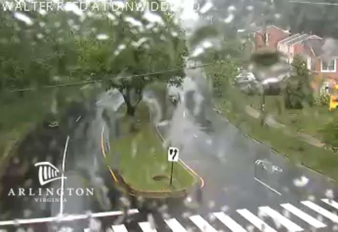
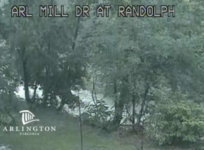
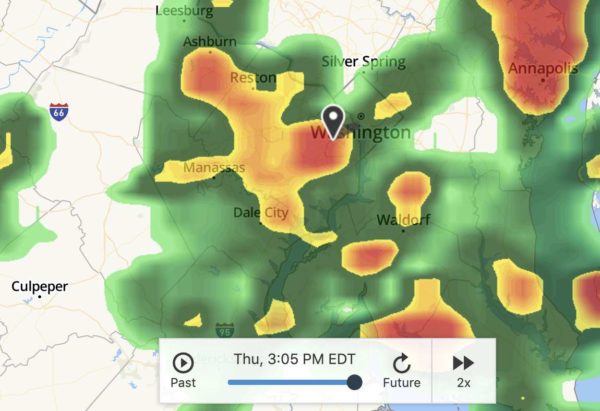
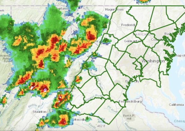
After an early morning storm, Arlington is expecting more heavy rain today.

The region is under a Flash Flood Watch starting at noon. Forecasters say slow-moving storms could dump several inches of rain, potentially causing flash flooding.

More from the National Weather Service:

…FLASH FLOOD WATCH REMAINS IN EFFECT FROM NOON EDT TODAY THROUGH THIS EVENING…

* A COLD FRONT WILL MOVE INTO THE AREA WEDNESDAY AND THEN STALL OUT. NUMEROUS SLOW MOVING SHOWERS AND THUNDERSTORMS WILL POSE A RISK OF FLASH FLOODING. THUNDERSTORMS COULD PRODUCE ONE TO TWO INCHES OF RAIN WITH ISOLATED AMOUNTS UP TO FOUR INCHES POSSIBLE.

PRECAUTIONARY/PREPAREDNESS ACTIONS…

A FLASH FLOOD WATCH MEANS THAT CONDITIONS MAY DEVELOP THAT LEAD TO FLASH FLOODING. FLASH FLOODING IS A VERY DANGEROUS SITUATION.

YOU SHOULD MONITOR LATER FORECASTS AND BE PREPARED TO TAKE ACTION SHOULD FLASH FLOOD WARNINGS BE ISSUED.


New N. Va. Unemployment Claims Drop — “New claims for unemployment benefits filed by Northern Virginia residents fell last week to their lowest level since pandemic-related business shutdowns began, even as thousands of area residents continue collecting unemployment.” Arlington had 352 new claims and 5,280 continuing claims. [InsideNova]

Developers ‘Double Dip’ PPP Loans — Companies affiliated with major local developers received million in PPP loans, in some cases with multiple loans backing individual properties in Arlington, D.C. and elsewhere. [Washington Business Journal]

Another Flash Flood Watch TodayUpdated at 8 a.m. — “More thunderstorms with heavy rain are expected today. A Flash Flood Watch is in effect again this afternoon and tonight for much of our area.” [Twitter]

Citizen’s Police Academy Seeking Participants — “The Arlington County Police Department is now accepting applications for the 24th Citizen’s Police Academy (CPA). The CPA is an educational program designed to create better understanding and communication between police and the community they serve.” [Arlington County]

New Mural in Crystal City — “Last week, the @gensler_design team helped JBG SMITH paint a mural at 2250 Crystal Drive in National Landing to remind our neighbors that ‘even through tough times, the sun will always rise.'” [Twitter]

Flickr pool photo by Vincent


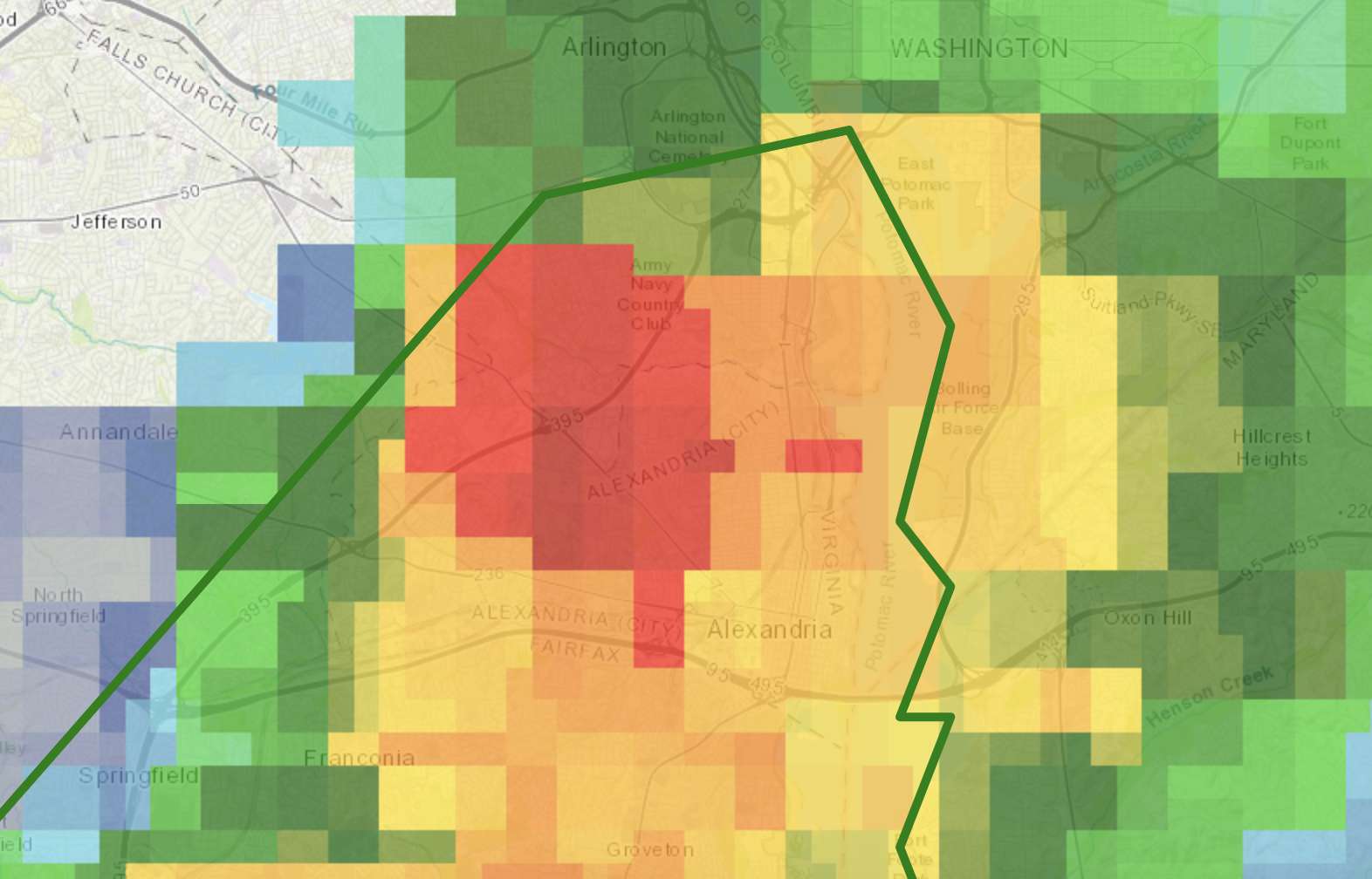
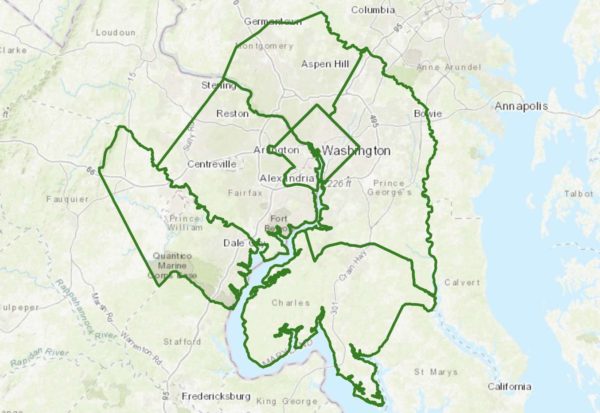
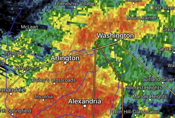
A portion of southern Arlington County is now under a Flood Warning, as a slow-moving storm drenches areas south of Route 50.

The warning is in effect until 8:45 p.m. An inch or so of rain has fallen and flooding is imminent, the National Weather Service says.

A Flash Flood Watch, meanwhile, remains in effect until 6 a.m.

More from NWS:

BULLETIN – IMMEDIATE BROADCAST REQUESTED
FLOOD WARNING
NATIONAL WEATHER SERVICE BALTIMORE MD/WASHINGTON DC
453 PM EDT THU AUG 6 2020

THE NATIONAL WEATHER SERVICE IN STERLING VIRGINIA HAS ISSUED A

* FLOOD WARNING FOR… SOUTHEASTERN ARLINGTON COUNTY IN NORTHERN VIRGINIA… SOUTHEASTERN FAIRFAX COUNTY IN NORTHERN VIRGINIA… THE CITY OF ALEXANDRIA IN NORTHERN VIRGINIA…

* UNTIL 845 PM EDT.

* AT 452 PM EDT, DOPPLER RADAR INDICATED THUNDERSTORMS PRODUCING HEAVY RAIN WHICH WILL CAUSE FLOODING. UP TO ONE INCH OF RAIN HAS ALREADY FALLEN. ADDITIONAL RAINFALL AMOUNTS OF UP TO ONE INCH ARE POSSIBLE.

* SOME LOCATIONS THAT WILL EXPERIENCE FLOODING INCLUDE… ARLINGTON, ALEXANDRIA, SPRINGFIELD, FORT WASHINGTON, FORT HUNT, GROVETON, HUNTINGTON, FORT BELVOIR, CRYSTAL CITY, LINCOLNIA, LORTON, FRANCONIA, HYBLA VALLEY, NEWINGTON, WEST SPRINGFIELD, MOUNT VERNON, HAYFIELD AND MASON NECK.

PRECAUTIONARY/PREPAREDNESS ACTIONS…

TURN AROUND, DON’T DROWN WHEN ENCOUNTERING FLOODED ROADS. MOST FLOOD DEATHS OCCUR IN VEHICLES.

EXCESSIVE RUNOFF FROM HEAVY RAINFALL WILL CAUSE FLOODING OF SMALL CREEKS AND STREAMS, URBAN AREAS, HIGHWAYS, STREETS AND UNDERPASSES AS WELL AS OTHER DRAINAGE AREAS AND LOW LYING SPOTS.


(Updated at 1:35 p.m.) After getting drenched by a storm early this morning, Arlington may be getting another round of heavy rain tonight.

The county and the D.C. region is currently under a Flash Flood Watch. Slow-moving storms are expected to form this afternoon, dumping torrential rainfall on ground already saturated by the morning storm and Isaias earlier this week — a recipe for flooding.

The watch is now in effect until 6 a.m. Friday; it was originally set to expire at midnight but was extended Thursday afternoon.

More from the National Weather Service:

…FLASH FLOOD WATCH IN EFFECT THROUGH THIS EVENING…

Through this evening… Numerous slow moving showers and thunderstorms continue to develop across the region and should expand and redevelop with time. Locations which are repetitively affected could receive multiple-inch rainfall totals. This could lead to rapid rises on streams and flash flooding of low lying areas.

PRECAUTIONARY/PREPAREDNESS ACTIONS… A Flash Flood Watch means that conditions may develop that lead to flash flooding. Flash flooding is a very dangerous situation. You should monitor later forecasts and be prepared to take action should Flash Flood Warnings be issued.

Image via The Weather Channel


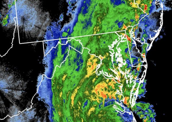
Isaias made landfall in North Carolina last night as a Category 1 hurricane and is now approaching the D.C. area as a tropical storm.

Wind from the storm is expected to ramp up locally over the next hour, but the main threat remains heavy rain.

The National Weather Service issued a Flood Warning this morning for Arlington, Alexandria, Falls Church and parts of Fairfax. Several additional inches of rain are likely to fall and cause flooding, forecasters say.

More from NWS:

BULLETIN – IMMEDIATE BROADCAST REQUESTED
FLOOD WARNING
NATIONAL WEATHER SERVICE BALTIMORE MD/WASHINGTON DC
701 AM EDT TUE AUG 4 2020

THE NATIONAL WEATHER SERVICE IN STERLING VIRGINIA HAS ISSUED A

* FLOOD WARNING FOR…
THE CITY OF FAIRFAX IN NORTHERN VIRGINIA…
ARLINGTON COUNTY IN NORTHERN VIRGINIA…
THE CITY OF FALLS CHURCH IN NORTHERN VIRGINIA…
EASTERN FAIRFAX COUNTY IN NORTHERN VIRGINIA…
THE CITY OF ALEXANDRIA IN NORTHERN VIRGINIA…

* UNTIL 100 PM EDT.

* AT 700 AM EDT, DOPPLER RADAR AND AUTOMATED RAIN GAUGES INDICATED THAT HEAVY RAIN WAS FALLING OVER THE AREA. THE HEAVY RAIN WILL CAUSE FLOODING. UP TO ONE INCH OF RAIN HAS ALREADY FALLEN.ADDITIONAL RAINFALL AMOUNTS OF SEVERAL INCHES ARE POSSIBLE, AND FLASH FLOOD WARNINGS COULD BE REQUIRED LATER TODAY. FOR NOW, THOUGH, FLOODING WILL BE RELATIVELY SLOW TO DEVELOP.

* SOME LOCATIONS THAT WILL EXPERIENCE FLOODING INCLUDE… ARLINGTON, ALEXANDRIA, RESTON, ANNANDALE, SPRINGFIELD, FORT WASHINGTON, FAIRFAX, FORT HUNT, VIENNA, GROVETON, FALLS CHURCH, HUNTINGTON, MANTUA, FORT BELVOIR, PIMMIT HILLS, NATIONAL HARBOR, MCLEAN, REAGAN NATIONAL AIRPORT, ROSSLYN AND CRYSTAL CITY.

PRECAUTIONARY/PREPAREDNESS ACTIONS…

TURN AROUND, DON’T DROWN WHEN ENCOUNTERING FLOODED ROADS. MOST FLOOD DEATHS OCCUR IN VEHICLES.

A FLOOD WARNING MEANS THAT FLOODING IS IMMINENT OR OCCURRING. ALL INTERESTED PARTIES SHOULD TAKE NECESSARY PRECAUTIONS IMMEDIATELY.


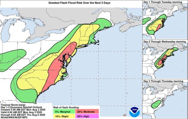
(Updated at 11:55 a.m.) Arlington County is urging residents to prepare today for Tropical Storm Isaias, which is currently making its way up the East Coast.

While windy conditions and some thunderstorms are likely as Isaias approaches this afternoon and evening, the main threat locally is heavy rain. Forecasters say the tropical storm could dump 3-6 inches of rain on the immediate D.C. area, potentially causing flooding.

A Flash Flood Watch is in effect for Arlington, D.C. and surrounding areas through Tuesday. A Tropical Storm Watch was upgraded to a Tropical Storm Warning late Monday morning.

The last time such a warning was issued for Arlington was for Hurricane Irene in 2011. That storm caused moderate damage around Arlington, mostly from felled trees.

More on the storm threat and preparations:

(more…)


Low Water Pressure in RosslynUpdated at 9 a.m. — “LOW WATER PRESSURE: Customers in the Rosslyn area may be experiencing low water pressure due to a water main break on Key Blvd b/w N Edgewood St and N Danville St. Crews have been dispatched. Expected completion time: TBD. An update will be provided once we have more information.” [Twitter]

Changes to Crystal City Development — “JBG Smith Properties is shrinking plans for a pair of residential towers at 2000 and 2001 South Bell Street in Crystal City in a bid to get them approved after Arlington County planners raised concerns about its height. The developer filed revised plans for the Amazon-adjacent development earlier in July, lopping off several stories of each proposed tower to appease Arlington officials.” [Washington Business Journal]

New Sheriff’s Office Employee — “On July 20, 2020, the Arlington County Sheriff’s Office welcomed Diana Fetterer to the Pretrial Section, where she will begin her new role as a member of the newly established Behavioral Health Docket Team… The Behavioral Health Docket is scheduled to start in September 2020.” [Arlington County]

Flash Flood Watch Today — “Showers with scattered thunderstorms are expected overnight through Friday. Locally heavy rainfall may produce flooding. A Flash Flood Watch is now in effect for much of the region.” [Twitter]


Storms today may cause flash flooding, forecasters say.

The National Weather Service has issued a Flash Flood Watch for Arlington and the immediate D.C. metro area, saying that torrential downpours could dump 2-3 inches of rain in under an hour.

The watch will go into effect at 3 p.m.

More from NWS:

THE NATIONAL WEATHER SERVICE IN STERLING VIRGINIA HAS ISSUED A

* FLASH FLOOD WATCH FOR PORTIONS OF MARYLAND, THE DISTRICT OF COLUMBIA, AND NORTHERN VIRGINIA, INCLUDING THE FOLLOWING AREAS, IN MARYLAND, CENTRAL AND SOUTHEAST MONTGOMERY, CHARLES, AND PRINCE GEORGES. THE DISTRICT OF COLUMBIA. IN NORTHERN VIRGINIA, ARLINGTON/FALLS CHURCH/ALEXANDRIA, FAIRFAX, AND  PRINCE WILLIAM.

* FROM 3 PM THIS AFTERNOON UNTIL 11 PM EDT THIS EVENING.

* A SLOW-MOVING COLD FRONT WILL INTERSECT A HOT AND HUMID AIR MASS RESULTING IN SCATTERED TO NUMEROUS SHOWERS AND THUNDERSTORMS LATE THIS AFTERNOON AND EVENING. MULTIPLE ROUNDS OF THUNDERSTORMS ARE POSSIBLE, WHICH COULD RESULT IN ISOLATED RAINFALL AMOUNTS OF 2 TO 3 INCHES IN A SHORT AMOUNT OF TIME. THESE RAINFALL AMOUNTS MAY RESULT IN RAPID RISES OF WATER ON  SMALL STREAMS AND CREEKS, AS WELL AS IN URBAN AND POOR DRAINAGE AREAS.

PRECAUTIONARY/PREPAREDNESS ACTIONS…

A FLASH FLOOD WATCH MEANS THAT CONDITIONS MAY DEVELOP THAT LEAD TO FLASH FLOODING. FLASH FLOODING IS A VERY DANGEROUS SITUATION.

YOU SHOULD MONITOR LATER FORECASTS AND BE PREPARED TO TAKE ACTION SHOULD FLASH FLOOD WARNINGS BE ISSUED.

In addition to the threat of heavy rain, some storms may be severe, with gusty winds and frequent lightning.


Update at 10:15 p.m. — A Flood Warning has now been issued for parts of Arlington, with new storms forming over the area.

THE NATIONAL WEATHER SERVICE IN STERLING VIRGINIA HAS ISSUED A

* FLOOD WARNING FOR…
THE DISTRICT OF COLUMBIA…
WEST CENTRAL PRINCE GEORGES COUNTY IN CENTRAL MARYLAND…
ARLINGTON COUNTY IN NORTHERN VIRGINIA…

* UNTIL 415 AM EDT FRIDAY.

* AT 1013 PM EDT, EMERGENCY MANAGEMENT REPORTED FLOODING IN SOUTHEAST DC AND FOREST HEIGHTS MARYLAND. ADDITIONAL THUNDERSTORMS IN THE AREA MAY RESULT IN HEAVY RAINFALL OF UP TO AN INCH.

* SOME LOCATIONS THAT WILL EXPERIENCE FLOODING INCLUDE… ARLINGTON, ALEXANDRIA, FORESTVILLE, FALLS CHURCH, CORAL HILLS, BLADENSBURG, NATIONAL HARBOR, NATIONALS PARK, FEDEX FIELD, HOWARD UNIVERSITY, GALLAUDET UNIVERSITY, REAGAN NATIONAL AIRPORT, ROSSLYN, CRYSTAL CITY, RFK STADIUM, LANDOVER, CAMP SPRINGS, OXON HILL, WALKER MILL AND LAKE ARBOR.

PRECAUTIONARY/PREPAREDNESS ACTIONS…

TURN AROUND, DON’T DROWN WHEN ENCOUNTERING FLOODED ROADS. MOST FLOOD DEATHS OCCUR IN VEHICLES.

BE ESPECIALLY CAUTIOUS AT NIGHT WHEN IT IS HARDER TO RECOGNIZE THE DANGERS OF FLOODING.

Earlier: A portion of Arlington is now under a Severe Thunderstorm Warning.

The warning is in effect until 9:30 p.m., as a strong storm with gusty winds, torrential rain and frequent lightning passes through the area.

Arlington is also currently under a Flash Flood Watch.

More from the National Weather Service:

BULLETIN – IMMEDIATE BROADCAST REQUESTED
SEVERE THUNDERSTORM WARNING
NATIONAL WEATHER SERVICE BALTIMORE MD/WASHINGTON DC
846 PM EDT THU JUL 23 2020

THE NATIONAL WEATHER SERVICE IN STERLING VIRGINIA HAS ISSUED A

* SEVERE THUNDERSTORM WARNING…

* UNTIL 930 PM EDT.

* AT 845 PM EDT, A SEVERE THUNDERSTORM WAS LOCATED OVER FRIENDLY, OR OVER FORT WASHINGTON, AND IS NEARLY STATIONARY.

HAZARD…ISOLATED DAMAGING WIND GUSTS OF UP TO 60 MPH.

SOURCE…RADAR INDICATED.

IMPACT…DAMAGING WINDS WILL CAUSE SOME TREES AND LARGE BRANCHES TO FALL. THIS COULD INJURE THOSE OUTDOORS, AS WELL AS DAMAGE HOMES AND VEHICLES. ROADWAYS MAY BECOME BLOCKED BY DOWNED TREES. LOCALIZED POWER OUTAGES ARE POSSIBLE. UNSECURED LIGHT OBJECTS MAY BECOME PROJECTILES.

* LOCATIONS IMPACTED INCLUDE… ARLINGTON, ALEXANDRIA, DALE CITY, ANNANDALE, CLINTON, SPRINGFIELD, FORT WASHINGTON, FORT HUNT, GROVETON, FALLS CHURCH, HUNTINGTON, FORT BELVOIR, WOODBRIDGE, NATIONAL HARBOR, NATIONALS PARK, REAGAN NATIONAL AIRPORT, CRYSTAL CITY, ANDREWS AIR FORCE BASE, LAKE RIDGE AND BURKE.

PRECAUTIONARY/PREPAREDNESS ACTIONS…

FOR YOUR PROTECTION MOVE TO AN INTERIOR ROOM ON THE LOWEST FLOOR OF A BUILDING.


Update at 3:35 p.m. — A Severe Thunderstorm Warning and Flash Flood Warning have been issued.

In addition to a Heat Advisory and a Severe Thunderstorm Watch, Arlington, D.C. and surrounding area are also now under a Flash Flood Watch.

The watch is in effect until 11 p.m. The National Weather Service says storms packing torrential rains may cause localized flooding.

More from NWS:

136 PM EDT WED JUL 22 2020

…FLASH FLOOD WATCH IN EFFECT UNTIL 11 PM EDT THIS EVENING…

THE NATIONAL WEATHER SERVICE IN STERLING VIRGINIA HAS ISSUED A

* FLASH FLOOD WATCH…

* UNTIL 11 PM EDT THIS EVENING

* THUNDERSTORMS WITH LOCALLY HEAVY RAIN ARE EXPECTED ACROSS THE WATCH AREA THIS AFTERNOON AND EVENING. RAINFALL OF 1 TO 3 INCHES MAY FALL WITHIN AN HOUR, RESULTING IN LOCALIZED FLASH FLOODING.

PRECAUTIONARY/PREPAREDNESS ACTIONS…

A FLASH FLOOD WATCH MEANS THAT CONDITIONS MAY DEVELOP THAT LEAD TO FLASH FLOODING. FLASH FLOODING IS A VERY DANGEROUS SITUATION.

YOU SHOULD MONITOR LATER FORECASTS AND BE PREPARED TO TAKE ACTION SHOULD FLASH FLOOD WARNINGS BE ISSUED.


Online Forums Devolve into Shouting Matches — Falls Church News-Press columnist Charlie Clark writes about how a Nextdoor post about kids not wearing masks during a baseball game erupted into a barrage of insults and debates among neighbors. Nextdoor is not alone in becoming a forum for heated local debates on hot button issues: last month the popular Fairlington Appreciation Society Facebook group shut down after flame wars broke out over issues related to the Black Lives Matter protests. [Falls Church News-Press]

Virtual ‘Arlington Cares’ Event Tomorrow — “This free, virtual event will recognize the 2020 Community Service Award Winners and remind us of the importance of serving others. A heartwarming opportunity for all ages that will celebrate the overwhelming goodness that is within our community.” [Event Calendar]

Reduction in Homelessness Prior to Pandemic — “For the 20th consecutive year, the Metropolitan Washington Council of Governments (COG) Homeless Services Planning and Coordinating Committee has conducted a regional Point-in-Time (PIT) enumeration of the area’s residents experiencing homelessness and those who were formerly homeless. This year’s enumeration and survey occurred on January 22, 2020. Arlington saw a 7-percent reduction in overall homelessness, down from 215 persons in 2019 to 199 in 2020.” [Arlington County]

More Flood Damage in Waverly Hills — “After countless floods in Arlington’s Waverly Hills neighborhood soaked his basement, Tom Reich finally ordered a custom-made waterproof door to protect his home’s bottom level.
On Tuesday, the day before it was scheduled to arrive, yet another storm dumped buckets of rain on the region — and especially on 18th Street North. There, overwhelmed storm water mains sent three feet of water coursing down the street.” [Washington Post]

Beyer Furious at Response to Shooting Inquiry — “‘For nearly three years Bijan Ghaisar’s family and community have sought answers from federal authorities about why these officers killed Bijan and what consequences they will face. This response which tells us nothing after an eight-month delay is an insult to the people we represent,’ said [Rep. Don] Beyer. ‘The contempt such a pathetic answer shows for public transparency and accountability is unacceptable and will further damage the standing of the U.S. Park Police at a time when the region’s trust in them is already at an all-time low.'” [House of Representatives]

Report Businesses Flouting the Rules, Gov. Says — “As Virginia starts seeing an increase in COVID-19 cases, Gov. Ralph Northam reiterated Friday what has become a familiar message about limiting crowds, washing hand frequently and wearing face coverings. But he added a new fourth point: Report businesses flouting the rules to the local health department.” [InsideNova]

Freddie’s Closes Temporarily — “Out of an abundance of caution, we have decided to close temporarily. One of our employees has tested positive for COVID-19. We are actively reaching out to customers and staff who may have been in contact since Wednesday July 8. We are beginning the process to have the restaurant fully sanitized so we may safely reopen as soon as possible.” [Facebook]

Nearby: MoCo Starting School Year Online — “Montgomery County students will begin the next academic year online, with a phased approach to bring them back to school buildings part-time by the end of November, according to the school district’s draft plan released Saturday.” [Bethesda Magazine]


View More Stories