 Update at 3:20 p.m. — WMATA says Metrobuses will operate on a Moderate Snow Plan on Tuesday.
It’s an uncertain forecast in part due to above-freezing temperatures today, but forecasters say D.C. area residents should expect 1-3 inches of snow between late tonight and Tuesday night.
The National Weather Service has issued a Winter Weather Advisory, warning of the potential for snow accumulation disrupting driving tomorrow, particularly during the morning commute.
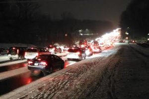
We all know what a measly inch of snow did during the nightmare evening commute a couple of weeks ago — though road crews are likely to be more prepared this time around.
The Clarendon-Courthouse Mardi Gras Parade, meanwhile, is once again being threatened by winter weather. On the parade’s website, organizers say they “will be making a weather announcement here mid-day on Tuesday, Feb. 9, about the parade,” which is scheduled for Tuesday night.
From the NWS:
… WINTER WEATHER ADVISORY IN EFFECT FROM 10 PM THIS EVENING TO MIDNIGHT EST TUESDAY NIGHT…
THE NATIONAL WEATHER SERVICE IN BALTIMORE MD/WASHINGTON HAS ISSUED A WINTER WEATHER ADVISORY FOR SNOW… WHICH IS IN EFFECT FROM 10 PM THIS EVENING TO MIDNIGHT EST TUESDAY NIGHT.
* PRECIPITATION TYPE… SNOW.
* ACCUMULATIONS… SNOW ACCUMULATION OF 1 TO 3 INCHES… WITH LOCALLY HIGHER AMOUNTS PARTICULARLY IN THE NORTHWEST SUBURBS.
* TIMING… A MIXTURE OF RAIN AND SNOW WILL DEVELOP THIS EVENING. PRECIPITATION WILL TURN TO ALL SNOW AROUND OR SHORTLY AFTER MIDNIGHT. PERIODS OF SNOW WILL CONTINUE INTO TUESDAY AND THE ADVISORY MAY NEED TO BE EXTENDED.
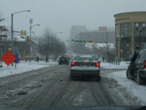
* IMPACTS… SNOW COVERED ROADS AND TRAVEL DISRUPTIONS.
* WINDS… NORTH 5 TO 10 MPH.
* TEMPERATURES… IN THE LOWER TO MIDDLE 30S.
PRECAUTIONARY/PREPAREDNESS ACTIONS…
A WINTER WEATHER ADVISORY FOR SNOW MEANS THAT PERIODS OF SNOW WILL CAUSE PRIMARILY TRAVEL DIFFICULTIES. BE PREPARED FOR SNOW COVERED ROADS AND LIMITED VISIBILITIES… AND USE CAUTION WHILE DRIVING.
VDOT, meanwhile, says drives should be prepared for the possibility of a messy commute Tuesday. From a press release:
The Virginia Department of Transportation asks drivers to plan now for their commutes Tuesday, as several inches of snow are forecast to impact both the morning and evening rush hours in northern Virginia. Drivers are asked to monitor forecasts for changes or heavier weather bands that may impact their schedule, and to plan accordingly to telework, delay commutes or allow extra time for a slow and cautious trip.
Crews have treated interstates and major roads in Fairfax, Loudoun and Prince William counties with brine and liquid magnesium chloride in advance of the snow. Tonight, about 1,450 trucks will pre-deploy along interstates, main roads and neighborhood streets. They will remain on duty to plow and treat roads through the day Tuesday.
VDOT reminds drivers to use extreme caution during winter weather, to reduce speeds, and to be aware of potential slick spots such as bridges, ramps, hills, curves and shaded areas.
Reminders for drivers and residents:
If possible, park in driveways or on the odd-numbered side of the street to allow plows room to pass.
If you must be on the road, check www.511virginia.org or use the mobile app before leaving for road conditions.
Follow @vadotnova on Twitter.
VDOT’s Northern Virginia District includes Loudoun, Fairfax, Prince William and Arlington counties (Arlington maintains its own secondary roads).


