Ice / freezing rain on windshield (file photo)

Arlington Public Schools will open on a two-hour delay on Thursday due to expected freezing rain, the school system just announced.

APS follows Fairfax County Public Schools in announcing a two hour delay tonight. Other Northern Virginia districts have announced weather plans ranging from two hour delays to closures.

From APS:

CODE 2: All APS schools and offices will open two hours late Thursday, Dec. 15. The Extended Day program will also open two hours late and morning field trips are canceled. Custodial and maintenance staff and food service workers should report to work at their regularly scheduled time. All other employees should report to work two hours past their usual start time. For updates about Pool Operations, go to www.apsva.us/aquatics. For information about Arlington County operations go to www.arlingtonva.us.

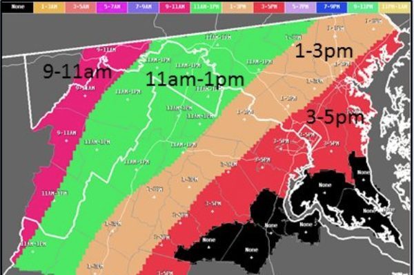
More on the storm timing from the National Weather Service:

Metro, meanwhile, said today that it’s tracking the weather and will respond to hazardous conditions as necessary.

Metro is keeping an eye on the sky and advising customers to be prepared for potential service impacts to Metrobus service tomorrow, December 15, if icy conditions materialize.

Metrobus plans to provide regular scheduled service tomorrow. However, if road conditions are observed to be hazardous, Metrobus customers may experience delays or detours as outlined in Metro’s light snow plan, which adjusts service on a route-by-route basis to keep buses off of steep hills, narrow roadways, and other challenging route segments during inclement weather.

Customers can review planned detours in advance to see how their service may be affected by clicking here. If conditions require that a route be detoured, customers will be notified via MetroAlerts email and text messages. Customers are also encouraged sign up for MetroAlerts and to follow @wmata, @metrobusinfo, and @metrorailinfo on Twitter for the latest service information.

Customers should allow additional travel time and use caution on platforms, escalators, parking lots and other areas that may be slippery.

Elsewhere across the system, Metrorail is expected to operate on a normal weekday schedule. MetroAccess will operate normally, with extra travel time possible based on road conditions.

VDOT is encouraging drivers to stay off the roads after the frozen precipitation starts falling overnight.

Motorists should avoid travel as frozen precipitation will create icy roadway conditions in portions of the Commonwealth tonight and tomorrow morning. Pavement temperatures will be at or near freezing levels. Temperatures will drop overnight and could cause treacherous conditions during the morning commute, primarily in the northern, northwestern and parts of central Virginia. As a reminder, bridges, overpasses and shaded areas tend to freeze first.

Freezing rain is forecasted to begin around 9 p.m. tonight in northwest Virginia and will continue through the morning.

Most Virginia Department of Transportation (VDOT) crews did not apply liquid pretreatment to roads in areas where the event is forecasted to start as rain, as the pretreatment application will wash away and be ineffective. VDOT crews are ready to treat roadways with salt, sand and abrasives once icy conditions begin to develop. Wreckers are pre-staged along certain routes and tree crews are available to handle downed trees.

Motorists should be vigilant, pay attention to weather forecasts in areas where they plan to drive, and delay travel in the impacted areas.


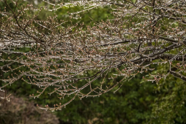
Freezing rain clings to trees in Westover in 2021 (Staff Photo by Jay Westcott)

Freezing rain will likely fall early Thursday, prompting a Winter Weather Advisory from the National Weather Service.

Arlington could see dangerous, icy conditions on local roads tomorrow morning, forecasters say. Eventually, the frozen precipitation will switch over to just plain rain as temperatures rise during the day.

Gusty winds are also expected on Thursday.

From from NWS:

…WINTER WEATHER ADVISORY IN EFFECT FROM 10 PM THIS EVENING TO 1 PM EST THURSDAY…

* WHAT…Freezing rain expected. Total ice accumulations of a glaze to around one tenth of an inch.

* WHERE…Portions of central, northeast and northern Maryland, The District of Columbia and northern Virginia.

* WHEN…From 10 PM this evening to 1 PM EST Thursday.

* IMPACTS…Difficult travel conditions are possible. The hazardous conditions will likely impact the morning commute on Thursday.

* ADDITIONAL DETAILS…Wintry precipitation begins this evening, then becomes more intense tonight into Thursday morning. Warmer air should push in Thursday afternoon changing the precipitation to rain.

PRECAUTIONARY/PREPAREDNESS ACTIONS…

Slow down and use caution while traveling.

When venturing outside, watch your first few steps taken on steps, sidewalks, and driveways, which could be icy and slippery, increasing your risk of a fall and injury.

The Capital Weather Gang says Arlington is on the approximate line between some ice accumulation and mostly wet roads, with northern portions of the county likely seeing more ice.

VDOT, meanwhile, says it’s preparing to do battle with Mother Nature and try to keep roads passable.

From a VDOT press release:

The Virginia Department of Transportation (VDOT) is mobilizing its equipment and resources in preparation for a winter weather event to impact parts of the Commonwealth Wednesday night into Thursday.

Incoming rain throughout Virginia is forecasted to shift to sleet and freezing rain in the northern, northwestern, and central areas of the Commonwealth beginning around 10 p.m. on Wednesday, Dec. 14 and going through the morning of Thursday, Dec. 15. This weather event is expected to impact VDOT’s Staunton, Salem, Culpeper, Northern Virginia and Lynchburg districts.

VDOT is paying close attention to the forecast and preparing for what could be a significant icing event. District crews will not apply liquid pretreatment to roads in areas where the event is forecasted to start as rain, which will wash away the pretreatment application. Crews are preparing equipment and will be ready to treat roadways with salt, sand and abrasives as precipitation transitions to sleet or freezing rain.

Motorists should pay attention to weather forecasts in areas where they plan to drive and delay travel on Thursday morning in the impacted areas, especially along the I-81 corridor, Culpeper and Northern Virginia regions.

Safety and Travel Resources

When winter weather arrives, residents and motorists should plan travel ahead of time, check road conditions, prepare an emergency car kit, follow forecasts and announcements and limit travel based on conditions. […]

Statewide Improvements for the 2022-2023 SeasonIn addition to its traditional year-round snow preparation, VDOT made improvements to address items from the Snow Removal and I-95 Incident Performance Audits by the State Inspector General and the Winter Weather Event and I-95 Interagency After-Action Report by CNA:

Improved contracting to be more flexible, competitive and attractive to contractors to address equipment and personnel shortages.

Improved communications and command structure for better internal and interagency cooperation during crisis events.

Assigned staff to drive routes and report on conditions to supplement traffic cameras.

Acquired a system to allow two-way communications between drivers and VDOT within a defined geographic area.

Continued participation in winter weather exercises, led by The Virginia Department of Emergency Management, to foster interagency cooperation.

Resources and Readiness

In addition to operational improvements, VDOT maintains a number of resources to contend with inclement weather.

  • $220 million statewide budgeted for winter weather in 2022-2023
  • 11,493 pieces of equipment (VDOT-owned and contracted equipment combined, as of Nov. 30)
  • Approximately 1,148 vehicle contracts in process, and is continuing to receive additional contract bids (as of Nov. 30)
  • More than 696,000 tons of salt, sand and treated abrasives, and more than 2.3 million gallons of liquid calcium chloride and salt brine.

(Updated at 4:20 p.m.) Authorities are urging Arlington residents and others in the D.C. area to stay home today amid an extended bout of freezing rain.

Sidewalks and many roads are reported to be very slick. The ice is expected to build as the day goes on.

County and VDOT crews are out spreading salt, but even treated surfaces can become icy as rain falls amid sub-freezing surface temperatures. At least two bridges in the Courthouse area were closed due to slick conditions.

“Due to icy conditions the 10th Street bridge and Courthouse Rd bridge of Route 50 have been closed,” an Arlington Alert said at 9:30 a.m.

The earlier Winter Weather Advisory was upgraded to an Ice Storm Warning as of 2 p.m. Saturday. As of 3 p.m., the National Weather Service reported more than a tenth of an inch of ice accumulation in Arlington.

More from NWS:

156 PM EST SAT FEB 13 2021

…ICE STORM WARNING IN EFFECT UNTIL 7 AM EST SUNDAY…

* WHAT…TWO TO THREE TENTHS OF AN INCH OF SLEET AND FREEZING RAIN CAUSING SIGNIFICANT ICING IMPACTS.

* WHERE…THE DISTRICT OF COLUMBIA, AND PORTIONS OF CENTRAL MARYLAND AND NORTHERN VIRGINIA.

* WHEN…UNTIL 7 AM EST SUNDAY.

* IMPACTS…DIFFICULT TRAVEL CONDITIONS.

* ADDITIONAL DETAILS…ROADWAYS ARE BECOMING VERY ICY AND DANGEROUS. AVOID ALL UNNECESSARY TRAVEL.

PRECAUTIONARY/PREPAREDNESS ACTIONS…

TRAVEL IS STRONGLY DISCOURAGED. IF YOU MUST TRAVEL, KEEP AN EXTRA FLASHLIGHT, FOOD AND WATER IN YOUR VEHICLE IN CASE OF AN EMERGENCY. PREPARE FOR POSSIBLE POWER OUTAGES.

WHEN VENTURING OUTSIDE, WATCH YOUR FIRST FEW STEPS TAKEN ON STEPS, SIDEWALKS, AND DRIVEWAYS, WHICH COULD BE ICY AND SLIPPERY, INCREASING YOUR RISK OF A FALL AND INJURY.

In an email earlier this morning, VDOT said those who absolutely must travel should “use extreme caution.”

Significant icing is anticipated with the next wave of inclement weather. With prolonged freezing rain and low pavement temperatures expected through the day Saturday, VDOT strongly advises against nonessential travel. Those who must drive should closely monitor weather and road conditions, and use extreme caution. Even on treated roads, slick pavement will be possible. […]

Crews have positioned materials and equipment, and will apply treatment such as sand and salt as needed to icy patches and trouble spots to improve traction. Tree crews are ready to trim and remove branches weighed down or broken by ice, and to support utility companies on potential downed or entangled lines.

Numerous crashes have been reported around Arlington since this morning, including on treated roads. Virginia State Police say the VSP division that serves Arlington and other parts of Northern Virginia has responded to 83 crashes and 29 disabled vehicles as of 4 p.m.

“Virginia State Police continues to discourage Virginians from driving through Sunday (Feb. 14) due to extremely icy and treacherous conditions across much of Central, Southeastern and Northern Virginia,” a spokeswoman said via email.

More from social media:

https://twitter.com/jenkochan/status/1360593888415797254


Arlington County is under a Winter Weather Advisory through 9 a.m. Tuesday.

A mix of rain, freezing rain, sleet and snow is expected to fall tonight, with the precipitation likely to start around 6 p.m. Up to two inches of snow may accumulate, though if temperatures stay slightly warmer there may be little to no snow accumulation, forecasters say.

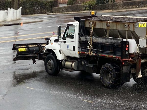
Both Arlington County and VDOT crews are pre-treating roads in advance of the winter weather.

“Crews are spot pre-treating areas in higher elevations today,” VDOT said. “About 400 trucks will be staging along roads this afternoon, ready to treat roads as precipitation begins. Tree crews will also be on alert in case of downed branches due to ice.”

More from the National Weather Service:

…WINTER WEATHER ADVISORY IN EFFECT UNTIL 9 AM EST TUESDAY…

WHAT… Mixed precipitation. Snow accumulations of 1 to 2 inches and ice accumulations around a trace.

WHERE… In Maryland, Prince Georges and Anne Arundel Counties. In District of Columbia… In Virginia, Fairfax County, and Arlington/Falls Church/Alexandria.

WHEN… Until 9 AM EST Tuesday.

IMPACTS… Plan on slippery road conditions. The hazardous conditions could impact the evening and morning commute.

PRECAUTIONARY/PREPAREDNESS ACTIONS… Slow down and use caution while traveling. When venturing outside, watch your first few steps taken on steps, sidewalks, and driveways, which could be icy and slippery, increasing your risk of a fall and injury.

File photo


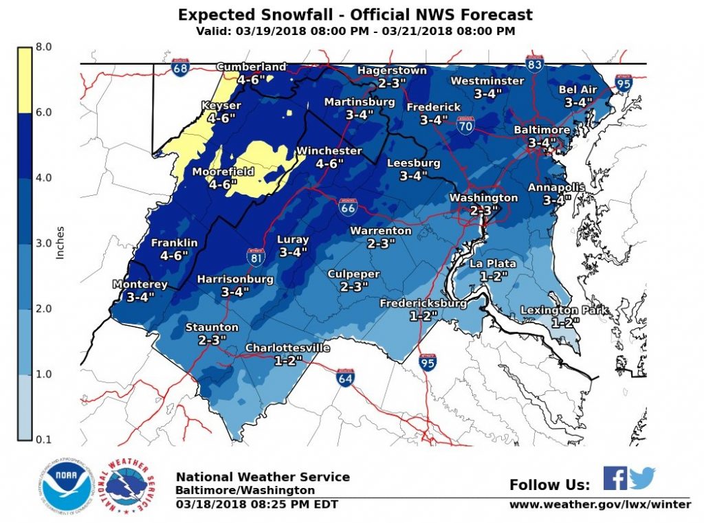
(Updated at 5:15 p.m.) A Winter Storm Watch has been issued for the D.C. area as Arlington County crews prepare for several inches of snow.

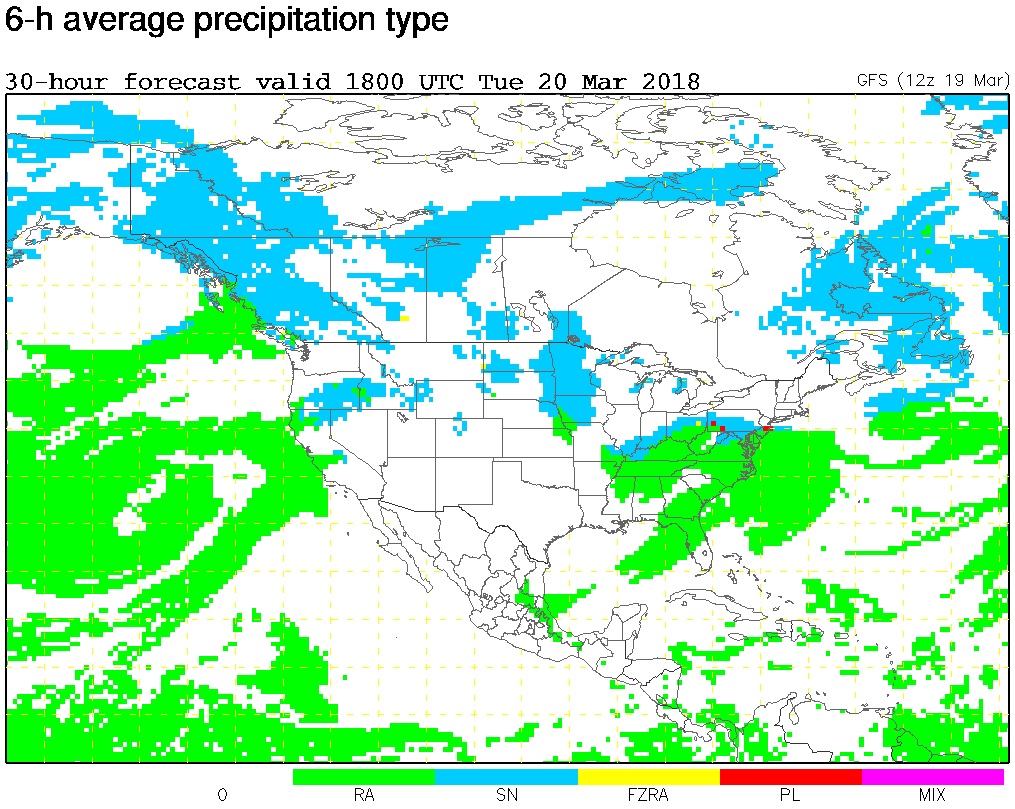
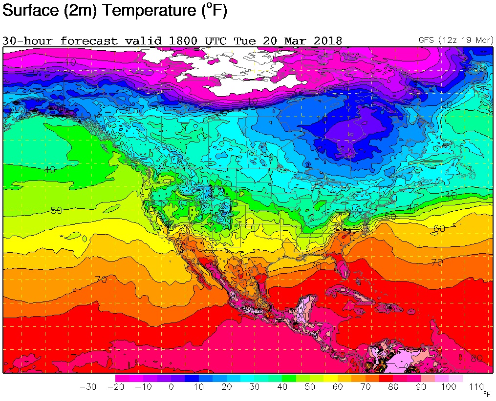
The storm is expected to start as rain tomorrow, the first day of spring, before transitioning to snow. The National Weather Service noted on its Twitter page that there is “lots of uncertainty” in terms of the type of precipitation.

More from NWS:

…WINTER STORM WATCH IN EFFECT FROM LATE TUESDAY NIGHT THROUGH WEDNESDAY EVENING…

* WHAT…Heavy wet snow possible, with a total wet snow accumulation of 5 inches or more.

* WHERE…Metropolitan Baltimore and Washington areas, as well as the northern and central Shenandoah Valley.

* WHEN…From late Tuesday night through Wednesday evening.

* ADDITIONAL DETAILS…Plan on difficult travel conditions. Significant reductions in visibility are possible.

PRECAUTIONARY/PREPAREDNESS ACTIONS…

A Winter Storm Watch means there is potential for significant snow, sleet or ice accumulations that may impact travel. Continue to monitor the latest forecasts.

Via Twitter, the Virginia Department of Transportation said crews will not be pretreating the roads because of the expected rain on Tuesday. An Arlington Department of Environmental Services representative confirmed that the county will not be pretreating for the same reasons, but added that trucks are “ready to treat arterials and any trouble spots should they appear overnight.”

More from VDOT:

The first day of Spring in northern Virginia is forecast to bring snow and sleet and Virginia Department of Transportation crews will be ready. The National Weather Service has already issued a Winter Weather Advisory and Winter Storm Watch for the area. Drivers should continue to monitor the weather and be prepared to stay off the roads if the timing and intensity of this storm impacts rush hours.

Overnight Monday, plow trucks will be staged and ready to treat roads with salt and sand at the beginning of the storm. After two inches have fallen, crews will be able to begin to push snow and/or continuously treat affected areas.

Drivers are asked to:

  • Stay closely tuned to weather forecasts (see National Weather Service) throughout the day Tuesday and Wednesday.
  • Consider adjusting trips around the forecast for safety.
  • Assume any “wet” pavement to be slick. Bridges, ramps, overpasses and lower-volume roads may get slippery first, and even previously treated roads will become slick quickly with the low pavement temperatures.
  • Ensure gas and wiper fluid tanks are full, and have a good emergency kit. Here’s how: www.ready.gov/car.
  • Be aware that low temperatures will mean continued potential for refreeze and slick road conditions.

Via social media:


`(Updated at 8:40 a.m.) Very spotty frozen precipitation fell overnight in Arlington, leading to some slick spots but no serious issues.

Concerns about an icy commute, however, led Arlington Public Schools to delay the start of school.

More from APS:

All APS schools and offices will open two hours late today. The Extended Day program will also open two hours late and morning field trips are canceled. Essential employees and food service workers should report to work at their regularly scheduled time. All other employees should report to work two hours past their usual start time.

The school system’s decision, in turn, prompted Arlington’s Dept. of Parks and Recreation to also delay or cancel some of its programs.

From DPR:

Due to an Arlington Public School two-hour delayed opening, DPR will proceed as follows:

  • All congregate meal programs are cancelled.
  • All Early Childhood Programs (Preschool and Co-ops) are cancelled.
  • All Enjoy Arlington classes, 55+ classes, trips, nature center programs and sports league activities scheduled to start prior to 11:59 a.m. are cancelled in all buildings.
  • All Enjoy Arlington classes, 55+ classes, trips, nature center programs and sports league activities with scheduled start times of NOON or later will proceed as scheduled.
  • All evening Enjoy Arlington classes, sports league activities and nature center programs will proceed as scheduled.
  • All Community Centers (including the five joint use centers at Langston, TJ, Gunston, Carver and Drew will open on time as schedule.
  • APS Pools are open on time.

Arlington County government is expected to open on time.

Other delays and closures of note around the region this morning:

  • Federal government: Two hour delay
  • Fairfax County Public Schools: Closed
  • Loudoun County Public Schools: Closed
  • Prince William County Schools: Closed
  • Falls Church City Public Schools: Two Hour Delay
  • Alexandria City Public Schools: Open on time
  • Montgomery County (Md.) Public Schools: Closed
  • D.C. Public Schools: Open on time

Wednesday morning’s commute may be icy inside and outside the Beltway, forecasters are warning.

A Winter Weather Advisory will be in effect from 3-10 a.m., with sleet and freezing rain expected to fall in Arlington and much of the D.C. region.

More from the National Weather Service:

…WINTER WEATHER ADVISORY REMAINS IN EFFECT FROM 3 AM TO 10 AM EST WEDNESDAY… * WHAT…MIXED PRECIPITATION EXPECTED. A COATING OF SLEET WITH A FEW HUNDREDTHS TO UP TO ONE TENTH OF AN INCH OF ICE IS EXPECTED. THE HIGHEST ICE ACCUMULATIONS WILL BE NORTH AND WEST OF THE CITIES OF WASHINGTON AND BALTIMORE AND NORTH AND WEST OF INTERSTATE 95. * WHERE…THE WASHINGTON AND BALTIMORE METROPOLITAN AREAS AS WELL AS PORTIONS OF THE VIRGINIA PIEDMONT. * WHEN…FROM 3 AM TO 10 AM EST WEDNESDAY. * ADDITIONAL DETAILS…LIGHT SLEET AND FREEZING RAIN WILL OVERSPREAD THE AREA BETWEEN 2 AM AND 5 AM EARLY WEDNESDAY MORNING. PRECIPITATION WILL CHANGE TO RAIN BY 10 AM WEDNESDAY MORNING WITH TEMPERATURES RISING WELL ABOVE FREEZING. THE ICE MAY RESULT IN SLIPPERY CONDITIONS…ESPECIALLY ON ELEVATED SURFACES DURING THE MORNING COMMUTE WEDNESDAY. BE PREPARED FOR REDUCED VISIBILITIES AT TIMES. PRECAUTIONARY/PREPAREDNESS ACTIONS… A WINTER WEATHER ADVISORY MEANS THAT PERIODS OF SNOW, SLEET OR FREEZING RAIN WILL CAUSE TRAVEL DIFFICULTIES. BE PREPARED FOR SLIPPERY ROADS AND LIMITED VISIBILITIES, AND USE CAUTION WHILE DRIVING. THE LATEST ROAD CONDITIONS FOR THE STATE YOU ARE CALLING FROM CAN BE OBTAINED BY CALLING 5 1 1. &&

Arlington and Virginia Dept. of Transportation crews have been preparing to treat roadways overnight. VDOT issued a press release urging drivers to delay trips in the event of slippery conditions and be extra careful if they must hit road early Wednesday.

The Virginia Department of Transportation is treating roads in advance of a wintry mix forecasted to arrive during the early morning hours Wednesday. Drivers are asked to monitor the weather closely (see National Weather Service forecast), and adjust their trips as needed to avoid driving in icy conditions.

Overnight tonight, crews will load and stage trucks in northern Virginia, ready to treat roads with salt and sand through the the morning as needed.

Drivers are asked to:

  • Stay closely tuned to forecasts (see National Weather Service)
  • If conditions are icy, delay trips for safety.
  • Assume any “wet” pavement to be icy. Bridges, ramps, overpasses and lower-volume roads will freeze first, and even previously treated roads become slick quickly with low pavement temperatures.
  • Ensure gas and wiper fluid tanks are full, and have a good emergency kit:www.ready.gov/car.

Some updates via Twitter:


The threat of freezing rain has prompted early dismissals for students, government employees and private sector employees alike, but so far few if any problems have been reported in Arlington.

The early dismissals did create an early rush hour on local highways, as workers and students headed home, but here in Arlington roads and sidewalks remained passable and largely free of slick spots, despite a wave a sleet earlier this afternoon.

The precipitation is over for now, but more is possible this evening. A re-freeze is also threatening to make tomorrow’s morning commute treacherous.

The following tweets show activity during the two-hour-or-so span from the start of the sleet to the heaviest of the traffic.


Arlington Public Schools will be closing two hours early due to the threat of freezing rain during the evening commute.

More from APS:

All APS schools and offices will close two hours early today. The Extended Day Program will stay open until 4 p.m. Extracurricular activities, interscholastic games, team practices, field trips, adult education classes, and programs in schools and on school grounds are canceled.

APS made the announcement around 10 a.m., as county crews were gearing up to pretreat local roadways.


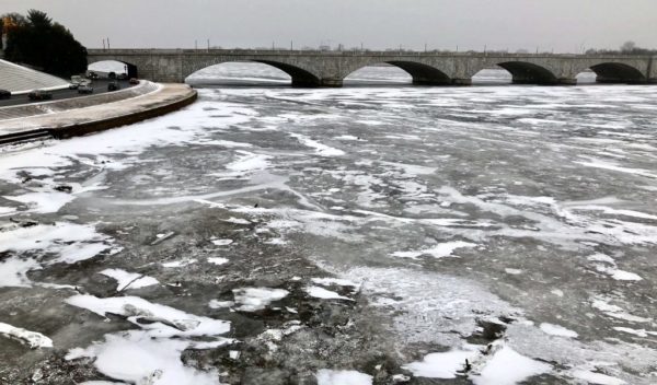
Ice Training for ACFD Water Rescue Team — While you were enjoying your weekend, snug in your warm home amid 10 degree weather, the Arlington County Fire Department’s water rescue team was using a chainsaw to cut holes in the ice on the Potomac and then jumping in. [Washington Post]

Freezing Rain Still Expected Tonight — A Winter Weather Advisory remains in effect tonight, as forecasters expect freezing rain to fall this afternoon and potentially make for a very messy evening commute. [Capital Weather Gang, Twitter]

Civic Federation Seeking County Event Help — The Arlington County Civic Federation is asking county government to help make it more affordable for civic associations to hold events on county property. Currently, there are insurance requirements that eat into civic associations’ meager budgets. [InsideNova]

Metro Proposes Refunds for Delays — “Under the proposal, riders would receive an automatic credit on their SmarTrip card if their trip is delayed by 15 minutes or more. Staff will ask Metro’s board to approve the change this week… The refunds would only be given during the weekday rush period.” [NBC Washington]

Crystal City Startup Scores $3 Million — Stardog Union, a “Enterprise Knowledge Graph startup” based in Crystal City, has added $3 million to its Series A venture funding round. The funding will be used for “marketing, sales and speeding up product development.” [Technically DC]

Notable Local Runner Publishes Novel — “Arlington marathon champion Jay Jacob Wind has published his first novel, a techno-thriller entitled The Man Who Stole the Sun, available now on Amazon Kindle and hand-printed by mail-order. ‘It is the first marathon terror fiction novel, based on the Marine Corps Marathon though Washington, DC, since the very real Boston Marathon bombing nearly five years ago, in April, 2013,’ Wind said.” [PRNewswire]

Flickr pool photo by John Sonderman


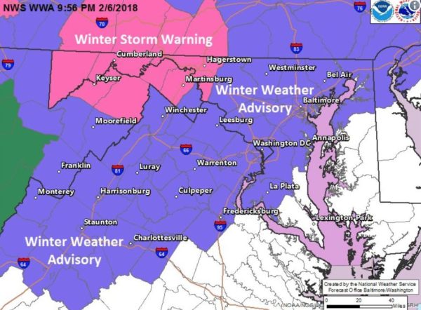
Ice / freezing rain on windshieldThe National Weather Service has issued a Winter Weather Advisory for Arlington and surrounding areas on Saturday.

County and VDOT crews are already pretreating roads ahead of the potentially snowy and slippery weather.

From NWS:

WINTER WEATHER ADVISORY IN EFFECT FROM MIDNIGHT TONIGHT TO 6 PM EST SATURDAY… THE NATIONAL WEATHER SERVICE IN BALTIMORE MD/WASHINGTON HAS ISSUED A WINTER WEATHER ADVISORY FOR SNOW… SLEET AND FREEZING RAIN… WHICH IS IN EFFECT FROM MIDNIGHT TONIGHT TO 6 PM EST SATURDAY. * PRECIPITATION TYPE… SNOW… SLEET… AND FREEZING RAIN. * ACCUMULATIONS… SNOW ACCUMULATION OF UP TO 1 INCH… ALONG WITH AROUND A TRACE OF ICE. * TIMING… LATE TONIGHT THROUGH SATURDAY. * IMPACTS… ICY PATCHES ON ROADS AND BRIDGES WILL MAKE TRAVEL DIFFICULT. * WINDS… EAST 5 MPH OR LESS. * TEMPERATURES… IN THE LOWER 30S. PRECAUTIONARY/PREPAREDNESS ACTIONS… A WINTER WEATHER ADVISORY MEANS THAT PERIODS OF SNOW… SLEET… AND FREEZING RAIN WILL CAUSE TRAVEL DIFFICULTIES. BE PREPARED FOR SLIPPERY ROADS AND LIMITED VISIBILITIES… AND USE CAUTION WHILE DRIVING.


View More Stories