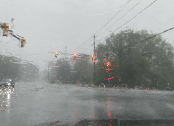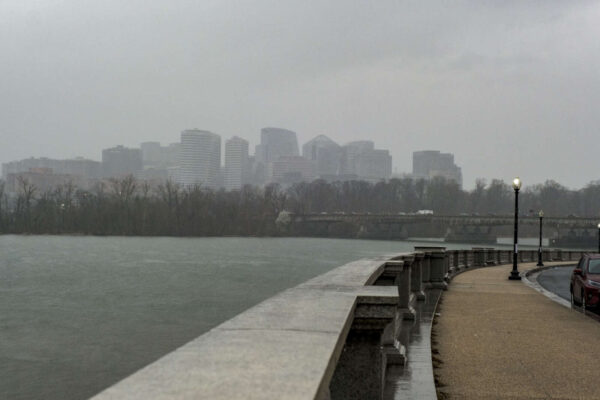
Heavy rain along the Potomac River, with Rosslyn in the background (staff photo by Jay Westcott)

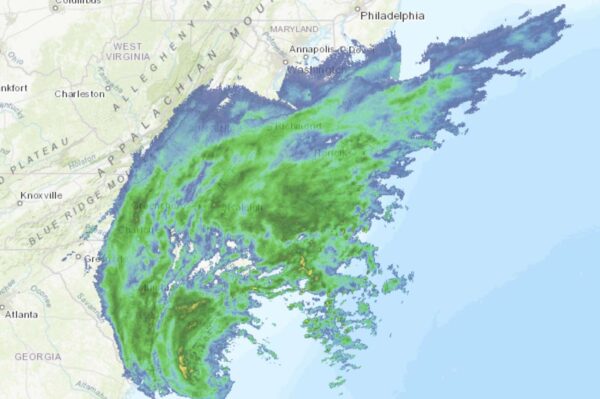
The remnants of Hurricane Nicole are heading our way, meaning a soggy and stormy Veterans Day is on tap.

The rain will start falling early Friday morning. Downpours and gusty winds are expected to follow as the day goes on, before the skies clear Saturday.

Officials are encouraging local residents to get ready now, clearing leaves from storm drains and gutters.

The storm will make for some large, soggy leaf piles on the side of the road. Arlington County does not start its vacuum leaf collection process until next week.

So far, no watches or warnings have been issued for the county. Nicole is packing a threat of localized flooding and isolated tornadoes, but Arlington is outside of the zones where those threats are most likely.

More via Twitter:

https://twitter.com/readyarlington/status/1590724482364100609?s=46&t=bbAwMb2Xxziyg8Pqu9b9ww


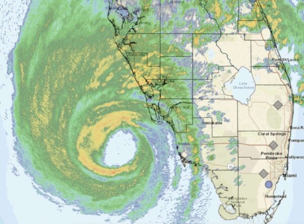
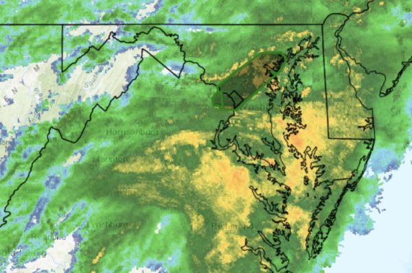
Rains from Hurricane Ian approaching the D.C. area (via National Weather Service)

Rain and wind associated with Hurricane Ian are expected to ramp up tonight in the D.C. area, but the biggest local impacts might be on your weekend plans.

Already a number of Arlington events have been modified or rescheduled, including:

No land-based watches or warnings have been issued for Arlington ahead of the storm, so far, but a Gale Warning has been issued for watercraft on the Potomac. Wind gusts of up to 40 mph are expected between 8 p.m. tonight and 6 a.m. Saturday, according to the National Weather Service.

Rain from the storm system could last all weekend and drag into Tuesday, but after an extended stretch of dry weather little to no flooding is expected locally.

Still, authorities are asking Arlington residents to be prepared just in case.

https://twitter.com/ReadyArlington/status/1575573149550518273


Hurricane Ian as of 9 a.m. on Wednesday (via National Weather Service)

Hurricane Ian is poised to slam parts of Florida today and tomorrow before making its way north, potentially bringing heavy rain to our area.

Virginia often urges residents to have a hurricane preparedness plan, but we’re wondering whether Arlington residents actually do that. After all, it’s the coastal areas like Virginia Beach that are more vulnerable to hurricanes, while Arlington is more insulated from the worst of the impacts thanks to our inland location.

The most significant hurricane to threaten Arlington in recent memory was Hurricane Irene in 2011, but while it did pack tropical storm-force winds that caused some damage, numerous downed trees, and power outages, most poll respondents said it wasn’t as bad as expected.

That’s not to say that a hurricane cannot, under the right conditions, eventually cause even worse damage here — so perhaps it will pay to be prepared.

But how many Arlington residents actually take concrete steps to prepare for hurricanes here? Let’s find out.

Image via National Weather Service


(Updated at 11:50 a.m.) If the early morning lightning storm didn’t wake you up, congratulations: you’re either an exceptionally deep sleeper or have some very high quality windows.

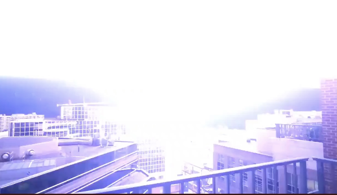
A supercell thunderstorm spawned ahead of the remnants of Hurricane Ida brought exceptionally frequent lightning and thunder to the area between 3-4 a.m. The light show and the loud booms awakened numerous local residents, not to mention their dogs and kids.

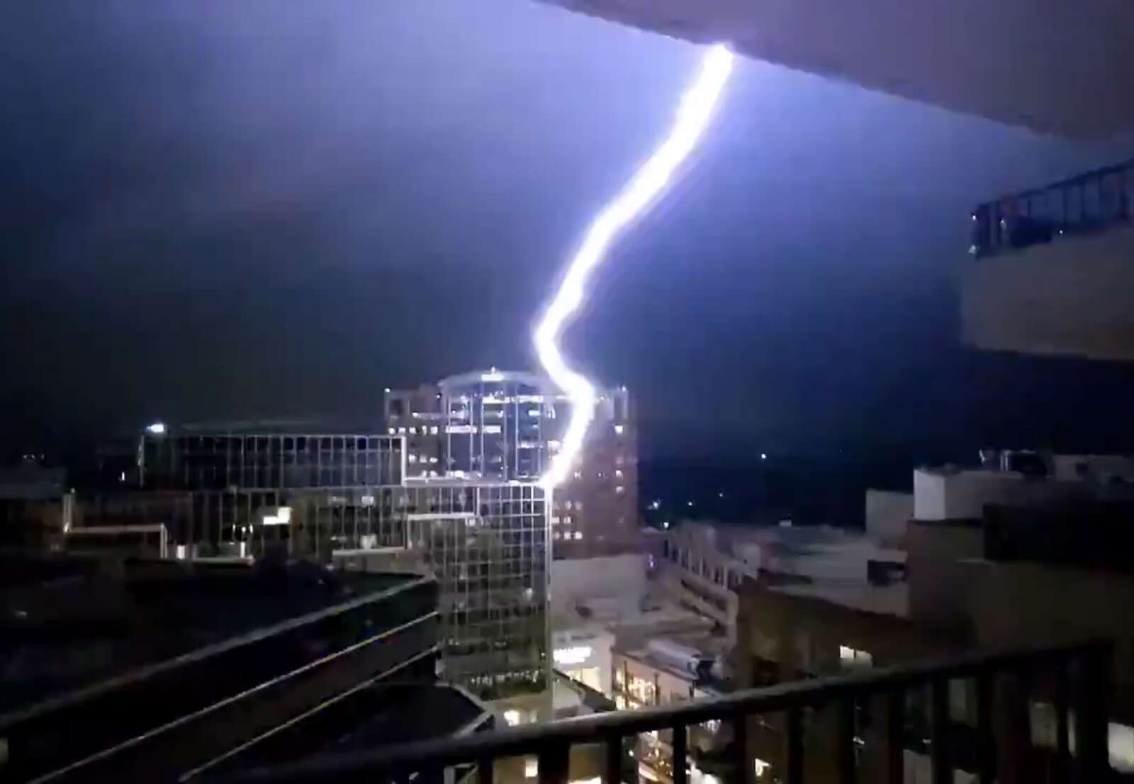
One Ballston resident and weather enthusiast even captured a bolt of lightning striking a building above Ballston Quarter mall.

The bolt — one among many during the storm, which also packed torrential rainfall and prompted both a Flood Warning and a Severe Thunderstorm Warning — set off fire alarms in the area.

https://twitter.com/elaurenb/status/1432980032205508613?s=21

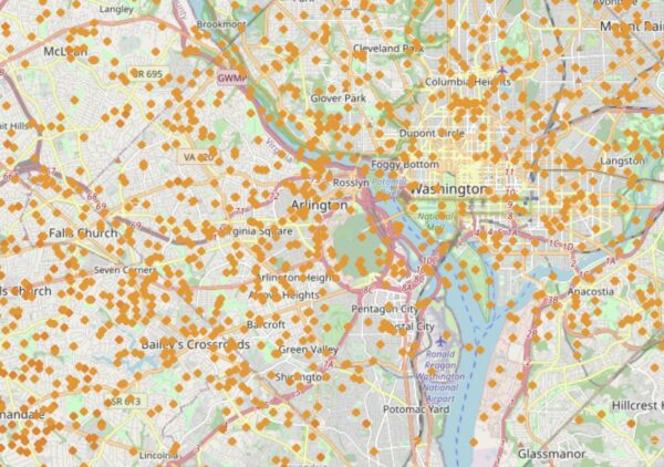
A map of the lightning strikes last night, below, shows the degree to which Arlington was peppered by mother nature’s fury.

Lightning strikes early Wednesday morning (via lightningmaps.org)

Luckily, there were no reports of major flooding in Arlington as a result of the storm, unlike parts of Fairfax County and Montgomery County, where water rescues took place. There were some reports of storm damage, including a large tree branch that went through a home’s roof near the intersection of Military Road and Route 29 in Cherrydale, at least one tree down along the GW Parkway, and multiple trees down on Roosevelt Island.

We’re not done with the wild weather yet, however. Ida’s tropical remains may spawn more strong storms and cause additional flooding later today.

Tornadoes are even a possibility, forecasters say. A Tornado Watch was issued just before noon today.

A Flash Flood Watch for Arlington and the region remains in effect through Thursday morning.


Northam Declares State of Emergency — “Governor Ralph Northam today declared a state of emergency to respond to impacts from Tropical Depression Ida, which is expected to cause heavy rains and flooding along the I-81 and I-66 corridors. Localities in the southwest region have already experienced heavy rainfall in recent days, leading to flash floods and complicating storm preparation efforts. In addition to the flood threat, there is also a risk of tornadoes across the Commonwealth.” [Gov. Ralph Northam]

Jail to Distribute Fentanyl Tests — “Beginning September 1, 2021, Arlington County will begin to distribute fentanyl test strips to individuals being released from incarceration. This new effort is in response to rising overdose numbers.” [Arlington County]

Pike Apartment Building Sold — “Zurich Alternative Asset Management has sold Siena Park, a 188-unit multifamily community in Arlington, Va., for $80.1 million. The property includes 33,602 square feet of retail and 17,373 square feet of office space. Located at 2301 Columbia Pike, Siena Park is just 15 minutes from Washington, D.C.” [Commercial Observer]

Marymount Testing VR Headsets — “Eric Bubar, a Marymount associate professor of physics, has led 3D printing projects and testing for face masks and other polymer-based personal protective equipment. But more recently, the professor… is working with three other science faculty members to develop virtual reality technology for Marymount chemistry students to take lab classes remotely — and, perhaps in the future, for physical therapy patients.” [Washington Business Journal]

Local Catholic Org Seeking Help with Refugees — “Following the withdrawal of U.S. troops from Afghanistan, diocesan Catholic Charities has issued a plea for resources to support Afghan refugees resettling in Virginia as the Taliban’s rapid resurgence prompted Afghan translators and others who assisted U.S. military forces to flee the country along with their families… Catholic Charities has prioritized finding properties for rent in Fredericksburg, Sterling and Woodbridge, as the agency hopes to place the Afghans near family and friends in the area.” [Arlington Catholic Herald]

It’s National Preparedness Month — “It’s a situation everyone has experienced: The media and public safety agencies warn of an impending storm, chance of power outages, and loss of service. But you find yourself scrambling at the last minute for batteries, water, and ideas to keep your family entertained. Disasters don’t plan ahead — even during a pandemic — but you can.” [Arlington County]


Holiday decorations now on sale at the Pentagon City Costco (photo courtesy John Antonelli)

Local Pet Rescue Orgs Take in Hurricane Evacuees — “One of the first transports of dogs arrived Sunday with Lucky Dog Animal Rescue, which was able to find fosters to take in evacuated dogs from Mississippi shelters… Homeward Trails Animal Rescue is another rescue urgently working to take in dogs and cats in Hurricane Ida’s path… ‘Fostering or adopting an animal NOW will save more than that one life. It will save dozens. Please donate, foster and adopt NOW.'” [WUSA 9, WTOP, WJLA]

Arlington Girl Hooks Record-Setting Fish — “If you happen to meet 5-year-old Caroline May Evans, she may want to tell you about the fish she caught. It’s a story worth hearing: She and her mom and dad hiked 12 miles into the remote Wind River Mountains of Wyoming, where she swung a red worm over the outlet of a lake with no name and caught what turns out to be a world-record golden trout. Caroline’s fish, landed on July 8, a few days before her 5th birthday, weighed 2 pounds, a remarkable size for a golden.” [Field and Stream]

Young Dems Blast Arlington Bishop — From the Arlington Young Democrats: “In a letter penned to his church community, Bishop Michael F. Burbridge of Arlington made heinous statements about trans folks and even trans children, where he stated that “no one is transgender.” Not only is this statement harmful to the hundreds of thousands of trans people that live in this country, many of whom live here in Arlington, but it is categorically false.” [Twitter]

APS to Punish Less, Teach More — “The Arlington County, Virginia, public schools are reimagining discipline, in the hope that teaching valuable life lessons will benefit students more than punitive consequences. On the first day of the 2021-2022 school year, Superintendent Francisco Duran, standing outside the newly opened Cardinal Elementary School, in North Arlington, said the school system is shifting the focus of discipline from punishment to making amends.” [WTOP]

Glebe Road Over Pimmit Run Back Open — “After more than two weeks, N. Glebe Road between Military Road and Chain Bridge Road/Virginia Route 123 in Arlington reopened Monday morning after delays caused by storm damage. The stretch was was originally set to be closed for nine days beginning Aug. 13 and ending Aug. 23, but an additional week was added on because of the impact of severe weather.” [WJLA]

Police Make Credit Card Theft Arrest — “The officer located the owner of the wallet, contacted him, and learned the wallet was previously stolen and there were fraudulent charges on the victim’s credit cards. The officer initiated a follow-up investigation and developed a suspect description. At approximately 8:22 a.m. on August 29, the officer was on patrol in the area of Wilson Boulevard and N. Randolph Street, observed the suspect on foot, and took him into custody without incident.” [ACPD]


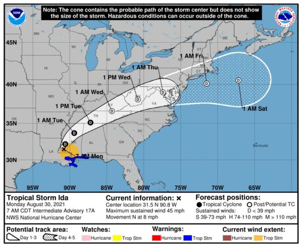
Expected track of the remnants of Hurricane Ida (via National Weather Service)

(Updated at noon) The remnants of Hurricane Ida are heading our way, and forecasters are already warning of potential flooding.

Ida has ravaged portions of Louisiana and Mississippi since making landfall as a Category 4 storm Sunday afternoon. It knocked out power to more than a million homes and businesses, including the entire city of New Orleans; interrupted 911 service; and caused catastrophic flooding, prompting numerous water rescues.

Now a tropical storm, Ida is on a northeasterly track that is expected to put its remnants squarely over the D.C. area starting Wednesday.

Two days ahead of Ida’s arrival, the National Weather Service this morning issued a Flash Flood Watch, to take effect from 11 a.m. Wednesday to 8 a.m. Thursday. Some 2-5 inches of rain could fall during that time.

Forecasters are also warning of the potential for severe weather or even tornadoes spawned by Ida.

“Heavy tropical rainfall could result in considerable flash flooding,” NWS wrote. “A few severe thunderstorms are possible Wednesday into Wednesday night. Damaging wind gusts and a brief tornado are the main threats.”

More from NWS:

…FLASH FLOOD WATCH IN EFFECT FROM WEDNESDAY MORNING THROUGH THURSDAY MORNING…

The National Weather Service in Sterling Virginia has issued a

* Flash Flood Watch for portions of DC, Maryland and Virginia…

* From Wednesday morning through Thursday morning.

* The remnants of Ida will interact with a stalled front, resulting in a prolonged period of heavy rainfall beginning Wednesday morning and continuing through Wednesday night. Rainfall amounts of 2 to 4 inches are expected, with localized amounts up to 6 inches possible.

* This amount of heavy rainfall will not only result in the potential for considerable flash flooding of creeks, small streams, and urban areas, but also the potential for river flooding on the main stem rivers.

PRECAUTIONARY/PREPAREDNESS ACTIONS…

You should monitor later forecasts and be prepared to take action should Flash Flood Warnings be issued.

Strong storms are also possible tonight (Monday), with the arrival of a cold front that will end our stretch of sweltering weather and temperatures in the 90s.

“Isolated damaging wind gusts are possible this afternoon and evening,” NWS wrote. “An isolated instance of flooding is also possible.”

Just before noon, a Flash Flood Watch was issued for Monday afternoon.

1148 AM EDT Mon Aug 30 2021

…FLASH FLOOD WATCH IN EFFECT UNTIL 10 PM EDT THIS EVENING…
…FLASH FLOOD WATCH REMAINS IN EFFECT FROM WEDNESDAY MORNING
THROUGH THURSDAY MORNING…

The National Weather Service in Sterling Virginia has issued a

* Flash Flood Watch for portions of DC, Maryland and Virginia…

* Until 10 PM EDT this evening.

* Scattered to numerous showers and thunderstorms are likely this afternoon and evening, some of which may produce a few inches of rain in a short period of time.

* Heavy rainfall in a short period of time would result in rapid rises of water in small streams and creeks, and in urban and poor drainage areas.

PRECAUTIONARY/PREPAREDNESS ACTIONS…

You should monitor later forecasts and be prepared to take action should Flash Flood Warnings be issued.


Update at 4 p.m. — The Flood Warning has now been cancelled.

Earlier: As what remains of Hurricane Zeta drenches the region, Arlington County is now under a Flood Warning, meaning flooding is currently happening or is imminent.

“Observations show we’re crossing the 1.5″ rain total threshold throughout much of the urban corridor,” the National Weather Service said just before noon. “Flooding is going to be slow to develop but we should see increasing reports of it this afternoon.”

Flooding has already been reported west of Arlington in Fairfax County, along Wolftrap Creek and Accotink Creek. The warning is in effect until 5:30 p.m.

In addition to heavy rain, strong winds are expected between roughly 5-8 p.m. this evening as the center of the storm passes the region.

More on the potential for flooding, from the National Weather Service:

BULLETIN – IMMEDIATE BROADCAST REQUESTED
FLOOD WARNING
NATIONAL WEATHER SERVICE BALTIMORE MD/WASHINGTON DC
1130 AM EDT THU OCT 29 2020

THE NATIONAL WEATHER SERVICE IN STERLING VIRGINIA HAS ISSUED A

* FLOOD WARNING FOR… THE DISTRICT OF COLUMBIA… NORTHWESTERN ANNE ARUNDEL COUNTY IN CENTRAL MARYLAND… EASTERN HOWARD COUNTY IN CENTRAL MARYLAND… SOUTHEASTERN MONTGOMERY COUNTY IN CENTRAL MARYLAND… NORTHERN PRINCE GEORGES COUNTY IN CENTRAL MARYLAND… BALTIMORE COUNTY IN NORTHERN MARYLAND… BALTIMORE CITY IN NORTHERN MARYLAND… ARLINGTON COUNTY IN NORTHERN VIRGINIA… NORTHEASTERN FAIRFAX COUNTY IN NORTHERN VIRGINIA… THE CITY OF ALEXANDRIA IN NORTHERN VIRGINIA… THE CITY OF FALLS CHURCH IN NORTHERN VIRGINIA…

* UNTIL 530 PM EDT.

* AT 1130 AM EDT, DOPPLER RADAR INDICATED HEAVY RAIN. FLOODING IS ONGOING OR EXPECTED TO BEGIN SHORTLY IN THE WARNED AREA. BETWEEN 0.5 AND 1.5 INCHES OF RAIN HAVE FALLEN.

ADDITIONAL RAINFALL AMOUNTS OF 1 TO 3 INCHES ARE POSSIBLE IN THE  WARNED AREA THROUGHOUT THE DAY.

PRECAUTIONARY/PREPAREDNESS ACTIONS…

A FLOOD WARNING MEANS THAT FLOODING IS IMMINENT OR OCCURRING. ALL INTERESTED PARTIES SHOULD TAKE NECESSARY PRECAUTIONS IMMEDIATELY.

TURN AROUND, DON’T DROWN WHEN ENCOUNTERING FLOODED ROADS. MOST FLOOD DEATHS OCCUR IN VEHICLES.

Image via National Weather Service


Update at 12:15 p.m. — A Flood Warning has now been issued.

Earlier: Arlington and much of the region is under a Flood Watch as the remnants of Hurricane Zeta track across the South and towards the D.C. area.

Rain is expected to begin overnight and continue throughout Thursday. Around 2-3 inches of rain are expected to fall.

Zeta will also bring windy conditions, with winds of up to 30-40 mph during the peak of the storm, later in the day on Thursday. That raises the possibility of downed trees and power lines.

Zeta made landfall late Wednesday afternoon as a Category 2 hurricane, stronger than initially expected. As of 9 p.m. tonight the storm was still packing hurricane-force winds as it tears through Gulfport, Biloxi and other areas along the Gulf of Mexico. It’s expected to bring strong winds and heavy rain to Birmingham, Atlanta, Asheville, Roanoke and Richmond before reaching our region.

More on the Flood Watch from the National Weather Service:

THE NATIONAL WEATHER SERVICE IN STERLING VIRGINIA HAS ISSUED A

* FLOOD WATCH FOR PORTIONS OF VIRGINIA AND EASTERN WEST VIRGINIA,  INCLUDING THE FOLLOWING AREAS: IN VIRGINIA, ALBEMARLE, AUGUSTA, CENTRAL VIRGINIA BLUE RIDGE, CLARKE, EASTERN HIGHLAND, GREENE,  MADISON, NELSON, NORTHERN VIRGINIA BLUE RIDGE, PAGE, RAPPAHANNOCK, ROCKINGHAM, SHENANDOAH, WARREN AND WESTERN HIGHLAND. IN EASTERN WEST VIRGINIA, EASTERN PENDLETON AND WESTERN PENDLETON.

* FROM LATE TONIGHT THROUGH THURSDAY AFTERNOON

* HEAVY RAINFALL FROM ZETA COULD LEAD TO SOME FLOODING OF SMALL STREAMS, CREEKS, AND URBAN AREAS. RAIN AMOUNTS OF 2 TO 3 INCHES ARE EXPECTED WITH LOCALLY HIGHER AMOUNTS POSSIBLE.

* SCATTERED INCIDENTS OF FLOODING DUE TO HEAVY RAIN ARE POSSIBLE. CLOGGED DRAINS DUE TO LEAF DEBRIS MAY CAUSE ADDITIONAL FLOODING CONCERNS.

PRECAUTIONARY/PREPAREDNESS ACTIONS…

DO NOT ENTER OR CROSS FLOWING WATER OR WATER OF UNKNOWN DEPTH.

STAY AWAY OR BE SWEPT AWAY. RIVER BANKS AND CULVERTS CAN BECOME UNSTABLE AND UNSAFE.

A FLOOD WATCH MEANS THERE IS A POTENTIAL FOR FLOODING BASED ON CURRENT FORECASTS. YOU SHOULD MONITOR LATER FORECASTS AND BE ALERT FOR POSSIBLE FLOOD WARNINGS. THOSE LIVING IN AREAS PRONE TO FLOODING  SHOULD BE PREPARED TO TAKE ACTION SHOULD FLOODING DEVELOP.


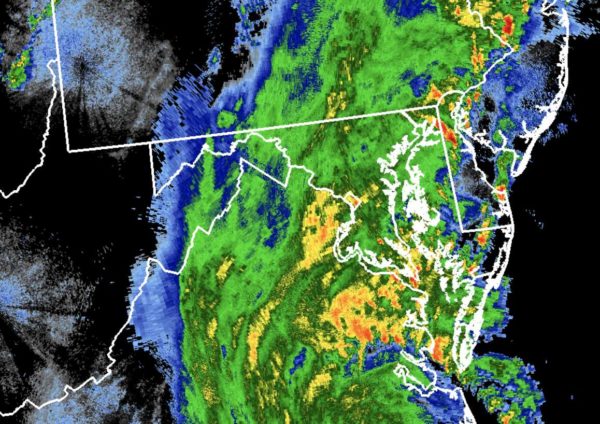
Isaias made landfall in North Carolina last night as a Category 1 hurricane and is now approaching the D.C. area as a tropical storm.

Wind from the storm is expected to ramp up locally over the next hour, but the main threat remains heavy rain.

The National Weather Service issued a Flood Warning this morning for Arlington, Alexandria, Falls Church and parts of Fairfax. Several additional inches of rain are likely to fall and cause flooding, forecasters say.

More from NWS:

BULLETIN – IMMEDIATE BROADCAST REQUESTED
FLOOD WARNING
NATIONAL WEATHER SERVICE BALTIMORE MD/WASHINGTON DC
701 AM EDT TUE AUG 4 2020

THE NATIONAL WEATHER SERVICE IN STERLING VIRGINIA HAS ISSUED A

* FLOOD WARNING FOR…
THE CITY OF FAIRFAX IN NORTHERN VIRGINIA…
ARLINGTON COUNTY IN NORTHERN VIRGINIA…
THE CITY OF FALLS CHURCH IN NORTHERN VIRGINIA…
EASTERN FAIRFAX COUNTY IN NORTHERN VIRGINIA…
THE CITY OF ALEXANDRIA IN NORTHERN VIRGINIA…

* UNTIL 100 PM EDT.

* AT 700 AM EDT, DOPPLER RADAR AND AUTOMATED RAIN GAUGES INDICATED THAT HEAVY RAIN WAS FALLING OVER THE AREA. THE HEAVY RAIN WILL CAUSE FLOODING. UP TO ONE INCH OF RAIN HAS ALREADY FALLEN.ADDITIONAL RAINFALL AMOUNTS OF SEVERAL INCHES ARE POSSIBLE, AND FLASH FLOOD WARNINGS COULD BE REQUIRED LATER TODAY. FOR NOW, THOUGH, FLOODING WILL BE RELATIVELY SLOW TO DEVELOP.

* SOME LOCATIONS THAT WILL EXPERIENCE FLOODING INCLUDE… ARLINGTON, ALEXANDRIA, RESTON, ANNANDALE, SPRINGFIELD, FORT WASHINGTON, FAIRFAX, FORT HUNT, VIENNA, GROVETON, FALLS CHURCH, HUNTINGTON, MANTUA, FORT BELVOIR, PIMMIT HILLS, NATIONAL HARBOR, MCLEAN, REAGAN NATIONAL AIRPORT, ROSSLYN AND CRYSTAL CITY.

PRECAUTIONARY/PREPAREDNESS ACTIONS…

TURN AROUND, DON’T DROWN WHEN ENCOUNTERING FLOODED ROADS. MOST FLOOD DEATHS OCCUR IN VEHICLES.

A FLOOD WARNING MEANS THAT FLOODING IS IMMINENT OR OCCURRING. ALL INTERESTED PARTIES SHOULD TAKE NECESSARY PRECAUTIONS IMMEDIATELY.


(Updated at 11:55 a.m.) Arlington County is urging residents to prepare today for Tropical Storm Isaias, which is currently making its way up the East Coast.

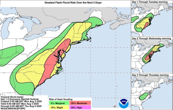
While windy conditions and some thunderstorms are likely as Isaias approaches this afternoon and evening, the main threat locally is heavy rain. Forecasters say the tropical storm could dump 3-6 inches of rain on the immediate D.C. area, potentially causing flooding.

A Flash Flood Watch is in effect for Arlington, D.C. and surrounding areas through Tuesday. A Tropical Storm Watch was upgraded to a Tropical Storm Warning late Monday morning.

The last time such a warning was issued for Arlington was for Hurricane Irene in 2011. That storm caused moderate damage around Arlington, mostly from felled trees.

More on the storm threat and preparations:

(more…)


View More Stories