Yesterday’s Winter Storm Watch has been upgraded to a Winter Storm Warning.

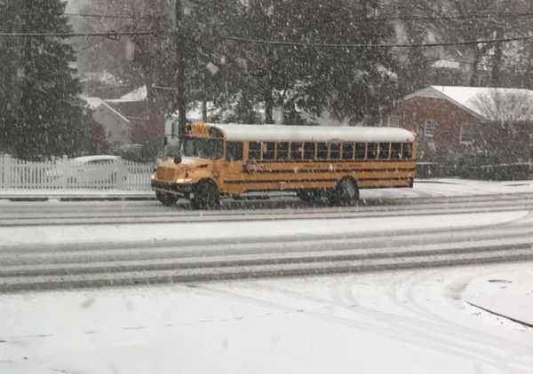
The winter storm that has been causing major problems in Texas and the central U.S. is making its way towards the D.C. area on its march up to New England. It’s expected to drop 3-6 inches of snow on Arlington and the immediate D.C. area before the precipitation switches to sleet and freezing rain.

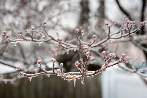
The ice accumulation could cause dangerous road conditions and power outages, forecasters and local officials warn.

“With heavy snow, sleet, freezing rain and ice in the forecast for Northern Virginia on Thursday and Friday, significant road impacts are expected,” the Virginia Dept. of Transportation said today. “While VDOT crews prepare to deploy, residents are asked to closely monitor weather updates and plan ahead to avoid nonessential travel tomorrow and Friday.”

“Crews will finish pre-treating about 2,000 lane miles of interstates and primary routes in Arlington, Fairfax, Loudoun and Prince William counties today,” VDOT added. “Drivers are asked to be alert to brine tankers and to give them room, as they move slowly to spray the salt water solution on the pavement. Pretreatment will help prevent ice from bonding to assist crews with snow and ice removal at the storm’s onset.”

Arlington County crews are also currently pretreating local roadways.

A Winter Storm Warning was issued for the region this morning. More from the National Weather Service:

1024 AM EST WED FEB 17 2021

…WINTER STORM WARNING REMAINS IN EFFECT FROM 3 AM THURSDAY TO 6 AM EST FRIDAY…

* WHAT…HEAVY SNOW ALONG WITH SLEET AND FREEZING RAIN. TOTAL SNOW ACCUMULATIONS AROUND 3 TO 6 INCHES WITH ICE ACCUMULATION AROUND ONE TENTH TO ONE QUARTER OF AN INCH.

* WHERE…THE WASHINGTON AND BALTIMORE METROPOLITAN AREAS.

* WHEN…FROM 3 AM THURSDAY TO 6 AM EST FRIDAY. SNOW WILL BEGIN BETWEEN 3 AND 5 AM. SNOW WILL CHANGE TO A MIXTURE OF SLEET AND FREEZING RAIN DURING THE LATE MORNING AND EARLY AFTERNOON HOURS.

* IMPACTS…POWER OUTAGES AND TREE DAMAGE ARE LIKELY DUE TO THE ICE. TRAVEL COULD BE NEARLY IMPOSSIBLE. THE HAZARDOUS CONDITIONS COULD IMPACT THE MORNING OR EVENING COMMUTE.

* ADDITIONAL DETAILS…SNOW THURSDAY MORNING WILL BE HEAVY AT TIMES WITH SNOWFALL RATES AROUND 1 TO 2 INCHES PER HOUR POSSIBLE ALONG WITH VISIBILITY REDUCED TO AROUND ONE-QUARTER MILE AT TIME.

PRECAUTIONARY/PREPAREDNESS ACTIONS…

IF YOU MUST TRAVEL, KEEP AN EXTRA FLASHLIGHT, FOOD, AND WATER IN YOUR VEHICLE IN CASE OF AN EMERGENCY.

WHEN VENTURING OUTSIDE, WATCH YOUR FIRST FEW STEPS TAKEN ON STEPS, SIDEWALKS, AND DRIVEWAYS, WHICH COULD BE ICY AND SLIPPERY, INCREASING YOUR RISK OF A FALL AND INJURY.

File photo


(Updated at 4:20 p.m.) Authorities are urging Arlington residents and others in the D.C. area to stay home today amid an extended bout of freezing rain.

Sidewalks and many roads are reported to be very slick. The ice is expected to build as the day goes on.

County and VDOT crews are out spreading salt, but even treated surfaces can become icy as rain falls amid sub-freezing surface temperatures. At least two bridges in the Courthouse area were closed due to slick conditions.

“Due to icy conditions the 10th Street bridge and Courthouse Rd bridge of Route 50 have been closed,” an Arlington Alert said at 9:30 a.m.

The earlier Winter Weather Advisory was upgraded to an Ice Storm Warning as of 2 p.m. Saturday. As of 3 p.m., the National Weather Service reported more than a tenth of an inch of ice accumulation in Arlington.

More from NWS:

156 PM EST SAT FEB 13 2021

…ICE STORM WARNING IN EFFECT UNTIL 7 AM EST SUNDAY…

* WHAT…TWO TO THREE TENTHS OF AN INCH OF SLEET AND FREEZING RAIN CAUSING SIGNIFICANT ICING IMPACTS.

* WHERE…THE DISTRICT OF COLUMBIA, AND PORTIONS OF CENTRAL MARYLAND AND NORTHERN VIRGINIA.

* WHEN…UNTIL 7 AM EST SUNDAY.

* IMPACTS…DIFFICULT TRAVEL CONDITIONS.

* ADDITIONAL DETAILS…ROADWAYS ARE BECOMING VERY ICY AND DANGEROUS. AVOID ALL UNNECESSARY TRAVEL.

PRECAUTIONARY/PREPAREDNESS ACTIONS…

TRAVEL IS STRONGLY DISCOURAGED. IF YOU MUST TRAVEL, KEEP AN EXTRA FLASHLIGHT, FOOD AND WATER IN YOUR VEHICLE IN CASE OF AN EMERGENCY. PREPARE FOR POSSIBLE POWER OUTAGES.

WHEN VENTURING OUTSIDE, WATCH YOUR FIRST FEW STEPS TAKEN ON STEPS, SIDEWALKS, AND DRIVEWAYS, WHICH COULD BE ICY AND SLIPPERY, INCREASING YOUR RISK OF A FALL AND INJURY.

In an email earlier this morning, VDOT said those who absolutely must travel should “use extreme caution.”

Significant icing is anticipated with the next wave of inclement weather. With prolonged freezing rain and low pavement temperatures expected through the day Saturday, VDOT strongly advises against nonessential travel. Those who must drive should closely monitor weather and road conditions, and use extreme caution. Even on treated roads, slick pavement will be possible. […]

Crews have positioned materials and equipment, and will apply treatment such as sand and salt as needed to icy patches and trouble spots to improve traction. Tree crews are ready to trim and remove branches weighed down or broken by ice, and to support utility companies on potential downed or entangled lines.

Numerous crashes have been reported around Arlington since this morning, including on treated roads. Virginia State Police say the VSP division that serves Arlington and other parts of Northern Virginia has responded to 83 crashes and 29 disabled vehicles as of 4 p.m.

“Virginia State Police continues to discourage Virginians from driving through Sunday (Feb. 14) due to extremely icy and treacherous conditions across much of Central, Southeastern and Northern Virginia,” a spokeswoman said via email.

More from social media:

https://twitter.com/jenkochan/status/1360593888415797254


(Updated at 5 p.m.) Arlington County is under a Winter Weather Advisory for Saturday into Sunday.

The National Weather Service says wintry precipitation starting Saturday morning may lead to slippery roads, with ice accumulation up to a fifth of an inch or so.

An earlier Winter Storm Watch was downgraded to an advisory Friday afternoon.

More from NWS:

310 PM EST Fri Feb 12 2021

…WINTER WEATHER ADVISORY IN EFFECT FROM 10 AM SATURDAY TO 7 AM EST SUNDAY…

* WHAT…Freezing rain, mixed with sleet at times. Storm total ice accumulations of one tenth to two tenths of an inch.

* WHERE…The District of Columbia, and portions of central and southern Maryland and central, northern and northwest Virginia.

* WHEN…From 10 AM Saturday to 7 AM EST Sunday.

* IMPACTS…Prepare for difficult travel conditions.

* ADDITIONAL DETAILS…Even a small amount of ice on untreated surfaces can make travel treacherous.

PRECAUTIONARY/PREPAREDNESS ACTIONS…

Slow down and use caution while traveling. Prepare for possible power outages.

When venturing outside, watch your first few steps taken on steps, sidewalks, and driveways, which could be icy and slippery, increasing your risk of a fall and injury.

In a sign of what may be to come, Metro is planning to operate on a moderate snow service plan to start the day on Saturday.

It does not take much ice buildup on roadways to create very dangerous conditions. On Thursday morning, an icy highway in Fort Worth, Texas caused a massive pileup that killed six people and involved more than 100 vehicles.


Schools Closed, Federal Gov’t on Delay — Due to anticipated icy conditions this morning, Arlington Public Schools has closed schools, though distance learning is still on. Federal government offices have a 10 a.m. delayed opening. [Twitter, Twitter]

Arlington Xmas Decorations Go Viral — Two Arlington homes, next door to one another, have very different approaches to holiday decorating, as seen in a tweet that went viral. [Twitter]

Might Mayor Pete Live in Arlington? — “Pete and Chasten have an affinity for airports — Pete proposed to Chasten at O’Hare in Chicago and Chasten proposed to Pete at an airport in Berlin — so why not live walking distance from DCA? Besides having a great beer bar and Synetic Theater, the area also known as Crystal City is a major transportation hub, which could work in Pete’s favor as he starts his new role.” [Washingtonian, Twitter]

Bill Would Strip Lee’s Name from Arlington House — Confederate General Robert E. Lee’s name is likely to soon be removed from Lee Highway in Arlington, and potentially from his former home in Arlington National Cemetery as well. Rep. Don Beyer (D-Va.) has introduced legislation that would rename what’s currently known as “Arlington House: The Robert E. Lee Memorial” as just “Arlington House.” Arlington County is in the process of removing an illustration of the house, which critics say is a symbol of slavery, from its logo and seal. [Press Release, Twitter]

Wreaths on the Way — The wreaths for this weekend’s Wreaths Across America event at Arlington National Cemetery are currently making their way to Arlington from Maine via convoy. [Twitter, Facebook]

Funeral for Vietnam War Hero — “Despite the winter elements that hit the [D.C. area] Wednesday morning, Medal of Honor recipient Command Sgt. Maj. Bennie G. Adkins was given modified military funeral honors at Arlington National Cemetery. Adkins died from COVID-19 earlier this year in April at the age of 86.” [WJLA]

Local Nonprofit Gets Grant — “The Arlington-based nonprofit organization, Latinas Leading Tomorrow (LLT) announced their latest financial contribution from the Arlington Women’s Civic Alliance (AWCA) to support LLT’s leadership training and college readiness programs. ” [Press Release]


(Updated at 10:20 p.m.) Arlington Public Schools will open on a two hour delay Wednesday, following today’s snowfall.

Officials hope the delay will allow slick spots on roads and sidewalks, from an expected refreeze overnight, to start to melt.

APS announced the delay at 8:45 p.m. Tuesday night, noting that morning field trips will be cancelled.

Arlington officials and forecasters are continuing to warn that temperatures will likely dip below freezing overnight, producing black ice and making driving dangerous.

Snow crews “will be on standby” to treat any problem spots, Arlington’s Dept. of Environmental Services said.

The National Weather Service says it will be breezy and cold Wednesday, with wind gusts up to 35-45 mph.

Also tonight, Arlington’s Dept. of Parks and Recreation announced changes with its programs Wednesday.

Arlington Public Schools have announced a two hour delay Wed., Jan. 8 so DPR will proceed as follows per the DPR Inclement Weather Policy:

  • All congregate meal programs will begin at 10 a.m.
  • All Early Childhood Programs (Preschool and Co-op) will begin at 10 a.m.
  • All Enjoy Arlington classes (except for Gymnastics), 55+ classes and trips, nature center programs, sports activities, leagues and instructional programs in County and joint use facilities scheduled to start prior to 9:59 a.m. are cancelled.
  • All Enjoy Arlington classes (except for Gymnastic), 55+ classes and trips, nature center programs, sports activities, leagues and instructional programs in County and joint use facilities scheduled to start at 10 a.m. or later will proceed as scheduled.
  • Gymnastic Classes scheduled to start prior to 11:59 a.m. are cancelled.
  • Gymnastic Classes scheduled to start at noon or later will proceed as scheduled.
  • All community centers (including the five joint use centers located at Carver, Drew, Gunston, Langston and TJ) will open as scheduled.

(Updated at 8:15 a.m.) Arlington public schools are opening on a two-hour delay Wednesday, due to expected icy conditions.

APS announced the delay Tuesday night “based on the current weather forecast and conditions,” leaving open the possibility that worse-than-expected road conditions Wednesday could prompt a cancellation. Fairfax County Public Schools announced earlier that its schools would be closed tomorrow.

Wednesday morning, APS affirmed the two-hour delay decision.

The federal government, meanwhile, will open on a three-hour delay.

Authorities are asking anyone driving overnight and in the morning to take extra precautions due to the likelihood of dropping temperatures turning wet roads into icy hazards. Around Arlington Wednesday, there were some reports of black ice, particularly on local roads.

“VDOT asks that drivers be aware of weather and road conditions prior to making decisions to travel tonight and Wednesday morning,” said VDOT’s Northern Virginia office, in a press release. “Plan for the potential need to delay commutes Wednesday morning, as low temperatures overnight will freeze precipitation and create potential hazardous conditions.”

At least one significant crash was reported Tuesday night — a multi-vehicle wreck on I-395 near the Pentagon — but it’s unclear if weather was a factor.

As if the deep freeze wasn’t bad enough, the National Weather Service issued a Wind Advisory Tuesday night.

…WIND ADVISORY IN EFFECT FROM 9 AM TO 6 PM EST WEDNESDAY…

The National Weather Service in Baltimore MD/Washington has issued a Wind Advisory, which is in effect from 9 AM to 6 PM EST Wednesday.

* TIMING…Mid-morning through late afternoon Wednesday.

* WINDS…West 20 to 30 mph with gusts up to 50 mph.

* IMPACTS…Strong winds may blow down limbs, trees, and power lines. Scattered power outages are expected.

PRECAUTIONARY/PREPAREDNESS ACTIONS…

A Wind Advisory means that winds of 45 to 55 mph are expected. Winds this strong can make driving difficult, especially for high profile vehicles.


Rain will turn to snow Tuesday afternoon, just in time to potentially cause problems for the drive home.

The National Weather Service has issued a Winter Weather Advisory ahead of the wintry precipitation, warning of “hazardous conditions” during the evening commute. The snow will be followed by plummeting temperatures that will turn wet spots into icy patches for the Wednesday morning commute.

More from the National Weather Service:

…WINTER WEATHER ADVISORY IN EFFECT FROM 3 PM TUESDAY TO MIDNIGHT EST TUESDAY NIGHT… * WHAT…ANY RAIN WILL CHANGE TO SNOW DURING THE LATE AFTERNOON AND EARLY EVENING HOURS. TOTAL SNOW ACCUMULATIONS OF 1 TO 2 INCHES EXPECTED. * WHERE…THE DISTRICT OF COLUMBIA, AND PORTIONS OF CENTRAL AND SOUTHERN MARYLAND AND CENTRAL AND NORTHERN VIRGINIA. * WHEN…FROM 3 PM TUESDAY TO MIDNIGHT EST TUESDAY NIGHT. * ADDITIONAL DETAILS…PLAN ON SLIPPERY ROAD CONDITIONS. THE HAZARDOUS CONDITIONS WILL IMPACT THE EVENING COMMUTE. TEMPERATURES WILL FALL BELOW FREEZING DURING THE EVENING, CAUSING ANY MOISTURE OR SLUSH TO FREEZE ON UNTREATED SURFACES. PRECAUTIONARY/PREPAREDNESS ACTIONS… A WINTER WEATHER ADVISORY FOR SNOW MEANS PERIODS OF SNOW WILL CAUSE PRIMARILY TRAVEL DIFFICULTIES. EXPECT SNOW COVERED ROADS AND LIMITED VISIBILITIES, AND USE CAUTION WHILE DRIVING. THE LATEST ROAD CONDITIONS FOR THE STATE YOU ARE CALLING FROM CAN BE OBTAINED BY CALLING 5 1 1. &&

More from VDOT and Arlington’s Dept. of Environmental Services:


Housing and the County Budget — A new Greater Greater Washington article explores ways to add new housing at a time when Arlington County is facing a serious budget gap. [GGW]

Trails Treacherous for Cyclists — Despite efforts to plow local trails, many stretches in Arlington were still icy or snow-covered yesterday. [Twitter]

Police Warn About Phone Scam — “The Arlington County Police Department is warning the public about a fundraising phone scam targeting County residents. Residents have contacted the police department after receiving unsolicited phone calls from individual(s) claiming to be with the Arlington County Police Department and requesting donations to benefit the disabled and underprivileged children.” [Arlington County]

Fraser Among Those Called By Scammers — Arlington resident and local media personality Sarah Fraser was among those to be called by the scammers posing as ACPD. [Twitter]

A Modest Proposal for Stop Signs — “Close observation of local driving practices confirms the view that stop signs have become irrelevant, since no one obeys them. The closest drivers come is to slow and then slide through the intersection. It would be a cost-saving measure if Arlington County were to remove all its stop signs and replace them with ‘Yield’ signs.” [InsideNova]

Va. 8th District Has Most Federal Workers — “The House member with the most federal workers in his or her district is Democratic Rep. Don Beyer, whose Virginia district includes 86,900 federal workers. (Among districts with no military bases, Democratic Rep. Gerry Connolly’s neighboring Virginia district has the highest number of federal workers.)” [Pew Research h/t Patricia Sullivan]

Stuck School Bus in Maywood — “#ArlingtonVA school bus stuck this am on N Fillmore St & 23rd St. N 3 days *AFTER* the snow! This hill on Fillmore is NEVER timely plowed or cleared. Do not put children at risk! Can @ArlingtonVA please clear this street.” [Twitter]


Icy Conditions on N. Glebe Road — The northbound lanes of N. Glebe Road are closed at Military Road “for an unknown amount of time” due to icy conditions. [Twitter]

County Board Member is Pregnant — Arlington County Board Chair Katie Cristol and her husband Steve are expecting their first child in May. [Twitter]

Long-Time APS Employee Dies — Charles Weber, a World War II veteran who “worked for Arlington County Public Schools for thirty-seven years and served as Principal of Swanson Junior High School and Stratford Junior High School,” has died at the age of 91. [Dignity Memorial]

Scooter Trips > Bikeshare Trips — “In October, when Arlington, Va.’s scooter pilot began, there were 69,189 Bird and Lime scooter trips for 75,425 total miles traveled with Bird and Lime. Meanwhile, Capital Bikeshare – routinely and still considered a success, with lots more potential – had 26,532 total trips in Arlington in October.” [Mobility Labs, Twitter]

Growing Number of $200K+ Earners in Arlington — “If there’s one place in America that doesn’t need a helping hand from Jeff Bezos, it could be [Arlington and the D.C. suburbs]. The Washington commuter area is home to four of the top 10 (Nos. 2, 3, 5 and 6) fastest-growing census tracts of high earners.” [Bloomberg]

Conspiracy Theorists Eye Cemetery — “QAnon believers have become convinced the deep-state cabal has a bunker under Arlington Cemetery, connected to a tunnel running straight to Comet Ping Pong.” [Twitter]


Some Yorktown residents say their neighborhood has become an icy mess at times over the last few weeks — and they believe a newly installed speed bump is to blame.

County officials still aren’t sure of the exact problem on the road, but they aren’t willing to blame the speed bump quite yet. Regardless of the exact source of the issue, people living along 26th Street N. as it runs between N. George Mason Drive and N. Glebe Road, say they’re desperate for a solution.

“We have had to have the county send salt trucks twice since [last] Friday to specifically address the road downhill from the speed bump,” David Miller, who lives along the 4900 block of 26th Street N., told ARLnow via email. “We expect this will be worse as we have more days below 32 degrees. We have not seen any accidents yet as a result of the ice/water, but have had our own cars slide while coming out of our driveway, so we fully expect it is only a matter of time.”

Miller says the road first started getting soaked with water about six months ago, the day after the county removed a speed bump from the area. Accordingly, neighbors can’t help but draw a connection between the two events.

However, he says the issue wasn’t serious until about six weeks ago, when the county installed a new speed bump and temperatures started to dip, leading residents to inform county officials about the problem. Everyone living in the area is convinced this is due to a leak of some kind, Miller said, but the county hasn’t come to a definitive conclusion just yet.

Katie O’Brien, a spokeswoman for the county’s Department of Environmental Services, says workers are indeed “actively investigating” what’s going on in the neighborhood. She says county staff “have been unable to identify a leak” thus far, making it possible that there are other factors at play in the area.

“Due to the record amount of rain we have received this year, there are a number of locations throughout the county that are supersaturated and the standing ground water may give off the appearance of a water main leak,” O’Brien wrote in an email. “We are also monitoring these locations as a precaution.”

Miller does give the county credit for its responsiveness to the issue, but remains frustrated that the problem is still unsolved all these weeks later. With temperatures continuing to plummet, he fears what will happen if the county still can’t find a fix in the coming months.

“Everyone on the street is concerned for the danger that the ice is creating,” he said.

Photo courtesy of David Miller


The National Weather Service is warning of the potential for icy roads Saturday morning.

Rain falling on sub-freezing pavement — the raindrops are expected to start falling around 8-9 a.m. — may turn to ice and make driving hazardous.

More from an NWS Special Weather Statement:

…POTENTIAL FOR PATCHY ICY CONDITIONS EARLY SATURDAY MORNING ALONG AND WEST OF INTERSTATE 95 IN THE BALTIMORE METROPOLITAN AREA AND NEAR INTERSTATE 95 AROUND WASHINGTON DC AND SPOTSYLVANIA COUNTY IN VIRGINIA… RAINFALL IS EXPECTED TO START AROUND DAYBREAK SATURDAY MORNING IN THE GREATER BALTIMORE/WASHINGTON VICINITY. THE RECENT COLD SNAP HAS CAUSED ELEVATED ROADWAYS, BRIDGES, AND OVERPASSES TO BE AT OR BELOW FREEZING FOR AN EXTENDED PERIOD OF TIME. DESPITE FORECAST AIR TEMPERATURES BEING ABOVE FREEZING EARLY ON SATURDAY MORNING IN DOWNTOWN BALTIMORE AND WASHINGTON, THERE MAY BE RESIDUAL AREAS AT GROUND LEVEL WHICH WILL CONTINUE TO BE BELOW FREEZING. THIS WILL CREATE THE POTENTIAL FOR PATCHY AREAS OF ICE TO ACCUMULATE BETWEEN DAWN AND 10 AM ON SATURDAY MORNING. THE GREATEST POTENTIAL FOR THIS PATCHY ICE WILL BE IN THE NORTHWEST SUBURBS OF BALTIMORE, NEAR WASHINGTON DC AND SPOTSYLVANIA COUNTY IN VIRGINIA. PLEASE CHECK BACK OVERNIGHT FOR UPDATED FORECASTS, INCLUDING THE POTENTIAL EXPANSION OF WINTER WEATHER ADVISORIES FURTHER EAST INTO MAJOR METROPOLITAN AREAS.


View More Stories