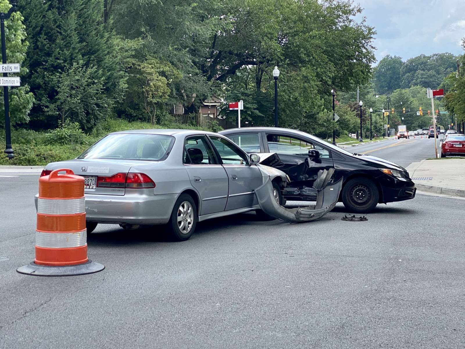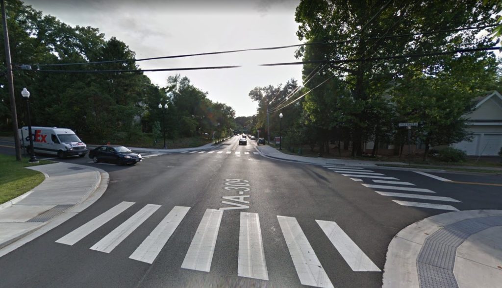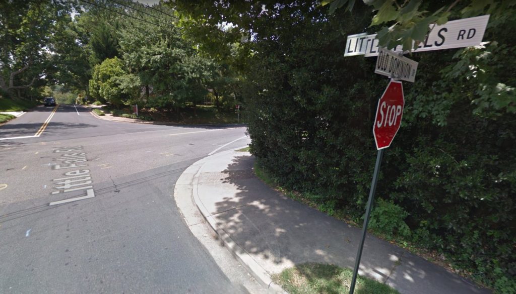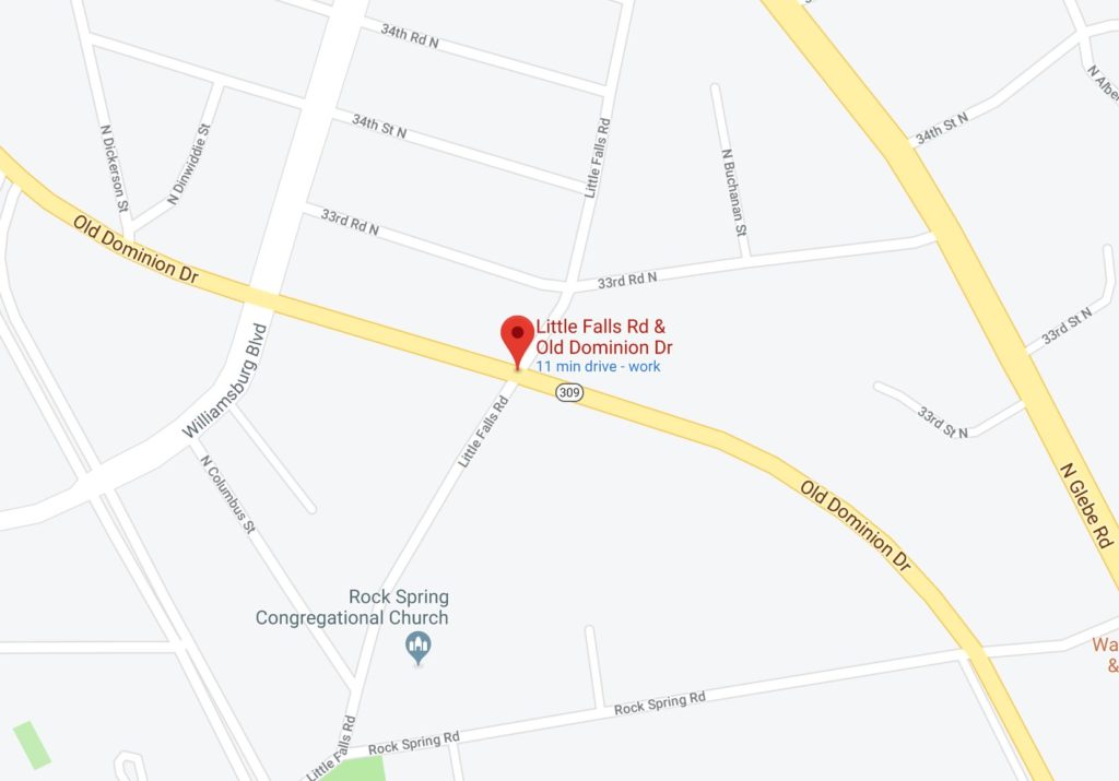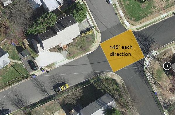
For years the intersection of Old Dominion Drive and Little Falls Road has been the scene of numerous crashes.

Now, after a push for traffic signals and minor efforts to make it safer, the intersection in the Rock Spring neighborhood has undergone its biggest change yet.

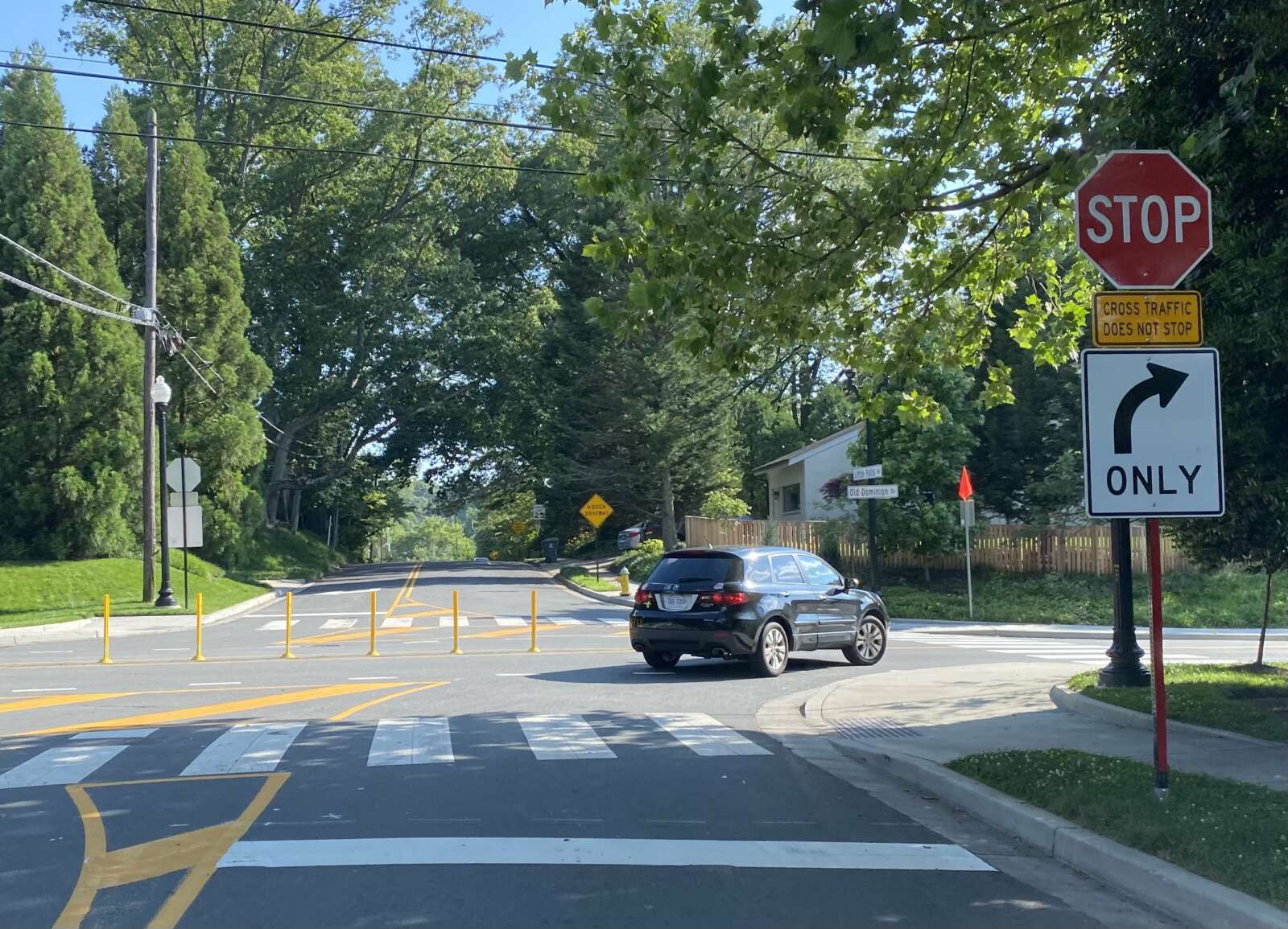
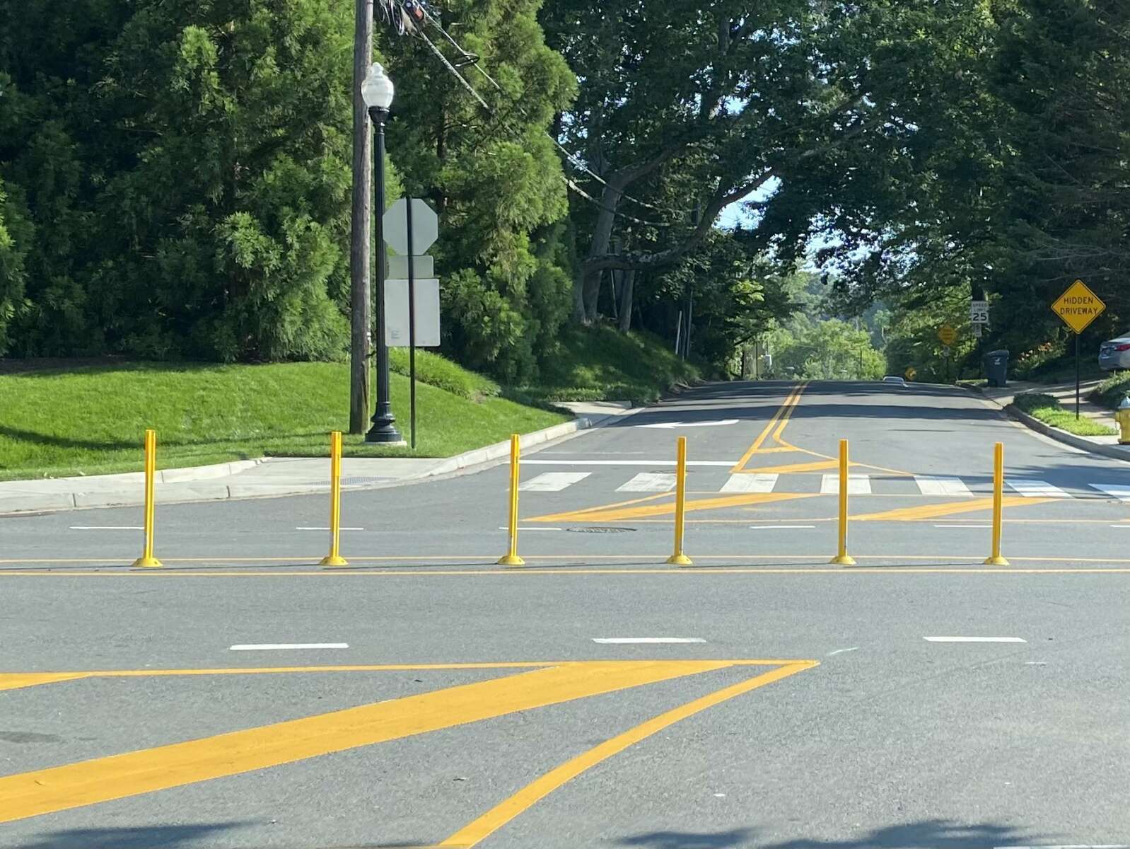
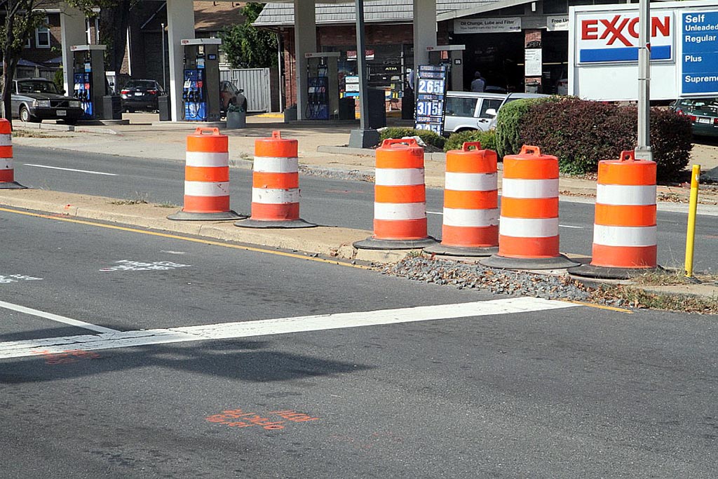
Instead of the rush hour restrictions that were put in place last year — making it right-turn-only for Little Falls Road traffic during certain hours — a recently-constructed row of bollards now ensures that those driving on Little Falls can only turn right at all times.

The bollards also prevent left turns from Old Dominion Drive.

“On June 10, the Virginia Department of Transportation installed a small center island of along the centerline of Old Dominion Drive to make Little Falls Road right-in/right-out at Old Dominion Drive,” Arlington County Dept. of Environmental Services spokeswoman Katie O’Brien tells ARLnow. “Additional markings and signage have been installed to help guide right-turning drivers. We anticipate making small changes, such as to the center median material, in the coming months.”

“These short-term changes were made because a crash trend has been identified at this location, including a high number of angle collisions involving drivers either turning left or continuing through the intersection from Little Falls Road,” O’Brien continued.

There were 13 crashes at the intersection in 2018, 14 crashes in 2019, 12 crashes in 2020 and 4 crashes so far in 2021, according to Arlington County Police Department spokeswoman Ashley Savage.

O’Brien also wrote in an email that the county and VDOT will be studying the possibility of lowering the speed limit on Old Dominion Drive or installing a traffic signal at the problematic intersection.

To help Arlington County and the Virginia Department of Transportation determine a long term solution, The County will also collect additional speed and volume data in this area. This data will help VDOT and County staff evaluate:

  • If a traffic signal is warranted. For the traffic signal, the County will work with VDOT to determine if the intersection meets the State Signal Justification requirement.
  • If a speed limit reduction is warranted. For the speed evaluation, the County will work with VDOT to determine whether a posted speed limit reduction is warranted.

Old Dominion Drive was formerly a streetcar line. It was converted into a road in the 1930s.


After years of public outcry, and dozens of car crashes at an intersection in the Rock Spring neighborhood, county officials said they are working on a possible solution.

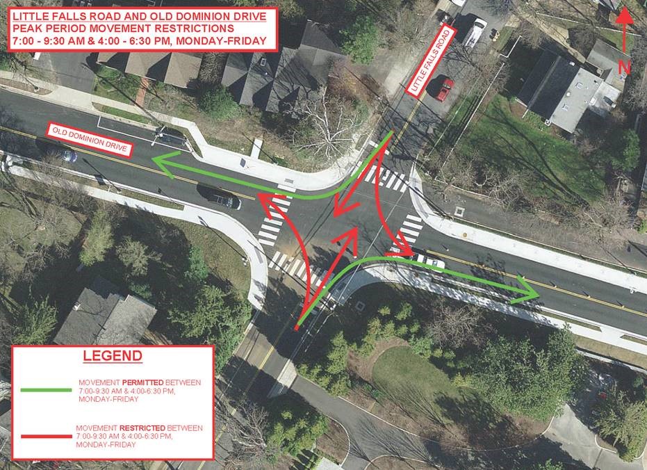
Arlington’s Department of Environmental Services (DES) says it will be installing signs with new rules for drivers on Little Falls Road at the intersection with Old Dominion Drive later this month. The changes will forbid drivers on Little Falls Road from turning left or going straight at the intersection during morning and evening rush hours — only right turns will be permitted.

“The changes are intended to help address a crash trend at this location that includes a high number of angle collisions involving drivers either turning left or continuing through the intersection from Little Falls Road,” said DES spokesman Eric Balliet.

The right-turn-only restriction will be in place between 7-9:30 a.m. and 4-6:30 p.m. Monday through Friday. Signs will be posted later this month before the start of the new school year, according to Balliet.

Last week, authorities closed the intersection due to a crash, something that neighbors say is all too common.

“Every single week there is at least one major accident at this intersection,” one resident wrote on social media in response to the article. “[The] last one was so bad two cars ended up in the front yard of the house in the corner.”

“It feels like there’s an accident there weekly,” another commentator wrote. “Neighbors have repeatedly asked for a four way stop or some traffic control at this location and have been told it’s not possible due to the proximity to the traffic light at Old Dominion/Williamsburg.”

In 2017, Williamsburg Middle School student Andy Nogas asked the County Board for help installing a stoplight at the intersection. An online version of his letter gained 112 petition signatures.

“I have seen more than 15 crashes and many near misses [at this intersection and] I am writing to ask you to do something about this,” he wrote.

In response, the Board pledged to assign a county staff member to the problem. Balliet said the resulting research indicated a traffic signal wasn’t the right solution:

Transportation Engineering & Operations staff evaluated several traffic management countermeasures for this location, including adding a traffic light, adding an all-way stop, and restricting certain types of vehicle movements. A signal is not warranted per engineering standards, as traffic volumes on Little Falls Road are too low. An all-way stop is not suitable as Old Dominion is a major arterial, and not feasible due to excessive queuing on Old Dominion based on traffic modeling. Adding movement restrictions is the recommended countermeasure to address the safety concerns.

About two years ago Arlington County completed a major road improvement project for this stretch of Old Dominion Drive, adding sidewalks, street lights, stormwater infrastructure and updated traffic signals.

Since Nogas’ letter, police have recorded 27 crashes at the intersection, according to Arlington County Police spokeswoman Ashley Savage: seven in 2017, 13 in 2018, and 7 as of 2019 so far.

In total, Savage said people were injured in nine of those crashes.

“Once implemented, we will monitor its effectiveness and will encourage the community to share their experiences with the new restrictions,” Balliet said of the new turning rules.

Map via Google Maps


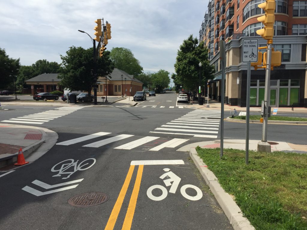
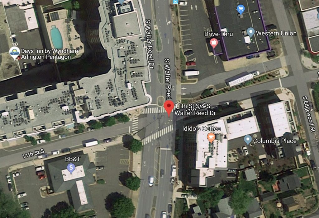
A set of traffic lights near Columbia Pike isn’t working for bicycles, officials say.

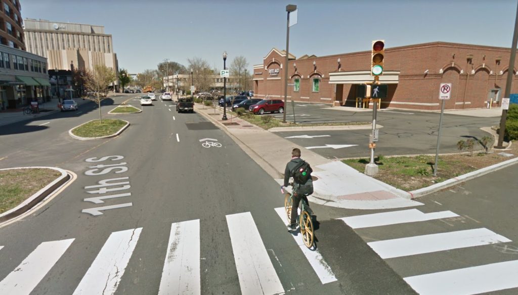
The Department of Environmental Services (DES) confirmed that traffic signal at the intersection of S. Walter Reed Drive and 11th Street S. is not detecting bicycles.

DES crews discovered this week that an underground conduit collapsed, effectively disabling the sensors that detect bicycles waiting to cross Walter Reed Drive and trigger a green light.

“There’s currently no bike lane detection because we weren’t able to get the cable from the controller to this side of the intersection due to the collapsed conduit,” DES spokesman Eric Balliet tells ARLnow.

“Staff are working on how to address the issue, but we don’t have an estimate at this time for when a fix can be implemented,” he said.

In the meantime, the department reconfigured the intersection to give a green light to the contraflow bike lane on 11th Street during each light cycle. In a contraflow bike lane, bicyclists ride against the flow of traffic.

The department found the problem after cyclists — including Arlington County official Henry Dunbar — noted on social media earlier this month that some intersections hadn’t turned green for them.

Balliet said crews inspected N. Veitch Street and Lee Highway on Wednesday after the online complaints and found no issues.

No other intersections have known issues either, but Bailliet said in an emailed statement that some intersections use a new vehicle detection technology and it can be finicky:

The newer detection cameras the County uses for vehicular detection can also detect bicycles, but the system requires the bicycle to approach the intersection in a vehicular or bicycle lane in order to be detected. If the bicycle doesn’t adhere to the stop bar area or rides in an atypical pattern, the cameras will likely not detect the bicycle as the zones are set up with the stop bar as a reference and can only be triggered from travel in a single general direction.

He added that cameras will also fail to detect bicycles on sidewalks and riders need to continue pushing walk buttons to cross safety.

DES asks travelers to report intersection problems to the county’s online system so crews can investigate.

Images via Google Maps


(Updated at 9:30 a.m.) Arlington County is considering a series of transportation improvements, including a fix to the complicated West and South Glebe Road intersection.

At Saturday’s County Board meeting the Board scheduled to vote on the approval of a series of grant requests for up to six projects with a total funding of up to $5.4 million.

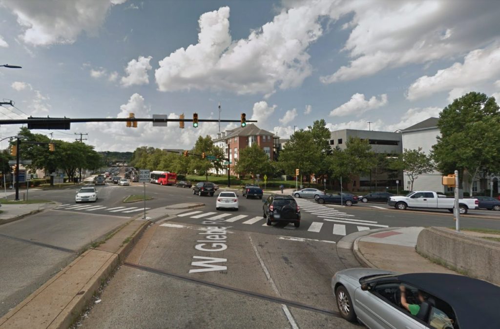
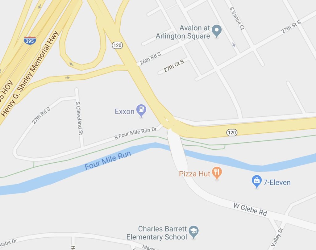
The most expensive of the projects would be cleaning up the somewhat crash-prone Glebe Road intersection for $3 million in grant funding. W. Glebe Road, S. Glebe Road and S. Four Mile Run Drive all feed into the same intersection. By adjusting the geometry and the lane configuration, the county hopes to reduce instances of crashes.

Staff also note in the proposal that adjusting traffic signal timing and turn movements on S. Four Mile Run Drive could alleviate congestion on northbound I-395 by reducing backups on the ramp to S. Glebe Road.

The grant requests also include a series of transit improvements. The report notes that motorists frequently violate the Potomac Yard Transitway travel restrictions in Crystal City. The planned fix would add red markings to the lanes to denote the entry points to the transitway.

Other improvements include reliability upgrades for the 22F and 16Y Metrobus lines, serving Pentagon-Shirlingt0n-Fairlington and Columbia Pike-Court House-Farragut Square, respectively.

The 7Y Metrobus route would also gain additional noon-to-midnight bus service starting in December.

Also included among the grant requests is a funding request for $211,962 to extend the Commuter Store operations at the Pentagon for another 12 months. The store sells transit passes and provides commuter assistance, serving approximately 1,800 customers per month according to the staff report. Current funding for operations is set to expire on March 31, 2020.

Photos via Google Maps


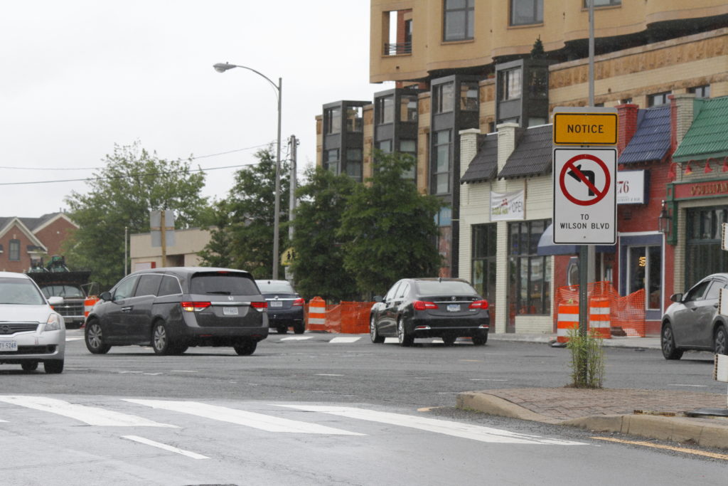
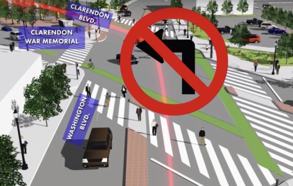
Drivers at the busy Washington and Wilson Blvd intersection are continuing to make the left turn onto Wilson, despite that action having been made illegal in March.

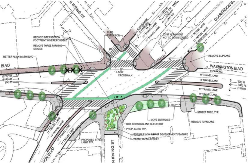
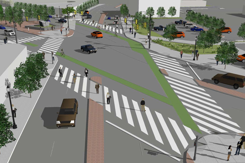
Current plans call for the tricky intersection to be overhauled and made easier to navigate for both pedestrians and drivers. That includes eliminating the left turn that has caused frequent backups.

At least two signs at the intersection indicate that left turns are not allowed, even though the street does feature a left-turn lane that serves seemingly no purpose as the road funnels into one lane at the other side of the intersection.

County transportation spokesman Eric Balliet told ARLnow that the violations are not surprising when a change is made to an intersection like that.

“It takes time to change driver behavior, especially when the change is to a long-standing travel pattern,” said Balliet. “We always start with education, finding ways to inform drivers about the change and their options. Our efforts so far included a blog post and video shared multiple times through the county’s email listservs, social media posts from our department as well as Arlington County Police, an electronic message board located near the intersection, and the new signage we’ve installed noting the restriction.”

Navigation apps Waze and Google Maps no longer direct drivers to make the turn, which Balliet said was partially the result of communication from county staff.

Balliet said he believes as construction continues on the intersection, known at Clarendon Circle, the confusion should clear up.

“The no-left-turn will become clearer to drivers as construction for the Clarendon Circle project moves forward and the street is reconfigured to remove the left turn pocket,” said Balliet.


Couple of Carbeques — Vehicle fires shut down several lanes of northbound I-395 and both lanes of N. Glebe Road near Chain Bridge during yesterday’s evening rush hour. [Twitter, Twitter]

Today: Left Turn No More — “Barring unforeseen circumstances (which we’ve seen before), this left turn from Washington Boulevard to Wilson Boulevard in Clarendon becomes history tomorrow, Wednesday, April 24.” [Twitter]

Caps Significant Others Watch Game in Clarendon — “Hey, isn’t that… the wives and girlfriends of Capitals players, gathered together at Bracket Room during Monday night’s playoffs game against the Carolina Hurricanes?” [Washington Post]

Nearby: Virginia Tech Still Picking Alexandria Site — “When Alexandria and Virginia Tech announced plans for a new Innovation Campus… the university gave every indication it would build the $1 billion project at Stonebridge Associates’ Oakville Triangle property… But the deal is not done yet — and the university has expanded its search to other sites in Alexandria.” [Washington Business Journal]

Photo courtesy Dennis Dimick


(Updated at 4 p.m.) Arlington County will soon be adding a permanent turn restriction at a busy Clarendon intersection.

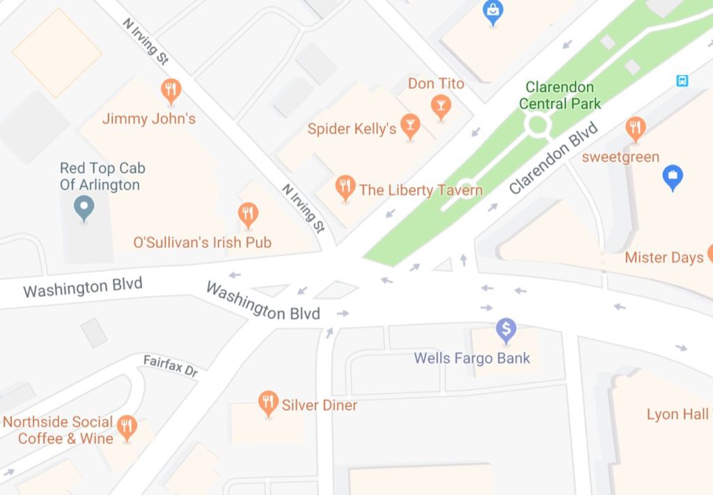
As part of the changes to the “Clarendon Circle” intersection of Clarendon, Washington and Wilson boulevards, westbound traffic on Washington Blvd will no longer be allowed to turn left onto Wilson Blvd.

The move will eliminate a tricky turn but will mean that some drivers will have to adjust their routes to get to their destinations.

The restriction is set to go into effect a bit later this month, county officials say. Other, temporary restrictions will also be put into place.

More from a press release:

In late March, the left turn from westbound Washington Boulevard to Wilson Boulevard will be permanently removed during construction to improve the Clarendon Circle intersection.

Construction will soon start on sidewalk improvements along Washington Boulevard between Clarendon Boulevard and North Hudson Street. Travel lanes on this section of Washington Boulevard will be reduced from two lanes to one and the left turn to Wilson Boulevard will be removed. Once this work is complete, the road will be restored to two through lanes but left turns to Wilson Boulevard will remain prohibited.

Drivers on westbound Washington Boulevard will have other options for reaching Wilson Boulevard. Before Clarendon Circle, drivers can turn left onto 10th Street North and then make a left to Wilson Boulevard. If they continue through the Clarendon Circle intersection, drivers can turn left onto North Kirkwood Road and then make a right onto Wilson Boulevard.

The County is redesigning the Clarendon Circle intersection and reducing its overall size to improve access and safety for people walking, biking and driving. Wider sidewalks and medians will make it safer and easier for people traveling around the intersection and shorten crossing distances.


(Updated at 12:15 p.m.) The busy “Five Points Intersection” in Cherrydale, which was just overhauled to the tune of $1.7 million, is still not very popular with some people in Cherrydale.

The neighborhood’s civic association has called a meeting with county staffers to discuss “new problems caused by the County’s reconstruction.” The association listed fifteen different issues on its website.

Construction on the project, which was the result of several years of study and discussion, wrapped up this summer, but many residents remain unhappy with the way the intersection is configured.

“Years after Cherydalers offered their input, the County went ahead with its own plans for the intersection,” the civic association’s website says. “While the project offers some improvements, on balance it seems to have created more problems than it has solved. We have asked that County staff who have decision-making authority attend our meeting, but we don’t have confirmation on who exactly from the County will be attending.”

The meeting is scheduled for Wednesday, Oct. 3, at H-B Woodlawn (4100 Vacation Lane) starting at 7:30 p.m.

In response to the complaints and meeting request, Arlington County’s Dept. of Environmental Services issued the following statement Friday.

County staff received the list of concerns from the Cherrydale Civic Association, and held an on-site meeting with them on Sept. 17. As with any right-of-way project, we intend to conduct an after-action engineering analysis upon project completion to determine whether the design of the intersection is performing as envisioned during the planning process. This analysis involves site observations and collecting traffic data, and we optimize and make tweaks as needed based on those observations. This process will take up to three months.

We will continue to work with the Civic Association. We will need to have the analysis underway in order to make recommendations on all comments for how to move forward.

The full list of 15 community concerns is below.

1. Eastbound traffic on Old Dominion during morning rush hours backs up much more substantially than it ever used to, with the back-up extending beyond Glebe Road. We are requesting that the County prioritize its signal re-timing program for this stretch of Lee Highway/Old Dominion to alleviate this back-up.

2. The County’s signal programming decisions concerning the left turn signals for cars turning left from westbound Lee Highway onto either Quincy Street or Old LeeHighway is confusing and problematic. The left arrow signal turns red after only 7- or 8- seconds after turning green, causing cars to come to a full stop. The left arrow signal then quickly resumes as a blinking yellow left arrow for another 9- or 10-seconds, but drivers must contend with oncoming traffic from Old Lee Highway. This signaling program dramatically reduces the flow of left-turning traffic and causes cars to back-up on westbound Lee Highway, especially during the afternoon rush hours. We are requesting that the County revisit this signal timing.

3. The new left turn patterns for cars turning left from Military Road onto Lee Highway and from Quincy Street onto Old Dominion is also reducing traffic flow through the intersection. The new pattern allows far fewer left-turning cars to clear the intersection before the light turns red, and also causes a queue of left-turning cars that have already entered the intersection from Military Road to remain in the intersection after the left arrow for westbound cars on Lee Highway turns green, further reducing the number of cars that can turn left from westbound Lee Highway onto either Quincy Street or Old Lee Highway. This also poses a hazard to pedestrians in the new crosswalk on Lee Highway. We are requesting that the County restore the long-standing left-turn pattern for Quincy Street and Military Road and place signs to so indicate.

4. The signal visors on the traffic lights for westbound cars proceeding from westbound Lee Highway to Old Dominion are so restrictive that westbound cars cannot even clearly see the signals. This is causing confusion and reducing the flow of westbound traffic through the intersection.

5. Collectively, these signal problems make for angry drivers who tend to speed through the intersection after the signals have changed, which is extremely dangerous for pedestrians and cyclists.

6. The new pedestrian crosswalk on the east side of the intersection near Browns Honda and Northside Vet is very hard to see for drivers turning left from Military Road onto eastbound Lee Highway and is behind the stop line for westbound Lee Highway. Drivers caught in the short left-turn signal from westbound Lee Highway tend to block the cross walk, and other westbound cars also block the crosswalk. We are requesting that the County modify many aspects of the intersection to make the crosswalk safe, including the left-turn system for cars coming from Military Road.

7. The pedestrian signal across Military Road automatically comes on almost 20 seconds after the light of westbound cars on Lee Highway turns green and only after the signal for eastbound Old Dominion turns green. We are requesting that this be changed to follow the signal timing for westbound Lee Highway.

8. The pedestrian signal across Old Lee Highway only turns on when the light is green for Military Road and Quincy Street. We are requesting that the pedestrian signal come on after the left arrow for cars traveling westbound on Lee Highway turns red but the light is green for cars traveling eastbound on Old Dominion.

9. The pedestrian signal across Quincy Street only turns on when the light is green for Old Dominion. We are requesting that the pedestrian signal also come when the light is green for cars traveling eastbound on Old Lee Highway.

10. One of the new curb ramps for the new crosswalks come up at 90 degrees from the street. This design is challenging for people on wheels (wheelchairs, strollers, bikes, scooters, etc.) and poses an unnecessary risk of falls. We are requesting that the County reinstall the curb with sloped sides, similar to what the County recently installed at Route 50 and Henderson Streets.

11. The stop-for-pedestrians placard in the middle of the street on Military Road near the Vacation Lane crosswalk is no longer on the yellow line, and now sits at least one foot into the southbound traffic lane of Military Road. This is causing cars to swerve into the newly painted bike lanes on this part of Military Road, and presenting a serious hazard to cyclists. We are requesting that the County relocate this placard ASAP.

12. We remain disappointed that the County did not eliminate the slip lane from Military Road to Old Dominion. The slip lane seems unnecessary and is not pedestrian friendly. Cars using the slip lane are stopping in the pedestrian crosswalk before turning onto Old Dominion. We are requesting that the County now eliminate the slip lane or at least ensure that there is adequate signage to ensure that cars actually yield to pedestrians and stop blocking the crosswalk.

13. Cars and work vehicles are parking/puling over in some of the new bike lanes, especially on southbound Quincy Street south of 21stStreet. This causes bikers to reenter the traffic lane. We are requesting that the County install bollards, ensure that it has adequate no-parking signs along this stretch of Quincy Street, and actively ticket & tow violators to ensure the bike lanes are actually usable for bikers.

14. Several cars turning left from southbound Pollard Street onto eastbound Lee Highway are still coming to a full stop in front of the Cherrydale Volunteer Fire Department and waiting for the Lee Highway light to turn green. This also blocks traffic for cars proceeding north on Pollard Street onto Lee Highway. Although the County has added do-not-block intersection signs in this area, the intersection remains confusing for drivers. We are requesting that the County put the same yellow X-pattern striping in front of the Cherrydale Volunteer Fire Department that it has placed in front of County-owned Fire Station No. 3 just up the street on Old Dominion.

15. Now that the County has re-aligned the eastbound lanes in front of the Cherrydale Volunteer Fire Department and the 3800 block of Lee Highway (in front of Gaijin Ramin/Subway/Fit To Be Tan), visibility for drivers turning from Oakland Street is much improved, and the County’s/VDOT’s no parking bollards in front of Subway seem unnecessary. Those businesses have long struggled because of the lack of adequate “teaser” parking along Lee Highway, and we recently lost a much-loved business due to inadequate customer traffic. The County seems to allow parking closer to almost every other intersection. We are requesting that the County/VDOT reduce the no-parking zone to match up with other intersections.​


An overhaul of the “Five Points Intersection” in Cherrydale should be completed soon, with night work to finish pavement markings and paving scheduled from 10 p.m. to 5 a.m. starting Monday (July 30) and continuing through Thursday (Aug. 2), weather permitting.

Work got underway last September, and changes included upgrading all traffic signal equipment, adding or modifying several lanes and improving crosswalks.

The County Board awarded a contract for the revamping last April after several years of study and discussion of the intersection, which is located at Lee Highway, Old Dominion Drive, N. Quincy Street, Military Road and N. Quebec Street.

The county advises drivers to avoid the intersection during the upcoming night work.

Photo via Arlington County


Three troublesome intersections across Arlington are now set for some improvements, as part of the county’s “Neighborhood Complete Streets” program.

The county revealed yesterday (Wednesday) that it has chosen a trio of intersections for “pilot projects” of the program, which is designed to fund a whole host of local road projects in areas plagued by frequent accidents. In the coming months, workers will start construction at:

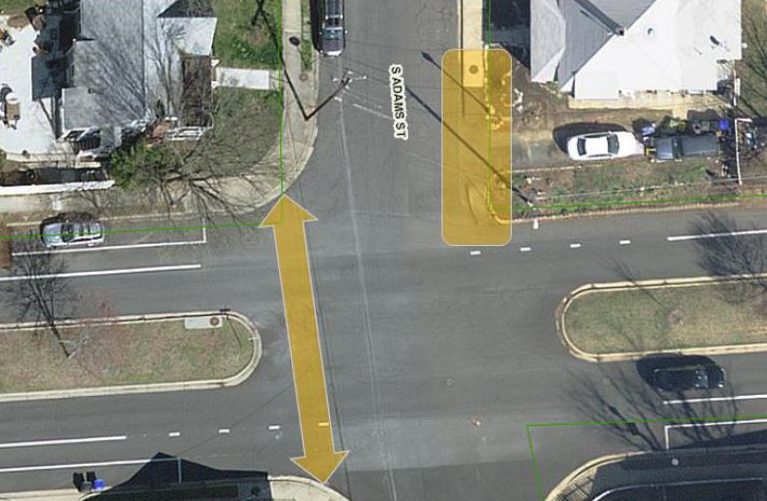
  • 6th Street S. at S. Adams Street in Penrose
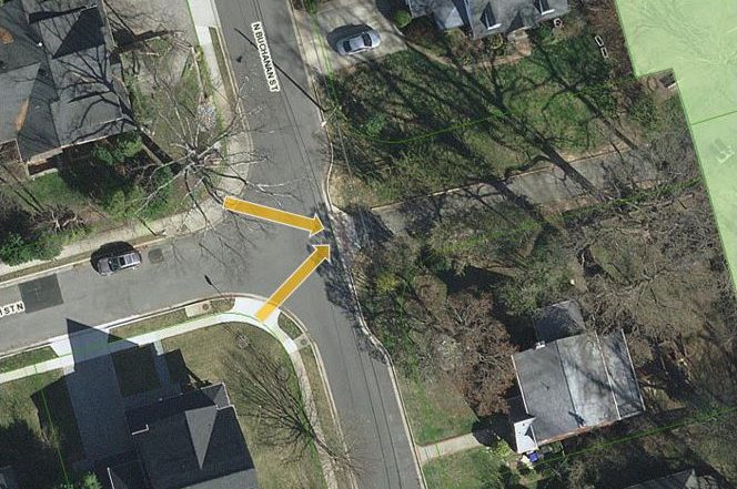
  • N. Buchanan Street at 13th Street N. and 14th Street N. in Waycroft-Woodlawn
  • 6th Street N. at N. Edison Street and N. Emerson Street in Bluemont

At 6th Street S., officials chose the intersection due to its “extremely wide pedestrian crossing,” according to the county’s website.

“Though there is a center median, it doesn’t provide a refuge for pedestrians crossing 6th Street South, which is both a bicycle and transit route,” staff wrote.

Similarly, county staff note that the “intersection of 6th Street N. and N. Emerson Street has a sharp bend that leads to the intersection of 6th Street N. and N. Edison Street, which is extremely wide.”

“The large width of this neighborhood intersection makes it easy for cars to travel quickly through this area, even while turning, and makes for a longer pedestrian crossing,” staff wrote.

Finally, the county is aiming for improvements at N. Buchanan Street in order to make it easier for pedestrians and cyclists to gain access to nearby Woodlawn Park.

Officials have yet to decide on the exact details of the construction at these intersections, and will hold a series of public meetings to collect community input:

  • 6th Street S.: Trinity Episcopal Church Children’s Center, Tuesday (June 19) at 7:30 p.m.
  • N. Buchanan Street: Entrance of Woodlawn Park at N. Buchanan Street and 14th Street N., June 23 from 9:30 to 11:30 am and June 25 from 8:30 to 10:30 am.
  • 6th Street N.: Arlington Traditional School, June 27 at 7:30 p.m.

The county is planning to add “tactical/interim improvements” at each intersection this fall, as it works on more extensive plans.

Arlington officials picked these three projects after asking for public submissions of tricky intersections around the county and reviewed 169 potential projects in all. The county is currently studying all of those intersections, and will eventually score and rank each one for potential funding going forward.

However, transportation officials warn that the county’s recent budget squeeze has forced staff to trim funding for the program a bit, though they have not eliminated it entirely.


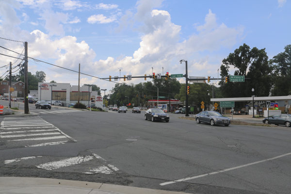
Drivers, bicyclists and pedestrians alike should start seeing changes soon to the busy and confusing “Five Points Intersection” in Cherrydale.

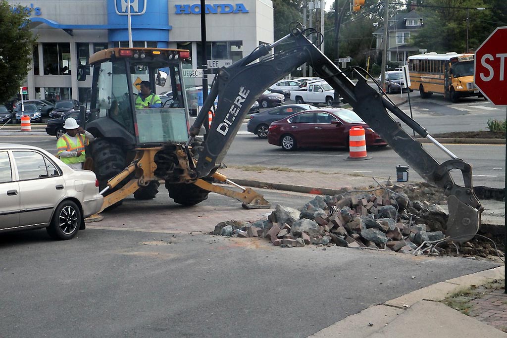
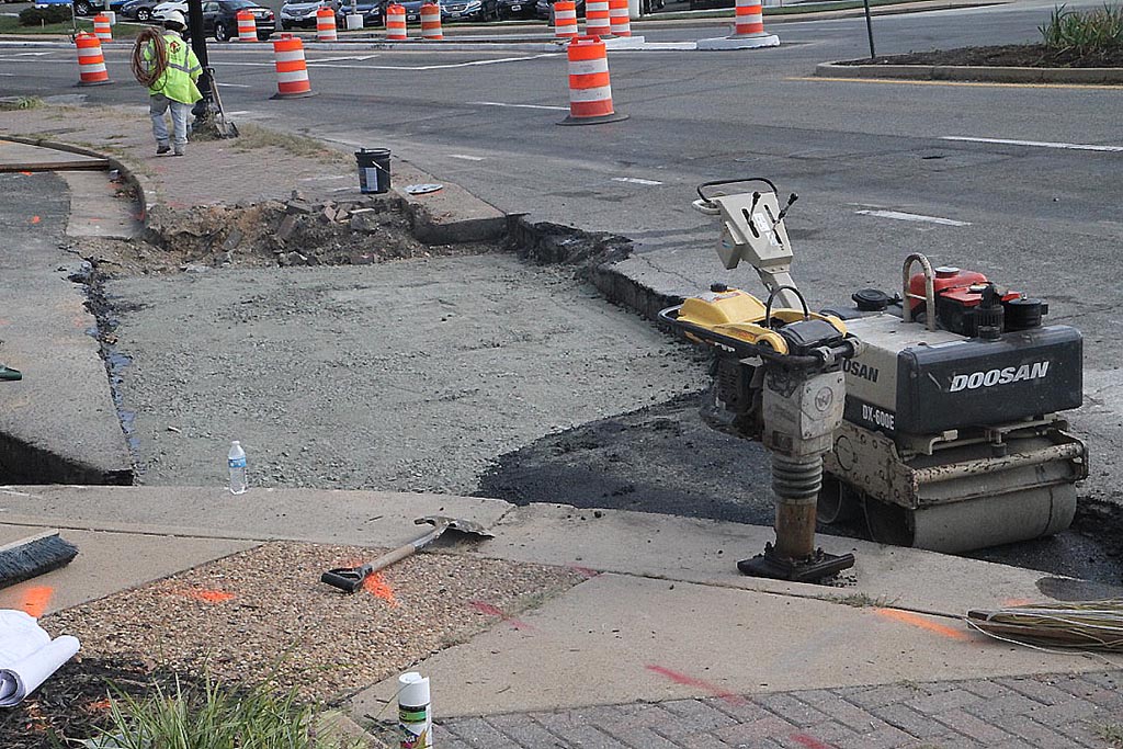
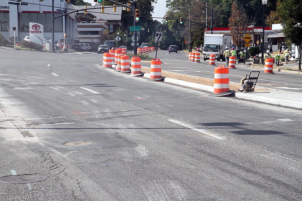
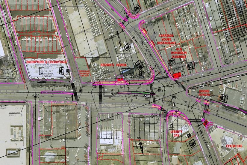
Crews are currently digging up areas of the intersection of Lee Highway, Military Road, Old Dominion Drive, N. Quincy Street and N. Quebec Street.

They will upgrade traffic signals, add bike lanes, improve crosswalks and transit stops, widen sidewalks and add new ADA-accessible curb ramps. The intersection also will get new concrete curbs and gutters, sidewalks, driveways, asphalt pavement and street lighting.

Already, several medians around the intersection have been widened, while work is underway to dig up the corner of Lee Highway and Military Road.

During construction, those in the area can expect the following work hours and construction impacts, per a county press release:

  • Work hours will be 9:30 a.m. to 3:30 p.m. Monday through Thursday, and 9:30 a.m. to 2 p.m. Friday (9 a.m. to 4 p.m. Monday through Friday in the project area along N. Quincy Street).
  • Construction crews typically will close one travel lane adjacent to the work area with drums/cones while maintaining one lane of traffic in each direction.
  • All businesses located within the project area will remain open.
  • Sidewalk detours and temporary crosswalks will be used to maintain pedestrian access throughout the project area.
  • Several bus stops will be temporarily relocated during construction. Notices will be posted in advance on bus stop flags, and will say where temporary bus stops will be located.

“Improving this busy intersection at the Lee Highway/Old Dominion Drive and N. Quincy Street/Military Road — a major transportation crossing for pedestrians, bikers, transit users and motorists — is part of the County’s larger effort to make the Cherrydale neighborhood safer and more accessible for all modes of travel,” said the county’s Director of Transportation Dennis Leach in a statement.

The work is expected to be completed next summer. County staff spent several years studying ways to improve safety for pedestrians and help simplify some dangerously complicated traffic patterns.


View More Stories