Arlington County will be setting aside $1.6 million for improvement projects on national parkland in the crosshairs of a future pedestrian bridge between Crystal City and National Airport.

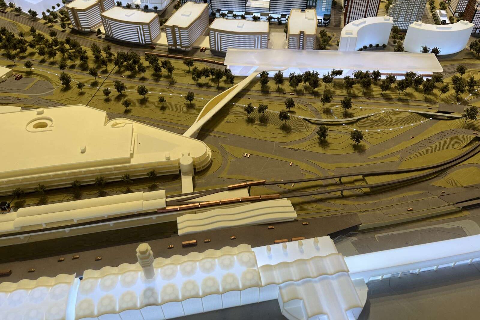
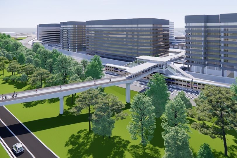
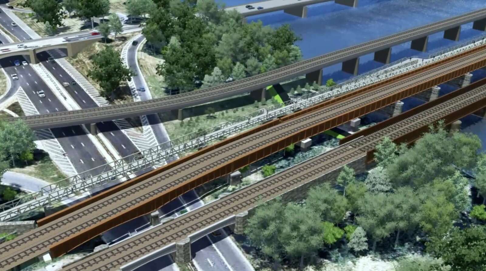
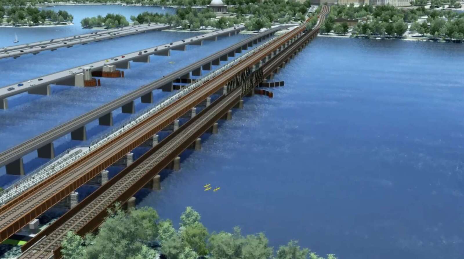
The long-discussed bridge, dubbed CC2DCA, is about to clear a major milestone: completion of a federally mandated review of its adverse impacts to the environment and historic properties.

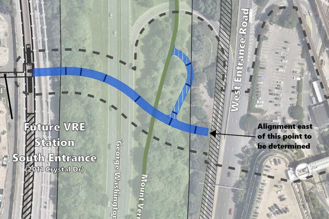
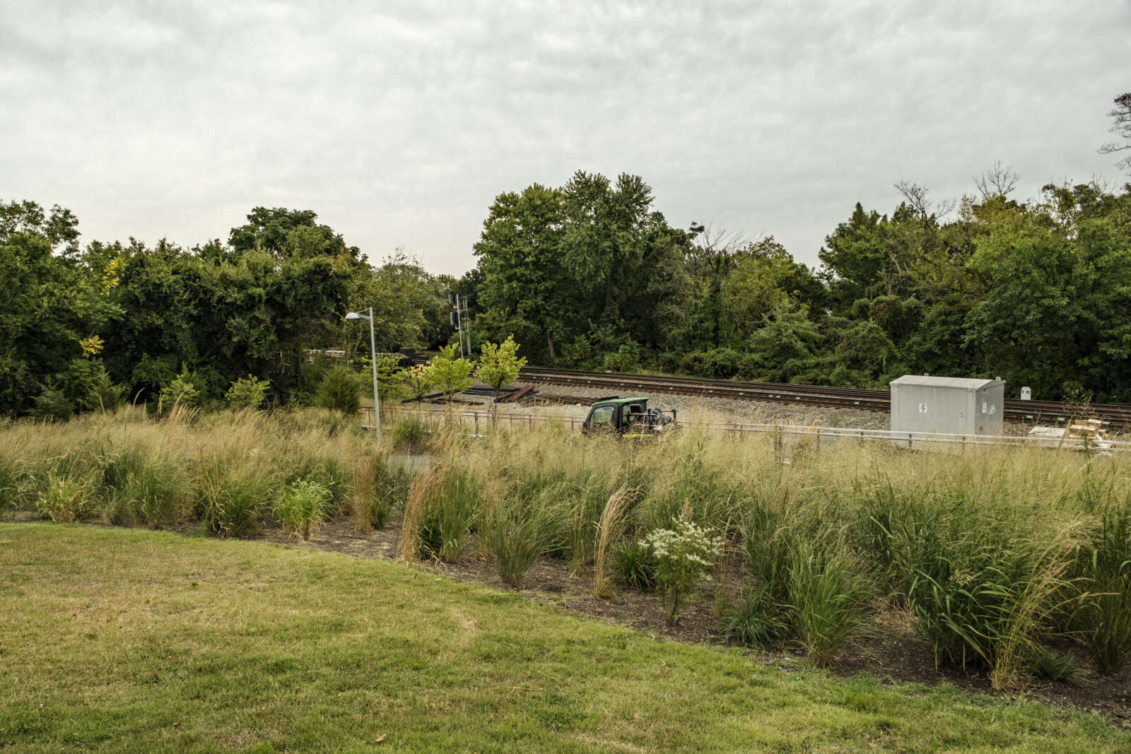
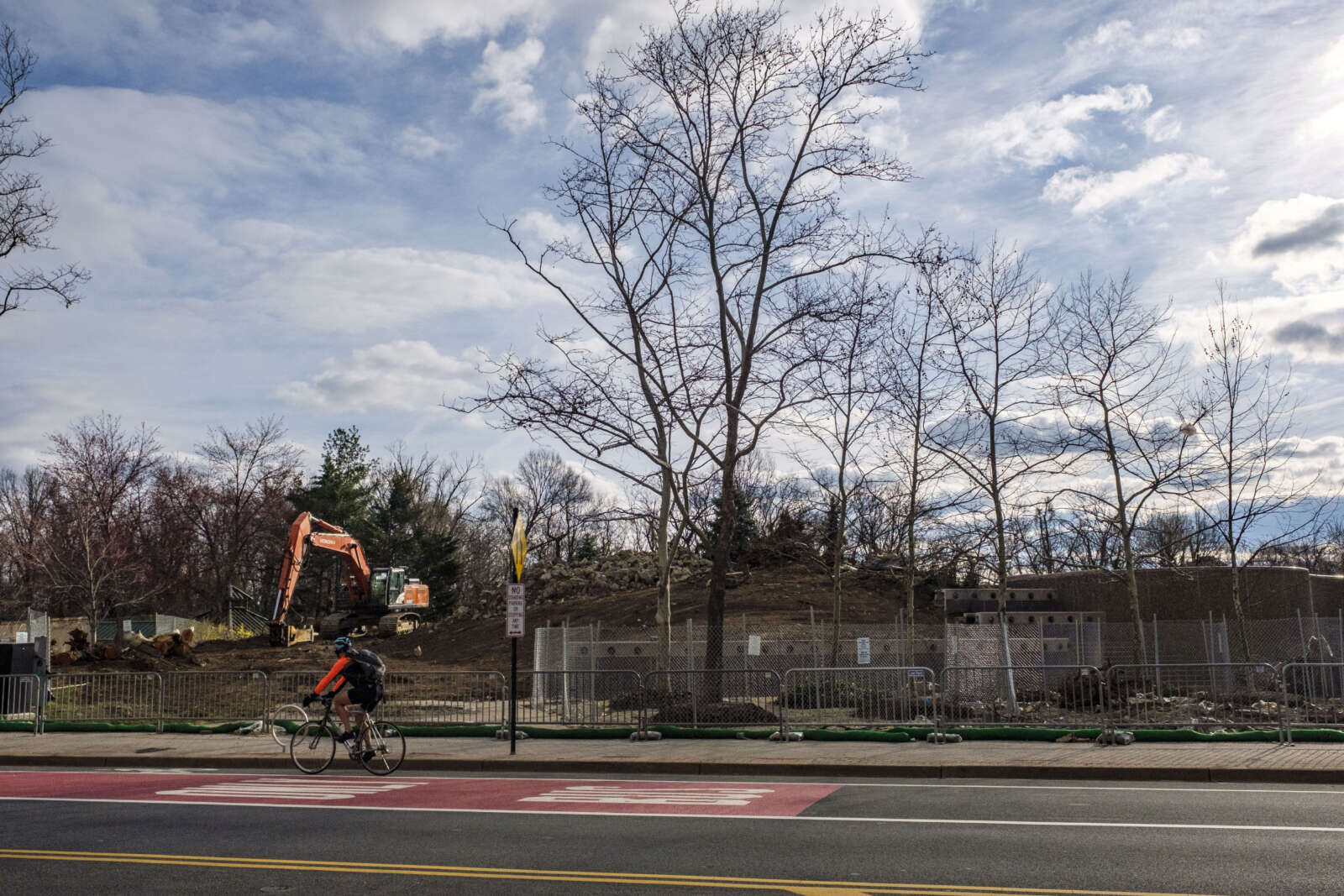
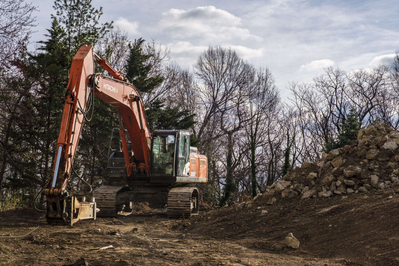
While environmental effects were deemed minimal, several National Park Service-controlled historic resources were flagged for impacts, according to a county report, including the George Washington Memorial Parkway and the Mount Vernon Trail.

The parks service and the county have settled on three improvement projects to mitigate this predicted impact. Once a design contract for the project is awarded, the county will transfer money to NPS for the work. Funding will come from the Crystal City Tax Increment Financing fund, which pays for infrastructure improvements that revitalize Crystal City, Pentagon City and Potomac Yard.

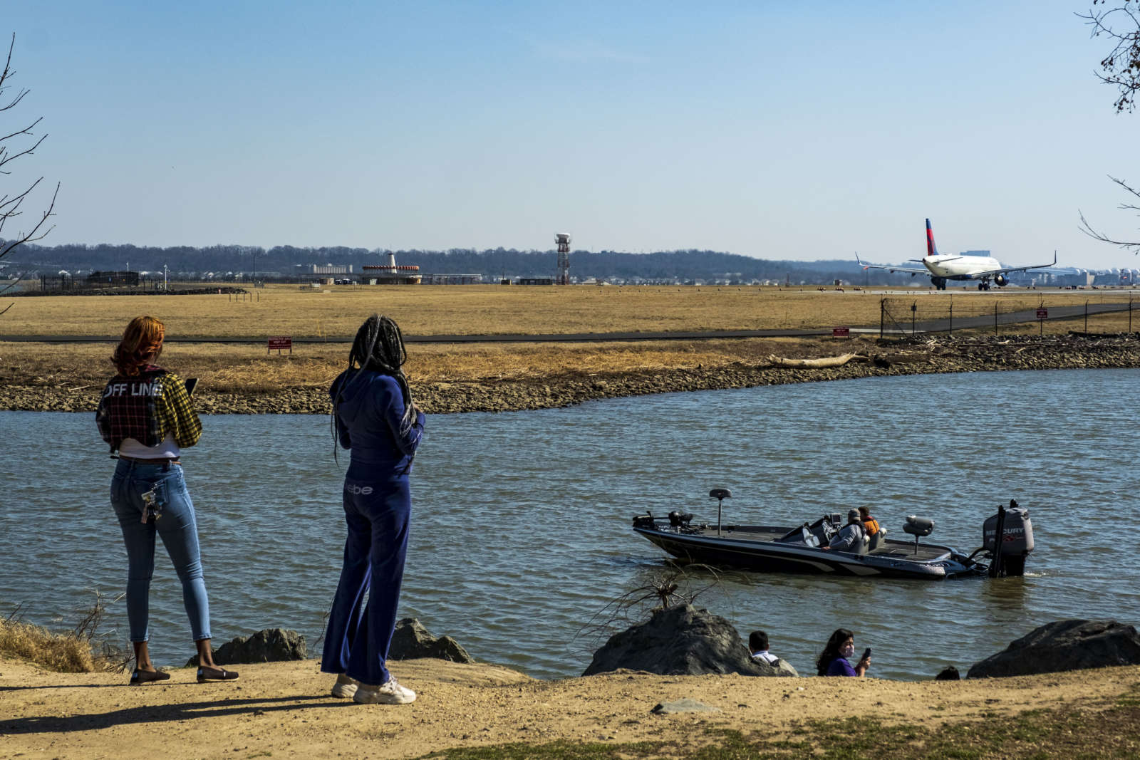
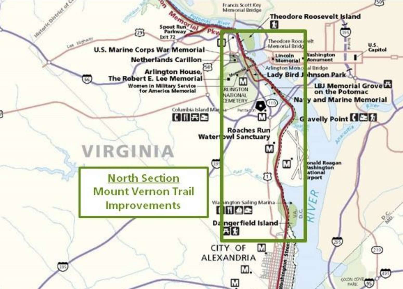
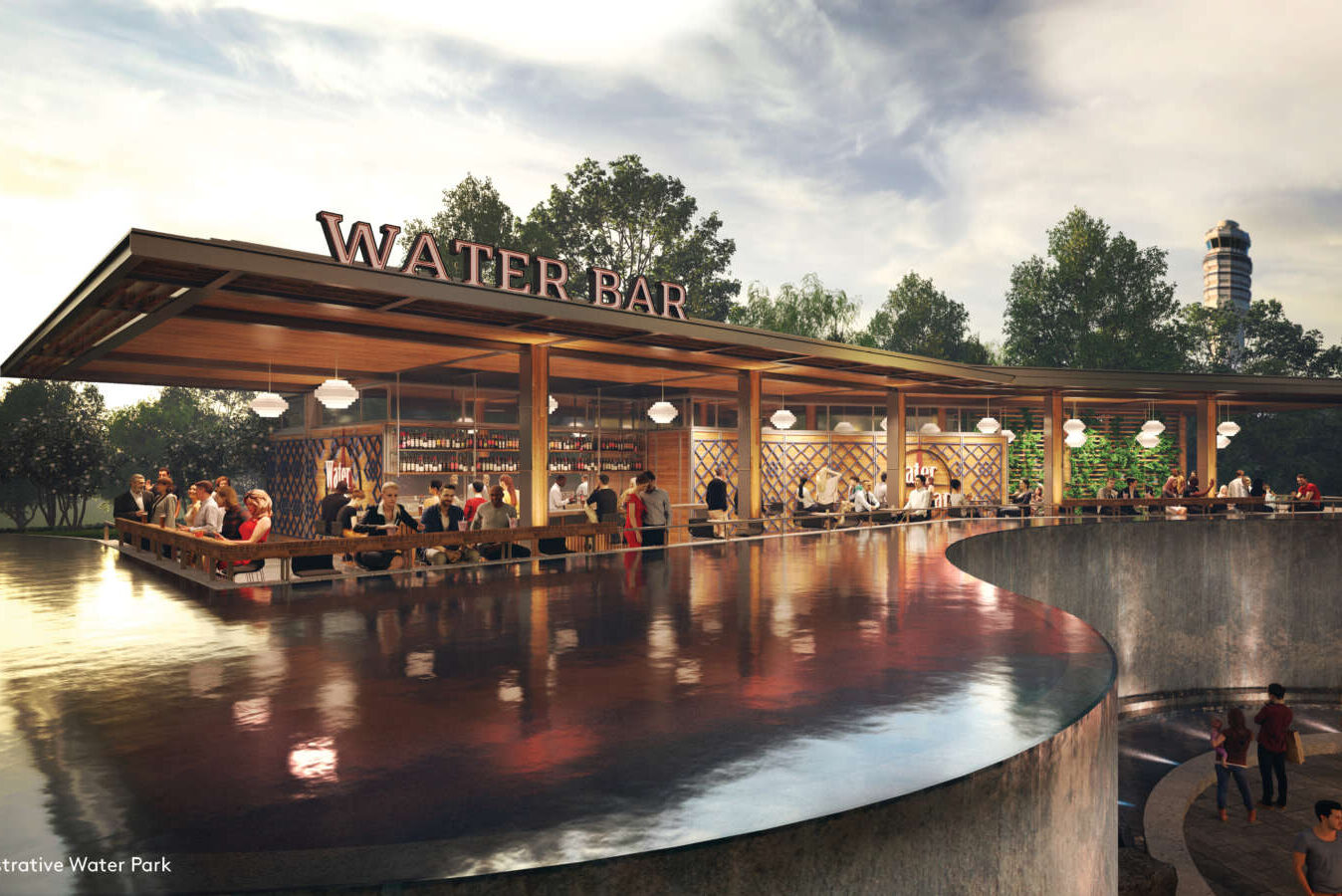
The biggest chunk, $1 million, will go toward planning and implementing improvements at Gravelly Point, as this public area could see more users traveling to and from the CC2DCA bridge via the Mount Vernon Trail.

The site could see a new parking lot, a rehabilitated boat launch — complete with an accessible canoe and kayak launch — relocated public restrooms and improved aesthetics of public-use areas.

“The Gravelly Point site is the closest major Mount Vernon Trail hub to the project area; the new CC2DCA bridge is less than a mile from Gravelly Point,” it continued. “The site rehabilitation will benefit trail users by improving the public amenities and repair deteriorated infrastructure that is in danger of further deterioration with the additional usage generated by CC2DCA.”

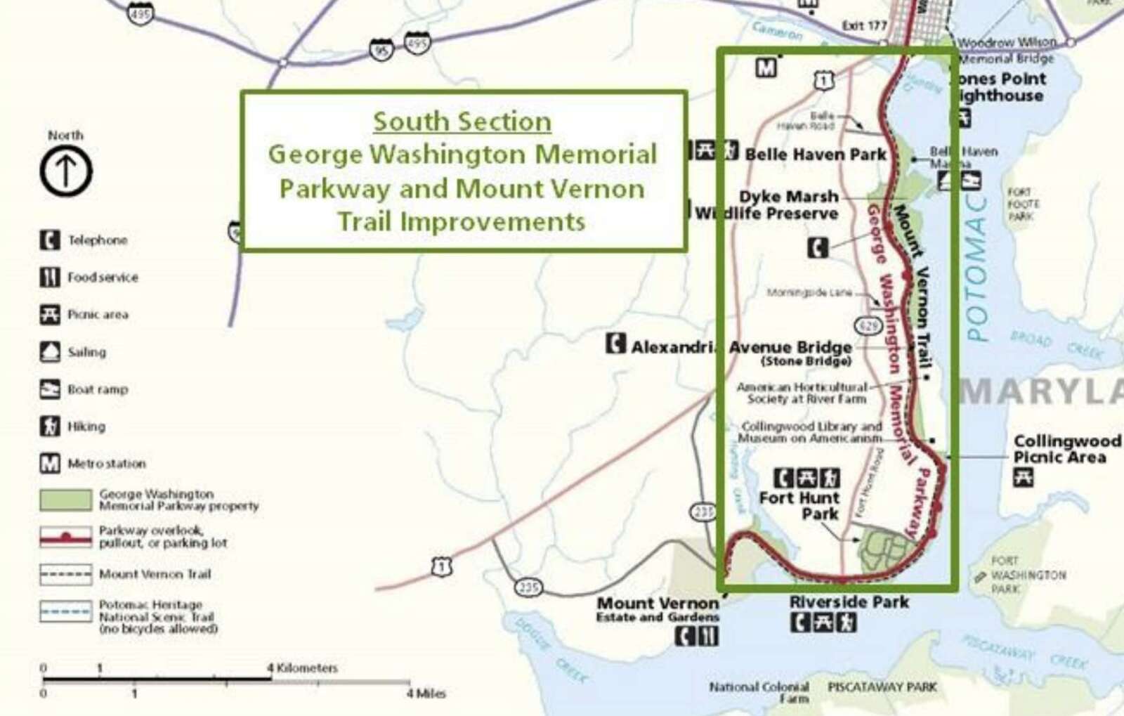
Next, $500,000 will fund maintenance activities by the Friends of the Mount Vernon Trail over five years, including edging the trail, replacing boardwalk bridge components like decking, cutting back vegetation overgrowth, grinding out asphalt root heaves and power washing scum from bridge decks.

Lastly, $150,000 to fund planning work to add interpretive signage to the GW Parkway highlighting underrepresented stories from Abingdon Plantation and Arlington House.

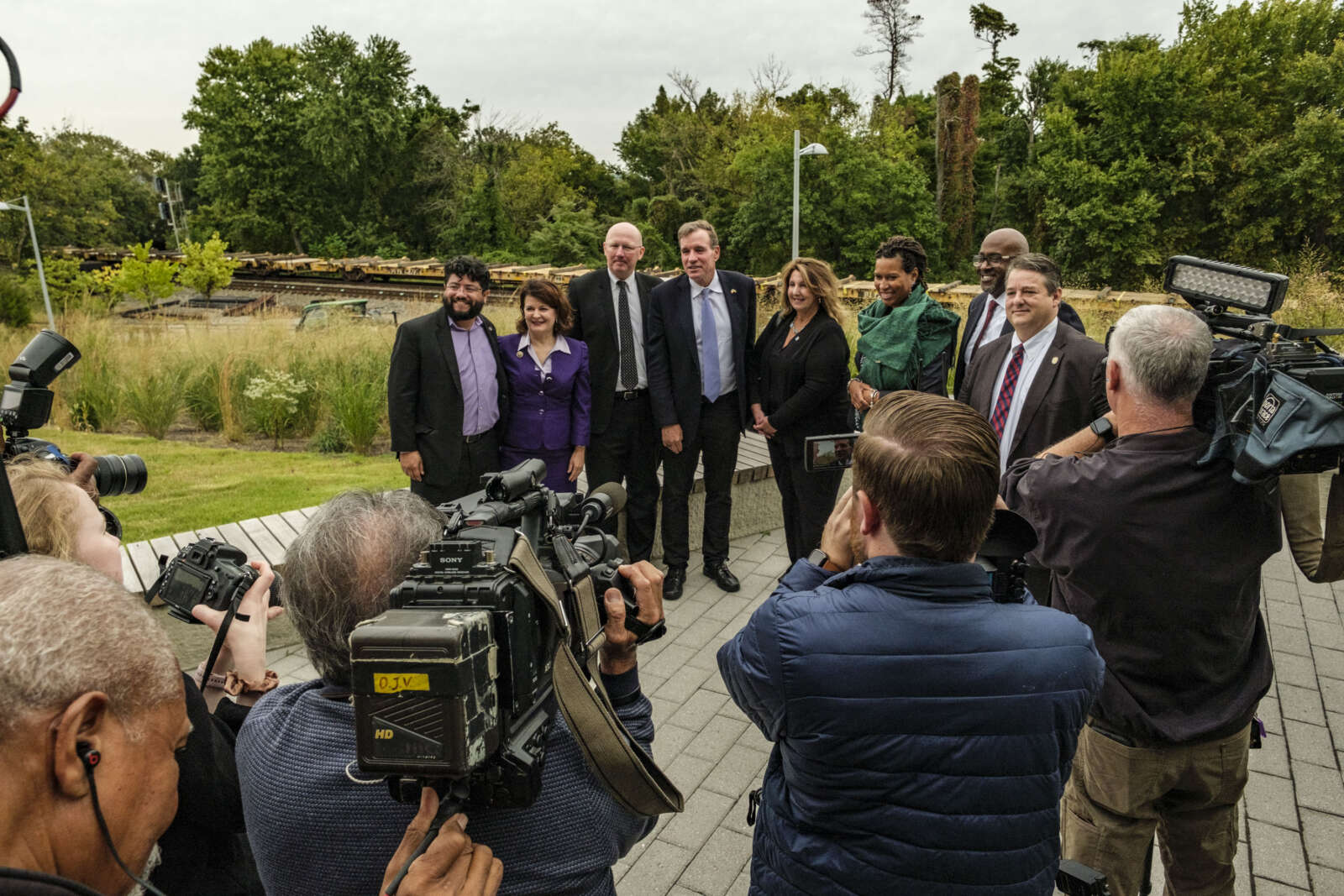
These projects are outlined in an agreement between the county and NPS, which the Arlington County Board approved during its Saturday, Dec. 16 meeting.

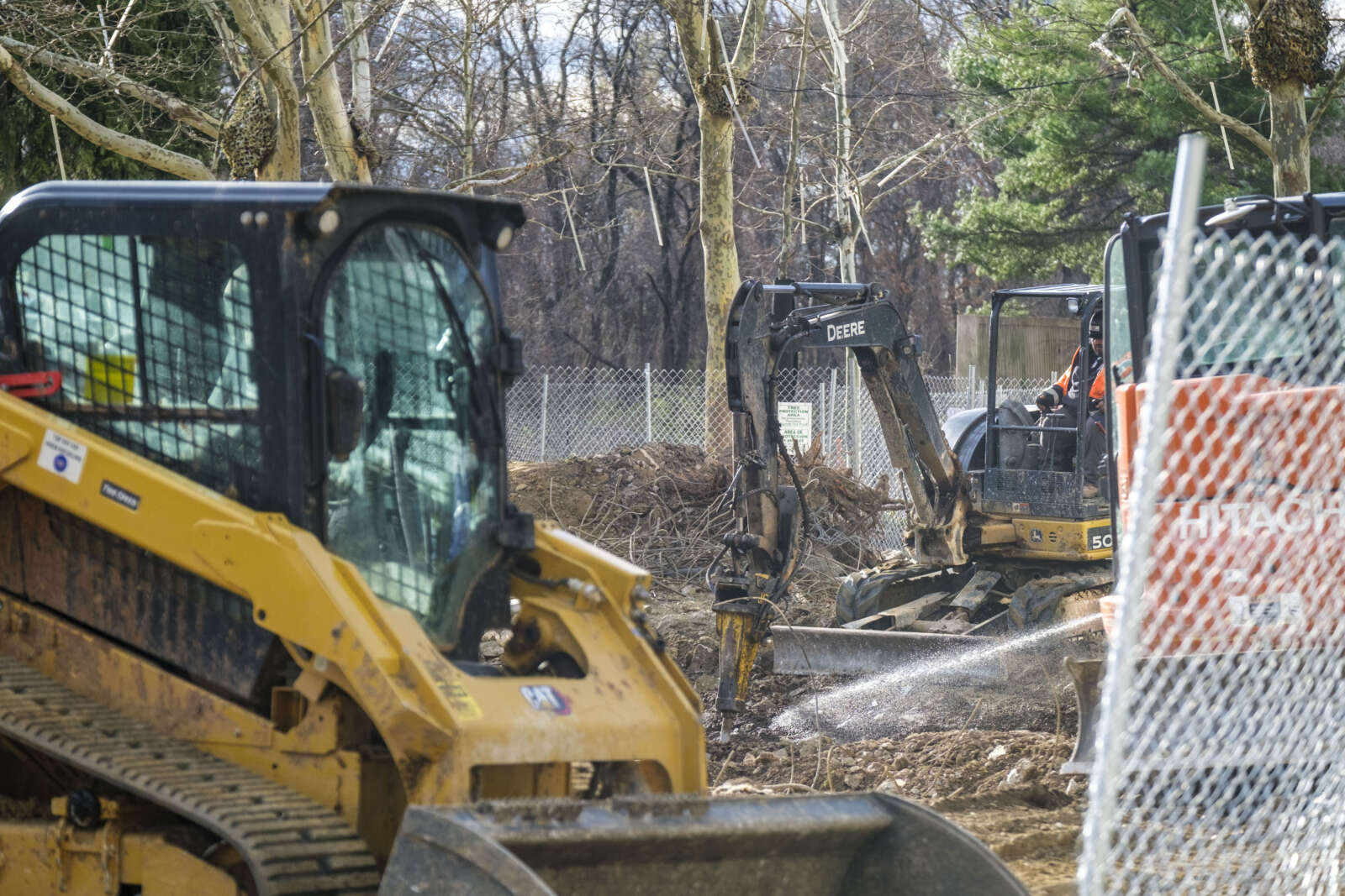
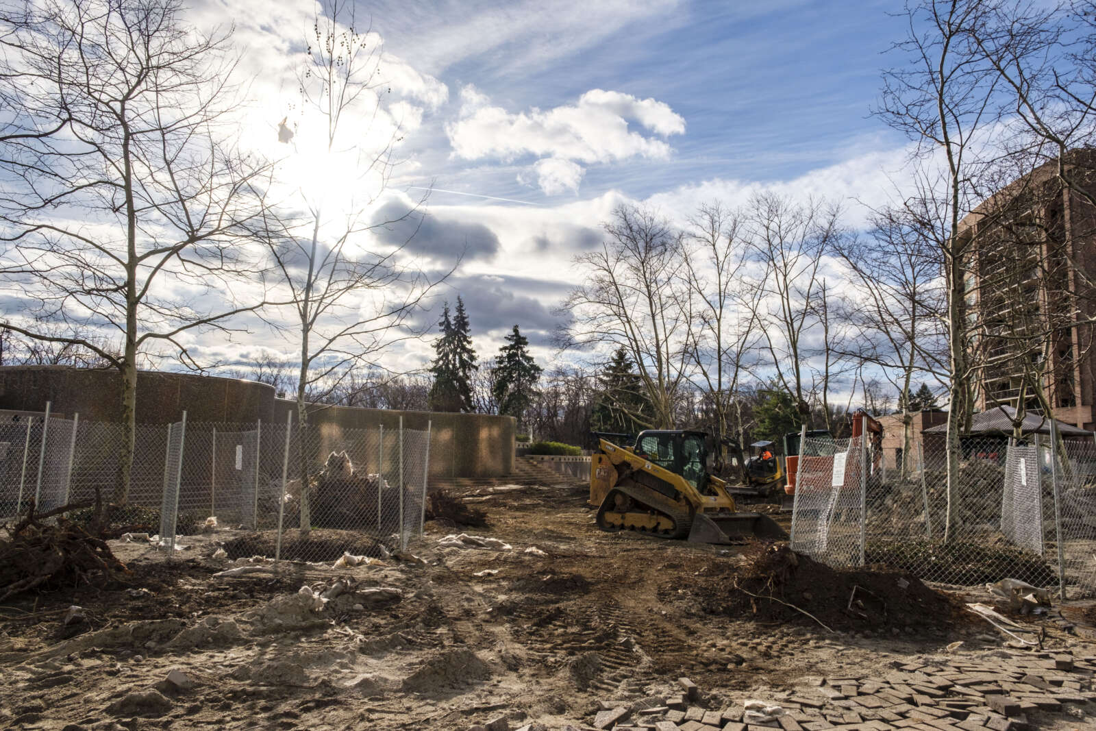
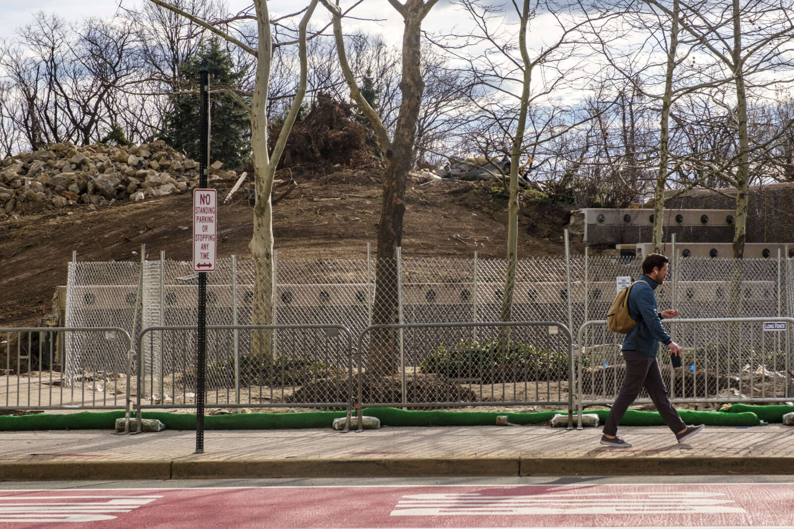
This agreement also requires the county to give NPS opportunities to review and give input as CC2DCA designs take shape and holds Arlington to executing a plan to protect and restore vegetation along the GW Parkway. The impact on scenic views for drivers, as well as vegetation removal, is expected to be relatively minimal, with about 146 trees removed.

The Board also approved an agreement with the county, NPS, the Federal Highway Administration, the Virginia Dept. of Transportation and the Virginia Historic Preservation Officer. This agreement is one of the final steps in the federally mandated environmental assessment study.

Originally proposed in 2017, CC2DCA was one of the transportation projects identified after Amazon announced plans to build its second headquarters in Arlington.

The last four years have been spent on design work, public engagement and the environmental study. Arlington and VDOT reviewed 16 possible bridge alignments and whittled them down to one that was picked earlier this year.

“Throughout the NEPA study, there has been overwhelming support for a direct multimodal connection between Crystal City and DCA,” the county report said. “During each public engagement period, the vast majority of individuals surveyed indicated they would use a CC2DCA connection if constructed.”

If CC2DCA comes to fruition, construction is expected to begin in late 2027 and last for two years, working around separate plans from the Metropolitan Washington Airports Authority to redo roadways and add more parking, new car rental facility and office space at DCA.


Arlington County is in the early stages of designing a multi-use trail facility along Long Bridge Drive.

Now through mid-October, the county is gathering input on how people currently use this corridor, which will inform designs set for public review next spring.

The trail would connect a bike network through Crystal City to the future Long Bridge Rail Project: a planned $2.3 billion bridge over the Potomac River set to double rail capacity and provide an adjacent bike and pedestrian bridge between Crystal City and the Southwest Waterfront area of D.C.

This trail, expected to cost $7.8 million, will be a better connection to the entrance of the proposed bridge, behind the Long Bridge Aquatic Center, than the existing bike lanes along Long Bridge Drive and Long Bridge Park Esplanade, according to the county.

“Preliminary planning work has identified a need for a minimum 12′-wide multi-use trail between the new bridge and Crystal City, as this route is expected to become a major multimodal commuter route between Arlington and D.C.,” per the project webpage.

“Without this project, most commuters will likely attempt to navigate the Long Bridge Park Esplanade and walking trail, which is not intended for use as a commuter cycling route,” the site continues.

Proposed Long Bridge Drive trail (via Arlington County)

The proposed trail will link to a half-mile shared-use path on Boundary Channel Drive, being built by the Virginia Dept. of Transportation, connecting the Mount Vernon Trail to the Pentagon and Long Bridge Park.

Headed toward Crystal City, the trail will connect with a planned multi-use trail at 12th Street S. and forthcoming cycle track along Army Navy Drive.

When complete, Long Bridge Drive trail will help meet demand for more active transportation connections amid current and expected growth in Crystal City and Pentagon City, the county says. These areas are seeing significant redevelopment — largely residential — in part spurred by Amazon’s second headquarters.

“A direct link from Long Bridge Park to the Mt. Vernon Trail will dramatically improve multi-modal connections both for the immediate vicinity and for links between the regional activity centers of Crystal City, Pentagon City, [the] Pentagon, Potomac Yard and the regional trail network,” it says.

The county has set aside $7.8 million in local funds designated for infrastructure improvements in Crystal City. The project was identified for funding in the adopted 2023-32 Capital Improvement Program.

Arlington County says the trail would advance its goals to improve connections to public spaces, neighborhoods, schools and transit stations and improve safety for all road users.

“Providing a multi-use trail that fully separates people walking and biking is an essential safety tool for a corridor that provides motor vehicle access to a major interstate, especially when we anticipate a significant increase in bicycle and pedestrian traffic along the corridor in the coming years,” the county says.


(Updated at 4:05 p.m.) The herculean effort to clean up from Saturday’s storms and restore power to tens of thousands is continuing Monday morning.

The GW Parkway remains closed to most traffic between Spout Run Parkway and the Beltway — and is expected to remain closed until later this week, as crews work to clear a large number of downed trees and branches.

The southbound lanes of Spout Run Parkway, where at least one car was damaged by a fallen tree Saturday, also remain closed.

From a press release issued Monday afternoon:

The George Washington Memorial Parkway is currently experiencing closures due to the aftermath of Saturday’s storm. Crews are diligently working to clear fallen trees from the roadway, and these closures are expected to last for the next few days.

To enhance and expedite the restoration process, George Washington Memorial Parkway has deployed a total of five crews, including its own team, assistance from the National Capital Parks-East (NACE), and three additional emergency contracting crews.

The North Parkway, from Spout Run Parkway to I-495, remains closed, except for the northbound lanes from Route 123 to I-495. Additionally, the southbound lanes of the Spout Run Parkway are also closed.

These closures are necessary to ensure the removal of hazardous trees, including those that have fallen across the roadway and broken limbs that pose a risk to travel lanes. The recovery work is estimated to be completed within three to four days.

Round-the-clock power restoration work whittled down the peak of more than 34,000 without electricity in Arlington — half that of the 2012 derecho — to 3,154 as of 11:15 a.m. Monday, according to Dominion’s website.

The remaining small outages are scattered throughout the county, though most are concentrated in north-central Arlington — between Route 50 and Langston Blvd — including the Orange Line corridor, which was particularly hard hit.

Throughout Northern Virginia, 4,732 Dominion customers remained in the dark this morning, according to the power company. Crews have been working long shifts and overnight to restore power, with much of that effort happening in Arlington.

As of 4 p.m., the outages were down to 2,029 in Arlington and 2,338 throughout Northern Virginia.

More storm stories are emerging as the cleanup continues.

In Courthouse, a heavy metal table was blown off a condo patio during the storm’s intense winds and is now stuck high in a tree, above a sidewalk.

“The tree is right across the street from the entrance of the Palatine apartment building,” a tipster told ARLnow on Sunday. By Monday morning, however, the table had been removed by a tree maintenance crew, the tipster said.

Trees came down throughout Arlington, taking down utility lines, blocking roads, and in at least eight known cases falling onto houses. One unlucky family was on their way to Walt Disney World in Orlando when a huge tree smashed into their stately brick house near Lacey Woods Park, we’re told.

For those on the go, it’s not just drivers who have to deal with fallen trees and other debris. A trail cleanup is planned for 5:30 p.m. today on the Mount Vernon Trail near Rosslyn, which “got hit particularly hard,” according to a social media post.

Additionally, numerous trees are reported to be down on the Custis Trail and at least one park is closed due to storm damage.

“Rocky Run Park is closed for maintenance due to damages caused by the July 29 storms,” said Arlington’s Dept. of Parks and Recreation. “Please do not go onto the park grounds.”

Arlington National Cemetery, meanwhile, is also closed today except for funerals amid widespread tree damage at the nation’s most hallowed ground.

More storm damage photos from social media, below.


Scooting along near Arlington National Cemetery (staff photo by Jay Westcott)

The third time could be the charm for Arlington County, which is applying for federal funding to improve cycling and walking connections around Arlington National Cemetery.

On Saturday, the Arlington County Board is scheduled to review the county’s third application for funding from the Rebuilding American Infrastructure with Sustainability and Equity (RAISE) Program.

The money would partially fund the construction of a long-proposed Arlington National Cemetery (ANC) Wall Trail along Washington Blvd, which would connect Columbia Pike and the Pentagon City area with Memorial Avenue and the Arlington Memorial Bridge into D.C.

“Connectivity for bike-ped users across this part of the County is complicated by the combined barrier effects of secured federal facilities such as ANC, Joint Base Myer-Henderson Hall, and the Pentagon Reservation” and “a high-volume roadway network” comprised of Arlington Boulevard, Washington Blvd, Route 1 as it runs through Pentagon City, I-395 and the GW Parkway, the county notes in a report.

The new trail would run along the western side of Washington Blvd. An existing trail on the opposite side gets dicey near Memorial Circle for pedestrians and cyclists looking to connect to the Mt. Vernon Trail or cross into D.C.

The Federal Highway Administration is designing this multi-use trail in conjunction with the realignment of Columbia Pike. This work is being done to accommodate the 50-acre southern expansion of the ANC, which will add about 80,000 burial sites, allowing burials through the 2050s.

Arlington County has unsuccessfully applied for RAISE funding in the 2021 and 2022 fiscal years. This fiscal year, the federal program has nearly $2.3 billion to dole out “for investments in surface transportation that will have a significant local or regional impact,” per the notice of funding opportunity.

“RAISE is a cost reimbursement program and not a lump sum grant award,” the county report notes. “Previous programs have been highly competitive.”

The Arlington Memorial Trail will run west along Washington Blvd and Richmond Hwy, starting at the eastern end of a realigned Columbia Pike to Memorial Avenue, immediately adjacent to the Arlington Cemetery Metro station.

It will link up to an existing trail along the west side of Richmond Hwy, which provides a connection to the Iwo Jima Memorial, to Rosslyn and to the larger network of bicycle and pedestrian trails along the Rosslyn-Ballston corridor.

Renderings of Arlington National Cemetery expansion and Columbia Pike reconfiguration project (via National Capital Planning Commission)

The estimated cost of the Arlington Memorial Trail in the approved 10-year capital improvement plan is $25 million. If the federal government green lights the full $15 million, the county would cover the remaining $10 million through a mix of the commercial and industrial tax and funding it receives from the Northern Virginia Transportation Authority for local projects.

Projects can receive $5 million to $25 million. A single state cannot receive more than $225 million and awards must be split evenly between urban and rural areas.

Selected projects will be announced by the end of June.


The National Park Service is starting to work on plans to improve safety along the portion of the Mount Vernon Trail that winds through Arlington County.

South of the City of Alexandria, in Fairfax County, it will make similar improvements to the trail and reconstruct that portion of the GW Parkway.

The 18-mile Mount Vernon Trail runs from Mount Vernon in Fairfax County to Roosevelt Island near Rosslyn, passing by Crystal City as it parallels the GW Parkway. NPS says it is time to address deferred maintenance needs and safety along the entirety of the 18-mile Mount Vernon Trail and the southern portion of the 15.2-mile GW Parkway.

“The road and trail improvements being considered would enhance the visitor experience for drivers, pedestrians, and cyclists,” the NPS project webpage says. “Potential improvements to the road include the implementation of a road, crosswalks and intersection changes. Potential safety enhancements for the trail would include potential trail widening and intersection improvements.”

Plans to widen the trail come two years after a report was released recommending this change due to heavy use and crash risks.

“The MVT is beginning to show its age, from deteriorating pavement and bridges, to limited accessibility features, and outdated signage and striping,” the report says. “These attributes, combined with increasing usage and user behavior, contribute to risk exposure and considerable crash history.”

For instance, from 2006-10, there were 225 reported bike and pedestrian crashes on the trail.

Crash locations along the Mount Vernon Trail in Arlington (via National Park Service)

The report also found the trail has “meandering curves, timber bridges, and in some areas, dense vegetation.”

While controlled by the National Park Service, over time local volunteers have stepped up in an attempt to keep it clean and safe for users amid sparse maintenance from the park service.

NPS says it aims to provide solutions that maintain the parkway’s “scenic and historic character,” and an assessment will determine the potential environmental impact of the changes.

“The Plan is needed to help preserve the historic parkway for future generations, improve the visitor experience, reduce annual park operations and maintenance costs, and improve visitor safety,” writes GW Parkway Superintendent Charles Cuvelier in a public notice of an upcoming meeting about the project.

A virtual public meeting presenting initial plan alternatives will be held on Dec. 6 from 7-8:30 pm. There is no need to pre-register.

“Engaging with you is a critical part of our preliminary engineering and planning process,” the press release said. “Your feedback will be used to refine project designs and to support the analysis of any environmental impacts.”

The website has more information on how to join the meeting:

At the time of the meeting, click the link to join on your computer or mobile device and enter the Webinar ID (Webinar ID: 314-024-315) and your email. If you do not have Go-To-Webinar, you will be prompted to install a small file to your computer or download the app on your mobile device.

You can call into the meeting (no video) using the toll-free phone number and conference ID:

Call in number: (877) 309-2074

Phone Conference ID: 278-447-448

After the meeting, comments will be accepted from Dec. 6 through Jan. 4, 2023.

NPS last made changes to this stretch of the parkway and trail in 2012 to improve safety near the Memorial Circle and at several crossings. Changes included replacing signs, installing rumble strips, painting directional symbols and moving a crosswalk.

Although the plan’s scope only addresses the stretch of the Mount Vernon Trail through Arlington, the GW Parkway through Arlington sees its fair share of crashes.

Less than a week ago, a car drove off the GW Parkway and into the Potomac River near Columbia Island Marina and the Humpback Bridge. One occupant died and the other occupant was hospitalized.

One hotspot on the GW Parkway, near Key Bridge, frequently sees overturned vehicles during rainy weather.

The park service is currently in the midst of a major rehabilitation of the northern section of the GW Parkway that passes through Arlington and Fairfax County.


A proposed bridge for bicyclists and pedestrians between Crystal City and the Southwest Waterfront area of D.C. has received $20 million in federal funding to move forward.

When complete, the 16-foot-wide shared-use path will connect Long Bridge Park and East and West Potomac parks via the Mount Vernon Trail.

On the Virginia side, the bridge will be located behind the Long Bridge Park Aquatics & Fitness Center (333 Long Bridge Drive), which opened last year. It will eventually provide a connection to the expanded and relocated Virginia Railway Express (VRE) station set to open in 2024.

Several local elected officials, including D.C. Mayor Muriel Bowser, Arlington County Board Vice-Chair Christian Dorsey and Alexandria Vice-Mayor Amy Jackson, gathered this morning (Friday) at the aquatics center to hold an oversized $20 million check and celebrate the project, which could be completed by 2030.

“This is going to be a major gateway for Arlington that allows residents and visitors who walk, bike or roll to come to this beautiful facility and the environs around Long Bridge Park, but then be able to move on to Crystal City and National Landing and points beyond via the Mount Vernon Trail and the robust bicycle infrastructure that we are developing that will go all the way through to the City of Alexandria,” Dorsey said. “This helps meet Arlington and our region’s goals of moving more people with less automobile traffic. ”

U.S. Sen. Mark Warner (D-Va.) secured the funding from the Rebuilding American Infrastructure with Sustainability and Equity (RAISE) program, which was included in the Infrastructure Investment and Jobs Act, which Warner co-wrote.

“I am thrilled to announce this new funding for the Long Bridge Pedestrian Crossing project. This $20 million investment was made possible by the bipartisan infrastructure law I was proud to help write and will help the Virginia Passenger Rail Authority (VRPA) complete a new span across the Potomac dedicated to cyclists and pedestrians,” Warner said in a statement. “This project is a key component of the broader effort to fix a major rail chokepoint and expand commuter and passenger service over the Potomac River.”

The shared-use bridge serves as environmental mitigation for the Long Bridge Project to add a two-track rail bridge next to the existing two-track 117-year-old Long Bridge, owned by the freight railroad company CSX Transportation. Once completed, the expanded railway is projected to bring an annual $6 billion in benefits to the region by 2040, according to a press release.

“We would never even be in the running [for funding for this project] if it weren’t for the infrastructure bill,” Warner told reporters after the event. “That’s got $58 billion additional dollars for passenger rail. We intend to make sure the District and Virginia get its share and it’s our hope the passenger rail bridge would open before the end of the decade.”

The goal of the $2 billion Long Bridge Project, discussions for which began in 2010, is to alleviate rail congestion on the existing Long Bridge. Annually, up to 1.3 million Amtrak passengers and 4.5 million VRE commuters traverse the bridge, in addition to CSX freight trains, according to a project website.

Officials say that the aging bridge is heavily utilized and frequently experiences bottlenecks, and — as if to prove their point — a freight train and an Amtrak train sped by within five minutes of each other during the media event.

Meanwhile, pedestrians and cyclists looking to cross the Potomac at this point have to navigate crossings shared with vehicles and maneuver a 10-foot-wide shared-use path on the 14th Street Bridge.

The lead agency on the project will be the VPRA, which the Virginia General Assembly created in 2020 to “promote, sustain and expand the availability of passenger and commuter rail service in the Commonwealth,” said VPRA Executive Director DJ Stadtler.

While elected officials heralded the new pathway over the Potomac, pedestrians and bicyclists in attendance told ARLnow that the 16-foot bridge is still too narrow to accommodate cyclists and pedestrians alike.

Stadtler told ARLnow that VPRA’s initial 10% complete designs proposed a 14-foot bridge, but in response to feedback, is widening it to 16 feet for the 30% complete designs. The agency has “considered all options” and has determined the current proposal is an appropriate width, he added.

There will be opportunities for the public to weigh in next spring.

During the event, Dorsey joked about the bridge width.

“What did you say, a 20-foot bridge?” he said, to cheers from cyclists in attendance.

(more…)


Arlington County is applying for $15 million in federal funding to improve cycling and walking connections around Arlington National Cemetery.

The money would partially fund the construction of a long-proposed Arlington National Cemetery (ANC) Wall Trail along Washington Blvd, which would connect Columbia Pike and the Pentagon City area with Memorial Avenue and the Arlington Memorial Bridge into D.C.

The Arlington County Board is scheduled to review the application on Saturday.

“The ANC Wall Trail will provide a missing link in the County and regional non-motorized network that will complete a bicycle and pedestrian connection between all three of the County’s major development corridors,” the county says in a report.

Right now, the cemetery is an “effective barrier to demand for non-motorized travel to and across Memorial Bridge,” according to the county, as security concerns after 9/11 led the Department of Defense to prohibit travel through the burial grounds.

The trail would run along the western side of Washington Blvd from Columbia Pike to Memorial Drive. Currently, there is a trail on the other side of Washington Blvd, a highway also known as State Route 27, but it gets dicey near Memorial Circle for pedestrians and cyclists looking to access the nearby Mt. Vernon Trail or cross into D.C.

Renderings of Arlington National Cemetery expansion and Columbia Pike reconfiguration project (via National Capital Planning Commission)

The Columbia Pike interchange with Washington Blvd is set to be modified as part of the ANC Defense Access Roads Project, which will also move Columbia Pike closer to I-395, realign S. Joyce Street, build a new S. Nash Street connector road, and remove part of Southgate Road.

This work, funded by the federal government and managed by the Federal Highway Administration, will facilitate the addition of 70 acres to the southern portion of the cemetery, making room for 60,000 burial sites and space for the 9/11 Pentagon Memorial Visitor Education Center.

Road work is underway, and early next year, road users can expect to be redirected from the Pike to side streets near Pentagon City. The new burial ground could open in late 2025.

New cycling and pedestrian facilities and grading for the connection to the future ANC Wall Trail are also included in the project. Part of its scope includes designing the trail, for which Arlington County agreed to pay $500,000.

The county expects final designs to be developed over the next year or so. The overall cost of the trail is estimated at $25 million.

Once the wall trail is built, cyclists and pedestrians will be able to connect to Pentagon City via S. Joyce Street at the southern end of the ANC Wall Trail. It will allow safer bike and pedestrian travel between Pentagon City and Columbia Pike to D.C. and the Rosslyn-Ballston corridor.

North of Memorial Avenue, cyclists and pedestrians would be able to link up to the existing trail alongside Route 110, which provides a connection to the Iwo Jima Memorial, to Rosslyn, and to the larger network of bicycle and pedestrian trails along the R-B corridor, the county says.

The $15 million, if awarded, would come from the U.S. Department of Transportation’s “Rebuilding American Infrastructure with Sustainability and Equity” (RAISE) program, which has $1.5 billion earmarked to reimburse localities for surface transportation projects.

The Transportation Department caps awards at $25 million, and one state can receive no more than $225 million. Awards must be split evenly between urban and rural areas.

There is a “low likelihood of a funding award compared with other external transportation capital funding programs,” the county report notes.

Arlington applied last year and was denied funding — along with every other application from Virginia, according to the report. Staff will be meeting with federal transportation staff to understand why and plan to use that information for the new application.


Construction has started on major renovations to the Crystal City Water Park, JBG Smith announced Monday.

JBG Smith will update the existing, 1.6-acre park at 1601 Crystal Drive with new restaurant kiosks and seating areas, a full-service restaurant, new water features — including a “water wall” with a bar perched on top — and a stage.

The Arlington County Board approved plans for the park in March 2021, after deferring an earlier proposal that members predicted would lead to unsafe pedestrian and cyclist interactions.

The privately-owned park has long hosted small food and drink vendors. The new kiosks will highlight local, minority- and women-owned businesses, “local favorites” and “renowned names,” JBG Smith says.

“We are particularly excited about the Water Park kiosks, which will serve as incubator spaces where up-and-coming chefs and [restaurateurs] can experiment and grow,” JBG Smith Senior Vice President of Retail Leasing Amy Rice said in a statement.

In addition to decorative water features, the revamped park will also feature public art installations and a building with public restrooms and bike facilities near the entrance to the Mt. Vernon Trail. JBG Smith says it is working with Virginia Railway Express to build an accessible connection to the future entrance of the relocated VRE station.

The Water Park is not the only JBG-owned public space getting upgrades. Two blocks south at 2121 Crystal Drive, a lightly used private park space in front of an office building will see renovations and the construction of a 5,587-square-foot restaurant. Work on that project also started recently.

The restaurant, named Surreal, will be led by Chef Enrique Limardo and his team, which are behind Seven Reasons and Imperfecto in D.C.

JBG Smith expects to complete both the Crystal City Water Park and Surreal in 2023.

“We see these both as inviting public spaces where families will enjoy a sunny day and colleagues can gather after work for a drink, a bite to eat and live music,” said JBG Smith Executive Vice President Bryan Moll in a statement.

Visitors will be able to keep their drinks in hand as they walk these open spaces. Last year, the Virginia Alcoholic Beverage Control Authority gave the developer the go-ahead to establish a “sip and stroll” zone within the boundaries of Crystal City Water Park and the courtyard.

It will be Arlington’s third “sip and stroll” zone, after the Village at Shirlington and Westpost (formerly Pentagon Row).

These two projects, plus Amazon’s second headquarters and other redevelopment projects by JBG Smith, will triple the number of retail businesses in Crystal City, Pentagon City and Potomac Yard, dubbed National Landing, the developer says.


As seen along Fairfax Drive in Ballston (staff photo by Jay Westcott)

Board Calls Out Youngkin’s Auditor Veto — “The Arlington County Board said Wednesday that Virginia Gov. Glenn Youngkin’s veto of its police oversight bill was ‘deeply frustrating.'” [WTOP, Arlington County]

Sen. Kaine Has Long Covid — “Sen. Tim Kaine got covid-19 in the spring of 2020, and nearly two years later he still has mild symptoms.
‘I tell people it feels like all my nerves have had like five cups of coffee,’ Kaine said Wednesday of his ’24/7′ tingling sensation, just after introducing legislation intended to expand understanding of long covid.” [Washington Post]

Volunteers Clean Up Muddy Trail –From the Friends of the Mount Vernon Trail: “Before and after of the Gravelly Point mud puddle which was removed by volunteers on Saturday while edging the trail. Make a difference on the trail when you register for one of our upcoming volunteer events.” [Twitter]

It’s Thursday — Partly cloudy throughout the day. High of 53 and low of 35. Sunrise at 6:39 am and sunset at 6:05 pm. [Weather.gov]


Volunteers apply non-skid treatment to Trollheim Bridge on the Mount Vernon Trail (Photo via Friends of Mount Vernon Trail/Twitter)

The National Landing Business Improvement District and the group Friends of Mount Vernon Trail are teaming up to help maintain the heavily-used trail.

This includes financial support from the BID for supplies and equipment, and a series of Saturday clean-up events through Jan. 22.

“We are really excited to partner with the National Landing BID to achieve our common goal of making the Mount Vernon Trail a safe and pleasant doorway to National Landing,” Judd Isbell, president of the Friends of the Mount Vernon Trail, wrote in a press release. “The BID’s sponsorship of our 2022 trail improvement events is providing vital support to purchase equipment and supplies for our volunteers.”

“We’ve had over 800 volunteers so far in 2021 and there have been times where we’ve had more volunteers than tools at our events,” Isabell added.

The sponsorship will provide resources to “better connect trail users to facilities, events and businesses in National Landing,” the nonprofit organization wrote in a blog post on Friday.

The BID declined to comment on exacts in terms of resources and funding. The sponsorship deal does appear to come with some swag, however.

The BID said the partnership will further its mission of making the Crystal City, Pentagon City and Potomac Yard neighborhoods a better place.

“Our wealth of green spaces and access to regional trails like the Mount Vernon Trail which boasts uninterrupted views of the D.C. skyline and stunning nature preserves, is part of what makes National Landing such an active, vibrant community,” National Landing BID president Tracy Sayegh Gabriel said.

The clean-up events began this past Saturday and will continue every week until Jan. 22. Each event will focus on a different section of the trail. For example, on New Year’s Day, volunteers will meet on the trail near the Crystal City Connector to help prune vegetation, cut tree branches, and pick up trash. Volunteers don’t need any special training and all tools will be provided.

There will also be a day of service on Jan. 17, Martin Luther King Day, in Alexandria.

“National Landing’s green spaces and direct access to trails like Mount Vernon are an integral part of our community,” wrote a National Landing BID spokesperson to ARLnow. “The National Landing BID’s mission is to support and complement our community’s exciting transformation, and that involves working with local groups, like the Friends of Mount Vernon Trail, to preserve our natural surroundings for years to come.”

The 18-mile Mount Vernon Trail runs from Mount Vernon in Fairfax County to Roosevelt Island near Rosslyn, passing by Crystal City as it parallels the GW Parkway. The trail is controlled by the National Park Service but volunteers have stepped up to keep it clean and safe for users amid sparse maintenance from the park service.


Blue and Orange Line Changes Today — “There will be no rail service between Rosslyn and Pentagon stations due to the ongoing investigation into Tuesday’s derailment between Rosslyn and Arlington Cemetery stations. Free shuttle buses will replace trains between Rosslyn, Arlington Cemetery, and Pentagon stations. Blue Line service will operate between Franconia-Springfield and Mt. Vernon Square stations only… Orange Line service will operate between Vienna and New Carrollton stations and Silver Line service will operate between Wiehle-Reston East and Largo Town Center stations, with single tracking between Clarendon and Foggy Bottom.” [WMATA]

Suspicious Object in Pentagon Parking Lot — From the Pentagon Force Protection Agency yesterday afternoon: “At approximately 6:30 a.m., a Pentagon Force Protection Agency (PFPA) Police unit on routine patrol in South parking when they observed a suspicious object. The area was immediately cordoned off, and vehicle and pedestrian traffic was blocked from the area. PFPA Hazardous Device Unit responded and the object was rendered safely at about 6:50 a.m. The all clear was given at 7:35 a.m… There is no threat to the Pentagon and surrounding area. The incident is under further investigation.” [Twitter, Twitter]

Arlingtonian Swims Around Manhattan — “What’s that popular phrase often given as the reason climbers attempt to scale Mount Everest: ‘Because it is there.’ That’s pretty much the same explanation Andie Nelson gave, in addition to being a new challenge, for successfully completing the 28.5-mile 20 Bridges Manhattan Swim around the famous New York City island-borough on Aug. 24. It was the first time the Arlington resident attempted the swim.” [Sun Gazette]

Pair Face Drug, Robbery Charges — “800 block of S. Frederick Street. At approximately 5:43 p.m. on October 10, police were dispatched to the report of a burglary just occurred. Based upon information provided by dispatch and witnesses in the area, a lookout was broadcast and two of the three suspects were located and taken into custody without incident. The investigation determined that the three known suspects allegedly forced entry into the victim’s apartment and physically assaulted her before stealing two cell phones and fleeing the scene on foot. During a search of the two suspects incident to arrest, items consistent with drug paraphernalia were recovered.” [ACPD]

Clarendon Road Closure Today — From the Arlington Dept. of Environmental Services: “Wednesday 9am – 1pm: Temporary closure of EB Washington Blvd between N Kirkwood and Wilson Blvd for roadway infrastructure. Expect detour at Kirkwood to 10th St North, then to Wilson. WB Washington Blvd open but expect delays.” [Twitter]

Volunteer to Remove Trail Bumps — From Friends of the Mount Vernon Trail: “Tired of those bumps on the trail? Volunteer to help us fix them. Volunteer to fix the bumps near Memorial Bridge on 10/16.” [Twitter, Eventbrite]

Video Tour of Local Fire Station — From the Arlington County Fire Department: “Since COVID prevented us from opening up our fire stations to tours during fire prevention week, we hope our community enjoys this video tour of Fire Station 5 given by the members assigned there on C Shift.” [Twitter, YouTube]


View More Stories