Arlington County and the City of Alexandria are applying for a pair of grants that would bring significant changes to the Mt. Vernon Trail and a portion of King Street near Fairlington.

The county and the city are supporting each other’s grant applications to the Virginia SMART SCALE transportation funding program.

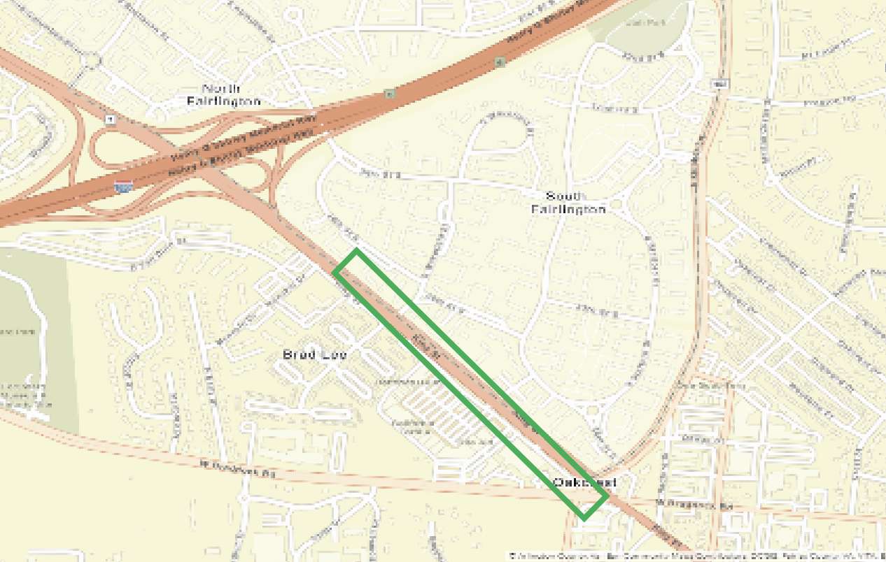
Alexandria is asking the Commonwealth for up to $40 million for what it calls the Upper King Street Multimodal Improvement project. The project “would fund design, right-of-way and construction of traffic/multimodal and streetscape improvements along King Street (VA 7) between Quaker Lane / Braddock Road and Menokin Drive,” adjacent to Arlington’s Fairlington neighborhood.

The car-oriented stretch is nonetheless a key pedestrian connection between Fairlington and the Bradlee Shopping Center. It has seen a number of significant crashes over the past few years.

“Today, there is a significant lack of multimodal facilities, contributing to safety needs along this corridor,” notes a county staff report, attached to a resolution supporting the application which will be considered by the Arlington County Board this weekend.

Also this weekend, the Board will consider its own SMART SCALE application, which asks for $20 million to widen and reconstruct 6.5 miles of the Mt. Vernon Trail between Roosevelt Island in Arlington and Jones Point Park, at the bottom of the Beltway, in Alexandria.

More from another county staff report:

This project would provide funding to the National Park Service (NPS) to improve and reconstruct approximately 6.5 miles of the Mount Vernon Trail in Arlington and Alexandria, from Roosevelt Island to near Jones Point Park. A portion of the 6.5 miles is within the District of Columbia; the SMART SCALE application is only for the portion in Virginia, with the District of Columbia portion funded separately. The National Park Service (NPS) will manage the project across all jurisdictions. The project widens the trail’s paved surface from between seven and eight feet to 11 feet where feasible, and makes other associated improvements including striping center and edge lines, signage, improved bridges, and realigned trail intersections. On June 23, 2020, the Alexandria City Council approved a resolution of support for Arlington to submit one project application for the trail portions in Virginia.

A recent National Park Service report recommended a widening of the trail due to heavy use and crash risks.

The county is also asking for $29.1 million in SMART SCALE funding to build two new street-level elevators to the Courthouse Metro station, including a replacement of the existing elevator.

The staff report, however, notes that the odds of any project being funded are relatively low.

“For this round’s pre-application cycle, 484 pre-applications were submitted for a total project cost of $7.5 billion, with nearly $3.1 billion in costs attributable to the VDOT Northern Virginia District,” county staff wrote. “Prior to the COVID-19 pandemic, approximately $700 million to $800 million in funding statewide was expected to be available for award in this round of SMART SCALE.”

“Generally, large projects that expand highway or transit capacity score well, with smaller projects scoring less well, but remaining competitive due to their comparatively lower costs,” the report adds.

Both the resolution and the application authorization are on this Saturday’s County Board agenda.


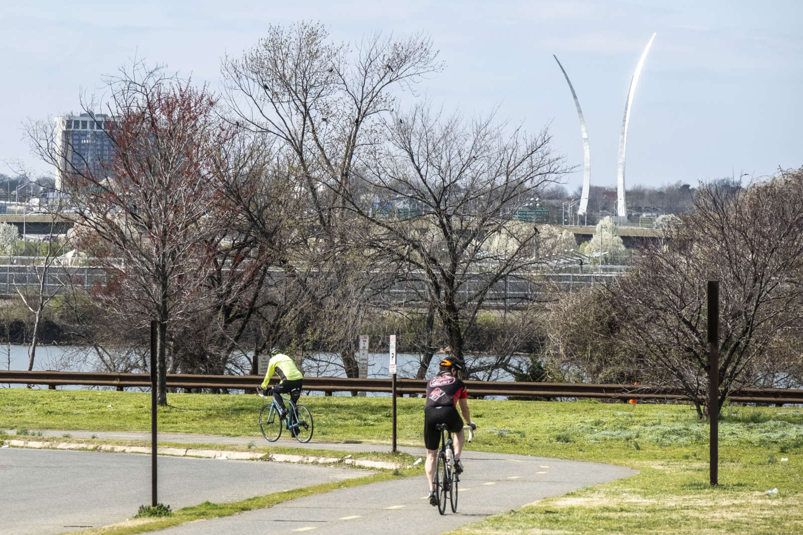
Portions of the Mount Vernon Trail in Arlington should be widened due to heavy use and crash risks, according to a new study.

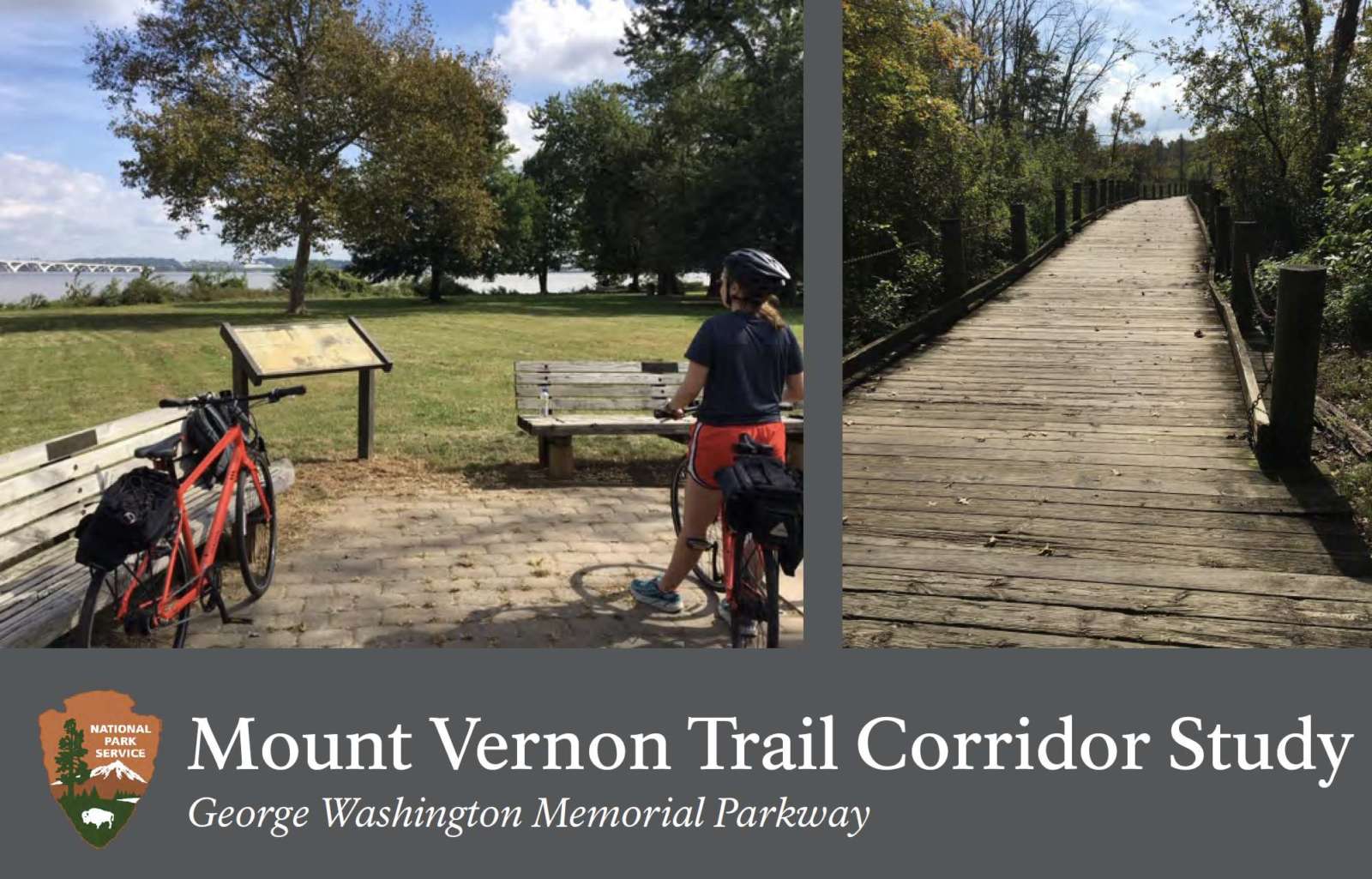
The National Park Service this month released a report on its Mount Vernon Trail Corridor Study, which examined the condition of the trail, usage patterns and potential improvements.

The trail, which runs along the Potomac from the Rosslyn area to George Washington’s Mount Vernon estate, is used by more than one millions cyclists and pedestrians per year. But its 1970s-era design no longer reflects current engineering standards and the trail’s heavy usage, the report says.

“The trail is relatively narrow by modern standards, and characterized by meandering curves, timber bridges, and in some areas, dense vegetation,” says the report. “The MVT is beginning to show its age, from deteriorating pavement and bridges, to limited accessibility features, and outdated signage and striping. These attributes, combined with increasing usage and user behavior, contribute to risk exposure and considerable crash history.”

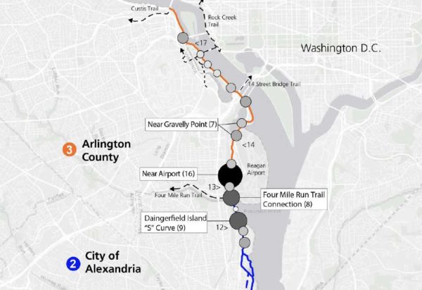
There were 225 reported bike and pedestrian crashes on the trail between 2006 and 2010, according to the study. Many of those were at crash hotspots along the trail in Arlington, including near Reagan National Airport, Gravelly Point and the 14th Street Bridge.

“Trail intersections, roadway crossings, surface transitions, and blind curves along the MVT were associated with higher crash and injury rates,” the report says. “On average, the MVT experiences one ambulance call per week related to a bicycle or pedestrian injury.”

“Collisions are more likely to involve male bicyclists (although males are typically overrepresented in the bicycling community),” the study also notes.

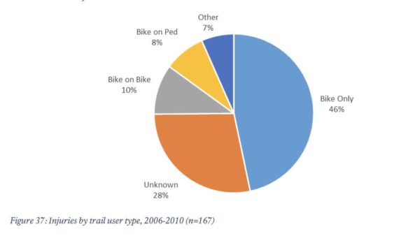
Reported crash injuries range include lacerations, bone fractures and head injuries, attributable to both single-person wrecks and collisions between trail users.

Among the near-term (1-4 year) improvements recommended in the report are new way-finding signs, increased trail maintenance, reduced-slip surfaces on bridges, and new “slow zones” at certain points on the trail.

“‘Slow zones,’ including the appropriate signage and pavement markings [could] be used at areas of high conflict among different trail users (e.g., at Arlington Memorial Bridge, Belle Haven Park, Gravelly Point, and other appropriate locations),” the report says.

The recommendations for medium-term changes — potentially 5-7 years away — are more drastic.

The study recommends that portions of the trail in Arlington be reconstructed and widened to at least 11 feet, in accordance with modern multi-use trail standards, compared to the current average 8-9 foot width. Another possibility: separating cyclists and pedestrians in high-traffic areas like Gravelly Point.

That’s in addition to improved trailheads at Crystal City and Gravelly Point, with “more bicycle parking, repair stations, and additional amenities.”

More from the report:

Widening the trail to meet this standard improves trail safety by providing appropriate width to minimize user conflict in high-traffic areas. Focus areas for widening and modernization include:

  • The portion of the trail located between Four Mile Run and the Theodore Roosevelt Island Bridge, pursuant to NEPA analysis. Some segments of trail in this area face widening constraints, but much of this high-use segment could be widened to better align with best practices and serve trail users.
  • Trail intersection enhancements, such as implementing trail roundabouts, at the 14th Street Bridge and Four Mile Run to better manage these conflict areas by slowing bicycle traffic and reducing conflict points.
  • Consider the use of bicycle-pedestrian separation at areas such as Gravelly Point, which have high levels of user conflict and pedestrian use. This could include a designated pedestrian path or increased separation and access control between the trail and adjacent site. A potential trail redesign in this location could also reduce motorist and trail user conflict at the trail intersection with the Gravelly Point parking lot.

A Mount Vernon Trail widening might not sit well with some local activists. A similar proposal, to widen portions of the W&OD Trail in Arlington and provide separate lanes for cyclists and pedestrians is facing opposition from some who have expressed environmental concerns.


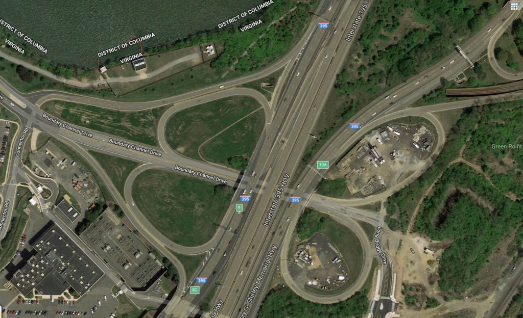
A $17.2 million overhaul of the Boundary Channel Drive interchange along I-395 is in the works.

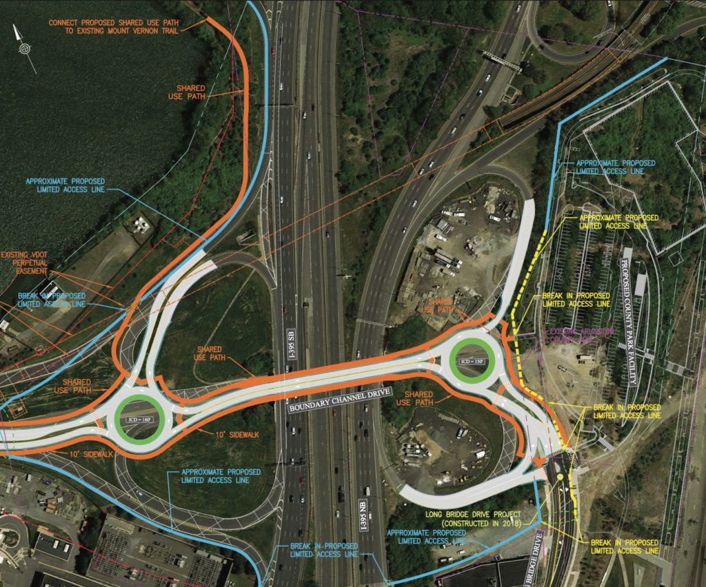
Plans call for overhauling the existing, difficult-to-navigate interchange near the Pentagon and Crystal City with two rotaries, to be installed on either side of I-395.

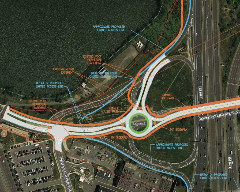
The 150 and 160-foot wide rotaries aim to merge traffic from Boundary Channel Drive and the Pentagon Access Road on the left, and the Boundary Channel and Long Bridge Drive on the right. The project would remove I-395’s two southbound loop ramp, and add a new multi-use trail, shared by cyclists and pedestrians, connecting the Mt. Vernon Trail to Long Bridge Park.

The project will be managed by the Virginia Department of Transportation (VDOT) and is expected to cost around $17 million.

The Arlington County Board will review an agreement for the project during its upcoming meeting this Saturday. As of Tuesday, the project was featured on the Board’s consent agenda, a place usually reserved for items expected to pass without debate.

Officials hope the redesign will better connect to the long awaited Long Bridge Park Aquatics Center and better serve area commuters, as staff noted in a report to the Board:

The Interchange serves the Pentagon (five million square foot office building with 25,000 employees), Pentagon City (12.7 million square feet of office, 2.3 million square feet of retail and over 13,000 residential units), Crystal City, Long Bridge Park plus its future park expansion and the future Aquatics & Fitness Center, which is expected to draw regional visitors from Maryland and the District of Columbia, as well as from the areas south and west of Arlington in Virginia. The existing interchange design is dated and will need to be redesigned to better serve the transportation needs of the existing and future land uses in the area.

The county held public meetings to showcase the designs in 2015, during which staff noted feedback “varied greatly.” The points staff said residents agreed on included:

  • There needs to be fewer ramps onto I-395
  • Rotary islands need to be designed to not allow cars to speed
  • Pedestrian crossings need to be designed to reduce conflicts with cars and bicycles

County staff also noted that plan for the trail meets goals set by the newly-upgraded bike element of the Arlington County Master Transportation Plan to make it easier for cyclists and pedestrians to use the Mt. Vernon Trail.

“The Mount Vernon Trail connection is an extremely critical part of the project and will create a much-needed link between Long Bridge Park and the trail,” the staff report said.

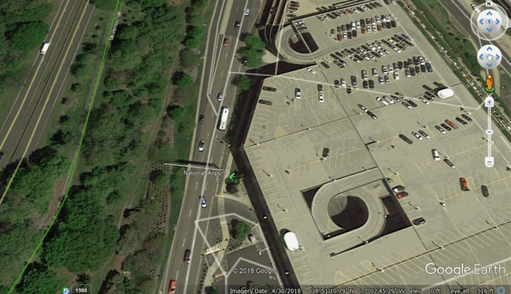
Image 3 via Google Maps


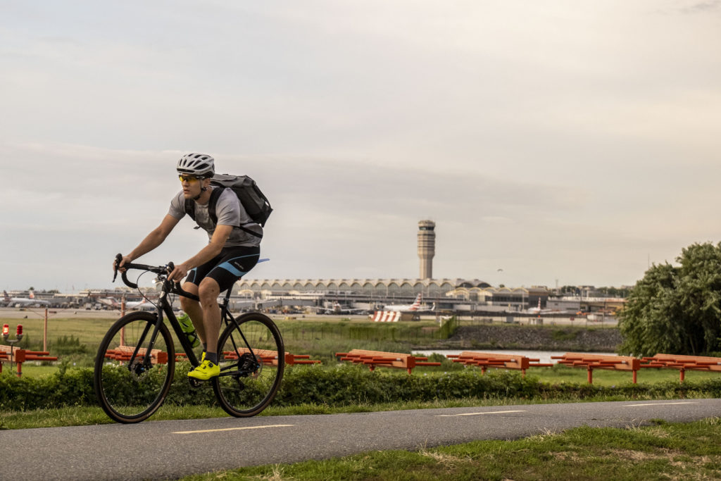
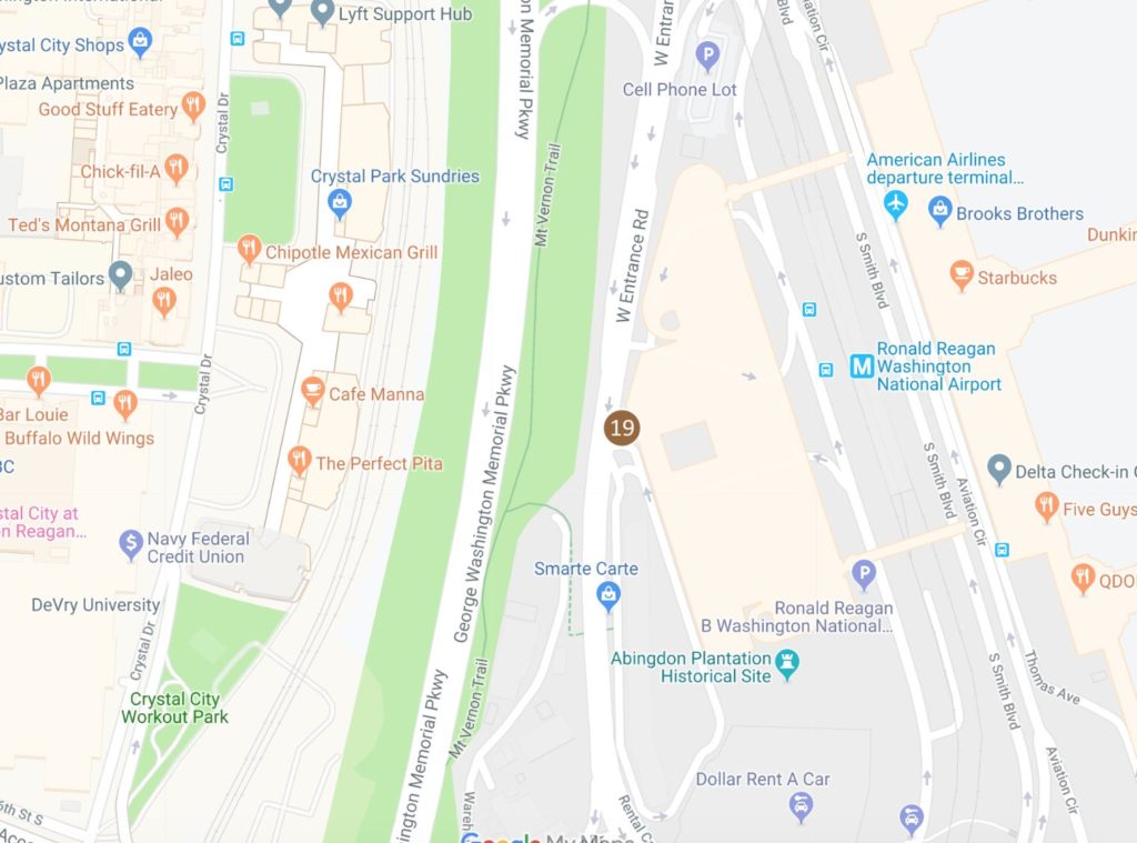
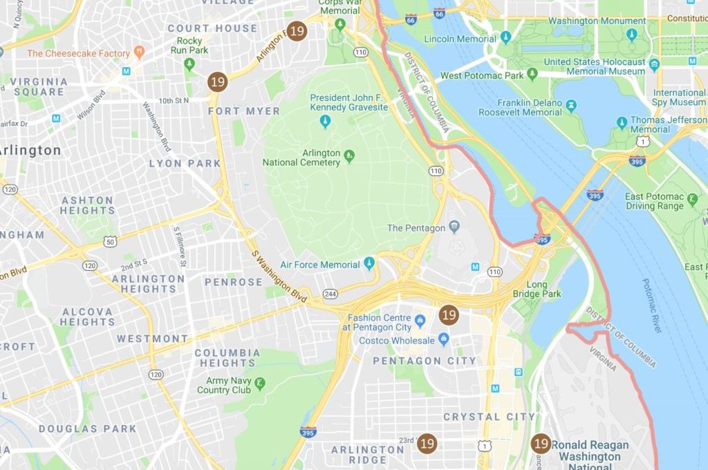
A new Capital Bikeshare station is slated to arrive at Reagan National Airport sometime next year, officials say.

County and airport officials say they’ve agreed on a site adjacent to a parking garage, near Terminal B, for the Bikeshare station. The plan is now awaiting final approval from the Virginia Department of Transportation (VDOT).

Officials scouted the location for its proximity to the Mt. Vernon Trail, which they hope will make connecting to the airport easier for cyclists.

“I know it’s been on the books since 2014 when I joined BikeArlington,” said Henry Dunbar, who heads the organization in charge of local Capital Bikeshare stations. “So it’s always been on the back burner, but we’re now really committed to it.”

Dunbar said Arlington is currently home to 92 Capital Bikeshare stations. The new station is part of Bike Arlington’s plan to add six more stations countywide, as well as a few dozen new bikes.

Funding for all the new stations comes from a 2014 grant from the Federal Highway Administration’s Federal Lands Access Program. Dunbar says VDOT needs to approve the final equipment purchases this year, which he hopes will allow construction to begin in 2020.

“The approvals for this project’s award are being worked through this month,” said VDOT spokeswoman Jenni McCord, who added that the state agency is working with eh county to ensure that the station complies with federal standards like environmental requirements.

The project already has the greenlight from the airport itself.

“We have been pursuing the establishment of a bike facility for quite some time,” said MWAA spokesman Robert Yingling. “The only thing left to do is establish an agreement on how the site is constructed.”

The airport has several racks for people to park privately-owned bikes. But some racks are currently inaccessible due to the on-going construction replacing the dreaded 35X gate and adding a new security screening area.

It’s not clear how many people would use the future Bikeshare station. Yingling pointed out many travelers have luggage which wouldn’t fit on a bike. But Dunbar is optimistic that light-packing travelers will want take advantage of a cheap commute that avoids the area’s frequent traffic headaches.

“There are also thousands of people who go to the airport every day who work there,” he said.

Yingling added that, “for most airports it’s not practical to have a bicycle station on campus.” But he noted DCA is special: the Arlington airport is located in an urban area, with connections to nearby trails.

“As far as I know, it’s the first one for a U.S. airport,” said Dunbar of the upcoming station.

Map via Google Maps/Bike Arlington


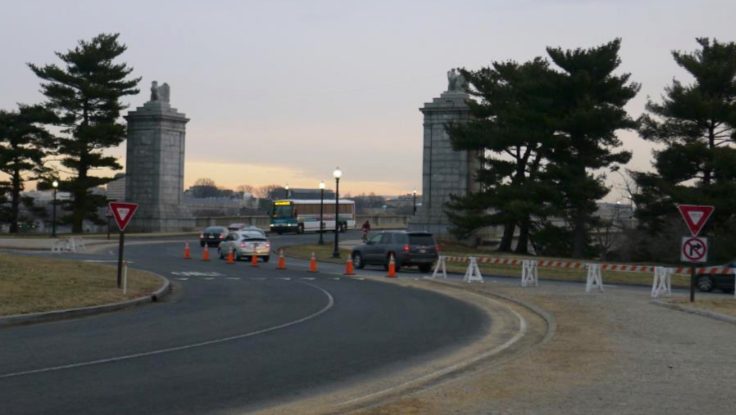
Transportation officials are proposing a host of safety improvements for Memorial Circle, a confusing confluence of roads connecting Arlington National Cemetery to the Arlington Memorial Bridge.

The circle has long been the site of all manner of dangerous crashes, particularly those involving cyclists and pedestrians looking to access the nearby Mt. Vernon Trail or cross into D.C. But the National Park Service has drawn up a series of changes for the roads in the area designed to address the issue, including traffic pattern changes to transform the circle into something more like a traditional roundabout.

“The project area is at a major convergence of regional roadways and modes that interact through a complex series of roadway merges (on-ramps), weaves, diverges (off-ramps), and intersections, resulting in traffic congestion and crashes,” NPS planners wrote in a November environmental assessment. “The proposed action would change the way area users access and circulate through the area by car, bicycle, or foot.”

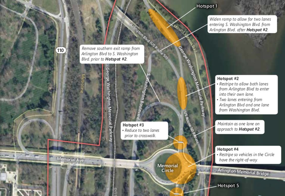
Officials estimate that the area saw approximately 600 crashes between 2006 and 2012. Lawmakers previously secured some safety improvements for the G.W. Parkway and the circle to try to address the issue. The new NPS proposal would address not only the circle itself, but also the roads approaching the area from both the north and south: S. Arlington Blvd and Washington Blvd.

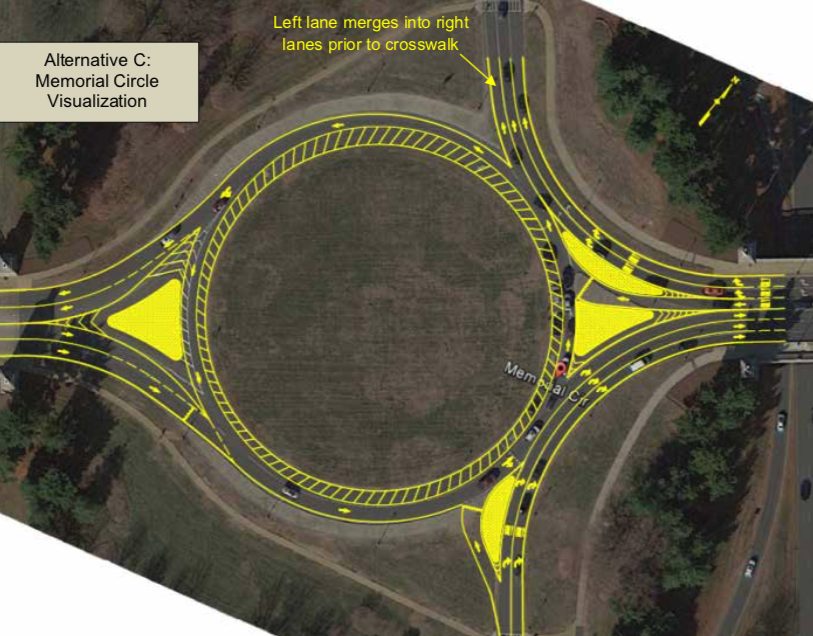
Perhaps the most substantial change park officials are proposing would be cutting back on one lane of traffic in the circle, in order to “allow the circle to function more like a modern roundabout,” the NPS wrote. That means that drivers in the circle would have the right of way, and anyone entering the circle would need to yield to them.

The NPS also plans to split up an island on the east side of the circle, near where it meets the Memorial Bridge, allowing two westbound lanes coming from the bridge to “bypass the circle and head north onto S. Arlington Boulevard” and one lane of traffic to proceed and enter the circle.

For roads north of the circle, officials are proposing some improved signage at the various intersections, including “fluorescent yellow advance pedestrian crossing warning signs” at some and “rapid flashing beacon” signs at others.

But they’re also envisioning more dramatic improvements, like reducing Washington Blvd down to one lane, and removing both the “existing southern exit ramp connecting S. Arlington Blvd and S. Washington Blvd” and “the existing far left exit lane of S. Arlington Blvd.”

As S. Arlington Blvd exits the circle, the NPS also envisions reducing the road from three lanes down to two leading up to the crosswalk. The existing far left lane leading onto a ramp to S. Washington Blvd is slated to be removed, as is the exit ramp itself.

The NPS is planning similar pedestrian sign improvements for intersections south of the circle, as well as other lane reductions.

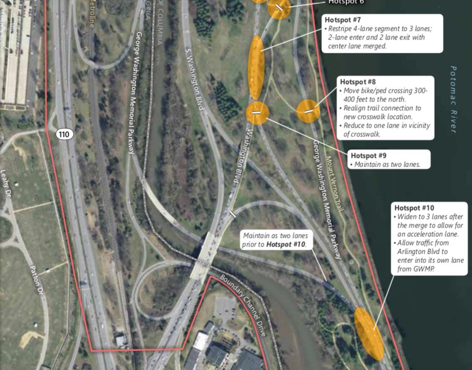
One major change would be the construction of a new concrete island where Washington Blvd enters the circle to its south, allowing two lanes of the road to bypass the circle and reach the Memorial Bridge, and one lane to enter the circle. That would require a slightly widening of the road in the area, the NPS wrote.

The plans also call for Washington Blvd to be reduced from four lanes to three south of the circle “in order to simplify merging patterns,” while the G.W. Parkway would be widened “to add an acceleration lane allowing traffic from Arlington Blvd to enter the parkway in its own dedicated lane before merging onto the two-lane parkway.”

Additionally, the NPS envisions relocating two bike and pedestrians crossings south of the circle. One, located as a trail crossing Washington Blvd, “would be relocated closer to the Circle, to allow pedestrians and bicyclists to cross where vehicle speeds are slower and where drivers are anticipating conflicts.” The other, designed to help people cross the parkway to the southeast of the circle, would be moved slightly further north of the parkway.

The NPS traffic analysis of these proposed changes suggest they’d generate “an overall improvement” in congestion on the roads, in addition to substantial safety upgrades.

People in the bicycling community are pretty skeptical of the latter assertion, however.

The NPS is accepting comments on the plans through Dec. 29.


(Updated at 2:45 p.m.) Parks officials have signed off on some big changes at Theodore Roosevelt Island, including the rehabilitation of a troublesome section of the Mt. Vernon Trail and the addition of several new landing spots for small boats and kayaks.

The National Park Service announced yesterday (Monday) that it will move ahead with a variety of construction projects on the island, located off the George Washington Memorial Parkway near Rosslyn, after settling on some final designs and certifying they’ll have minimal environmental impacts on the island.

Some of the changes will be relatively small, like the addition of some new signs and markers detailing Theodore Roosevelt’s legacy — the island is home to the lone memorial to the nation’s 26th president in D.C. Others will be more substantial, such as the total overhaul and realignment of a boardwalk-style bridge on the Mt. Vernon Trail, which runs from underneath the Roosevelt Bridge to just south of the island’s parking lot.

The park service’s plans call for a “replacement of the bridge deck and railing to provide a smoother riding surface.” That will likely come as good news to area cyclists, who have nicknamed it “the Trollheim Bridge” for its treacherous surface — TheWashCycle blog described it as a the “notoriously slippery part of the Mt. Vernon trail that has caused literally thousands of crashes” in a post last year.

The main, 1,400-foot-section of the bridge also meets an additional 90-foot section toward its north end, creating an awkward “T” intersection for cyclists. The realignment work will eliminate that intersection, creating a new left turn lane as well.

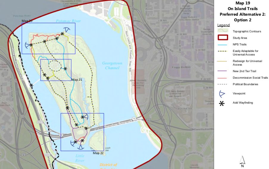
Other walking trails on the island will see some improvements under the plans as well. The NPS is hoping to improve connections between the pedestrian bridge and the island’s Memorial Plaza and create “universal access to the entire Swamp Trail, including access to the comfort station.” That small rest stop is also set to see a refresh under these plans.

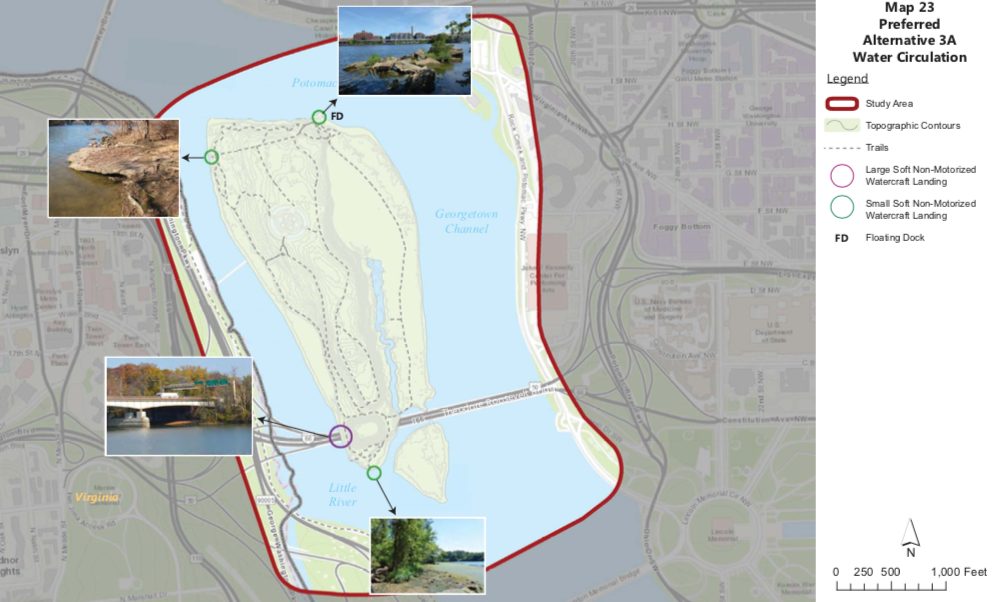
The NPS is also hoping to add a total of four landings for canoes, kayaks and row boats on the island. Each one will be about 12 feet wide, and provide “access for approximately 4-5 kayaks/canoes,” according to the park service’s documents. The plans also call for the construction of a roughly 100-foot-long “floating dock” for larger craft, to be located at the island’s northeast corner, once the home of a ferry landing.

The park service noted in an environmental analysis of these proposed changes that, currently, “boaters and kayakers anchor or beach their non-motorized watercraft on unmarked areas along the shoreline.” Officials fear that the “practice impacts natural and archeological resources and has the potential to expose boaters and kayakers to underwater hazards in shoreline areas,” reasoning that the new landings should alleviate that issue. The area could also be in line to see increased boating activity, should the NPS’ plans to build the long-anticipated Rosslyn boathouse continue to advance.

Additionally, the park service wants to add some more vegetation and trees to the largely wooded island. Some new shrubs will be designed to cover up existing “social” bike trails on the island’s north shore line; other tree plantings will replace the roughly 200 ash trees the NPS had to remove last summer due to an “emerald ash borer infestation.”

The NPS says it’s still searching for funding for the entire range of projects on the island, but some will move ahead in the near term. The Mt. Vernon Trail bridge improvements, for instance, are currently out for bid by federal officials and could be completed by sometime in 2020.


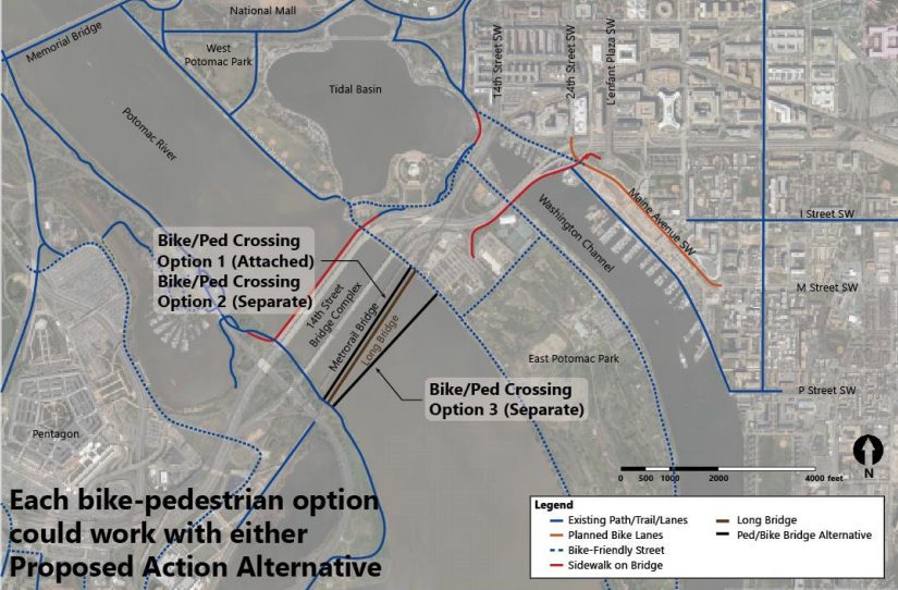
A coalition of businesses, neighborhood groups and transportation advocates are urging planners to include a bike and pedestrian trail along the long-planned replacement for the Long Bridge, a key railroad connection from Virginia into D.C.

A total of 15 organizations from Arlington, the District and the rest of the metropolitan Washington region penned a new letter last Thursday (Nov. 1) to both local and federal transportation officials working on the project, calling the inclusion of a trail alongside the bridge part of “a once in a generation opportunity to transform our regional transportation network.”

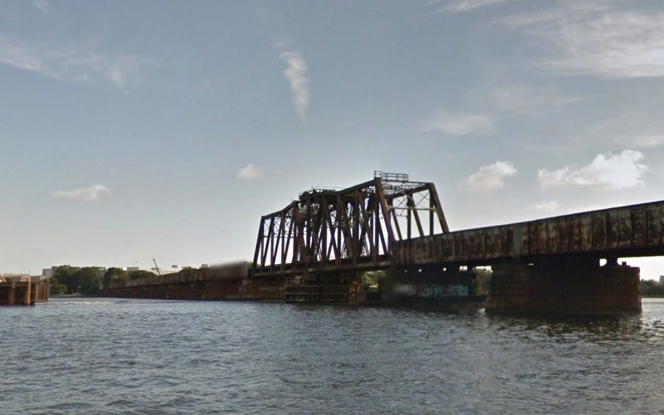
Planners are still sorting out exactly what the new bridge might look like. The original structure, which runs from near the Pentagon in Arlington to Southwest D.C., was built back in 1904, and officials from around the region have viewed replacing it as a necessary step for improving freight and passenger rail service between D.C. and Northern Virginia.

However, the prospect of including a trail alongside the new Long Bridge was not formally included in the various assessments of potential designs of the project. Accordingly, the group penning the letter sought to emphasize the benefits such a trail could have for the region’s commuters, and its economy.

The organizations — which include the Crystal City Civic Association, Friends of Long Bridge Park, the Washington Area Bicyclist Association, and Greater Greater Washington — stressed that any new trail crossing the Potomac River would provide “crucial links to several important regional trails.” The current crossing along the 14th Street Bridge does not offer a connection to the regional trail network on the D.C. side. of the bridge, and the friends group supporting the Mt. Vernon Trail co-signed the letter.

The groups also stressed that such a trail would spur economic development “by linking two key activity nodes in Southwest D.C. and Crystal City.” That goes doubly so if officials also follow the groups’ recommendation that the trail “connect to the esplanade in Long Bridge Park” and “extend as far towards L’Enfant Plaza as physically possible” on the D.C. side.

Perhaps most importantly, the letter urges that the trail “be funded and constructed concurrently with the rail component of the Long Bridge project,” and that it “should be incorporated into the design of the broader project in a way that optimizes the achievability of the project with regard to cost and complexity.”

In a draft of an environmental impact statement prepared in late June, federal and local planners stress that any trail is “not part of the purpose and need” of the project. Even still, they agreed to include the study of four potential trail crossings in more detailed studies of the project to be completed over the coming months.

Planners have so far narrowed potential designs of the bridge replacement down to two options; both involve building a new, two-track bridge alongside the existing structure, but one alternative calls for the current bridge to stay in place and the other would involve fully replacing it.

Two of the trail designs call for building the crossing alongside the new bridge. Two others call for building the trail along its own, independent bridge: one proposal envisions it being upstream of the new two-track bridge, another would be downstream.

The transit advocates at Greater Greater Washington have expressed doubts about these proposals in the past, arguing that the designs “do the bare minimum” and represent a missed opportunity for planners. However, officials did agree to examine trail crossings over the Long Bridge Park side of the G.W. Parkway, “with an evaluation of connections to the Mount Vernon Trail and Ohio Drive S.W.,” two features that were previously championed by Greater Greater Washington.

Even still, there remains no guarantee that the trail will indeed be included in the project — the June report notes that Virginia rail officials noted “noted that the primary focus of the project is increasing rail capacity, and expressed significant concerns regarding safety and constructability of any combined-mode structure.”

Planners are still a long ways off from finalizing designs, however. The first step is settling on a single “preferred alternative” to examine in more detail, which planners hope to do within the next two months.

Officials then hope to have engineering and environmental analyses drawn up by summer 2019, and the project still needs additional funding. Virginia officials and the rail company CSX, which owns the bridge, have committed to chip in a total of $30 million for the effort, though there’s no telling just how much the bridge replacement might ultimately cost.


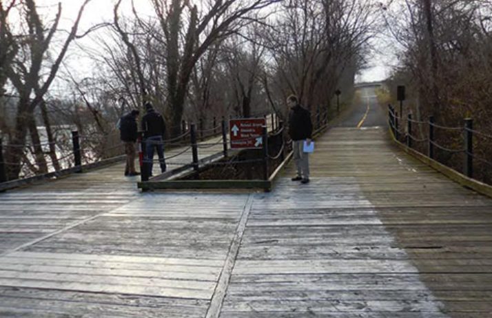
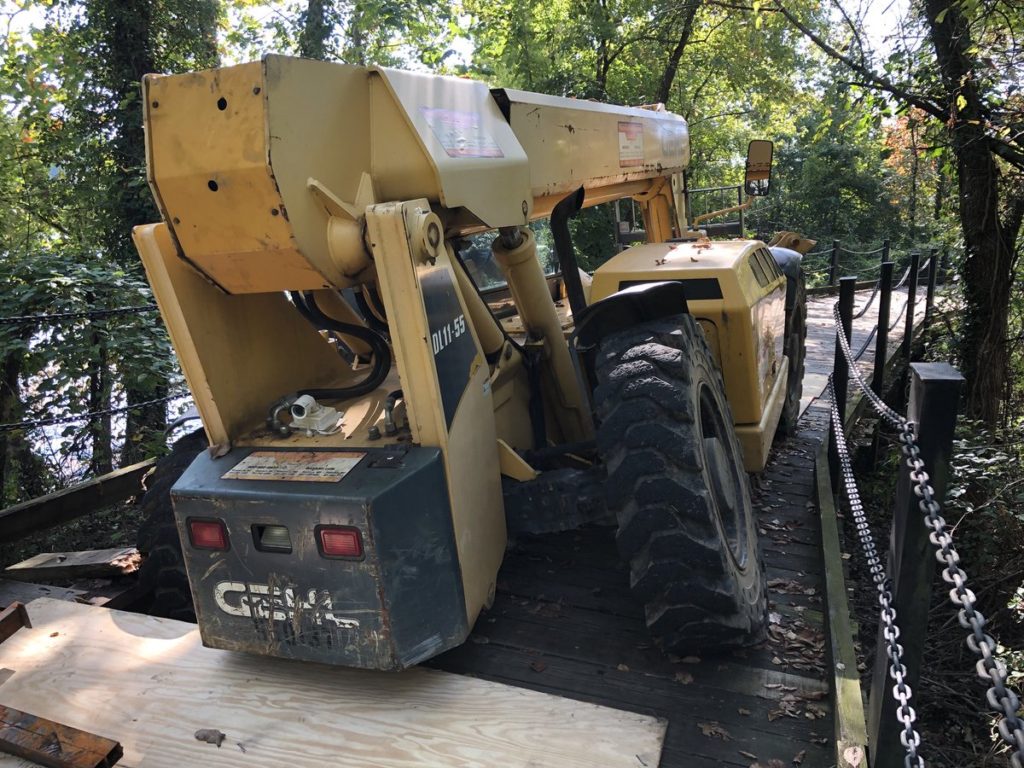
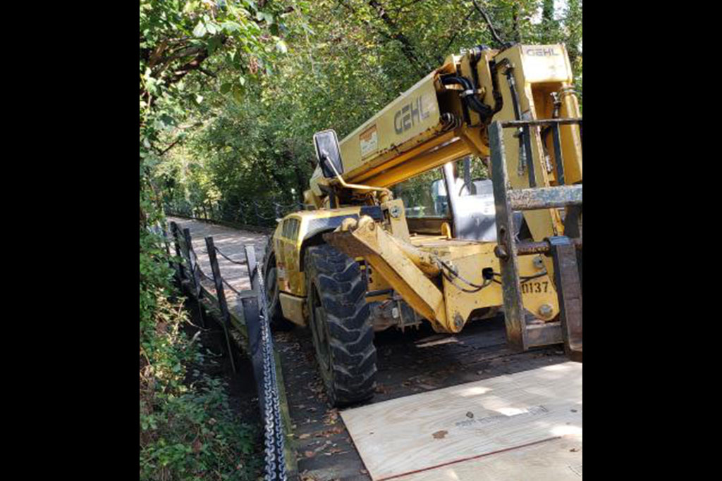
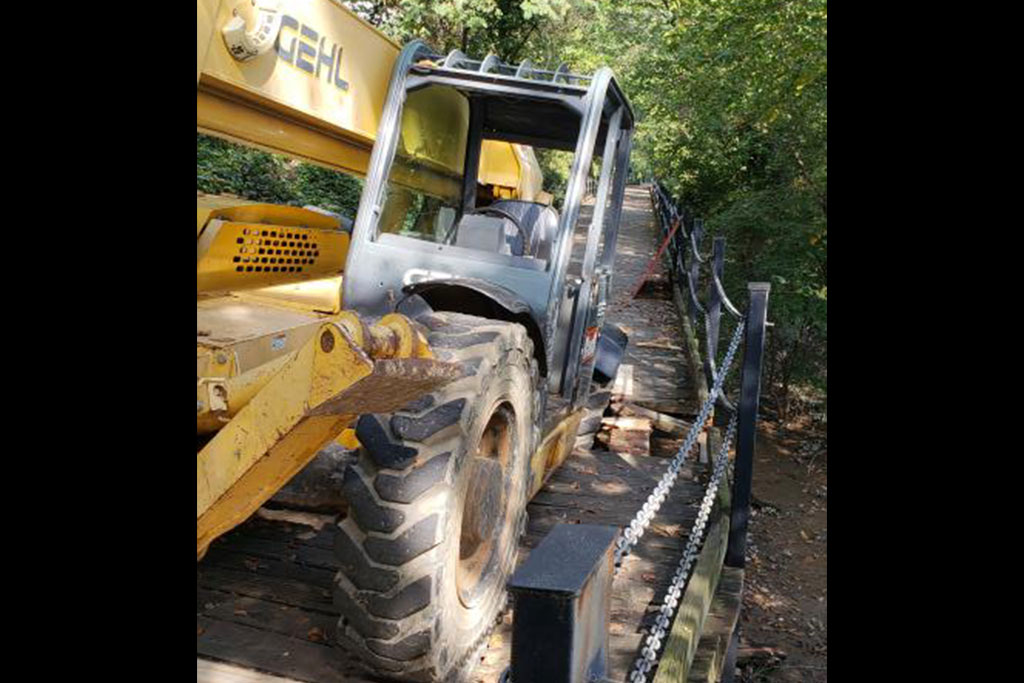
The Mt. Vernon Trail is currently blocked near Roosevelt Island after someone tried to drive a piece of large construction equipment over a rickety wooden bridge.

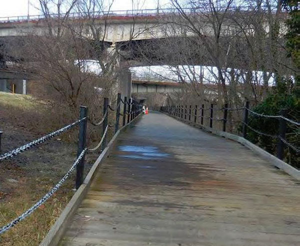
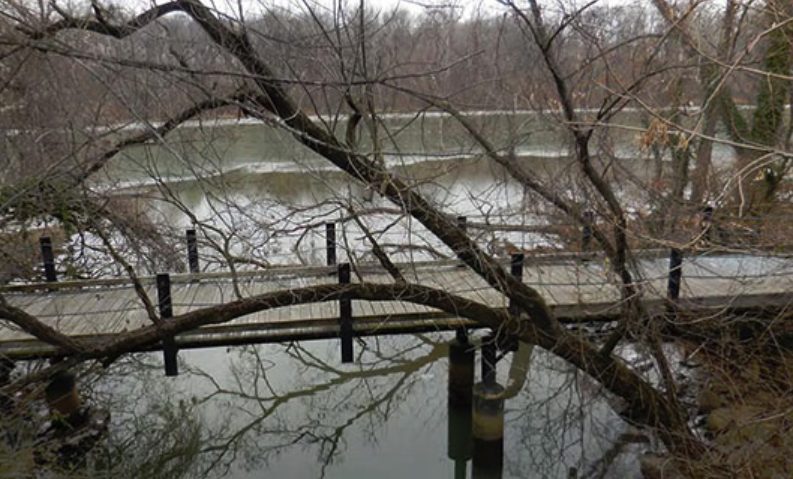
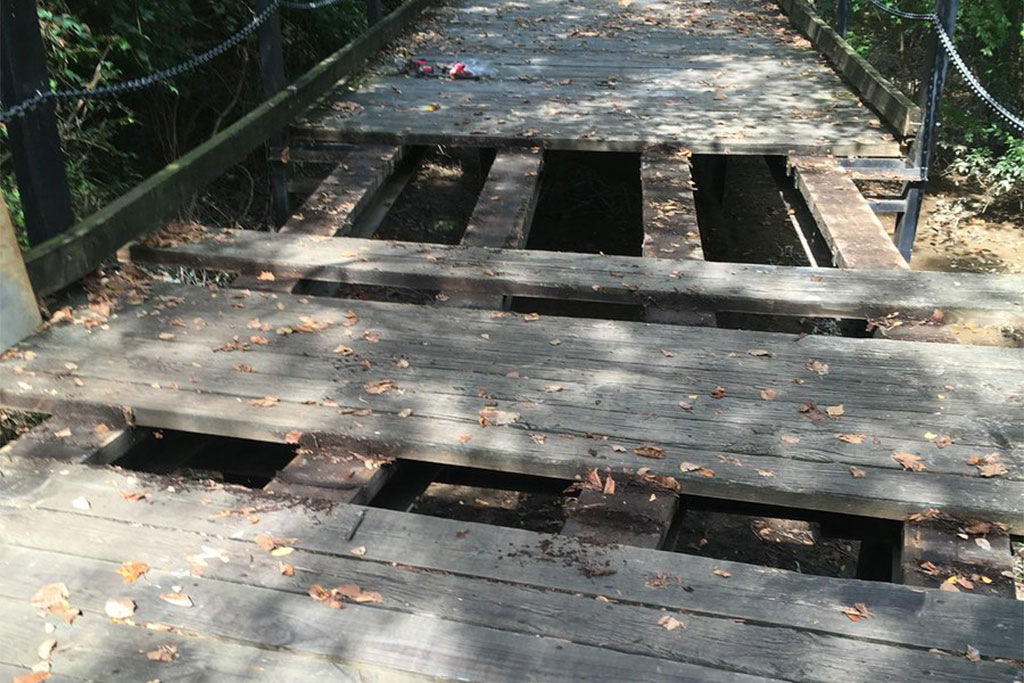
The wooden plank bridge carries trail traffic in the area of Roosevelt Island and the Roosevelt Bridge, near Rosslyn. It is noted for being slippery when wet and generally uneven at all times, causing bikes to shake as cyclists ride over it.

Earlier today, a large piece of construction equipment was driven over the bridge and, predictably, broke a number of boards before getting stuck. The National Park Service is currently working to assess and repair the structure so that the trail can be reopened.

“NPS and Federal Highway Administration engineers are assessing the bridge,” said NPS spokesman Jonathan Shafer. “We hope to reopen the bridge and this section of the Mt. Vernon Trail soon, but we don’t have a time set yet.”

Via Twitter, an NPS spokeswoman said they were “hoping to reopen by evening commute but not sure yet,” adding that cyclists can detour past the closure by crossing bridges into D.C. and back.

Shafer says the circumstances around how the equipment was driven onto the boardwalk are being investigated. He said the equipment does not belong to the park service.

“It was not NPS equipment,” he said. “U.S. Park Police are investigating this.”

Update at 5 p.m. — The trail has reopened, according to NPS.

Photos (1 & 4) via NPS/Twitter (2 & 3) via BikeArlington Forum


Prep work for major construction on the Memorial Bridge is prompting some lane closures and other travel disruptions in the area over the next few days.

Workers are planning to set up “staging areas” just south of Memorial Circle to prepare for a full rehab effort on the bridge later this fall, which will include a full weekend shutdown of the bridge in mid-September.

That means drivers in the area can expect “temporary lane closures as trucks deliver material there,” largely during the day. The closures could also impact the Mount Vernon Trail, with the National Park Service warning that the trail likely won’t close entirely but “users may have to wait while workers move material over it.”

The NPS recently had to schedule overnight lane closures on the G.W. Parkway and Washington Blvd to pave roads leading up to the stage area, but it expects that today (Friday) was the last day of those disruptions.

Labor Day should also mark the end of work on the Windy Run Bridge along the G.W. Parkway. Workers are hoping to do away with the lane closures and shifts that have marked that section of the parkway for the last few weeks sometime after the holiday.

Photo via National Park Service


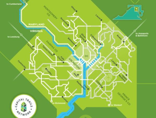
A coalition of bicycling and transit advocates has drawn up a new map of the entire D.C. region’s bike trails, in a bid to promote a more holistic view of the area’s biking options.

The Capital Trails Coalition released the “diagrammatic map” today (Monday), displaying not only the 436 miles of existing trails across the region but also another 302 miles of planned paths that will someday create even more connectivity for cyclists.

The coalition, which includes both local government transportation agencies and a host of advocacy groups, included bike trails in six jurisdictions around the region on the map: Arlington County, Alexandria, D.C., Fairfax County, Montgomery County and Prince George’s County. Coalition Chair Jack Koczela hopes that will help people to see cycling as a viable option no matter where they live around the D.C. region, laying out a clear, unified guide to easily bikeable trails for commuting and recreation alike.

“We hope this comes to have the feel of the iconic Metrorail map,” Koczela told ARLnow. “This is so people can get an idea of what it is we’re talking about in terms of actual trails available to everybody around the region.”

Koczela says the coalition has spent more than two years now drafting the map, as the group sought to work with cyclists to identify trails that are both easy to ride and provide good access to the region’s activity and transit centers.

He’s hoping that the map will prove particularly useful to D.C. suburbs like Arlington. If commuters currently rely on cars or public transit to get to work because they aren’t sure how a trail that starts in Arlington connects with one in D.C., or even Maryland, he foresees this map being a vital resource to provide alternatives.

“A lot of people’s experience on trails is really hyperlocal, and a lot of people aren’t thinking of these trails as a way to connect them to other areas of the region,” said Carm Saimbre, communications coordinator for the Washington Area Bicyclist Association, a coalition member. “The vision with this is to create connections and fill gaps in the network, so it becomes just as established as getting around the Beltway by car.”

With so many planned trails included on the map, Koczela notes that the document is certainly an aspirational one in many respects. In Arlington alone, the map includes not only trails currently under construction, like a new section of trail alongside Washington Blvd, but also ones still in the planning stages, like the extension of the Mt. Vernon Trail from Theodore Roosevelt Island.

But by showing just how adding more trails could better connect the region, Koczela thinks the map will be a valuable tool as his coalition lobbies for more funding for bike infrastructure going forward.

“Our goal for the next year is to increase awareness and get the political community engaged, thinking about the trails as a network,” Koczela said.

Photo via the Capital Trails Coalition


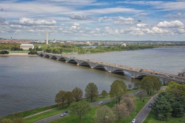
Plans are underway to address Arlington Memorial Bridge’s crumbling facade and deep structural issues, but over the next week it will mean extra traffic for morning commuters across the bridge.

From today (Monday) until Friday (Aug. 17) two lanes of Arlington Memorial Bridge on the G.W. Parkway will be closed to prepare the bridge for full rehabilitation later this fall. The rightmost westbound lane will be closed from 6 a.m. until 3 p.m. and the center eastbound lane will be closed from 9:30 a.m. until 3 p.m.

The parkway will also see late evening closures over the coming week to prepare the bridge for rehabilitation later this fall. From Wednesday, Aug. 15 until Sunday, Aug. 19, one northbound lane of the parkway will be closed south of Memorial Circle, near the Potomac River. Closures will start at 7 p.m. and end at 5 a.m.

The plan is to move the construction equipment from the road to a fenced staging area on the river. Workers on-site will direct traffic as heavy equipment is moved into the construction site.

Cyclists and pedestrians on the Mount Vernon Trail may also experience delays during this process. While the trail won’t close, the equipment will be passing over the trail and workers onsite will be directing traffic on the trail.

The full bridge rehabilitation later this fall will reduce the bridge to three lanes of traffic: one eastbound, one westbound, and one that will shift to accommodate rush hour traffic.

In 2016, the Federal Highway Administration informed the National Park Service (NPS) that, without repairs, the bridge will require full closure in 2021. According to NPS, the current schedule of closures will help strengthen the bridge; adding new concrete to the roads, reinforcing the rusted steel drawbridge, and making repairs to the underside of the road. The full rehabilitation later this fall will replace the drawbridge span, replace most of the concrete across the bridge with prefabricated concrete panels.

The NPS is also closing lanes on the Windy Run Bridge to keep up with additional bridge rehab needs, with work running through the fall.

Photo via National Park Service


View More Stories